Our trip lasted 18 days, we travelled 7,440 km and it cost us in total €2,446 Diesel €439 Tolls €247 Hotels and breakfasts, including those not covered by the price of some rooms €929 Dinners €473 Churches, museums, castles etc. €161 Bottles of port, wine, souvenirs €127 Sandwiches, fruit, lunch €50 Parking €20
When Michele said to me, how about spending our holidays visiting Portugal, I would never have imagined I could plan this trip and get to see all these marvels of nature and of humankind. The choice of May was perfect, especially for me, who can't stand the heat and the sun being too strong, and without making any bookings we never had trouble finding accommodation (only the last night in Catalonia). The Atlantic coasts are very cool and the wind — sometimes gentle, sometimes fierce — is the true master. This month we had a few days of rain, which didn't bother us much; on the contrary, the light mist hanging in the air made the landscape mysterious. On this trip towards Portugal we crossed Spanish regions, travelling almost always along the coasts and visiting the big cities and the hinterland only superficially — they certainly deserve another trip.
The Basque Country coast is less jagged than the other regions we visited; not to be missed are the hermitage of San Juan de Gaztelugatxe and the Alto del Sollube. Another thing that struck me is the cleanliness and order everywhere: not a piece of paper, can or bottle on the ground, even the little streets spotless.. Cantabria, where the rias and the cliffs begin, with ancient and historic towns like Castro Urdiales and the medieval Santillana del Mar, and where the spectacular Picos de Europa mountain range begins.
Asturias, where the Picos de Europa continue, with the sanctuary of Covadonga and Cabo de Peñas Galicia, beautiful and wild, the impressive cliffs of the Playa de las Catedrales, the northernmost tourist road in Spain that reaches Punta de la Estaca de Bares, the Sierra de la Capelada and the turbulent Costa da Morte with Cabo Vilán, Punta da Barca and Muxía, and the grand cathedral of Santiago de Compostela.
And what can I say about Portugal, one of the oldest nations in Europe, a maritime power, homeland of some of the greatest navigators and explorers, with beautiful coasts, impressive cliffs, beaches, medieval towns, the Manueline style adorning fairytale cathedrals and palaces, the craftwork with the azulejo tiles that tell the history of Portugal and decorate houses, parks and churches, the brightly coloured Barcelos roosters, the symbol of the nation, the white, red and sweet wines that pleasantly surprised us, the cuisine, the fish cooked with an enormous variety of choices, the meat with porco à Alentejana, and the sweets — I don't know what adjective to use to describe the works of art of the pastry shop.
Daniela and Michele
France, Atlantic Spain, Portugal, May 2009
Where are we going on holiday? Michele, my husband, was asking me: how about going to Portugal? They tell me it's very beautiful, why don't you put together an itinerary?. Finally, in December 2008, I retired after 40 years of work, and with more free time I started using the computer, looking for the simplest things, like photographs of the cities I wanted to visit; reading travel accounts, and Portugal had caught my interest. So the destination was settled: Portugal. But when? August, no, too hot; May seemed to us the best month, the month of flowers, which as well as brightening the meadows adorn balconies and city flowerbeds; moreover it's not peak holiday season and you can set off without booking and stop wherever you want At this point I buy a guidebook, the Routard — no, actually four: Southern France, Northwest Spain, Portugal and Central Spain.
The photographs I saw online helped me decide, so I planned the trip, also with the help of ViaMichelin and an atlas: after crossing France we would pass through the Basque Country, Cantabria, Asturias and Galicia to reach Portugal as far as the Algarve, then back up to central Portugal and then Spain, finally reaching the south of France and returning home
Monday 4 May
Villa Cortese Pyla plage 1080 km Having loaded our car, a Dacia Logan, and switched on the Navigon, we set off at 6.00 from Villa Cortese. We crossed the border through the Fréjus tunnel (€32.20) Before the Épine tunnel, after 340 km, we took a break At the Clermont-Ferrand north exit, at 604 km, we stopped for lunch. At Saint-Germain-les-Vergnes we stopped for diesel, and at 6 p.m., after 1080 km, we arrived. On the Navigon, at the start of the trip, we set the fast route, and so we took the motorway the whole way — beautiful, flowing, no traffic, with gorgeous views, but very expensive! At the end of the day the tolls from home to Pyla-sur-Mer cost us €121……..
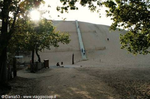
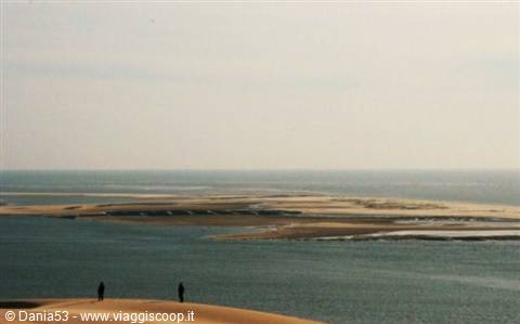
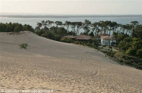
Arriving at Pyla plage we had some trouble finding a room for the night; that everything would be full in high season was expected, but that in May so few hotels would be open left me astonished. Finally, after driving all around the town, we found a room for €60 at the Hôtel Ttiki-Etxea Stairs and wooden floor creaking at every step, a small bathroom, a bed and a little table that felt like they might break at any moment; given the little choice we had, we made do After dinner, refreshed and rested, at 9.30 p.m. we reached the dunes, walking along a path lined by the usual tourist shops (all closed) A flight of steps helps the climb towards this important sand formation, unique of its kind and a national heritage site since 1978.
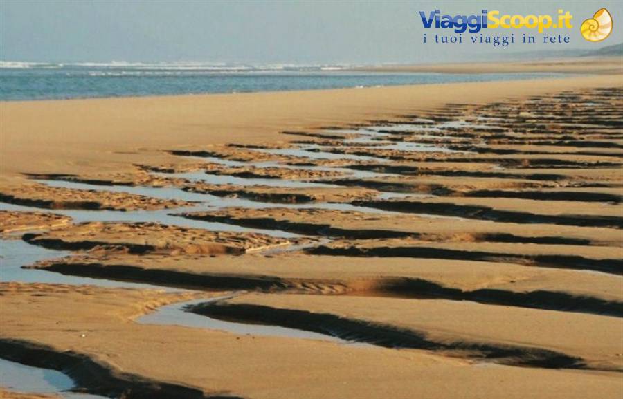
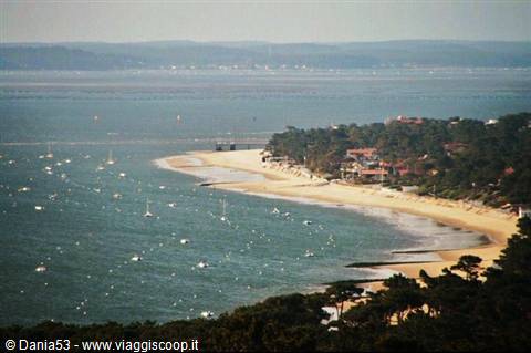
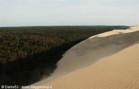
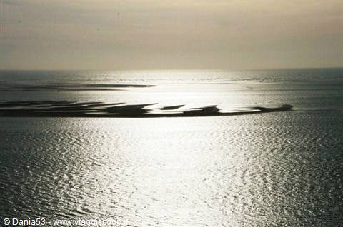
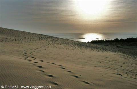
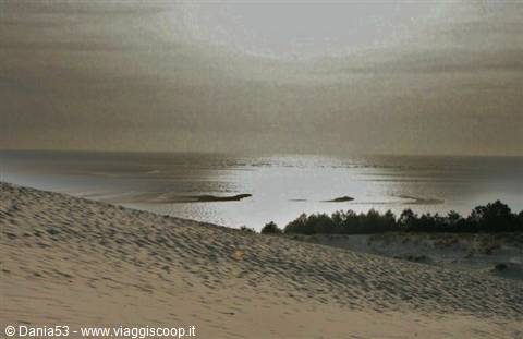
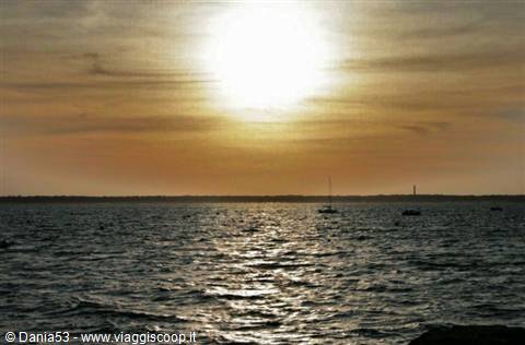
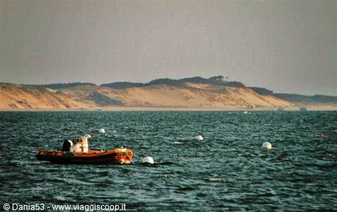
2.7 km long, it stretches across a 500 m front and is the highest in Europe at 117 m, made up of 60 million tonnes of sand relentlessly piled up by the wind and the sea, which devours the nearby forest by about 4 m a year. Once we reached the top we saw the mountain of sand meeting the waters of the Atlantic and the sun creating golden reflections. We walked up and down, took photos, ran and played with the sand, watched the sun set on the horizon, but the tiredness from the long day and the freezing wind blowing made us head back to the hotel, reluctantly.
Day 15 May 2009
Location: Biarritz, Hondarribia, Zumaia, Cape Maxtxitxako, Alto del Sollube Region: Aquitaine, Basque Country Country: FRANCE (FR) 0 Trip start date: Monday, May 4, 2009 Trip end date: Friday, May 22, 2009
Tuesday, May 5 Pyla plage-Biscarosse-Biarritz--Hondarribia-Zumaia-- Cape Maxtxitxako--Alto del Sollube 360km
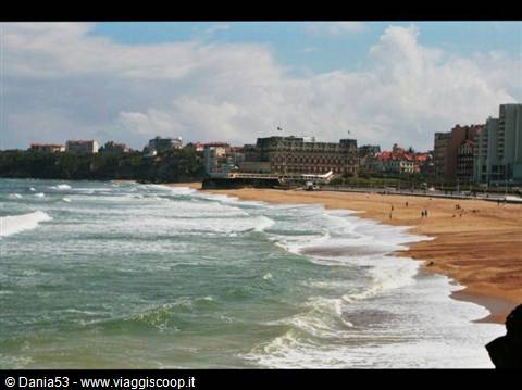
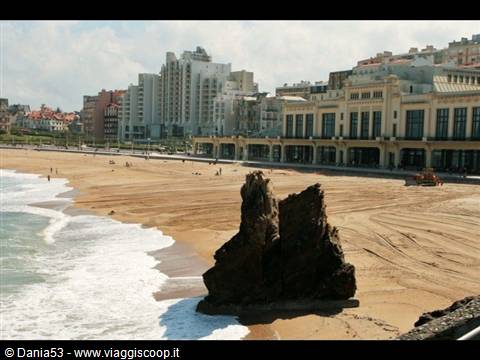
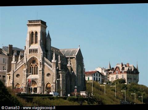
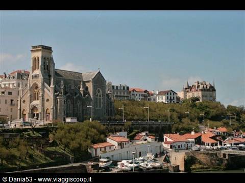
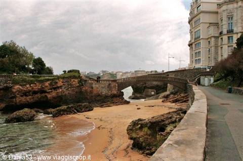
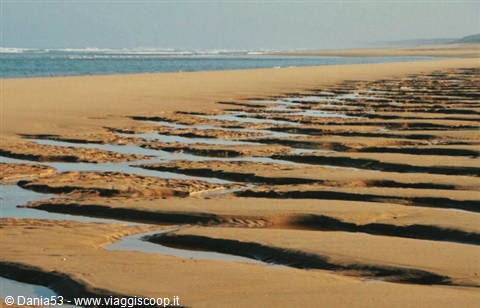
Breakfast at the only bar we found open with cappuccino and a croissant, and then off toward the beach of Biscarosse, 104 km long, which stretches as far as Capbreton. Here we walked on the sand watching lots of kids windsurfing, then we headed to Biarritz, a legendary place of the belle époque that became fashionable thanks to the Countess Eugenia de Montijo, wife of Napoleon the Third, who built her summer residence perched over the sea, now the Hotel Du Palais, which with its Art Deco casino forms a backdrop to the beach that today is one of Europe's surfing hubs thanks to its waves. In front of us we see the Orthodox church of Saint Alexander Nevsky with its beautiful blue dome, which we didn't visit because in May it's open to the public only on Thursday and Saturday afternoons. Another characteristic square is Place Sainte Eugenie, overlooked by the parish church.
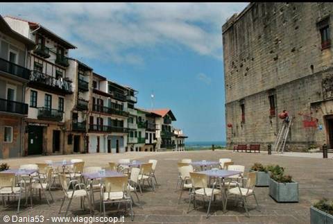
Further on is the rock of the Virgin, and on the opposite side the point of Saint Martin, upon which stands a lighthouse 44 m tall. Continuing along the coastal road we entered the Basque country (in Basque, Euskadi); the first town we come to is Hondarribia, whose center is enclosed by solid walls. We walk through its cobbled streets lined with many houses and mansions bearing coats of arms; in the upper part, in Plaza de Armas, we saw the castle of Charles V, which houses a parador, and which is a very austere architecture: a cube of stone with a door and a few windows. Going down near the sea, particularly on Calle San Pedro, it's possible to see houses with a great many colorful windows. Afterward we continued west along the evocative road perched over the Atlantic, and we stopped at Zumaia; we parked and set off walking alongside the canal that reaches the mouth of the sea.
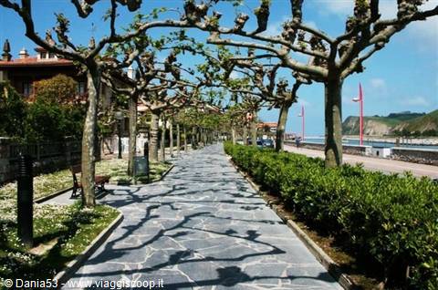
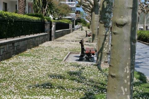
The first thing that struck us is the cleanliness, not even a leaf on the ground, the squares and houses impeccable with their flowering gardens; the avenue leading to the harbor entrance is lined with large trees whose branches intertwine forming an arch; at this time of year they are without leaves, and the sun passing through them casts its shadow on the ground forming embroidery-like patterns. The sidewalks are covered with a lawn full of little white flowers, and the benches invite you to relax looking at the view. In a higher position, what looks like a fortress dominating the town is the church of San Pedro.
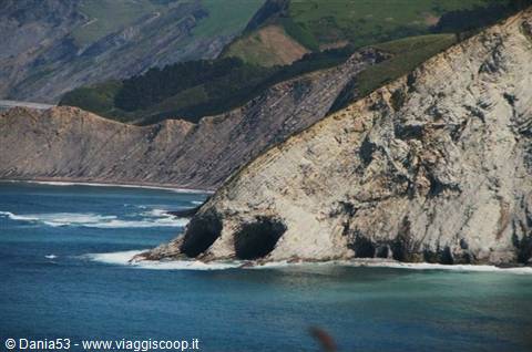
The Gipuzkoan coast, which from Zumaia leads to Deba, is made up of climbs, curves and surprising geological formations formed by slate sediments alternating with sandstone and clay (the flysch); in the cliffs, caves carved by the waves look like the eye sockets of human skulls. Before stopping for the night we wanted to see Cape Matxitxako and San Juan de Gaztelugatxe, so we hurried toward Bermeo; once past it, the road climbs up the mountain through a eucalyptus forest that scents the air. After a few km we arrived at the cape, at its highest point at 122 m above sea level, where there's a lighthouse from which you can see the bay below. The coast offers a landscape made of cliffs and islets, that of Aketze and that of San Juan de Gaztelugatxe, while a light haze was settling over the landscape; out in the ocean you could make out an oil platform.
Afterward we continued on to reach the hermitage of San Juan de Gaztelugatxe, but the road was closed due to a landslide, since at this point the sea erodes the rocky coast. So we decided to see the hermitage the following day, coming from the opposite side; it's already 9 pm and we'd begun to feel the tiredness of the day, so we turned back toward Bermeo to look for a hotel. After the tranquility of the coasts we found ourselves in a busy, chaotic town, with streets blocked by roadworks and a myriad of one-way streets. Even the GPS went haywire and we didn't find a single hotel either. We left the town in the direction of Alto de Sollube and finally, after several wasted detours, we found a b&b, the Manuko Benta in Vizcaya.
From the outside it looks like a farmer's house faced in stone; I wasn't expecting the beautiful interior with gleaming wooden stairs and landing, rugs, antique little tables with lamps spreading soft light, scented candles, rooms in the same style, the bedspread and curtains in lace. The b&b has a small restaurant on the ground floor, where we ordered a dish with an unpronounceable name. When it arrived we savored some very good meat with vegetables; meanwhile outside a thick fog had wrapped around everything.
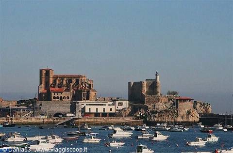
Castro Urdiales Santa María church
Day 26 May 2009
Wednesday, May 6
San Juan de Gaztelugatxe--Castro Urdiales--Noja--Cape Ajo--Santander--Santillana del Mar-Comillas 210 km
This morning, after paying 34 € for dinner and 56 € for the room and breakfast, we went out and realized we were several hundred meters above sea level with a lovely panorama in front of us, with the sun lighting up the valley and the surrounding hills. We head toward Bakio and, having taken the road for San Juan de Gaztelugatxe, to our regret we found signs indicating that the road was closed. Having asked for information, we continued on, since we'd been told it was possible to see the hermitage from above.
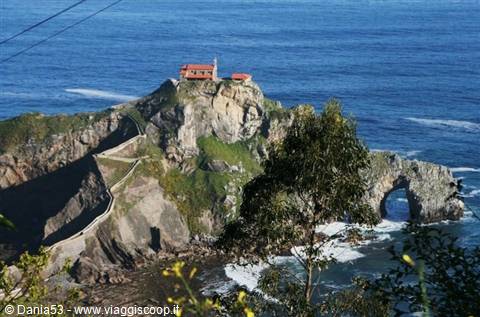
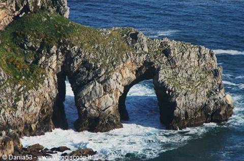
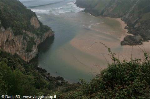
After continuing for about 1 km we found a spot where from the edge of the road you can see a small island connected to the mainland by a narrow causeway and 231 steps built on a rocky outcrop, at the end of which stands the little church; below it the rocks and the foaming ocean breaking against the two arches, the sun's rays passing through a light haze giving this place something unreal and magical. With this wonderful vision in our eyes we left the Basque Country to head toward Castro Urdiales in Cantabria; once we arrived we went to the port where the fishing boats were unloading their fish, we wandered around the town hall square with its clock tower, and we browsed among the shops under the arcades. In front of us the town, with houses with pointed roofs that almost look like little castles.
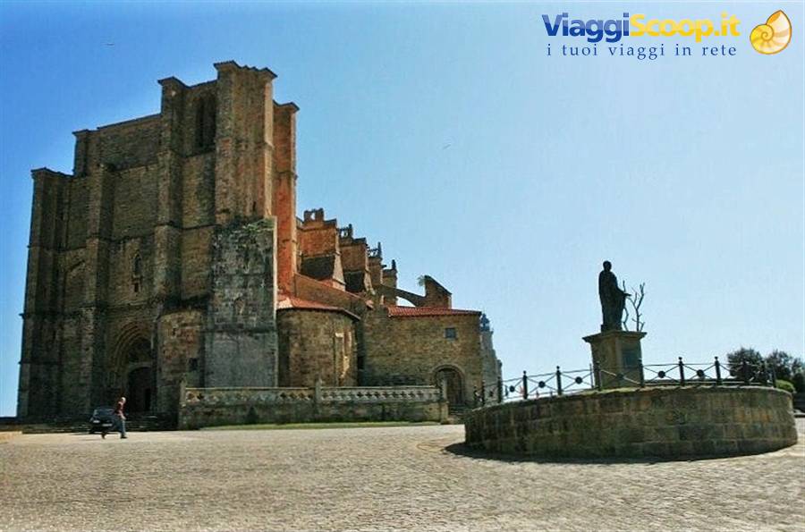
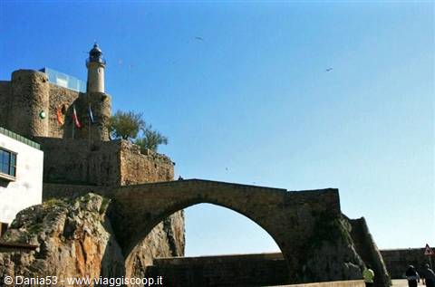
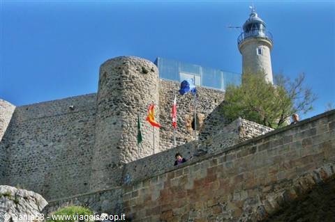
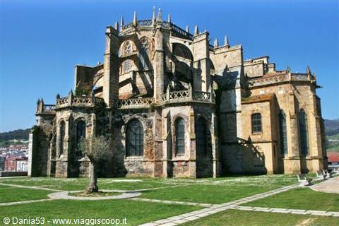
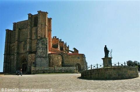
Continuing on we reached the end of the promontory where stands a lighthouse built on a medieval castle that seems to have belonged to the order of the Templars, connected by a suspension bridge over the ocean shaped like an arch; the waves passing beneath and crashing against the rocks produced a deafening noise. Behind the lighthouse is the church of Santa Maria, a Gothic-style construction with flying buttresses and magnificent wooden sculptures inside. In the square in front of the church stands the statue of Vespasian; the visit ended with a walk along the pier, and turning back we enjoyed the view of this monumental complex, and it's a truly exceptional sight. We continue on to Noja, a town situated on a hill overlooking the sea; the road we took is a succession of houses, buildings, nightclubs, pubs, arcades and restaurants, fortunately all closed.
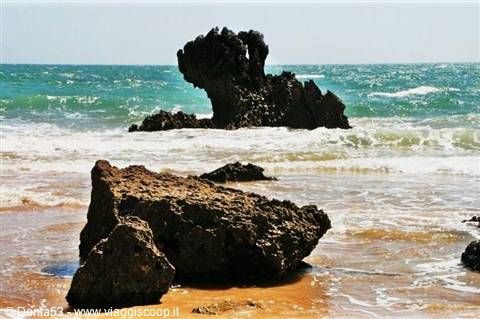
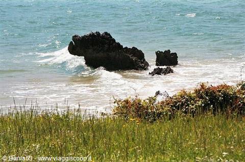
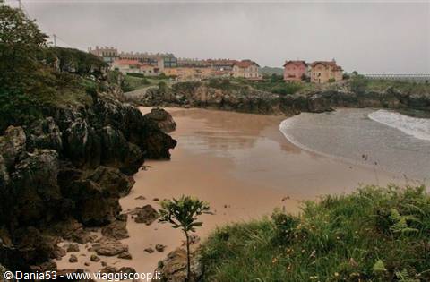
I'd never want to be here in high season, with a flood of vacationers invading it; quite another thing are the beach and the sea dotted with hundreds of rocks emerging from the water. Some near the shore have strange shapes: one even looked like a rhinoceros ready to attack an enemy, another like a castle, another still like a hand with its fingers spread reaching toward the sky. We walked along the beach under an all-too-hot sun and breathed in the scent of the saltiness rising from the sea. Further on, just 13 km away, is Cape Ajo; once we arrived we head toward the lighthouse and see several trucks with cables protruding, spinning in every direction, and a helicopter circling above the promontory; an English crew is shooting a documentary. We nonetheless admired the view, took a stroll and snapped photos.
We continued on to Santander; we take the CA 141 and drive along the Bay of Santander, cross the bridge over the Ria de Solia, and pass through Astillero, a commercial port and industrial zone where there are companies engaged in boat construction and repair. We continued along the Paseo de la Pereda, Calle de Castellar, with the sea and the landing stage on one side and on the other a continuous row of handsome white buildings; continuing on Avenida de la Reina Victoria, the buildings give way to beautiful villas and lush vegetation. We arrive at Avenida de la Magdalena, where there's the parking area overlooking Playa la Concha, or Playa del Camello, named that for a rock that resembles this animal; we're in the first days of May but on the beach there are already several people sunbathing.
Santillana del Mar
Day 36 May 2009
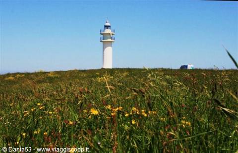
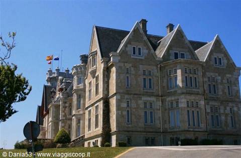
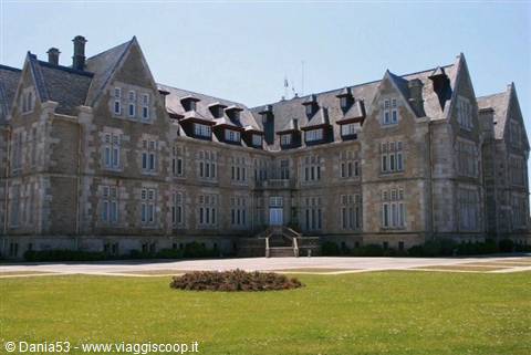
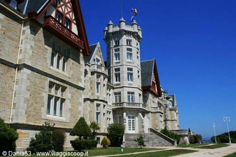
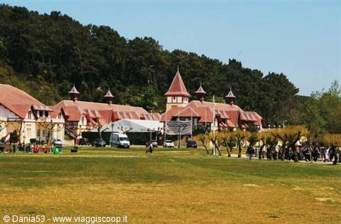
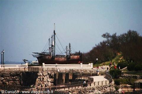
The tip of the Magdalena Peninsula is a public park, admission is free, it's 25,000 square meters where you can jog, relax under majestic trees or stroll freely and admire the ocean. Inside the park we can see the stables, the small lighthouse of La Cerda located on the tip at the far end of the park; in front of the lighthouse it's possible to see the island of Mouro, and continuing on we reach the Magdalena Palace, the ancient summer residence of Alfonso XIII built in 1909 in English style. Further ahead, on a terrace built on the cliffs, are the replicas of the three galleons on which Francisco De Orellana explored and gave its name to the Amazon River. Arriving at its estuary in August 1542, he gave this name to the river because along its course he was attacked by warrior native women like the Amazons of Greek mythology.
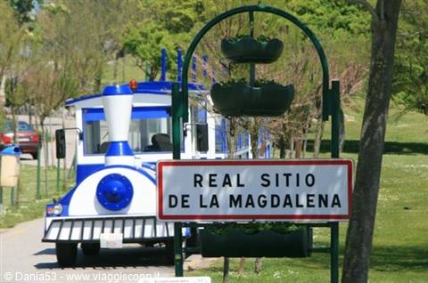
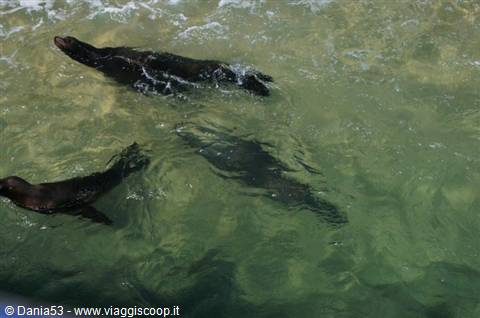
Beside the galleons is placed the balsa raft with which Vital Alsar, fascinated by the idea of a voyage across the Pacific, in 1970 accomplished the feat with three companions, covering in 156 days the 7,000 miles that separate Ecuador from Australia, where he arrived after storms and difficulties of every kind without the raft suffering any damage worth mentioning. In the park there is also a mini zoo, the water comes directly from the sea and you can see seals, penguins and sea lions; for children or for those who don't want to tire themselves out there's the Magdaleno, a little tourist train that in 25 minutes makes a complete circuit inside the peninsula and provides explanations. At the end of the visit, before leaving, we head to where the parking area ends; from this point you can see another beach, the most famous one, that of Sardinero.
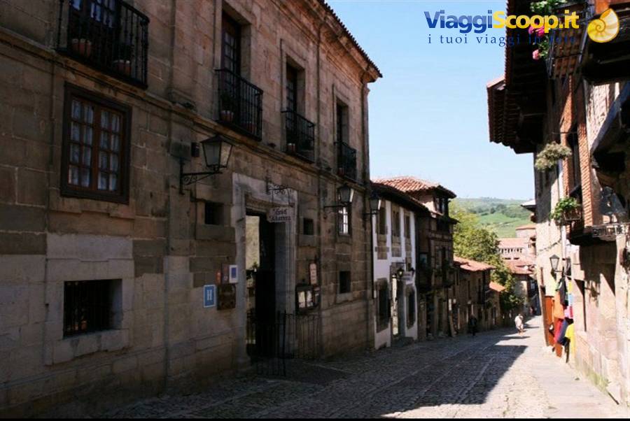
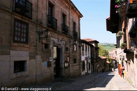
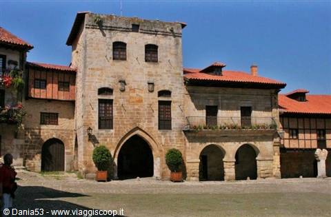
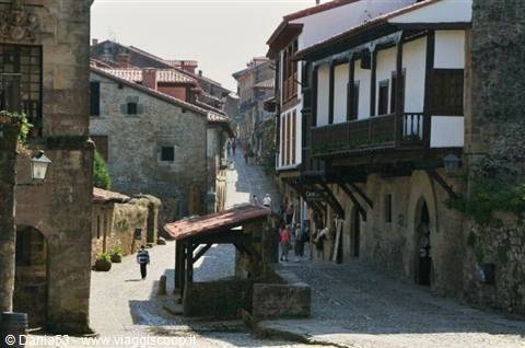
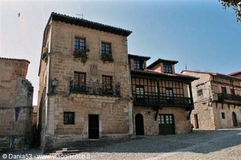
It seems that Queen Isabella, when she stayed at the Magdalena, used to bathe in the waves in these waters; behind the beach are buildings and villas in belle epoque style and the famous casino. We leave the city continuing along the Carretera Cantabrica; after about 30 km we arrive at Santillana Del Mar, we park in one of the many parking areas of the little town, which is explored entirely on foot. Santillana is a medieval jewel, very well preserved, with cobbled streets, stone buildings and artisan shops; venturing into the town we see numerous residences with facades adorned with coats of arms in excellent condition.
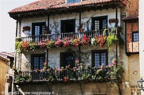
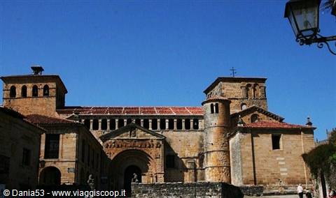
Via San Joan Infante is lined with low houses with wooden balconies full of flowers; this leads into Plaza Major, one of the most characteristic corners of the town, with the houses Aguila Y La Parra and the Parador Gil Blas, and further on the town hall with a large wrought-iron balcony and the tower of Don Boria. Continuing on we come across other noble houses; from this point the street is called Del Rio and heads toward a picturesque watering trough; the view is closed by the 13th-century collegiate church of Santa Juliana, one of the most representative Romanesque monuments of the region. The church has its origins in a monastery which, according to tradition, guarded the relics of Santa Juliana of Nicomedia (Turkey), beheaded by Maximian for being Christian and brought to the Cantabrian coast by Benedictine monks.
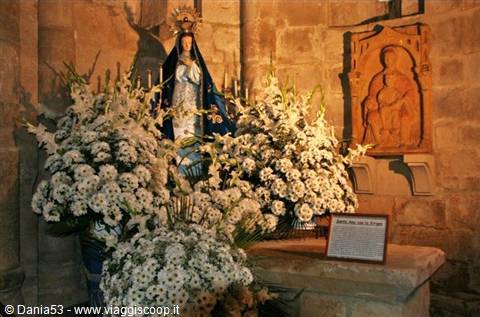
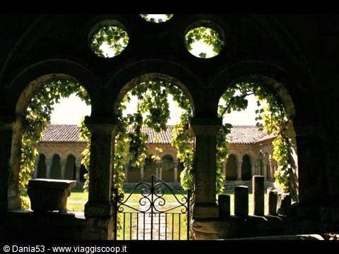
The visit to the collegiate church costs €3 per person; inside are the carved sarcophagus of Santa Juliana and wall paintings, on the altar a 15th-century altarpiece in Hispano-Flemish style with painted panels on the martyrdom of the holy apostles; on the right you enter the Hispano-Romanesque cloister with fantastic capitals, along the walls sarcophagi with heraldic motifs of important figures of the clergy and nobility. We continue on the CA 131 and after 17 km we arrive at Comillas, where we stop and immediately find a room for €35 in a guesthouse right in front of the beach; after unloading the suitcases we go out to visit the town. The first thing that strikes us is the grandiose bulk of the pontifical university that dominates above the houses; unfortunately it's all wrapped up for renovations.
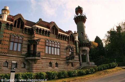
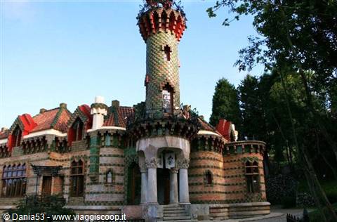
From the top of the hill that surrounds the town there's a beautiful view of the coast, and of the monumental cemetery, where the great sculpture of the exterminating angel stands out with its sword in hand. We continue our tour of the town as far as the palace of Sobrellano, the ancient residence of the Marquis of Comillas, surrounded by a vast park where Gaudí built the whimsical El Capricho villa in Moorish style with walls and turret covered in ceramics depicting sunflowers arranged to create fanciful chromatic effects. It's almost 10 p.m. now, which for Spaniards is a normal time to have dinner; we look for a restaurant and in front of the beach we go into one belonging to a fishermen's guild where for €30 we eat very fresh fish with a salad and fries; after this long day we go to sleep.
Sanctuary of Covadonga
Day 47 May 2009
Thursday, May 7 Picos De Europa--Sanctuary Of Covadonga - Cabo De Penas lighthouse -Luarca- -Ribadeo------337 km
This morning the weather is terrible, it's pouring rain and there's fog; the original plan, which called for the tour of the Picos De Europa passing through Panes as far as Fuente Dé then returning to Potes and crossing the other side of the Picos to reach Posada De Valdeon and then Covadonga, has to be changed; we decide to head straight for Covadonga following the coast road in the direction of Pechon. The road runs close to the cliffs with many small rias, little fjords where the sea enters for kilometers inland; meanwhile it has stopped raining but a light fog remains, offering a mysterious scenario. We continue and we're in Asturias; a few km before Ribadesella we take the road that will lead us to the entrance to the Picos De Europa National Park from this side.
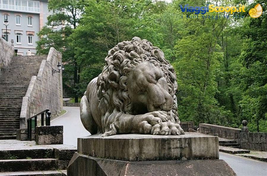
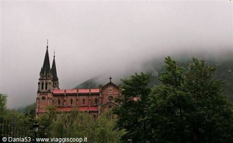
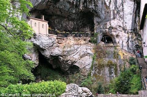
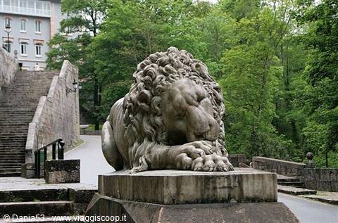
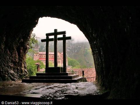
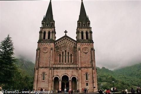
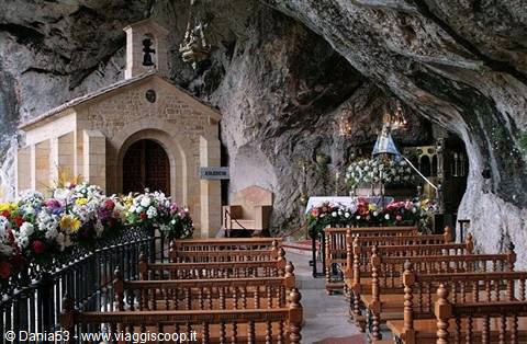
A mountain range that combines the charm of deep gorges with the spectacularity of the peaks, even if they're barely visible given the light fog. Arriving in the hollow of a narrow valley, surrounded by majestic mountains, we see the imposing bulk of the Sanctuary Of Covadonga. At the entrance we are welcomed by the statues of two sleeping lions; on one side of the mountain a waterfall cascades down and there's also a spring of water where pilgrims quench their thirst; on the other side a staircase leads to a cave located above the waterfall, among which stands out the chapel of the shrine with the statue of the Virgin and the tomb of Pelayo, Visigothic king of Asturias, who is said to have received from the Virgin, appearing to him in a dream in the cave, the invitation to fight the Muslims.
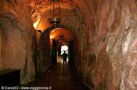
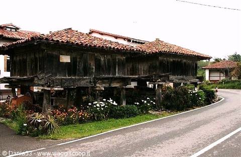
The battle of Covadonga against the Moors allowed the survival of a Christian stronghold in northern Spain and was considered the beginning of the "reconquista" from Muslim rule. On the right, carved into the mountain, there's a corridor that leads to the square where the majestic basilica stands; below the imposing cliffs that surround it are the statue of Don Pelayo topped by the cross of victory and the "campanona," a bell 4 meters tall and 4 tons heavy built in 1900. Twelve km away are the lakes Enol and Ercina, but the rain that has started falling again and the fog make us give up on continuing; we leave the national park and head toward Cabo De Penas. Along the way we see strange square houses resting on four pillars, made of wood with stone roofs and no stairs: these are the horreos, places used to protect the harvest from rodents, and to keep it as dry as possible.
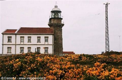
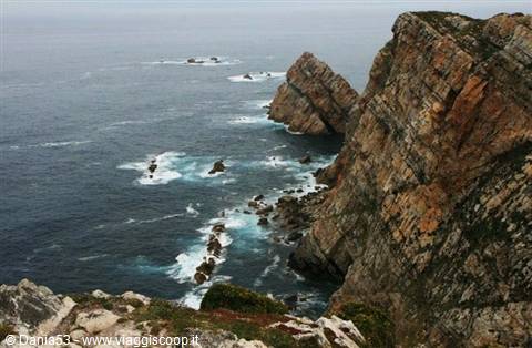
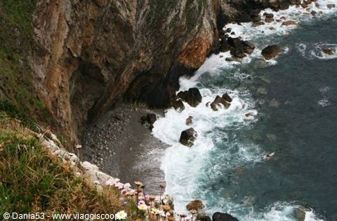
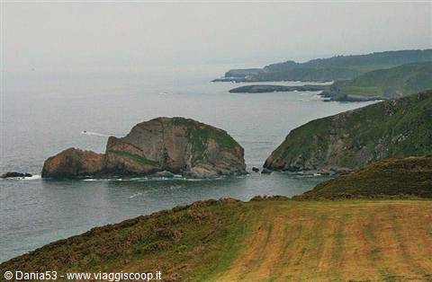
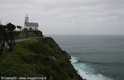
Following the road signs we reached the top of a cliff, a strip of land that juts into the Cantabrian Sea, with cliffs more than 100 m high: the lighthouse of Cabo De Penas, one of the oldest weather observatories in Asturias; near the lighthouse there's a wooden walkway that overlooks a breathtaking panorama of the sea, the rocky walls and rocks emerging from the water, all around meadows full of flowers. We continue on this road and admire a landscape in which inlets, beaches and small harbors alternate; a curious one is that of Luarca, built in the shape of an S with the scenic road that rises sheer above the lighthouse where there's the chapel of La Atalaya and the cemetery perched on the coast, considered one of the most beautiful in Spain. It's 8 p.m.
when we arrive at the ria of Ribadeo, a natural connecting point between Asturias and Galicia, and not far from the sea we find a guesthouse, the O Lar de Carmina, run by a very friendly lady who for €30 gives us a nice clean room; we unload the car, rest a bit and then go down to dinner; here too we eat a good plate of fish with salad and fries, and we also each have a slice of cake, spending €17.80 for two, unbelievable.
Ribadeo Playa de las Catedrales
Day 58 May 2009
Friday, May 8
Porto Barquero-Punta Da Estaca De Bares-Vixia De Herbeira-Sant Andres De Teixido-La Coruna-Camarinas--318 km
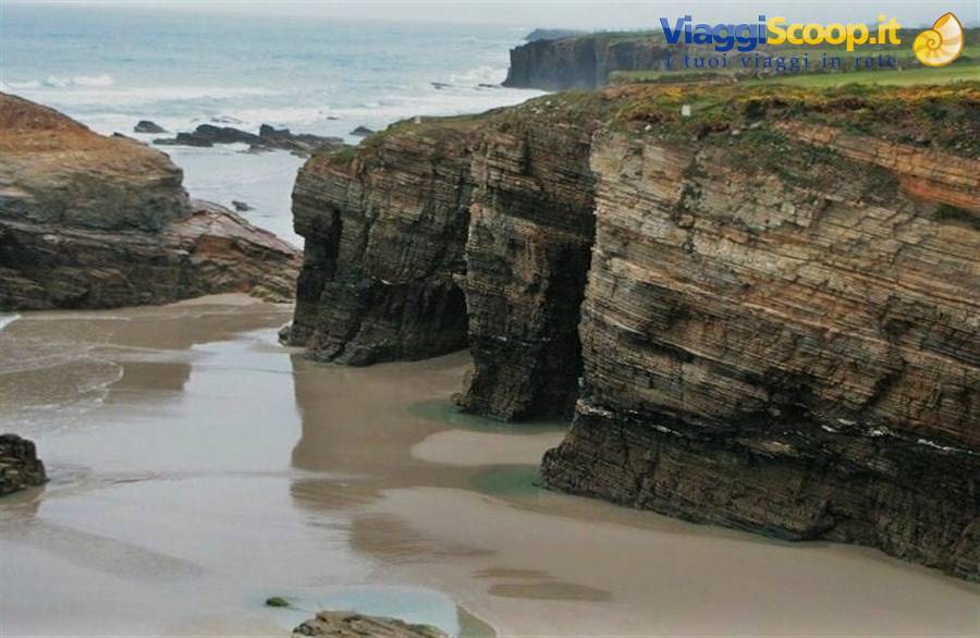
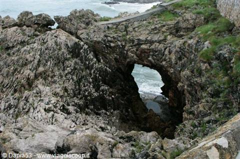
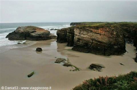
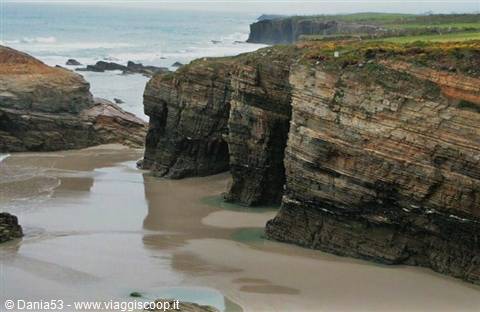
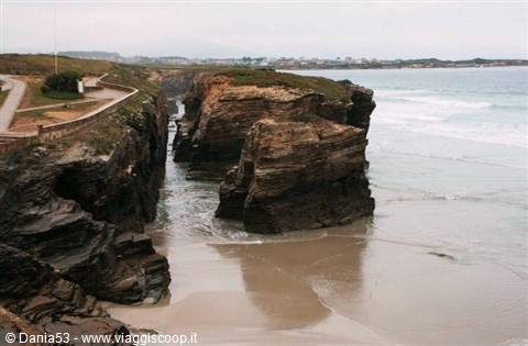
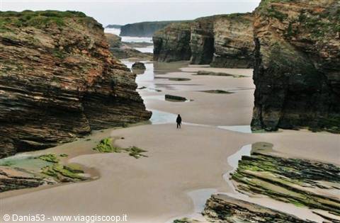
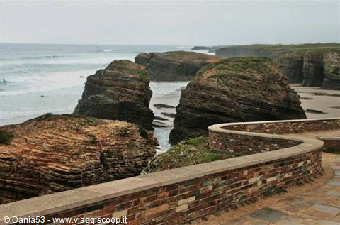
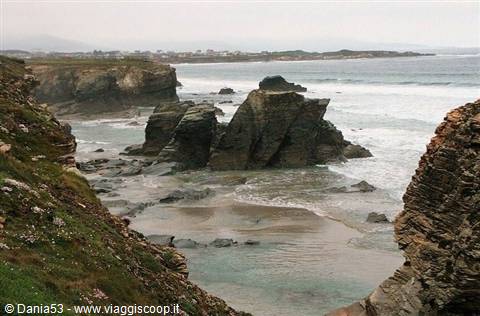
After breakfast at 8:30 we're in front of the sea; Ribadeo, besides being the outpost of Galicia, has the beach considered the most beautiful in Spain and Europe; its original name is beach of the holy waters, but it's better known as "beach of the cathedrals." It can be visited by walking on the beach only at low tide; there are spectacular rock formations carved by wind erosion and water that have created shapes reminiscent of Gothic architecture, as the name of the beach suggests; the rocks look like cathedrals more than 30 meters high, hollowed out inside into natural caves, truly exceptional, with streaks formed by centuries of marine immersion; you access it via a staircase that leads directly to the beach. Having climbed back up, we follow the beautiful path that for a few km winds along the edge of the cliffs.
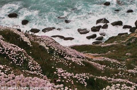
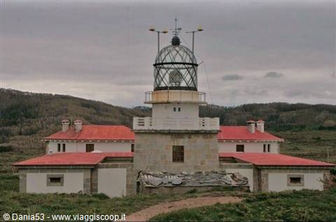
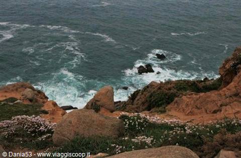
Today it's not raining but it's very cloudy and perhaps we can't fully enjoy this beauty, but it fascinated us nonetheless. Continuing to follow the jagged coasts of Galicia we arrive at Porto do Barquero, a characteristic fishing village; from here along a very narrow road we reach Porto de Bares, a small village nestled between two beaches, then we continue for 2 km to the lighthouse built on a hill at 92 m above sea level; this is an important ornithological observation center; from the rear of the lighthouse a path leads to the tip of the cliff, the northernmost of the Iberian Peninsula, where the Atlantic Ocean and the Cantabrian Sea meet.
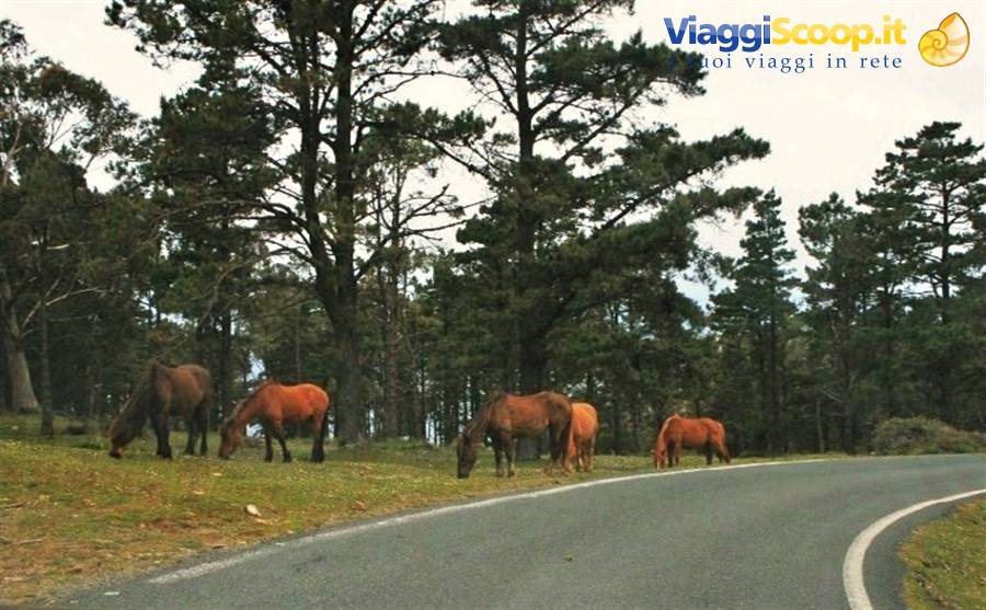
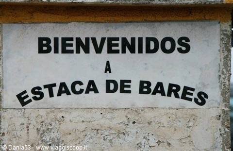
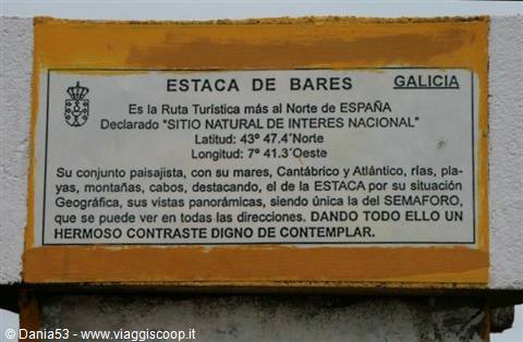
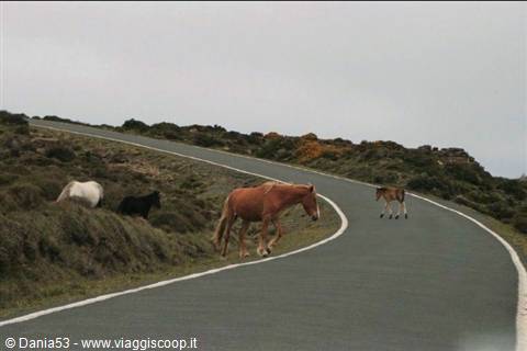
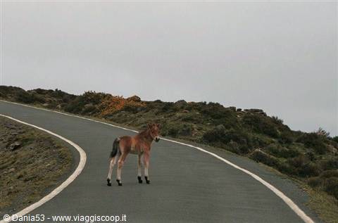
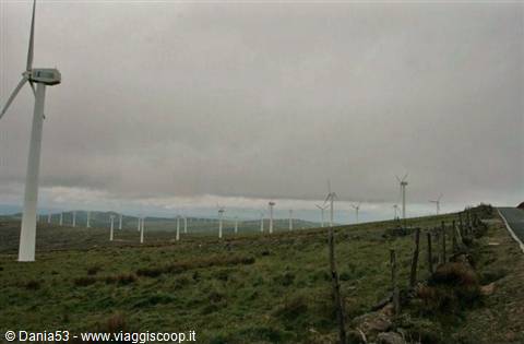
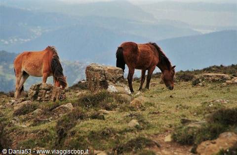
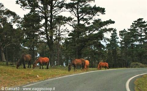
This place is called Estaca De Bares and is the northernmost tourist route in Spain, declared a "natural site of national interest." The road, with a magnificent scenario, leads onto a peninsula northeast of Cedeira, crosses the Sierra De La Capelada, an area of wild nature and expanses of heather and broom. The road is narrow but beautiful; it's just us and herds of wild horses grazing, while we admire everything around us, a magnificent foal approaches our car. At the top of the hill many wind turbines seem to emerge from the low, dark clouds; the contrast is surprising; continuing on we reach the highest point of the Capelada cliffs, called Vixia De Herbeira; the viewpoint is at 612 m above sea level. They are considered the highest in Europe; the panoramas are impressive.
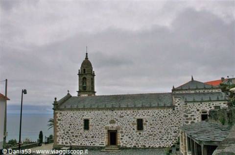
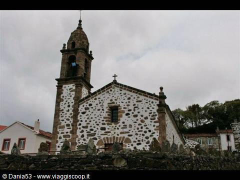
We follow a winding little road and before us, there, the sanctuary of Sant Andres de Teixido pops up, built on top of a cliff surrounded by the houses of the village and the numerous shops selling souvenirs typical of this place: little statues made by the inhabitants with bread crumbs, baked and painted, called "sandresinos." St. Andrew is the protector of fishermen, and mixing their Christian faith with some vestiges of animistic cults, the inhabitants sustain the pilgrimage to the sanctuary, a place where all Galicians had to go once in their life, under penalty of having to return there dead in the form of an animal. Another belief says to go and drink at the fountain of the three channels, the saint's spring, and then throw a piece of bread into the water source and make a wish; if it floats, the wish will come true.
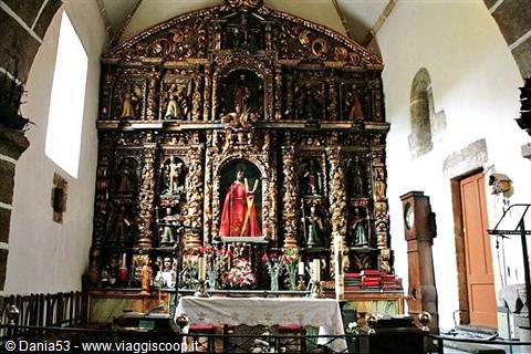
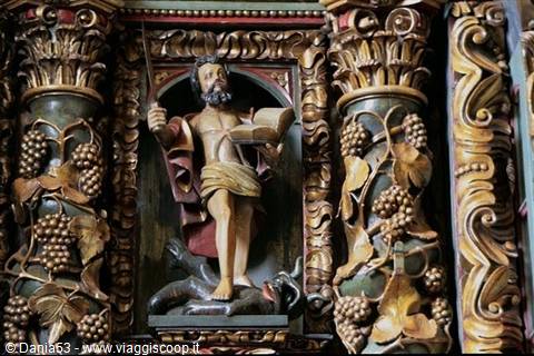
The church, created by Miguel Lopez de La Pena in 1789, is built of stone, very simple inside, a single nave; the altar is a large baroque wooden portal that highlights in the center the splendid figure of St. Andrew with the red cloak, surrounded by carved columns with vine tendrils and niches with images of saints and cherubs that stand out for their gold color; there are also paintings depicting the martyrdom of St. Andrew. We are surprised to see on one side of the church the numerous votive offerings left by the faithful in search of a grace; there are objects of every kind: bracelets, necklaces, gloves, baby booties. Having come out, we stop to look at the spectacularity of the environment; the magic of the place cannot leave anyone who visits it indifferent.
Sierra de la Capelada
Day 68 May 2009
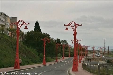
We leave the village crossing eucalyptus woods and follow a downhill road with several hairpin turns as far as Punta Candelara. After having seen the previous wonders, this one has nothing special; we continue passing through Cedeira and Ferrol to arrive at La Coruna; our goal is not to visit the city but to reach the tower of Hercules. La Coruna is known as the "balcony of the Atlantic." To reach the lighthouse we drive along the whole city; in front of the port on Avenida Della Marina we observe the particular architecture of the houses painted white with the glass of the verandas creating geometric reflections, and for this it is also called the "city of glass." We go along the paseo maritimo that circles the isthmus; the promontory on which the city center stands is very long and the iron street lamps painted red create a beautiful scenery.
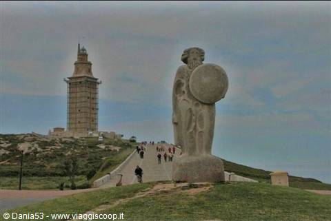
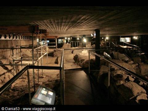
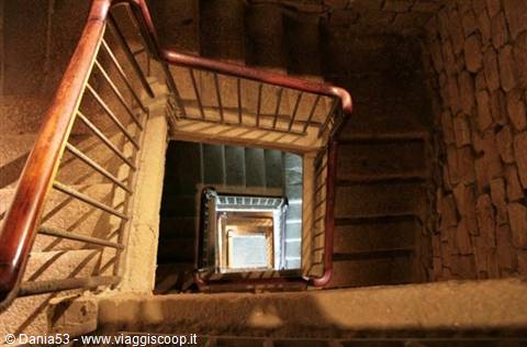
We park near the lighthouse, whose location dates back to Roman times; since the most remote times it was a strategic port. The first to understand its importance were the Romans, who built a naval base here. The lighthouse was built at the beginning of the second century by the emperor Trajan; excavations have uncovered at the base of the tower a stone with the following inscription which, translated, means "Consecrated to Mars, Gaius Servius Lupus, architect of Aemium in Lusitania, in fulfillment of a vow." At the beginning of the climb leading to the tower we see the statue of Charon bound to Hercules in mythology. Paying a ticket of €3 per person you can access the interior where there are the primitive remains of the ancient construction and climb 242 steps to reach the highest point of the lighthouse, a stunning viewpoint at 68 m of height.
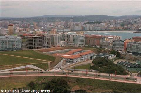
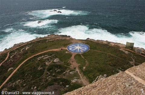
The very strong wind sweeps the promontory making the landscape clear and with vivid colors; the panorama is magnificent: on one side the city, on the other a large compass rose and the foaming sea against the rocks; all around the tower a large park with Celtic sculptures. Unfortunately we have to go down and continue the journey; we set off again toward Camarinas. This area is one of the most desert-like of Galicia; from Coruna to Finisterre winds the "coast of death," which owes its macabre name to the number of ships overwhelmed by the fury of the ocean. Arriving at Camarinas, following the directions of the Routard we look for the pension Gaviota; we're welcomed by a lady who shows us the attic room which we pay €35. We have to climb three flights of stairs with suitcases, camera bag, pc and various bits and pieces; Michele grumbles but it's already 9 p.m.
and I don't want to waste more time changing accommodation, so as a proverb from our parts says: legs on shoulders and up we go; besides, the room is nice and clean. Quick shower and off to look for a restaurant; we go into the Villa De Oro where I order Galician octopus, while Michele is undecided, so the owner goes into the kitchen and shortly after comes out with a large tray full of very fresh fish and asks us to choose the one that might satisfy us most; cooked it was exquisite, it melted in the mouth, and as a side dish vegetables and salad. Stuffed, we pay the bill €30 and go around the town; the shop windows are full of doilies, towels and other linens with stunning lace; meanwhile an icy wind has risen and we go back to the room.
Cape Vilán Lighthouse
Day 79 May 2009
Saturday, May 9
Cabo Vilan- Muxia -Finisterre -Santiago De Compostela -Combarro--275 km
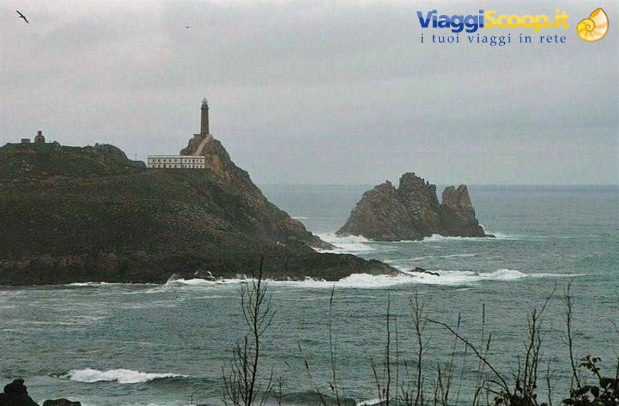
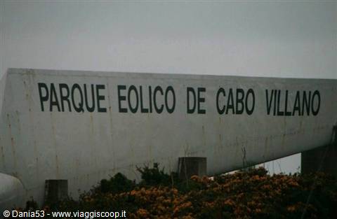
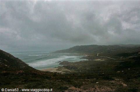
As agreed with the owner of the guesthouse, we leave the room key in the hall and go out; it's not raining but the sky is cloudy. The evening before we had spotted a pastry shop and we stop for breakfast: cappuccino with churros that look like long biscuits and filloas which are very sweet fritters with cream. At 9 we're on our way to Cabo Vilan. The ria of Camarinas extends from Punta da Barca in the south to Cabo Vilan in the north; the unpaved road climbs up the sides of the cliff; the force of the wind allows the exploitation of wind energy and here in the park of Cabo Vilan the blades move at incredible speed.
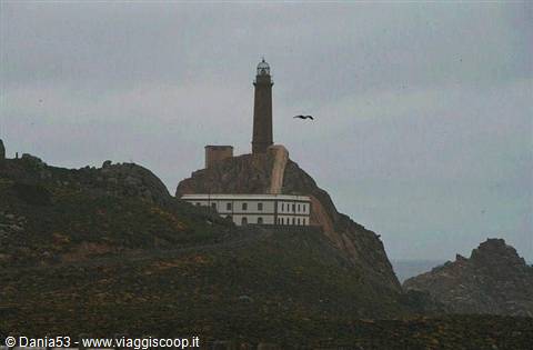
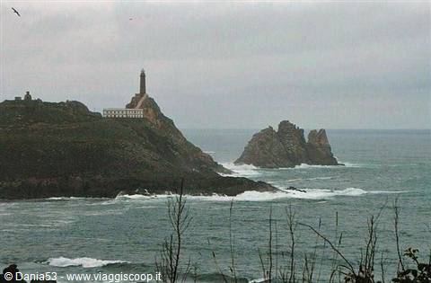
The lighthouse rises on a small strip of land that enters the sea and faces an islet called Vilan di fora; built on a ridge of pink granitic rock with an octagonal shape, it is 125 m high and you access it by climbing a staircase of 250 steps; it was the first Spanish lighthouse to operate thanks to electric light; at the base there's a large white building provided with a covered passage, it's the keeper's house. Near Cabo Vilan numerous shipwrecks have occurred; the most famous is that of the English ship Serpent on November 10, 1890, in which 172 naval cadets died; the only 3 who survived were wearing life jackets. This fact, having become known to the English navy, led to the life jacket becoming mandatory on ships.
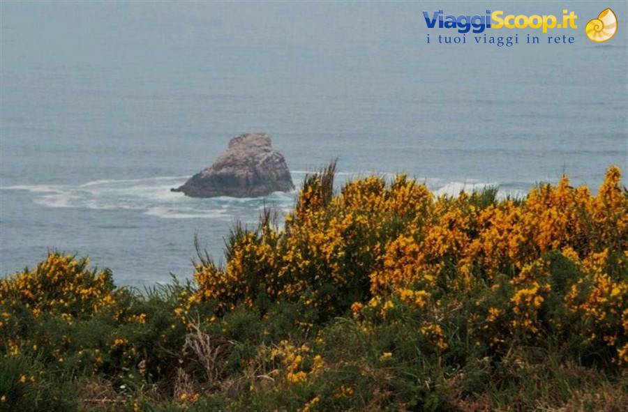
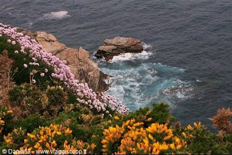
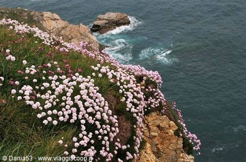
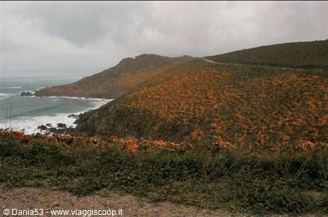
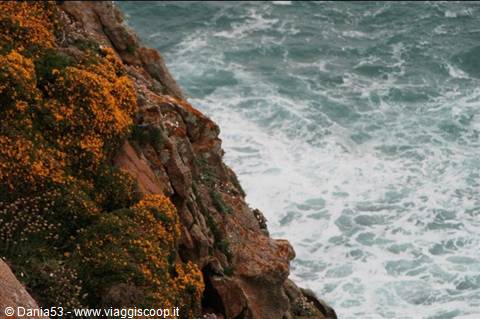
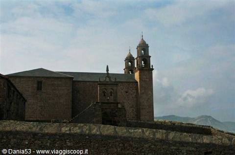
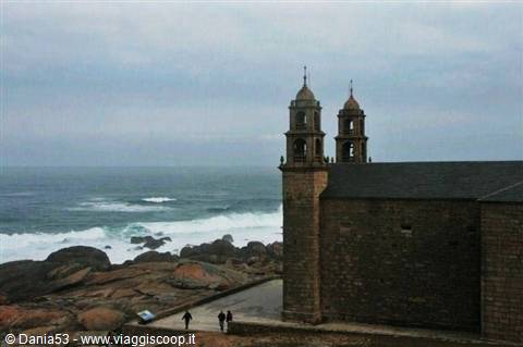
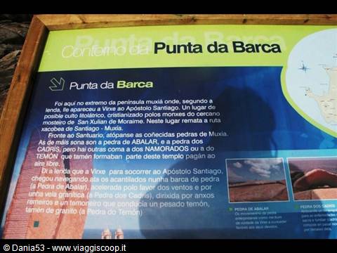
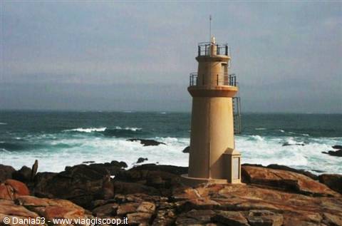
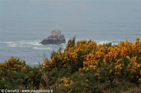
The three survivors were helped by the inhabitants of Xavina, who gave burial to the dead in a field near the beach that since then has been known as the cemetery of the English, and you can see it continuing along the lighthouse road. All around is a riot of colorful flowers that from the top of the cliffs descend to the sea; yellow predominates but there are also red, purple, pink, fuchsia and other flowers; it's a wonderful sight that will remain impressed on us forever. We move on until we reach Muxia, a small fishing port nestled on a point of land in the Ria of Camarinas, famous for the sanctuary of Nosa Senora Da Barca located on a rock near the lighthouse of Punta Da Barca, all around large granite rocks on which you can walk that descend to the sea.
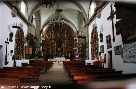
This sanctuary is connected to the Camino de Santiago; legend says that here Our Lady appeared to the apostle on a stone boat to encourage him to continue his preaching; according to the inhabitants of the area, Muxia is the end of the Camino de Santiago even though few pilgrims arrive here, everyone heads to the more famous Finisterre. Inside the church on the altar there's an 18th-century altarpiece with abundant decorations and the statues of the twelve apostles; from the ceiling hang numerous model sailing ships and boats.
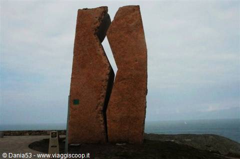
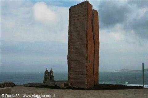
The pilgrims in a sign of devotion pay homage to the Virgin in order to protect sailors from the whims of the ocean; in the four days following the second Sunday of September they try to move "a pedra de abalar" (the rocking stone) which symbolizes the Virgin's boat, whose rocking gives a long lament, or to pass under "a pedra dos cadris," granite blocks shaped by the force of natural elements; it's said that kidney diseases are cured. Higher up than the church we see a monolith called "la herida" (the wound), erected by the association "Nunca Mais" (never again) as a testimony to the disaster caused by the sinking of the oil tanker Prestige on November 19, 2002, which occurred in front of Muxia and, losing 70,000 tons of fuel, had a tragic impact on the coasts of Galicia, a disaster that brought the economy to its knees; 60% of Gallegos live on fishing.
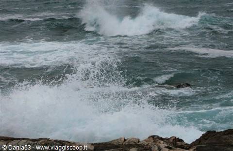
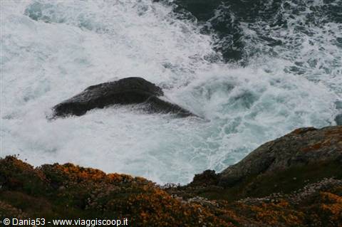
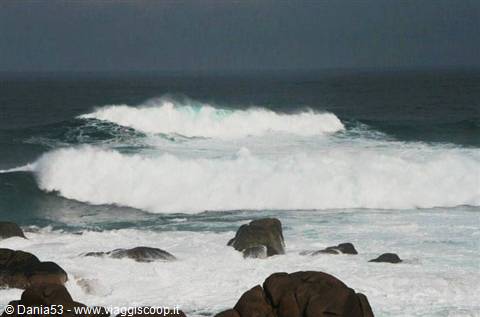
In Muxia it was possible to verify the disastrous impact that an accident of this type can generate: the rocks, the beach and even the paving of the square of this pretty village were covered by a layer of oil, in some places several centimeters thick. Before leaving we sit on the rocks and watch the powerful sprays of the ocean; although almost seven years have passed since the day of the disaster and the wind and rain have lashed these coasts, the wound is still visible; the cliff in some places is still blackened by tar.
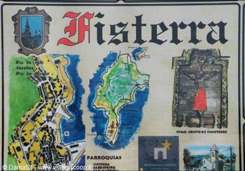
Fisterra, the point where ancient peoples believed the world ended and the land seems to leave space for the infinity of the sea and its mysteries, is our next stop and is also the final point of the Camino de Santiago, the place where pilgrims went to collect the scallop shell as proof of their pilgrimage; for us it's a choice of itinerary convenience since we'll visit Santiago afterward.
Cabo Fisterra
Day 89 May 2009
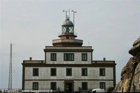
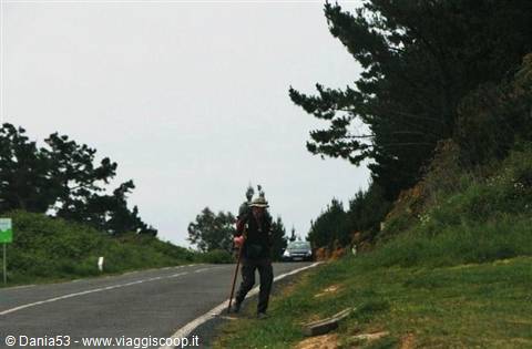
The road leading to the lighthouse passes through the town of Fisterra; there are houses and many construction sites that disfigure the landscape; continuing on we skirt the ocean and the landscape improves, though there's no comparison with Muxia and Cabo Vilan; we meet pilgrims, some on bicycles, some on foot with backpack and staff; arriving at the lighthouse we walk on the cliffs and near a rock with a large stone cross we see some scorched hiking boots, around them many remains of fires; tradition has it that pilgrims burn a garment used during the journey. We leave Fisterra and the coast of death to go to Santiago, skirting the ria of Muros which extends in the form of a fissure in the middle of granite rocks; the road always winds through a suggestive landscape with beautiful beaches and the lagoon.
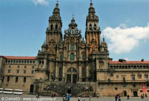
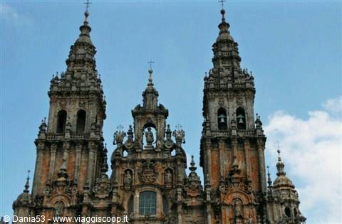
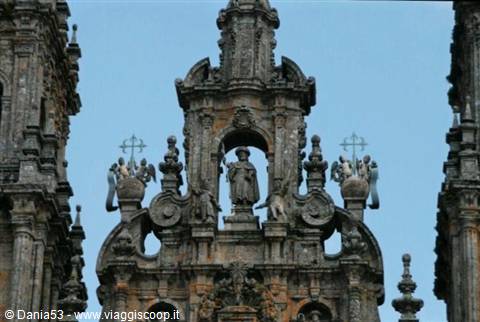
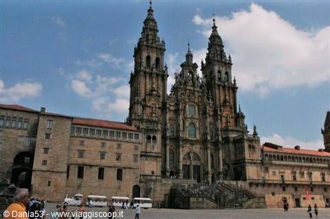
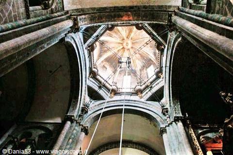
As we approach Santiago we see the spires of the cathedral popping up above the roofs, and when we find it in front of us we're left breathless. It's enormous; the Latin cross plan measures 97 x 65 meters and the vaults rise up to 24 meters. The main facade, the Obradoiro, is in baroque style; it was erected between 1738 and 1750 in order to protect the portico of glory from the weather; facing west, it is the main entrance of the cathedral, the third temple of the Christian world after Rome and Jerusalem, and is preceded by a monumental staircase. On the sides two towers 76 meters high with the statues of Santiago's parents, the mother's in the tower das Campas, the father's in the tower da Caraca, and in the center at the highest part stands the statue of Santiago, surrounded by other statues, balconies and pinnacles.
Having passed the portal you enter the portico of glory, the ancient facade of the cathedral completed in 1188 after work lasting 20 years; it's a masterpiece of Romanesque sculpture composed of three arches with over 200 figures carved in granite; the central column where pilgrims place their hands asking for their prayers to be answered is worn away by the rubbing that over the centuries has left its mark.
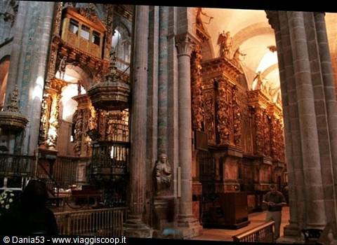
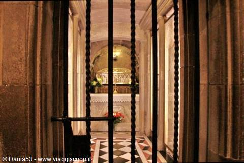
The altar surmounted by a baldachin is a baroque riot, at whose center stands the statue of Saint James covered by a silver cloak; it is crossed by two one-way passages; one descends to the crypt built on the foundations of the church and in which the relics of the apostle are kept, visible behind a small gate, in front of which is a kneeler where some tired but happy pilgrims pray; the other goes up behind the altar allowing pilgrims to kiss the bust of the saint; in front is a stone statue that seems to have the features of Master Mateo, the architect who built the portico of glory, and we see some young people performing a curious ritual: striking their head three times against the statue, a habit that seems to come from university students as a good-luck sign for intelligence and luck in exams.
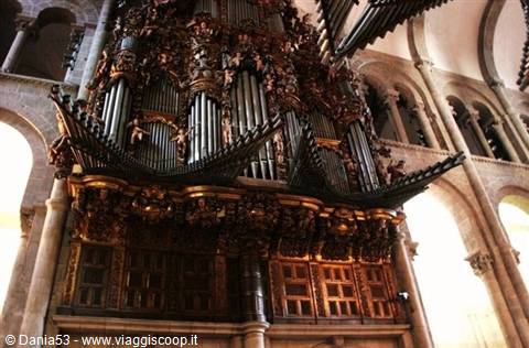
Above a portal in the lunette is carved the representation of the court of the heavenly Jerusalem; up high two large baroque organs stand out; in the side naves are 4 of the 16 chapels present in the cathedral. From the dome hangs the sphere that hooks the mythical botafumeiro, an enormous silver censer that has distant origins; its use in fact dates back to the Middle Ages when its perfume sought to mitigate the smell of the pilgrims who arrived at the end of the journey after many days in which they had little chance to wash. It weighs 62 kilos and is 1.60 m tall and is the largest in the world; it is loaded with 40 kg between charcoal and incense, reaching a total weight of about 100 kg; the rope that suspends it from the crossing measures 65 m, is 5 cm in diameter and weighs 90 kg. Previously the ropes were made of hemp or esparto; since 2004 they are of synthetic material.
To move it there are 8 men called tiraboleiros dressed in red; they hoist it to 22 m of height and then with a system of ropes and pulleys give it a pendular motion until it grazes the ceiling at a speed of 70 km per hour; it is used only in solemn masses and on the occasion of the holy year. Recently you can see it in operation upon request by groups of pilgrims paying €300. When the botafumeiro is not in operation it is replaced by another censer, known by the name "la alcachofa," the artichoke. The cathedral museum is divided into various spaces; there are displayed various sculptural works, collections of reliquaries, of goldsmithing.
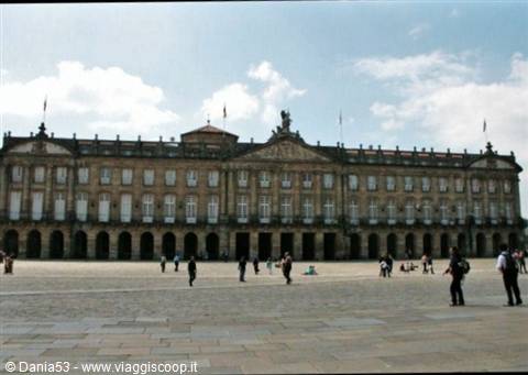
The royal pantheon, where you can see the tombs of the rulers of Galicia; from the transept you also reach the cloister where there are various rooms that house important collections of tapestries, the botafumeiro when it is not in operation and the library where books of incalculable value are kept. Now we are in the Praza do Obradoiro, onto which the cathedral faces and which is one of the most beautiful, surrounded by splendid buildings such as the Pazo de Xelmirez (episcopal palace), opposite the Pazo de Raxoi, seat of the town hall and recently of the presidency of the government of Galicia, surmounted by the equestrian statue of Santiago Matamoros brandishing his saber.
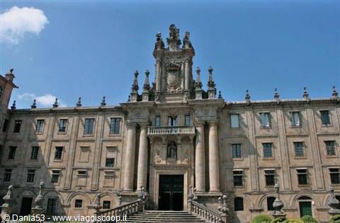
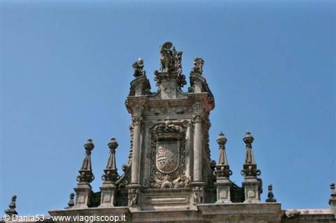
On the left the rectorate of the college of San Xerome, while to the north the square is closed by the Hostal dos Reis Catolicos, commissioned in 1492 by the rulers Ferdinand and Isabella to welcome pilgrims, now transformed into one of the most luxurious paradors of Spain; on the facade there are decorated pillars and sculptures with the effigies of the Catholic monarchs. Having turned the corner of the cathedral we are in Praza da Inmaculada where we see the facade called of the Acibecheria and the monastery of San Martin Pinario, the most important in Santiago, today transformed into a seminary; above the entrance is a large shield of Spain with the image of Saint Martin on horseback carved between two elegant columns.
We continue toward the rear of the cathedral and find ourselves in Praza da Quintana with the Holy Door or door of forgiveness; this is opened only on the occasion of the Compostelan holy year or when July 25 falls on a Sunday. Following a by now consolidated ritual, pilgrims enter through the Holy Door and exit from the portico Da Gloria; in the past only sovereigns entered through this door; onto this square also face the casa Da Parra and the monastery of San Paio de Antealtares with 48 windows closed by grates, commissioned by Alfonso II to guard the relics of Santiago just discovered.
Continuing always around the cathedral we find ourselves in Praza Das Praterias (gate of the goldsmiths) because of the many silversmiths' shops that faced onto it; here there is the only external door in Romanesque style, surmounted by the clock tower in baroque style 72 m high called Berenguela because of its bell; all together these squares form the Obradoiro, a Galician word that describes the place where artisans worked. We continue the visit among narrow streets and historic buildings; under a portico a boy in traditional dress plays the gaita (Galician bagpipes); we stroll through streets with numerous clothing shops, souvenirs, with objects connected to the camino such as the staff and the vieira (scallop shell), jet jewelry and silver statuettes so cute that we buy about ten for friends and relatives.
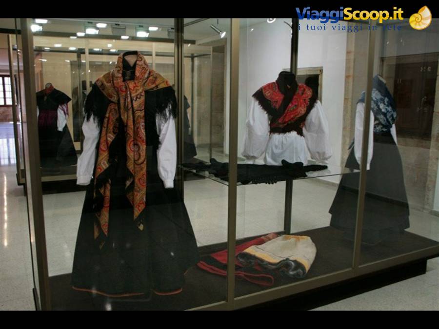
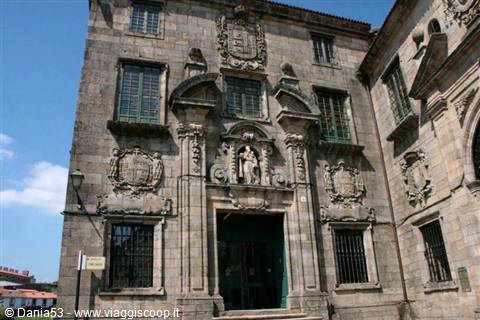
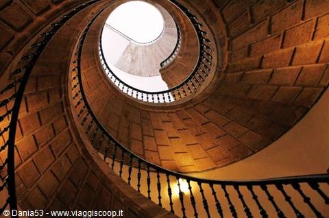
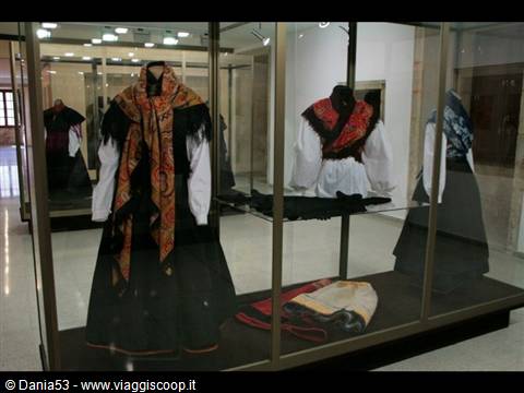
Continuing to wander around the city we arrive in front of the church that houses the Pantheon of illustrious Galicians and the monastery of Santo Domingos di Bonaval, now the Museo do Pobo Galego (museum of the Galician people). Having entered, what surprises us is the triple spiral staircase; we visit the rooms dedicated to the sea, to trades, to the countryside, to clothing, with traditional dresses on display that help us understand Galician culture.
Santiago de Compostela Museo do Pobo Galego
Day 99 May 2009
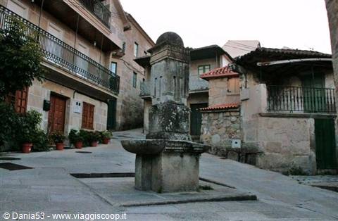
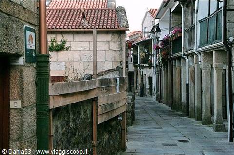
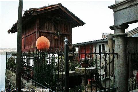
This city of undisputed religious, artistic, cultural and historical interest would deserve much more than the visit we made today, but time is a tyrant and forces us to continue the journey. We leave the city and take the Autopista del Cantabrico which brings us to the Rias Baixas overlooking the Atlantic; this is the most rural area of Spain; the water has carved a coast so jagged as to shape fjords and beaches along the beautiful coastline of the ria of Pontevedra; a few kilometers away is Combarro where we find a room on the main road at the hotel Xeito (€32). While we look for a restaurant for dinner we visit this fishing village; we walk on little streets paved in stone that slope down toward the shore where houses face with bunches of corn hung on the balconies to dry, and little squares with the cruceros (ancient stone crucifixes).
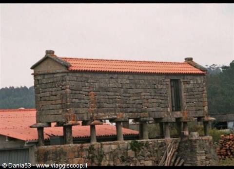
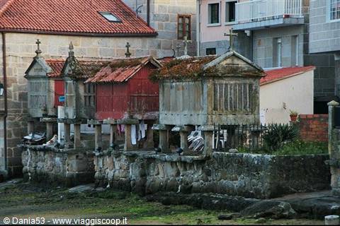
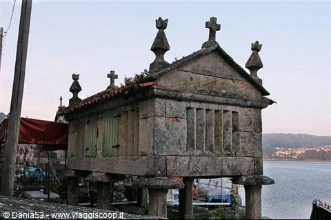
Having reached the port we see a panorama with groups of horreos facing the bay, the best preserved in all of Galicia; some of these have become shops for wine tasting, others for typical products of the area. The Galician horreos are different from the Asturian ones; these have Celtic and Roman origins; they rest on mushroom-shaped pedestals in rectangular stone and ventilation is allowed by grooves; on the roof they have pinnacles and crosses, symbols of protection and fertility. Inside one of these country houses is the restaurant Alvarinas with characteristic antique decor with old barrels and other traditional features; we eat a plate of mariscos (seafood) and drink one of the best wines of these areas, the Albarino; we pay €31 for dinner. Today too has been a full day and, satisfied, we return to the hotel.
Castro Monte Santa Tegra
Day 1010 May 2009
Sunday, May 10
Vigo-Baiona--Santa Tegra -Portugal border-123 km.
It's 8:30 and we're traveling along the ria of Vigo, an extension of the sea in front of the Cies islands; we cross over the bridge of Rande and head toward Monte Do Castro, 136 m high, which dominates the city. The first impression of Vigo is not good: road works, construction sites that force us to spin around like tops, and fortunately, given the early hour, the traffic is light. We see houses and buildings smeared with words (long live this, down with that, I love you, I hate you) along almost all the streets we drive; having arrived near the park of Monte Do Castro we park and head toward the viewpoint; in every corner there are papers, bottles, cans, filth; we also see the bay and the port from which commercial vessels and fishing boats set sail.
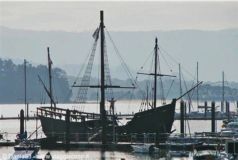
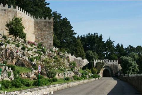
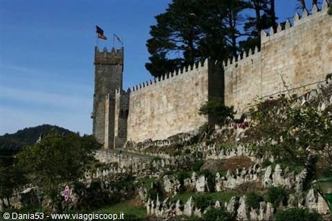
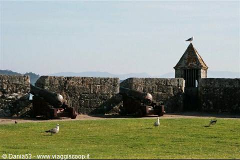
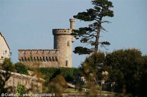
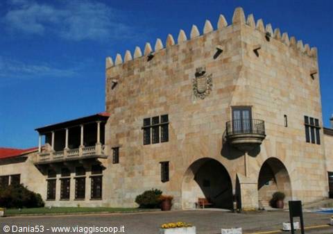
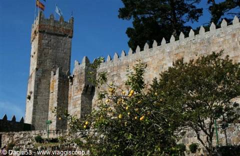
The city's economy is based on the automotive industry, metalworking and food processing with the processing and preservation of fish, and on the large shipyards; above all these buildings hovers a light haze that we know well: smog. We quickly leave the city and go to Baiona, which rises near cape Sillerio; in the bay several boats sway on the water, among them the replica of the caravel "La Pinta" which landed here in 1493 commanded by Martin Pinzon, lieutenant of Christopher Columbus, announcing to the world the discovery of America. The bay opens up near the Minor river; on a rock stands the fortress of Montereal with three kilometers of walls on which you can walk among bastions, outworks and cannons; inside the perimeter a church surrounded by an open portico onto the gardens, while the central nucleus of the fortress has become a luxurious parador.
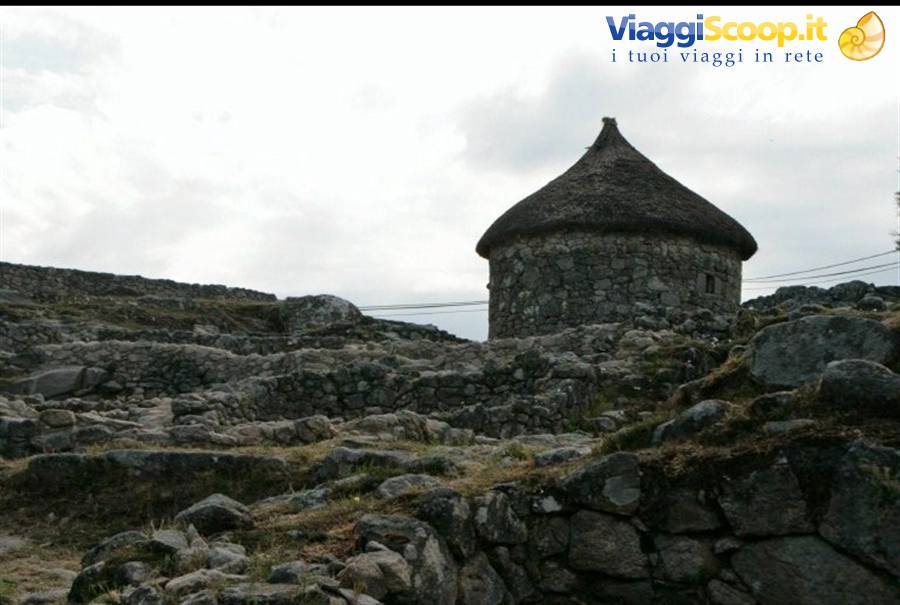
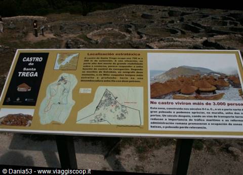
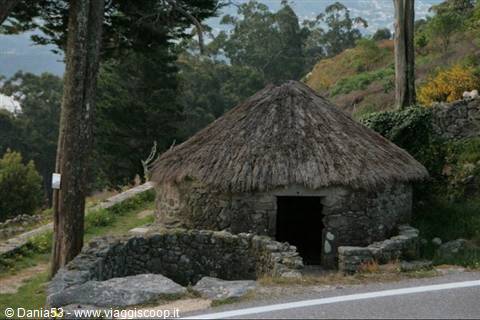
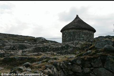
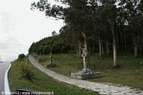
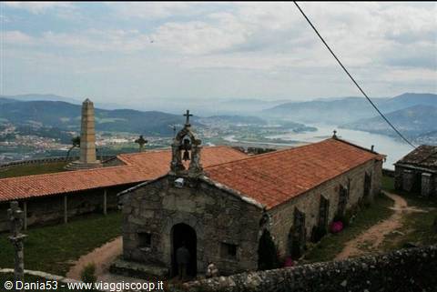
About thirty kilometers away is A Guarda, the southernmost town of Galicia, and Monte Santa Tegra rises with panoramic views over the Mino river; the road is steep but offers a phenomenal view of the bay. During the construction works of the road in 1913 a Celtic-Roman castro was discovered, composed of more than a thousand dwellings; there are numerous oval-shaped foundations and the reconstruction of a house as it must have been in those times; continuing along the edges of the road there are two Stations of the Cross, one ancient made of simple crosses, the other of Celtic inspiration like those of Ireland and Scotland. At the top, the small sanctuary of Santa Tegra, where a small relic of the saint's arm is exposed for the veneration of the faithful. For €0.80 we visit the museum where pieces from the Bronze Age, Iron Age, Roman coins, silver pieces and stone workings are displayed.
The summit is called Pico Do Facho (peak of the fire) where in ancient times bonfires were lit to warn the town of the arrival of pirates; here there is a commemorative cross and a magnificent view of the little town, of the port of La Guarda on one side, and the coasts of Portugal on the other. We continue the journey toward Camposancos at the mouth of the Mino river where you take the ferry to Caminha in Portugal, but then we decide to follow the road inland as far as the bridge of Amizade and arrive at Vila Nova de Cerveira. The journey continues in Portugal.
0 reader comments