After the "usual" extremely troubled pre-holiday week, with Federico ill and therefore rushing here and there, between doctors, emergency rooms and pharmacies, after the inevitable work matters to close and the providential last-minute recovery of the little one and then after an endless wedding that kept us busy yesterday until late at night... after all this, though slightly worn out, we are ready to leave for a new trip, extremely intriguing but anything but relaxing... We will not be alone in this imminent adventure, but in the company of the grandparents, so as to repeat the happy experience of three years ago, and today as then we will go to the States to do, this time, an incredible "coast to coast": in just three weeks a little madness...
From Washington (the capital of this boundless state, as big as a continent), on the Atlantic Ocean, to Los Angeles, on the Pacific Ocean, through fifteen states, grazing Canada to the north and Mexico to the south: something that, with the help of good fortune, can leave an indelible mark on our lives as passionate travelers. Barely three hours of sleep and the alarm goes off, so sleepy but charged with adrenaline I get out of bed and at 5:15 I am, by car, at the grandparents' place... I accompany them to the station and then go back home... Meanwhile Sabrina and Federico have also gotten ready, so at 6:00 we set off again, accompanied by the other grandfather (we involved really all the relatives!) and we reach our travel companions at the station.
The train arrives on time at track 1 and at 6:30 we start racing along the rails to reach, less than an hour later, equally on time, the Bologna station... From there, after having laboriously dragged all the luggage up and down the stairs (long live modernity!), we get on the shuttle that, shortly before 8:00, drops us off in front of the entrance of Marconi airport. We check the suitcases directly for Boston, have a quick breakfast then go through the metal detector and wait at gate number 21. Everything proceeds according to plan and we don't have to wait beyond the scheduled time, so, having boarded flight AF 1229, an Air France Airbus A318, twenty minutes after 10:00 we lift off the ground heading for Paris...
We gain altitude and cross the Po Valley, then fly over the still snow-covered Alps (probably the Aosta Valley with the imposing peaks of the Matterhorn and Mont Blanc clearly visible), then over France a single great expanse of clouds awaits us. We land at Charles de Gaulle airport at 11:39, in the middle of autumn, while it rains steadily and grayness reigns unchallenged, but we don't pay too much attention to the weather conditions and immediately get to work so as not to miss the next flight, since the time at our disposal is certainly not abundant.
We move from Terminal D to Terminal A and after a mini-interrogation, for security reasons, at the American Airlines counter we go through the metal detector again and through gate 48A we board the Boeing 767 that, identified as flight AA 147, almost perfectly on time, taxis on the Paris runway and climbs in altitude to face the transatlantic crossing that will take us once again to the States. We catch a glimpse for a moment of the unmistakable silhouette of the Eiffel Tower and then we dive into the clouds, so the spectacle beyond the window becomes a single immense expanse of candid, blinding water vapor... Never seen so many clouds in my life: old Europe is completely covered by them, at least the part we fly over, and also a good stretch of the Atlantic Ocean. I take the opportunity then to set the hands of the clock to the arrival time zone (six hours less)...
and in the blink of an eye it is morning again. Occasionally we glimpse some patches of ocean then, a handful of minutes before 15:00, we begin to descend, we spot land and a little later, at 15:12, the wheels of our plane gently touch American soil... and for all of us a new star-spangled adventure begins... We face without problems the always tough U.S. customs, but time is short because another flight awaits us... We retrieve our suitcases safe and sound and immediately check them in for Washington, then we look for and find the shuttle to transfer from Terminal E to Terminal B... By now there is only half an hour left before departure, so they let us through a preferential lane at the metal detector and we arrive at the gate just in time to learn that... the flight is delayed...
indeed, shortly after they even announce that, like many others, it has been canceled due to the bad weather raging on the east coast. It's a setback: an exhausting wait begins and only after several hours do they give us the tickets for a new flight, for tomorrow at 13:15... but the problems don't end there!... They do find us, at the expense of American Eagle, a hotel to stay in, but we were supposed to pick up the rental car tonight in Washington, so having left the airport we go to National in Boston, explain the problem and they modify our reservation with a small surcharge, then we return to the starting point and from there, with a taxi and a voucher from the airline, we reach, on the outskirts of Boston, the Homewood Suites, which will host us for this unscheduled night...
The kind lady at the reception also calls Washington, to the Days Inn that was supposed to host us, and says that we will arrive tomorrow evening, then she hands us the keys to our rooms and finally we can go rest: in the States it is 21:30, but twenty-four hours have now passed since our departure and we are so tired that we no longer even have the strength to be angry about the uncomfortable situation that has arisen.
Chicago: the Tribune Tower
Day 230 Jul 2007
We wake up in Boston, in Massachusetts, where we never would have thought we would open our eyes again on this trip... and beyond the window of our room it is pouring rain, so our worry immediately runs to the plane waiting for us and its departure, which could once again be called into question. Because of the time zone we all wake up rather early and after having skipped dinner yesterday this morning we treat ourselves to a hearty breakfast, before patiently waiting for the taxi that will take us back to the airport. At 10:00 sharp the same taxi driver from last night reappears, whom I had asked to come back, and half an hour later we are again at Terminal B of Boston Logan Airport, at the American Eagle counter, where however they point out that our replacement flight is a U.S.
Airways one...So we change pavilion and prepare to face a very long line for check-in at the end of which, it seems, we will finally take off... After two hours we arrive before the metal detector and are selected for a more thorough check (what a pain...!)... we endure even this and immediately after we reach gate number 18, from which, God willing, we will board, at 13:45, flight U.S. Airways 2037... On the video terminals, however, it appears that it is delayed: first to 14:11, then to 14:30, finally, after boarding, at 15:16, the Airbus A319 finally lifts off the ground heading for Washington! We climb above those cursed clouds that have caused us so much trouble and after about an hour, at 16:27, we touch the ground of Washington Reagan Airport... A miracle: there is even a timid sun!...
We retrieve all our luggage safe and sound, go out into the open air and with the appropriate shuttle we reach National, where they finally hand us our car: a beautiful Toyota Sienna (license plate Florida X84 ECD), and with that, finally happy, we set off for our "on the road" trip in the States. It is not easy to dedicate ourselves immediately, body and soul, to the visits on the program, but we have no choice: we had an entire day available to discover all the beauties of the American capital and instead, unfortunately, it is almost 18:00 and we have no more than two hours of daylight left. We head immediately toward the center of the District of Columbia, where Washington is located, a sort of city-state created ad hoc, that is, a limited portion of territory that together with the other fifty real states of the federation forms the United States of America.
Having crossed the Potomac River we take the Mall, a strip of green over three kilometers long around which almost all the most interesting monuments of the capital are found. We are initially a bit disoriented and, having momentarily neglected the Lincoln Memorial, the first thing that catches our eye is the imposing silhouette of the Washington Monument which, built in 1885 in the shape of an obelisk to commemorate the first president of the United States, is the tallest structure in the world made of simple masonry (almost 170 meters high). Right in front of it is one of the best-known buildings on the face of the Earth: the White House... it is a real emotion to be able to glimpse it among the vegetation that surrounds it, even if, unfortunately, partly due to lack of time, partly due to the post-9/11 security measures, we cannot get very close to it.
We continue then along the Mall, flanked by historic buildings, with the scenic view of the very white Capitol at the end... The Capitol is the seat of Congress and, having appeared in numerous films, is almost as famous as the White House, with which it shares the role of the most important political building in the country. Having taken the ritual photos we immediately hit the road again and, passing first by the monumental Union Station and then in front of the FBI building, we end up parking near the westernmost part of the Mall... On foot we thus reach the Veteran Memorial, a chilling monument created to remember the American soldiers fallen in the Vietnam War: 58,022 names engraved in an immense V of black granite. Nearby is also the colossal Lincoln Memorial, which houses the imposing statue, six meters tall, of the president of the same name, seated in his armchair.
The place is very evocative and even more so with the sun setting, inexorable but spectacular, setting the sky ablaze behind the monument. Having returned to use the car, now in semi-darkness, we pass by Arlington Cemetery, where 175,000 American soldiers rest, as well as former president John Fitzgerald Kennedy, assassinated in Dallas in 1963. We also pass near the famous Pentagon (the largest building in the world, as well as the headquarters of the U.S. Department of Defense) and arrive in Virginia at the Days Inn Arlington Pentagon, which will host us for this night (to tell the truth, we were supposed to be here last night too). We leave our luggage in the room and rush to dinner since it is already past 21:00, then we return and go straight to sleep because tomorrow awaits us the longest leg of the whole trip, purely a transfer one.
Mount Rushmore National Memorial
Day 331 Jul 2007
The alarm goes off at 6:00, but favored by the time zone we don't struggle too much to leave the covers... We have the breakfast included in the room price and then we set off on the enterprise of crossing the States by car, from east to west. We observe once again in the distance the dome of the Capitol, ideally greet it and head quickly toward the outskirts of a capital that we promise ourselves, one day, to visit as it deserves, then, easier said than done, we leave the state of Virginia... we pass, crossing hills, through that of Maryland... one hill after another we also cut through a piece of Pennsylvania... and devouring hills and more hills we arrive in Ohio, where we stop for lunch at a service area among huge and colorful typically American trucks. When we get back on the road the landscape becomes flatter and characterized by immense corn plantations.
We pass near Cleveland and Lake Erie, on whose shores the region of Ontario and therefore Canada also faces. We are practically halfway through the leg and Ohio seems never to end, then, in the late afternoon, we enter the state of Indiana, cross it completely from east to west and arrive in Illinois, by now very close to the destination, that is Chicago. We cross, on the southern outskirts of the metropolis, the Skyway Bridge, an impressive iron structure built in 1958 to span the Calumet River, and from its summit we glimpse the skyline of Downtown, with its skyscrapers on the shore of Lake Michigan. We thus start a race with the sun, which is rapidly descending toward the horizon, and we arrive in time at Navy Pier to capture the grandiose profile of Chicago with the magnificent colors of sunset.
Extremely tired but extremely satisfied with the spectacle at the end of the day we go looking for our hotel since it is already well past 20:00 (and along the way we also gained an hour of time zone!)... Luckily it is not far and in a short time we find ourselves in front of the Howard Johnson Inn that will host us for this night. The accommodation is rather spartan and a bit retro, but it's fine, with a magnificent view of the skyscrapers and even internal parking. We take possession of the only room we had booked and then, on foot, we go to dinner at Gino's Pizza, a few blocks away. We taste vaguely Italian food and immediately after we go to rest, because the pace of this trip is really frantic!
Custer State Park
Day 41 Aug 2007
After the super-fast tour of Washington and after yesterday's very long transfer, we finally wake up in Chicago ready to make the first visit as per the program. We try to leave as early as possible: already before 8:00 we have breakfast in a characteristic place adjacent to the hotel, then, having left the luggage in storage at the reception, we set off, using the public transport passes purchased some time ago on the internet, which they had even sent to our home. By bus we head toward the center of Chicago, capital of Illinois and one of the largest American metropolises, with its three million inhabitants (eight, considering the outskirts), and second only to New York in terms of skyscrapers and bold architectural solutions...
The city's fortune was, in some way, made by a fire of biblical proportions that in 1871 destroyed two out of three buildings, so, given the results, it was thought well to rebuild them adopting metal structures rather than wooden ones, and from then on began the vertical development of Downtown... Having covered a good stretch of La Salle Street we get off the bus just after crossing the Chicago River and first of all we observe, on its banks, the gigantic Merchandise Mart, which houses the store with the largest warehouse in the world and is currently owned by the Kennedy family, then on foot we make our way into the city center. We pass under the El, short for Elevated: the elevated subway, wobbly and rusty, which is somewhat the symbol of Chicago...
and to think that some years ago it was saved at the last minute from demolition, and it would have been a shame because it is a true piece of this city's history. Built in 1893 it also appeared in several successful films such as "The Fugitive", with Harrison Ford, and more recently in "Spiderman 2", as the scene of the battle between Spider-Man and the evil Doctor Octopus... Nearby we reach the colossal Thompson Center, one of the most recent constructions of the Loop, that portion of Downtown bounded by the El, erected in 1984 and characterized by an enormous full-height atrium, then we head, surrounded by vertiginous skyscrapers, to the Daley Center, a gigantic construction on whose square, dominated by a large sculpture by Pablo Picasso, interesting buildings face.
Continuing our walk we go again to the banks of the Chicago River to see the Marina Towers, two twin towers with curious architecture, which because of their appearance have also been nicknamed "Ears of Corn"... We enjoy excellent panoramic views, characterized by the green of some well-kept gardens along the river and then we return toward the center to get on the El and do the Loop circuit from a very particular observation point... Thus the skyscrapers of Chicago pass by the sides of the elevated track and rattling along we end up finishing our ride right near "her majesty", the Sears Tower. The tallest building in Chicago and the United States, with its 442 meters, 110 floors and 100 elevators, was completed in the now distant 1974 and for a long period was also at the top of the world ranking...
Another one is in the works, which will have to rise nearby by 2009, but the 610 meters of the futuristic Chicago Spire will not be enough to reclaim the record, which will probably remain with Asia. In our very own personal Guinness, the Sears Tower instead fully deserves a place, so we take the opportunity to go up by elevator to the panoramic terrace on the 103rd floor, from which the view is truly breathtaking, a shame only about today's dense haze. Having set foot back on the ground, by public transport we reach, almost on the shores of Lake Michigan, Millennium Park, inaugurated in 2004 and placed at the center of a magnificent backdrop of skyscrapers, which are reflected on the astonishing Cloud Gate Sculpture, an enormous work by Anish Kapoor, a contemporary artist who must be given great credit for having placed it in a truly exceptional context...
Just as striking is the nearby eccentric theater. After unforgettable moments in the futuristic Millennium Park, almost at noon, we set off on foot along the so-called Magnificent Mile, alias North Michigan Avenue, one of the most architecturally interesting walks in the city... Having crossed the Chicago River once again, in fact, before our eyes appear the beautiful views of the very white Wrigley Building, erected in 1921, and of the Gothic Tribune Tower, four years younger and home to the first newspaper of Illinois. The street, which runs parallel to the lake, is very long, so we take advantage once again of our pass and in a short time we find ourselves, a few blocks further north, at the foot of the impressive Hancock Tower...
The second tallest building in Chicago, from the top of its 96 floors (344 meters plus the antennas) it dominates this area of the city, including the strange Water Tower, which is not a skyscraper, but one of the few buildings that survived the 1871 fire and, built entirely of light stone, in a Gothic Rococo style, once served to distribute drinking water. Having practically completed the visit of downtown Chicago, again by bus, we return to the Howard Johnson Inn, where our luggage is waiting for us, and having loaded everything into the car we immediately set off toward the outskirts. Traffic light after traffic light, block after block we arrive in the Oak Park neighborhood, where the Frank Lloyd Wright Historic District is located...
The famous architect, who had his studio here, had several buildings erected in the area at the beginning of the twentieth century, still on fine display along with many others characteristic of the era, among which is the birthplace of the famous writer Ernest Hemingway. We take some photos and have lunch, as usual quickly, parked on the tree-lined avenues of Oak Park, before definitively leaving behind, around 15:00, the beautiful Chicago, which we will never forget. We follow Interstates number 88 and 80 westward, cross the Mississippi River (the longest in North America) and enter the state of Iowa. We travel through endless lands cultivated with sunflowers and peanuts and, by now at sunset, we reach Des Moines, the capital of this deeply continental and flat state.
We thus stop at the Quality Inn, on the northern outskirts of the city, where, after a dinner of Italian-American pasta, we prepare to spend another night, comforted by the starry sky of this endless country.
Wyoming land
Day 52 Aug 2007
Another very long leg of approach to the mythical West awaits us, so the alarm going off early is a must. During the night the sky has become, unfortunately, cloudy and the forecast does not rule out rain... a shame, because on the program there is the visit to the nearby county of Madison, with its covered bridges, made famous by the film "The Bridges of Madison County", with Clint Eastwood and Meryl Streep. We have breakfast and then a quick but essential grocery run, then we take Interstate number 35 south to exit almost immediately, after a handful of miles, while, as if by magic, the sky opens and the sun comes out. A little off the highway, already within the county borders, we encounter the first bridge: the Imes Bridge which, erected in 1870, turns out to be the oldest among those still existing.
The construction, entirely painted red, is very characteristic, even if today it can only be crossed on foot, and rightly so, given its historical importance. In its presence, however, one wonders what the reasons were, at that time, certainly not aesthetic, for covering a bridge, and the answer lies in the fact that the timber used for the flooring was much more expensive than that used for the roof and sides, so much so as to make it worthwhile to protect it from bad weather. Having resumed the road to Winterset, the county seat, we follow a dusty dirt road along which we encounter the Holliwell Bridge, the longest of the series (less than forty meters), then, now on the outskirts of the town, the Cutler-Donahoe Bridge, immersed in the green of a small public park.
On the streets of Winterset several scenes of the film that made the region famous were shot, but the small town has another solid bond with the world of cinema. In a modest little wooden house, painted white, a short distance from the center, on May 26, 1907 the mythical John Wayne was in fact born, a true sacred monster of star-spangled cinema: in his long career, not for nothing, he acted in over 250 films, mostly westerns. Having paid homage to the most famous inhabitant of the county we go west of the town, along another dusty road, until we reach the Roseman Bridge, perhaps the best-known and most scenic bridge, appearing in several segments of the film, then, having spotted a graceful deer, we return toward the county seat and continuing our itinerary we follow yet another dirt road northward.
We thus come in sight of the Hogback Bridge, the last bridge of the series, which stands out, as usual, all painted red in the bucolic surrounding landscape. Extremely satisfied with the original tour just completed we return to the paved road, with the car having practically changed color it is so dusty, then we continue until we regain the Interstate too (this time number 80), and following it we speed westward, since the morning is almost completely gone and we still have an endless number of miles to cover. Now at the western border of Iowa we stop for lunch at a very well-equipped rest area and when we resume, in the early afternoon, traveling along number 29, we enter the state of South Dakota.
Having reached the city of Sioux Falls we stop to see, more than anything to break the monotony of the highway, Falls Park: nothing exceptional, just little waterfalls descending among some reddish rocks... after all we are practically on the plains and nothing more spectacular could have been expected. Having almost immediately resumed our journey we take Interstate number 90 westward and a little later we exit at the town of Mitchell to see a curiosity: the Corn Palace, which can be considered a real American gimmick! It is a vast construction, architecturally a bit gaudy, complete with minarets and bulbous domes, which every year is renewed with murals and decorations entirely made with parts of cereals, especially corn, and the resulting effect is truly unique and pleasant.
The whole thing was born at the end of the nineteenth century to advertise the products of the surrounding lands and over the years has become an occasion for celebration now rooted in local traditions. We stay in Mitchell just long enough to take a few photos and then we go back to racking up kilometers on number 90. We cross the Missouri River and set the clock hands back another hour (now they are eight compared to Italy)... We continue steadily westward, while the landscape changes and the prairies take over from the crops, giving the environment a more fitting appearance for the great West. Now in the evening we reach Kadoka, a remote village with a few motels, among which is the Best Western H and H El Centro, where we take lodging... We take a shower and then go to dinner while the few places nearby are already closing down...
We find one still open, rather spartan, but we have to make do, then we go to enjoy our well-earned rest, after the over nine hundred kilometers covered today as well in the heart of the United States.
Yellowstone National Park
Day 63 Aug 2007
When I pull back the curtains of our room a small curse escapes me: the sky is gloomy and a light drizzle is falling... and to think that an intense day awaited us, with so many beautiful things to see, but let's not despair and trust in a quick improvement. We go to have breakfast in a place adjacent to the hotel that seems straight out of an episode of "Happy Days" and Federico has a small accident with a pitcher of maple syrup... "Oh... Mom!"... he exclaims... the handle comes off and all the contents end up on him and on the floor... it is the apotheosis of stickiness and there is nothing else to do but go to the room to change him from head to toe, but we have to do it while the "universal flood" also breaks loose... and if the morning shows the day, I really don't think this can be an exceptional day.
In a tremendous delay we finally leave and shortly after we present ourselves in front of the "gate" of Badlands National Park, while it stops raining but grayness still reigns unchallenged. We purchase the Golden Eagle Card, which will allow us to enter all the protected national areas of the States and then we pass through the entrance of the first park of this trip. Badlands National Park, established as a National Monument in 1939 and elevated to Park in 1978, covers a vast area of great geological and naturalistic interest, in particular it offers scenery composed of fanciful pinnacles eroded by the weather, with shades of a thousand colors, and vast prairies in which some scenes of the film "Dances with Wolves", with Kevin Costner, were shot. A scenic road winds through the area of the pinnacles and that is the one we are about to take.
On foot we venture along the wooden walkways of the Window and Door Trails, we also stop at the numerous overlooks along the route, but unfortunately we cannot fully enjoy the beauties of Badlands, which with the presence of the sun to enhance its colors, could have offered a truly first-rate spectacle. We leave the park when it is already past 11:00 and using again Interstate number 90 we head toward Rapid City, in western South Dakota, while, mischievously, the sun comes out, and then disappears again under big rain clouds... ugh... and double ugh... We are heading toward the famous Mount Rushmore and the sky seems to offer no escape... Instead we stop at a supermarket for a quick grocery run and when we come out there are wide patches of blue above our heads.
Even though it is now lunchtime we race toward Mount Rushmore and when we get there there is a splendid sun (what crazy weather!)... We park the car and a few minutes later we are in front of the four presidents carved into the rock of the Black Hills: what an emotion, they look fake and yet they really are them! The work to create the Mount Rushmore National Memorial began in 1927, with four hundred workers under the orders of the sculptor Gutzon Borglum and continued for fourteen years, until the death of the artist in 1941, in the end however the faces of George Washington, first president and father of the United States, of Thomas Jefferson, third president and author of the declaration of independence, of Theodore Roosevelt, twenty-sixth president and architect of American economic development at the beginning of the twentieth century, and Abraham Lincoln, sixteenth president and sup
porter of freedom and equality during the very harsh interlude of the civil war, were imprinted on the rocks of South Dakota so that (words of Borglum) "... wind and rain will not carry them away"... We walk along the avenue with all the flags of the fifty states of the union and reach the panoramic terrace overlooking the enormous monument. We stay for a while admiring what until today we had only seen in photographs and then, leaving behind us a true icon of the States, we return to the car and have a quick lunch with our sandwiches. Given the good weather conditions we don't waste time and as soon as possible we hit the road again, so we cannot help but notice the enormous quantity of motorcycles (especially Harley Davidsons) circulating... evidently the area is a cult for enthusiasts of this kind.
We head toward the heart of the Black Hills, among endless prairies, not by chance the region was the set of a television series very well known to our generation, because "Little House on the Prairie" was definitely part of our childhood. We climb suggestive hairpin turns among the mountains and enter Custer State Park, a reserve of almost three hundred square kilometers in which it seems very easy to encounter wildlife. In fact, traveling along the Wildlife Loop we encounter deer and antelope, the immense herd of bison for which the park is famous and the very nice prairie dogs, so we can leave the Black Hills truly satisfied... and we descend again along narrow hairpin turns, along the Needles Highway, among narrow tunnels, incredible narrow passages and the suggestive granite ridges of the Cathedral Spires.
It is now evening and, while the sky darkens again, we settle for seeing only from a distance the Crazy Horse Memorial, another large sculpture that is taking shape among these mountains. Designed by Korczak Ziolkowski, assistant to Gutzon Borglum in the works of Mount Rushmore, to honor the Indian chief Crazy Horse, it was begun in 1948 and its realization has always proceeded with extreme slowness and amid a thousand problems, especially after the sculptor's death in 1982, but when it is completed it will be the largest sculpture in the world, 195 meters wide and 172 high (the four presidents are "only" 18 meters tall!). For the moment, however, only the face of its proud protagonist stands out... Having taken a few photos we speed toward the end of the leg, because the sun, which appears and disappears among the clouds, is rapidly setting.
Along the last stretch of road we leave South Dakota behind and enter Wyoming, then, shortly after 20:00, we arrive in the town of Sundance, where we stop for the night at the Best Western Inn. We go straight to dinner in what seems to be the only restaurant in town and then we retire to our lodgings: it was really a beautiful day, intense and rich in emotions, a shame only about the bad weather at Badlands National Park.
Yellowstone National Park: White Dome Geyser
Day 74 Aug 2007
The sun filters, at dawn, through the window of our room, and at the same time the alarm goes off, because today too we will have to cover over seven hundred kilometers, thus completing the march of approach to the Rocky Mountains. In the geographical area of the Black Hills, however, there is still an important visit to make, so, once the morning chores are done and the luggage loaded into the car, we go a few miles northwest of Sundance to see the surprising Devils Tower. Six Sioux girls were gathering flowers when they were attacked by some bears... The great spirit, to help them, then lifted the ground beneath them and the bears, trying to climb, left the mark of their claws on the rock, but had to give up... Thus was born, according to an Indian legend, Devils Tower...
In reality, one of the largest basalt monoliths in the world, it was created thanks to a volcanic phenomenon and rises, impetuous, with its 263 meters, among the gentle hills of eastern Wyoming. We observe the "Devil's Tower" a bit from all angles... there is no denying it, it is photogenic, after all it also appeared in the famous film "Close Encounters of the Third Kind", directed by Steven Spielberg, back in 1977... and then we are won over by the charm of the very numerous prairie dogs, which swarm in the surrounding meadows and stand up on their hind legs as we pass. Already before 10:00 we regain Interstate 90, which we follow swiftly westward, among the immense prairies and the very numerous deer grazing on the edges of the road... whose presence by now is no longer news.
Having passed the town of Sheridan we exit the highway and make our way, via Highway number 14, among the high mountains of Bighorn National Forest. We graze three thousand meters of altitude and after a stop for lunch in the cool air we make a small detour, along a dirt road, to go see the Bighorn Medicine Wheel, an enigmatic circle of stones used by the Indians for ritual purposes for over seven hundred years, but from the parking lot at the end of the dirt track there are still three miles to walk and, although the thing may appear interesting, we have to give up because, above all, there is not enough time available. Having regained the ribbon of asphalt we descend rapidly from the mountains and, back almost two thousand meters lower to the prairies, the temperature rises again by over ten degrees.
Having thus reached the town of Lowell we turn right, just before the built-up area, to go visit the Bighorn Canyon National Recreation Area, a protected area created in 1966 around an artificial lake and along the course of the Bighorn River. As soon as we enter the park road the sun, unfortunately, disappears behind big gray clouds, but we don't lose heart and go to the place called Horseshoe Bend, where the river forms a small lake surrounded by reddish rocks... Meanwhile, very strong gusts of wind rise out of nowhere, which clear the sky in a few minutes, and as if by magic all the colors of the landscape light up... incredible: we are in the north of the States, not even too far from Canada, and here the environment is of a desert type so much so that it seems we are in Arizona, instead we move a little further north and even enter for a few miles into the state of Montana.
We thus reach the extraordinary Devil's Canyon Overlook, a vertiginous panoramic point that allows us to observe from above the boundless chasm in which the Bighorn River flows... beautiful, very beautiful, but naturally we cannot linger too long because it is getting late. Having returned to Lowell and to Wyoming we resume the road westward, a road strewn, on its sides, with characteristic pumps for oil extraction, in a fascinating landscape, and that is how, carried away by taking photographs, instead of heading toward the city of Cody (founded by the mythical Buffalo Bill, alias William Cody), we find ourselves much further north, in Montana, and instead of turning back we improvise an alternative route.
The mistake we made cost us no more than about twenty miles and then, perhaps, every cloud has a silver lining, because we find ourselves having to travel the entire Beartooth Scenic Byway, a bold road opened in 1936 and, it is said, one of the most spectacular in North America. We begin in fact to climb among very high mountains, which exceed four thousand meters in altitude, on which here and there there is still some patch of snow and after an endless number of curves, among stupendous panoramas, we touch what will almost certainly be the roof of the trip: the Beartooth Pass, which rises to 10974 feet (3345 meters!) above sea level... with the outside temperature a few degrees above zero and with grandma, who doesn't show it, but is a little worried about her high blood pressure...
Luckily then in a few dozen miles we halve the altitude and, even grazing an accident with a bambi, which appeared suddenly in the middle of the roadway, we reach for the evening the remote town of Cooke City, now at the gates of the celebrated Yellowstone National Park. We settle into a motel of the Super 8 chain and shortly after we go out for dinner in a very western place, with old tools and hunting trophies on the walls, thus concluding a beautiful day, considering that it was supposed to be mostly just a transfer day.
Yellowstone National Park: Old Faithful
Day 85 Aug 2007
Exactly one week after departure the sun shines beyond the glass of the window and in our hearts we feel we have now completed the most difficult part of the trip, with the conquest of the Rocky Mountains, a magnificent North American backbone that we will now follow from north to south... not before, however, having visited one of the quintessential star-spangled symbols: Yellowstone National Park. It is decidedly cold in the early hours of the morning when we leave Cooke City behind, but the sky is clear and we trust in a quick rise in temperature. We travel a few miles and find ourselves in front of the entrance gate of Yellowstone, which we pass quickly thanks to the Golden Eagle Card, so it is a great emotion to find ourselves within the borders of the most famous natural park in the world.
The result of an apocalyptic volcanic phenomenon that occurred about six hundred thousand years ago and vast nine thousand square kilometers (a little more than Umbria!), Yellowstone National Park was founded in 1872 and is the oldest National Park of the United States and of the entire planet, declared a "World Heritage Site" by UNESCO in 1978. Immediately Yogi, Boo Boo and Ranger Smith come to mind, famous cartoon characters who are ideally placed here... but of the bears, for now, not even a shadow. On the other hand, traveling along the road that follows the Lamar Valley, we encounter numerous herds of imperious bison, grazing peacefully in the vast meadows at the edges of the roadway. Traveling carefree, immersed in nature, on this very green plateau at over two thousand meters of altitude, we thus reach the first place of some interest: the curious Petrified Tree.
It is the petrified trunk of a tree fifty million years old... nothing special compared to the Petrified Forest National Park in Arizona, but this one has the particularity of still being nicely upright and rooted in the ground. Taking the road that goes south of the park we stop to see the panoramic point over the Yellowstone River called Calcite Spring, and the nearby Tower Falls, the 40-meter drop that the waters of Tower Creek make to plunge into the bed of the river that gives the park its name. Having gotten back in the car we graze Mount Washburn and arrive at Canyon Village to visit all the panoramic points
Jackson Hole
Day 96 Aug 2007
When we wake up and look out of the window we have the feeling of being in the middle of the Po Valley in the depths of November, with a thick fog enveloping everything... A little saddened, we have breakfast and meekly leave the Comfort Inn, heading back towards Yellowstone. We follow the road that gradually climbs towards the centre of the park, skirting the Madison River, whose waters must be very hot because they steam abundantly, giving the impression of generating the hateful mist that surrounds us... We don't despair, though, because overhead every now and then you can make out the shape of a very pale sun.
Having reached the Madison junction we head south, drive through the hushed surroundings of the Firehole Canyon Drive and then, a little further on, also take the Firehole Lake Drive, which goes into the so-called Lower Geyser Basin, while it's almost 10:00 and above us a few auspicious patches of blue appear. So we stop near the intriguing White Dome Geyser and there we wait for the sun... We wait a good half hour, but in the end we are rewarded with a beautiful clear sky and a spectacular eruption of the geyser. Finally back on the road accompanied by good weather conditions, we spot in the woods along the sides of the road two splendid coyotes wandering probably in search of food... We somehow manage to capture them on camera and then, having completed the detour, we return to the main route of the park, which we resume following towards the southernmost exit of Yellowstone.
We skip the part of the Lower Geyser Basin on our right to reach, a few miles further on, the far more interesting Midway Geyser Basin, where the Grand Prismatic Spring is located, the largest hot water spring in the park, with a diameter of almost one hundred metres, as well as the second largest in the world. On foot we set off along the wooden boardwalks and can observe it up close, with its marvellous colour shades... but we're not satisfied. We get back in the car, drive another very short stretch of road and, having crossed the pedestrian bridge over the Firehole River, we set off along the trail that leads to Fairy Falls. After 15 minutes of walking, here we are again at the Midway Geyser Basin, but on the other side of the river, and near the Grand Prismatic Spring we climb, not without effort, up the hill opposite to see the place from above...
an enchantment, with the whole valley at our feet and the spring looking almost like an abstract element, with its almost perfectly circular shape and its evanescent edges, of a thousand colours, from green to red to yellow, standing out among enormous charred toothpicks (the result of a fire that devastated the park several years ago)... a moving scene... perhaps the most beautiful view of Yellowstone! It's almost noon when, back at the car, we continue enthusiastically still southwards and stop first at Biscuit Basin, another area rich in interesting geothermal phenomena, which develops around the very blue Sapphire Pool, and then in the big car park of the Upper Geyser Basin, the most famous place in Yellowstone as regards thermal springs, with their most varied rumblings and spurts of boiling water coming from underground.
We have lunch in a picnic area and then in the early afternoon we set off on foot to explore the area with the highest concentration of geysers in the world: 75 in an area of about six square kilometres (a quarter of those existing on the planet), plus 600 hot water springs. First of all we stop in front of "Her Majesty", Old Faithful, probably the most famous geyser on the face of the Earth, whose eruption is predicted in less than half an hour, at 14:55... The "Old Faithful" (this is the literary translation of its name) is renowned for its punctuality, and shoots its jet of hot water and steam up to 55 metres high, at intervals ranging between 45 and 110 minutes, with a prediction error of about 10%... Indeed shortly after 15:00, in front of a large crowd, it performs its proverbial puff...
perhaps not one of its best performances (it could do much more), but certainly exciting! After the Old Faithful show we continue exploring the Upper Geyser Basin, crossing the Firehole River a first time to wander among the gurgles and puffs of steam of Geyser Hill and a second time to reach the vicinity of the stunning Castle Geyser, one of the oldest and most scenic in the park. Time flies and we are forced, much to our regret, to leave the Upper Geyser Basin behind as well to resume our route, which is still very, very long before reaching the end of the stage... not before, however, having also taken a look at the nearby Black Sand Basin, in which the beautiful Sunset Lake stands out, with its crystalline reflections.
The main road after Old Faithful climbs gently towards Craig Pass, at about 2500 metres of altitude, and there we cross, within a few miles, the Continental Divide twice, that ideal watershed line between the Atlantic and Pacific Oceans, and immediately afterwards we arrive at West Thumb, on the shores of Lake Yellowstone, which occupies an ancient volcanic crater and is the largest mountain lake in all of North America. At West Thumb we go to see another Geyser Basin, but, perhaps because by now we are drunk on fumaroles and bubbling pools, it disappoints us a little... Yellowstone National Park did not disappoint us at all, however, and probably alone it is worth the trip and which a little later we leave behind us, exiting through its southernmost gate...
In the middle of a fine thunderstorm we cross another National Park, that of Grand Teton, almost the natural continuation of Yellowstone, established in 1929 with the aim of preserving an area rich in wildlife, dotted with lakes and scattered with very high peaks (the Tetons, precisely), which parade on our right, but are against the light and wrapped in clouds, therefore unphotographable. Weather permitting, perhaps, we'll come back tomorrow morning... meanwhile for the night we arrive in the lovely town of Jackson Hole, take lodging at the local Super 8, have dinner at Pizza Hut (a chain particularly dear to Federico) and in this way we conclude a stupendous day, which we will never forget!
Flaming Gorge National Recreation Area
Day 107 Aug 2007
After a small flood in the bathroom during the night, we get up to find the sun shining outside, so we'll drive a few kilometres back to see the Tetons in the right light. Already before 9:00 we're on our way to the National Park and a little later on the shore of the placid Jenny Lake photographing the magnificent natural backdrop of rocks that rise well over four thousand metres high. In the quiet of the morning we then head back towards Jackson Hole and spot a fine herd of cervids... then, in the distance, a bear running towards the woods... bingo! Exactly the animal we most wanted to encounter...
Unfortunately, though, it quickly disappears among the vegetation and we don't see it again: it was only a few moments but fantastic! Having arrived back in town we devote ourselves to visiting the historic centre, which arose at the end of the nineteenth century where a fur trappers' fair used to be held, and is entirely made up of characteristic wooden buildings in western style, erected along the grid of streets that develop around Town Square, the main square, characterised at its four corners by monumental arches made of deer and wapiti antlers. We let ourselves be ensnared by the numerous souvenir shops and fascinated by an enormous bison skull to hang on the wall, but they're asking 600 dollars just for shipping to Italy, on top of the actual cost of the object, and though annoyed we abandon the idea...
and in the late morning also Jackson Hole, which we leave behind us heading south along Highway number 89. There are over five hundred kilometres still to cover today and a little later, when we turn into the Green River valley, also Highway number 189, the landscape suddenly becomes arid, almost desert-like. We are practically in the middle of nowhere, while the hour grows late and our appetite grows, but along the route there isn't even a tree for shelter from the sun and the places marked on the map are insignificant, so we arrive well after 14:00 in the town of Green River. Parked near a small public park we can finally have lunch, while we notice that a stone flung up by the wheel of a truck along the motorway has chipped the car's windscreen... let's hope the crack doesn't lengthen and that the damage is covered by insurance.
Around 15:00 we set off again and a little south of the town we enter the Flaming Gorge National Recreation Area, created in 1968 along the banks of a particularly interesting stretch of the Green River. We leave Wyoming and also enter Utah (a state we had already touched on our 2004 trip), surrounded by beautiful views of the river and the red rocks that flank it. We then climb to Red Canyon, a spectacular viewpoint over the Green River which here flows, between high walls, more than three hundred metres further down in primordial quiet, because the place is not well known and we are, in practice, the only tourists there. Having resumed our itinerary we cross a pass at 2800 metres of altitude and then descend, amid beautiful views, to the town of Vernal, where we'll stop at nightfall, but not now...
and we continue further, for the westernmost section of the nearby Dinosaur National Monument. The National Monument, established in 1915 to protect the largest deposit of dinosaur bones in the world, was subsequently enlarged to include extensive areas of purely scenic interest. The most famous area of the park, the Dinosaur Quarry, where you can observe various fossil remains still embedded in the sandstone, is however closed for renovations, and we knew this from home, so we devote ourselves to the natural beauties and reach the so-called Split Mountain, a scenic rock sheer (needless to say) over the Green River. Having parked the car we set off on foot towards the river, where some rafting enthusiasts are hauling their rubber dinghies ashore, we spot a little snake and a few moments later a small accident happens...
This time it's Federico's head that gets cut, against the protruding edge of a metal bin... a cut not deep at first glance, but enough for us to make a precautionary return to Vernal and to the Econo Lodge that will host us for the night. We give the little one some first aid and then go out for dinner again at Pizza Hut, to console him, then we spend a good hour inside an enormous supermarket, before dragging ourselves, utterly exhausted, to our room for a well-deserved rest.
Colorado National Monument
Day 118 Aug 2007
Practically halfway through the trip, but already past the halfway point of the route, we wake up in Utah, the nation par excellence of the Mormons, even though this area of the state is mainly famous for the discoveries of fossil remains belonging to the great reptiles of the Jurassic, so, with the Dinosaur Quarry closed, we console ourselves by devoting ourselves to the interesting Natural History Museum of Vernal. In less than an hour we retrace, with the help of fine reconstructions, the geological and palaeontological history of the region, then we set off by car to see the central section of the Dinosaur National Monument. Following Highway number 40 eastwards we enter the state of Colorado and, having reached the small settlement of Dinosaur (where the few streets bear the names of prehistoric reptiles), we venture into the park along the Harpers Corner Drive...
We cover almost thirty miles, as far as the Island Park Overlook, but we could have saved ourselves the trip, because any other excursion in the area would have offered us the same panoramas... not bad, but not exciting either. Back in Dinosaur we then take roads number 64 and 139 southwards. We cross a pass at almost three thousand metres of altitude and, having reached Grand Junction, we cross the Colorado River, which brings so many good memories to mind, to arrive almost at 14:00 at the east entrance of the Colorado National Monument. We have lunch in a picnic area and in the early afternoon we set off to visit the park, which was established as a National Monument as early as 1911 in order to conserve one of the most classic landscapes of the American West.
We climb the spectacular hairpins of the Rim Rock Drive onto a plateau (the Colorado Plateau) and then begin to follow its edge, made of rocks eroded by the weather and of extraordinary colours (red, purple, orange and brown) due to the abundant presence of iron and other minerals. We stop at the various viewpoints signposted along the route, immersed in a sublime landscape, from the Red Canyon Overlook to the stunning Artist Point and the Coke Ovens Overlook, characterised by a curious parade of rocks, while a mischievous sun plays hide-and-seek among clouds that look like so many cotton balls... Continuing without haste we then reach the exceptional Monument Canyon View, Grand View and Independence Monument View, all marvellous glimpses of the valley below and of the park's highest spire.
Having passed the Visitor Center we also make the small detour that leads to Book Cliff View and the very short Window Rock Trail, having walked which we can savour the magnificent overall view of almost all the rock formations of the Colorado National Monument. Descending in tight hairpins towards the wide valley of the Colorado River, we finally observe the precarious balance of the Balanced Rock and immediately afterwards we leave the park, which has truly delighted us, with its vast panoramas, and satisfied beyond measure, from every point of view. Now past 18:00 we resume chewing up kilometres southwards (by now this is the prevailing cardinal direction) and following road number 50 we arrive for the evening at the Super 8 in Montrose.
We go out for dinner at Denny's (another good fast food chain) and as usual we retire to our room to meditate on the beautiful day just spent and on the trip... so far tiring, but at the same time full of satisfactions.
Great Sand Dunes National Park
Day 129 Aug 2007
There's a beautiful sun today in Colorado, and we can consider ourselves lucky because last week it rained a great deal. We have breakfast at the hotel and leave Montrose behind to go to the nearby Black Canyon of the Gunnison National Park... Created in 1933 as a National Monument to protect the 12 most spectacular miles of the canyon formed by the Gunnison River before it empties, at Grand Junction, into the waters of the Colorado, it was elevated to National Park in 1999 and perhaps rightly so given the impressive dimensions of the chasm, among the most astounding in the world. We enter the park following the road that climbs up a mountain system cut in two by the river and, having reached the South Rim, we begin stopping at the various overlooks, starting with the extraordinary Gunnison Point and then the Cross Fissures View...
The light isn't always optimal and the bottom of the canyon is often in shadow, one of the reasons why it's called Black, besides the dark colour of the rocks that form it... The Painted Wall View, however, is spine-tingling, the view of the park's most impressive wall, streaked with magnificent veins and practically vertical: a single drop of over 700 metres from the rim to the bend of the Gunnison River below! After also walking the short but evocative trail that leads to Dragon Point we return unhurriedly towards the park entrance and, believing we are shortening the route, descend along the very steep East Portal Road, down to the river bed, only to realise that the road was a dead end, but spectacular nonetheless... so not a waste of time.
Having taken the right road we return, satisfied, to Highway number 50 and going east after a few miles we enter the Curecanti National Recreation Area: here the Gunnison River, dammed by a dam, creates a beautiful lake, surrounded by equally beautiful heights, among which the scenic Dillon Pinnacles stand out, set against the blue of a sky today clearer than ever. We have lunch in a rest area on the shores of the lake, which we then travel all the way from west to east, then turn right along road number 149, which goes south climbing up into the mountains. Having passed the town of Lake City, at 2700 metres of altitude, the ribbon of asphalt climbs still higher, hairpin after hairpin, and then still higher... until it touches the 11530 feet (3514 metres!) of Slumgullion Pass...
we thought near Yellowstone we had reached the roof of the trip and instead here's the record beaten! Along the descent we glimpse, at the roadside, some charming marmots and then we stop to see the intriguing Clear Creek Falls, a hundred-foot drop that the water of a stream performs in a magnificent setting of verdant peaks on which there is still, here and there, some patch of snow. Descending still further we turn into the valley of the Rio Grande, a historic river of the West, along with the Colorado, which ends its course in the distant Gulf of Mexico, and we arrive on a vast plateau in which the Great Sand Dunes National Park is located, which we set off to visit, while we notice on the car's windscreen a second crack caused by a stone and let out a few curses...
Converted from Monument to National Park in 2000, the Great Sand Dunes embraces an area that extends at the foot of the Sangre de Cristo Mountains in which, through a strange combination of winds, the most impressive sand dunes in all the States have formed, reaching a height of almost two hundred metres... Indeed they appear on the horizon when they are still several kilometres away and once reached we ford a little river on foot and try to climb them... How tiring, but it was worth it: even though we didn't reach the summit, for which several hours of walking are needed, we immersed ourselves completely in the environment and enjoyed beautiful panoramas. Now with the first lights of sunset we leave the Great Sand Dunes National Park behind us, a little piece of Sahara among the Rocky Mountains, and for the night we reach the Days Inn of Alamosa, a town in southern Colorado.
We have dinner in a pizzeria with lots of Italian memorabilia on the walls, but of Italian there's nothing else, apart from a remote descent of the girl serving at the tables, and then we drag ourselves to our room, putting an end to another beautiful day.
Taos Pueblo
Day 1310 Aug 2007
It's a real pleasure to wake up in the morning while the sun shines high in the Colorado sky, so we set off, charged with new energy, still heading south along Highway 285. Near the town of Antonito we notice an old locomotive puffing steam, ready to depart for the tourist ride on the historic Cumbres and Toltec Scenic Railroad, and a little later we leave Colorado to enter New Mexico. Traveling on Highway 64 we cross the Rio Grande on the spectacular Gorge Bridge, an imposing metal structure built in 1966, almost two hundred meters above the river's course, which flows within the steep rocky walls of a deep canyon... There we stop for a few moments so we can walk to the center of the bridge from which there is a beautiful view, and then to browse among some Indian stalls, which are the prelude to the next, imminent, visit.
Just a handful more miles and we arrive at Taos, a Spanish outpost in colonial times, as well as the home of one of the oldest Native American communities in the United States. Just north of the town, in fact, is the Taos Pueblo, where we are about to go and where the Tiwa-speaking population has lived for at least a thousand years and still continues to live today. We register at the entrance to the village and immediately afterwards we begin to explore it... as far as possible, given that not all areas are accessible.
We head toward the center and when we reach the Plaza, dating back to the 18th century, we remain enchanted: imaginative adobe buildings (a construction technique that involves the use of dried grass and mud) surround us, starting with the characteristic church of San Geronimo, moving on to the dwellings, some even multi-story, which stand out wonderfully against the blue sky of New Mexico. We deliberately lose ourselves among the alleys, in search of evocative views, and in the little Indian souvenir shops, so we spend a good two hours at Taos Pueblo, completely immersed in a surreal atmosphere, in which the warm tones of the earth prevail along with the strong contrasts tied to the traditions of this ancient people.
Having left the Pueblo, now in the late morning, we head toward the center of colonial Taos, founded by the Spanish in 1630, which develops around the scenic plaza overlooked by buildings, even modern ones, in a rigorously adobe style... There is no shortage, moreover, of some buildings of historical interest, such as Kit Carson's house on the street of the same name: a well-known figure of the American West, who appeared more than once even in the Tex Willer comics. Noon has already passed a while ago, but we don't stop, because some clouds are gathering from the west and we want to complete the visit of the area while the sun is still out. We stop to see, only from the outside, the Hacienda Martinez, the residence of a Hispanic family from the 1800s... nothing exciting... then we go to the nearby Ranchos de Taos to visit the splendid church of San Francisco de Asis.
Built around 1776 in adobe (rigorously original!), the religious building is, according to the guide, one of the architecturally most beautiful works of colonial New Mexico, with its receding and rounded walls... and rightly so!... because, truly, it is enchanting and incredibly photogenic, so much so that we immortalize it from the most varied angles, before leaving it behind and continuing our journey south along Highway 68. It has gotten really late because of the beauties of Taos and we have lunch, already in the early afternoon, at a visitors center on the banks of the Rio Grande, then we get back on the road and go, heading toward big clouds, in the direction of Los Alamos, a town famous as the U.S. Army base where the atomic bombs of Hiroshima and Nagasaki were assembled...
it gives you the chills a bit just thinking about it! We thus arrive, on the heights in the surroundings, at Bandelier National Monument, where the remains of an Indian settlement dating back to the 12th-13th century are found, which is why the Park was founded in 1916. We leave the car and on foot head to the mouth of Frijoles Canyon, where we can see, aided also by a few rays of sun, the ruins of Long House and the evocative Talus Houses, troglodytic dwellings carved into the soft volcanic rock of the gorge, in an attractive natural setting. Although brief, but interesting, the visit to Bandelier National Monument kept us busy for more than an hour and it is almost 5:00 p.m. when we set off again in the direction of Santa Fe, the capital of New Mexico and a historic colonial-era city...
We would like to pass through the town and go see the Pecos National Monument (another beautiful Indian settlement), before returning to Santa Fe for the night, but once we reach the capital we realize it would get really too late... what a shame! We stop right away at the Econo Lodge and for once we do things calmly: I please Federico by taking him to the pool, we tidy up our things, clean ourselves up properly, and then for dinner we go to Hiop (a good fast food chain we had already had a chance to try in Florida), worthily concluding a day dedicated, for the most part, to the proud Indian people of New Mexico.
Taos
Day 1411 Aug 2007
Although the forecast announces clouds over Santa Fe, a beautiful sun is shining. We have breakfast and then go to visit the historic center of the city, founded by the Spanish in 1604 and almost immediately made capital of New Mexico... Despite this title, however, Santa Fe never became a metropolis and even today has just over sixty thousand inhabitants... Its Plaza has thus remained intact and surrounded by characteristic buildings, among which is the Governor's Palace, which completely fills the northern side and which, although appearing less aesthetically pleasing than the others, turns out to be the oldest building in the United States (erected in 1610).
The nearby church of San Francis of Asis also has a claim to fame: that of having been the first cathedral built west of the Mississippi, but every corner of Santa Fe is interesting, because it is cared for down to the smallest details (even the multi-story parking garages are built respecting the architectural style), so it is pleasant to stroll through the wooden porticoes and peek inside the numerous ateliers and craft shops, though unaffordable for the prices they display... Not by chance are we in one of the trendiest cities in the States. In the mid-morning we leave the capital and, briefly crossing the historic Route 66, head south along Highway 14, also known as the Turquoise Trail.
In the area, in fact, there were several turquoise mines, but mining activity is no longer what it once was and a certain decay is the inevitable consequence, so the town of Madrid stands out as particularly curious, having remained in appearance as it was in the mid-twentieth century... basically a small slice of another era. Back on the Interstate we arrive at Albuquerque, the metropolis of New Mexico, and in its outskirts we go to visit the interesting Petroglyph National Monument, created in 1990 to preserve an area rich in rock engravings made by the Indians between 1300 and 1650. In the part of the park called Boca Negra Canyon we walk in, along the Mesa Trail, onto a hill strewn with very black volcanic boulders on which some simple but evocative designs are imprinted... nothing transcendental, but a nice interlude on the long road that will take us to the end of today's stage.
We have lunch within the boundaries of Petroglyph and then set off again, promptly, heading south, following Interstate 25, which runs between desolate wastelands, just as the road runner does when it suddenly crosses the road in front of us... perhaps chased by Wile E. Coyote. At San Antonio we take Highway 380 heading east and, after crossing a small mountain system, we pass through the Valley of Fires Recreation Area, a panoramic balcony over an impressive black lava flow more than 45 miles long, which emerged about 1500 years ago from who knows where, since no volcanic cones can be seen on the horizon. Along the way we arrive at the town of Carrizozo, where we start following Highway 54 south, while a very brief yet sudden downpour breaks out and at the same time a car maintenance warning light comes on...
We continue with our hearts in our throats, hoping it's just the ordinary service interval... and after the windshield, whose crack is growing more every day, we have to put up with this too, about 1600 miles from the finish line. We leave the turnoff for Roswell on our left, a small town renowned as the place where an alien spaceship supposedly crashed on the night of July 4, 1947, and we arrive at Alamogordo, which ties its name to the first (sad) nuclear test in human history. Following Highway 70 we then approach, now in the late afternoon, the White Sands National Monument, a vast area of very white gypsum dunes, recognized as a National Monument since 1933. After passing through the entrance gate we proceed along the Dunes Drive, with the candid mounds of sand initially covered by plenty of vegetation and then completely bare...
even the road becomes white and the landscape becomes highly evocative... The sensation is extraordinary: it seems as if it has just snowed, and yet outside it is 37 degrees... above zero! We get out of the car and go walking in that almost unreal setting, with the blinding hills standing out against the blue of the sky and the ridges shaped by the wind... Thus beautiful scenes unfold before our eyes, which we will never forget, in an ancestral silence, almost until sunset, when we get back on the road and cover the last stretch of the stage, as far as the city of Las Cruces and the Super 8 where we will stay. A little before 8:00 p.m. we take possession of our room and after dinner at Pizza Hut we go to rest, with our minds still on the sublime views of White Sands National Monument.
Petroglyph National Monument
Day 1512 Aug 2007
At dawn on the third week of the trip we try to get going promptly, since we have a reservation to visit a mine at noon and it is almost 400 kilometers to get there... Naturally, however, we leave late and the morning stage becomes a race against time, always on the edge of the strict American speed limits. Heading west on Interstate 10, after almost two hours we exit the highway and start following Highway 80 south. We leave New Mexico and enter Arizona before reaching the town of Douglas, just a few kilometers from the border with Mexico, whose heights can be seen in the distance. Having reached the southernmost point of the entire trip, we continue and arrive at Bisbee, the long-awaited destination, while it is 11:45 and we start looking for the Queen Mine Tour.
We find it on the outskirts of town: we park the car, put on heavier clothes to enter the former copper mine, present ourselves at the entrance, and discover that the noon tour will depart in an hour, because it is only 11:00 and we had completely forgotten about the time zone change between New Mexico and Arizona!... So much for that: much more calmly we buy the tickets and then, while waiting, we go to see, in the surroundings, the Lavender Open Pit Mine, which is right beside Highway 80 and is one of the largest open-pit copper mines in the world, closed in 1975... a truly impressive hole! A little before noon (the real one) we return to the Queen Mine.
They have us put on a miner's helmet and oilskin, then, with the help of a rattling little train, we reach the heart of the mountain, where it is less than ten degrees Celsius and where, until the 1970s, dozens of kilometers of tunnels were dug to extract more than 3.6 million tons of copper, as well as gold, silver, lead, and zinc, in what was one of the richest mines in the States... A former miner accompanies us and explains all the secrets of the trade over almost an hour, with great enthusiasm... too bad, however, that we can only understand one word out of a hundred, so, although interesting, the visit also turns out (because of us) to be a bit boring.
Back out in the over thirty-degree open air, we look for a bit of shade to have lunch, then we pass through the streets of old Bisbee, which have remained in appearance from the era when the mines played a primary role and the city, with over twenty thousand inhabitants, was the most populous in Arizona... now everything is decadent, but fascinating. Back on Highway 80 we travel a handful of miles and arrive at the nearby town of Tombstone, whose name (Tombstone) says it all. We find the Holiday Inn Express that will host us for the night and since we are a bit "tired-ish" (as Forrest Gump said in a famous movie), after more than two weeks of traveling at a frenetic pace, we allow ourselves a couple of hours of relaxation by the pool, then we clean up and go to visit the village. Tombstone is surely the most representative and genuine expression of the Wild West.
Founded in 1878 near a silver mine, irremediably lost to flooding after a few years, it has practically remained unchanged over time and its stories of outlaws and settling of scores have by now become legend... not by chance one of the most emblematic places is Boothill Graveyard, the small cemetery, closed in 1884, which we are about to visit on the northern outskirts of town: almost none of its 276 silent guests died a natural death, at least judging by the epitaphs reported on several of the headstones... like "Killed by an Indian" or "Hanged by mistake." But Tombstone became especially famous for an epic gunfight: the so-called "Gunfight at the O.K. Corral," from which also came a well-known film, with Kirk Douglas and Burt Lancaster, and in the cemetery, among others, there are also the unfortunate protagonists of the event...
After the evocative Boothill Graveyard we go to see the town center, which develops especially along dusty Allen Street, flanked by characteristic and historic buildings... truly exciting: it feels like being in the middle of a movie set, and instead it is all incredibly original! Too bad it got late (if you can call six in the evening late) and many places are now closed: in particular the Bird Cage Theater, which must have been really interesting, and the Rose Tree Inn Museum, with the largest rose garden in the world. We can nevertheless console ourselves with the beautiful Crystal Palace (typically western), with the very American Big Nose Kate Saloon, and above all with the place where the real "Gunfight at the O.K. Corral" took place... all in a wonderful setting, with the warm light of sunset and the long shadows of evening on the arid land of Arizona.
Gradually it gets dark and the stars light up in the Tombstone sky... so what better way to end the day than in a Steak House, on the corner between Allen Street and Fifth Street, in front of a succulent steak and a big baked potato!...
White Sands National Monument
Day 1613 Aug 2007
After a pharaonic breakfast we leave the Holiday Inn greeted, at the hotel door, by a big hairy spider (probably a tarantula!), which frightens Federico terribly. We thus leave behind the incredible Tombstone and, back on Interstate 10, we return, a little later, to the "real world." Almost at Tucson, the second city of Arizona, we exit the highway following the signs for Saguaro National Park, or rather its eastern section, already a National Monument in 1933 and elevated to Park in 1994 together with the western one, about thirty miles away. The park, as can be guessed from the name, preserves an area rich in monumental saguaro cacti, which are somewhat the symbol of the Wild West, with their fleshy, columnar green trunks and their classic branches that sometimes resemble two arms raised as if to greet... We immediately encounter some specimens along the road...
Then, when we cross the boundaries of the protected area, the great monuments of nature, which can exceed ten meters in height, become denser and give the place a truly intriguing appearance. We venture along Cactus Forest Drive, which climbs among hills completely covered with succulents (not only saguaros), some of them in bloom, and it is a real spectacle. We make numerous stops and also take the short Desert Ecology Trail... we spot several road runners and also a hare with enormous ears called a Jack Rabbit, then, having completed the road loop, we leave this section of the park truly enthusiastic. Continuing our visit of the region, we skip downtown Tucson and go to its southern outskirts, where Mission San Xavier is located: a Christian church founded by a Spanish Jesuit in 1692.
The current religious building, however, dates back to 1783 and apparently is one of the best preserved and most fascinating in all of the United States. When it can be made out in the distance, its blinding white stands out against the surrounding landscape, but some conspicuous scaffolding also stands out, heralding an extensive restoration... fortunately, however, the towered facade is only half covered and lets us imagine how it might look in its entirety... very beautiful, in Baroque style, with Moorish details. The interiors are splendid too, richly decorated... not comparable to those of a European church, but still extremely characteristic. The heat is beginning to make itself felt in this part of the country and the temperature is already 37 degrees, in the late morning, when we reach the western suburbs of Tucson and the Old Tucson Studios.
The most famous film set of the old west was built in 1939 and over sixty films have been shot among its dusty streets (four of them with the legendary John Wayne)... The memory of those days, however, is by now rather distant in time and the place, although evocative, is a bit decadent, despite the reconstruction of almost half of the buildings, which were destroyed following a fire in 1995. We spend a couple of scorching hours at the Old Tucson Studios, during which we have lunch with an enormous ice cream and watch the most classic of western shootouts on Main Street, then we move a few miles to the nearby Sonora Desert Museum.
Among gigantic saguaros, a beautiful museum has been set up about the desert and everything Mother Nature can offer in Arizona, so following a route that begins with minerals, we review an exhaustive parade of magnificent plants and sad animals in cages, returning to the starting point in about two hours, enriched by an overall positive experience. Having spent the hottest hours of the day outdoors, and therefore rather worn out, we get back in the car to visit the western section of Saguaro National Park.
Driving along the unpaved Hohokam Road we pass through a forest of magnificent and imposing succulents, then, as a storm rises from the south, we leave the Tucson area, which we liked very much, and, taking Interstate 10 first and then 8, we speed west, with the temperature rising vertiginously to +43! In the late afternoon we arrive at Gila Bend, a small town in the middle of nowhere, which would be nothing without motels and gas stations, but there we have decided to spend the night, at the local Travelodge. We have dinner with a plate of good pasta at Little Italy, a restaurant run by a Sicilian couple... Only the wife asks us why we ended up in Gila Bend... but more than anything we would like to ask her how they ended up in that place, since we are only passing through... And with this question we go to sleep, while the temperature is still, solidly, at +37!
Tombstone
Day 1714 Aug 2007
Thank goodness for air conditioning: when we leave our room, shortly after 7:00, in Gila Bend it is already 33 degrees! After breakfast we start following Highway 85 south, following the signs for Mexico. We thus drive through desolate lands, patrolled by the Border Patrol, the American border police who guard the border to prevent the entry of illegal immigrants, and along the road we also observe some vultures, sinisterly perched on utility poles. We pass through the characteristic town of Ajo, with its white churches that already have a Hispanic flavor, and arrive, now in the mid-morning, at the Organ Pipe Cactus National Monument... Located in the heart of the Sonoran Desert, the National Monument, established in 1937, focuses in particular, as can be deduced from the name, on organ pipe cacti, which are found nowhere else in the United States.
The first to welcome us along the main road of the park, however, are numerous saguaros, then, having reached the visitor center, we take the Ajo Mountain Drive, a 21-mile unpaved route that climbs into the nearby heights, in the kingdom of succulents. The track is rather rough and our Toyota Sienna is anything but an off-road vehicle, but we do not despair and with extreme caution continue exploring; after all, the landscapes are splendid and one certainly cannot give them up... We thus spend more than two fantastic hours, in complete solitude, among monumental saguaros and beautiful organ pipes, as well as terrible cholla cacti, which I also had the pleasure of touching: atrocious pain, for a few moments! Very few tourists make it all the way down here (Mexico is only five miles away), but it is absolutely worth it.
Of course, for a moment the thought crossed my mind that if the car had broken down... with that heat, in the middle of the desert... but in the end we return safe, sound, and happy to the visitor center and the paved road, then, having reversed course, we immediately resume racking up miles, because the stage is still very long. On the way back to Gila Bend we stop for lunch in Ajo, pass the Border Patrol checkpoint, and continue briskly north. The temperature rises past forty degrees, while in the distance we observe the skyscrapers of Phoenix, the capital of Arizona, then we begin to climb into the mountains, at more than a thousand meters of altitude, but the heat shows no sign of decreasing. We head toward big clouds and it starts to rain, and then yes, the thermometer drops, by more than ten degrees, in fact twenty!... in just a few moments!...
Then it stops and rises back to +30, but no higher. We thus arrive at Montezuma Castle National Monument where, above a bend in Beaver Creek, are the evocative remains of a Sinagua Indian settlement, dating back to 1400... The main building, very well preserved, is set among the rocks at a height of several dozen meters, but it is not accessible to the public, so, although interesting, the visit to the site keeps us busy for no more than half an hour. Back on Interstate 17 first and then Highway 179, we soon reach Sedona, among the magnificent red peaks that frame it and have made it famous, but it is cloudy and the lack of sun diminishes them a bit... We hope it won't be like this tomorrow when we go to discover them...
Meanwhile we arrive at the Days Inn that will host us for two whole nights and since it is still quite early I treat myself, with Federico, to a swim in the pool, then we go out for dinner at a place for which we had found an advertisement with a 20% discount at the reception: the Red Planet Diner. We eat decently and then, as usual, we retire to our room, also because, although Sedona is a very touristy place, in the evening all the shops are rigorously closed.
Saguaro National Park
Day 1815 Aug 2007
It is a wonderful Ferragosto to open your eyes among the red peaks of Sedona and a sky clearer than ever... moreover, for the first and last time on this vacation, we do it calmly because we will have to spend the whole day in the area. So here's to us, Sedona, capital of the "new age," dotted with "vortexes": supposed points, scattered throughout the territory, where psychic and electromagnetic energies are said to concentrate and where, some say, one can find personal and planetary harmony... But above all, here's to us, Sedona, a town immersed in the most typical landscape of the American far west.
First of all we take Dry Creek Road to see the formations northwest of the town, then following the signs for the airport we climb, indeed, to Airport Mesa, from which one enjoys a stunning view of the green valley below, from which emerge the warm colors of the rocks that blend with the intense blue of the sky... a perfect picture, even more beautiful when observed from the nearby "vortex," a peak reachable in just five minutes on foot. Having come down from Airport Mesa we venture onto Schnebly Hill Road: an infernal unpaved road that climbs, among exceptional panoramic views, onto the heights east of Sedona... It takes us almost two hours to cover eight interminable miles, but it is an experience one certainly cannot miss! At noon, back on the paved road, we go north along Highway 89A to Slide Rock State Park, while unfortunately menacing clouds are rapidly gathering on the horizon.
We have lunch in the picnic area beside the park parking lot, then we go to see the stretch of river around which the recreation area was established and where, if one wants, one can even swim, but the water of Oak Creek is freezing and the sun is absent, so Federico is content to spend some time building a dam with the stones of the stream. The red rocks of Slide Rock are attractive, too bad about the not exactly optimal weather conditions, which show no sign of improving at all and end up ruining our whole afternoon a bit... We go to see Red Rock Crossing, a famous ford on the Oak Creek River, against the backdrop of the fantastic rock formations of Cathedral Rock, which has several times served as a natural set for various Hollywood western films.
We then move to the other bank of the river, at the foot of the Twin Buttes, where Holy Cross is located, a little church built in 1956, designed by Marguerite Brunswig Staude, a student of Frank Lloyd Wright, and wonderfully set among the rocks. Finally, we also go to see Bell Rock, a peak on top of which is the most famous "vortex" of Sedona... but the sun remains the whole time behind an odious layer of clouds. Rather disappointed by the gloomy visits of the afternoon, we go to spend some time among the little shops in the center, before returning to the hotel and shortly afterwards going out for dinner at Oxaca, a delicious Mexican restaurant... And at the end of the evening everyone to bed because tomorrow awaits one of the longest and most tiring stages of the trip, which will take us all the way to the shores of the Pacific Ocean.
Ajo
Day 1916 Aug 2007
This morning (very early, at 6:00) we are greeted by a young wild boar, which passes in front of the window of our room. We have breakfast and shortly after 7:00 we set off, with more than six hundred miles (almost a thousand kilometers) ahead of us to reach the ocean and practically complete, physically, the long-awaited "coast to coast." A beautiful sun is shining today so, first of all, we stop to take a few photos where yesterday the clouds had somehow stopped our scorching index finger: at Holy Cross, at Cathedral Rock, and at Bell Rock, even though the light is not the right one (the visits, in fact, had not been planned for the afternoon by chance). Immediately afterwards we start following Highway 89A north, which rapidly gains altitude and takes us back above two thousand meters, with the temperature at 18 degrees.
At Flagstaff we take Interstate 40 heading west and, leaving the signs for the Grand Canyon on our right, we prepare to travel the only stretch of road that coincides with our 2004 itinerary. We descend from the Colorado Plateau and the temperature starts rising again impressively toward +40, then, continuing to rack up miles, we cross the Colorado River once again and leave Arizona for California (the fifteenth and last state in chronological order of this trip). In the middle of the Mojave Desert we exit the highway following the signs south for Amboy... The place appears written on the road map, but in practice it is just a crossroads with a few houses... mostly uninhabited... after all, who would dare live there?...
There, in fact, we beat the heat record with +44! We continue to Twentynine Palms, fifty miles away, and in the town center we stop for lunch: the temperature is almost the same, but it seems like another world, with a nice public park and cool green grass... the proximity of Palm Springs, a jet-set town, makes itself felt. In the early afternoon we venture onto the neighboring hills in Joshua Tree National Park, a vast protected area, already a National Monument in 1936 and declared a Park in 1994. Always having lived in the shadow of its better-known California peers and therefore a bit mistreated, Joshua Tree National Park, we believe, may instead be worth the time we intend to devote to it.
Just past the entrance, here at the edge of the road are the first very strange trees that give the park its name: they are found only in this area of the planet and are an unusual species of yucca, of the agave family, as well as being beautiful and extremely characteristic, with their twisted branches and, at the top of each branch, a very green tuft of leaves that vaguely resembles a pom-pom. With every kilometer the Joshua Trees become more and more numerous and scattered among marvelous smooth granite rocks... a real spectacle, which reaches its apotheosis at Hidden Valley, a place where, according to legend, cattle rustlers hid their stolen livestock. Further on, the road to Keys View (a panoramic point) is closed for works and we continue beyond, while the trees decrease in number and size, until they disappear completely at the entrance to Pinto Basin Road.
Shortly afterwards we would like to see the White Tank Arch, a bold rock formation, but the dirt road that gives access to the area where it is located is closed with a metal bar, without any explanation... damn!... So we console ourselves with the impressive expanse of chollas at the Cholla Cactus Garden, where a sign warns of the danger of the plants... thanks, but I already knew that! Having crossed the entire eastern part of the park, with its purely desert appearance, we stop for a few moments at the Cottonwood Spring palm grove and then leave behind the surprising Joshua Tree National Park through its southernmost entrance.
The temperature is still above forty when, having traveled through the Salton Sea valley, we take Road S22, which climbs toward Anza-Borrego Desert State Park, an area that is in theory also interesting, but the thick haze present does not allow us to fully enjoy the panoramic views we encounter along the route. We cross a mountain and, as if by magic, the desert gives way to green valleys... We face an endless series of curves and ups and downs, while the sun sets inexorably and in the distance the ocean can be glimpsed, but there are still several kilometers to travel on this endless day and we arrive in complete darkness on the outskirts of a metropolis like San Diego... Fortunately we do not lose our bearings and, although extremely tired, we also track down the Super 8 that will host us for this night...
We have dinner nearby, a bit worn out (but deep down also satisfied with today's stage), and then we drag ourselves to the room to get the rest we deserve.
Organ Pipe Cactus National Monument
Day 2017 Aug 2007
It is the last full day of the trip that we will spend in the States and we wake up at the Super 8 in San Diego, the second-largest urban agglomeration in California by population. We have breakfast, leave our suitcases in storage at the reception, and then set off to visit the famous San Diego Zoo, opened in 1915 and, by size, number one in the world. Having left the car in the immense parking lot in front, we buy the tickets (rather expensive), enter, and immediately immerse ourselves in the animal world, but also the plant world given the magnificent setting. All morning we wander along the zoo paths observing many of the more than four thousand animals present, some of which are completely unknown to us. Among the most exciting, first of all the panda, and then the koala, the tapir, bears, monkeys, felines, ungulates, and so on...
There's no denying it: a beautiful zoo, fantastic animals, wonderful organization and setting... but how sad to see all those creatures in cages... much better to see even just one, but completely free, and probably from this trip we will more gladly remember the few seconds of spotting the bear at Grand Teton National Park rather than the sparkling San Diego Zoo. Aware of this, we nevertheless try to enjoy the visit and, given the size of the area, we also take a ride on the cable car, then the panoramic bus, and finally we watch a nice show whose star is a sea lion... We have lunch inside the park and then leave when it is already past 2:00 p.m. Back at the Super 8 and having collected our suitcases, we go to discover what remains to be seen in San Diego.
We skip SeaWorld, which we have already seen in Orlando, Florida, and after crossing the whole city we reach the shores of the bay on which it faces. From there, by means of a spectacular bridge, we land on the opposite Coronado Island, which closes the bay off from the force of the ocean and which plays a primary role in the country's seaside tourism. Right in front of the Pacific Ocean, in fact, is the Victorian Hotel del Coronado, an extravagant building considered a historic monument, since from its inauguration, which took place in 1888, it has always linked its name to the most varied intrigues of politics, money, and cinema.
We take a walk along the beach, with the scenic outline of the hotel on the right and the sea on the left, which we go to touch almost ritually as a symbol of the successful expedition across the American continent, then we retrace our steps and cross the bridge again that takes us back to San Diego. In the distance we scan the skyline of Downtown, which is nothing exceptional compared to the memories of Chicago, and before leaving the city we also go to take a look at Old Town, the first settled nucleus of San Diego and among the oldest in all of California, created in 1820... The six blocks, all of aged and characteristic buildings, which develop around the very central Washington Square, are a real surprise: delightful corners in Mexican style and nice little shops in which we deliberately lose ourselves... with the concrete risk of being late again this evening! At almost 6:00 p.m.
we set off for Los Angeles... The distance to travel is not much, but the traffic is heavy (truly impressive to see seven lanes of cars stopped in line in the same direction!), so we arrive at the Rodeway Inn in Cottonwood, near LAX, from where we will take off tomorrow morning, in the dark, shortly after 8:00 p.m. We take the luggage to the room and go to have dinner at a Mexican fast food place, then we return to organize the suitcases for departure and rest a bit, since the next night we will spend on the uncomfortable seats of the plane.
Joshua Tree National Park
Day 2118 Aug 2007
We're going home: at 5:00 the alarm goes off, we have a skimpy breakfast in the room, and then we leave the Rodeway Inn. We cover the short distance that separates us from National and return the car with which we traveled, in the United States, 6176 miles (equal to 9881 kilometers) and everything went smoothly, despite the broken windshield (covered by insurance) and the maintenance light that came on, which gave us some worry. At 6:30 we are at Terminal 4 of LAX (Los Angeles International Airport) and immediately get in line for check-in. The line of people ahead of us is impressive and we arm ourselves with a lot of patience, but meanwhile time passes and the flight is scheduled for 9:00. I ask an employee for information and he sends us to the electronic ticket line, but the machine there says no... They then move us to a third line...
and meanwhile time passes: it is 8:00 and I start getting nervous!... I point it out and they tell me to stay in my place!... Incredible, we are in the number one country in the world and the disorganization is total: a single line for all flights, both for those who are very early and for those whose time is now tight like ours. We reach the counter at 8:40... and they tell us there is no more time to board... fantastic!... Thanks American Airlines!... Moreover, the next chance to fly home seems to be only tomorrow at the same time: we are bewildered, but we have to accept the situation! We leave the airport, bags in hand, get on the rental car bus, and go to Alamo. We thus ask for another car for a day: it is 10:30 and we will have to do something, besides looking for a hotel for the night.
They give us a white Chevrolet Uplander (California plate 5VAE 234), with which we return to the Rodeway Inn, since the price was good and it is nearby, then, having taken possession of our rooms again, we have lunch with some food bought at the nearby supermarket. In the early afternoon we set off by car and go north along the coast to the well-known town of Malibu, which we had not seen on the 2004 trip, and we find the classic beach houses, much sought after and with exorbitant prices, but our morale is at rock bottom and they do not excite us at all. As the maintenance light also comes on in this car, we then go, passing by the Santa Monica Pier, to Venice Beach... the best thing that happened to us on this unfortunate day... As three years ago, the place is wonderful, full of colors and people of every kind, a true slice of made-in-the-U.S.A. life...
As luck would have it, we also find all the car license plates of the states we crossed, of which we are collectors, and this too is a positive aspect... We spend the whole afternoon at Venice Beach, regaining a touch of good humor, then we return to the Rodeway Inn, go out for dinner once again at Pizza Hut,
Joshua Tree National Park
Day 2219 Aug 2007
The alarm goes off at 3:40... At this time we should already have been in Bologna and instead here we are still in Los Angeles. Very far ahead of schedule, at 4:30, I drop everyone off at Terminal 4 of LAX, they get in line and I go to return the car to Alamo: with it we covered another 77 miles, which added to the previous 6176 makes 6253, equal to 10004 kilometres... it's true, we wanted to exceed ten thousand and deliberately missed the flight yesterday... but in reality it's very early, I'm very sleepy and I'm rambling. With the shuttle I reach the others at the airport, who in the meantime have been moved to the electronic check-in...
The machine says no again today, but the lady providing assistance, unlike yesterday's, goes behind the counter and in a moment sorts us out (even in America people aren't all the same and I only hope her colleague gets severe pains in the lower belly...). We check in the suitcases (for which we have to pay 25 dollars because of an excess weight of 6.5 kilos... zero tolerance!), go through the metal detector and, God willing, sit down waiting for the flight at gate 49A... This morning in just over an hour we managed to do what yesterday wasn't possible in more than two, and now we'll have to wait three very long hours for our plane's departure, meanwhile though we can finally relax our nerves. It's almost take-off time and we notice there's a half-hour delay...
and the nerves start tensing up again, given that we have to catch a connecting flight to Bologna that's rather tight in Brussels. Apparently there's bad weather in Chicago, where we'll make a stopover, and the departure is postponed further: first by 45 minutes, then by an hour, finally by an hour and a half! At 11:19 we finally lift off the ground (flight AA88) and the American Airlines Boeing 767 immediately turns towards Chicago, but catching the connection to Bologna will be almost impossible... it would take a miracle, given that there were two hours of time available... almost as much as the delay.
Along the way we lose two hours of time zone and everything goes for the best, despite some harmless turbulence, only we land in the Illinois capital at 16:40, monstrously late on schedule, while outside the window the weather is horrible, autumn-like, and the sun of twenty days ago during our visit to Chicago seems only a distant memory. Who knows when the plane will leave again?...We wonder as we're disembarking, but almost without realising it we find ourselves immediately boarded, through an adjoining door, on another plane, with the same flight number (another Boeing 767), which at 17:58 taxis on the runway of O'Hare Airport and takes off in the direction of Europe... Goodbye America, and see you soon... And at that very moment hope is rekindled in us too of catching the connection to Bologna.
After a few hours of flying, at full speed towards the sunset, it's already the dead of night. So I set the hands of my watch back to the time zone of Brussels and Italy and in the blink of an eye it's...
Old San Diego
Day 2320 Aug 2007
This date shouldn't even have appeared in the travel diary, and yet here it is... We proceed through the Atlantic night leaving the American continent behind us and, passing a little south of Greenland, we look out over Europe as dawn begins to break. Outside the window there are lots of clouds, but below us is Ireland, then we begin our descent towards Brussels, where we land, pulling off a good recovery, at 8:18 on a gloomy morning. We get off the plane and start running for the last flight, but we're not in the States and the complications are fewer, so in 35 minutes we do customs, check-in and metal detector and present ourselves at gate A54 for boarding... a few more little problems with the tickets and then we board the Avro RJ 85 of Brussel Airlines and we stop arguing with planes! Right on time, finally, flight SN 3123 takes off direct to Italy...
We climb above the clouds and practically see land again only at Bologna, where we happily land at 11:18... Now all that's left is to take the train. We collect all the luggage (and that's no small matter!), get on the shuttle to the station and when we get there we hear the local train to Rimini announced as departing from platform 8: a great dash with suitcases in hand and we jump on the 12:09 train, so we set off immediately towards the finish line. Having arrived in Forlì we find someone kind-hearted who has come to pick us up, in this way we say goodbye to the grandparents, who this time too have been good travelling companions, and at 13:22, more than twenty-four hours after the alarm in Los Angeles, we are once again in front of our own gate.
It was a wonderful trip, an epic ride from the Atlantic to the Pacific through the immense spaces and sublime landscapes of North America, but it was also a very hard trip, because ten thousand kilometres in twenty days are really a lot and they didn't leave us much time to savour and meditate on what each day unfolded before our eyes, so only after calmly sorting out our thoughts and beautiful memories will we be able to truly say how wonderful this "coast to coast" was and place it, as it deserves, in the Olympus of our adventures.
Sono d'accordo con macgreg , le tue foto sono sempre molto belle, molto meno gli errori d'ortografia nelle parole inglesi: (Las Cruces non Las Crucis, turquoise, Spielberg, San Xavier del Bac e diverse altre). La cosa imperdonabile è dire che Chicago è la capitale dell' Illinois (è Springfield). Certo i tuoi racconti sono molto dettagliati, spero non sarai così cattivo quando pubblicherò i miei. Bravo e complimenti per lo spirito del vero viaggiatore.
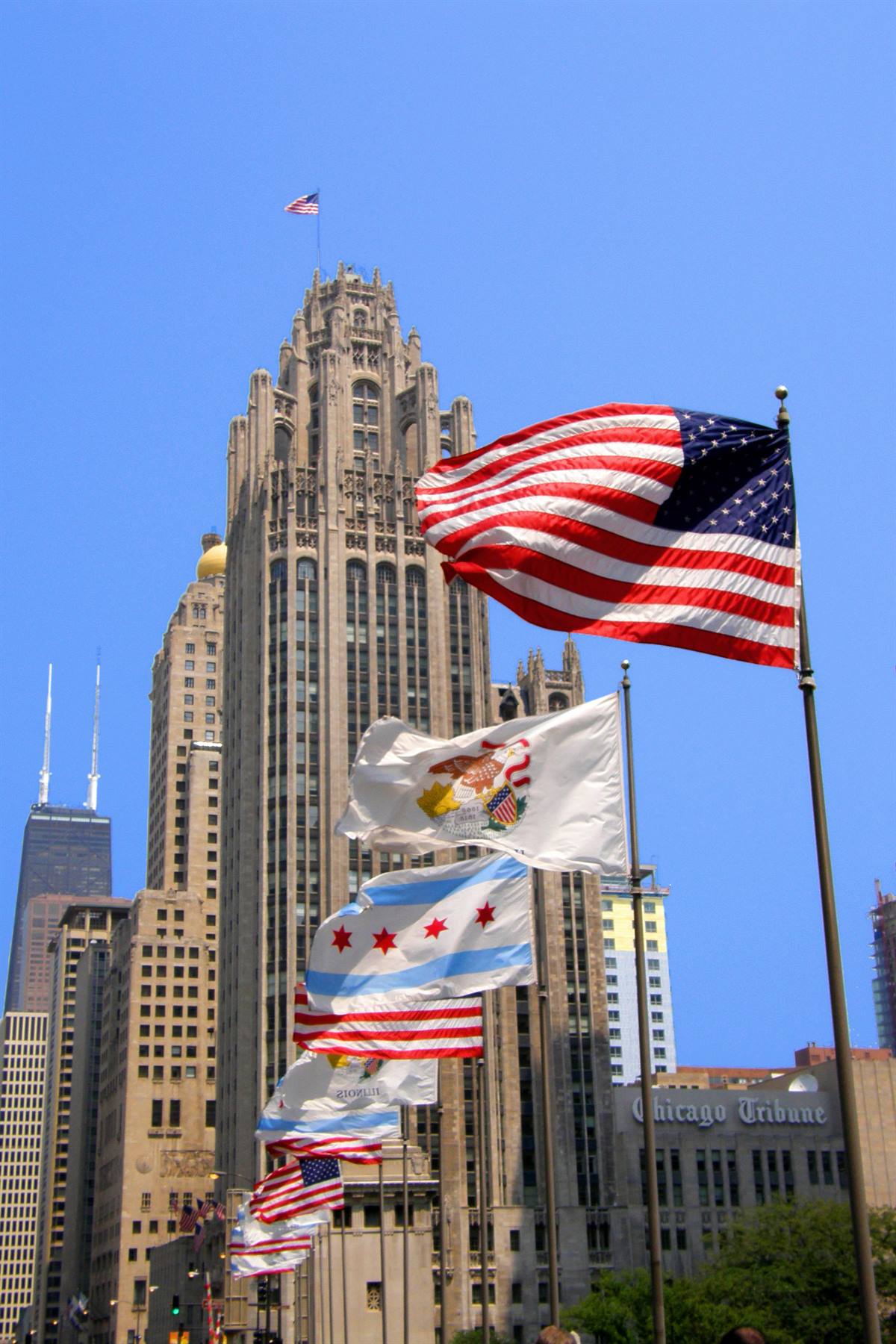
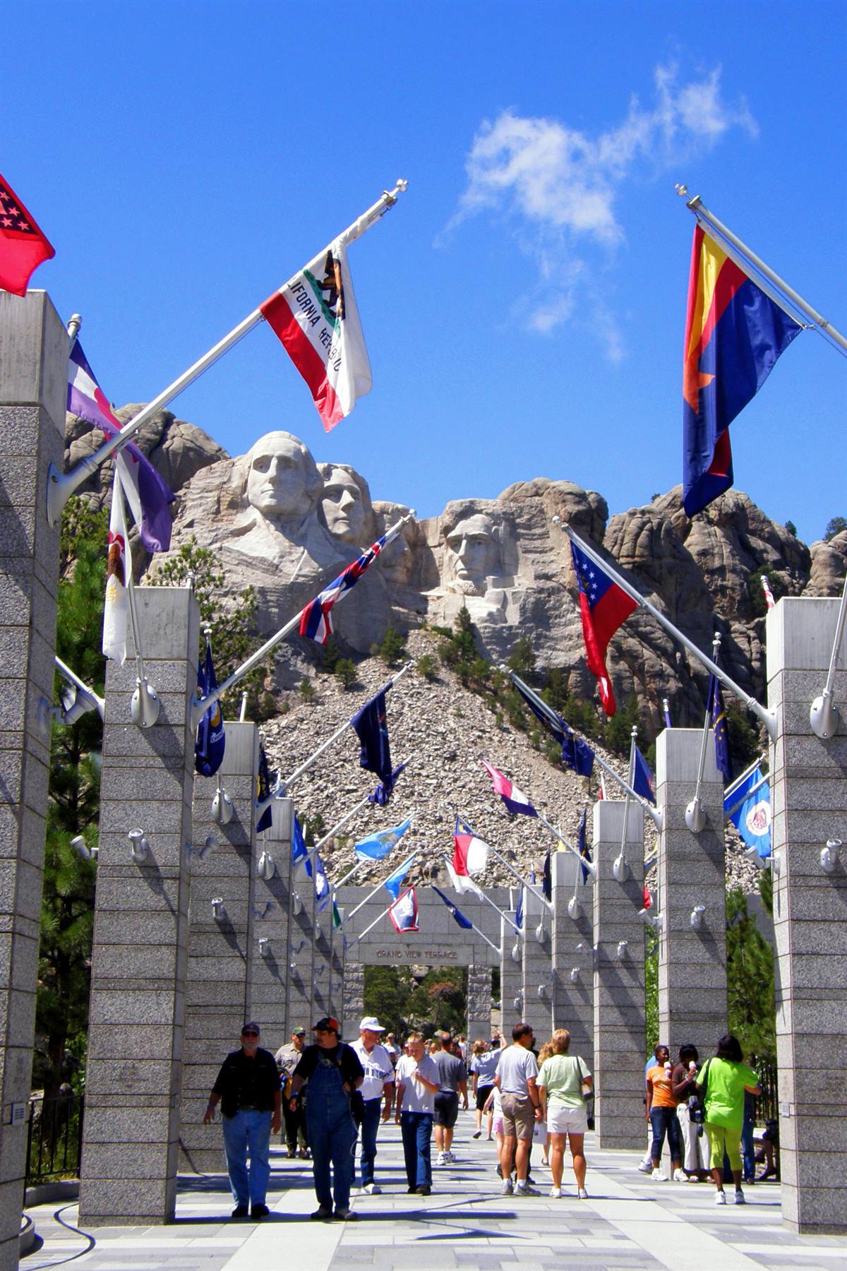
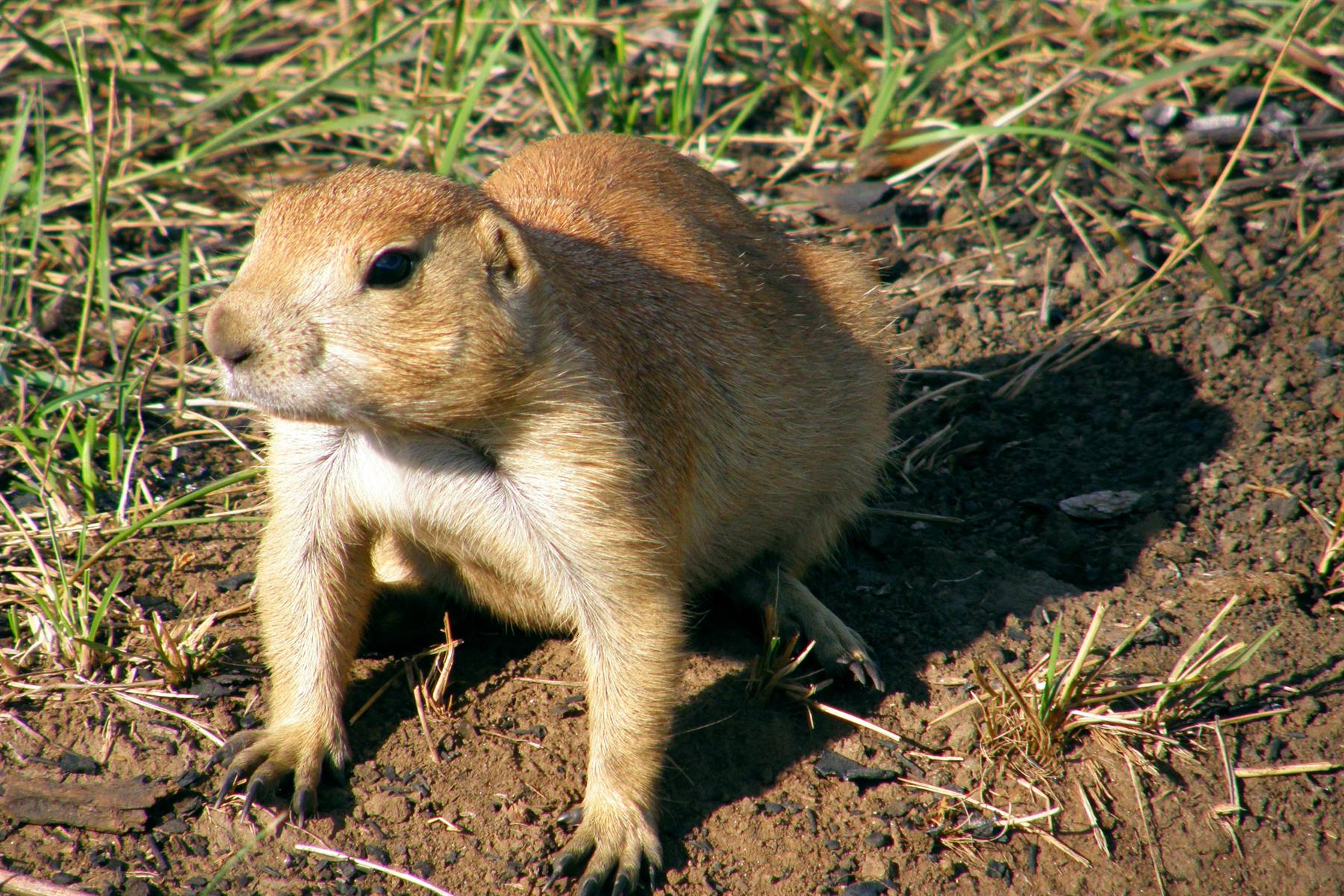
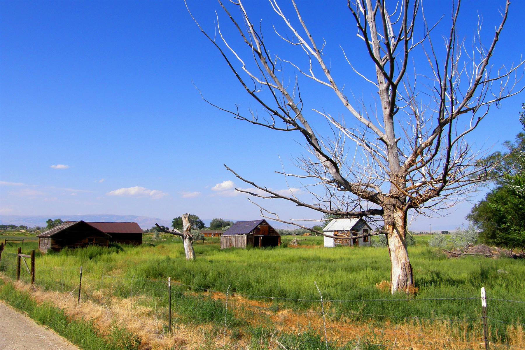
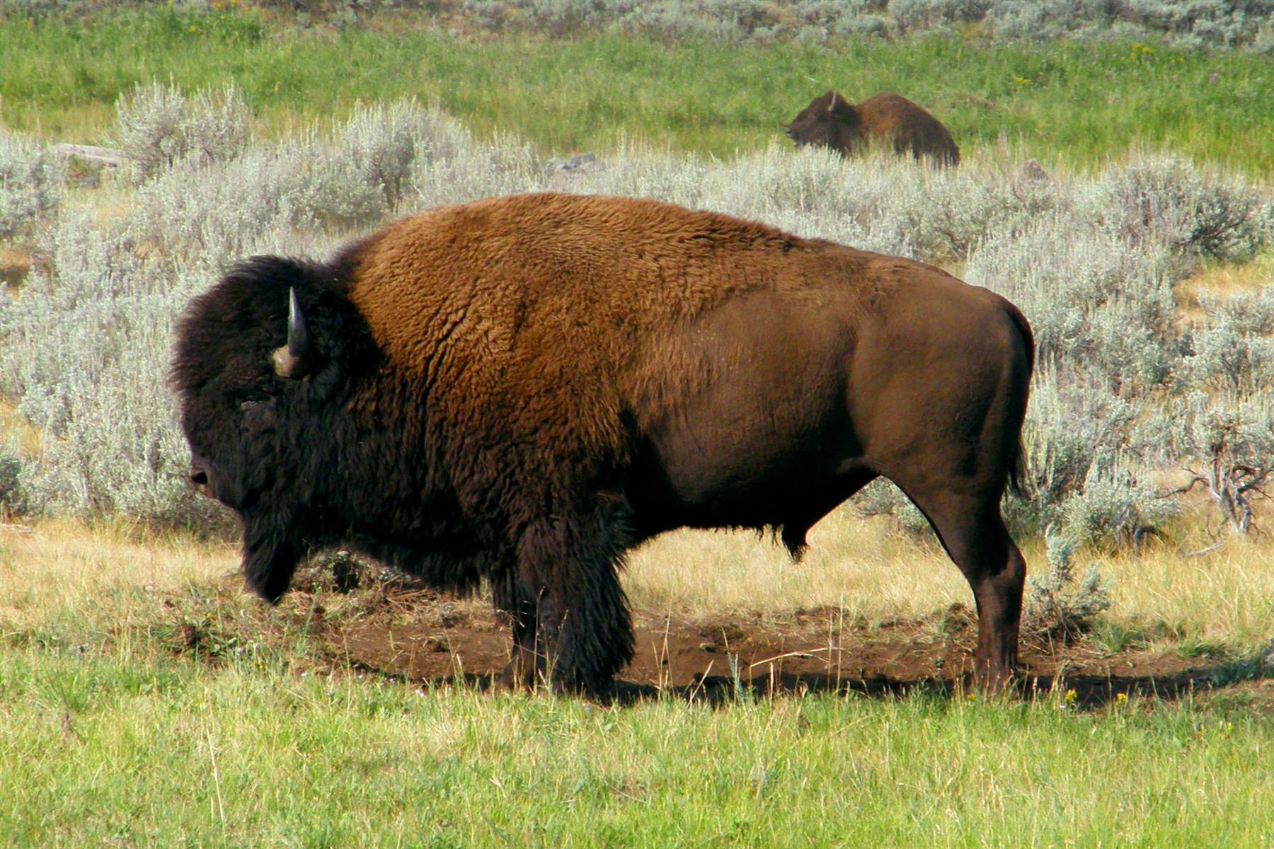
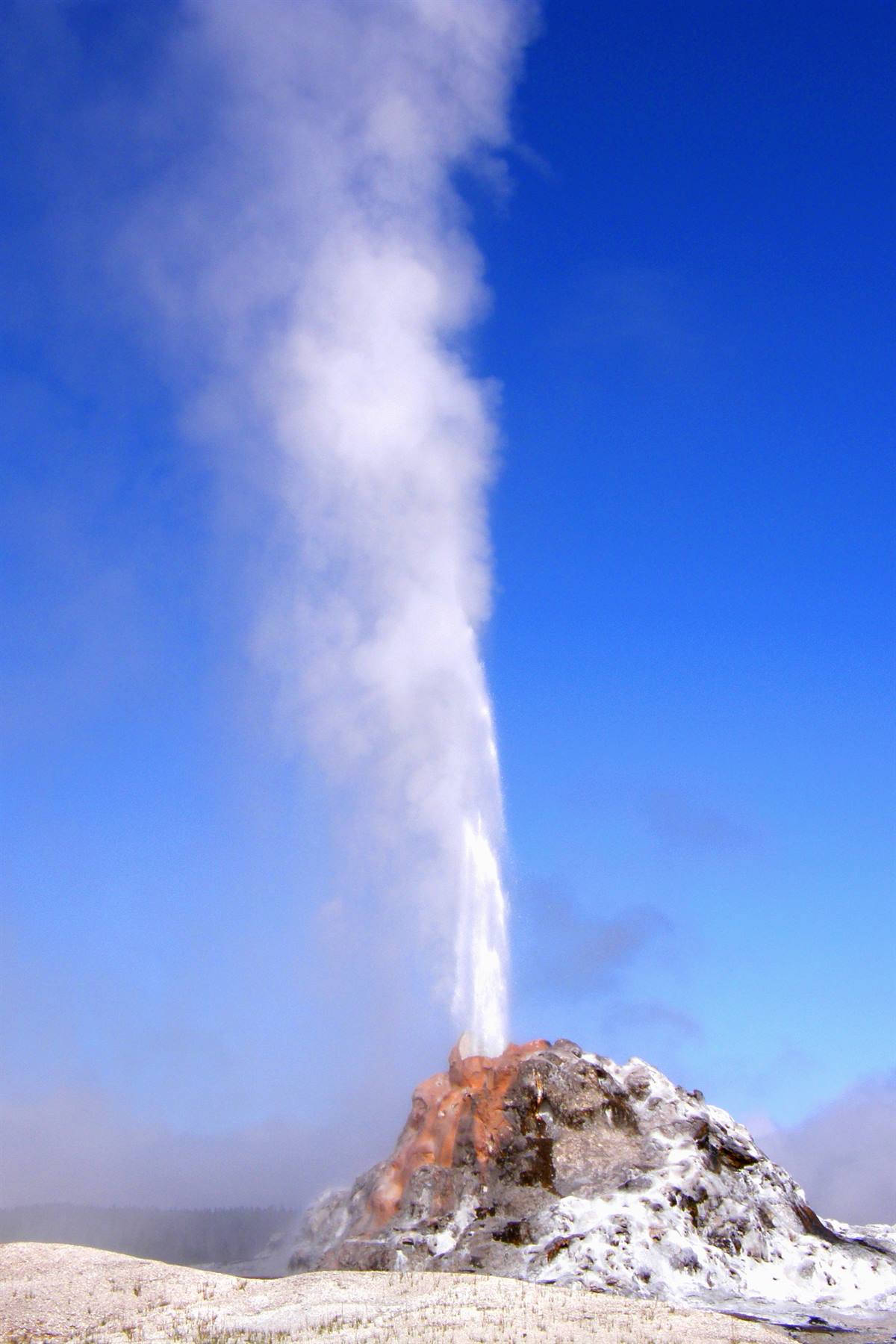
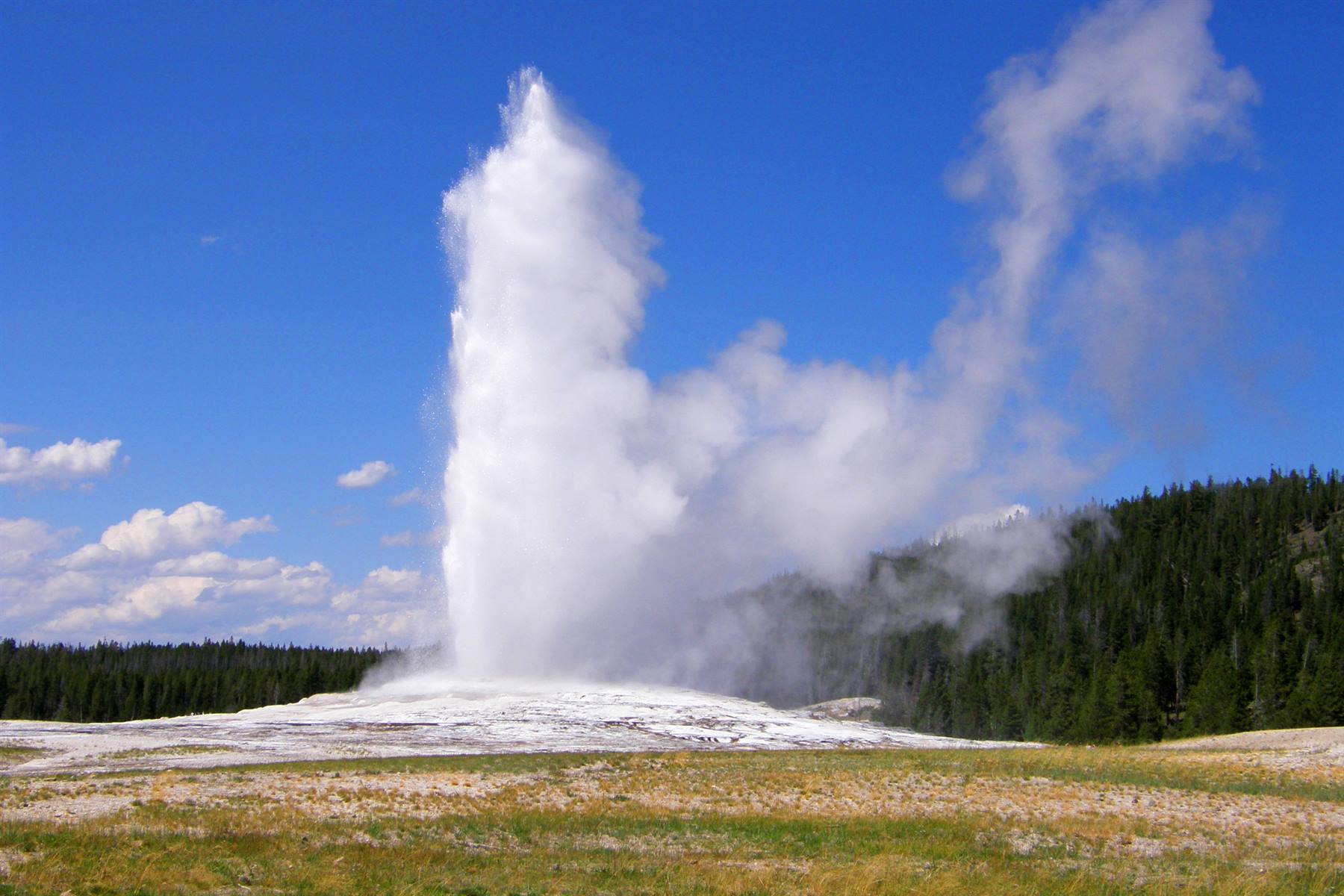
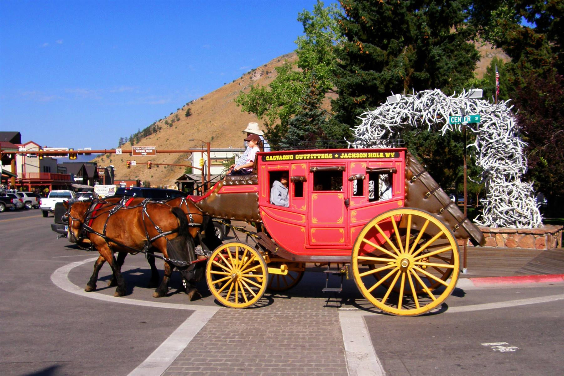
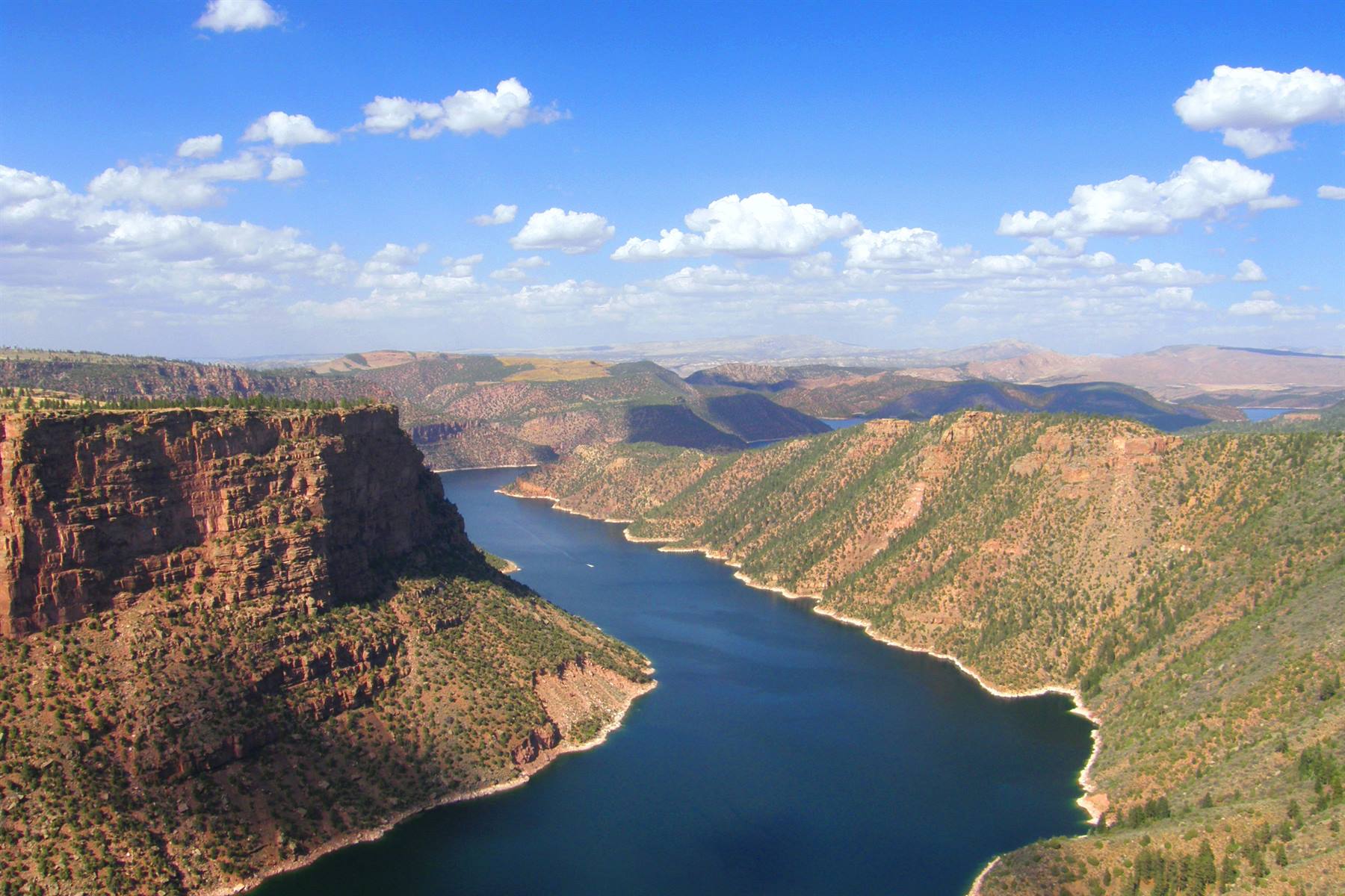
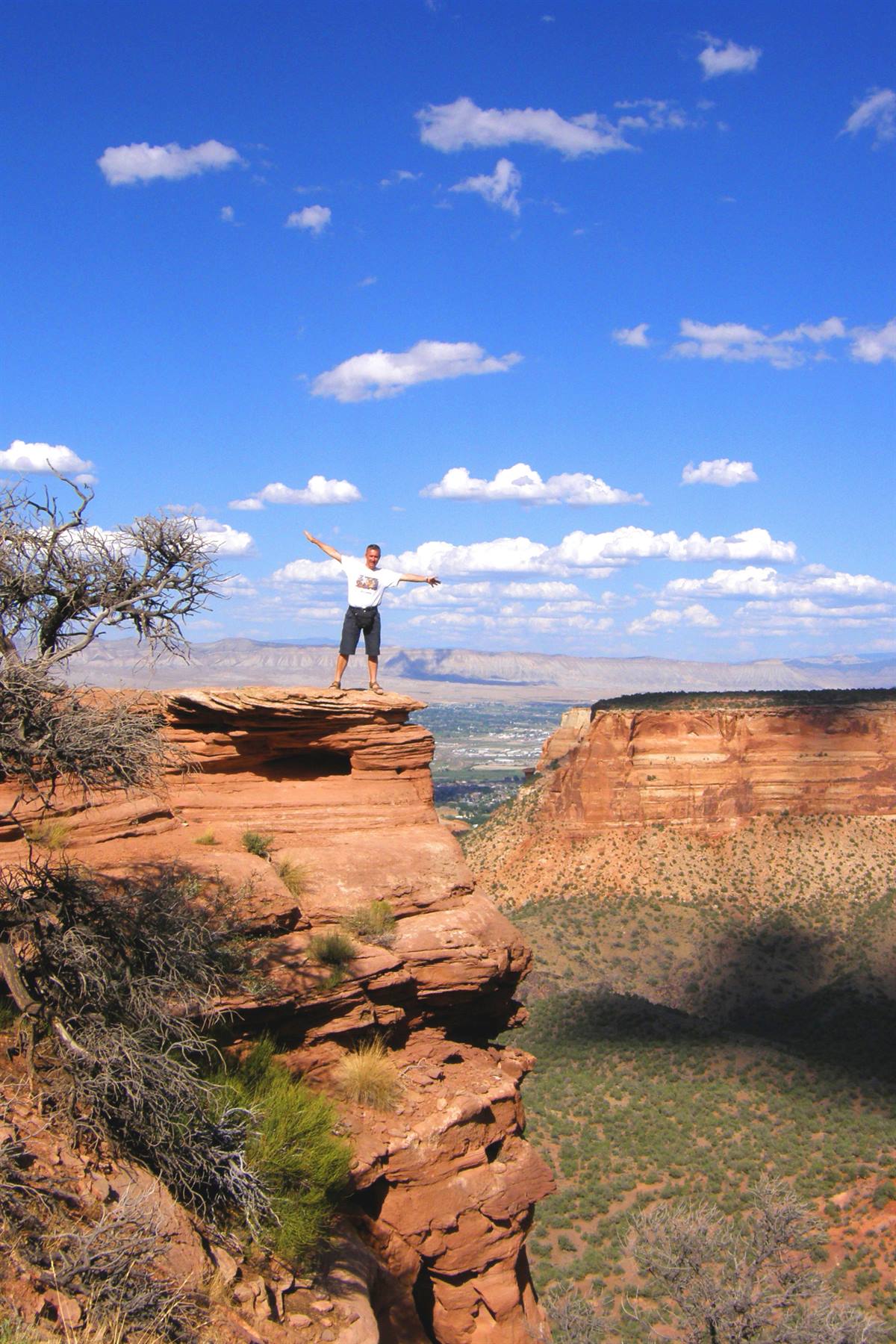
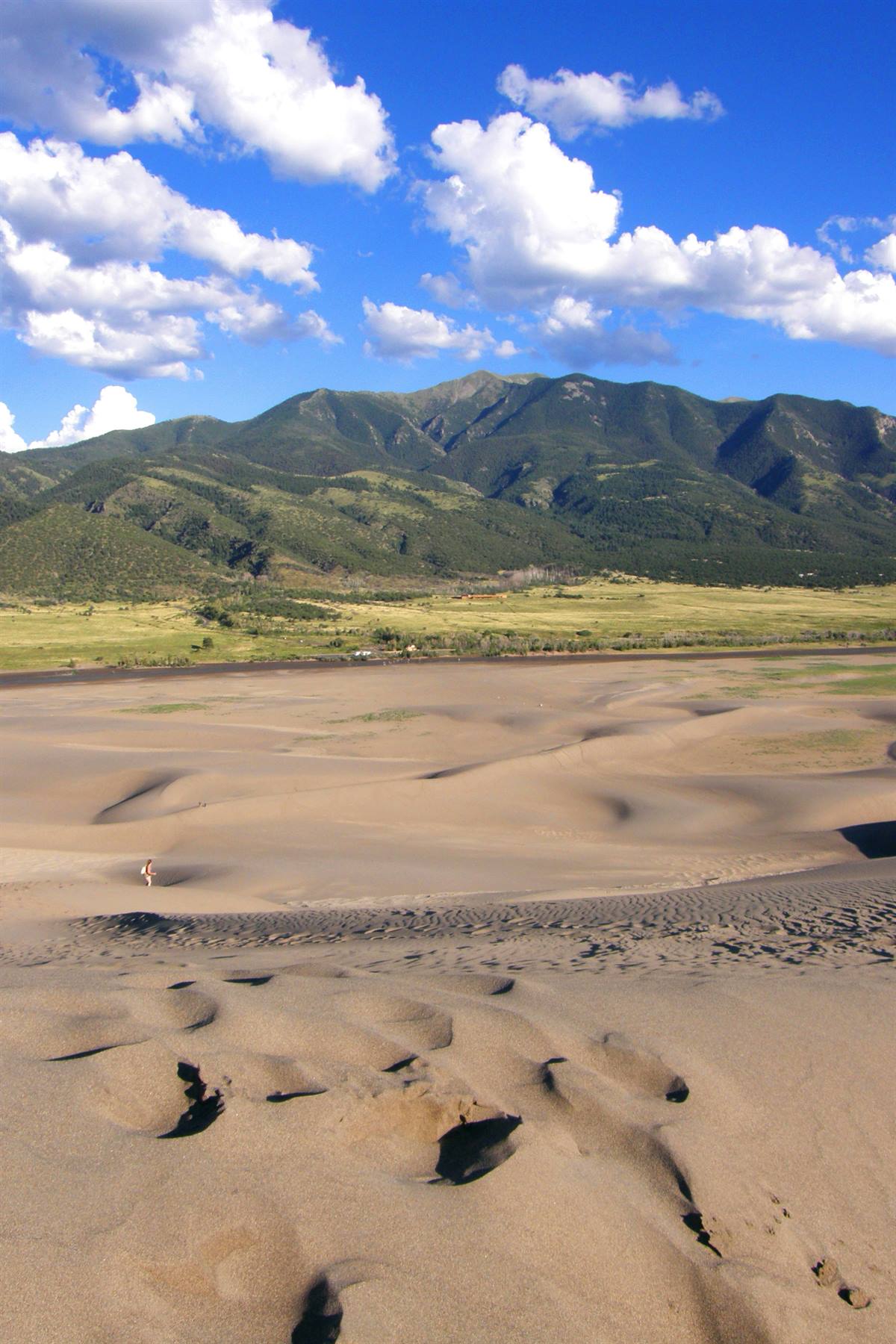
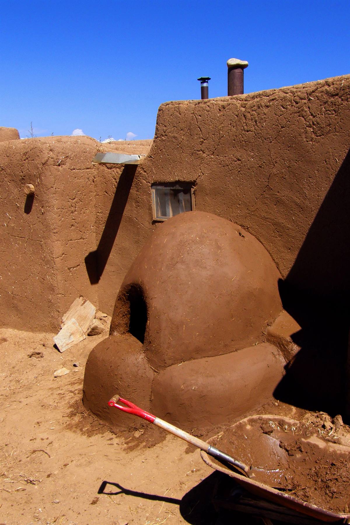
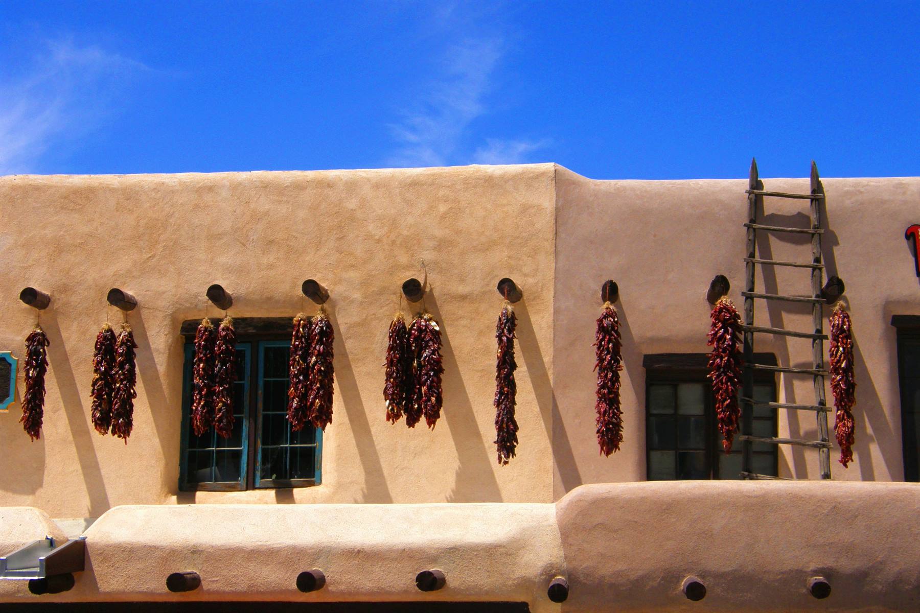
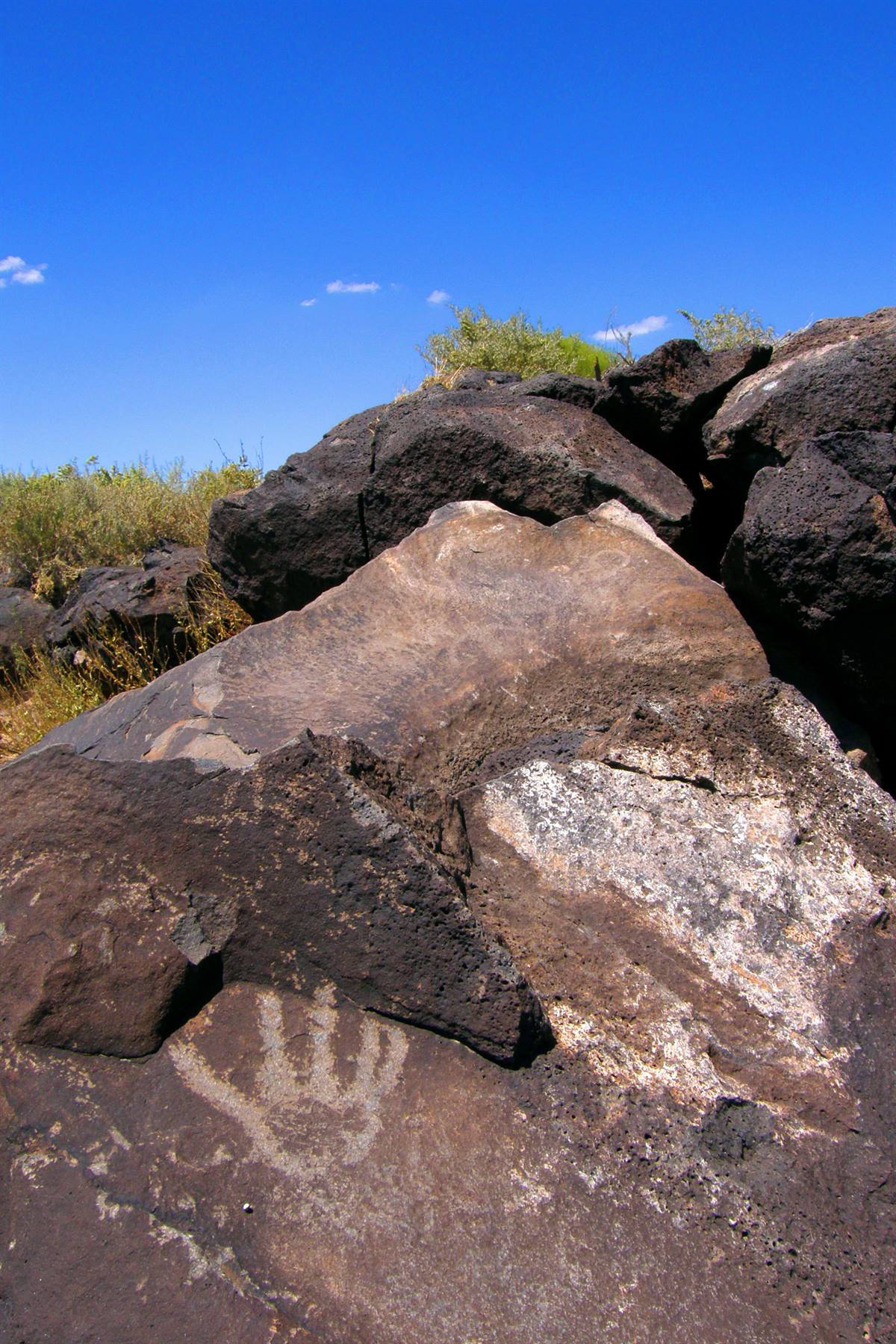
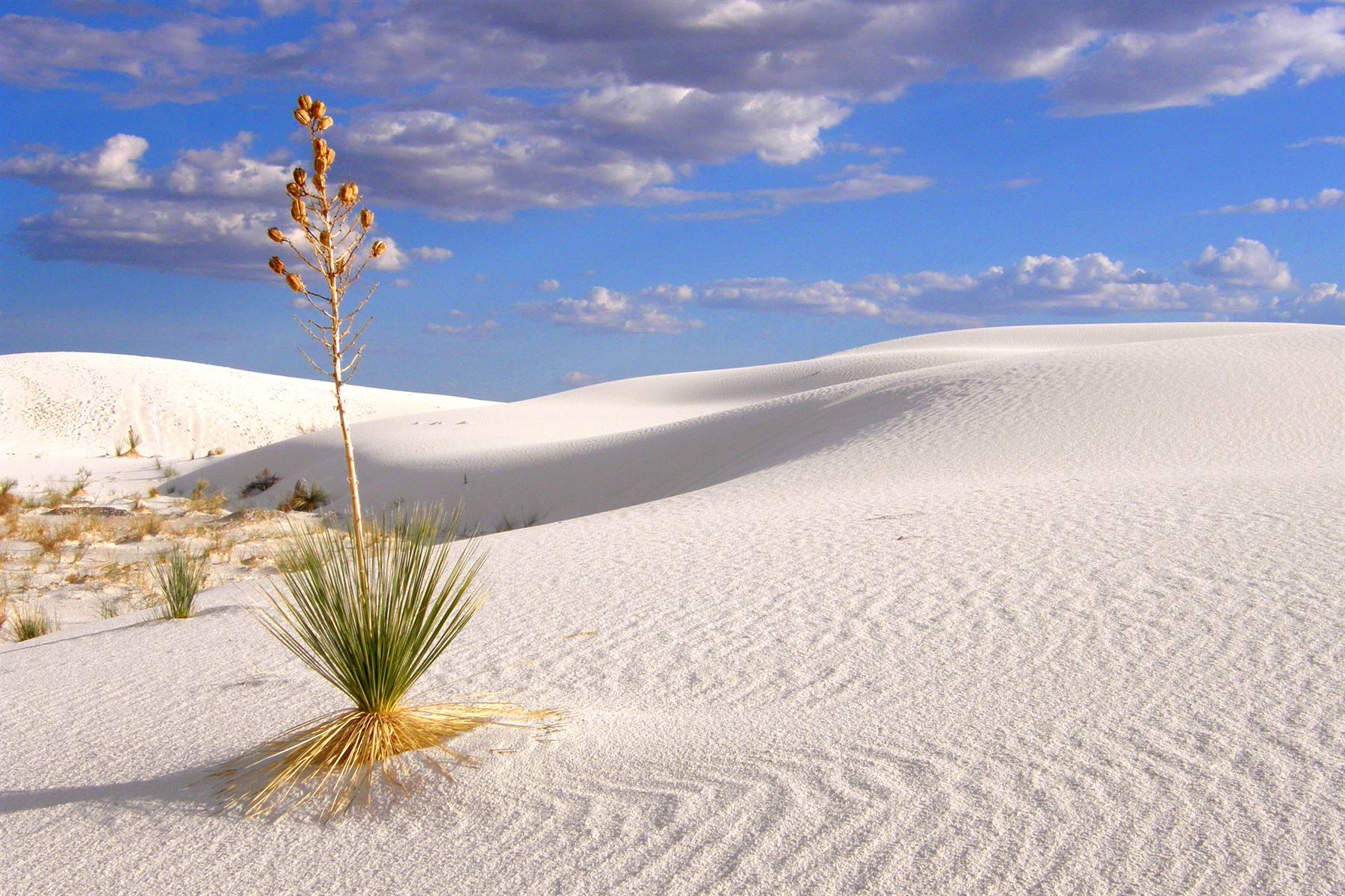
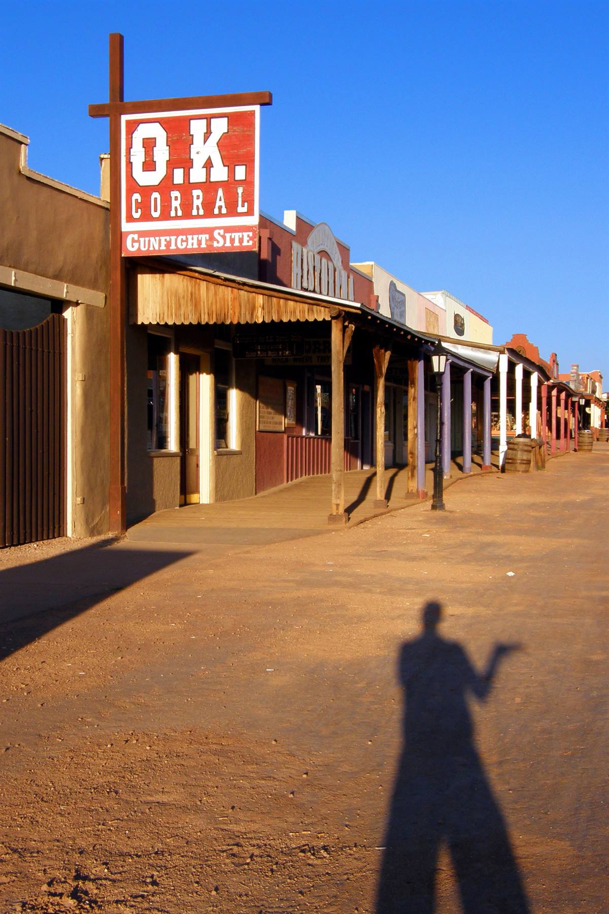
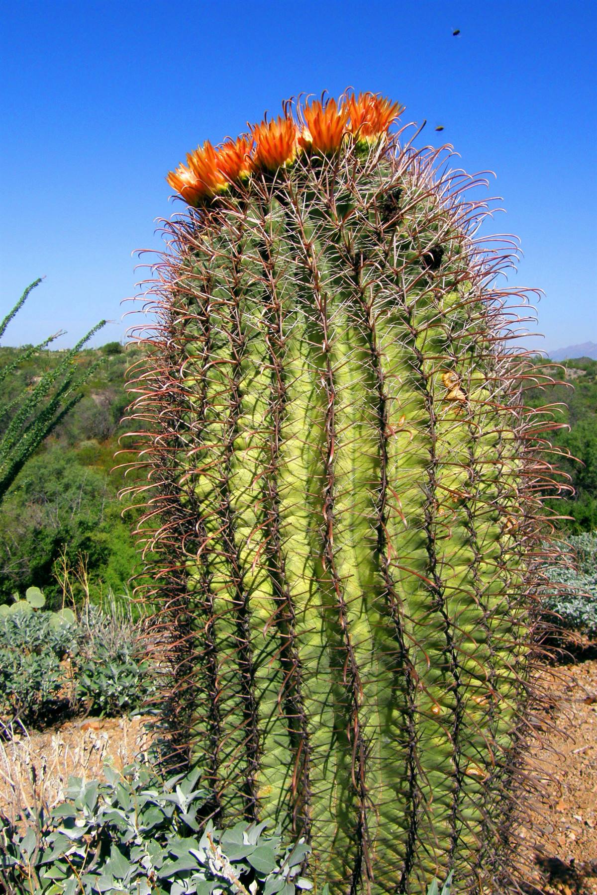
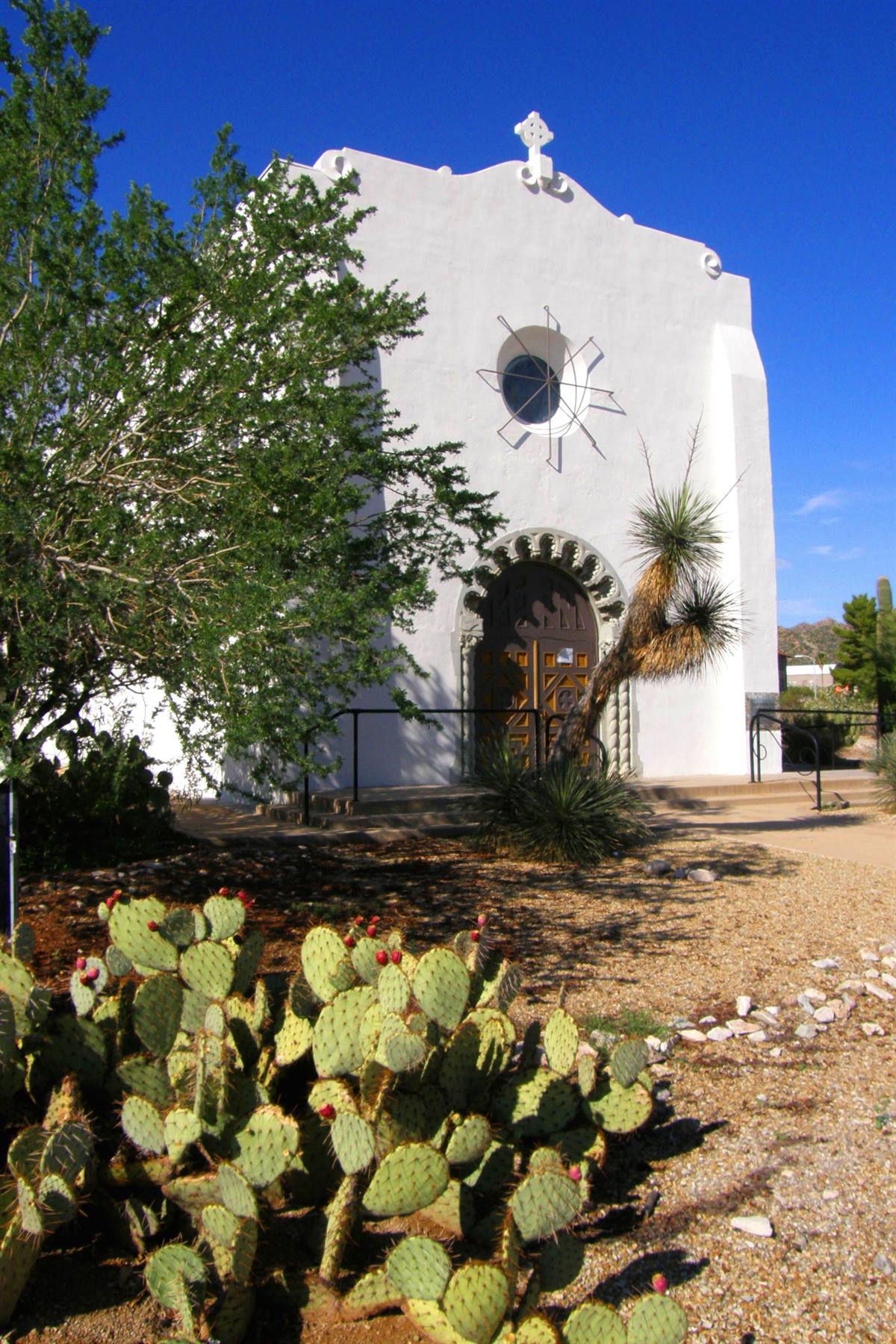
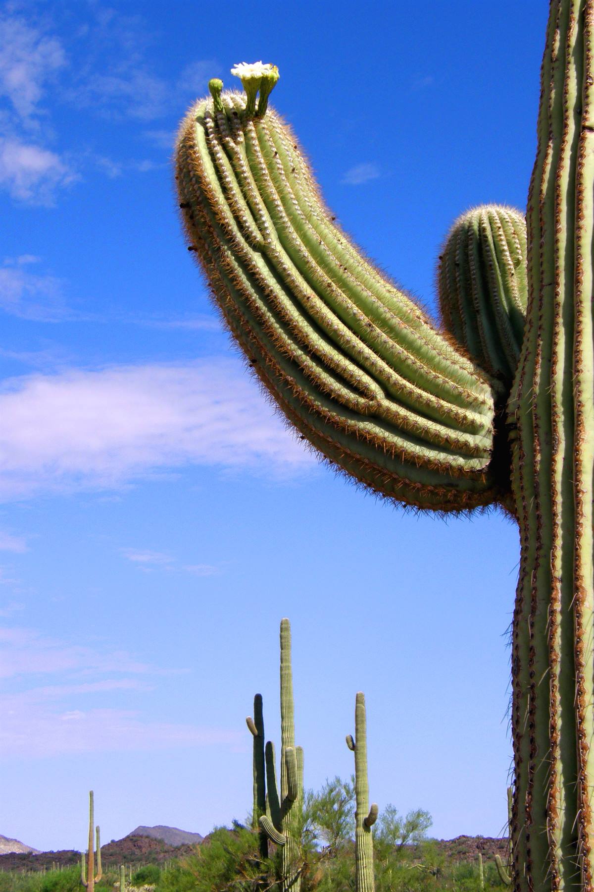
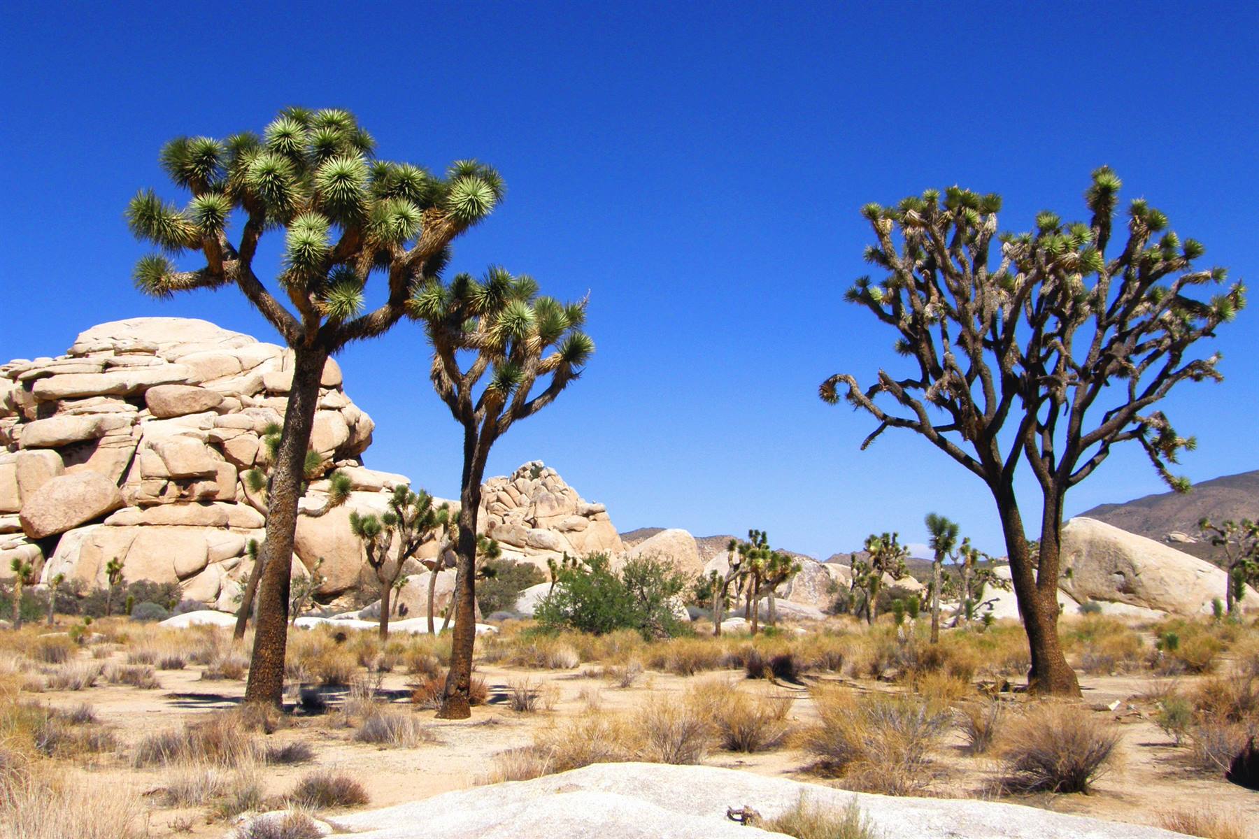
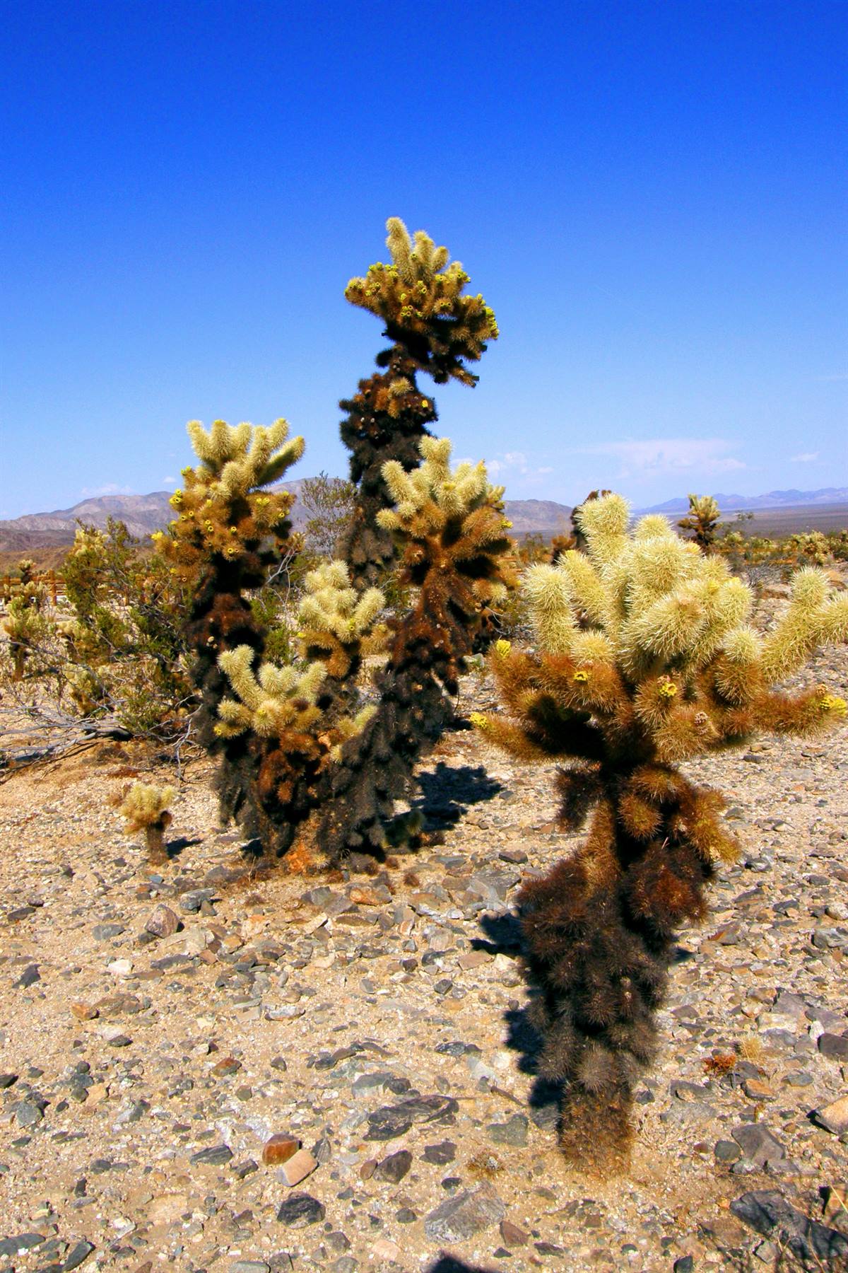
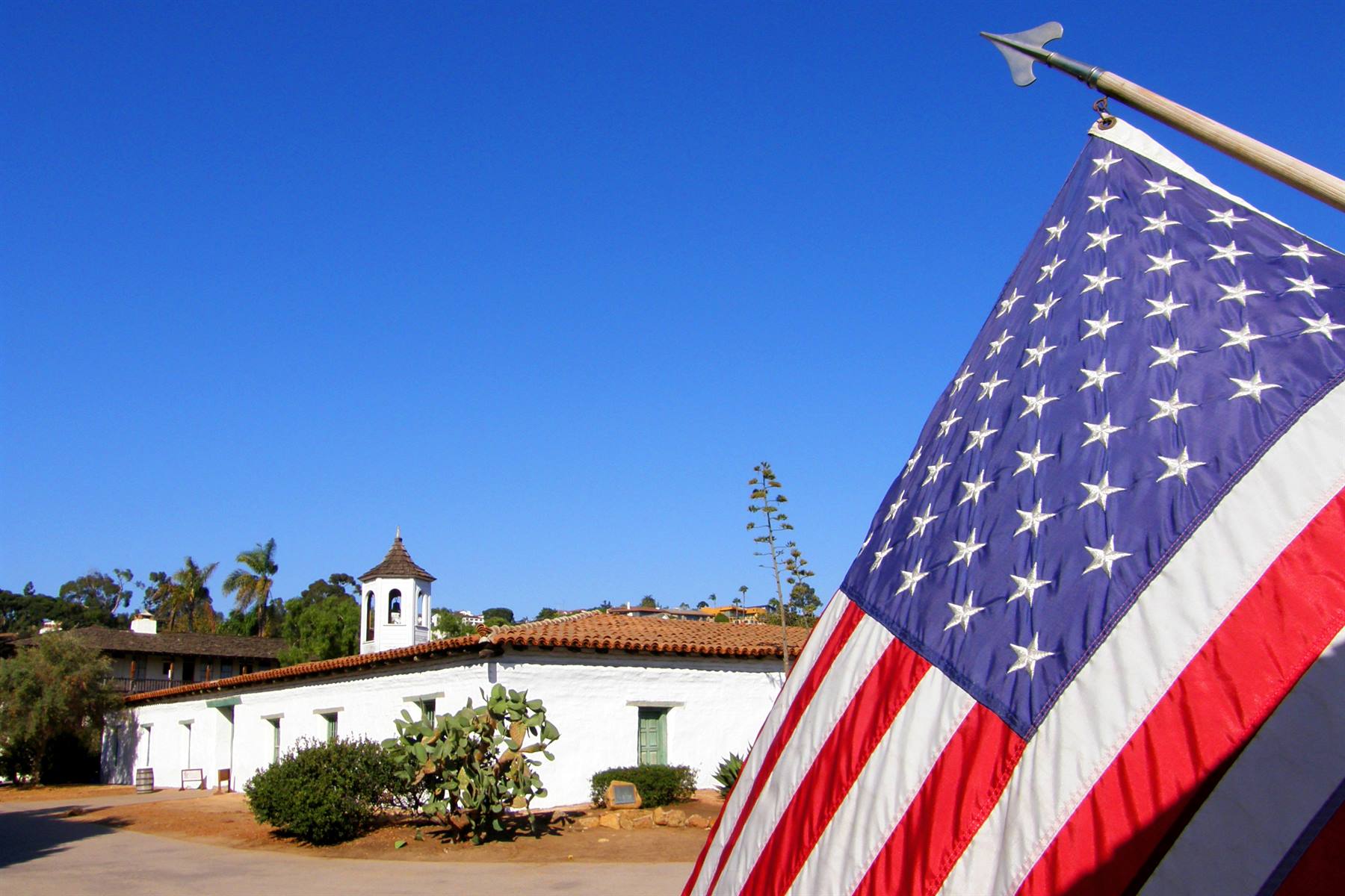
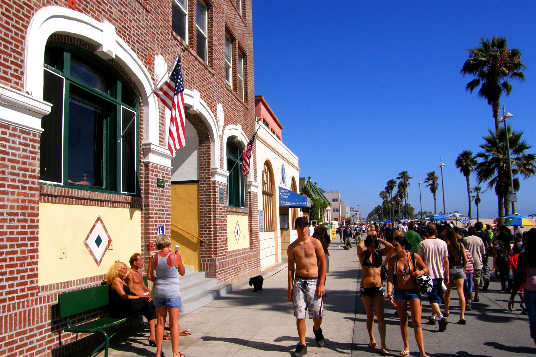


2 reader comments
le tue foto sono sempre le migliori!!!
Sono d'accordo con macgreg , le tue foto sono sempre molto belle, molto meno gli errori d'ortografia nelle parole inglesi: (Las Cruces non Las Crucis, turquoise, Spielberg, San Xavier del Bac e diverse altre). La cosa imperdonabile è dire che Chicago è la capitale dell' Illinois (è Springfield). Certo i tuoi racconti sono molto dettagliati, spero non sarai così cattivo quando pubblicherò i miei. Bravo e complimenti per lo spirito del vero viaggiatore.