This year, after NY, we go back to the States for a second time, but now it's the West's turn. We'll visit California and the western parks, passing through Las Vegas and ending our tour in Los Angeles. We booked everything ourselves online: the flights (KLM), the hotels for every night, the hire car; we covered about 4500 km and saw 4 states (6 if we also count Colorado and New Mexico, which we only brushed past...). The account is divided by date and will be updated as we go: if anyone is curious or has questions, you can write to us, we'll be happy to answer! Happy reading everyone
Day 118 Aug 2007
off we go
We leave Milan Malpensa on time with the KLM flight to Amsterdam at 6:28 and land on Dutch soil after about an hour and a half of flight. In Amsterdam the 11:10 flight to San Francisco awaits us, but we have to wait a bit before leaving again because our aircraft still has to be cleaned: besides, when we board, we are a bit disappointed by the plane which doesn't have TVs for every seat, but ones hanging in the aisles...what a shame...the one that had taken us to New York was certainly better, but it was a Northwest one. So we leave a bit late, at 11:30 and, after 11 hours of flight, we arrive at SFO at 13:15 local time, but for us it's 22:15..... The trip goes quite well, I even manage to sleep a bit, while Fra has more trouble falling asleep.
Once finally arrived at SFO airport and collected our suitcases, we take a kind of shared taxi (on which however we travel alone) called Van Door to Door, which for $35 takes us to the hotel (in the end the cost is almost the same as a normal taxi). Our hotel is the Heritage Marina (which I strongly advise against, you'll understand why later) it's fairly central, not far from Fisherman's Wharf, but it immediately appears to us not very nice, not well kept, although the room overall, while being nothing special, is acceptable. We rest a couple of hours in the room before going out (it's now 16:00, but for us it's the middle of the night) and around 18 we go out.
We walk down the famous "streets of San Francisco" towards Fisherman's, we follow Van Ness Avenue, the street of our hotel, towards the sea and we notice the steepness of these streets: but how do they park cars on such slopes??! After about fifteen minutes on foot, we reach the sea and glimpse the Golden Gate Bridge on the left: even though it's a bit far and with the sun behind it, you can already make out the shape and colour of this bridge seen a thousand times on TV.
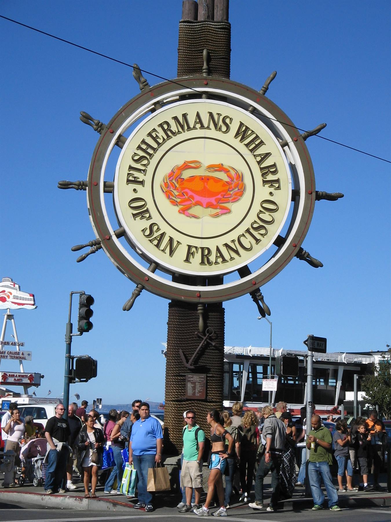
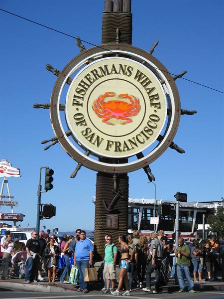
We walk along the seafront promenade towards Fisherman's where a freezing wind is blowing! We'd been told that San Francisco, because of its bay, has a rather chilly climate all year round, which however in summer, for me who am always cold, is really unpleasant, but you just need to wrap up a bit more than usual and the problem is solved! Fisherman's appears before us in all its swarming of people, tourists, shops, restaurants, fast foods, lights, colours...We wander around looking about us and reach the famous Pier 39, the most characteristic and even livelier part of Fisherman's, where, besides the sea lions that lazily station themselves on the pier (there are many and they're noisy and every now and then they make strange sounds) you can find some typical Californian symbols, like the legendary Bubba Gump restaurant, the restaurant inspired by the film Forrest Gump, which is really n
ice (with a souvenir shop attached too) but where we can't manage to have dinner because there's too long a queue. We then settle for dinner at the Wape Stop, a Californian-style restaurant, with surfboards hanging on the walls: dinner is good and I try the prawn skewers that I would have wanted to get at Bubba's (but we'll try again tomorrow to go there) We are dead tired, for us this day has lasted 35 hours.....we walk back to the hotel under an icy wind coming from the Pacific and at 22 we collapse exhausted. The first impression of SFO is definitely positive, even though tiredness hasn't allowed us to appreciate it fully: tomorrow and the day after we'll have enough time to do so.
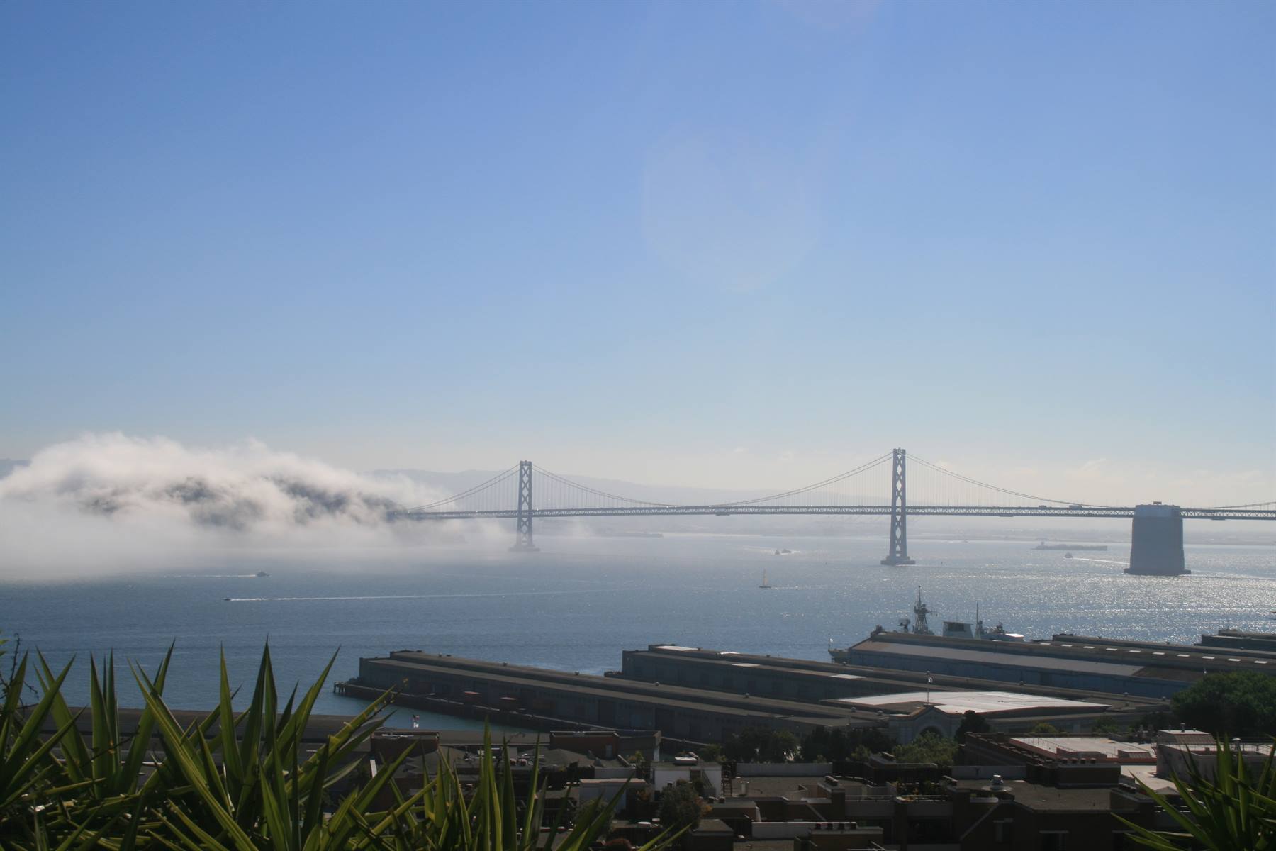
Bay Bridge
Day 219 Aug 2007
san francisco
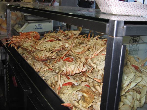
At 3 in the morning I wake up and can't fall back asleep! Let's hope the effects of jet lag fade soon, otherwise I'll suffer from it for the whole holiday.. While Fra sleeps peacefully (maybe he did well not to sleep much on the plane...), at 5 I decide to get up, update the diary and decide what itinerary to follow to discover SFO in these two days. At 7, when Fra also wakes up, we have a nasty surprise: his left arm is covered in little red spots accompanied by an annoying itch..and we can't figure out what it could be. I think it's an allergic reaction to the crab eaten the night before, because it was the only "strange" thing he ate. Fra is a bit agitated, but we've just arrived, we have so many things to do and see, that we don't give it much weight.
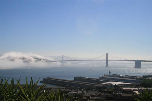
So we decide that today we'll visit the eastern part of the city, on foot; tomorrow instead we'll take the bicycle to cross the Golden Gate and go as far as Sausalito. Once out of the hotel we head along the steep streets of SFO in the direction of the legendary Lombard Street: it's a normal street but which, at a certain point, descends with a steep drop in eight switchback curves, adorned with flower beds and a nice glimpse over the city. After the inevitable photos and after seeing what an effort the cars actually make to go down, we continue on foot towards Telegraph Hill, in a continuous steep up-and-down. We climb up high until we reach the Coit Tower which however we don't visit, but from which you can get a nice view of the Bay Bridge, the other and less famous bridge of SFO.
We then go down towards Downtown, the area of SFO with the skyscrapers among which the Transamerica Pyramid stands out above all, a pyramid-shaped building that is quite tall, and the Embarcadero Center, a modern shopping and business centre which today that it's Sunday is deserted but which we imagine crowded on working days. Nearby we also visit the lobby of the Hyatt hotel, truly spectacular, very modern, very spacious and with a big ball-shaped sculpture in the centre. We then move towards Chinatown, unmissable in every big city, whose entrance is marked by a beautiful Chinese-style arch that marks its boundaries, and we then head towards Union Square, the true commercial heart of the city, full of designer stores and many brands, including Macy's and Tiffany.
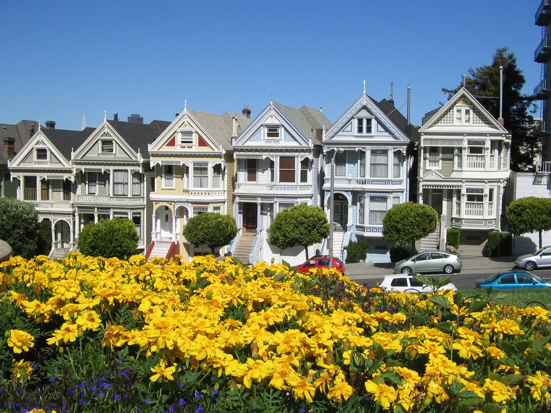
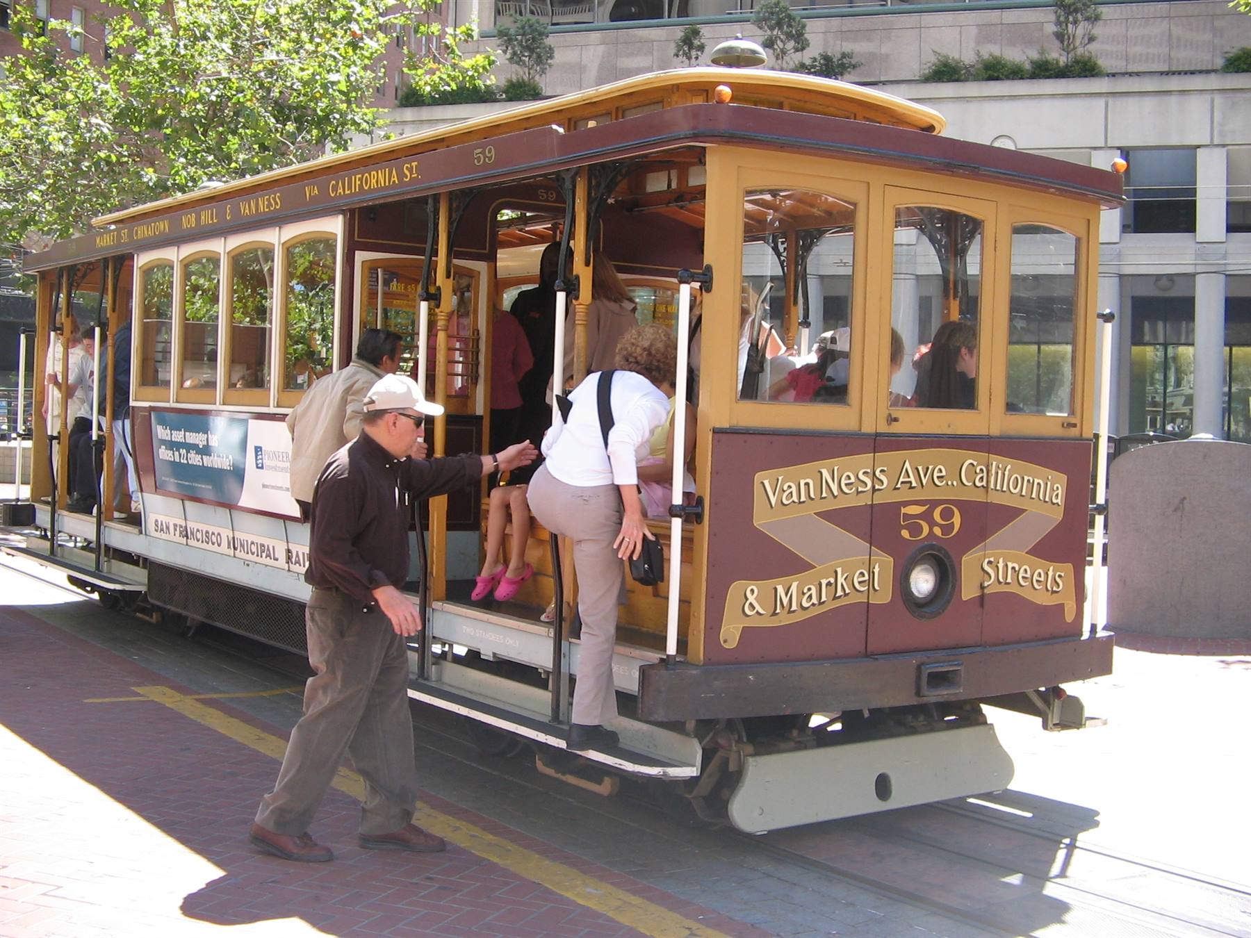
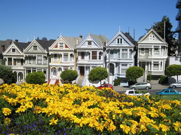
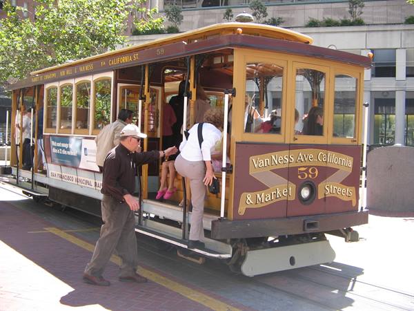
We then go down towards Market Street and then Powell Street where there's one of the terminus of the famous SFO Cable Car, the old rack railways that go up and down the city and which are a real tourist attraction. We also notice the presence of some trams from the municipality of Milan, with Italian writing on them...and I must say they have a certain effect on us.... On Powell Street we take the metro (which we access not with a ticket but by inserting coins directly into a slot) and arrive in the upper part of SFO, because we want to immortalise in a photo the famous six sisters, the six little houses in Alamo Square that are said to be a real architectural gem. In reality most of the city's houses are in Victorian style, very pleasant to the eye and which helps make SFO the most European American city.
After walking a bit once out of the metro, we arrive at Alamo Square (which is nothing other than a lawn-hill) and we lie down on the grass to rest and take photos of the famous little houses which live and with the afternoon light appear truly beautiful! We then walk down towards the ocean to another park, Alta Plaza, and then go back towards the hotel. For dinner we decide to go back to Bubba Gump, where we have to wait about half an hour for a table, so we take the opportunity to browse the little shops of Pier 39 and do some shopping. On the table at Bubba's there really is the sign with the writing "Stop Forrest" and "Run Forrest", a signal for the waiters who know whether they should stop at your table or ignore you, moreover all the TVs of the place broadcast the film Forrest Gump.
Fisherman Wharf
Day 320 Aug 2007
san francisco
Today we rent bikes at Fisherman's and head towards the Golden Gate and Sausalito; in our plans there would also be the idea of seeing the Presidio park and Golden Gate Park, but we'll see how far our strength holds out.
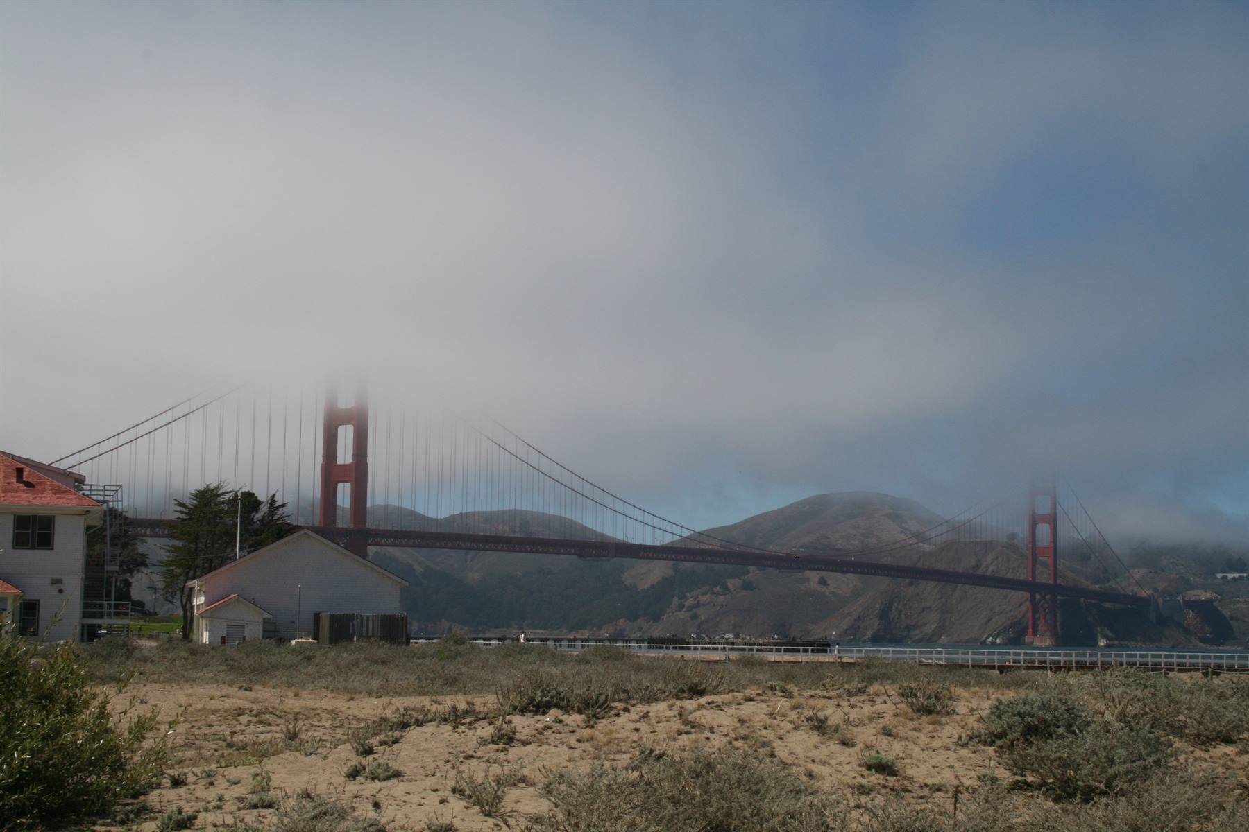
Unfortunately the day is chilly and very foggy: we cycle along the bike path to the GGB...or at least, it should be there, in front of us, but it takes a certain amount of imagination, because due to the fog, you can't see anything: the only sign of the bridge's presence is the siren-like sounds that come from the two pillars of the bridge, at close range, one after the other, perhaps to signal its presence to ships (?)..who knows! We continue on our titanic feat towards the bridge (my legs are already in pieces) but no, the fog refuses to go away and so we cross it completely enveloped in the mist...only once under the famous red pillars, can we see and photograph them in all their splendour.
The light fog surrounds us, and it's a real cloud driven by the wind...and what wind! The crossing of the GGB ends in a nice square on the other side of the bay: the view of the bridge from here would be magnificent, if only you could see it! It's true, even with the fog it has its charm, but photographing a mass of grey air isn't the best... The bridge stands out on our right while the bay and the city centre remain on the left, with Alcatraz island in the middle of the sea! We wait a few moments in the panoramic square, hoping that the fog will go away and we make friends with two guys from Sesto SG (what a small world!); then, since the situation doesn't change, we decide to continue our descent towards Sausalito.
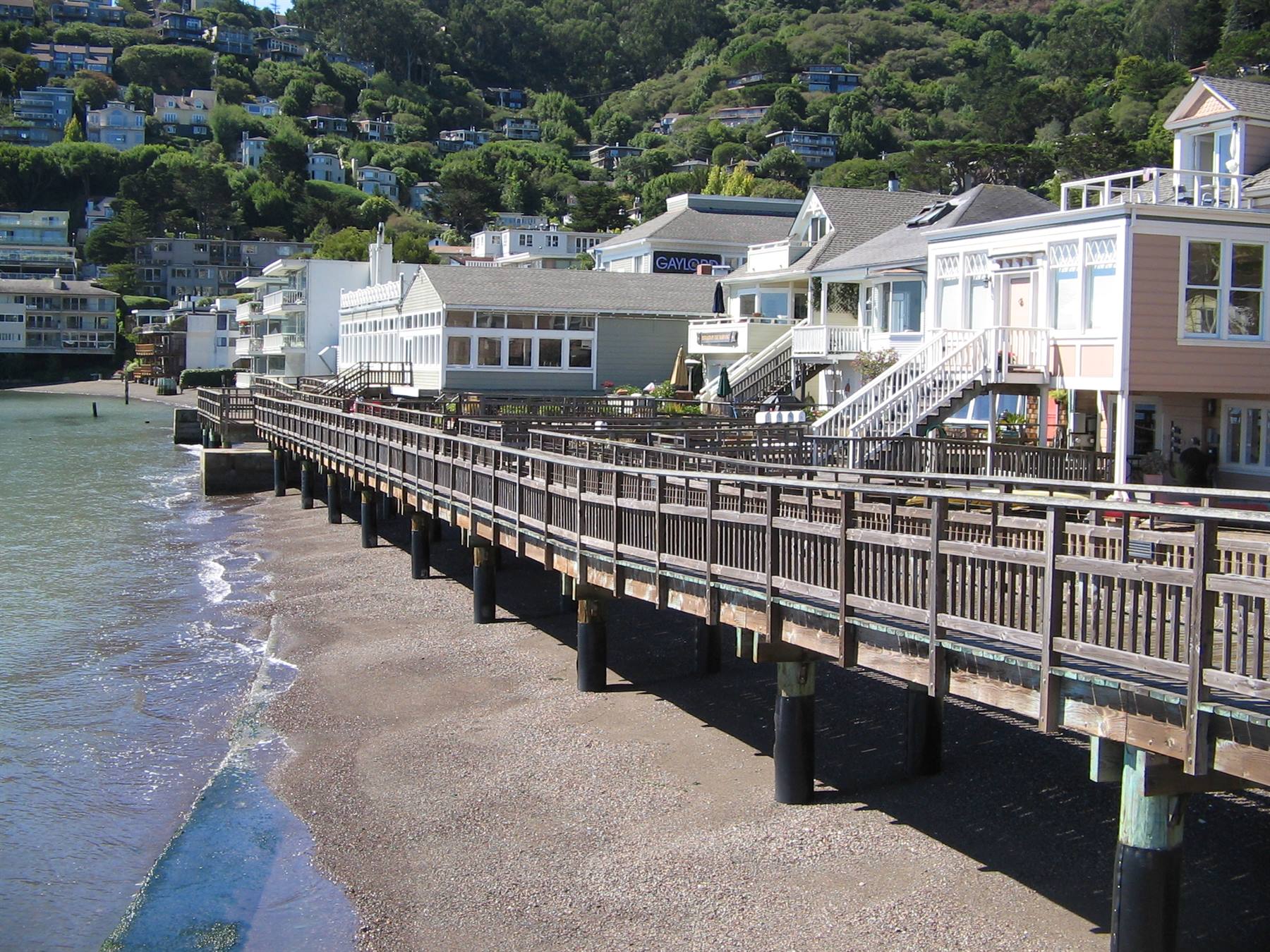
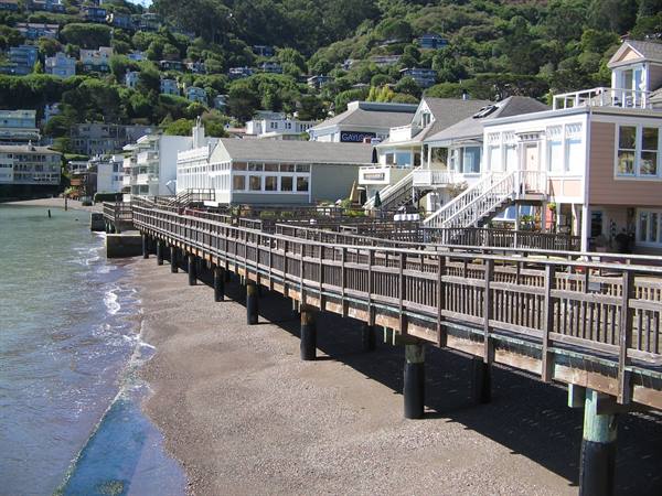
As soon as we descend (the descent is rather steep...who knows what the climb back will be like..help..) towards the sea the temperature rises, the sun appears and the climate is definitely better! Sausalito is really lovely: a seaside town, a former fishermen's village, quiet and very clean...it seems like the ideal place to live! We park the bike and wander around on foot, have lunch and then head back towards the bridge. The climb is terrible, as I thought..and in fact I have to get off the bicycle because I really can't take it anymore, and so I continue on foot until the bridge reappears in front of us, but the fog, that great white serpent, shows no sign of going away. It's now 14 so we decide to continue our itinerary.
We take a little tour of the Presidio park, very beautiful, really well kept and surrounded by little streets and houses that to describe simply as "beautiful" is really too little: everything clean, tidy, well-kept little gardens, bike paths, little lakes with swans...SFO is really a beautiful city, there's no denying it, it really deserves a visit! The bike ride has by now destroyed our legs so we decide to take back the bikes we had rented for the whole day. We follow the bike path that runs along the sea, the temperature rises and the fog disappears; it's now 15 and the GGB is completely free of clouds and appears, red, in all its beauty! Truly a shame not to have seen it like this up close, but it's clear that the morning isn't the best moment: better to wait for the afternoon when by then the fog dissolves.
Once at Fisherman's we decide to face a long queue of people to get on the legendary cable cars: you can't visit SFO without having taken at least a little ride on these rack vehicles! After about an hour of waiting (there really are many people who want to take a ride) we get on the cable. I hang outside and Fra sits in front of me: the cable starts, the "driver", if we want to call him that, moves a big lever back and forth and the cable goes up and down the steep streets of the city; it's fun, especially hanging outside you get the impression of being on a merry-go-round at an amusement park rather than on public transport. We go as far as the cable terminus on Powell Street, get off and take a bus to go back to the hotel.
In the evening for dinner we go out towards Fisherman's and have dinner at the Hooters place, a chain of American restaurants famous for the rather buxom and scantily clad waitresses, a true paradise for all the little men!
the six sisters
Day 421 Aug 2007
MONTEREY -17 MILE DRIVE –CARMEL-PACIFIC GROVE
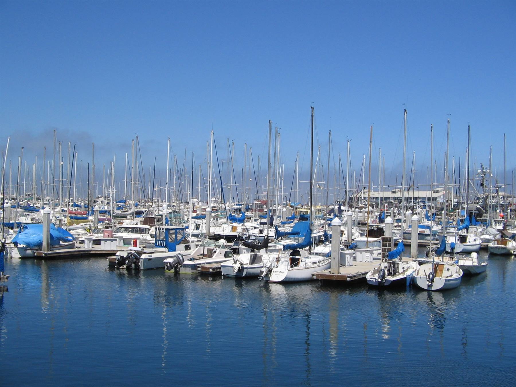
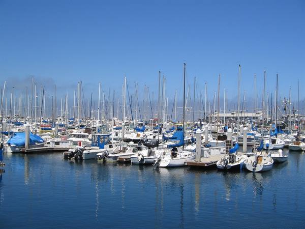
Today we leave SFO to start our On The Road trip, we leave the hotel and walk down with our suitcases in tow, towards the Hertz car rental, where they give us a Chevrolet Cobalt model, blue and at 9:30 we're already ready to leave: heading south towards Monterey. We find some traffic along the highway, so we arrive in Monterey when it's already noon: we park at Fisherman's (this town has one too) and have lunch in a really nice little restaurant overlooking the sea. To liven things up there are also two seals playing in the water and a couple of pelicans that come and perch right outside the window, near us. It's really a nice little place, Monterey, but we'll come back maybe tonight for dinner. At 15 we enter the 17 Mile Drive, a toll road that offers beautiful views over the ocean and which personally reminds me a lot of the Irish landscapes.
There are enchanting views, the famous lone cypress, many birds and sea animals, but also beautiful golf courses and majestic villas hidden by flower beds and thick vegetation: this road is a real gem, there's no doubt about it and it's worth paying the $9 it cost us to see it. Just outside the route of the 17 Mile Drive is the village of Carmel: a small village, with low houses, no traffic lights nor signs, only shops and art galleries...to us it seemed a bit fake-touristy and so we didn't linger much. We only looked for and found the Mission, but it was already closed, so we took a look at it from the gate and then headed towards Pacific Grove, in search of our hotel. At 18 we arrive in Pacific Grove, the village of butterflies, so called because it seems that in spring lots of them really do arrive.
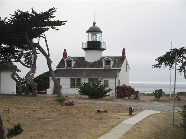
We find our hotel, the Seebreeze Lodge, a type of hotel we will find often as we continue our holiday: the rooms are all on the ground floor and all have parking in front of the door, like a Motel. We take a quick tour by car around Pacific Grove, we see the lighthouse and some beaches that are very similar to the landscapes of the 17 Mile Drive, but the village itself doesn't offer much. In the evening, for dinner, we decide to go back to Monterey and dine again at Fisherman's, after wandering around the town centre where a kind of market is being held selling mostly foodstuffs.
The restaurant where we have dinner is the Old Fisherman Grotto which, entering Fisherman's, is on the left: a nice place, where we ate well and where I ordered (without knowing it) a raw spinach salad, which I had never seen nor ever tasted until now! The dish turned out to be excellent: spinach, walnuts and a sweet-and-sour little sauce that made them delicious, very good!! Dinner over we go back to the Lodge in Pacific Grove: the room is nice and the temperature rather low...just 18 degrees...but it will perhaps be one of the last times we'll be able to enjoy the cool on this trip..good night!
Golden Gate in the fog
Day 522 Aug 2007
Sequoia
Today a day of driving awaits us to reach Sequoia Park, so we get up rather early. We have breakfast in the reception of the lodge (they have no other spaces), practically standing up and we ask information from the guy at the reception about how long he thinks it takes to reach Sequoia Park, but he makes a surprised face and says he's never been there and hasn't the slightest idea where it is....whatever! maybe we pronounced the name wrong and he didn't understand. Anyway, at 8:30 we're already ready in the car and we leave. Around 10 we make a stop at Los Banos, about halfway, and then set off again: at 12:30 we arrive at Three Rivers, at the entrance of the park, where we have the hotel.
We decide to stop for lunch in a local little bar (in these small towns there's really nothing...) where we meet two families from Milan like us who are doing the opposite tour to ours, in fact they come from Death Valley and are headed to San Francisco. After lunch we head to the park and at 14 we arrive at the entrance; we buy the Annual Pass which, at a cost of $80 will give us access to visit all the parks in the States (except those in Indian territories) and we enter Sequoia. The landscape is mountainous, but it's also very hot, which we weren't expecting, given the altitude and the presence of so much vegetation. Initially the road climbs with some switchbacks and the trees are still "normal", like those of our mountains, then we are forced to stop for a while due to roadworks. We set off again.
Curve after curve the landscape changes, the trees get taller and the sequoias appear in all their majesty: we are inside the Giant Forest, the kingdom of the biggest trees in the world. The road leads to the park museum, in front of which The Sentinel stands, so we get out and take some photos. Then we take the car again towards the General Sherman, the biggest sequoia, which is a little further on and is reached on foot via a path in the woods: and after a bit of walking, finally there it is, surrounded by lots of photographers, like every self-respecting star. To call it majestic is an understatement, it's the biggest living being in the world and also its age of about 2500 years is quite something.
We take photos of every tree we come across and follow the Congress Trail, a winding path in the woods: at a certain point I realise we're the only ones there, I don't see other people, only trees...and what if a bear came out right now?? The multitude of signs with warnings like "don't feed the bears", suggests that there are many in the park and I don't know how we would react if we saw one... We go back to the car and while we pass near Moro Rock, a deer crosses the road in front of us, but it's too quick and I can't photograph it; so we continue, hoping to see other animals and we drive under Tunnel Log, a tunnel carved from a sequoia that fell on the road in 1937. It's now 17, we decide to leave this marvellous park and we leave the sequoias behind us, heading along the road towards Three Rivers, but the surprises aren't over.
Suddenly the cars in front of us slow down and we don't understand why, when at a certain point, on the edge of the road we see a little black face emerge: it's a bear! It looks like a cub, it's not very big, it pops its head out onto the road and heedless of the cars of curious people who stop to photograph it, it seems to be eating fruit from a plant. I film it with the video camera, but we don't have time to take any photos of it because the car behind us, impatient with the slowing down, decides to overtake us at full speed, passes in front of the bear which gets scared and disappears into the undergrowth...what a shame, but at least the video camera caught it and I'll definitely include it in the video of this holiday. At 19 we arrive at the lodge, we check in, take a shower and go out trying to find a place for dinner.
We decide on a restaurant where they make pizza (as an alternative there's only a Mexican) and we have dinner in the company of Americans who enthusiastically watch a political debate on TV. Then we go back towards the lodge and on the way back a coyote crosses the road! It's now 23 and it's still very hot: tonight the air conditioning will keep us company!
cable car
Day 623 Aug 2007
Death Valley
23 August 2007 Thursday DEATH VALLEY Today will be the most exhausting leg: according to Google Maps directions we should take about 6 hours to reach Death Valley, so we get up very early. Breakfast is even worse than the one in Pacific Grove: in fact it consists of going to the reception, taking a little cake from the basket on the counter, going back to the room and making yourself a fantastic tea or coffee with the steam machine: but where have the American breakfasts with eggs and bacon and cholesterol gone??? Oh well, the positive side of the matter is that we eat quickly and shortly after we leave the room ready to set off.
As already said the road will be long: we'll travel all day heading towards Death Valley, we'll arrive at Furnace Creek, where we'll sleep tonight, only in the late afternoon, so we'll divide up the various points of the valley tomorrow morning, with a bit of cool...hopefully. At 8:30 we leave Three Rivers, we drive a bit and move away from the Sequoia landscapes until nothing surrounds us: there's nothing, only the desert! We arrive in Mojave, a little town in the middle of the desert of the same name, at 12:30, just in time for lunch.
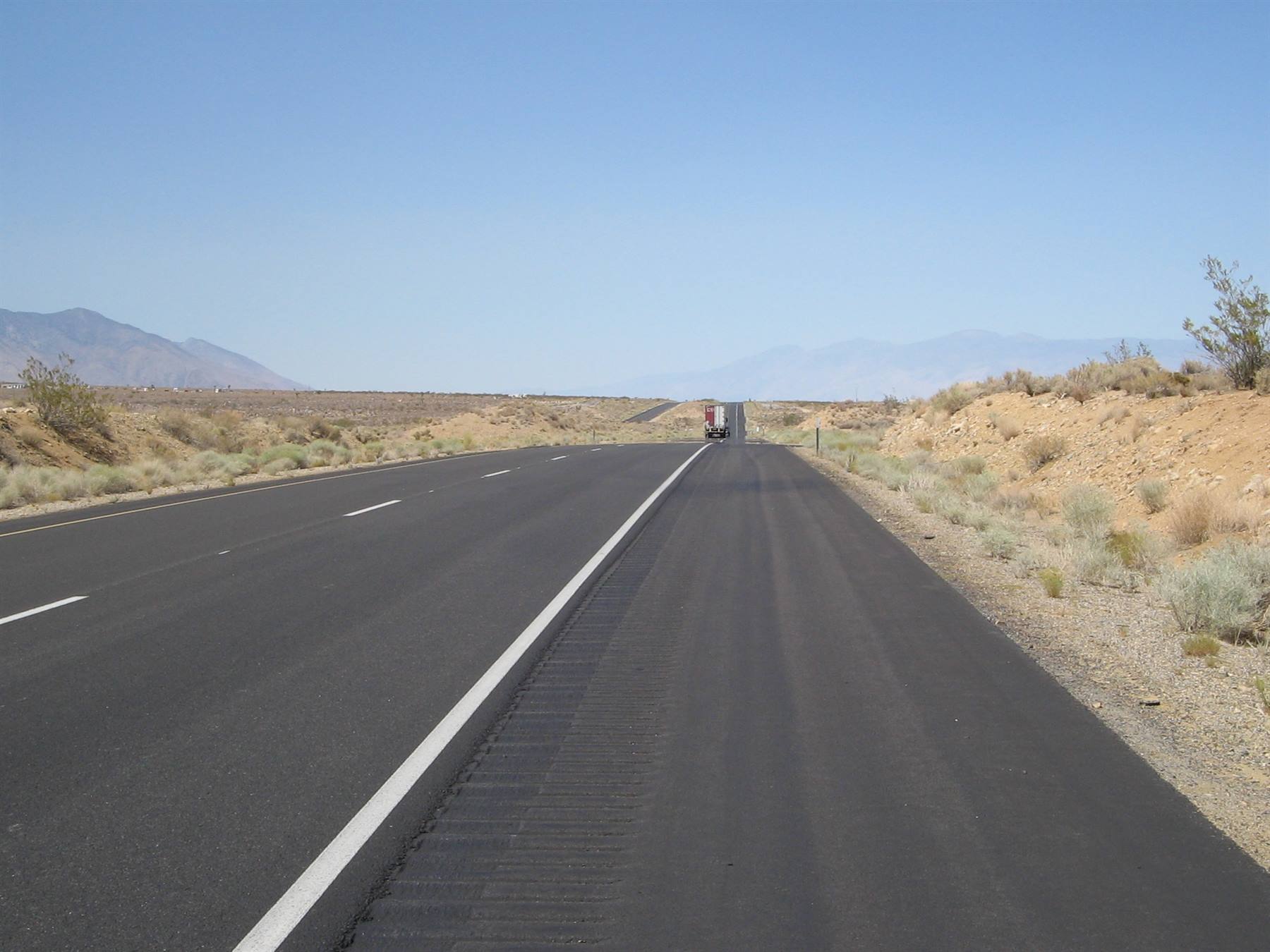
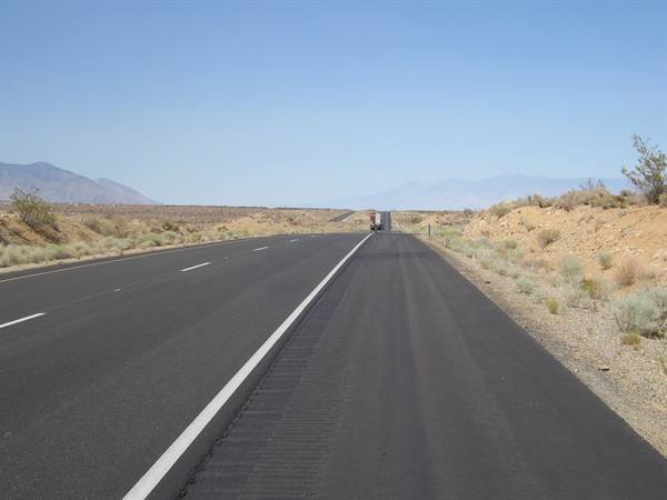
Mojave is what you could call a real American "town" out of a western film: a road as wide as our highways, a couple of petrol stations, eight or nine fast foods (unmissable, they're EVERYWHERE), two buildings that calling "homes" seems excessive, infernal heat...and that's it! How they can call these clusters "towns", I don't get it...if Americans came to see where we live, I think they'd be scared. The centre of the USA that we'll also see in the following days is all like this: these wide, deserted roads, with nothing around, only asphalt, desert and clouds....and me who keeps taking photos of the road, because for me it's so strange to see so much empty space all at once, these are visions we're not used to.. Anyway, in Mojave we have lunch at Denny's, a fast food chain that we appreciate, since we can also eat salads and not just the usual hamburger and fries.
At 13 we set off again and at 15:30 we enter the Death Valley park, after crossing a desert of Joshua Trees, these strange shrubs that are a cross between a tree and a cactus. The road that leads to Death Valley is mind-blowing: there's nobody, on the journey that lasts a couple of hours we maybe come across five other cars. In front of us there's only the road and it's a black serpent that at a certain point gets lost in the nothing, so much so that the eye can't see its end...it's incredible. The entrance to the Death Valley park is marked only by a sign, there are no rangers asking for the ticket, then the road continues for a bit until it starts to descend and you enter the actual valley.
The car thermometer reads 105 degrees....that is at least 35°! We get out to take some photos of this infernal and at the same time fascinating nothing, and the sensation is that of being inside an oven: I had never felt heat like this, even though it's very dry and windy it's truly incredible and reminds me a lot of the Australian desert, when we were at Uluru and the Olgas, but now I couldn't say in which of the two cases it was worse. The first cluster of houses and lodges we find is Stovepipe Wells, shortly after which we find the sand dunes of the same name: they are a sight, fine, light, almost white sand and it would be nice to reach them on foot if this temperature allowed it... At 17:30 we arrive at Furnace Creek, at the ranch where we'll sleep and the temperature is 115°F....48° Celsius.....infernal: now you understand why this valley is named the way it is.
While we check in at the reception of the ranch, we notice a group of big crows, motionless and with their beaks open looking for a bit of cool: it's incredible, they look like statues..it's clear that for them too, although used to living in this place, the temperature is hardly bearable. We go to the room to freshen up for a moment, but then we decide to go out. I had read in one of the many travel accounts, that seeing the path called Artist Drive at sunset is the best moment. So we go out and head towards this path, which is about half an hour from the ranch. From the main road you take a one-way little road on the right and you find yourself for about twenty minutes immersed in another world: there are only rock mountains with colours ranging from red, to orange to brown, very beautiful.
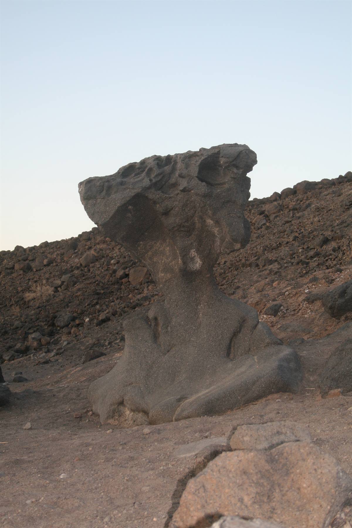
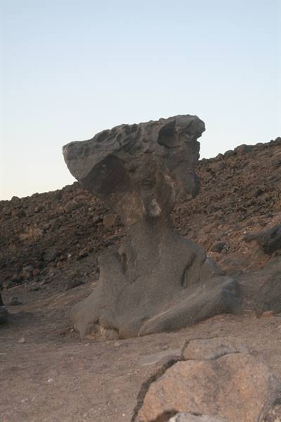
But the riot of colours comes once you arrive at the Artists Palette: a rock that really looks like a palette where a painter has mixed the colours: there are shades of green, blue, yellow, pink and brown, due to the presence of minerals in the rock., truly beautiful and with the sunset light the illumination is perfect. We then continue along the path until you come out again onto the main road and we photograph the rock called Mushroom Rock which, as I remember from other photos, must have broken recently, because it's half of what I expected it to be. We then go back towards the ranch and have dinner at the excellent steakhouse, very nice and where we ate excellent meat. We leave the steakhouse, take a little tour of the souvenir shop where I buy my cowgirl hat and when we leave the shop we take a look at the thermometer under the porch: it still reads 48°!! Good night...
Sausalito
Day 724 Aug 2007
DEATH VALLEY - LAS VEGAS
24 August 2007 Friday DEATH VALLEY - LAS VEGAS At 6 we wake up, we have to take advantage of the fact that it's not very hot to see the valley. After breakfast and check out we set off, towards the Devil's Golf Course, the devil's golf course: it's an impressive expanse of salt. There are only holes created by the salt and if you stay silent you seem to hear around you the sound of the salt cracking. Having left this immense expanse of salt, we continue on the main road towards Badwater Basin, the lowest point below sea level in the USA. It's an immense depression 85 metres below sea level that has something gloomy about it: it's salt water, not drinkable, but not poisonous to humans. Although it's early morning we come across two cars of Italians, so we can't enjoy it alone, but at least it's all in shadow, so we don't die of heat.
We then continue towards Zabriskie Point, where the rocks have a colour different from all the rest of Death: they are yellowish, white, it looks like custard spread on the mountains all around, it's truly a beautiful sight. The last stop of the Death Valley is the highest viewpoint, that is Dante's View, so called because from up here it really seems like you can see Dante's hell:the valley stretches out all below us, in all its majesty and it's of a mind-blowing desolation, it looks like the moon. We leave Death Valley, which we liked a lot anyway, since it's quite a unique place of its kind, and at 9:30 we set off towards Las Vegas. We exit the park from the opposite side to the one we came from, and after a few kilometres from the park exit, we cross the border into Nevada.
We stop to take a break in Amargosa, at a service station that looks like it came out of a western film, all covered in wood and with a reproduction of the Route 66 map inside. After hours of desert and nothing we arrive in Las Vegas: the traffic increases, casinos appear everywhere and the city looms on the horizon, in front of us. We go to the Excalibur, where we'll spend tonight: it's a hotel shaped like a medieval castle, white with coloured towers. This city is incredible, but I imagined it exactly like this. It's an amusement park for adults, with these crazy hotels thatwould need to all be seen, if there were time, and casinos and entertainment of every kind.
Unfortunately the first hours in LV we spend in a first aid clinic where the doctor prescribes Fra antibiotics and antihistamines to recover from what she calls a real infection: the cause, which we also thought about, could only be an insect, perhaps fleas picked up at the San Francisco hotel (this is why we don't recommend staying there). After this unexpected detour, which however at least reassures Fra since now we have the medicines to take, we stop for lunch at the Harley Davidson Café, a place on the strip, inside which motorbikes move along the walls on a kind of suspended rail..what a place.... Exhausted and overheated (here too, at this time of the afternoon, it's close to 45°) we go back to the hotel: before reaching the rooms, in any hotel in LV, you have to pass among the slot machines and gaming tables, very crowded on weekend days like this.
We rest in the room for a while, then we go out and start seeing the hotels: some, like the Mandalay Bay, the Luxor and the Excalibur are connected by a suspended monorail train, with no driver that goes back and forth transporting people. Others instead are connected by bridges, like the New York- New York and the Excalibur or the Bellagio and the Caesar Palace. They are all stunning and in particular we visit the NY-NY, a reproduction of the city with the Statue of Liberty, Brooklyn Bridge and skyscrapers; the Bellagio, whose fountain show in the evening is truly impressive, the Mirage, the Treasure Island and the Venetian, the most spectacular of all: it reproduces Venice both inside and outside, with the canals and the gondoliers who sing in Italian and a sky that gives the impression that it's always day....these hotels are magnificent, there's no denying it...
We decide to stop right at the Venetian for dinner and eat on the banks of the "canal" in a Mexican restaurant. Then we go back, but the tiredness accumulated today is so much that we decide to take a taxi: we make friends with the taxi driver of Ethiopian origins who tells us he's been to Italy, to Parma, where he ate the best cheese of his life and also tells us that he was amazed at how fast Italian trains are....a really nice guy.
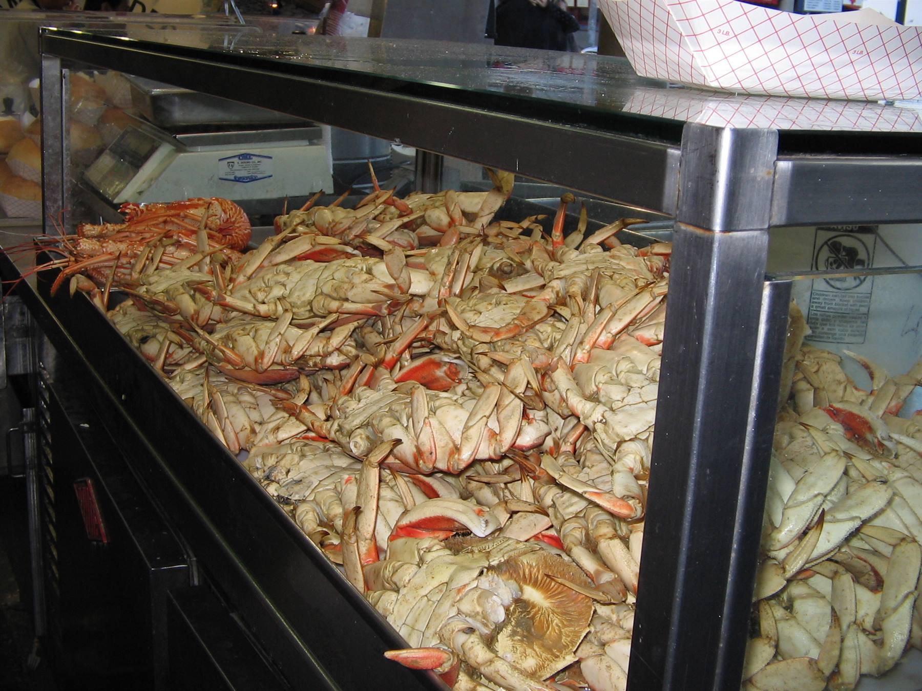
crabs at the Fisherman
Day 825 Aug 2007
BRYCE CANYON
Today we wake up with a bit more calm and enjoy a nice substantial breakfast at the Excalibur. At 10 we say goodbye to Las Vegas, even though in a few days we'll return, when we'll be almost at the end of our trip, returning from the Grand Canyon. We leave Nevada and enter Utah: this they say is a very beautiful state and we already notice it from how the landscape changes: Nevada is really not very scenic, only desert, here instead there are rocks, mountains and a definitely more pleasant temperature. On the road towards Bryce, we decide to take the detour towards Zion Park: we hadn't planned to see it, due to lack of time, but since it's located exactly on our route and since we're ahead of schedule for Bryce, we decide to pass through it.
We cross it all remaining on route 9 and I must say it was a pleasant detour: Zion has mountains of a really beautiful red-orange colour and we also pass under a couple of tunnels and another couple of tunnels dug into the mountain, very particular. Having left the park, we set off again for Bryce, but it starts to rain: we are hopeful of leaving the clouds behind us and arriving at Bryce in time to see it in the dry. We arrive at 16 at Ruby's Inn, the town (so to speak) where we'll stay tonight and then we enter a little further on into Bryce, after crossing the usual little gate with the rangers. The road that leads to the various panoramic points of the canyon is inside a wood, but you can't imagine what there is once past the trees.
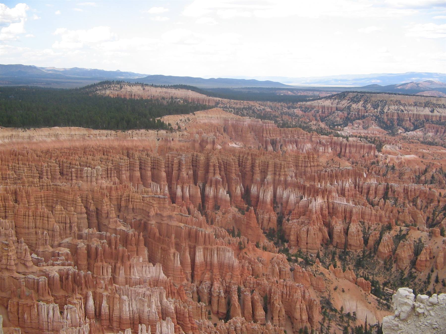
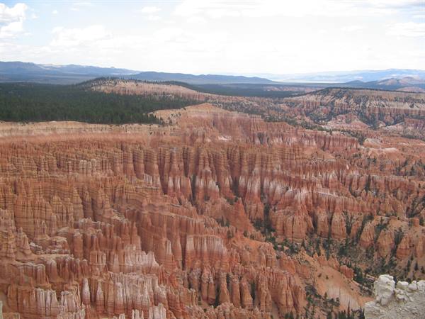
The first viewpoint where we stop is Sunset Point; we park the car and walk a few steps on foot, until the spectacle opens up before us: an immense amphitheatre of rocks that seem to stand like so many soldiers of a vast army with colour gradations from yellow to red, passing through pink and orange: it's spectacular, perhaps the most beautiful place we've seen so far. We take photos at every step and go down a little along the path that allows you to go deeper into the canyon and see these wonders up close. It seems unthinkable that water, wind and sand could create a wonder like this, but so it is. We leave Sunset Point and head also to Inspiration Point and then to Bryce Point: they all overlook the amphitheatre and the spectacle is truly breathtaking.
Unfortunately the clouds and the rain falling on the horizon don't bring out the colour of the rocks, but if they're already fantastic like this, who knows how they'd appear kissed by the sunlight... With our eyes now full of wonder, we go back towards the lodge that will host us for the night: at the reception the lady tells us that at 7 there'll be a rodeo not far away and we decide to go. Just the time to take the suitcases to the room and we go out on foot towards the place where they hold the rodeo: we sit in the stands and wait.
There are the cowboys with boots with spurs, the red mountains of Bryce all around, the sun slowly settling on the horizon and a perfect climate: now this is the West!!! The idyll unfortunately breaks suddenly with the arrival of a group of noisy Italian gentlemen, who start shouting and calling each other from every point of the stands (the famous Mrs Maria), so much so that they even get called out by the other spectators present: I get irritated, but why must we always be recognised abroad for being noisy and rude??? Luckily the show begins and it's fun to see these big guys doing everything to stay on horseback and bulls even if only for a few seconds. The rodeo lasts about an hour, interspersed with little shows for children held by a clown.
We then go back towards the lodge and the restaurant, which is on the other side of the road: we hurry a bit, hoping to avoid the big group of noisy Italians and we take a table: when though we order two beers, the waitress asks us for ID. ID????? Do we look under 21???? We can't believe it, and we think it's a kind of obligation she has to follow (Utah is the Mormons' state, ok, but are they really so strict and prudish??): we show her our passports, she checks them and then goes away. I then see if she does the same with the nearby tables, but it doesn't seem so: so did she really think we were that young?? Dinner over and our beer drunk (!) we go back to the room: the deserved rest awaits us after this beautiful and intense day.
port of Monterey
Day 926 Aug 2007
PAGE – ANTELOPE CANYON
At 7 we get up, have breakfast and leave for Page. At 10 we arrive in Page and it's quite hot, even though the sky isn't very clear and we fear that the trip to Antelope Canyon might be ruined because of the clouds. As soon as we arrive in Page we spot our hotel on the left, but we head towards the center of town to look for the place where they organize the Antelope tours: we know in fact that they are very much in demand, so we think the sooner we book, the better. When we arrive at the office that organizes the tours, entirely run by Navajo Indians (we are inside their territory), the guy we talk to tells us that the first available spots are for the 1:30 pm tour, then he stops, rethinks, does some calculations on the calculator, and in the end finds us a spot for the 11:30 tour.
Thank goodness, I think, because we wouldn't have known what to do until 1:30 and also because the weather isn't improving and the threatening clouds come and go. After booking the tour and while waiting for this hour or so to pass, we decide to go to the hotel to check in. Our hotel is the Arizona Inn and it's completely run by Indians: they check us in but they don't give us the room, because it's too early, so we go out and, still with the suitcases in the car, we go to the nearest McDonald's to nibble on something. From the McDonald's parking lot, which is rather high up, as indeed is all of Page, we see the dam and Lake Powell. At 11:20 we show up punctually at the meeting point: they have us get into their pickups that have about ten seats and we set off.
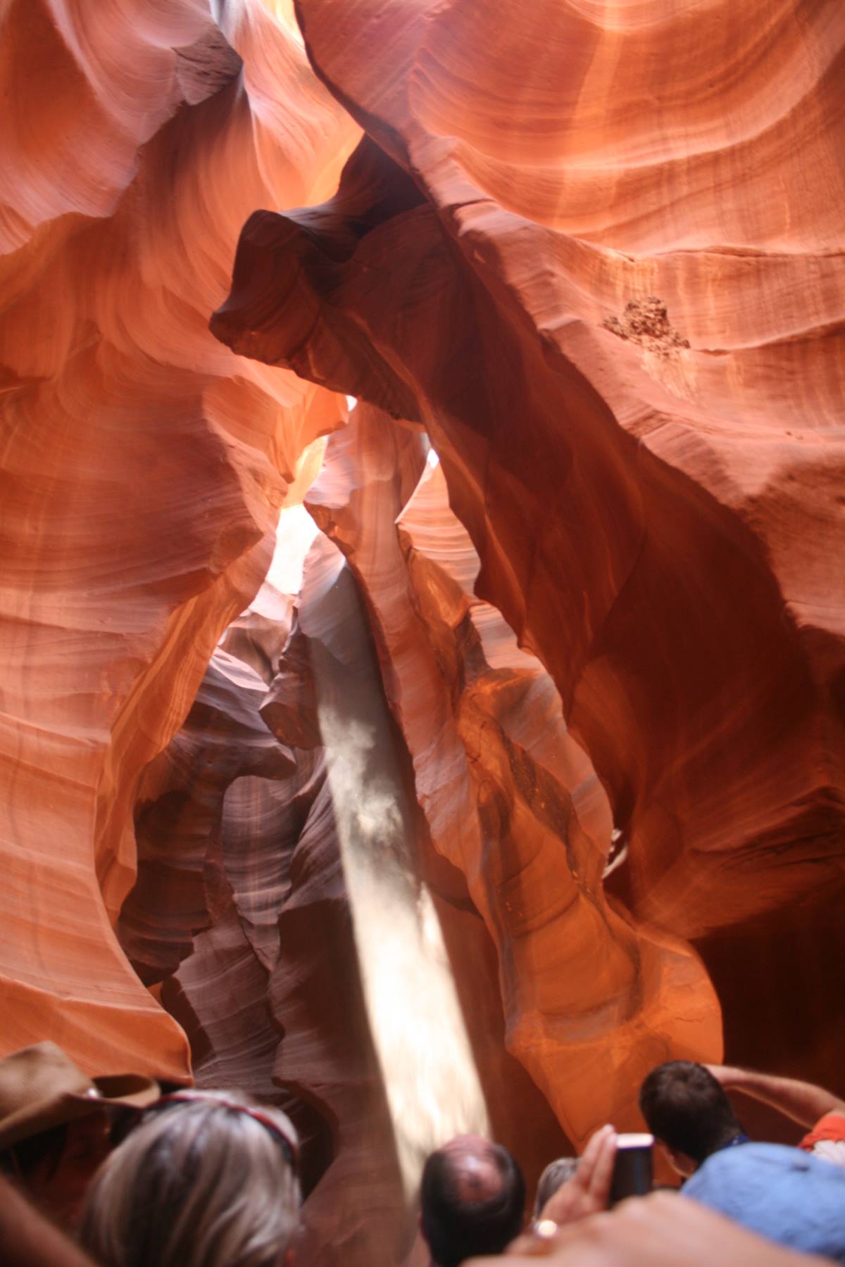
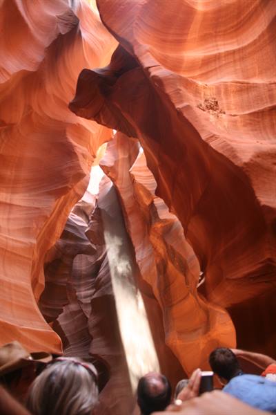
To get to the Canyon you drive a couple of miles out of Page, then you turn onto a dirt road (that's why they use the pickup) and in the end you arrive among some rocks until the pickups stop in a parking lot, we get out and see the entrance of the canyon in front of us: a big crack in a rock. Unfortunately, as I expected, there are a lot of people, besides our tour, also from the previous tours that are coming out of the canyon...so there's a coming and going of people that I would have preferred to avoid. Anyway, despite the crowd we go into the crack in the rock and a new world opens up in front of us: the rock, shaped by wind and water, has a smooth appearance, they look like many scarves spread in the wind and the colors...the colors are indescribable...Red, pink, orange, brown, ochre, sand, the most disparate shades that change when the light comes in and when it leaves.
I have the camcorder in my hand and Fra is taking photos and it's a continuous clicking: too bad that you can't always avoid people's heads, but even so the photos will turn out beautiful. It's an enchanting place, it should be visited in total solitude to appreciate it at its best and to take photos that don't include other people, something that is impossible for us right now. The light and the rocks create strange tricks, so you see an eye that cries, a bird that flies and a bear: the Navajo guide throws the pink sand, which is on the floor of the canyon, upwards and the beam of light that penetrates from above becomes clearer than ever.....and evokes something mystical, almost religious. At the end of the canyon you come out into the sunlight: the guide tells us that we have 20 more minutes before leaving and that therefore we can do whatever we want.
We, of course, go back into the canyon, because the wonder is all there, certainly not outside: we go through it all again and take more photos, while the light, which is right overhead, despite the clouds, manages to slip between the rocks and gives us this spectacle of nature, perhaps unique in the world. At around 1 pm we set off again towards Page, with our eyes now filled with the wonder we have just seen and we return to base. Since it's still early to go to the hotel, we decide to continue our trip along the Colorado River and Lake Powell, so we go to see a place that intrigues me, a place fundamental to the story of the book by Faletti that I have just finished reading. It's Horseshoe Bend, the horseshoe-shaped bend that the Colorado River draws in its slow flow.
We arrive at the parking lot and leave the car: to get to the Horseshoe you in fact have to walk a path of about a quarter of an hour, completely under the sun, before you can see it. After the walk, almost all flat, we arrive at the edge of the precipice and the enormous rock appears in front of us: I must say it makes quite an impression, both for the sheer drop in front of us and for the majesty of the river that here has truly shaped the rock so much that it seems made on purpose. We take a few photos, while I think about the scenes from Faletti's book and then we go back towards the car: I almost faint because of the heat and the sun beating down hard, so much so that as soon as we get to the car I have to pull myself together for a moment....
Once the "bad" moment has passed, we set off again towards Page and go to the hotel, where they finally give us the room: the room is very large, clean and with very high ceilings! We rest, we are exhausted and the heat is suffocating.... We wake up from our nap when it's already 5 pm and after a shower, we recover and go out. We want to take a drive towards Lake Powell and we set off, even though on the horizon there are gray clouds threatening rain. We get as far as the dam on the river, take some photos, while the wind picks up and then we head towards the lake: in reality here too there are rangers who ask us for the pass before letting us in towards the lake. We get to the first little village, where you board for the lake tours, we take a drive around, but we head back almost immediately towards Page because it's starting to rain seriously.
In Page we have dinner at a steakhouse near the office where they organize the Antelope tours and then we go back to the hotel to sleep.
road....
Day 1027 Aug 2007
MONUMENT VALLEY
After breakfast, we leave the hotel: our intention is to take a drive towards Lake Powell, to leave Monument Valley for the afternoon, the best moment to see it, that is with the light of sunset We head for the second time towards the lake, but it starts raining first slowly, then harder and harder: we see, so to speak, given the pouring rain, a little piece of lake, but then we decide to give up since we're in the middle of a storm and it's raining so hard that you can't see anything outside the windows. We don't know what to do, since it's still early to get to the Monument, but we can't stay in Page under the universal deluge either! So, after a quick consultation, we decide that it's better to head towards Kayenta, the little village at the beginning of the road towards the Monument, hoping that the rain won't follow us all the way there.
We make the trip to Kayenta almost entirely in the rain and we arrive at our destination at 11:30; a few clouds open up in the sky and we, hopefully, make a stop at Burger King for lunch. As soon as we go out, though, it starts raining again: it doesn't seem like a good idea to see the Monument in the rain, but what can we do? I take a look at the map, but I don't see alternatives for a possible destination that will keep us busy for the day, while waiting for the rain to stop. At a certain point, though, I see that on the map the Four Corners is marked, the point where 4 states meet (Utah, Arizona, Colorado and New Mexico) and it doesn't seem far. I saw some photos before leaving that talked about this point, unique in the USA, where the borders (straight lines) of these 4 states meet perfectly: it's nothing special, but at least it's a curiosity worth seeing.
We arrive at the Four Corners point in the rain: we go in (paying a good 6 dollars) take a couple of photos hastily and then set off again; from Kayenta it took us almost two hours to get here, to see this metal square on the ground that indicates the states, only to then turn back. A bit disappointed and depressed by the adverse weather conditions, we head back towards Monument Valley. Finally, by now almost at Kayenta, we spot a bit of sun in front of us...the clouds seem to have vented enough and maybe now they'll go away for good. It's now 3 pm, so we head towards the entrance of the Monument. The road that leads to Monument Valley is a few miles long and straddles Arizona and Utah: the first two rock formations you encounter are the Sentinel, on the right, and the Sitting Indian on the left, now illuminated by the sun peeking through the clouds.
Then, in the middle of nowhere, the rocks increase in number, until a road sign indicates the entrance of the Monument on the right: we turn and arrive at the booth where the Indian lady has us pay for the ticket (here we are in Navajo territory so our Pass is not valid) and warns us that, due to the heavy rains, the road to the Valley is closed...what a shame. We decide to go in anyway and we get as far as the Visitors Center, beyond which you can't go except with guided tours: to put it briefly, the Indians organize tours inside the valley to see the monoliths up close, but you're not obliged to follow them, in fact, you can also use your own car and do their same route, but today, because of the rains, it's precisely this second option that is denied to us.
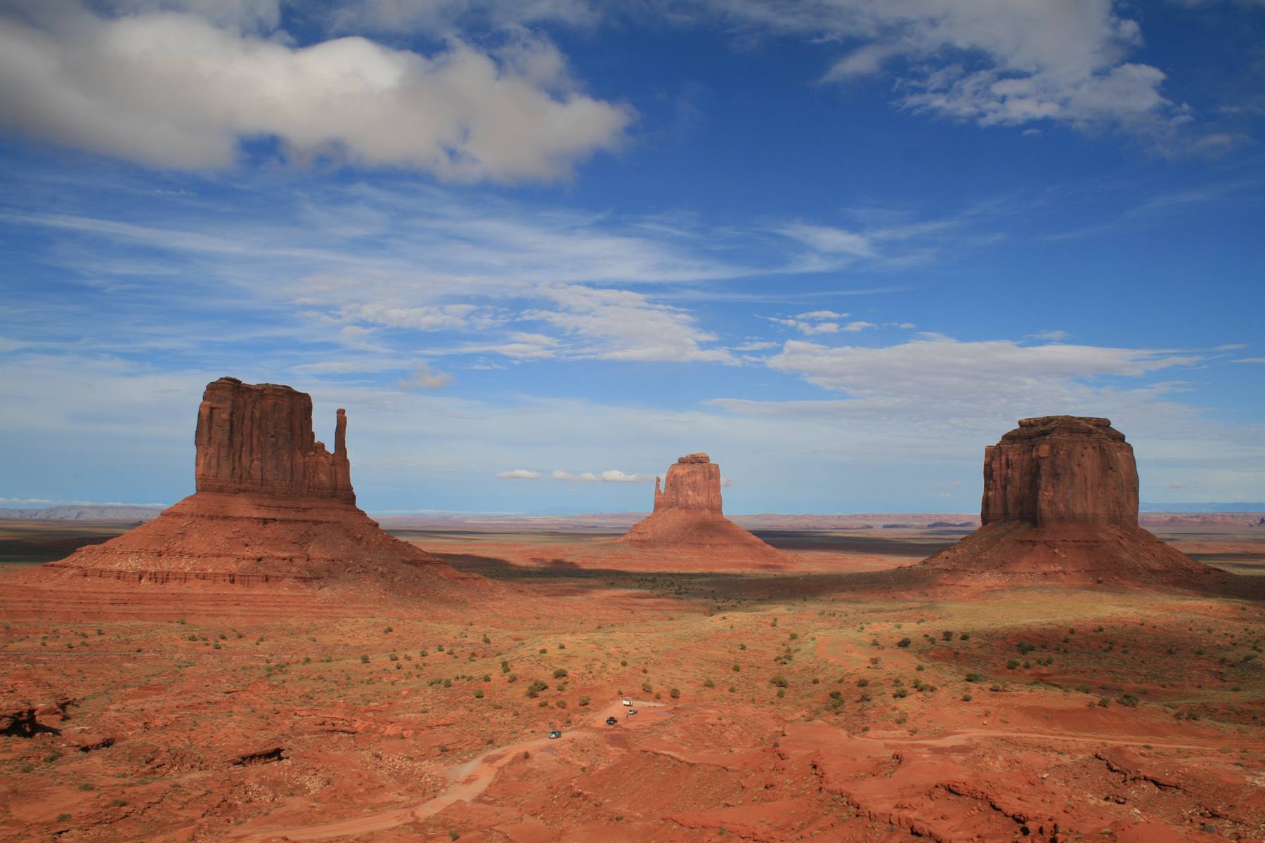
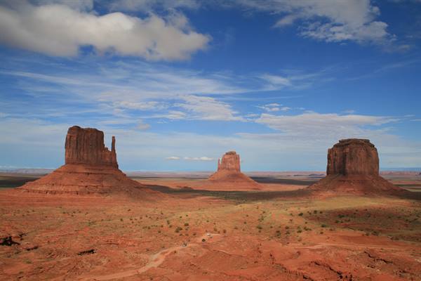
From the visitor center, however, we can still see the Three Sisters: these three twin rocks, seen in who knows how many western films, are there in front of us and we take lots of photos with this backdrop, while the clouds draw their shadows on the wet ground and on the rocks themselves. They are truly beautiful and we remain enchanted for a while looking at them and we also admire all the rocks around that rise from the valley, which, in reality, more than being a valley is a truly boundless plain. Then, not knowing what to do and not wanting to take the tour with the Indians, we decide to go back to the main road and we continue in the opposite direction from Kayenta. The Monument can also be seen from here and, even if less well, you can enjoy a splendid panorama.
Then I think about where the photo that I have on the desktop of the office computer might have been taken, but I can't find the exact spot. At a certain point, three big rocks, each different from the other, appear on the road in front of us and evoke a familiar image for me: it's them!! They are the rocks I was looking for, but the position doesn't convince me. So we continue always in the same direction, we pass them leaving them on our right and then they disappear. I have almost resigned myself to not seeing them again, when instead, almost magically, they reappear in the rearview mirror and now yes, I recognize the image that I've had before my eyes every day for months. The rocks are there and the road, dead straight, at a certain point curves sharply to the right..and I remember the scene from Forrest Gump when he says "..now I want to go home".
We take the usual photos, but the rocks are in shadow, so we promise ourselves to come back there the next morning to take photos with the right light. We then return towards Kayenta, where, apart from a few shacks and the usual fast-foods, there really is nothing. We go to our hotel, the Holiday Inn and while we check in we realize that the Navajo territory adopts the same time as Utah, so an hour ahead of Arizona, where we are. So, suddenly we find ourselves projected an hour ahead: it's already 7 pm and after taking the suitcases to the room, we go back to the hotel restaurant to have dinner..also because we have no alternatives....the little village doesn't seem to offer much. We have dinner in complete tranquility (without beer, because they don't have any..go figure) and we make friends with an elderly American man of Spanish origins, traveling with his wife and daughter.
The man is really nice, he looks like an American actor, one of those out of a western film: we probably inspire sympathy in him, so much so that he tells us he has traveled all over Europe and knows both Italy and Spain well.
mushroom rock
Day 1128 Aug 2007
GRAN CANYON
At 9:30 (Navajo time) and after breakfast (without sugar, because there's no more...) we leave Kayenta towards the Grand Canyon, the last "nature" stop of this trip. At 10 we arrive at the town of Tuba halfway there and at 11 we enter the Grand Canyon National Park, from the east entrance: at the usual booth we meet a nice ranger who after understanding that we are Italian, proudly shows us his tattoo on his left arm: a little red horse with the word "Ferrari" underneath! The park where the Grand Canyon is located is truly immense, full of tourists like never before, but surprisingly green: it's a real forest, with deer and squirrels, while we imagined it rocky and barren. The first observation point we see is Desert View: the Canyon appears for the first time before our eyes as a precipice whose end you can't see, and it's very suggestive.
Then we go back to the car and continue the visit towards the other panoramic points that we encounter along the road: Moran Point, Grand View Point and the last and very crowded Mother Point and all offer a rather wide and suggestive view of the Canyon. At 1 pm we arrive at Grand Canyon Village, the cluster of hotels and lodges (including ours) that rises on the shores of the Canyon, here at the South Rim. We have lunch inside the self-service of our hotel, the Maswik Lodge and we check in, then we rest a bit in the room. Around 3 pm we go out again, determined to explore the Canyon in some other way that isn't the usual view from one of the many panoramic points which, to tell the truth, doesn't satisfy us that much.
We set off determined to walk the Rim Trail, the path that runs alongside the canyon and that seems suitable for our tourist legs that aren't too well trained, but soon we realize that the view is always the same, the one already seen and seen again in the morning from the other panoramic points. The alternative could be to go down into the canyon on foot or on mule, but here the guides advise against doing it all in one day, and besides we're certainly not sporty enough to want to attempt the feat. So we think that the only alternative would be to see the Canyon from above, by helicopter. At the Village, where we are now, they don't do helicopter tours; you have to leave the park and go to Tusayan. So we set off, thinking that in any case it will be difficult to find a spot, since it seems that the tours have to be booked months in advance to be sure of finding a spot.
We leave the park and arrive in 10 minutes in Tusayan, where we don't have trouble finding the airport; we arrive, we go in, we ask if they have spots and they immediately find us two spots for the flight that leaves at 4:50, that is exactly 10 minutes later!! We are excited and incredulous....really that soon? No time to get used to the idea and we find ourselves on the helicopter ready to leave, us and four other German kids. They have me sit right next to the pilot, I put on the headphones and the helicopter slowly lifts off the ground and climbs higher and higher.
I see the trees beneath me becoming as big as a little patch of grass and after a few minutes, in the distance, the "meadow" ends and the rock begins: in no time at all we are inside the canyon, the precipice is beneath us and I get a shiver down my spine, I don't know if from the fear of finding myself suspended in the air or from the emotion of the spectacle of nature that is beneath my feet! The helicopter tour lasts about 30 minutes and is truly beautiful: finally we see the Colorado flowing at the bottom of the canyon and it almost seems like a trickle of water, while the rocks around us take on different shades of color, so much so that they seem painted by a painter.
Satisfied with our tour, we return to base and buy the photo with a little diploma from Papillon certifying that we were the protagonists of this fantastic experience, to be done at least once in a lifetime (but only once, considering also how much it costs!!) Satisfied with our tour (even though I get angry when I discover that my headphones weren't working and that so I missed the whole explanation, ugh...) we go back inside the park and decide what to do for dinner. After the usual family consultation, we decide to go back to Tusayan and have dinner at the famous steakhouse Yippee-Ei-O! A nice place, where we eat excellent meat served by waiters with hats and shirts like real cowboys!!
Antelope Canyon
Day 1229 Aug 2007
LAS VEGAS
9 am: we leave the Grand Canyon and head towards our second-to-last stop, Las Vegas. We return after a few days to the city of fun because it's a good base near a series of natural parks and it also serves to rest and be pampered in the beautiful hotels. We take the road south of the Grand Canyon and pass through Williams and stop for lunch in Kingman, at Denny's. At 2 pm, after a lot of desert and after crossing the Hoover Dam, we return to Nevada and at 3 pm we arrive in Las Vegas. This time we sleep at the Luxor, another truly spectacular hotel: we sleep inside the pyramid and our room has a slanted wall. We spend about an hour at the Luxor pool, very beautiful, to try to fight the heat, then we go out. We immediately notice how there are far fewer people around today compared to the weekend and how this allows us to walk more peacefully.
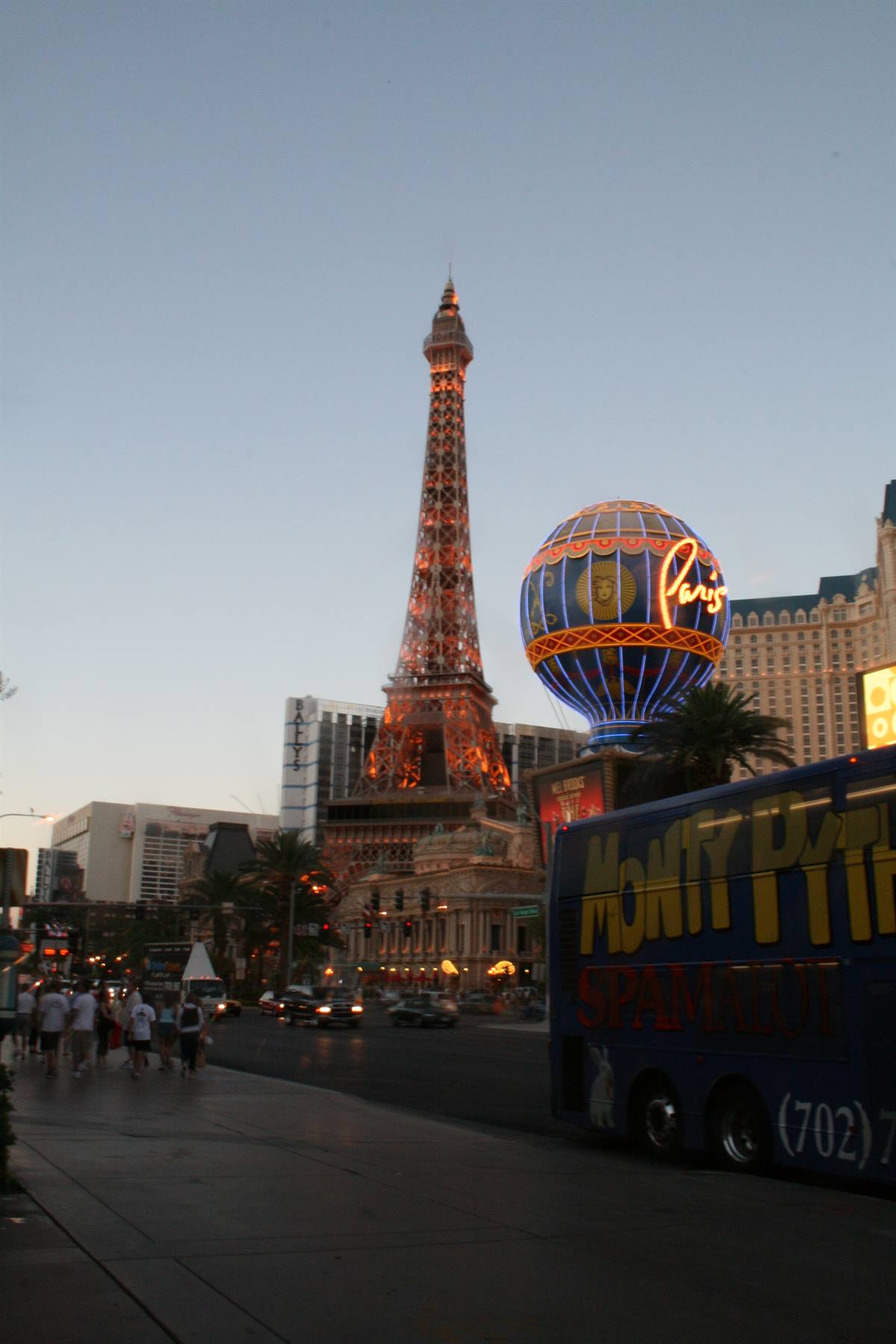
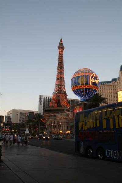
We do the usual little tour of the hotels and this time we see the Paris, the Caesar Palace and again the Bellagio. Vegas is a city that has to be seen, there's no denying it, but for us who have returned for the second time, it already feels like we know it like the back of our hands. We have dinner at the Paris where I eat a fantastic French-style "fish soup", then on the way back to the Luxor, we take the little train from the Excalibur and end up by mistake inside the Mandalay Bay: we give it a quick look and then go back to our room through a passage that connects the two hotels.
the three sisters
Day 1330 Aug 2007
los angeles
We wake up at 8:30 and leave Las Vegas and Nevada: we return to California, heading for Los Angeles. We cross the Mojave desert and stop in Baker for a break, then set off again towards Calico. We arrive in Calico at noon, under a scorching sun: you pay to enter the town, after which you go into the town itself. Calico is a real Wild West town, restored but original: we walk around it for a while, even though, given the multitude of tourists, it seems to us more fake than real. We set off again towards LA, but we decide to drive a little stretch of the legendary Route 66: we take the turnoff at Lenwood and get onto the road. Even though it's a piece of American history it's a road like the others, rather deserted and isolated, except that every now and then there's a road sign or a billboard reminding us where we are.
Very characteristic we found a bottle cemetery, literally hung on poles, a kind of open-air museum, a form of art "dedicated to the memory of those who lived and who died on the mother of all roads" After driving the whole stretch of Route 66, we get back onto the 15 freeway towards Los Angeles. We arrive in LA at 2 pm, but the freeway is rather busy, there are a lot of people and a lot of traffic, so much so that we arrive in Santa Monica when it's already 4 in the afternoon. We drive along Lincoln street towards Marina del Rey, until we find (or at least, think we have found) our hotel; once at the reception, however, the man kindly explains to us that the hotel where we booked is the Marina del Rey International, while they are the Marina del Rey Hotel. Too bad, we think, since this hotel was really nice, on the marina of Marina del Rey.
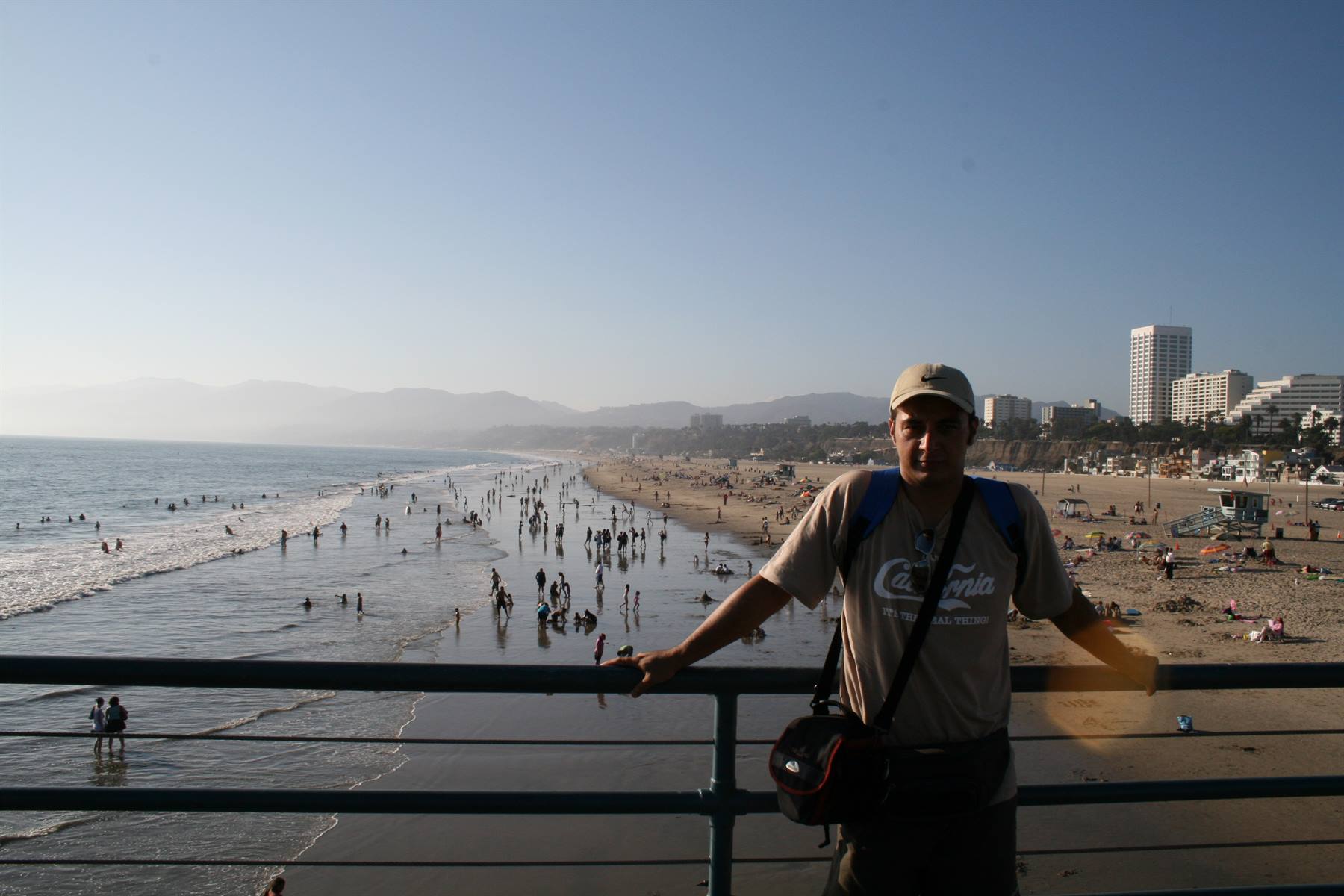
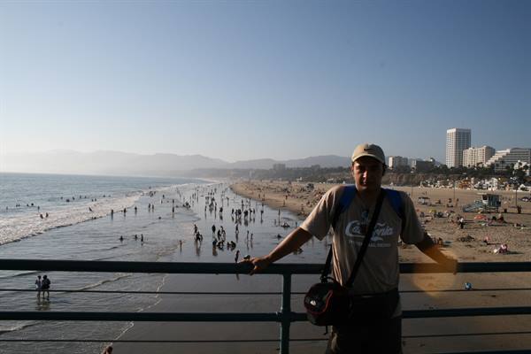
The guy also explains to us where our hotel is, which in fact we find, not very far away and it's nice anyway. After taking possession of the room we go to Santa Monica. When we arrive at the Santa Monica seafront, we park in the underground parking lot of a hotel and then take a walk along the seafront, very nice, with palm trees and freshly cut grass,...but full of bums. We walk the pier on foot to the end, where the amusement park and the various souvenir shops are, as well as some fishermen who fish directly in the sea. Then we decide to go down to the beach and we relax a bit in the California sun on the beach of Santa Monica, near the Baywatch huts and surrounded by a lot of seagulls. We spend a few hours of the afternoon like this, then we go back towards the seafront and go into the town.
Santa Monica has a nice center with a pedestrian area, where it's pleasant to stroll, and where there are several little shops, including the Apple one, where we dive in to use the internet and check the mail. We then decide to have dinner in an Italian restaurant, "Al lago", where we make the acquaintance of Pasquale, a former Neapolitan banker who moved to California for love or for money, we don't quite understand....and we don't understand other things he tells us either, since he contradicts himself more than once. Once out of the restaurant, after an excellent dinner of Italian cuisine, we walk until we reach the car and go back to the hotel.
Bryce Canyon
Day 1431 Aug 2007
LOS ANGELES
After a very slow breakfast at the hotel (slow because the waiter, alone, took a long time to serve us), we go out to discover LA by car.
We head to Santa Monica and from there we take the boulevard of the same name that passes through downtown and then reaches Beverly Hills.
The famous neighborhood, also made famous by a TV series that shaped my adolescence, is just as you see it in the movies, clean and tidy, so much so that it seems a bit fake.
We park in an underground parking lot and then walk to the famous Rodeo Drive: it's a beautiful street, with many shops, almost all Italian brands, but rather deserted at this hour, perhaps because it's early.
From Rodeo Drive, then, you slip into Via Rodeo, a pedestrian part of the same street, very nice, with beautiful shops, benches and flowered street lamps.
Having left Rodeo Drive we walk toward Beverly Hills and by car we do a tour among the beautiful villas of this neighborhood famous throughout the world. Some houses are very beautiful, but others are truly spectacular: well-kept gardens, everything clean..and you only see the occasional gardener busy cleaning or some group of builders busy constructing new luxurious residences.
We leave Beverly driving along Sunset Boulevard toward Hollywood and after a short while we arrive at the neighborhood of the stars.
In reality it isn't much, it's a bit disappointing and in the evening it seems to be frequented by a bad crowd; maybe it's that on television it really seems bigger, but Hollywood Boulevard is a somewhat anonymous street, with the stars on the sidewalk.
The stars are many, each with the name of a personality made famous by cinema or other fields of the entertainment world and they occupy both sides of the sidewalk.
In the square in front of the Chinese Theatre, where film premieres take place, there are the cement imprints of the hands and feet of the most acclaimed Hollywood stars: we too take a photo putting our hands in the imprints of the VIPs, but only for a few seconds, since the asphalt is scorching.
After our little walk through Hollywood, we decide to get closer to the famous sign on the hill to photograph it better.
We follow the directions read in a travel story, but we get lost in the little streets of the Hollywood hill and we also lose sight of the sign itself.
And it's incredible how these hills are so close to the city, and how the streets are intertwined with each other!!
Obviously we wander around a bit aimlessly in the tangle of narrow streets, until we see the sign: we stop, take the ritual photos and then, following a car that seems to know where it's going (unlike us!), we return to the main road.
It is at this point that we realize that to reach the sign it was enough to follow the street...., turning left after a few intersections past the Chinese Theatre: the Hollywood sign appears straight ahead of you, then you decide how close to get to photograph it.
It's around 2 pm and we have seen everything there was to see in Los Angeles, or at least everything that interested us.
So we decide to make a quick stop at the Universal Studios, which are not very far.
We arrive and take a stroll in the part that is not the actual Studios, but among the shops and restaurants that are there around.
The visit to the part where the film sets are located we skip, because the cost seems truly excessive to us, so we decide to head toward Malibu beach.
We therefore return toward Santa Monica, to then follow the seafront to Malibu..but there is a lot of traffic (due to an accident, we will discover later!) and we arrive more than an hour after we left the Studios.
In Malibu, in reality, we don't manage to see much: the houses rise on the sea side, blocking every public passage, but making this beach practically private: only from a little corner before and stopping along the road afterward, we manage to see the beach and the inevitable surfers who stay still for a long time waiting for the right wave.
After having given this brief look at one of the most famous beaches in the world, we head again toward Santa Monica and then continue on another crazy road: Venice Beach.
This beach is famous for the strange types that populate it: hippies, people who don't seem to have a home, bizarre types all muscle and others that I wouldn't know whether to define as artists or madmen...and among the others we also met a unfortunately severely malformed guy, without legs, who moved lying face down on a skateboard.
Missing instead, perhaps because it's too late, in fact we are already at sunset time, are the muscular types who show off their physiques in the outdoor gyms located directly on the beach.
In the evening we have dinner in a restaurant in Marina del Rey, right in front of the hotel, then we return and pack our suitcases; tomorrow we go home!
beach of Santa Monica
Day 151 Sep 2007
HEADING BACK HOME
September 01, 2007 Saturday RETURNING HOME
At 9 we leave the hotel heading to the airport, where we leave the car at Hertz and then reach the terminal with a minibus.
At 11 we leave from Los Angeles, a bit late, on a really small plane, with two seats on one side and only one on the other: the pilots are very young and most likely on their first flight and there is a single stewardess.
We arrive at noon in San Francisco and at 3:23 pm we leave for Amsterdam: the flight lasts 9 hours and in fact we arrive in Holland at 9:23 on Sunday morning, perfectly on time.
We then take the flight to Malpensa at 12:55 and arrive after a little less than an hour and a half at home...
racconto preciso e ben fatto anche se infarcito di luoghi comuni. Purtroppo in agosto gli italiani chiassosi e cafoni li troverai sempre, sembrano una razza inestinguibile! le foto mediocri eccetto Antelope canyon.
Complimenti.
Carlo
gianni · 17/08/2008
Gentilissimi, abbiamo intenzione di visitare il Grand Circle nella primav era 2009. Avrei molte domande. Se lo ritenete, mandate la vostra e-mail. Saluti, Gianni.
giangovo@libero.it


2 reader comments
racconto preciso e ben fatto anche se infarcito di luoghi comuni. Purtroppo in agosto gli italiani chiassosi e cafoni li troverai sempre, sembrano una razza inestinguibile! le foto mediocri eccetto Antelope canyon. Complimenti. Carlo
Gentilissimi, abbiamo intenzione di visitare il Grand Circle nella primav era 2009. Avrei molte domande. Se lo ritenete, mandate la vostra e-mail. Saluti, Gianni. giangovo@libero.it