Here we are at last, today is the big day of Departure, with a capital D. For how long have we thought about this trip... personally since the time when, still a child, I was given a book, which I still jealously keep, whose title is "Natural Wonders of the World". I remember leafing through it and being stunned by the images of the Grand Canyon and many other places in that part of the United States... but they seemed so distant, almost unreachable, yet today we're going to conquer them and a dream will become reality. It doesn't seem true, but we will truly cross the Atlantic Ocean and all the States to land in the great American "West". The sound of the alarm bursts in the middle of the night: it's not even three yet and, Federico aside, we've gotten very few hours of sleep, but tiredness isn't a problem because our enthusiasm, sky-high, fills our veins with adrenaline.
At 3:25 grandpa shows up to pick us up to take us to the airport and at 3:40 we're already on the road. The distance to cover is very short and it's incredible because, due to roadworks at the Marconi in Bologna, we'll take off, to go to America, right from our own city's airport. Already before 4:00 we're in front of the departures door of the Ridolfi in Forlì: we unload our things, say goodbye to grandpa and make an appointment with him... see you in a bit! In fact he runs home to get grandma and the luggage because, after so many trips in which they accompanied us only for the first leg, this time they'll come with us. Less than an hour later, finally all together, we check in the suitcases (directly to San Francisco... let's hope for the best!) and we wait at gate number 5 from where we'll board flight KL 1582.
The excitement rises, as time passes, until, slightly delayed, at 6:27 AM, the Fokker 100 of the Dutch flag carrier KLM lifts off the ground bound for Amsterdam. It's strange to see, beyond the window, such familiar landscapes, but it all ends quickly: a big cloud bank comes between us and the ground preventing us from seeing all or almost all, except, for some stretches, the still snow-covered Alps. Sabrina sleeps, catching up on some lost sleep, while the clouds give us no respite. Breakfast is offered to us and, a little later, at 8:14 AM we land at Schiphol International Airport, in the Dutch capital, while it has just rained. We disembark and, after a brief sortie to the baggage claim to check that our suitcases haven't been unloaded by mistake, we head toward Terminal F, with the little one having fun going along the numerous stairs and moving walkways.
Long lines await us: first at the passport control, then at the metal detector, in the end though we board the gigantic Boeing 747 of KLM which, identified as flight KL 605, leaves the runway at Amsterdam at 12:14 PM. We're seated in the middle rows and unfortunately we won't be able to see what will pass beneath our feet along the way. Having reached cruising altitude and speed I sync my watch to the time zone of San Francisco, where we'll arrive, and I move the hands back a full nine hours!... The curious thing is that the transatlantic flight will last about ten hours and the whole time we'll chase the sun with the result of landing, practically, only an hour after takeoff. The route passes very far north, so, now halfway through, we fly over the coasts of Greenland, dotted with icebergs.
Subsequently, beneath us, a good part of the North American continent passes, while Federico, super excited, absolutely cannot manage to do what would be a most welcome nap, then the land ends and an immense expanse of water appears on our right... it's the Pacific Ocean, the only one we still lacked. Following the coastline we go further south and begin to descend, while the outline of a big bridge appears... the unmistakable one of the Golden Gate! Shortly after, at 1:25 PM local time, we happily touch ground at San Francisco International Airport... here we are America!!! It doesn't seem true: we're really in the legendary California, legendary yes, but only one of the fifty-one states that make up the Federal Republic of the United States...
whether you like it or not, the number one nation in the world! We get off the plane and face a long line at passport control, then we collect our suitcases safe and sound and, after undergoing a small search for any food products, we finally go out into the open air. With the help of a monorail train we reach the car rental area, where we go to the counter of the Alamo company, with which we already had a reservation, and in very little time they give us, without price changes, a car of a higher category than the one expected: a magnificent Chevrolet Astro (California license plate 5HCE185), with plenty of space and eight comfortable seats.
Once the suitcases are loaded we get on the Highway number 101 heading downtown, so, while I get used to the lack of the gear shift and the clutch pedal, we find ourselves in front of the Best Western Americania hotel, which will host us for the next two nights. We leave all the luggage in the room and, despite the tiredness beginning to really make itself felt, we set off to discover our first American metropolis. We go along Market Street, flanked by stunning skyscrapers, we reach the bay of San Francisco and follow the waterfront until we turn left along the road that climbs to the small height of Telegraph Hill. Meanwhile the little one has fallen asleep and to wake him a small tragedy erupts, perhaps rightly so...
but he couldn't be denied the opportunity to observe the magnificent panorama over the skyline of Downtown (the city center), characterized by the unmistakable outline of the Transamerica Pyramid. We take a few photos then go back to the seafront to visit the famous Pier 39: a nice tourist trap, located right in front of the island of Alcatraz, with its famous former penitentiary. The pier is known above all because on its docks a colony of big sea lions has settled, but at this time of year they usually migrate further south, in fact there are only a few specimens, which of course we immortalize, but the whole thing turned out to be a small disappointment.
We stop to have dinner in a small restaurant on the Pier, with the view stretching, beyond the windows in the distance, all the way to the Golden Gate, then, shortly after 9:00, destroyed by the effects of the journey and the time zone, we go back to the hotel and retire to our room to get the well-deserved rest.
San Francisco cable-car
Day 226 Jun 2004
Already before 8:00 AM we're all on the road, ready to kick off the first real day as tourists in the States... and what better way to start than with an abundant American-style breakfast? Duly refueled we get on a little shuttle bus, provided free of charge by the hotel, and reach Union Square, the square that is somewhat the heart of San Francisco, surrounded by numerous skyscrapers. One block away is the departure station of the Cable Cars: the only means of transport in the world considered a historic monument! The characteristic cars, without which San Francisco would lose a part of its charm, rattle up and down the city's hills, successfully tackling slopes that even exceed 20%! To go up they hook with a grapple onto an endless steel cable that runs between the rails, while they let themselves go freewheeling on the dizzying descents, using only the handbrake to slow down.
Once they finally reach the terminus they are rotated by hand one hundred and eighty degrees by means of a large rotating platform: the operation we witness while waiting to buy the tickets that will allow us to travel on the Cable Cars for the whole day. We get on board but travel only a very short stretch of the line, up to Union Square, where we get off. We'll return to the car later, after having visited on foot a part of the city not served by these means. In no time we find ourselves in front of the Chinatown Gate, the symbolic door that gives access to what can be considered, with its one hundred thousand inhabitants, after New York, the most populous Chinese community outside Asia.
The ancestors of the current residents settled in the area already in 1848 and from then on they began to build a city within the city, with clearly Oriental features, those same features that still characterize it today. We go along Grant Avenue, the true backbone of the neighborhood, with its typical white-red street lamps and with the buildings with pagoda roofs, but we also observe what was the first cathedral of San Francisco, St. Mary's Church (unfortunately for it, today, completely out of place). Nearby we visit the colorful Waverly Place, particularly rich in Orientalizing decorations, then we momentarily leave Chinatown. We go into the nearby Downtown, a completely different reality, with its dizzying skyscrapers, among which the Transamerica Pyramid stands out for size and shape.
The building, which more than any other characterizes the city's skyline, can offer, if observed from its base, a particularly evocative perspective. After the skyscrapers we tackle the climb that takes us back to the hill of Chinatown, we pass in front of the fanciful building of the Bank of Canton, and we regain the Cable Cars line. We get on the first one that comes and shortly after we find ourselves at the terminus of Fisherman's Wharf... exactly the one we didn't want to reach. It doesn't matter much, because traveling on these strange cars is also fun, so, without worries, we go back up the hills of San Francisco. Intending to change line we get off right in front of the small museum dedicated to these incredible means of transport: it's housed inside a skillfully restored building and you can observe the machinery that allows the operation of all the city's Cable Cars.
After the brief but interesting visit we finally get on the right car and go to conquer the incredible slopes of the Powell-Hide Line: the surely most evocative and exciting stretch of track. Thus we also reach the right terminus, on Hide Street, in front of the pier where the Historic Ship is located: an interesting parade of old vessels, ideally led by the Balclutha, a large three-masted sailing ship beyond which, in the distance, the disturbing outline of the island of Alcatraz stands out. After a very quick hit-and-run at the nearby Ghirardelli Square (the kingdom of chocolate), we visit, to the little one's delight, the Historic Ship, where, besides the sailing ship, you can see the Hercules, an old tugboat, and the Eureka (paddle-propelled), once the largest ferry in the world.
Having explored, at Federico's wish, every tiniest nook of the vessels we then walk along the road that runs along the sea, until we reach Fisherman's Wharf. The old neighborhood of fishermen and food factories has over time transformed into a perfect tourist trap in which, given the hour, we too get ensnared. We have lunch and go back to the Cable Cars terminus, we tackle the evocative ups and downs in reverse and shortly after we find ourselves at Union Square, where an incredible number of Limousines parade at an incessant pace. Thanks to the Best Western shuttle we return to the hotel and, this time with the car, we set off for the second part of the day. We cross the whole city from east to west and arrive, on the shores of the Pacific Ocean, in view of the famous Golden Gate.
The most famous of the suspension bridges was inaugurated in 1937, after having been designed and built in just five years. Currently, every week, a team of twenty-five painters uses about two tons of red lead to make the structure impeccable, and it's precisely the color of the red lead that characterizes the Golden Gate which, reddish, stands out admirably against the backdrop of the Bay of San Francisco. We cross this incredible work of engineering and stop at Vista Point, a scenic overlook on the right at the exit of the bridge, which allows us to observe the structure from the right angle, with in addition the skyscrapers of Downtown standing out against the blue of the sky in the distance. We take numerous photos and then take a walk until we reach the central pillar, while an icy wind blows from the ocean and the bridge, though imperceptibly, sways in a not very reassuring manner.
Thus we regain the comfortable seats of the car and go down, on the shores of the bay, to the little town of Sausalito... which is nice, but nothing exceptional. We go back up toward the Golden Gate and take the road that goes into the Golden Gate Recreation Area, a protected area on the shores of the Pacific: from there it's possible to admire the bridge, from the top of the cliffs, in all its majesty! Having observed the Golden Gate, practically from all possible angles, we resume the road to the center of San Francisco and pass along the stretch of Lombard Street called "The crookedest street" (the winding street), one of the most famous and perhaps, indeed, also most winding streets in the world, made famous thanks to the numerous films that have been set there...
these Americans are truly incredible! Thus we arrive, now at the end of the day, near Pier 39: the intention would be to get an ice cream for dinner, but we don't find parking, so we decide to first go see the sunset from Treasure Island. The choice, however, turns out to be a small mistake, in fact we find confirmation of our doubts about the place which, located in the middle of the bay, is reached by traveling along the evocative Oakland Bay Bridge (two levels, the lower one for going out and the upper one for entering San Francisco): the sun sets
Sunset in San Francisco
Day 327 Jun 2004
Thanks to the effects of the time difference, getting up early in the morning is no problem, and shortly after 7:00 we are already ready to leave. We have a good breakfast and set off by car along the streets of San Francisco which, given the public holiday, are semi-deserted. We drive incredibly fast, so in no time at all we reach Alamo Square. This sort of square is overlooked by the city's most famous group of houses, the so-called Painted Ladies: six Victorian-style villas that contrast magnificently against the backdrop of the Downtown skyscrapers... but they are in shadow and we will come back later to photograph them. To tell the truth, the whole area is dotted with buildings constructed in this style: delightful structures that look as though they have come out of a fairy-tale book.
We cannot help but notice them, along with a characteristic fire engine, along the road that takes us from Alamo Square to the Mission district, historically the city's first. It was indeed from this place that the name San Francisco originated, and more precisely from that group of Spanish Franciscans who in 1776 founded Mission Dolores there, the very same church complex that we can still see today. The chapel, in particular, erected in 1782, is the oldest building in the city. We take a few photos and then, by car, reach Golden Gate Park, a huge green lung located in the central-western part of the city.
In particular we go to the Japanese Tea Garden, a small and immaculately kept Japanese garden inside which we spend some time strolling peacefully, among little bridges, bonsai and pagodas, immersed in an extraordinary tranquillity, so much so that it doesn't feel at all like being in the centre of a great metropolis. Just as in the neighbouring botanical gardens, a little less well kept, but literally invaded by squirrels that run around us in search of food. We end our visit to Golden Gate Park with the Conservatory of Flowers, a beautiful greenhouse built in 1878, in Victorian style, inside which, in almost unbearable humidity, we observe countless splendid species of tropical flowers and plants.
The first part of the day has flown by and it has got late, also because the check-out at the Best Western awaits us by 12:00, so we head back to the hotel, collect our luggage and set off again with it on board. Before leaving San Francisco we have an unsettled score to settle with the Painted Ladies, so we head once again towards Alamo Square. Compared with the morning, however, something has changed. The city has woken up and in particular a demonstration very well known around these parts has got under way: the Californian metropolis is one of the world capitals of homosexuality and today on Market Street the Gay Pride is taking place. We heterosexuals are not interested, but the traffic is almost completely blocked in the area and, Painted Ladies photo included, it takes us more than an hour to get out of the city and onto the Oakland Bay Bridge.
We thus leave San Francisco behind us, with its architectural and scenic wonders that make it truly unique... Perhaps, as many say, it really is the most beautiful city in the States. We cross the bay and in practice kick off the "on the road" tour of the American south-west: ahead of us the road to reach the ideal destination is very long but also extremely appealing. We drive a few dozen miles inland and, when we stop at a car park along the highway to have a snack, we cannot help but notice how much the outside temperature has already changed and shot upwards... in fact it's infernally hot! We drive across the central Californian plain which, entirely cultivated, at times vaguely reminds us of the Po Valley, and in the late afternoon we reach the small town of Mariposa, located about fifty miles from the entrance to Yosemite National Park, which we will visit tomorrow.
We stop for the night at a hotel of the Super 8 chain. We go up to our room and later come down to have dinner in a little Mexican restaurant, then, tired, we fling ourselves onto our beds: for tomorrow another hard but, we hope, wonderful day is planned.
Yosemite - Taft Point
Day 428 Jun 2004
We don't want to lose the good habit of waking up early, making the most of the day, and so we do. After taking advantage of the breakfast, included in the room price, we snap a few photos of some characteristic buildings in Mariposa and set off with the goal of visiting our first big national park: Yosemite (pronounced Yossemiti). We follow Road number 140 which goes deep into the Sierra Nevada and before long we come upon the valley where the Merced River flows, the river that comes out of Yosemite Valley, while the landscape around us becomes increasingly rugged. In about an hour we arrive at the park entrance, where for 65 dollars we buy the "Golden Eagle Pass," a card that will give us the chance to enter all the other national parks in the States.
So, a little excited, we pass through the gate that gives access to what was the first natural park in the world, established by a decree signed by Abraham Lincoln himself, in 1864. Yosemite, named in homage to the Indian tribe of the Uzumati, exterminated in the mid-19th century, stretches over thousands of hectares, incorporating within its boundaries majestic mountains that nearly reach 4000 meters in height... we, however, will content ourselves with visiting only a small part of it. Past a narrow passage, Yosemite Valley opens up before our eyes and right after, on our left, the impressive silhouette of El Capitan appears, one of the highest known cliffs, with its 900 meters practically vertical, a meeting point for free climbers from all over the world.
A little further on, on the same side of the valley, we also catch a glimpse of Yosemite Falls, spectacular waterfalls that in three drops overcome a height difference of 739 meters, thus making them the highest in North America and among the highest on the planet. The spectacle of nature literally wins us over, as we continue to go deeper into this strange valley whose floor, a few kilometers wide, is completely flat and in stark contrast with the impressive granite peaks surrounding it, among which Half Dome stands out, a grandiose monolith with its characteristic shape, which has become something of the symbol of Yosemite. A one-way road loops around the valley, going up it on the orographic left and then exiting from the other side. In its central part it runs alongside the Merced River, which placidly flows forming large bends in a wonderful natural setting.
A setting we try to enjoy with a stop along the riverbanks, accompanied by a short walk, in complete tranquility. Further on, along the ribbon of asphalt, we also stop at the point from which, by way of a modest scramble, in a splendid environmental setting, one reaches the base of Yosemite Falls. We would like to linger longer in these places, but time flies and it's almost 11:00 when we leave the valley floor to begin climbing along the road that leads to Glacier Point. It takes us about an hour to reach the 2200-meter elevation of perhaps the most famous viewpoint in the park, located at the top of a height that dominates Yosemite Valley, but after an endless series of curves we are abundantly rewarded.
The spectacle from up here is nothing short of breathtaking: the valley is now at our feet and the view ranges in the center over the imposing silhouette of Half Dome, to the right over Vernal and Nevada Falls, particularly rich in water, and to the left over Yosemite Falls which, though so large, from this height appear almost like an insignificant trickle. The vastness of the scene is such that it leaves us stunned and in contemplation for quite some time... then, slowly, we retrace our steps back to the car to have lunch and thus fill something other than our eyes, already saturated with wonders. Once we've filled up on energy, we move a few miles, leave the car in a parking lot at the edge of the road and set off along the Taft Trail.
Following the path we cross a beautiful stretch of forest, with imposing plants, and in less than half an hour we reach its terminal part, which overlooks, like Glacier Point, Yosemite Valley. We pass by the so-called Fissures, vertiginous cuts in the rock, like slashes of a big blade, inflicted by who knows whom on the severe edge of the precipice, and we come into view of the extraordinary granite spur of Taft. It's a kind of natural balcony, masterfully suspended several hundred meters above the valley floor, and the spectacle, with the view ranging in front over El Capitan, is grandiose... So we stay for a while observing the panorama, while several squirrels, to Federico's delight, hop around us, then, fully satisfied with the more than positive outcome of this first trail, we calmly tackle the way back.
By car we set off leaving Yosemite behind us, but carrying with us the indelible memories of its natural wonders. A good stretch of road awaits us before closing the stage and, in practice, we descend from the Sierra Nevada and then, in part, climb back up. Thus we arrive, almost at 20:00, at the Best Western Holiday Lodge in Three Rivers, now at the gates of Sequoia National Park, which we will visit tomorrow. We tidy ourselves up a bit and go out for dinner at a Pizza Factory, closing the day with a healthy laugh thanks to grandpa who, not yet in tune with American fast-foods, on the way out, in complete good faith, throws everything in the trash bin... tray included!... And with the smile still printed on our lips we go to the room to rest.
Sequoia N.P. - The President
Day 529 Jun 2004
We've become very fast: at 7:15 we're out of the room and, after having breakfast, at 8:00 we're already on the road. We follow the ribbon of asphalt of Highway number 198 which, one curve after another, climbs up the Sierra Nevada and before long we enter Sequoia National Park. The park, established in 1890 mainly to protect the millennia-old trees from which it takes its name, develops at an average altitude exceeding 2000 meters, so, even after the entrance, we tackle uphill an endless series of curves, while around us the landscape shows no signs of forests nor, much less, of sequoias, and if we hadn't had precise information about it, the doubt of having taken the wrong road would probably have arisen...
instead, at the exit of one of the last curves, the silhouette of three large trees in single file appears to us and from that point on, along with them, the entire, luxuriant forest also appears. We continue climbing a little more, until we reach the vicinity of a visitor center, in front of which The Sentinel towers, an enormous sequoia. From there we take a secondary road in the direction of Crescent Meadow, while a bit of smoke hovers in the air due to a small fire nearby: to be safe I ask a ranger for information... nothing to worry about, he answers me. The large plants stand out among the others, not only for their size, but also for their lighter bark: they really are a marvel, so we stop in their presence and it's an indescribable emotion to be able to touch them.
Following the road we arrive at the so-called Tunnel Log, a tunnel carved through the trunk of a large sequoia that fell some time ago for who knows what reason. We finally complete the visit of this area of the park by leaving the car in a parking lot to climb up to Moro Rock, a rocky spur on which a short but steep trail ventures. The path is, at times, vertiginous and about halfway along Sabrina, who doesn't have a good relationship with heights, frightened, stops to wait for us, because we, "fearless," continue to the top, from where there's a beautiful overview of the surrounding heights... a shame only about the smoke and haze. Leaving Crescent Meadow, on the way back from the walk, we further elevate our contact with nature by spotting, in a short span of time, two deer (probably fallow deer)... while the squirrels, very numerous, we stopped counting a while ago.
We go back along the main road and arrive, in the heart of the park, at a large parking lot where we leave the car to go before "his majesty" General Sherman... It's an immeasurable honor to stand before the largest living being on the planet: with its 83 meters in height it's not the tallest existing sequoia nor the thickest, though with its 11 meters of diameter at the base, but it's in terms of mass that the General seems to be unbeatable and despite its age, between 2300 and 2700 years, it appears in great shape and radiates health from every branch. After the ritual photos we set off along the Congress Trail, a very comfortable path that winds within the Giant Forest.
It's along this route that we can observe numerous specimens of giant sequoia, at times unfortunately damaged, more or less seriously, by the numerous fires, which here seem to develop, almost exclusively, for natural causes. In terms of size and state of conservation, the tree nicknamed The President stands out in particular, flanked, a few dozen meters away, by a dense group of sequoias that, given the excellent neighbor, could only be the so-called Senate! After more than an hour of complete immersion in nature, including the sighting of another beautiful deer, we're back... tired but fully satisfied with this scramble too. We get back in the car and cover a fair stretch of road: we leave Sequoia National Park behind us and enter Kings Canyon National Park.
The two parks are very similar and practically one the continuation of the other, so much so that one wonders why they aren't a single one... unfortunately we don't know, but there surely must be a reason. Thus we arrive at Grant Grove, that is, the grove of Grant: it's already 13:00 and we have lunch, as always "packed," before taking a short walk around the forest, naturally dominated by General Grant, a little younger and less tall than his more famous same-rank Sherman, but with a greater base diameter, exceeding 12 meters. All around then, associating the entire context with military hierarchies, we can't help but notice an incredible series of "subordinates"... often of high rank and deserving of honors. To complete the picture, of course, the fallen on the field couldn't be missing... an "old officer," collapsed to the ground in 1969, of which practically only the bark remains...
you can easily walk inside it and it's a very strange sensation that particularly amuses the little one. Grant Grove is truly a fantastic place and, all in all, the sequoias of Kings Canyon are perhaps more beautiful than those of its more famous neighboring park. In the early afternoon, reluctantly, we leave these exceptional monuments of nature: before considering the stage closed we still have to cover a good 450 kilometers. We descend from the Sierra along a secondary road, so winding it almost makes your head spin, then finally we arrive in the great central California plain: a single, immense garden in which everything is cultivated. Once near the town of Bakersfield, however, we turn east and in a few miles the landscape changes radically: the desert, dotted with Joshua Trees, takes over and warm colors become dominant.
We pass through the small Red Rock Canyon State Park and shortly after, in the distance, we glimpse the houses of Ridgecrest, on the outskirts of which, in an Econo Lodge chain hotel, we stop for the night. We go out for dinner at Denny's, a type of fast-food about which I had excellent references (fully confirmed), then we return to the hotel and, mentally reviewing the emotions that the giants of the forest gave us, we slowly slip into the world of dreams.
Death Valley - Mushroom Rock
Day 630 Jun 2004
PART ONE
The day that will surely be the longest of the trip starts very early, in fact, after the usual visits and over 500 kilometers of road traveled, this evening we will also dedicate ourselves to the follies of Las Vegas. Already before 8:00 we're on the road along Highway number 178 in the direction of Death Valley. Desert and inhospitable landscapes scroll past the windows, so much so that, passing through the disconcerting settlement of Trona, we wonder how anyone could decide to live in certain places, especially when there are much better ones nearby. The panorama, for non-residents like us, is nevertheless fascinating, even if this morning, unfortunately, we're not accompanied by the sun...
nothing worrying, it shouldn't rain, but if someone, at the start of this trip, had told me that today, while we're going to one of the hottest places on the planet, the sky would be cloudy, well, I certainly wouldn't have believed it! Around mid-morning, at the end of a very long descent, we enter the legendary Death Valley (since 1933 included in the Death Valley National Monument).
It's one of the deepest depressions in the northern hemisphere, with its lowest point located at 85.5 meters below sea level and, given its infernal climate (in 1913 it reached plus 57 degrees Celsius), it owes its sinister name to the phrase uttered by a pioneer who, having escaped a danger while crossing it, more or less, apparently, said this: "Thank God we got out of this valley of death!" We, without particular fears, instead enter it and at Stovepipe Wells, a tiny cluster of buildings with some commercial establishments, we make our first stop, while the heat begins to be felt and, in the distance, a few patches of clear sky leave us hoping.
We resume following the road for the valley floor and descend below sea level with the view ranging, to the left, over the Sand Dunes: a little piece of Sahara in the American West, but the road to visit them is closed to private cars and they remain in the distance, like the sun behind the clouds... We approach the heart of this place which, meter after meter, appears to us increasingly surreal, like the short dirt detour that takes us to Mustard Canyon... The name is appropriate because the strange mounds of arid terrain flanking the route really resemble in appearance the well-known condiment. In the vicinity we also visit the remains of an old borax mine.
There was a time when the valley was the protagonist of a small economic boom, with the extraction of this mineral, but everything then ended, supplanted, several decades later, by another resource, still wisely exploited today: tourism. We pass Furnace Creek, the oasis that, in practice, is the capital of Death Valley, as well as the only place where it's also possible to stay, and we take on the right the road that continues to descend toward Badwater Basin, the lowest point of this incredible depression... When, finally, we arrive, surrounded by the blinding white of the salt that covers the bottom of an ancient hydrographic basin, in that extraordinary place, at 282 feet (85.5 meters) below sea level, even the sun, thank God, wins its battle and comes out forcefully into the open, delighting us with its presence.
After some time has passed and the souvenir photo has been taken in front of the sign with the elevation written on it, which will without a shadow of a doubt be the lowest point of the trip, we calmly return in the direction of Furnace Creek, in fact, along the way, several stops await us. The first is at Devil's Golf Course (literally the "Devil's golf course"). It's a strange phenomenon staged by earth and salt crystals, with the complicity of the weather: it feels like being in the middle of a plowed field, where a plow, probably, has never passed. A little further on we take on the right the so-called Artist Drive: a one-way road that ventures to the base of an amphitheater whose rocks, pigmented by the numerous minerals present, have taken on fanciful tones.
It's a spectacle and a different view at the exit of every curve, up to the triumphant explosion of colors of the Artist Palette: the "palette" on which an imaginary artist seems to have mixed ochre, yellows, whites and blues in search of their infinite shades. It's almost 14:00 when we regain the main road. We linger a little longer to photograph the bizarre Mushroom Rock (a mushroom that the grandparents, though inveterate pickers, cannot pick), then finally we have lunch, in the shade of a very rare tree, in a parking lot in Furnace Creek. Half an hour of stop, no more, and we throw ourselves again headlong into the visit of Death Valley. This time we take Route 190, which exits toward the east, and we stop almost immediately at Zabriskie Point, a place made famous by the film of the same name by Antonioni.
The geological phenomenon that can be observed from this viewpoint is among the most fascinating of the valley, with the badlands eroded by the weather that look like papier-mâché and, yellowish, stand out wonderfully against the intense blue of the sky behind. Shortly beyond Zabriskie Point one can take another detour (one-way), which branches off from the main route and we don't let it slip away. Thus we go deep into Twenty Mule Canyon, along the track that the convoys loaded with borax followed, generally drawn, indeed, by twenty mules... in that era, perhaps, no one had the time and desire to look, like us, at the surrounding landscape which, wonderful in its raw desolation, certainly deserves more than a glance. We ideally remove mask and snorkel as we emerge...
from sea level, then we begin to climb, without a moment's pause, even with hairpin turns, until we reach the almost 1700 meters of Dante's View, a sort of natural balcony over Death Valley... The gigantic depression is now at our feet and can be embraced all in a single glance, with the white expanse of salt of Badwater Basin that looks like a frozen lake and, right in front, Telescope Peak, which if you add its height (3368 meters) to the negative one of the valley floor reaches the impressive difference in elevation of 3453 meters!!!... it doesn't seem so to look at them, but it's really so! With adrenaline at a thousand we bid farewell to Death Valley which, thanks to the emotions it has given us, despite its name, makes us feel more alive than ever.
We cover a few more dozen miles and we also bid farewell to California (which we will meet again at the end of the trip) to enter the state of Nevada. The ribbon of asphalt slips away smoothly under the wheels of our Chevrolet, while the sun, inexorable, descends toward the horizon enhancing the colors of the arid landscape that flows fast alongside the car, beyond the windows, then suddenly, after a rise, the improbable silhouette of a city appears... it seems a mirage, but it's really Las Vegas!
Death Valley - Twenty Mule Canyon
Day 730 Jun 2004
PART TWO
We land in the metropolis of entertainment par excellence shortly after 19:00 and immediately head to the hotel where we will stay: the fantastic Luxor, obviously with an Egyptian theme, complete with a life-size sphinx on the front and one of the largest in the world, with its 4400 rooms. In the top twenty places of this special ranking there are as many as eighteen from Las Vegas, which has monopolized the hypothetical podium: in first place The Venetian, with about 7000 suites, in second Mgm, with 5005 rooms and in third precisely the Luxor! We enter the lobby (truly impressive) and, after picking up the keys, we reach one of the first floors (the tenth!) with the elevator, which here is called "inclinator," since it goes up along the internal edges of the great pyramid that characterizes the complex.
We take a quick shower and then go out onto the Strip, the main street of Las Vegas which, with the arrival of darkness, has transformed and is now an immense sparkle of lights. The history of Las Vegas (and Nevada) is strange: less than a century ago it was just a place of passage, so local laws, contrary to other states, provided for much shorter application times, especially for divorce procedures (42 days)... but it was also easier to get married. Involuntarily this attracted people... and the consequent need to entertain them (with gambling) then sparked the spark thanks to which, today, we can see all this. It seems pure madness: the largest hotel-casinos in Las Vegas are located right along the Strip, whose name is appropriate, because strip means to completely strip someone and at gambling you can lose everything... even your clothes.
With a monorail train we reach the nearby Excalibur hotel which, centered on the theme of King Arthur, has the shapes of a wonderful medieval castle. Next to it is the stupefying New York-New York, which faithfully reconstructs, though on a reduced scale, the most famous skyscrapers of Manhattan (not the Twin Towers, fortunately), and in front the gigantic Mgm towers. We have dinner along the Strip in a fast-food and resume our walk in the incomparable American extravagance. We wander among the green tables of the Paris-Las Vegas, characterized by the reproduction (150 meters high!) of the Eiffel Tower and right in front we admire the Bellagio hotel, with its magnificent dancing fountains. Next to the latter is then the immense Caesar's Palace, built on the theme of ancient Rome and stage of historic boxing matches.
At the strenuous of the dancing fountains for the Bellagio other hotels offer free shows, like the spectacular fake volcanic eruption of the Mirage... but the most incredible show is offered by Treasure Island: a cast of actors and stunt-men stages an astonishing pirate naval battle, in dance version. The performances are held every hour and a half and we, unfortunately, arrive a few minutes before the last one, so we can't get a good position to see it and we don't enjoy it... a shame! On the other side of the street, compared to Treasure Island, we observe the incredible The Venetian, with faithfully reconstructed the Grand Canal and some very famous views of the lagoon city, while the hands of the clock, completing their last lap, trigger the date and in an instant it's...
Las Vegas - New York New York
Day 81 Jul 2004
Tiredness begins to be felt but, undeterred, we continue the visit of Las Vegas and by bus we reach Downtown to see Fremont Street, the historic heart of the city, with its extraordinary vault of lights that, given the now late hour, is only partially functioning... better little than nothing, says a famous theory anyway. It's now 1:00 and our resistance has been put to a hard test (Federico, eight years old at the end of the month, has truly amazed us!), so exhausted we get back on the bus that takes us back frozen (because of the air conditioning kept inexplicably very high) right in front of our hotel. We drag ourselves to the room and happy, for the good outcome of an unforgettable day, we grant ourselves a few hours of rest.
When the alarm goes off it seems to us we closed our eyes just a few minutes ago and it's not easy to reopen them, but enthusiasm helps us and in a short time we're ready, with luggage in hand, to come down from the great pyramid. We drive along the Strip, which in daylight has a whole different effect, we stop for breakfast at Denny's and not even by mid-morning we're ready for a new adventure. We leave Las Vegas toward the northeast on Interstate number 15 and after a few dozen miles we turn right following the signs for Valley of Fire State Park which, established in 1935, is the oldest state park in Nevada. Along the short stretch of road that takes us to the entrance the landscape begins to show the peculiar characteristics of the area, with the typical reddish rock formations, which probably inspired the name (Valley of Fire).
At the entrance there's no ranger and we leave, as everyone does (with great sense of civility), the requested five dollars inside an envelope in a special container, since in state parks the Golden Eagle Pass is not valid, and we begin the visit. Immediately we encounter the curious formations called Beehives, then, making a short detour, a small natural arch, which Federico immediately climbs, and the Ati Ati Rock, a rocky spur, which emerges from the red sand like fire, on which some Indian petroglyphs over four thousand years old are carved. Following a road on the left we head toward the heart of the park, while a mischievous big cloud positions itself right over our heads and the beautiful viewpoint called, for its infinite shades of color, Rainbow Vista is diminished to such an extent that, out of anger, I even avoid photographing it.
So we proceed quickly to where the ribbon of asphalt ends, at the foot of White Dome, and, ahead of schedule, we stop to have lunch waiting for the sun to return. Our choice is rewarded and, punctually, the clouds go away leaving room again for the clear sky, in this way we go to see the nearby Fire Canyon (the name is a guarantee) and on the way back, repeating the stop at Rainbow Vista, we can finally take the longed-for photo skipped in the morning. Having avoided due to the infernal heat the walk in the canyon called Mouse's Tank, we begin to exit the park toward the east and, having observed along the road the particular Seven Sisters (seven scenic rocks in single file), we stop to see Elephant Rock, which is somewhat the rock formation symbol of Valley of Fire.
To do so you have to walk a very short trail of one eighth of a mile (as well specified also on a sign at the sides of the parking lot), but it's a misfortune because having covered the distance several times, on the scorching ground of Nevada, we absolutely cannot find the rock (strangely poorly marked). I can't get over this small failure but we absolutely must go, because we're tired, hot and it's getting late. We leave behind the Valley of Fire State Park which, all in all, has satisfied us, deserving the right attention, and we regain Interstate number 15 following which, toward the northeast, we also bid farewell to the state of Nevada to enter Arizona. We change time zone and set the clock hands forward by an hour, while we proceed along the bottom of the attractive Virgin River Canyon, which leads us to cross the borders of Utah as well.
With big steps we approach the scenic peaks of Zion National Park and arrive in the town of Springdale, where we take lodging in the local hotel of the Quality Inn chain. We leave the suitcases in the room and, after a quick shower, we set off again by car. We pass the entrance of Zion National Park and immediately turn along the Mount Carmel Highway, a beautiful scenic road flanked by mountains displaying incredible colors, among which Checkerboard Mesa stands out. The elevations, suddenly, disappear when we exit the park, and we find ourselves traveling on a vast and green plateau. We proceed quickly in this scenario for several more miles, in practice racing with the sun that is setting, and we arrive in time to observe the admirable red sand dunes of Coral Pink Sand Dunes State Park with the warm light of twilight.
We stay walking on that soft sand, studded with magnificent yellow flowers, until the last ray of sun illuminates it, highlighting its burning hue, then, still in ecstasy, we head back along the road in the opposite direction to return to the hotel. We stop to have dinner in a restaurant along the way and arrive at the Quality Inn with darkness and a magnificent starry sky, thus closing in the best way also this beautiful and intense day.
Valley of Fire State Park
Day 92 Jul 2004
Exactly one week after the departure of this splendid trip we get out of bed delighted by the view that ranges over the heights of Zion National Park. In the crisp morning air there's an immense peace and we can prepare with relative calm because at the Quality Inn they won't serve breakfast before 8:00. Punctually we present ourselves, along with other people, at the opening of the establishment: in this way already before 9:00 we're ready to dedicate ourselves to the visit of our daily national park. Zion is yes, since 1919, the name of a park, which previously was for a long time a refuge place of the Mormon pioneers, but it's above all the name of a canyon formed by the Virgin River over millions of years and traversed, for almost ten miles, also by a spectacular road.
We pass (for the second time) the entrance gate of Zion National Park and, leaving to our right the detour for the Mount Carmel Highway, we enter Zion Canyon. The cliffs around us flaunt fantastic colors, ranging from beige to pink, from orange to red, and as we go they become increasingly rugged. About halfway along the paved route, near the Zion Lodge, we must however stop: from that point on, in fact, in high season, private vehicles are prohibited and you must continue with the help of a shuttle (completely free). We park the car and, before going further into the canyon, we dedicate ourselves to a short walk that starts right in front of the Zion Lodge.
A paved trail leads, in less than half an hour, to the so-called Emerald Pools, a delightful place, where you can calmly walk under some small waterfalls: very thin threads of water that descend, scenically, from a ledge of the overhanging rock. One could continue with the path up higher, but that doesn't seem to offer anything more scenically, so we decide to go back: there are still many things to do in this day and we intend to use the time available in the best way. We get on the shuttle and get off two stops further on to take, this time, the Weeping Rock walk. The path, short but steep, takes us right under a rock wall from which water descends with a pleasant drizzle effect.
We observe the phenomenon, without running the risk of getting wet, from a recess in the side of the mountain: a sort of natural balcony located in a privileged position, behind the little waterfall, from which we can also enjoy the splendid panorama over the red peaks of Zion. Having descended from Weeping Rock we get back on the bus, which takes us to where the ribbon of asphalt ends and the Riverside Walk begins. We walk for a long time on this route, alongside the Virgin River, with the canyon walls that, step by step, get closer and closer, and we reach the so-called Narrows, where only the river has the privilege of having a passage between the mountains. From this point, in fact, a very long excursion begins, which takes place almost entirely in the riverbed whose waters are, to say the least, freezing. We content ourselves with taking a few photos and a short stop...
Federico, instead, has fun building dams using the stones of the stream, while all around numerous squirrels scamper sympathetically in search of that food that tourists, according to the strict rules of the park, really cannot give them. With the extraordinary landscapes of Zion Canyon still in our eyes we return to the car: time has flown and noon has already passed by almost an hour, so, after consuming the deserved lunch, we resume without further delay our journey. We exit the park toward the south, from Springdale, to re-enter it a little further north following the short detour that takes us to the attractive viewpoint of Kolob Canyon. We snap a few photos and then definitively leave the red peaks of Zion, which certainly did not disappoint our expectations. We follow Highway number 15 to the town of Cedar and from there we begin to climb the mountains.
We go deep into the green landscape of Dixie National Forest and, one curve after another, we reach, then exceed ten thousand feet (about three thousand meters) of elevation, landing on a vast plateau. The landscape becomes slightly undulating, almost flat, and nothing suggests what instead awaits us. First a sign, then a parking lot with the ranger office next to it make us understand that we have arrived in Cedar Breaks National Monument, a protected area established in 1933 by President Franklin D. Roosevelt. We leave the car and look out from the viewpoint of Point Supreme with an exclamation of wonder that leaves us breathless: the plateau suddenly plunges into an amphitheater eroded by the weather, among the thousand shades of the terrain, tinted by iron and manganese oxides, in contrast with the green of the forest, which covers its upper profile, and the intense blue of the sky.
On foot we follow a short trail, which runs along the edge of the precipice, and we arrive, among grandiose panoramic views, at Spectra Point, where some millennial and twisted bristlecone pines grow, among the longest-lived plant species on the planet, while here and there, despite the summer already advanced, there are still small patches of snow. Ecstatic from the view of so much beauty we also cover, without hurry, the return path to the parking lot: we have lost more time than expected, but it was absolutely worth it. The ribbon of asphalt follows for a few miles, at a short distance, the edge of Cedar Breaks offering several viewpoints that we don't miss, then, taking a road on the right that moves away, we leave behind us also this extraordinary place.
We cross very green landscapes (it's incredible, only yesterday we were in full desert!) and descending slightly in elevation we arrive at the mouth of the Ut12 Scenic Byway, according to many the most beautiful road in the States. Today, however, we only travel a short stretch of it, the one that passes through Red Canyon, with the sunlight, now close to sunset, enhancing its warm tones... another marvel of this beautiful day. In this way we arrive at Rubys Inn, a tiny locality located at the gates of Bryce Canyon National Park, and there we take lodging in the Best Western of the same name. Again this evening it got late and we have dinner in a pizzeria well beyond 21:00, so as soon as we finish, in practice, it's also time to go to bed...
We have traveled a lot of road on foot among some of the wonders of Utah and we're all tired but happy, so soon we find ourselves in the world of dreams, even if, up to now, the whole trip seems to be a single, great dream.
Coral Pink Sand Dunes State Park
Day 103 Jul 2004
Shortly after 8:00 we're already ready to dedicate ourselves to the visit of one of the most famous American parks: Bryce Canyon National Park, created in 1924 with the purpose of preserving, despite the name, what in reality is not a canyon, but a limestone plateau eroded by the forces of nature. What the Indians called "red rocks standing up like so many men..." are the formations that characterize the place: multicolored pinnacles that defy the laws of gravity, called "hoodoo." We're at over two thousand meters of elevation and the early morning air is decidedly cool, so covered more than usual we set off to cover the very short stretch of road that separates our hotel from the park entrance and in a short time we find ourselves inside Bryce Canyon, named in honor of Ebeneezer Bryce, the first Mormon who settled there at the end of the 19th century.
Following the signs we arrive at the parking lot of Sunset Point and with trepidation we look out over the incredible amphitheater... the glance is sublime and the tide of multicolored spires almost makes your head spin. Walking on the edge of the cliff, accompanied by splendid panoramas, we arrive at Sunrise Point and from there we begin our excursion into the heart of the park. We descend along the Queens Garden Trail and, sheltered from the breeze that blows in the upper part of the cliffs, the temperature changes suddenly. We lighten our clothing, protect our heads from the sun and venture among the hoodoos. It's extraordinary: at every step the scenario changes and consequently we're forced to take a photo... accompanied by the unavoidable squirrels that, very numerous, scamper all around us.
Fortunately the heat (for which we were prepared) is very bearable, so we can fully enjoy the walk that develops among suggestive and scenic passages, until we reach the bottom of the fantastic chasm. We climb back up along the so-called Navajo Trail and right in its final part we cover the most attractive and astonishing stretch: the path becomes narrow and slips between very tall hoodoos and some trees, which seem to want to challenge the pinnacles in an attempt to conquer the longed-for sunlight. This singular and bold vertical world has been called "Wall Street"... and the comparison to the vertiginous skyscrapers of the New York streets really seems appropriate. The last meters of the Navajo Trail, which bring us back to the top, are very steep, but the beauty of the place alone compensates for the effort to tackle them...
so, after almost five kilometers, it's precisely the smallest of the group who ideally crosses the finish line of Sunset Point (first category mountain grand prix!), deserving all the praise of the case. Having regained the car, now at noon, we set off to discover the various viewpoints scattered along the park road. From Inspiration Point we can thus observe the astonishing sea of spires of Silent City and from Bryce Point the entire, incredible, fantastic amphitheater of rocks, masterfully sculpted by mother nature. From this point on Bryce Canyon National Park stretches south offering less spectacular but still beautiful views, like the view that can be enjoyed from Farview Point, a place where we also stop to have lunch.
In the early afternoon, going further into the park, we observe the suggestive Natural Bridge and the great hoodoo that characterizes Agua Canyon, then, having arrived where the road ends, at 2700 meters of elevation, we reach on foot Rainbow and Yovimpa Point, from which one literally dominates the entire surrounding landscape. Thanks to the clearness of the air in this area of Utah and with the help of an illustrative sign, which shows us some landmarks, we realize in fact that the view in front of us ranges over a distance that even exceeds three hundred kilometers! The great American West never ceases to amaze us and stunned also by these last, incredible, numbers we return, when the sun is still high in the sky, in the direction of Rubys Inn.
Along the way we spot a beautiful deer that we stop to observe until, intimidated by our presence, it disappears into the brush, then we arrive at the Best Western where we will spend also this night. Not having to cover other miles to close the stage and after a week of trip to say the least intense, we can thus finally grant ourselves a few hours of relaxation, to the immense joy of Federico who, in this way can take a swim in the hotel pool. Before it gets dark we go to take a photo in the nearby Red Canyon and on the
Bryce Canyon National Park
Day 114 Jul 2004
It's Independence Day: a national holiday which, unfortunately for Americans, falls on a Sunday this year. For us on holiday, however, it's a beautiful day just like all those that preceded it and, we hope, like those that will follow. Only yesterday, though, we saw the extraordinary Bryce Canyon and now it won't be easy to find something more beautiful, but above all it will be difficult for small things to fully satisfy us. Despite this, we certainly don't despair and, with our spirits sky-high, we confidently leave Rubys Inn heading north-east, along Route number 12. We drive a few miles and near the town of Cannonville we turn right onto the road that takes us to Kodachrome Basin State Park.
The small state park is characterised by fanciful, vaguely purplish rocks, smoothed by erosion, and owes its name to the National Geographic Society which, in 1948, given the colours of the place, named it thus precisely in honour of the famous photographic film. We enter the protected area, where absolute peace and tranquillity reign: perhaps it's thanks to the ultra-holiday, combined with the time of day, but we really seem to be the only tourists present in the park... and thanks to this, probably, we manage to see some large hares and a beautiful partridge with all her chicks in tow. We leave the car and set off along the short Angels Palace Trail which, climbing up the first heights, gives us a sufficient idea of the geological and scenic characteristics of the place, offering, at times, some truly interesting views.
Back in the car, we then move a short distance to tackle the walk that takes us to the foot of the so-called Shakespeare Arch which, rather small and in shadow, is not particularly scenic... All in all, though, we set off to leave Kodachrome Basin satisfied with the time we chose to devote to it... and that's already a success after having seen, only yesterday, the inimitable Bryce Canyon. We avoid driving the more than ten miles of dirt road that lead to the Grosvenor Arch and return to following Highway number 12, which for a long stretch gives us the impression of travelling through a vast flat area. But it's just an impression, because all of a sudden we look out, from above, over a valley below eroded by the course of a river into fantastic shapes and colours.
The scenery appeared by surprise before our eyes, when we absolutely were not expecting it, and for this reason we particularly appreciated it. We proceed among stupendous panoramas in what is probably the best part of the Ut 12 Scenic Byway, between the towns of Escalante and Boulder, then we return to speeding along the wooded banks of the Dixie National Forest, we gain altitude and stop to have lunch in a rest area among the trees. When we resume our journey we begin to descend from the mountains, up which the road had climbed, in the direction of Torrey, while the sky has unfortunately filled with clouds and this, probably, will contribute to ruining our afternoon in some way. We reach the end of Route number 12 and join number 24 heading east, with the vegetation around us having disappeared once again.
We pass in front of the Best Western Capitol Reef Resort, where we will stay tonight, and enter Capitol Reef National Park. The national park protects a vast area, extending from north to south, characterised, geologically, by a very long tectonic fault which, seen from above, vaguely resembling in shape the great coral reefs (reef), inspired the strange name. In the area, among other things, the reddest rocks of the entire American south-west are said to be found, which we certainly do not intend to let slip away, even though the roads passable by normal four-wheeled vehicles allow you to see only a very limited part of the territory.
The place has no entrance gate, so as soon as we pass the sign that defines its western boundary, surrounded by beautiful rock formations, we turn right to reach the Goosenecks on Sulphure Creek, which here forms two spectacular bends, but the sun is absent and we do not fully enjoy the viewpoint. A little further on we reach the pleasant oasis of Fruita, an improbable patch of green on the banks of the tumultuous Fremont River. Here, in the 19th century, the first Mormon settlers established themselves and, favoured by the climate, planted several fruit trees. The settlers are no longer there, but those orchards, maintained by the rangers, still exist and the fruit can be freely picked by tourists who leave, as compensation, a symbolic sum of money inside a special box (yet another demonstration of "made in U.S.A." civility!).
This is the apricot season and we pick a fair quantity, to the delight of the little one who wakes up from the warmth into which he had fallen. From Fruita we then follow the scenic road that goes deep into the heart of the park, flanked by astonishing cliffs, among which stands out the strange formation known as the Egyptian Temple. The ribbon of asphalt ends a little further on, at a fork from which two tracks set off. We take the left one, which goes into the suggestive Capitol Gorge, dominated by the imposing outline of the Golden Throne. On the way back, instead, just before the oasis, we turn right along the dirt road that leads to the pleasant narrows of Grand Wash, where, it seems, the famous outlaw Butch Cassidy once found refuge.
Of course Capitol Reef, as the guide also says, is not the most spectacular of the American parks, but it has nonetheless been able to offer us points of considerable scenic interest; it's just a shame that the sun was missing in more than one instance... but we are stubborn and will try to make up for this shortfall, with a bit of luck, tomorrow morning. We devote ourselves to picking another bit of fruit, also observing among the trees a marvellous herd of deer, then, after visiting the old Mormon school of Fruita (active until 1941) and some interesting Indian petroglyphs nearby, we head for the park exit. We pass by the magnificent parade of reddish rocks, each with a name (The Castle, Chimney Rock, Twin Rock...) associated with its own characteristic, and arrive at the Best Western Capitol Reef to take possession of our rooms.
In the evening we go out for dinner in the nearby town of Torrey, which, seen marked on the road map, seemed as though it should be a metropolis, and instead is tiny, comparable to one of our little country villages. While we are at the table a storm breaks out... let's hope it blows itself out and that tomorrow the sun returns to shine high in the sky, to illuminate in the best possible way this unforgettable holiday.
Red Canyon
Day 125 Jul 2004
The sky seems sufficiently free of clouds when, still sleepy, we come out of the door of our room. After breakfast, however, as we are about to do the planned, quick, review of Capitol Reef, the sun goes back to playing hide-and-seek with the clouds, which have reappeared out of nowhere in no time at all... and it's a bit of a letdown! The light, moreover, is not as good as in the afternoon, and we have to settle for taking a few more photos before leaving the park heading east along Route number 24. This road too, like number 12, is classified as a Scenic Byway, and rightly so given the panoramas it offers. Everything then becomes even more beautiful when the sun finally manages to win its battle and goes back to radiating light over the seductive landscape that extends around us as far as the eye can see.
Eating up the miles in this semi-desert environment, we arrive in the remote town of Hanksville, so remote that even Independence Day is celebrated there a day late. The local sheriff signals us to stop so as to allow a small parade of floats to pass along the main street, on which practically the entire population is riding. Finding ourselves thus the improvised and almost only spectators, we take advantage of it, stockpiling the candies that the parade participants throw by the handful at who knows whom. With Federico beaming at the unexpected haul he has accumulated, we resume our journey heading north-east on number 24 and, having reached about the middle of an interminable straight stretch, we turn left following the signs for Goblin Valley State Park.
Along the road leading to the park, a car in front of us, coming out of a bend, swerves frighteningly, almost spins out but miraculously stays on the road, so with our hearts still in our throats we pass through the entrance gate to the "Valley of the Goblins". More than a valley, in reality, it is a depression in the ground inside which, thanks to the continuous action of the weather, a myriad of pinnacles have formed, whose upper part vaguely resembles the classic headgear of goblins (goblin, indeed), or big mushrooms, as they had seemed to such a one Arthur Chaffin, the cowboy who by chance discovered them in the twenties, christening the place Mushroom Valley. So we too can let our imagination fly in search of the most appropriate name, starting with the Three Sisters, the first fairy-tale formation, perhaps the most representative, that we encounter just past the entrance...
one-nil to the goblins. The heart of the park, instead, is a veritable army of goblins, or an endless mushroom field in which we walk, for almost an hour, in search of the most attractive perspectives, assigning, at the same time, almost equally the points of this surreal dispute. In the end, however, it doesn't matter whether mushrooms or goblins prevail, because the real winner is, as always, nature, which has managed to astonish us yet again. The clear sky and the sun almost at its zenith have in the meantime made the temperature shoot upwards, and we seek refreshment inside our Chevrolet as we leave the astonishing Goblin Valley, regaining Highway 24, which a little further north joins Interstate number 70.
We drive along the highway heading east, stop for lunch in a rest area and, having reached the northernmost point of our itinerary, we then follow, heading south, Route number 128, also known as the Upper Colorado Scenic Byway. The encounter with the legendary Colorado is emotional in itself, and on top of that the road, chosen as an alternative to the shorter and easier 191, proves to be extremely scenic: a welcome surprise that goes beyond our rosiest expectations. The valley becomes particularly interesting right after the town of Dewey, where a bridge crosses the legendary river of the far west. A little further on, on the left, in fact, the imposing outline of the Fisher Tower appears, standing out in the severe rocky landscape around it.
We climb up to its foot, following a short dirt road, so we can enjoy the beautiful view that, from up there, embraces several bends of the Colorado River. The Scenic Byway continues along the left bank offering remarkable scenic views characterised by ochre-red cliffs, which stand out marvellously against the azure of the sky carpeted with candid little clouds that look like so many cotton balls. In this way we arrive, where the valley suddenly opens up, in the town of Moab, which will see us as its guests for the next two nights, staying at the local Sleep Inn. We take possession of our rooms even before 17:00, so we take the opportunity to spend a good hour relaxing at the edge of the pool, before going out for a stroll in the centre of what, after several days, finally looks like a real little town.
We have dinner with a good plate of pasta and close a positive day which, having begun almost as a transfer stage, has instead been able to offer us a few more magnificent pearls to add to the album of memories, which not even halfway through the trip already appears ideally full of virtual snapshots.
Capitol Reef National Park
Day 136 Jul 2004
PART ONE
The alarm goes off, as usual, early: an intense and rather tiring day awaits us, with few miles to drive and many on foot, plus there's the unknown factor of the heat, which in this part of the country really is no joke. We leave the Sleep Inn following road number 191 heading north, leave Moab and after a few miles turn right to enter the celebrated Arches National Park. Established as early as 1929 as a National Monument and elevated to a park in 1971, it preserves an area that is not very large in size but in which, however, the highest concentration of natural arches in the world is found.
Here wind, rain, ice and great temperature swings have worked ceaselessly for millions of years, giving rise to over two thousand arches, of every shape and size, which together with pinnacles and incredible balancing rocks create one of the most surprising and sumptuous landscapes of the American west. Not for nothing has the place been chosen, on more than one occasion, as a natural set for filming some cinematic sequences. Having passed the entrance gate we climb in switchbacks onto a plateau, and immediately the first marvel appears before our eyes: the parade of rocks known as Park Avenue, which vaguely recalls the sequence of buildings of the famous New York street. Further on, at Courthouse Tower Viewpoint, we encounter The Organ, Tower of Babel, Sheep Rock and Three Gossips, other marvellous rock formations.
What then can be said of the incredible Balanced Rock which, located in the central part of the park, seems to want to defy all the laws of gravity. It feels as though we are... indeed we are among the heights of Beep Beep and Wile E. Coyote, cartoon characters whose adventures are, ideally, set precisely in these places. The rock in apparent precarious balance is however backlit and we will come back later to photograph it; in the meantime we turn right to reach that area of the park called the Window Section. We park the car with the impressive arch called North Window in front of us. On foot we reach it, pass through it and climb onto a small rocky rise. From up there the view is sublime: on the left the South Window can be glimpsed while in the centre, in the foreground, is the North Window, beyond which, as on a big screen, the magnificent Turret Arch can be seen...
This latter formation, a few hundred metres away, is right in the centre of the scene and seems to have been created, not by chance, precisely at that point. The feeling one experiences before so much beauty is incredible, and personally, the immense joy of being a witness to it almost moves me to tears. Enchanted, we leave this area of the park and, regaining the main road, we arrive, as far as it goes, at the entrance to the so-called Devil's Garden... and the name is quite a programme, given that the heat is beginning to make itself felt. The "Devil's Gardens" are none other than a narrow and suggestive valley scorched by the sun and traversed by a trail, almost a mile long, which we simply cannot refrain from following, since it leads to the sensational Landscape Arch.
When we arrive, a little hot, at its presence, we can do nothing but utter an exclamation of wonder, even though from the observation point where one is allowed to stand one cannot perfectly grasp the dimensions of that slender "thread" of rock: a veritable feat of nature's engineering which, translated into figures, speaks of 32 metres of height and fully 89 of length, the longest span of its kind in the world, thinned further after the partial collapse of 1991. Satisfied at having conquered yet another marvel, we return to our car, and as soon as we resume driving we stop to photograph the exquisite Skyline Arch and to go and see, after a modest hike, the small but suggestive Sand Dunes Arch.
By now in the late morning we head towards the area of the park where the famous Delicate Arch is found: the rock formation that is the symbol of Arches National Park and of the whole of Utah, depicted even on the state's licence plates! We will however reach the arch only in the evening, with the sunset light, and for the moment we will content ourselves with seeing it only from afar. In this regard we start climbing, under the scorching sun, along a short and steep trail, but tiredness is beginning to make itself felt and Federico, at a certain point, probably rightly, refuses to continue, so everyone stops, in the shade of a very rare tree, to wait while only I go on to the top to take at least one photo. It was the little one, though, this time who made the right choice; in fact the effort was great and the photo, with the subject too distant, was not up to expectations...
it doesn't matter, because the beauties surrounding me are so many and so great as to make me quickly forget the effort made, especially when, shortly afterwards, back at the Window Section, we go to see up close and in the right light the astonishing, incredible, astounding Double Arch... only divine imagination could have conceived such a work, flanked by the Parade of Elephants: pachyderms of rock in single file, ideal guardians of the park's only double arch. We also take a photo of the Balanced Rock, which is no longer backlit, and head for the exit when it is already well past 13:00 and the heat has certainly reached its peak. We stop for lunch in a rest area on the banks of the Colorado, at the gates of Moab, and then return to the hotel.
Exhausted, we take a refreshing shower and allow ourselves some rest on our beds, then, after a good hour of relaxation in the pool, we are operational again.
Upper Colorado Scenic Byway
Day 146 Jul 2004
PART TWO
At 18:00 sharp, operation "Delicate Arch" kicks off: we return within the boundaries of the park and half an hour later we are ready to tackle perhaps the most difficult hike of the trip. It is still quite hot and a mile and a half (2400 metres) of hard climbing awaits us to reach the arch of arches. We struggle along, beaded with sweat, along the route, which in its central part unfolds over a bare, sloping rock face, whose constant gradient gives not a moment's respite. I almost feel sorry for Federico as, for long stretches, I lead him by the hand in fear of hearing him say he can't go on any more, but in the end we manage to gain the summit of the height.
We cover a short stretch of flat trail, skirting a scenic rocky ridge, and arrive in a sort of amphitheatre where, as if at the centre of a stage, the enchanting Delicate Arch stands, marvellously silhouetted against the grandiose panorama behind it, which is entrusted with the role of inimitable natural backdrop. We take our place in the "bleachers" along with lots of other people who, in religious silence, are waiting for the warm light of sunset. While waiting, I go, in the company of grandpa and Federico, first beneath the arch to admire its extraordinary features up close, then onto the surrounding rocks in search of suggestive framing; in the end, however, we return to our places to enjoy the show. As the minutes pass the rocks become ever redder and, at a certain point, the arch seems to shine with its own light against the backdrop of the limpid sky behind it.
The scene is extraordinarily beautiful and moving, but then the shadow inexorably takes over and, reluctantly, we must head back, also because we risk being caught by darkness. Along the descent we meet numerous people still climbing, who knows where they're going... the show for today is clearly over! A bit of a show is offered instead by grandma, who decides to test the hardness of the American ground and falls... nothing serious, fortunately. We reach the car park with the sun that, having just set, still inflames the few scattered clouds in the sky... we are tired but overjoyed to have seen the wonderful Delicate Arch.
So we head back in good spirits to Moab, while darkness has already descended to cover everything: we stop to have an ice cream for dinner and right after we rush to the hotel to enjoy the well-deserved night's rest, with our minds still turned to the inimitable Arches National Park.
Arches National Park - Balanced Rock
Day 157 Jul 2004
We have reached the halfway point of this stupendous trip and I believe I have by now exhausted all the adjectives to describe its beauties, but never mind, that means I will "resign myself" to being repetitive. We leave our room while learning from the local weather forecast that the humidity of the air is eleven per cent... and our dear Po Valley seems ever more distant. Near Moab there is, besides Arches, another national park, that of Canyonlands. For this reason we set off, with all our luggage with us, once again heading north along Route 191. We leave the entrance to Arches on our right and continue a few more miles, then turn left following the signs. We start climbing the heights and proceed calmly until we realise we have little petrol to venture into the park... we have no other choice: we must reverse course and return to Moab, thus losing quite a lot of precious time.
Fortune however wills that there be a service area just past the junction with 191, and this allows us to solve the problem in less than a quarter of an hour. With a full tank of fuel we thus resume the road to Canyonlands. Before entering the national park, however, we make the small detour that takes us to Dead Horse Point State Park. The tiny state park extends over some cliffs that overlook the course of the Colorado and over one in particular: a sort of promontory, whose narrowest part, comparable to an isthmus, does not exceed one hundred feet (about three hundred metres) in width. In the days of the far west the cowboys used to trap herds of wild horses here to easily capture the best specimens, while the others, left free, normally went away. One day, however, it inexplicably happened that they could not find the way out and they died there of thirst...
Having found the remains of the unfortunate animals, the place took the strange name it still bears today: Dead Horse Point. Of course it is a fine irony to die of thirst while watching the river flow, but it lies six hundred metres lower down and is practically unreachable. For us, instead, the grandiose panorama over the placid bends of the Colorado is a source of other extraordinary emotions; it's just a shame that, in the meantime, Federico puts out of action the second camera of this trip (first his own and now the one grandpa had lent him) and a small tragedy erupts...
In the end I buy him a "disposable" one, at the visitor centre, in the hope that it won't meet the same fate! Having filed away this little mishap, we resume the main road and enter Canyonlands National Park, a vast protected area, established in 1964, at the confluence of the Colorado and the Green River, which on the map draw a "Y", identifying three distinct and precise areas: to the north Island in the Sky, where we are, to the south-west The Maze, accessible only to off-road vehicles, and to the south-east The Needles, where we will go in the afternoon. Island in the Sky merits the name it bears, being a plateau bounded by the two rivers that flow fully two hundred feet lower down.
The main characteristic of this area is therefore the wide panoramas, which can be observed from the overlooks scattered along the edge of the cliffs; today, however, the sun is out but there is also a thick haze that somewhat diminishes their spectacularity. We drive the entire asphalted road, along which the views enjoyed from the viewpoints of Green River, Buck Canyon and Grand View appear particularly attractive, with the latter more penalised by the lack of visibility due to its vastness... a shame. The most beautiful thing in the end turns out to be the Mesa Arch, which we reach with a short trail and which, located in the foreground on the edge of the precipice, marvellously frames the majestic landscape behind it.
Partly because of the haze, partly because we still have the marvels of Arches in our eyes, we leave Island in the Sky not completely satisfied, but let's not dramatise and continue our itinerary more than confidently. Heading back towards Moab we stop for lunch, as yesterday, on the banks of the Colorado, and while I am walking with my mobile phone in hand in search of a signal I sprain my right ankle... nothing worrying, but I was better off before... among other things, now I make a pair with grandpa who has a bad left foot, the other one. Convinced by now that we are living what will certainly not be the best day of the trip, we return to following, this time heading south, Route number 191. We thus encounter the interesting Wilson Arch, then, at the strange Church Rock, we turn right to reach The Needles, the south-eastern part of Canyonlands.
Before re-entering the park, however, we stop to admire also the extraordinary Newspaper Rock, which the Navajo called "the rock that tells stories": an exceptional concentration of petroglyphs in excellent condition of preservation, engraved, over the span of two millennia, by the Anasazi Indians. The site certainly deserved the stop and, being right on the road to Canyonlands, it certainly didn't make us lose time; shortly afterwards, in fact, we pass through the entrance gate to The Needles. In this area, unlike Island in the Sky, we are on the canyon floor and first of all we go, following a short dirt road, to Cave Spring, where in a cavity in the rock, still furnished with rickety furniture, some authentic, rough cowboys lived until 1975.
We then take the track that insinuates itself, among beautiful rock formations, towards the so-called heights of Elephant Hill, and having arrived, after a few miles, at a rest area, we turn back because the route becomes impassable and reserved for off-road vehicles only. Having glimpsed, in the distance, the very strange Wooden Shoe Arch (which resembles an enormous shoe), we finally reach Big Spring Canyon Overlook, among suggestive rocky pinnacles that vaguely resemble so many mushrooms. Having finished our visit to Canyonlands, we cross the mountainous asperities of the Manti - La Sal National Forest and, having reached the town of Monticello, we take Road number 666, which after a few dozen miles leaves Utah to enter the state of Colorado.
The landscape changes radically with incredible speed: no longer arid but very green and with cultivated fields as far as the eye can see, no longer uninhabited but with cheerful farms scattered everywhere. We thus arrive in the town of Cortez, where we take lodging at the Best Western Sands. For dinner we manage to find a good plate of pasta (Italian style!)... less good, instead, are the conditions of my ankle, which has visibly swollen and gives me some discomfort; I try, however, not to attach importance to it and to think, above all, of how much beauty we still have to see on this trip to the States.
Arches National Park - Delicate Arch
Day 168 Jul 2004
After a few days of intense heat, this morning, on the other hand, it's rather cool and there are even a few too many clouds in the sky. We leave Cortez heading east, following Route 160, and after a few miles we turn right to enter Mesa Verde National Park which, established almost a hundred years ago, in 1906, also became part of the world heritage of humanity in 1978, under the aegis of UNESCO. Baptized by the Spanish "the green plateau," the park dominates the entire southwest of Colorado from a height of six hundred meters and within its boundaries, often hidden among the canyons, are found some of the most spectacular and best-preserved examples of ancient Anasazi Indian villages. The tribe settled in Mesa Verde as early as the 6th century AD and, initially nomadic, grew quickly with the introduction of agriculture and animal husbandry.
Around 1200, for obscure reasons, the settlements moved from the plateau to the canyons and at the end of the 13th century the entire Anasazi civilization, for mysterious reasons, disappeared from the territories, so the existence of the villages was lost in the memory of time, until the most classic of chance discoveries by some cowboys. After passing the park entrance gate we begin to climb, one hairpin bend after another, onto the plateau which, despite its name, is more black than green, devastated, not long ago, by a vast fire... Fortunately, however, stones don't burn and at least the ruins of the Indian villages should have been saved! We arrive at the visitor center and book the visits (unfortunately guided only) to the two most important archaeological sites: so we'll descend at 10:00 to Balcony House and at 12:00 to Cliff Palace.
We set off along the road that follows the edge of a rocky gorge and stop at the point where the trail leading to the first of the two settlements begins. There we find the ranger in charge of accompanying us on the visit waiting for us and at 10:00 sharp we begin to descend along the canyon wall. In no time we find ourselves, in a recess of the cliffs, among the suggestive ruins of Balcony House. We climb up and down dizzying little stairways, of wood or carved into the rock, we face narrow passages (even on our knees) and the little one has a great time (less so Sabrina who is afraid of heights)... too bad that, because of our terrible English, we can't understand the guide's explanations... He, on the other hand, realizes that we are foreigners and at the end of the visit gives Federico a ranger badge, who, oozing joy from every pore, immediately pins it proudly on his chest.
Back at the car we move, just a few hundred meters, to the starting point for Cliff Palace and descend, right to the edge of the canyon, to the meeting point. Already from there you get a splendid perspective of the site: the most famous and evocative of the park, which, clinging to a broad rocky cavity below the edge of the cliff, is made up of over two hundred rooms and turns out to be the largest cliff dwelling in all of North America. This time too we set off punctually, in the company of a ranger, to discover the ruins and we wander for almost an hour among the ancient stones, which form the dwellings and the enigmatic "kivas" (circular, underground rooms where religious rites were held). We climb back up through narrow and steep passages and, once we've regained the top of the plateau, we look for a place to eat our usual quick lunch of sandwiches...
and in no time we're ready to resume the visit. We stop to see the Spruce Tree House site, only from above though, despite Federico's protests who, galvanized by the morning's explorations, now wants to poke into everywhere, then we follow the ribbon of asphalt called Mesa Top Loop Road, along which we can observe, above all, the panoramic point over the interesting Square Tower House and the Sun Point Overlook, from which you can see in the distance, on the other side of the canyon, the incomparable Cliff Palace. We finally conclude the visit to Mesa Verde National Park with a quick sweep of the minor sites, scattered here and there along the road that returns to the visitor center. Once out of the park and having passed through Cortez again, we take Highway number 160 southwest until we enter Navajo land, while the landscape returns to being arid and semi-desert.
The largest Indian reservation in the States is almost a nation, with its own legislation and its own police forces... even with its own time zone, and it extends mostly in the northeastern part of Arizona, but touches, with its offshoots, three other states. Chance would have it that there is a point (the only one of its kind in the United States, but I can't think of others in the world) where these four states meet: it's Four Corners, where we arrive around mid-afternoon. The Indians have, rightly, thought to exploit the place economically, so, after paying the entrance ticket, we can take the ritual photos where, in the middle of nowhere, Colorado, New Mexico, Utah and Arizona meet, then, after a look at the Navajo stalls all around, we resume our journey.
We travel for quite a stretch in Arizona, then enter Utah again and in less than two hours, leaving the Navajo nation behind us, we reach the town of Blanding, where we'll spend the night. We take lodging at the Best Western Gateway Inn and conclude this interesting day, with visits on a theme slightly different from the usual, in a Steakhouse, dining on a delicious American steak.
Canyonlands - Mesa Arch
Day 179 Jul 2004
According to the forecast it shouldn't be an exceptional day from the weather point of view, in fact already from the early hours of the morning some high, thin clouds slightly dim the sun, but let's not despair and count on the fact that it improves. We leave shortly after 8:00, as usual, taking Route number 95 heading west and after about forty miles we enter the Natural Bridge National Monument. The small park, created in 1909 thanks to President Roosevelt and the prior interest of National Geographic, extends over an area crossed by some watercourses which, making their way among the rocks, have formed, over time, some suggestive natural bridges. A one-way road runs along the edge of a canyon at whose base these incredible works of nature's engineering are found.
The first bridge we encounter is Sipapu Bridge, located spanning the riverbed, at the bottom of the gorge, at least 150 meters of elevation below our current observation point. A steep trail, which we try to venture on, reaches it, but after passing some suggestive passages and having gotten about halfway, we realize that it's not worth continuing because, in any case, the view wouldn't improve, so we settle for taking a photo from afar and then retrace our steps. Further on, following the paved route that circles the park, we encounter Kachina Bridge which, being the least scenic and the most distant (over two kilometers), we settle for seeing from the scenic parking lot. The third and last natural bridge is Owachomo, which we go to see by descending along the short trail that reaches its base.
The light is good and the sky finally blue, so we enjoy it from all angles walking in the riverbed, which in this season is completely dry. The visit to the Natural Bridge National Monument, all things considered, was also positive and, once out of the park, we resume our journey taking Road number 261 which runs south cutting across what appears to be a vast plateau. At a certain point we turn right onto a dirt road which, although without signs, should lead us to Muley Point. Indeed, after a handful of miles, we arrive at a clearing where we leave the car: we take a few steps and before us opens a view that is nothing short of breathtaking. The panorama is vast and dominates the fantastic rocky scenery drawn by the bends of the San Juan River, with in the distance the unmistakable peaks of Monument Valley...
You feel as if you're on the roof of the world, too bad only that the day isn't perfect from the weather point of view, with too many clouds and a bit of haze. It's not easy to leave Muley Point, but we have to, and once we've regained Route 261 we descend into the valley below traveling the vertiginous Moki Dugway, a stretch of unpaved and extremely winding road that drops rapidly clinging to the walls of what appears to be an enormous geological step. At the end of the descent the asphalt reappears and shortly after we encounter the signs that lead us to the tiny Goosenecks State Park while unfortunately the clouds have increased and now are much more numerous than the patches of clear sky. The state park, little bigger than a parking lot, is a magnificent panoramic point that overlooks some winding and spectacular bends of the San Juan River.
We decide to stop there for lunch, hoping that, in the meantime, the weather conditions improve... instead the opposite happens and when we set off again the sky is almost completely covered with clouds. The last ray of sun is granted to us to photograph the curious Mexican Hut Rock, near the town of the same name, then we re-enter Navajo land and while we travel on the legendary Route 163 toward Monument Valley, one of the most evocative places in America, the sky turns completely gray... What bad luck: morale suddenly sinks to the depths and I let slip a few curses when, beside us, those legendary peaks file past, always seen in photographs against clear skies, today, in the most absolute grayness.
The idea of entering the park doesn't even cross our minds and we continue to the town of Kayenta, where we're staying at the Holiday Inn, hoping to be able to make the visit tomorrow morning with the sun and with the certainty of losing, in any case, one of the most classic and spectacular sunsets of the far-west. Irony of fate in Kayenta a few rays of sun still filter through, so we allow ourselves a bit of relaxation at the edge of the pool, until, even there, the clouds take over, then a strong wind rises and the sand begins to fly everywhere, with visibility reduced to a few hundred meters. We retreat to the room trusting in good fortune and when we go out for dinner we notice to the west an auspicious patch of blue sky... let's hope it widens, making way for a clear morning... and with this idea in mind we put an end to a day that was certainly not bad, but rather troubled.
Natural Bridges National Monument - Owachomo Bridge
Day 1810 Jul 2004
Sun!!!... There's sun!... and filled with renewed enthusiasm we set off to visit, finally, Monument Valley! Already along the route that precedes the place everything seems more beautiful to us, flooded as it is by the light that enhances and brightens its colors, then when we arrive on a straight stretch of road, with the horizon characterized by those unmistakable pinnacles, the scene from a famous film (Forrest Gump), which was shot here, comes to mind... but it's only one of many! The fame of the place is, in fact, inextricably linked to that of Hollywood, given the very high number of films that have been set there, especially westerns like "Stagecoach" or "Fort Apache," milestones of this genre, directed by the celebrated John Ford and starring the legendary John Wayne.
At 9:00 sharp we're in front of the entrance gate of Monument Valley, which, being inside an Indian reservation, is not a national park but a Navajo Tribal Park, maintained and managed exclusively by the Native Americans, who are its legitimate owners (some even live there). What, not having the characteristics, is improperly called a valley is visited by means of a dirt road, which touches all the points of greatest interest and which we too, obviously, are about to travel. As soon as we enter, the famous rock formations called East, West and Merrick Butte appear before our eyes: simply fantastic, but they're backlit and we'll photograph them on the way back, when we'll also stop with the right light at John Ford's Point.
For the moment we observe the scenic Three Sisters, with a little donkey in the foreground that seems to have been placed there on purpose, grazing on the sparse scrub that grows, heroically, in a land red as fire. Arriving at a fork we follow the route on the right, which becomes one-way, and we go into the heart of Monument Valley, among scenes of great suggestion and immeasurable beauty, until we reach the so-called Artist's Point, where the view over the immense, colorful sandy expanse and the majestic monoliths almost takes your breath away. What can we say then about the North Window and its enchanting perspective with the strange rock called The Thumb nearby, characterizing another splendid scenic glimpse.
After two hours of exciting visit we close the loop and arrive at John Ford's Point: the view from here too is sublime, with in the foreground the cliff, destined for the hero and his steed, that dominates the wonderful chaos of rocky peaks behind... For a dollar, on the spot, there's also an Indian offering the chance to take a photo, against this incredible backdrop, on the back of a docile horse, and Federico but above all grandpa (a western film enthusiast) take advantage of it and don't let it slip away. The morning has literally flown by and along the road that leads to the exit we're constantly stopping to take photographs: Monument Valley is truly one of the most photogenic places on the planet and my right index finger is now burning.
We just can't bring ourselves to leave: now, with the right light, the three Buttes seen from the visitor center are extraordinary, all that's missing is the stagecoach racing madly chased by the Indians and the picture is complete! Around 13:00 we leave the park and stop for lunch in a rest area adjacent to the visitor center, then, reluctantly, we leave this magnificent place... and many thanks to Manitou, or whoever, for the beautiful morning. We pass through Kayenta again, where we see a singular accident (right on the main road of the town lies on the ground, lifeless, a donkey, perhaps hit by a truck), then we leave on our right the turnoff for the Navajo National Monument of Betatakin, which we had to skip to see Monument Valley this morning, and after traveling over two hundred kilometers in Indian territory we arrive, just beyond its northwestern border, in the town of Page.
We leave the suitcases in the room at the Best Western at Lake Powell and go to see Lake Powell itself: an enormous artificial lake, which extends between the states of Utah and Arizona, formed following the construction, in the 1950s, of the Glen Canyon Dam, the dam that blocks the course of the Colorado River. The basin took a full seventeen years to fill and, counting its countless branches, has a coastline of 3,150 kilometers... Americans always do things big! After passing the dam we enter the Glen Canyon National Recreation Area (here too the Golden Eagle Pass is needed, which is a real godsend) and we start following the shores of the lake, which with their warm tones contrast magnificently with the intense blue of the water.
We thus arrive at Wahweap Marina, from where almost all the boats that ply the southern part of the great lake basin depart: we're looking for the company that operates the lake trips, so as to get information about the one that reaches the celebrated Rainbow Bridge, but we can't find it. So we return to Page and there, through an agency, we book the very expensive excursion (about a hundred dollars per person!) for tomorrow at 12:00... let's just hope it was worth it. We spend some time at the pool, with Federico galvanized by the presence of the hot tub, and in the evening we have a good dinner at Denny's, thus concluding a day that will enter, quite deservedly, into the hit parade of our memories.
Goosenecks State Park
Day 1911 Jul 2004
Page, like Kayenta, where we come from, is in Arizona, but Kayenta, in Navajo land, observes daylight saving time and Arizona doesn't, so, after setting the clock hands back, we enjoy a pleasant extra hour of sleep. After breakfast, however, we return within the boundaries of the reservation, in fact we move just a few miles outside Page to the starting point for the excursion to Antelope Canyon. We pay the ticket, which gives access to the place, to the Indians present there, and shortly after we find ourselves sitting in the bed of a truck set up to transport tourists, in the company of four Germans, racing along the bed of a dry torrent. The dusty journey lasts no more than ten minutes, until we arrive at the point where the bed, suddenly, seems obstructed by a thick layer of rock... and instead it isn't.
There we stop because only on foot can you access the incredible Antelope Canyon, which, discovered by chance in 1931 by a Navajo shepherdess, is a "slash in the sandstone," or rather, a crevice two hundred meters long and two wide carved masterfully, during periods of rain, by the flow of water. We begin to make our way into the gorge with the driver, equipped with a flashlight, who precedes us to check the sandy bottom of the canyon where a tarantula, which loves this type of environment, might even be hiding. It would be better to make the visit in the central hours of the day, with the sun's light almost at its zenith, but we have the appointment with the boat on Lake Powell and we have to settle... if what we're seeing means settling.
We can't imagine what the place is like at noon, but even at this hour it's stupendous! We remain immersed for a good half hour in a surreal world made of twisted, striped and smooth rocks... yellows, reds, ochres... brushstrokes of color without any logical sense... waves of sandstone that look like scarves moved by the wind... everything seems a dream, a fantastic hallucination, and yet it's reality! When we return to the open air, under the clear Arizona sky, we still can't believe that something like this can exist in nature and stunned, with our minds still clouded by the "fumes" of Antelope Canyon, we go back to sitting on that battered vehicle that takes us back, at the mercy of the uneven track, to the starting point.
Once we've regained our car we head back toward Page, pass through the town and arrive, right on time, at Wahweap Marina, from where we'll set sail for Rainbow Bridge. They hand us a sad little basket with lunch inside and, a few minutes after 12:00, we set off on the placid waters of Lake Powell whose level, well below standard, creating some shallows, forces us to follow a longer route and the kilometers to travel will certainly be more than the usual eighty. In the initial part the view, enclosed within the rather close shores, is beautiful but not exceptional, then when the lake opens up the landscape becomes majestic and surrounded by fanciful peaks, which seem to emerge from that greenish-blue fluid on which our boat glides placidly. Yes, on this trip, we had seen splendid scenes of land and sky... now water has been added too and the symphony of the elements is sublime...
only fire is missing, but it was probably at the origin of all this. We travel for almost three hours, while the enchanting shores of the lake scroll by on the sides of the boat, as if they were so many frames of a documentary, then, at a certain point, we turn right into the canyon that leads to Rainbow Bridge. The boat now glides slowly between two high and twisted walls of rock, going up a sort of very narrow and winding fjord... The whole setting seems unreal, built on purpose to amaze, and instead it's all incredibly true! We reach as far as the amount of water allows, then we dock and go ashore walking along a long pier, while we can't help but notice the enormous fish that roam the waters of the lake, having flocked in great numbers at our arrival.
Rainbow Bridge, declared a national monument in 1910, is a gigantic natural stone arch eighty-three meters high and, according to the ranger present on the spot, six years ago you could practically reach it by boat. The lake level, in the meantime, has however dropped by over thirty meters and today, to see it, you have to walk, round trip, almost an hour. The sun around here doesn't joke so, equipped with a spray bottle to wet ourselves offered by the rangers, we set off in the hallucinatory afternoon heat and, struggling perhaps less than expected, we arrive in the presence of that astounding work of nature. The "Rainbow Bridge" has a shape so perfect that it seems the fruit of a very precise design, and, immersed in the silence of the valley, we remain enchanted watching the work of that divine architect.
Rainbow Bridge is a place charged with mysticism and even sacred to the Navajo people, in fact, precisely for this reason, you cannot pass through it, but there's no need to: you can observe the arch from the right distance thus respecting Indian traditions. Back at the boat, while waiting to set sail again, we focus our attention on the usual, impeccable, American organization: the block of restrooms (which is never missing!) is placed on a raft that is moved in relation to the water level... it's nothing short of ingenious! The return, although three hours like the outward journey, is sublime, through those marvelous landscapes in the warm light of late afternoon and almost without realizing it we find ourselves back at Wahweap Marina. Ecstatic, for the exceptional outcome of the day, we return to the Best Western and prepare to go out for dinner...
The evening passes quietly and soon we retreat to the room: tomorrow we'll return to Navajo land and this time we'll be missing an hour of sleep... What never fails, on the other hand, are the extraordinary sensations that these places, daily, offer us.
Monument Valley
Day 2012 Jul 2004
After the two-night stop in Page we're ready to set off again with all our luggage in tow. Before definitively leaving the room, however, we go to see the last things in the surroundings. We stop to photograph, with the right light, the Glen Canyon Dam, then, following Highway 89 for a few miles, we reach a parking lot from which a trail of about a kilometer leads to the so-called Horseshoe Bend. The panoramic point called "The Horseshoe Bend" could only be a spectacular bend of the Colorado, which in this area, downstream of the dam, has become a river again... It's only 9:00 and it's already infernally hot.
We stay for a while observing the spectacle of that twisted riverbed, bordered with green, which passes between two wings of bare rock, in the harsh and desolate landscape that extends all around as far as the eye can see, then we return to the car and shortly after to the hotel to retrieve the suitcases. We resume following Road number 89, pass the Horseshoe Bend parking lot, and continue south until we make a detour that takes us again before the Colorado and two spectacular bridges that cross it: next to the more recent one is the Navajo Bridge which, built in 1929, is a historic monument and, currently, pedestrian only.
After passing the first of the two bridges we then descend to Lees Ferry, at the point where, at the end of the 19th century, the only ferry on the Colorado River within over a hundred kilometers operated, and along the way we encounter, just beyond the edge of the roadway, two astonishing mushroom-shaped rocks. Once we've regained Route 89 we continue south within the Navajo reservation and, given the hour, we start looking for a place to have lunch, but trees really seem not to exist in this corner of America. It's hallucinatory hot and we stop in a sun-drenched parking lot along the road, keeping the car running the whole time and, naturally, the air conditioning. In this way we lose very little time and, having resumed driving, we stop, after a few miles, immediately before the town of Tuba City, in the locality of Moenkopi, at the surprising Dinosaur Tracks.
An Indian, for ten dollars, acts as our guide through a rocky ledge, discovering some evident tracks left by dinosaurs in what, probably, 160 million years ago was a marshy area... certainly not today, given that it must be at least forty degrees and the only water present in the surroundings is what we pour into the footprints, to highlight them. During the brief but interesting visit the Navajo guide also points out the fossilized remains of a skeleton and those of an egg, which half emerges from the layer of sandstone in which it is found. Emerged from the Mesozoic era we take Road number 264 and, not having found (if there were any) the signs for Coal Mine Canyon, we enter Hopi Indian territory, while the sky rapidly clouds over and shortly after it even starts to rain.
In this strange reservation photography is forbidden but, perhaps thanks to the sudden and bad weather conditions, there's no need... and the level of interest of the day, after the peaks of recent days, drops drastically. We get onto Highway number 191 and traveling north we arrive in the town of Chinle, where we take lodging in the local Holiday Inn. In the room there are only two "queen size" and there are five of us, but this doesn't worry us because we push them together and make a single big bed, to Federico's delight... What worries us, on the other hand, are the weather conditions, which this evening are anything but good: big clouds invade the whole sky and we hope the night takes them away.
Rainbow Bridge
Day 2113 Jul 2004
The sky, thank God, has cleaned itself of those hateful clouds and now a magnificent sun is shining, so we can kick off the visit to the Canyon de Chelly National Monument. The park includes, in addition to the canyon from which it takes its name, also the so-called Canyon del Muerto, and together the two branches form, on the map, a "V" laid on its side, which in reality cuts deeply into a vast sedimentary plateau creating scenes of great suggestion. The particularity of these canyons, however, is that they have been inhabited for over 1500 years and the traces of ancient settlements, as at Mesa Verde, are scattered here and there, in fact, the National Monument was established, in 1931, precisely for the purpose of preserving the numerous archaeological sites present, as well as, naturally, for the beauty of the landscapes.
Our hotel is less than a mile from the entrance, so already before 9:00 we're seeing the first overlooks along Road number 7, which runs, in the southern part of the park, along the edge of Canyon de Chelly. At White House Overlook we stop and, having parked the car, we begin to descend following the only trail that allows (without a guide) reaching the bottom of the canyon. The path, which we can glimpse below us, descends in narrow hairpin bends and the thought of having to face it, on the way back, uphill is disheartening, but we don't lose heart and continue descending in absolute peace and silence, among those suggestive cliffs of reddish sandstone.
In about half an hour we arrive in front of the White House, which has nothing to do with President Bush and Washington, but is an ancient Indian village clinging to the overhanging walls of the canyon: probably the most beautiful ruin of Chelly. Unfortunately, however, in the morning it's all in shadow and it would have been better to make the excursion in the afternoon, but we have to settle. We take a few photos anyway and then dedicate ourselves to the climb back up, while the heat begins to make itself felt. Having regained, struggling perhaps less than expected, the upper part of the canyon we return to the hotel, where we had left the luggage due to the high risk of theft in the area (several signs scattered in the park warn about this) and, after a providential freshening up, we set off again to discover Canyon de Chelly.
We follow the South Rim road again while several clouds, which are gathering in the sky, force us to make a dash (defying the severe American speed limits) to be able to reach the Spider Rock Overlook (the most beautiful in the park) with the sun still present. From the belvedere you dominate a wide stretch of the canyon from whose bottom emerge the two astounding towers of Spider Rock which, being in Indian territory, can be compared to an enormous totem... The view is certainly spectacular and alone is worth the visit to Canyon de Chelly. Returning toward the park entrance we dedicate a few minutes to the interesting Sliding House Overlook, also characterized by some ruins set among the cliffs, and having reached the visitor center we stop for lunch in a rest area.
Refreshed, in the early afternoon, we resume our journey following, this time, the North Rim, which runs alongside Canyon del Muerto. Along this road too you come across several panoramic points, among which stands out, for the exceptional view, the Antelope House Overlook. Having concluded the visit, in many respects positive, to the Canyon de Chelly National Monument we go around the park from the east and descend south following Road number 12, which for a short stretch also enters the state of New Mexico, then, back in Arizona, we arrive in the city of Window Rock, official capital of the Navajo nation (the unofficial one is Gallup, in New Mexico, outside the reservation and Indian prohibition regarding alcohol). Window Rock, however, is also the name of a rock formation, which we go to see on the outskirts of the town.
It's a suggestive window, almost circular in shape, carved into the mountain, a sort of gigantic porthole beyond which we can observe the blue of the sky, before returning to churn out the miles we still have to travel to close the stage. From Window Rock, traveling west along Route 264, we arrive in the village of Ganado, where we go to see a historic place. The Hubbell Trading Post is the oldest existing commercial business in Navajo land and, opened in 1878 by a certain John Lorenzo Hubbell, remained active until 1967, the year in which it passed under the aegis of the national parks. The place, among other things, has also appeared several times in the famous Tex Willer comics, whose family, in reality, lived right around here. Unfortunately, however, it closes at 18:00 and we arrive only ten minutes before, so we're forced to make an extremely superficial visit...
too bad, because the site would have deserved a bit more attention. Having left Navajo territory to the south and consequently set the clock hands back an hour, we finally reach the town of Holbrook, where we take possession of our rooms at the local Motel 6. On the map this was marked as a big city and it's disheartening to see its real dimensions, but we'll get over it... we go out for dinner at a squalid McDonald's (perhaps the worst fast-food chain in the States), while in the distance a storm breaks out: the weather conditions are not optimal and we hope they improve, as usual, during the night, because tomorrow awaits us the visit of a particularly interesting national park.
Horseshoe Bend
Day 2214 Jul 2004
PART ONE
Last night worked too: the weather straightened out and when we leave our room the sky is blue and a beautiful sun is shining. We have breakfast at Denny's then, thanks to the cooperation of the girl at the reception, we manage to confirm by phone the awaited helicopter excursion tomorrow over the Grand Canyon, and more relaxed we can kick off this day. We travel a short stretch of Interstate number 40 east, until we reach the exit for Petrified Forest National Park. The park, established as early as 1906 as a National Monument to preserve the area with the highest concentration of fossil logs in the world, became a National Park in 1962 and also includes within it traces of Anasazi settlements and landscapes extremely interesting from the geological point of view.
After passing the north entrance, immediately before our eyes appear the incredible vermilion-red hills splashed with white of the Painted Desert, which we can observe from several panoramic points scattered along the route. Among all, the one we think is perhaps the most attractive is Chinde Point, a sort of natural walkway jutting out over the colorful formations. Following the park road, which crosses over the Interstate and heads south, we leave on our left the ruins of an Indian pueblo and stop a little further on to the right to see, with the help of some telescopes, the petroglyphs of the local Newspaper Rock. A little further on we then encounter the suggestive and colorful little hills called, given their shape, like the typical Indian tents, The Tepees, and immediately after we turn left to reach the area of the park called Blue Mesa.
The toponym is due to the particular coloration, tending toward blue, that some hills take on, visitable, among other things, by means of a short trail. We thus immerse ourselves for a good half hour in an astounding and almost unreal landscape, made of striped mounds and a thousand shades of terrain, interspersed with heroic patches of green and remnants of fossilized trees, against the backdrop of a turquoise sky, where some clouds seem the fruit of artistic brushstrokes. Once out of this fantastic world and having regained the interior of our car we then resume the exploration of the park. We continue south and stop to see the curious Agate Bridge: a bridge formed by a log resting on the two banks of a dry stream, which would be nothing extraordinary if the log weren't...
fossilized! From this point on, in practice, the Petrified Forest begins: 225 million years ago, in the Triassic period, in this place there was a luxuriant forest, which sank following a cataclysm and was buried by mud, sediments and volcanic ash. All this created particular conditions that allowed the trees to crystallize instead of decomposing. Time then raised that geological layer, often up to ninety meters, and erosion brought the remains of the forest back into the sunlight. We pass by the impressive expanses of logs of the Jasper and Crystal Forest and arrive, in the southernmost part of the park, at the Rainbow Forest Museum: in the small exhibition what strikes most is above all the display case in which are collected the pieces of petrified wood taken away by tourists who, repentant, then sent them back to the park complete with apologies.
From the museum we also access the Giant Logs, a little hill scattered with astounding fossilized logs: certainly the largest and most scenic specimens of the Petrified Forest National Park. Extremely satisfied with this visit too, we head back toward Holbrook passing by shops that sell, evidently authorized, enormous pieces of petrified wood... but as souvenirs they're too expensive and, above all, excessively bulky. Having arrived in Holbrook, via a different road from last night's, we're stunned when we discover that in reality it's a town of considerable size... all you had to do was continue beyond the McDonald's and after an underpass, beyond a curve, there was a whole other world: shopping centers, houses, fast-foods... a pleasant little town, built on the legendary Route 66 (the road that connected, already in the 1930s, Chicago to Los Angeles).
There are also several souvenir shops and we take the opportunity to do some shopping, with the lady owner of a shop who, having heard my comments about a t-shirt, with Bin Laden's face printed on it and the words "wanted dead or alive," absolutely wants to give it to me... These Americans are really strange, like the hotel we encounter on the outskirts of the city, made up of bungalows (in masonry) shaped like Indian tents, arranged in a circle around the services and the reception!
Canyon de Chelly - Spider Rock
Day 2314 Jul 2004
PART TWO
It's gotten late and we still have many miles to travel, so we have lunch at a service station, just outside Holbrook, on Interstate 40, and immediately after we resume driving, while the sky, as has been happening lately in the afternoon, rapidly clouds over. In the distance you can see some small tornadoes that raise a lot of dust and shortly after it begins to rain heavily, so much so that, for safety, we decide to stop in a rest area. When we set off again, in no time we reach, just outside the highway, the famous Meteor Crater (the largest meteor crater in the world, with a diameter of 1265 meters and a depth of 174!), but it starts raining again and we wait in the parking lot, from where the crater can't be seen.
To see it you have to, obviously, pay and, not being a national park, when the downpour ends, I go to the ticket office to get information: it's a real rip-off, since the entrance, for four adults and a child, would cost us a good 52 dollars, almost as much as the Golden Eagle Pass!... So we give up the visit, partly on principle and partly because, in any case, the weather conditions are not at all good. We resume following the highway and, under a dark and leaden sky, we reach the town of Flagstaff, from where we take Route 89 heading north. The landscape suddenly becomes harsh and mountainous, so much so that on our left we glimpse an even snow-capped peak, while we start following, on the opposite side of the roadway, the road that leads to Sunset Crater Volcano National Monument.
The small park, since 1930, protects a volcanic area characterized by the lava flows and the remnants of some impressive eruptions that occurred around the year 1100. Here, nine centuries later, large portions of territory, black as pitch, are still almost completely bare and the entire landscape presents itself with a decidedly Dante-esque appearance... too bad only that the sun is missing and it's also (strange but true) rather cold. The road that crosses Sunset Crater draws a kind of "U" on the map and before returning to Route 89 it also passes through Wupatki National Monument, founded in 1924 for the purpose of preserving an area particularly rich in ancient Anasazi settlements. The sites are truly numerous but we settle for seeing one in particular, perhaps the most evocative: it's the Wukoki Pueblo, built on top of an enormous boulder dominating a desolate moor.
We visit the place, in a mystic silence, accompanied by ourselves and by a ray of sun that pierces the clouds, while it seems we can see the ghosts of that ancient people wandering, in the half-light, among the ruins. This too was a splendid experience and, having also observed from a distance the pueblo that gives the park its name, we promptly resume our journey
Petrified Forest National Park
Day 2415 Jul 2004
Once again the night has done us a favour and, fortunately, this morning a beautiful sun is shining, so we get up calmly and prepare to tackle what, according to the programme, should be a stupendous day, entirely dedicated to the Grand Canyon, which, undoubtedly, along with Yellowstone, can be considered the most famous American national park. It was established in 1919 around that incredible gorge carved by the Colorado River over millions of years, which is one of the most astounding geological phenomena on the entire planet. The figures of the Grand Canyon are impressive: 443 kilometres long and up to 30 wide in some places, it reaches a maximum depth that nears 1600 metres, bringing to light geological layers 1.7 billion years old.
We are impatient to be able to look out over what should be a view without equal, but we must wait because there is not enough time to enter the park before boarding the Papillon Tours helicopter (booked from home) that will fly us over the canyon; indeed the departure is scheduled for 10:15 and the check-in for 9:45. We present ourselves at the desk well in advance and, after having cleared up the mix-up whereby Federico did not appear to be booked, we wait for our turn. It is the first time for all of us with this means of transport and, visibly excited, a handful of minutes after the scheduled time, we take off.
We put on headphones through which first a rough description of the place is transmitted (in Italian!), then the sumptuous music of "Chariots of Fire", which rises progressively in tone until, all of a sudden, we burst upon that immeasurable chasm, which almost takes your breath away. It is an indescribable sensation to fly in that immensity made of peaks and gullies, impressive vertical walls and multi-coloured rock formations, to soar above that stupefying abyss on whose bottom the Colorado flows impetuously, which from this height seems little more than an insignificant trickle. We remain hovering for about twenty minutes among those exceptional sceneries and then return to base, while unfortunately, in the distance, big grey clouds are already looming. We stop at the hotel to collect our backpacks and right after we queue up to enter the park.
We drive the few miles that separate us from the visitor centre and arrive, finally, at the edge of the canyon: sublime... I take a photo, make a short video... and the sun goes behind the clouds!... Damn...!!!... it's not even midday and the sky promises nothing good! We go first to Mather and then to Yavapai Point: the panorama is beautiful, but it's a bit like seeing the Louvre at night with the lights off, and this does not put us in a good mood at all... lucky instead are the squirrels which, not at all influenced by the bad weather conditions, hop merrily around us in search of food.
Hoping that the weather improves, we stop for lunch in a picnic area: first the sky deludes us, with a few rays of sun managing to filter through, then conditions worsen further and on the horizon lightning and thunderbolts rage, while yours truly turns blacker than the storm clouds! Despite everything we decide to get on the bus that goes to Yaki Point: if tomorrow morning there is sun we will try to see something before leaving, but there won't be time to go to this viewpoint too, rather distant compared with the others. We get off at Yaki Point while an icy wind blows and a few drops of rain begin to fall. The bus leaves and we look around: there isn't even a shelter to take cover under, and we take refuge under the trees while we observe, between one drop and another, the panorama, which even from here would be extraordinary...
if only there were sun! Fortunately the storm only grazes us and we avoid getting wet, but we get on the first bus that passes and return mournfully to the visitor centre... I am nothing short of furious and if I were a blasphemer today I would certainly have exhausted the whole repertoire! We stay for a while in the car waiting but the situation doesn't change, so, shortly before 16:00, disconsolate, we take the road to the hotel: the weather certainly won't change in the short term and we only harbour, still, some faint hope for the sunset. When we arrive in Tusayan some patches of white, scattered here and there among the flowerbeds, make us understand that there, would you believe it, it has even hailed!...
We take refuge in our room and later go to relax a bit in the pool: the nervous tension has tired me much more than certain long walks! The evening lights come down and we must also give up the sunset, for which we have really not been lucky on this trip: apart from the marvellous memory of Delicate Arch, we have missed the spectacle at Bryce Canyon, at Monument Valley and now at the Grand Canyon... better not to think about it too much and to make light of it. Tomorrow a very hard day awaits us, with 500 miles (800 kilometres) to cover, and we will make it even harder if the sun wants to give us one last gift: we will get up at 6:00 and devote a few hours to the Grand Canyon before leaving for Los Angeles... So we go out for dinner and right after return to our room to rest, while, believe it or not, some auspicious stars shine in the sky.
Grand Canyon National Park
Day 2516 Jul 2004
At 6:00 sharp the alarm goes off and I get up to look out of the window: the night, magical sweeper of the sky, is a guarantee, even though, in the distance, a little cloud is already beginning to appear. I call Sabrina and Federico back from the world of dreams and officially kick off operation "Grand Canyon bis": at 6:30 we are all having breakfast and not even half an hour later we pass, still a little sleepy, through the gates of the park. It is our intention to visit, with a special shuttle, the whole so-called West Rim Drive, a road, dotted with viewpoints, that runs for about ten kilometres a short distance from the edge of the canyon.
The first point at which we stop is Powell Point: now yes, the view is extraordinarily beautiful, with the light kindling and enhancing the colours, with the shadows and chiaroscuro giving a sense of depth to that immense and marvellous chaos of rocks... now yes, we have before our eyes the Grand Canyon we had always dreamed of seeing! The show continues at the nearby Hopi Point, while, incredibly, the clouds press on inexorably from the east... We make a brief stop at Mohave Point and linger longer at the vertiginous The Abyss. We manage to take one more photo with the sun present at Pima Point, then at the terminus of Hermits Rest everything ends damnably in shadow... it is just past 9:00!... We nevertheless have reason to consider ourselves satisfied: we have managed to see what we wanted, and more relieved we can resume our journey, which is now drawing to a close.
We return to the visitor centre and then to the hotel to collect our luggage, we send the postcards from the most representative place of the trip and begin to eat up the first of the eight hundred kilometres that separate us from Los Angeles. Not even thirty miles outside the park, irony of fate, the sun is shining... there must be a sort of magnet for the clouds inside that canyon!... We travel swiftly westwards
Grand Canyon National Park
Day 2617 Jul 2004
We go down to the reception to have the breakfast offered by the Econo Lodge, but having established that it consists of just a coffee, we go out to find something to add to it, then, having retrieved our backpacks, we can set this last day, which we'll spend entirely in the States, in motion too. We go north of the hotel and, having found Beachwood Drive, we drive along it because, apparently, it's by following this road that you can take a good photo of the famous "Hollywood" sign. Right afterwards we take Freeway number 101 and, following the snake-like line of cars ahead of us, we arrive at the famous Universal Studios. The studios of the most important American film company were created in 1915 and, open to visitors since 1964, today they are one of the major attractions of Los Angeles.
Having parked the car we pay, despite a discount card, the very steep entrance ticket and begin the visit. First of all we board the Tram Ride, the shuttle that tours the actual Studios, passing through film sets of famous movies, among which "Jurassic Park", "Jaws", "Psycho" and many others. Along the way they also show us various tricks and the entire journey, lasting almost an hour, into the world of cinema proves truly interesting. On our return we then devote ourselves to the various shows and attractions, generally linked to and inspired by famous films. We begin with the four-dimensional film of Shrek, the fantasy character dear to Federico whom we also meet, in flesh, blood and foam rubber, around the park.
We then move on to the thrilling virtual journey of "Back to the Future", from which the little one emerges a little shaken, so we try to make amends by taking him to see the funny "Animal Planet" show, with dogs, cats, parrots, pigeons and even an orangutan as the stars. We have a quick lunch and then go down to the lower level where we find the attraction linked to the film "Jurassic Park", but there are over 50 minutes of waiting and on top of that the ride frightens Sabrina, so we give up and queue up to see the special effects show. Right at that moment, perhaps because of the heat, grandma is struck by a slight malaise: nothing serious, probably a slight stomach upset, which however forces her to bow out... what a shame.
She settles down precautionarily in the shade, in grandpa's company, while we face the queue again and manage to see that show, which, although entertaining, was, perhaps because of the numerous explanations and our terrible English, nothing exceptional after all. Given the very short waiting times I also treat myself to the thrilling experience of the fire of "Backdraft", then we go back to the upper level to watch the astounding "Water World" show, with very good stuntmen and fantastic pyrotechnic effects: the most thorough epilogue of this visit to the Universal Studios. We stroll a bit more along the faithful reconstruction of streets that were sets of famous films and then, by now tired, around 4:00 pm, we leave this park so incredibly, perhaps too,... American!...
but which we certainly couldn't miss! By car we reach the vital centre of Hollywood, which can be identified with the Mann's Chinese Theater, surely the most famous cinema in the world, where most of the premieres are screened. Right in front, imprinted on the paving, are the famous handprints of the stars, so we have fun tracking down the best-known figures, past and present, among whom, to Federico's delight, Donald Duck also stands out! On the pavements of Hollywood Boulevard there is finally the evocative parade of stars of the Walk of Fame: in this case the names of the best-known show-business figures are written within the golden borders of a five-pointed star...
and Federico seeks out those of Mickey Mouse and Walt Disney! Having concluded the visit to this mythical neighbourhood we move on to that of Beverly Hills, which is certainly no less, and more precisely to Rodeo Drive: the street where the city's most luxurious shops are found. In the windows all the best-known international labels are displayed (especially Italian ones), the only shame being that, given the time, several shutters are already down... not that we intended to buy, but the mood, perhaps, would have been different. It's already past 7:00 pm and we make our way back to the hotel. Grandma, still grappling with her ailment, shuts herself in the room to rest, while we four go to dinner at the Italian restaurant "Stefano", right in front of the Econo Lodge. The place is rather shabby, but we eat spaghetti and pizza, accompanied by a good glass of wine...
and out comes the best dinner in over twenty days... what a shame grandma missed it. Right afterwards we go
Los Angeles - Walk of Fame
Day 2718 Jul 2004
We don't intend to leave anything behind, and even though it's the day of departure we get up at the same time as always: grandma is feeling better, so after breakfast we load the luggage and set off for a tour of Los Angeles by car. A few blocks from the Econo Lodge, at 565 Cahuenga Boulevard, we go to see the house that was the set of the legendary TV series "Happy Days"... a sweet childhood memory. We leave the Cunningham house behind us and reach Downtown, the real heart of Los Angeles. Among the forest of skyscrapers, which always stirs strong emotions, we particularly observe the Hotel Bonaventure, with its surprising architecture, which was also used for some scenes of the film "In the Line of Fire," with Clint Eastwood.
Nearby we then notice the Biltmore Hotel, where the Oscar ceremony was once held and where numerous successful films were shot, such as "Beverly Hills Cop" and "The Sting." Los Angeles is an atypical American metropolis because a few blocks from Downtown the buildings become low again and it feels like driving through the streets of a small provincial town. We drive along Wilshire Boulevard and arrive in Beverly Hills with the intention of seeing some villas owned by famous people. Following the very elegant tree-lined avenues, we come to 355 Carolwood Drive, where there is a tall hedge and a gate: I approach to see what was Walt Disney's house, but before I can do so completely I hear a sound and a voice asking me a question, so I apologize and leave.
We also pass in front of 144 Manovale Drive: this time beyond the hedge is the house that was Elvis Presley's, but you can't see anything... it's useless to look for other homes of famous people; they are all hidden by the greenery surrounding them. Staying in the neighborhood, we then return to Wilshire Boulevard, where, at number 9500, we stop to see the Hotel Regent, where several scenes of the film "Pretty Woman," with Richard Gere and Julia Roberts, were shot. Almost the whole morning has gone by when we reach the Westwood neighborhood, in whose small cemetery Marilyn Monroe's grave is supposed to be, but perhaps it is too small, because we can't find it, and we have to give up looking for it because it has gotten late. We then take the road toward the sea and arrive at the famous Venice Beach. We park the car and take a walk along the Ocean Front Walk...
the most genuine and imaginative expression of the "made in U.S.A." lifestyle. On the seafront, closed to cars, there are people practicing every kind of sport: from cycling to jogging, from basketball to rollerblading, all the way to bodybuilding and the famous exercise equipment of Muscle Beach! Meanwhile, at the ocean's edge, swimmers and the inevitable surfers are watched over by lifeguards perched on the classic observation towers that recall, in every way, the TV series "Baywatch." We spend the last hour of our American vacation this way, pleasantly, then, after lunch, we set off toward the airport.
We stop at Alamo to return the car: I kiss the steering wheel and thank it for always behaving well, because with it in the United States we covered a good 4,681 miles, or 7,490 kilometers! A shuttle from the rental company takes us to Terminal 2 of LAX (Los Angeles International Airport), where we check our bags directly through to Bologna. After completing all customs formalities, we board through gate number 26 on flight KL 602, and shortly afterward, at 16:14 (right on time), the KLM Boeing 747 takes off for Amsterdam... Goodbye America! Below us there are many clouds, preventing us from seeing land... we fly toward the night, and darkness comes quickly, but never completely, because the route passes far to the north. We synchronize our watches to Italian time, and in a very short time it is...
Los Angeles - Ocean Front Walk
Day 2819 Jul 2004
Just as darkness fell quickly, dawn breaks just as quickly, but below us there are always and only lots of clouds. Land appears only when we see the British coast, and shortly afterwards we begin our descent toward the Dutch capital. We land without any problems at Amsterdam's Schiphol Airport at 10:56, and from Terminal F we move to Terminal D, where we wait for the plane to Bologna. The KLM Fokker 100 coming from Italy isn't there yet, but it's only a matter of time, so when it finally arrives we board and, with flight number KL 1591, we lift off almost an hour late, at 14:32. We're seated in the last row and can barely see anything out the windows, but everything goes smoothly and we land at Bologna's Marconi Airport at 16:04. The journey isn't over yet, though, because we still have to get to Forlì, and tiredness—but above all the time difference—now make it harder than ever.
We retrieve our luggage safe and sound and then, paying an outrageous price, take the bus to the train station. Here we find no luggage carts of any kind and have to drag our suitcases behind us. The platform is, naturally, the farthest one and there are stairs to climb which (long live Italy) are certainly not escalators, and if there's an elevator it's well hidden (but there isn't one!). The train is at least on time, but it's one of those conceptually ancient ones, with three steps that, when you're carrying all your luggage, seem like Everest, and incredibly narrow aisles. Luckily we only have to travel a little over fifty kilometres, but they feel like five thousand, and in the end, taking the train from Bologna to Forlì was more exhausting than flying from Los Angeles to Bologna.
At 18:00 sharp we're at our city's station, where fortunately we find someone who has come to pick us up. We say goodbye to the grandparents, who have been good travel companions, and shortly afterwards, at 18:23, we're in front of our front gate. It's not easy to find the words to properly close out a trip like this: it will certainly remain, if not the most beautiful, one of the most astonishing of our entire lives.
So how could we not remember the immense spaces and the immeasurable natural beauty of the Grand Canyon, the desert landscapes of Death Valley in contrast with the green valleys of Yosemite and the majestic sequoias, the extraordinary architecture of Bryce, Monument Valley and Arches, the clear skies and the colours of the Petrified Forest and Lake Powell, with the sublime shapes of Antelope Canyon, and then the ancient traces of a people—the Indian people—who were once proud and noble, while today they are but a shadow of themselves. Finally there are the great cities, with the ups and downs of San Francisco, the follies of Las Vegas and Los Angeles, with Hollywood and the myth of cinema, which we breathed in everywhere throughout the entire itinerary, so much so that we can say we lived these incredible twenty-five days... as if inside a beautiful movie!
Belle le foto, ma 51 stati?? Il Furnace Creek NON è l'unico posto per dormire nella Death Valley. A Vegas cè la Strip non lo Streep. Il primo parco americano è stato lo Yellowstone.
Per il resto avte fatto un magnifico viaggio ben descritto.
Complimenti
Cla e Fra · 05/05/2007
Bravo Lucagiramondo, le tue foto sono sempre le più belle!
Complimenti!
viaggiatorematto · 09/07/2009
gran bel viaggetto...i ricordi mi sono tornati in mente di corsa!
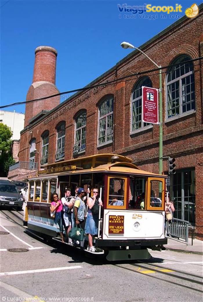
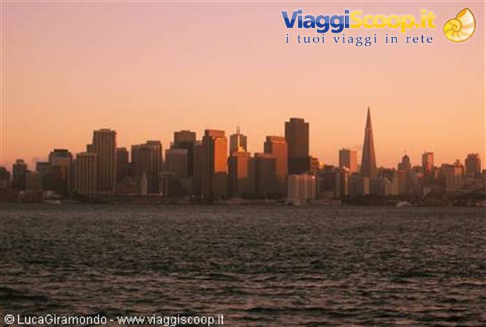
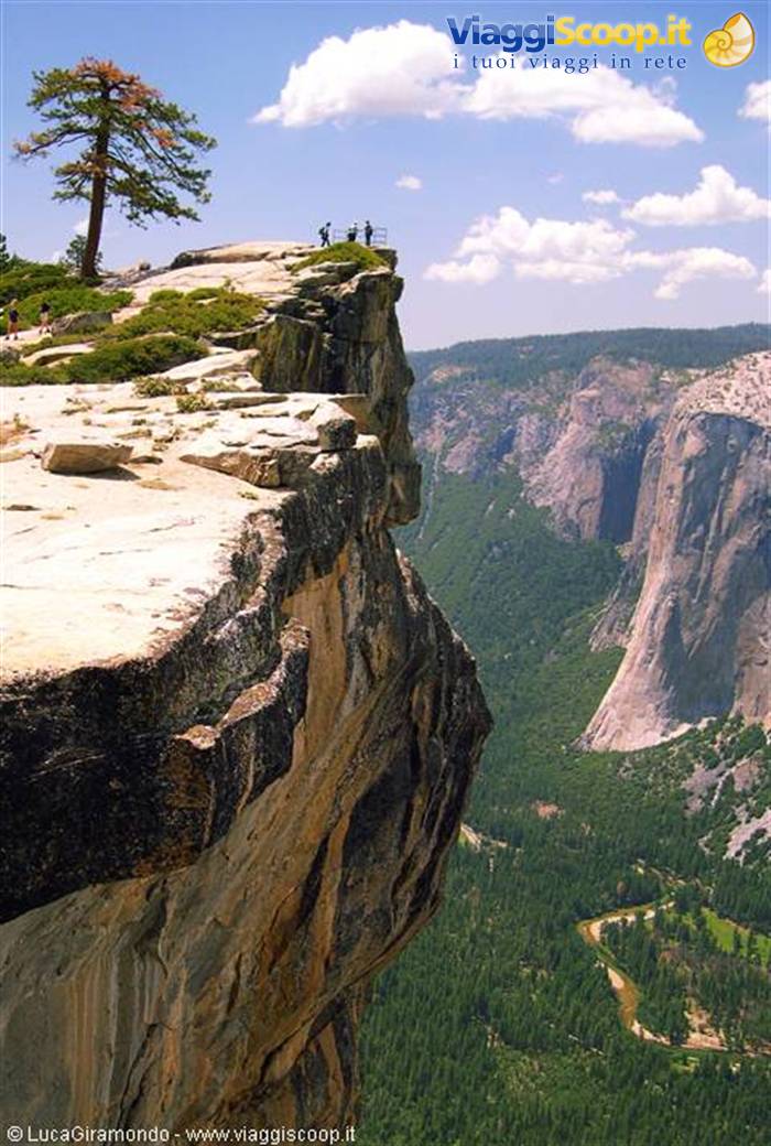
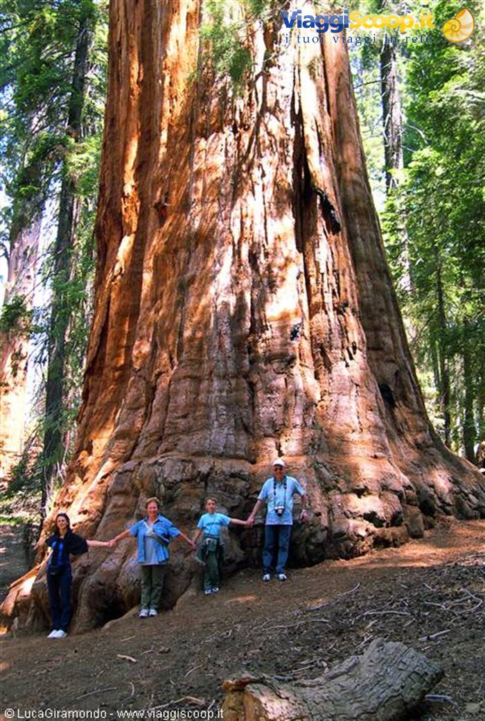
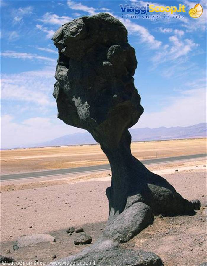
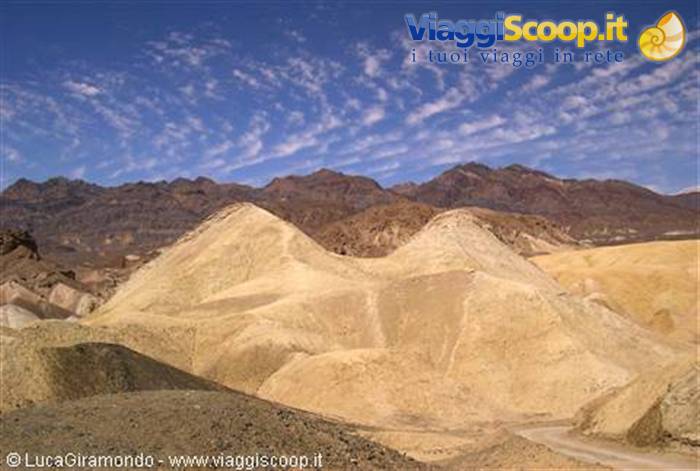
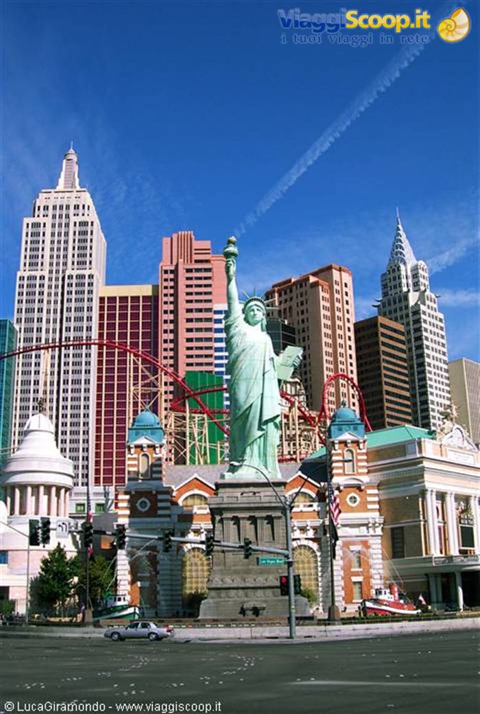
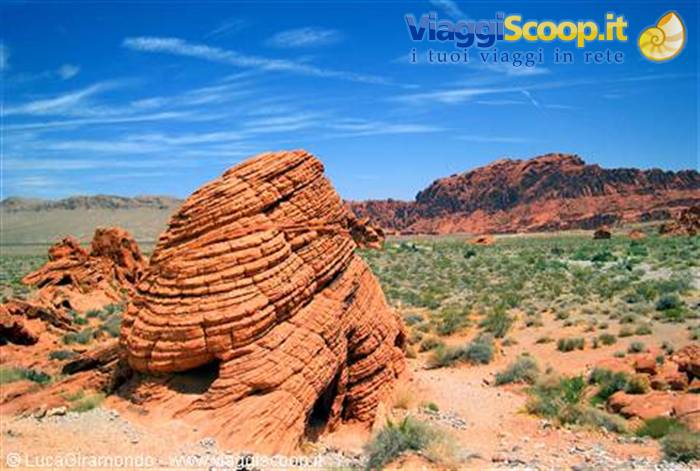
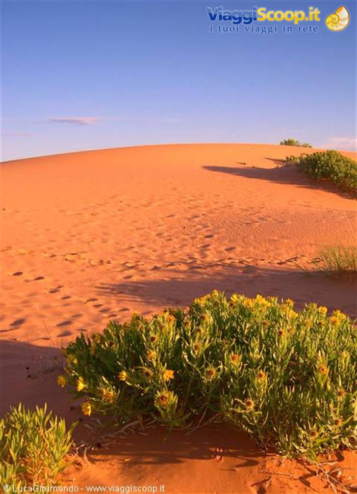
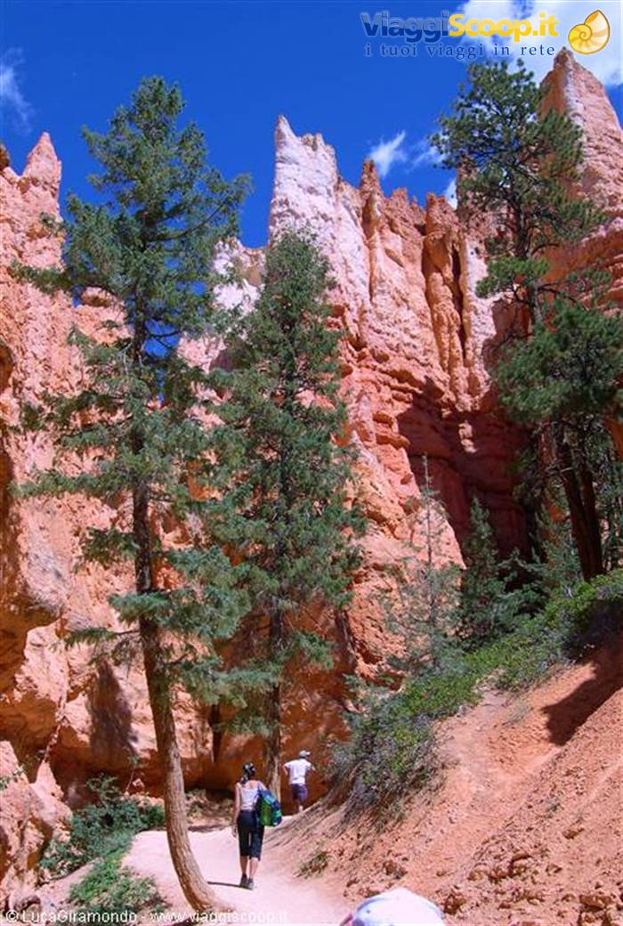
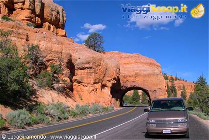
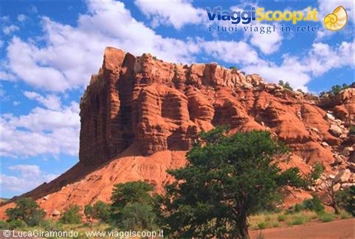
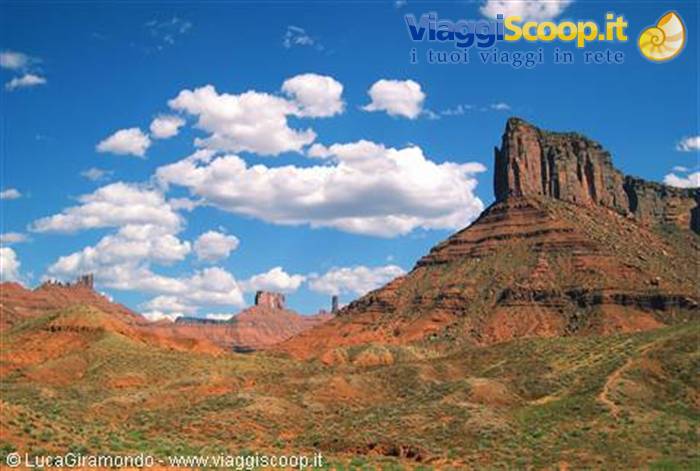
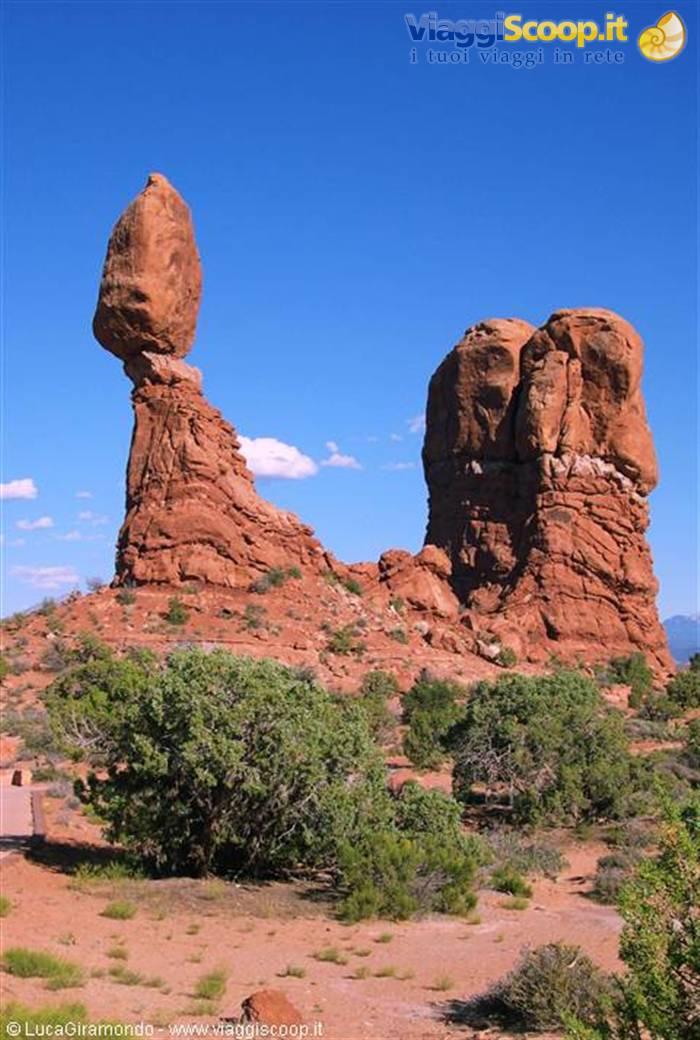
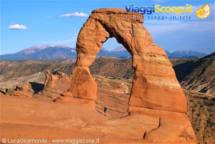
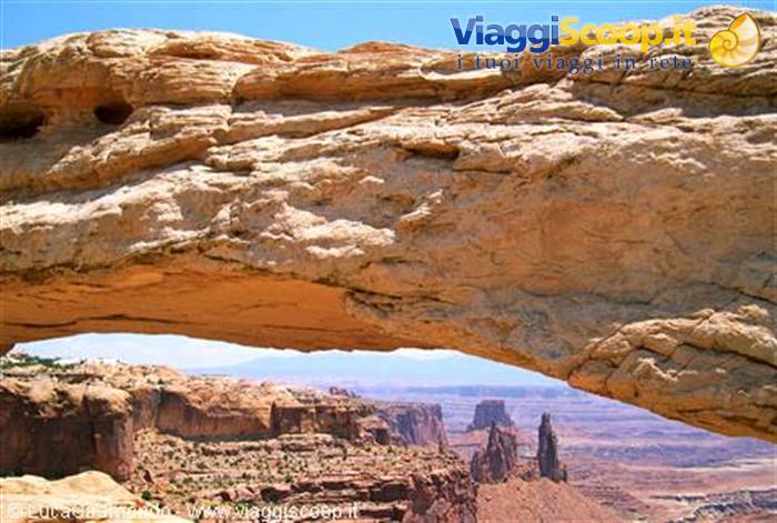
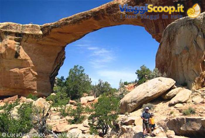
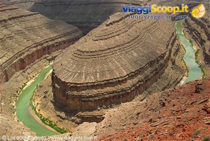
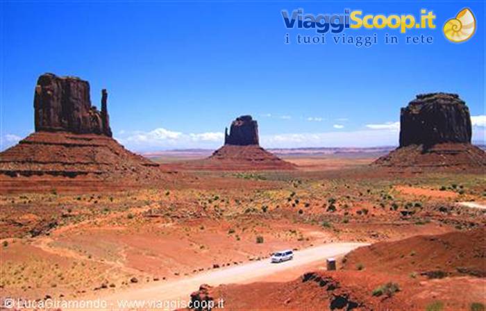
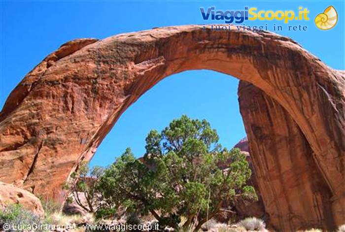
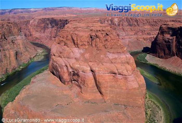
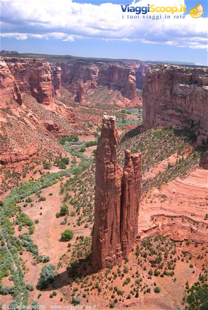
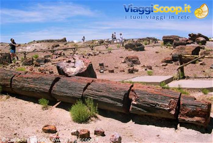
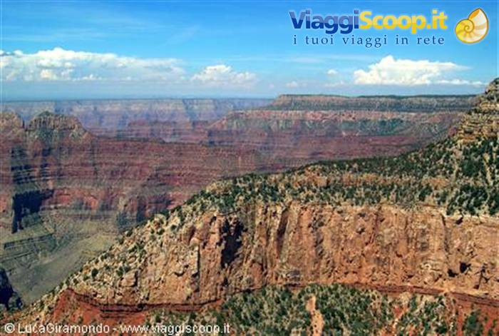
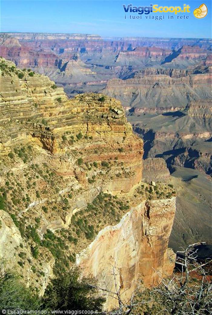
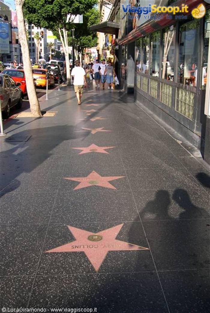
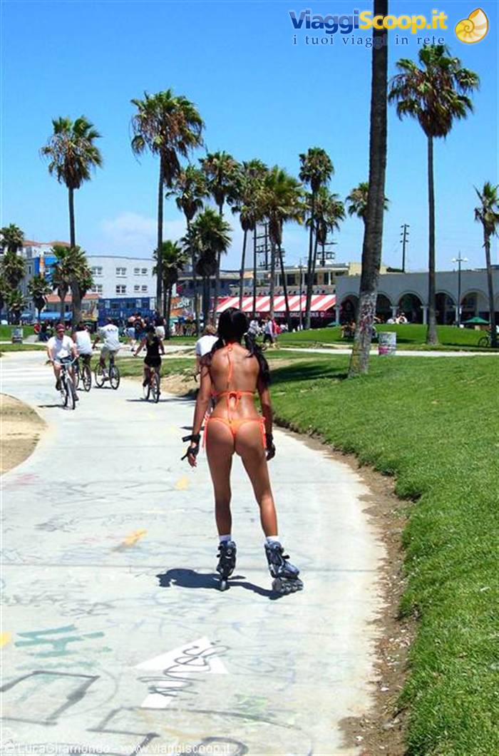
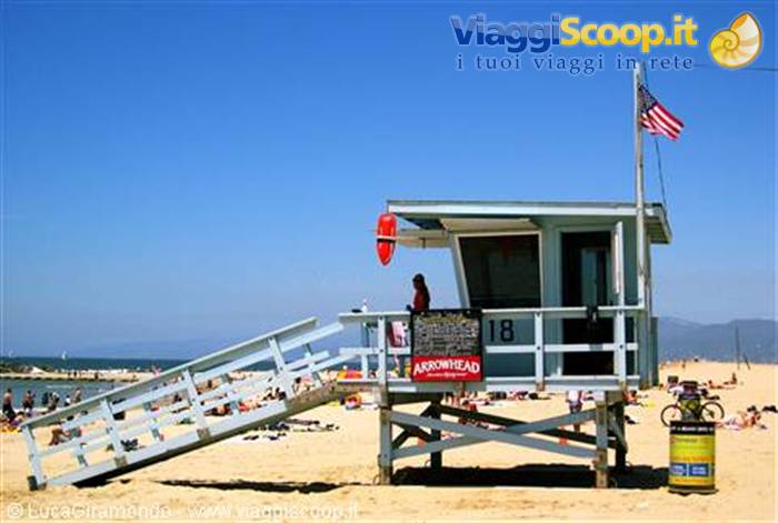


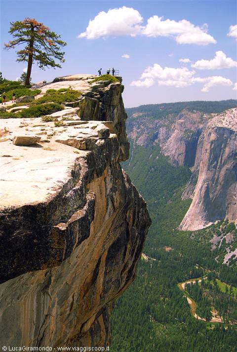


4 reader comments
foto impareggiabili
Belle le foto, ma 51 stati?? Il Furnace Creek NON è l'unico posto per dormire nella Death Valley. A Vegas cè la Strip non lo Streep. Il primo parco americano è stato lo Yellowstone. Per il resto avte fatto un magnifico viaggio ben descritto. Complimenti
Bravo Lucagiramondo, le tue foto sono sempre le più belle! Complimenti!
gran bel viaggetto...i ricordi mi sono tornati in mente di corsa!