Tenerife, El Hierro, La Gomera, La Palma, Gran Canaria
When
26 Jul 2009 – 14 Aug 2009 20 days · trip of 2009
Who
· @LucaGiramondo ·
How
Travel diary
The story · 20 days
By Luca, Sabrina and Federico
Day 126 Jul 2009
It was supposed to be an epic trip, after a whole year of waiting, after months of study and planning: New York, New England and Canada (Nova Scotia, Quebec and Ontario) and back to the Big Apple!... The flights and hotels along the eight thousand kilometres of the route had already been booked... But fate had something bigger and more beautiful in store for us: after thirteen years, another child on the way, by now unexpected but welcome... and then swine flu to complicate everything and advise us, with New York the main hotspot of the now full-blown pandemic, to change destination as a precaution.
So here, in short, is how we came to tackle this atypical three-week trip to the Canary Islands, a Spanish archipelago in the Atlantic Ocean, off the southern coast of Morocco, made up of seven main islands, of which we will visit five, the westernmost ones (Tenerife, El Hierro, La Gomera, La Palma and Gran Canaria), leaving out Lanzarote, already seen a few years ago, and Fuerteventura, material for another, future experience. Be that as it may, for the first time as four (or thereabouts) we are tackling an adventure... and all things considered, from Canada to the Canaries there isn't that much difference, since the first four letters are the same! Shortly after 4:00 the alarm goes off and we get up. We take care of the last details, close the suitcases and at 4:57 we hit the road.
Less than a quarter of an hour later we enter the A14 motorway at Faenza heading north, so around 5:40 we leave Bologna's Marconi airport on our right, from where yesterday we should have taken off for JFK in New York, and continue on, joining the A1. At 6:30 a stop near Parma for a coffee and then off we go, speeding towards Milan, where we arrive, without a hitch, well before 8:00. We leave the car at the Quick Parking on via Corsica, booked online, and take the bus to Linate airport, from which, as chance would have it, we have never departed for a trip. Our flight seems to be on time... We check in our bags, do the check-in and, once through the metal detector, we wait in front of gate A8.
Since everything has gone smoothly so far, we have to be patient for a bit, until around 11:00, when the operations begin that lead us to board the Airbus A319 of the flag carrier Alitalia, which, slightly delayed, at 11:47 lifts off from the Milan runway, identified as flight AZ48, bound for Madrid. We pass over the Alps in their southernmost part, fly over a stretch of France and, once over the Iberian Peninsula, after just over two hours we land at Barajas airport in the Spanish capital, while it is 13:34. As soon as we come out of the arrival gate, there in front of us is number 71, with the directions for the next flight: the Air Europa one departing at 15:40 for Tenerife. There is just time for a snack and then the boarding operations begin... which, however, drag on longer than expected and the Airbus A330 (flight UX9120) taxis onto the Madrid runway at 16:13.
We head straight southwest, also gaining an hour of time zone. We pass over the Algarve region and venture into the Atlantic Ocean, until from the window we notice, in the distance, the shape of the island of Lanzarote, then we begin our descent to land happily at Los Rodeos airport in Tenerife, which with its 2354 square kilometres is the largest island of the archipelago. We happily collect all our luggage, then at the exit we set off in search of the car rental booked online: Orlando Rent a Car. We find it and they hand us a grey Ford Focus (plate 4507 DSM) with which we are supposed to tackle the entire tour of the surrounding islands, but we learn with some disappointment that the company's insurance is only valid for Tenerife.
With a few extra worries, we then set off towards the south of the island, surrounded by a strange haze, in search of the hotel that will host us for the next five nights. We arrive around 20:00, near Tenerife-South airport, in the locality of San Miguel de Abona, at the Apartamentos Gema Aguamarina Golf. We take the bags to the room and then go out for dinner nearby, before lying down for a well-deserved and indispensable rest.
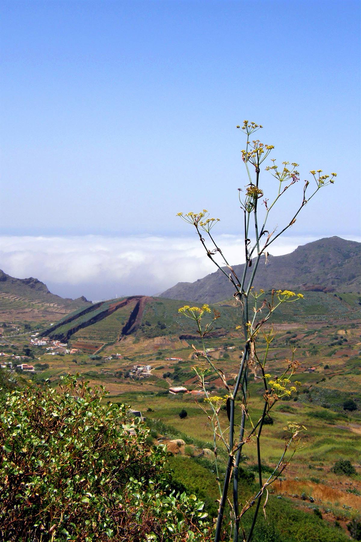
Valle de el Palmar
Day 227 Jul 2009
The exploration of the island of Tenerife begins early, an island that yesterday, on the way from the airport to the hotel, certainly did not enthuse us, with its gloomy landscape and its vast urban developments. After breakfast, included in the room price, and after a providential shop at the nearby supermarket, we take the Autopista del Sur heading northwest, until, past the large urban sprawl of Playa de las Americas, it ends and gives way to an ordinary single-carriageway road. The ribbon of asphalt now follows the coastline at a distance and at a considerable height, with scenery that, despite today's thick haze, becomes progressively more interesting and wild. We pass the town of Guia de Isora and, descending slightly in altitude, once we come in sight of the village of Tamaimo, surrounded by high and rugged peaks, we take the first photo of the day.
The road then climbs again in hairpin bends up to the village of Santiago del Teide, miraculously spared, in the past, from a volcanic eruption, in which the very white and baroque church of San Fernando stands out, built in the mid-16th century and located at the end of the main street... So we stop briefly to observe its asymmetrical facade, adorned with a wooden balcony, while some colourful festoons from a recent popular festival are being taken down, then we resume our itinerary wandering around the island. A little further on, after crossing a pass at over a thousand metres in altitude, near the village of Ruigomez we come across another characteristic and snow-white religious building, standing out against the blue sky behind it...
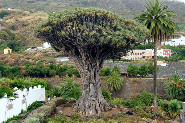
Then we descend towards the north coast of the island, which seems invaded by a low and unusual bank of clouds, into which we plunge before reaching the town of Icod de los Vinos. Located in the heart of a fertile wine-growing region (as the name suggests), this locality is above all famous for its Millenary Dragon Tree, which is not a terrifying fire-breathing being, but the largest specimen of a plant endemic to the Canary Islands (also known as the dragon tree), believed to be over a thousand years old... although in reality it should not be more than five hundred. So we park near the centre and on foot we head to the Plaza de la Iglesia, overlooked by the church of San Marcos and from where you get the best view of the imposing tree, considered one of the symbols of the entire archipelago.
Still deprived of the sun, crossing immense and very green banana plantations, we then move on, by the sea, to the town of Garachico, founded in the 16th century by Genoese merchants and one of the main ports of the island until 1706, when an eruption of the Volcan Negro destroyed its main structures... However, some interesting buildings remain as a testimony to that era, which we briefly visit, such as the Castillo de San Miguel (from 1575), placed to protect the bay, the old church of Santa Ana and the very central Plaza de la Libertad, with the convents of Santo Domingo and San Francisco characterising it. Shortly after midday we also leave Garachico behind and, proceeding along the coast towards the northwestern tip of Tenerife, we stop to have lunch with our sandwiches in a picnic area along the road that reaches the town of Los Silos.
In the very early afternoon we resume racking up kilometres, with the clouds progressively dissolving as we approach Cape Teno... At the entrance to the panoramic road that leads to the lighthouse, however, a series of very conspicuous signs urge us not to continue because, apparently, the road is dangerous, threatened by landslides and falling rocks. We are hesitant about it, but other cars arrive and continue, ignoring the warnings, so, a little foolhardy, we decide to go too.
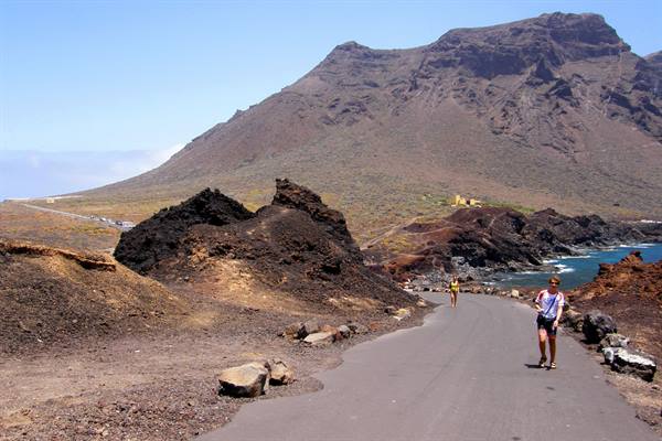
For a few kilometres the ribbon of asphalt is truly breathtaking, torn as it is with fingernails from the very high cliffs and battered by a strong and unsettling wind, up to the vertiginous Mirador de Don Pompeyo, then you enter a long, dark tunnel and at the exit you descend towards the sea, to reach the cape, where there are a car park (strangely full!) and the lighthouse, set in an extraordinary scenario of volcanic rocks plunging into the ocean... without a doubt the most beautiful picture of the day... and to think they wanted to forbid it to us! We take a pleasant walk, finally kissed by the sun, and in the end, back in the car, we retrace the entire incriminated but very beautiful stretch of road, then, near Buenavista del Norte we turn right, towards the interior, and begin to climb along the Valle de el Palmar.
One hairpin bend after another amid grandiose panoramas, we thus arrive in the remote village of Masca, once a pirates' den reachable only on muleback, surrounded by very high rocky walls, and from there, with another impressive climb (done almost entirely in first gear!), we return to the village of Santiago del Teide, practically closing a loop itinerary. At this point we descend towards the west coast, as far as the port of Los Gigantes, located practically at the foot of the eponymous, cyclopean cliffs, then, when it is now 17:00, we allow ourselves a bit of rest at the nearby, jet-black Playa de la Arena: nice, even if surrounded by a myriad of enormous apartment blocks... and there we also take a swim in the ocean (less cold than I remembered in Lanzarote), and finally return towards our hotel.
In the evening we try to go and eat fish in San Miguel de Tajao, just a handful of kilometres away, at a restaurant about which I had excellent references, but we find it closed, so we return to our area, concluding without the "cherry on top" a first day that was nonetheless positive in many respects.
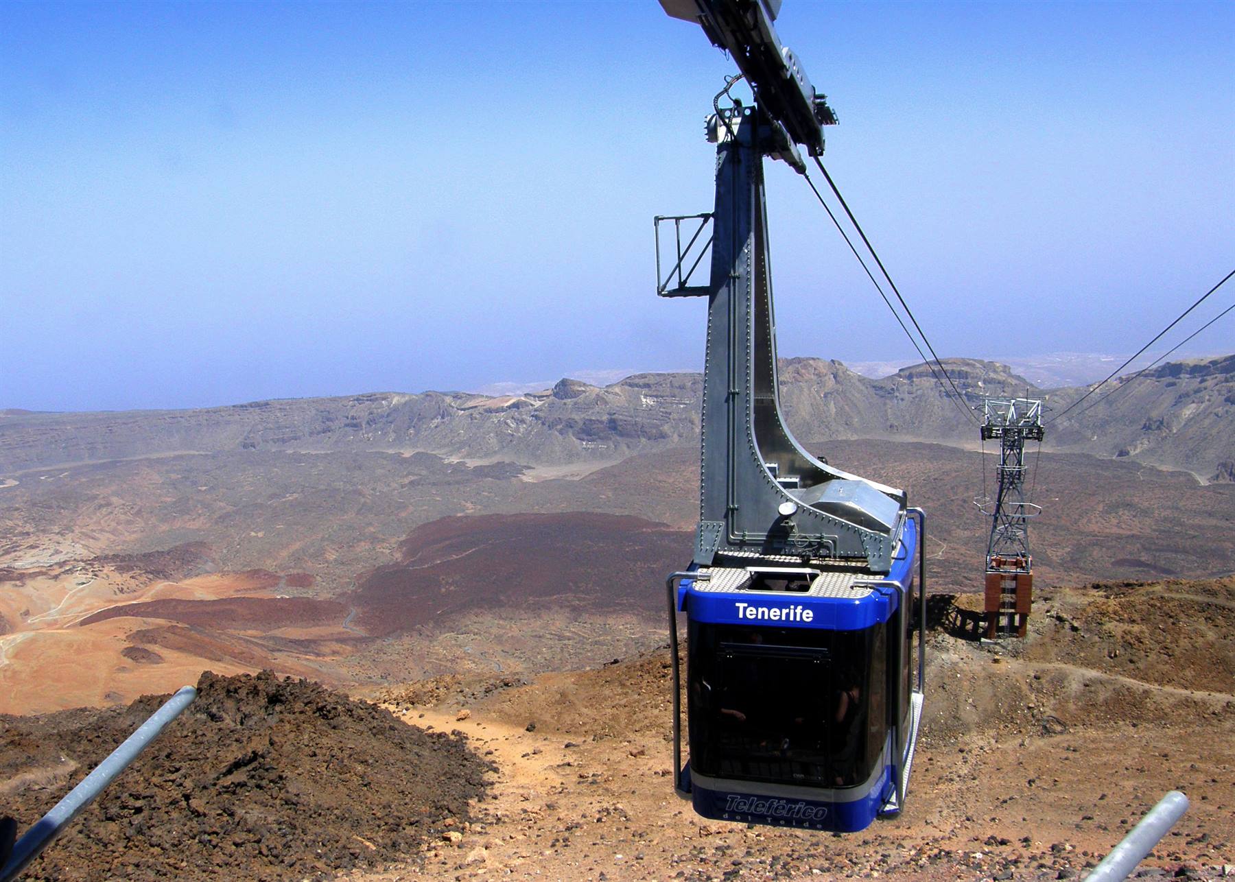
Parque Nacional del Teide - Pico del Teide
Day 328 Jul 2009
Mission Pico del Teide, an active volcano (even if its last eruption dates back to 1798) and the highest peak in Spain, with its 3718 metres, which characterises the profile of Tenerife, visible as it is from every part of it, but also its climate, more humid in the northwestern area rich in vegetation, hotter and drier in the arid and rocky southern one, so much so as to earn the island the nickname of "miniature continent". After all the routine morning operations we hit the road and begin to climb towards the centre of Tenerife. We pass through the villages of Granadilla de Abona and Villaflor and, one bend after another, one hairpin after another, we cross the entrance of the Parque Nacional del Teide, established in 1954 and still today one of the largest in the country.
At Boca de Tauce we enter the depression of Las Cañadas, sixteen kilometres in diameter, which came into being about three million years ago following the collapse of the ancient volcanic cone, in the centre of which rises the current, majestic, Pico del Teide... and already, despite the haze, our eyes widen at the wonder of the landscape, characterised by black lava flows and intense chromatic contrasts. The first real stop, however, is a few kilometres further on to see a fanciful rocky arch called Zapato de la Reina (the queen's shoe)... In fact, from a certain angle it vaguely resembles an elegant high-heeled shoe, and we try to get closer to it, but we end up getting a good scolding from a park warden for having carelessly left the beaten path and we don't even manage to photograph it.
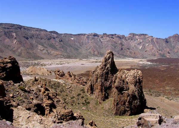
We then return to the asphalt road and, passing through Los Azulejos, an area of multi-coloured rocks due to the particular concentration of various minerals, we arrive in the area of the park called Los Roques, where the most beautiful and well-known formations are found, originating in their time, with the complicity of erosion, from volcanic phenomena and telluric upheavals. Once the car is parked, right before our eyes appears the Roque Cinchado, the most photographed rock spur of the entire island, with the unmistakable cone of the Teide in the background...
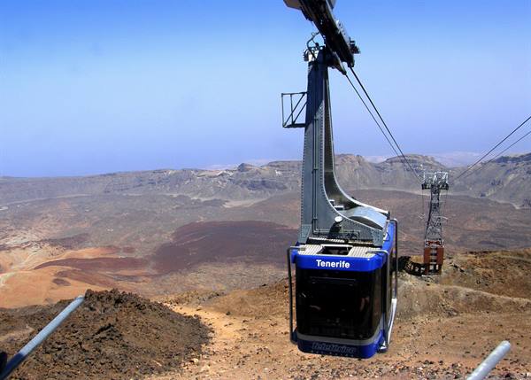
but the whole area deserves to be visited carefully, by means of an easy path that offers marvellous views of the Llano de Ucanca below, an arid plain that occupies the bottom of the ancient crater, but also of other bizarre formations, or of the rare plant species present, among which stands out the curious and endemic Echio Rosso, with its very long inflorescences unfortunately now withered, given the advanced season. We spend a good hour strolling pleasantly around the area of Los Roques, taking dozens of photographs, and in the end, extremely pleased, we hit the road again, while midday has long since passed and it is quite hot, even though we are at over two thousand metres in altitude. We thus arrive at the foot of the Pico del Teide, at the place where a cable car departs that leads up to the summit...
There is a nice queue of people waiting and we, armed with much patience, join it, while we bite into our usual sandwiches, with extreme calm... in fact the minute hand has to make more than a full turn before we can set foot inside the cabin, which then in a very short time takes us to the 3555 metres of the panoramic terrace over Las Cañadas. As soon as we arrive we cannot help but notice, attached to a wall, the highest public telephone in Spain, then we go out into the open air to enjoy the incomparable view... beautiful, very beautiful, despite the eternal, damned, haze. It is quite cold, but not excessively considering the altitude, in fact a long-sleeved T-shirt is enough to take a pleasant walk through the old lava flows up to a few miradors, but not to the crater's mouth, located less than two hundred metres higher, for which a special permit is required.
When we come down from the Pico del Teide it is already well past 16:00 and we immediately resume racking up kilometres. We stop at Minas de San Josè, at the place where a strange "lunar landscape" has come into being, made of whitish gravels piled up in fanciful dunes... and then, nearby, at the foot of a Dante-esque hill characterised by a thousand shades of red, and finally, having reached the El Portillo gate, we leave the park and begin to descend along the Valle de La Orotava. We cross an area of thick vegetation, then, progressively decreasing in altitude, we reach a densely populated area where the town of La Orotava is located, when it is now 17:30.
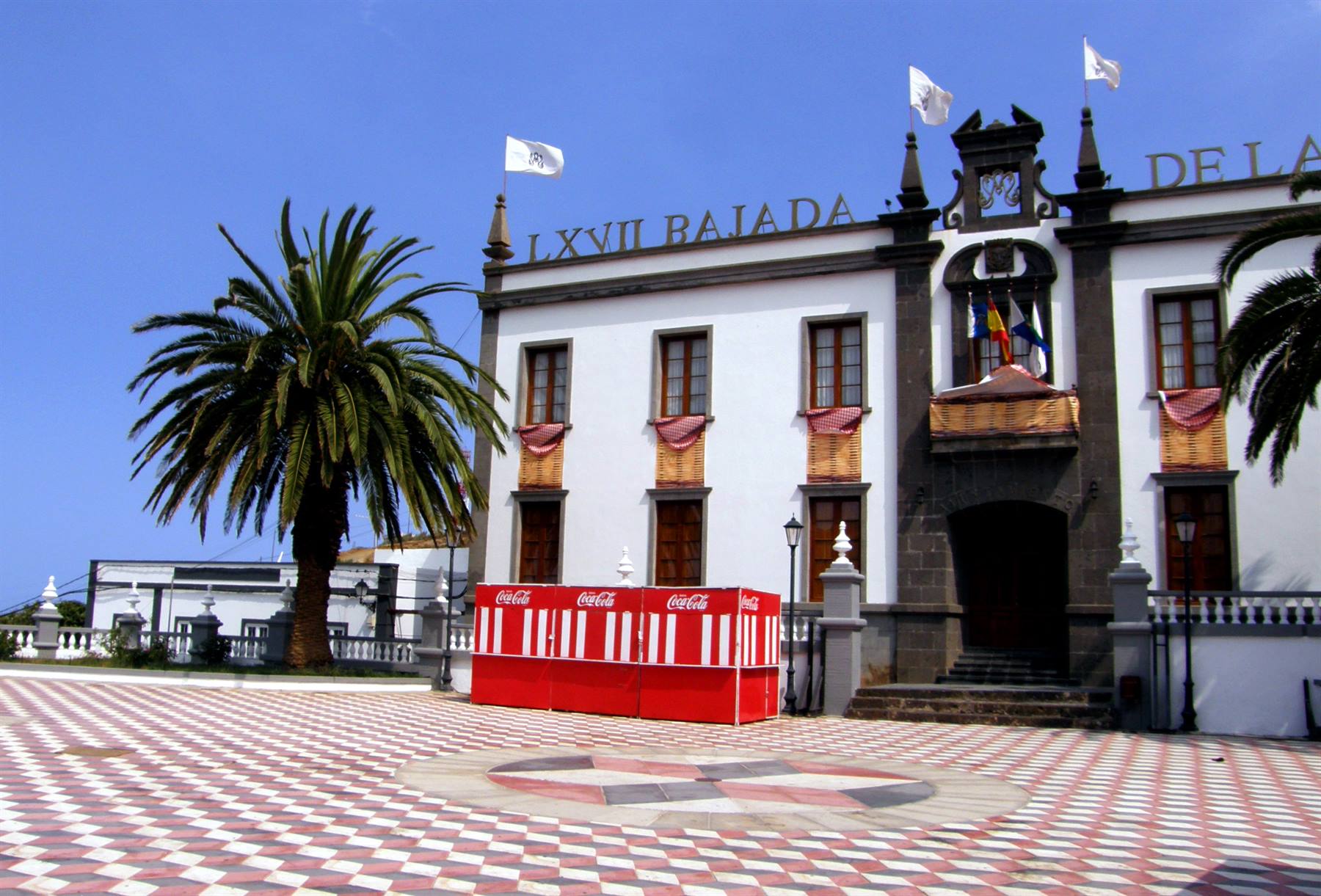
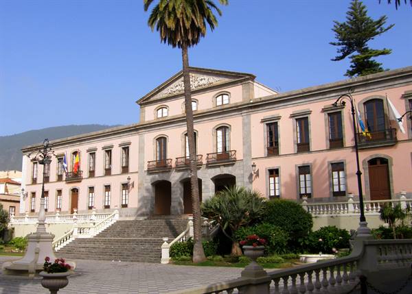
Before the Spanish conquest of the island, the settlement, located on the northern slope of the Teide, belonged to Taoro, the richest of the kingdoms of the Guanches, the ancient inhabitants of the Canaries, then some families of well-to-do Andalusian settlers settled there and La Orotava developed rapidly, so much so as to become one of the most beautiful cities of the archipelago. We park the car near the centre and on foot we walk along its main streets, flanked by interesting buildings dating back to the 17th-18th century. We begin with the abbey church of San Agustin, embellished with a beautiful Renaissance-Baroque portal, then continuing along the Carrera Escultor Estevez we arrive in front of the neoclassical Palacio Municipal, which dominates the elegant Plaza del Ayuntamiento, the setting of an important religious festival during the period of Corpus Domini.
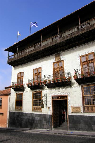
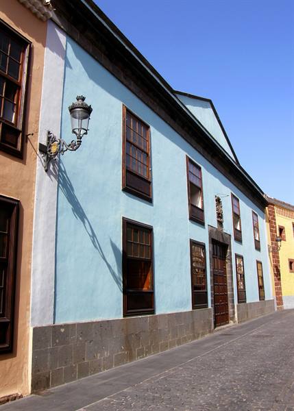
But the most representative building of La Orotava is the Casa de los Balcones, a palazzo built in 1632-70 and characterised by a lively facade embellished with a heavy carved door, elegant windows and long teak-wood balconies. Inside, moreover, there is a delightful patio overlooking which are the wooden balconies of the first and second floors. On the way back we notice other buildings with the classic wooden decorations, typical of Canarian architecture, as well as the imposing Baroque facade of the Iglesia de la Concepiton, then, given the now late hour, we regain the car to return to our hotel. There is still a lot of road to travel: we descend to the northern coast of the island where, heading west, as yesterday, low banks of clouds pile up, while towards the east, where we are headed, the sun is shining.
We thus travel the whole motorway that reaches Santa Cruz de Tenerife and then descends south to San Miguel de Abona and the Gema Aguamarina... and later, in front of a good plate of paella, we conclude what has been, without a shadow of a doubt, an intense but splendid stage of this Canarian itinerary of ours.
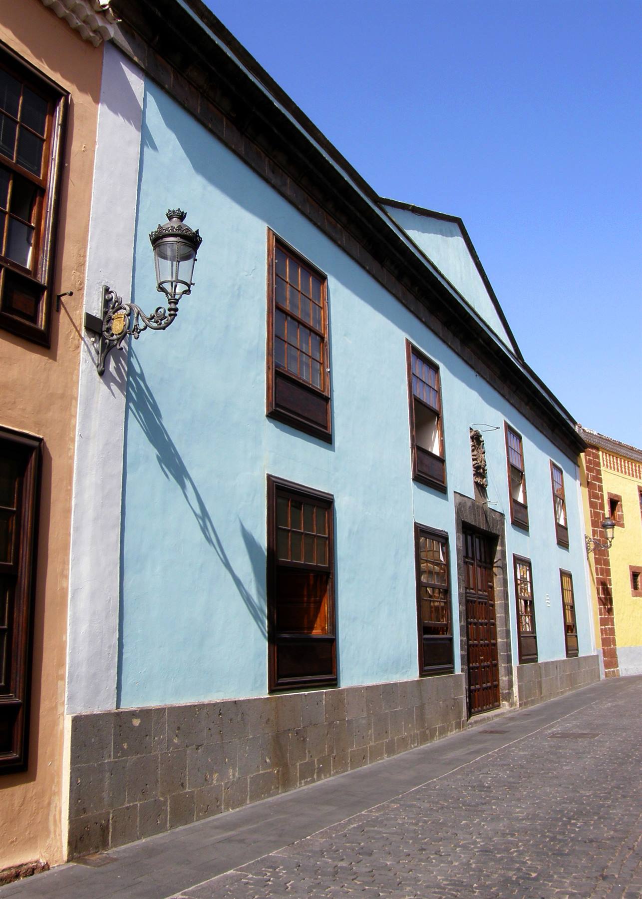
San Cristobal de la Laguna
Day 429 Jul 2009
After yesterday's marathon, today we intend to spend a much more relaxed day and, having had the usual breakfast, we take the motorway in a northeasterly direction. We pass Santa Cruz and, having reached the vicinity of Los Rodeos airport, we leave the dual carriageway to go and visit the nearby city of La Laguna. Its full name is Ciudad de San Cristobal de la Laguna and by size it is the second urban agglomeration of Tenerife. Founded in 1496 by the conquistador Alonso Fernandez de Lugo, it was originally the residence of the Adelantados, the military governors of the island, and until 1723 it was the capital of this rugged oceanic land.
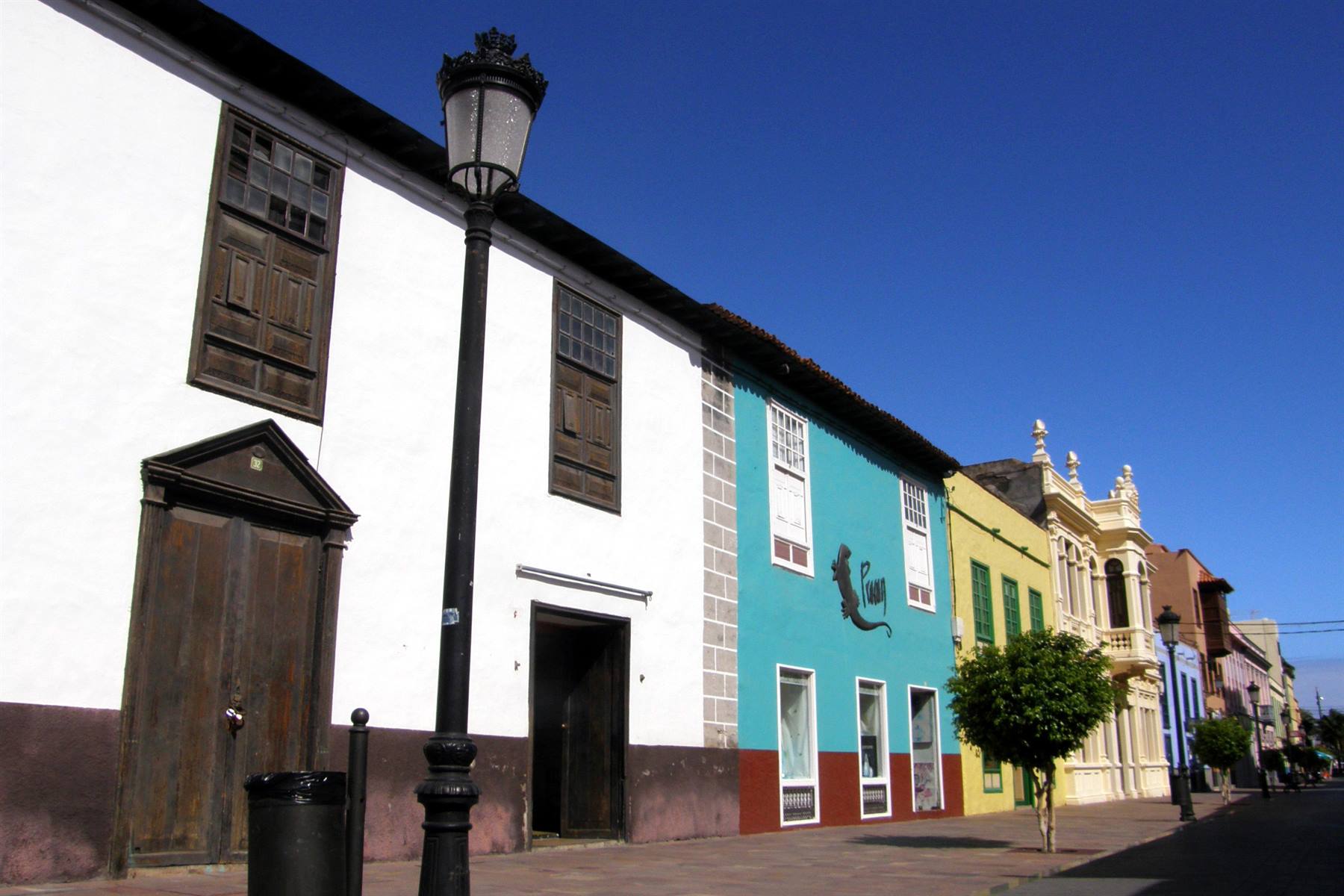
La Laguna, however, is also a university city, whose academic tradition dates back to the 18th century, and it preserves an interesting historic centre dotted with houses with characteristic wooden balconies, some fine religious buildings and the town hall, overlooking the lively Plaza de Adelantado. La Laguna did not enthuse us that much anyway, and soon we find ourselves on the road that leads to Santa Cruz de Tenerife, the current, modern capital, and more precisely to its elegant seafront overlooked by the futuristic and imposing auditorium, flanked by the 17th-century Castillo de San Juan, once having defensive functions for the port, and a little further on the monumental Plaza de España, the main reference point of the city.
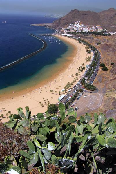
We do not stop in Santa Cruz and, continuing along the coast eastwards, we first arrive in the locality of San Andres, then in sight of the Playa de las Teresitas, the most famous beach of Tenerife, all soft golden sand imported from the Sahara. The coastal road climbs considerably in altitude, thus allowing us to have the sandy shore at our feet, standing out, light as it is, a little unnatural against the dark surrounding rocks... the complete opposite of the nearby, jet-black, Playa de las Gaviotas, certainly less inviting. We then retrace our steps and descend to the Playa de las Teresitas.
We leave the car in the immense car park behind and go to carve out a little patch of shade among the exotic palms that dot the beach, because it is midday and it is really quite hot! We spend the afternoon in complete relaxation, with a few swims, some wholesome reading, ice cream and iced drinks, so in no time at all the shadows lengthen and the time comes to return to our apartment, coming back from places that were not exactly thrilling, but on the other hand with our nerves more relaxed than usual.
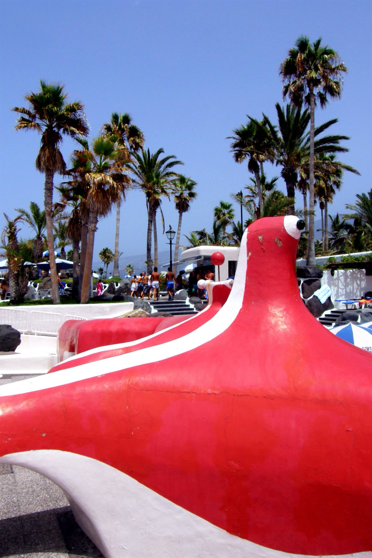
Puerto de la Cruz - Lago Martiánez
Day 530 Jul 2009
It is the last full day we will spend on the island of Tenerife and the sky is also rather cloudy. This morning, however, we get up with a fixed idea in our heads: to change the rental car and take one that gives us a bit more guarantee for the next two weeks (even if it were two days, but it is two weeks!). We travel the whole motorway that follows the eastern coast and go to Los Rodeos airport, where all the car rental company desks are located. We ask at Avis, but they give us some trouble and on top of that they have very high prices. We ask at Hertz, but they have no cars available. We finally ask at the Europecar desk and they offer us a car, at an acceptable rate, with insurance and assistance on all the islands of the archipelago...
exactly what we were looking for! We hand over the old car, with which we have travelled 730 kilometres, to Orlando Rent a Car, which will very honestly refund us the fee for the unused days, and we collect a gleaming grey Seat Leon (plate 6141 GGB), aboard which, at almost midday, we hit the road again to complete the last stage on the island of Tenerife. In the meantime the sun has come out again, but today the haze breaks every record... We nevertheless climb towards the Teide along the Carretera Dorsal, which crosses a splendid wooded area and offers several viewpoints...
over the thick surrounding mist! The landscape then changes appearance and the harsh volcanic scenario takes over above two thousand metres in altitude, when we pass by the Izaña Astrophysical Observatory, then we enter for a short stretch within the boundaries of the national park and, having reached El Portillo, as two days ago, we begin to descend along the Valle de La Orotava. We stop to observe the curious eruptive phenomenon that generated the Rosa (or Margarita) de Piedra and along the road that leads to the north coast of the island we stop for lunch, then we pass once again through La Orotava and in the early afternoon we reach the sea at the locality of Puerto de la Cruz.
The town, once a centre of fishermen and small traders, became the main port of the island after the destruction of that of Garachico and at the end of the 19th century it turned into a very fashionable tourist destination among the wealthier English... still today Puerto de la Cruz is one of the main holiday resorts of Tenerife. We deliberately skip the famous Loro Parque, partly because we don't much like zoos on principle, partly because it closely resembles the American Sea World, seen a few years ago, and we go directly to the centre of Puerto de la Cruz. We leave the car in an underground car park and on foot we walk along the lively seafront, on which the very white and characteristic Ermita San Telmo stands out, to reach the sight of the renowned Lago Martiánez.
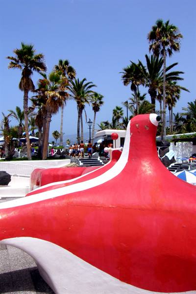
On the rocky promontory north of the town, in 1969, the famous Canarian artist César Manrique built, immersed in a lush tropical garden, this whimsical artificial lagoon, made of water features, harmonious chromatic contrasts and spatial oddities, always used as one of the most original swimming pools known... For just 3.50 euros each we thus have the opportunity to swim in a work of art and to spend the whole afternoon, in complete relaxation, in a unique place. Shortly after 18:00, however, the Lago Martiánez closes its doors and we leave, satisfied, towards our hotel, convinced of having concluded in the best possible way the visit of this first Canary Island.
Valverde
Day 631 Jul 2009
A day centred on the transfer from Tenerife to El Hierro... We get out of bed calmly, have our last breakfast at the Gema Aguamarina, pack our bags, stock up a bit for breakfast (not included in the next hotel) and shortly after 11:30 we leave San Miguel de Abona taking the motorway southwards. After a handful of kilometres we exit following the signs for Los Cristianos, and more precisely for its port, while on the right, in the distance, the apartment blocks of Playa de las Americas file past, a super-touristy locality, at the mercy of concrete development, which we have carefully avoided, then we queue up on the dock to board the Fred Olsen company ferry, booked online, departing at 12:00 sharp. The Benchijigua Express, a very modern fast ship, sets sail a few minutes late and soon we leave behind us, blurred in an almost unbelievable haze, the island of Tenerife.
After about an hour of sailing we dock at the pier of San Sebastian de la Gomera, an island we will visit in a few days, and once we set off again, after another hour and a half, we land in the Puerto de la Estaca, on the island of El Hierro. The westernmost strip of land of the archipelago is also the smallest, so much so that it is called "la isla chiquita" (the little island), because it extends for only 278 square kilometres, but it is also the least populated, with its just over six thousand inhabitants, the least touristy and the most pristine from a naturalistic point of view, so much so that it was declared, on 22 January 2000, a Unesco Biosphere Reserve.
A very hot wind, clearly of Saharan origin, is blowing when we get off the ferry and begin to follow the coastal road southwards, a road that at a certain point wedges into a very narrow one-way tunnel, regulated by what is probably the only traffic light on the island, to emerge into the spectacular gulf of Las Playas, overlooked by very high rocky walls. Right at the point where the tunnel ends is the scenic Roque de la Bonanza, a basaltic rock pierced by the force of the waves that rises vertically a few metres from the coast, then further on you come across a few sparse houses and, where the ribbon of asphalt ends, our exclusive and prestigious hotel...
Yes, because in El Hierro we really wanted to treat ourselves well and we chose the most beautiful hotel on the island (also marked on road maps): the Parador del Hierro, built in 1973 in Castilian style, where we will stay for four nights. The hotel structure faces directly onto the ocean and our room (number 402) has a wonderful view! We drop all our things and run to spend the rest of the afternoon at the edge of the pool, delighted by the grandiose landscape and the sole lapping of the sea. In the evening we learn with pleasure that the services offered by the hotel also include breakfast, but not dinner, naturally, for which we go out in search of a restaurant, which we do not find in the immediate vicinity.
We thus end up in Valverde, in the quiet capital at almost six hundred metres in altitude, in a modest trattoria where we eat very well, and with complete darkness now fallen we then return to the Parador, remarking to each other how much the climate and the pace of life of El Hierro appear to us much more positive compared to the frenzy of hyper-touristy Tenerife.
Little church of Mocanal
Day 71 Aug 2009
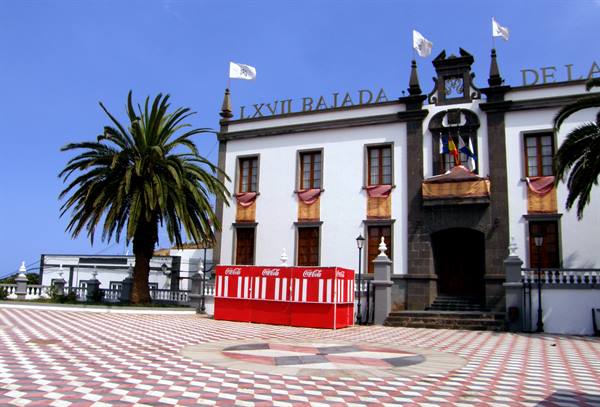
Today the exploration of El Hierro begins... and if a good day is seen from the morning, it will be a very positive exploration! In fact, when, shortly after 7:30, I open the window of our room the sun is rising from the sea, in the centre of the gulf of Las Playas, right before our eyes, offering us an unforgettable spectacle! After breakfast (an excellent breakfast, which wasn't even supposed to be included) we set off by car along the coast. We stop again to see the Roque de la Bonanza, but it is still in shadow against the very high cliffs behind it. We then climb up to Valverde, a tiny capital characterised by a main street and a pretty square overlooked by the town hall and the church of Santa Maria de la Conceptión. Here we do a little shopping and then continue along the road that climbs towards the centre of the island.
Having reached the village of San Andrés, now at over a thousand metres in altitude, we begin to follow the signs for the Garoé... We thus travel along narrow lanes and even a stretch of dirt road, but in the end we find this strange place, once sacred to the Bimbaches, the ancient inhabitants of the island. A long time ago, in a crevice of the mountain there was an enormous lime tree (the Árbol Santo), on whose fronds the water of the low clouds often present condensed (the so-called horizontal rain), collected afterwards in some surrounding pools... a most precious source considering that there are no springs on the island. That tree was felled by a strong storm in the early 1600s, but as a testimony the pools have remained and the mythical Árbol was, in the last century, replaced by a laurel plant...
nothing extraordinary, mind you, but enough to make the visit, all things considered, interesting. Having regained the main road, we also reach, in the vicinity, the Mirador de Jinama, a vast panoramic point over the entire north coast of the island, called El Golfo... About fifty thousand years ago in El Hierro one of the most violent and devastating natural phenomena ever heard of occurred, which radically changed the physiognomy of the island. A landslide of gigantic dimensions that in a few seconds, probably following an earthquake, sent more than three hundred cubic kilometres of material plunging into the sea, giving rise to the grandiose natural amphitheatre of El Golfo, the same amphitheatre that from the Mirador de Jinama unfolds majestically at our feet, even if the usual damned haze diminishes the spectacle a little.
As in the previous days, today too the heat is no joke and the high temperature combined with the strong wind has led the local authorities to close the road that passes through the highest point of the island, so much so that we find ourselves forced to change the planned itinerary. We thus descend in the direction of the village of Guarazoca and before reaching it we stop at the Mirador de la Peña, perhaps the best known panoramic point of El Hierro. This site too offers spectacular views over the bay of El Golfo, but with the same visibility problems as above. In 1988, however, it was laid out to a design by César Manrique, the same artist as the Lago Martiánez in Puerto de la Cruz, and the architecture makes up a little for the gloomy surrounding mist.
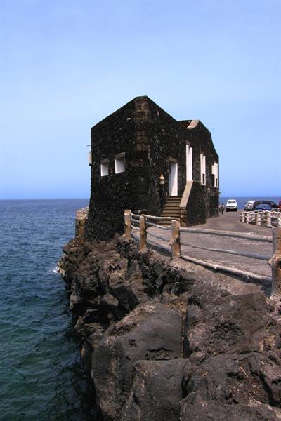
At this point of the day we complete the descent and conquer the coast of El Golfo in the village of Las Puntas where, in a suggestive position, on a rocky spur jutting out towards the sea, is the Puntagrande hotel, cited in the Guinness Book of Records as the smallest hotel in the world. Built in 1884, before being transformed into a hotel it was a port building and today it has four rooms, a bar and a restaurant. Midday has long since passed and we look for a shady spot in which to eat our traditional sandwich lunch... a difficult task! We stop near Los Llanillos and, tackling a long flight of steps, we descend to the sea at the so-called Charco Azul: there we find a table to lean on, a bit of shade thanks to the high cliffs and also an interesting stretch of coastline to photograph, characterised by pools, caves and a strange formation of basalt with prismatic columns...
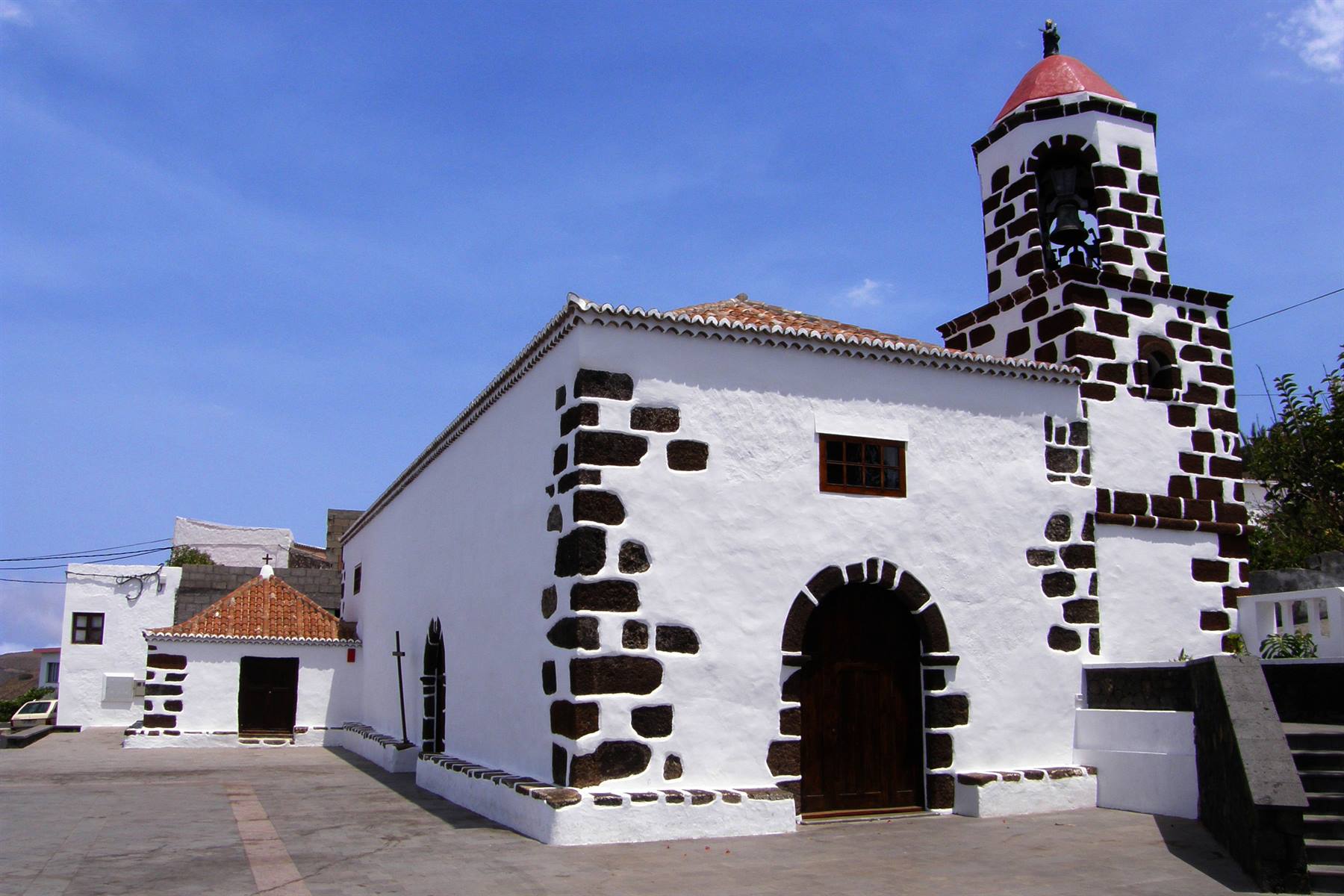
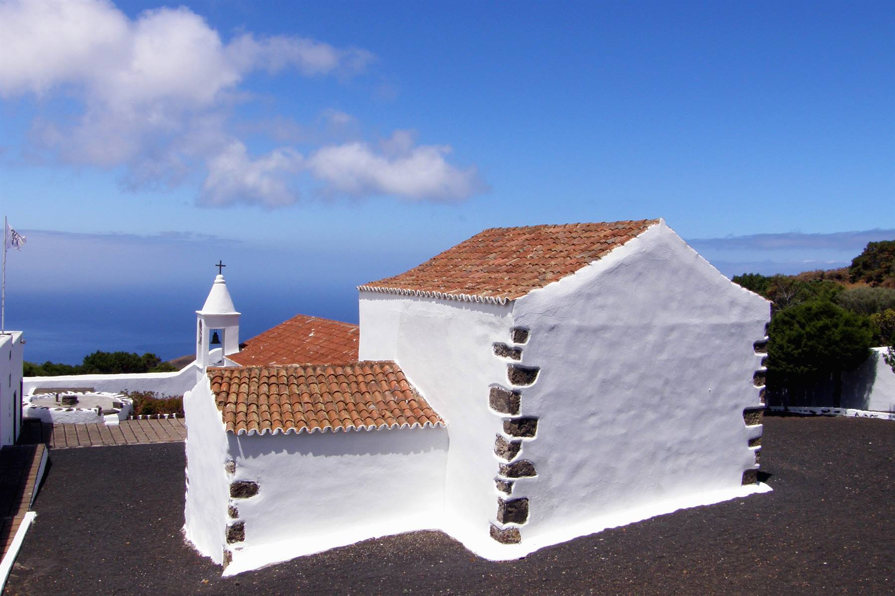
as well as lots of lizards. When we set off again, after the uphill slog to reach the car, we stop at the Ecomuseo and then at the Lagartario de Guinea, a complex of restored ancient shepherd's huts, as well as a breeding centre for a rare species of lizard, more than a metre long, called the Salmor lizard, which is found only in El Hierro... but the visit is guided only and the next one will be in more than two hours, so we decide to skip it. We thus go to the northernmost part of the island and, having admired the beautiful, snow-white little church of Mocanal, we come upon from above the suggestive inlet of Pozo de las Calcolsas to enjoy the panorama and to observe, in the immediate vicinity, a tiny and characteristic chapel, an expression of the character of this island, made of many small but extraordinary details.
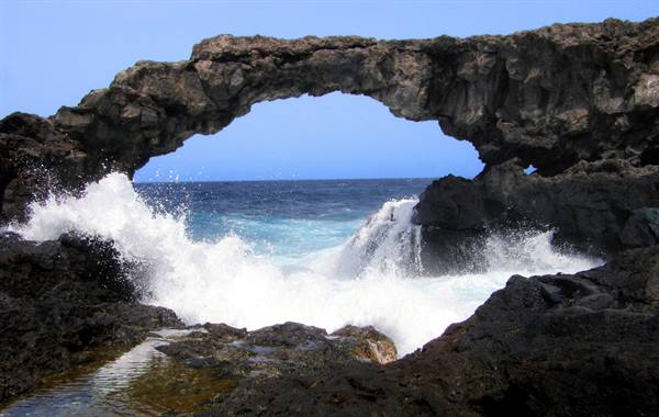
Another incredible series of bends and here we are at Charco Manso, in a place at the edge of reality, lost among tormented cliffs battered by the force of the ocean, where there is a stupendous natural rock arch, shaped by the incessant work of the waves... It would perhaps be worth stopping for a long time to meditate before the roar of the sea, but we want to conclude this beautiful day with a quiet swim in the pool and a bit of wholesome relaxation, so we waste no more time and make our way back to the Parador, so as to feel once again the undisputed masters of the incredible gulf of Las Playas, until darkness falls and the night in turn takes over.
Los Lajiales
Day 82 Aug 2009
We set off to visit the extreme western area of El Hierro: the wildest and least accessible. We cross the ridge of the island and travel the entire bay of El Golfo to reach the remote locality of Sabinosa, suggestively located halfway up the slope and at the foot of vertiginous rocky walls. From there the road descends in hairpin bends to the sea to venture into the westernmost region, but we find it blocked, due to the wind and heat that make the risk of fires very high, like the enormous one that broke out yesterday in La Palma, an island where we will land in four days. With a few curses we turn back and change our plans, hoping to be able to access the area tomorrow. Our new destination is now the southernmost tip of the island, an arid area, completely devoid of vegetation and therefore, we think, not at risk of fires...
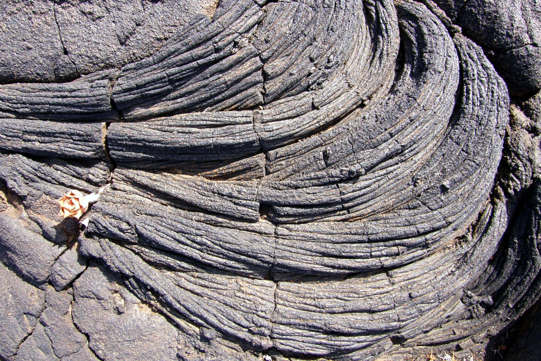
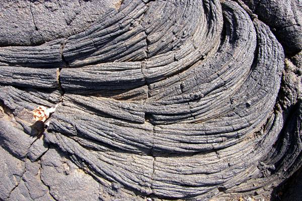
Due to the closed roads, however, we have to go "around the world" to get there and along the way we take the opportunity to ask some firefighters for information, who tell us that, very probably, it will be the same tomorrow too. By now in the late morning we cross the volcanic area of Los Lajiales, which is a vast field of lava that has solidified, thanks to particular conditions, into extravagant and fanciful shapes that give rise to almost unreal scenarios, made of intricate masses of petrified "ropes", trickles of magma in an apparently fluid state, which however have been solid for millennia, and in the interstices life timidly emerging in the form of pioneering plant species... an astounding phenomenon if observed in the smallest details! The ribbon of asphalt ends in the insignificant locality of La Restiga, made up mostly of anonymous apartment blocks...
Retracing our steps a little, a handful of kilometres, we however take the dirt track that leads to the Cala de Tacorón, on the volcanic coastline of Mar de las Calmas, and there we find a sort of recreational area where we can have lunch, but also a beautiful stretch of crystal-clear sea, albeit rocky, in which to take a refreshing swim. When we set off again, in the early afternoon, we return towards the highest part of the island and would like to stop at the so-called Mirador de las Playas, but we find this one closed too!... We then go to the small village of Isora and, nearby, we manage to reach the mirador of the same name, a panoramic terrace over the stretch of coast below, in which we clearly make out the shape of the Parador.
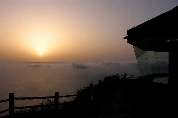
The view of the magnificent gulf and the pool by the sea are an irresistible draw, so we return to our hotel where we spend a few hours delighted by the usual stupendous panorama. The best part of this Canarian Sunday, however, is yet to come, in fact for dinner we go to the exclusive restaurant of the Mirador de la Peña, just in time to occupy one of the two front-row tables (where King Juan Carlos also sat!) and enjoy what will certainly remain one of the most beautiful experiences of this trip: a stupendous view over El Golfo seasoned with an unforgettable sunset!... For the record, we also ate well and spent little, considering the extraordinary spectacle (less than thirty euros each!)... This little island, unknown to classic tourist itineraries, really keeps astonishing us, more and more every day!
El Sabinar
Day 93 Aug 2009
The weather conditions this morning seem to have changed: the wind direction has changed, the air is crisper, so it is less hot and the sky is clearer... We thus try again to visit the extreme western tip of the island. We climb up to Valverde and then stop at the Mirador de la Peña to take a photo with much less haze, even if a large part of the landscape is still in shadow, whether because of the mountains or because of the presence of a few too many clouds. We travel the whole northern coast and, having reached where yesterday there was the roadblock... today it is no longer there!... Thank heavens, so we will be able to complete our programme of explorations! The landscape immediately becomes much more rugged and decidedly... volcanic.
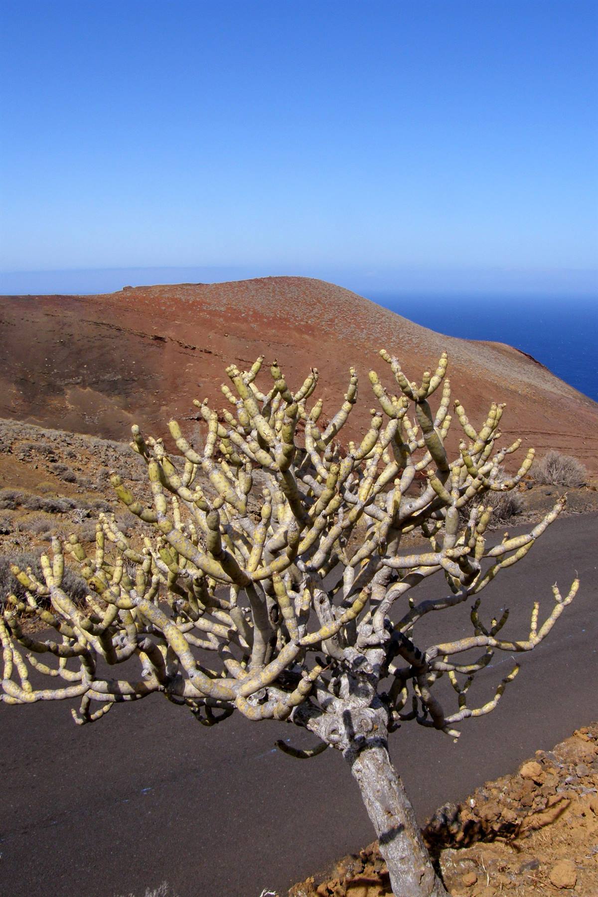
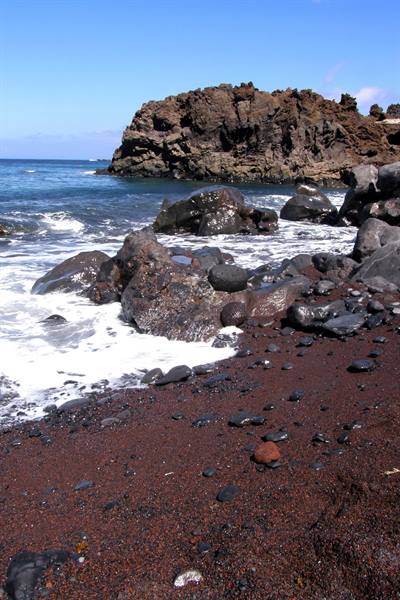
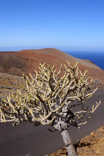
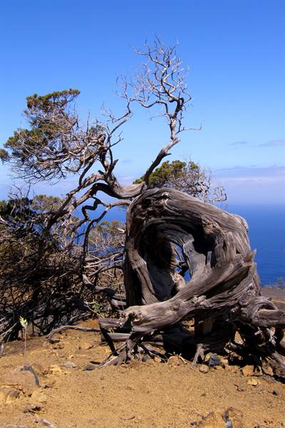
We stop to see the Playa de Verodal, located at the foot of a high cliff and characterised by a curious rust-coloured sand, then we begin to climb amid beautiful views, with vigorous colour contrasts, between the warm tones of the land and the intense blue of today's sky, towards the region of the Sabinar, where the famous white junipers should be found, bent by the wind into the most contorted shapes, considered the symbol of El Hierro. We come across a few fine specimens along the road, but not yet the most famous one, so we tackle the dusty dirt track that leads, amid primordial panoramas, to the Faro de Orchilla, which can be seen on the horizon flanked by an old volcanic cone.
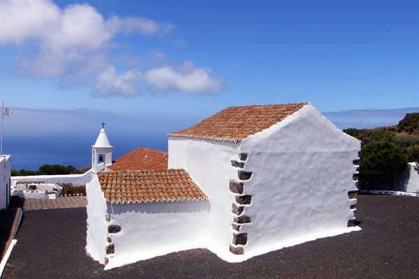
In 150 AD the Greek geographer Ptolemy indicated the western extremity of El Hierro as the boundary of the then-known world and from there the zero meridian was made to pass in 1634, until, in 1883, it was definitively moved to Greenwich... That point is the Cabo del Barbudo that we see in the distance, together with its commemorative monument, but it is reachable only on foot and it doesn't seem worth it. Having reached the base of the lighthouse we take a few photos and then climb back up along the dirt track to the ribbon of asphalt, then to the Ermita de Nuestra Señora de los Reyes, the sanctuary destination of pilgrimages, dedicated to the Holy Mother of the Kings (Magi), patroness of El Hierro: a little church and some buildings, all rigorously white, enclosed within a ring of walls,
Ermita de Nuestra Señora de los Reyes
Day 104 Aug 2009
Today we will leave El Hierro for another Canary Island: La Gomera, but only in the afternoon, so there's no hurry. After breakfast, while Sabrina and Federico go off to the edges of the pool, I drive up to Valverde to do some shopping, and on the way back I stop to photograph the Roque de la Bonanza in the right light, even though a parade of mischievous clouds makes me waste a lot of time... Those same clouds that then disturb us in the last hours of our stay at the Parador. At 1:30 PM we say goodbye to our very special sea view... we hand the keys to the reception and, with all the luggage loaded, we leave a piece of our heart in the gulf of Las Playas, and reach Puerto de la Estaca where we wait for the Fred Olsen ferry. The Benchijigua Express arrives on time and with it we set sail for La Gomera, after El Hierro the smallest of the Canaries, with its 378 square kilometers of area.
Also called "la isla redonda" (the round island) for the almost perfect shape of its outline, La Gomera is also particularly rugged, with deep valleys arranged in a radial pattern, which make it practically impossible to build a coastal road along its perimeter. From El Hierro a little more than an hour of sailing is enough; in fact, around 5:00 PM we disembark in the capital of La Gomera: San Sebastian, which we immediately stop to visit. First of all we see the so-called Torre del Conde which, immersed in the green of a small and well-kept garden, is all that remains of the ancient fortifications of the city; it was erected, in Gothic style, in 1447 by the first Spanish governor of the island, Hernán Peraza the Elder.
On Calle Real, the main street of the historic center, the characteristic facade of the Iglesia de la Virgen de la Asunción stands out, dating back to the mid-15th century, where it is said that Christopher Columbus also gathered in prayer before setting off to discover the Americas. Not by chance is La Gomera, besides being "la isla redonda," also called "la isla colombina," given its connection with the great navigator, who stopped there three times (in 1492, 1493 and 1498) before undertaking his overseas explorations, when he stayed at number 53 of Calle Real, in what is today called, naturally, Casa de Colon...
We cannot, however, see the Pozo de Colon, located in the inner courtyard of the old Customs House, which closed about an hour ago, on which one reads the inscription: "With this water America was baptized." Having devoted all the necessary time to San Sebastian, we set off for the town of Playa de Santiago, where we have booked our next accommodation. We climb toward the center of the island amid severe scenes of deep gorges and grandiose panoramas against the backdrop of the ocean, then descend to Playa de Santiago where we find, on a narrow dead-end street, the Apartamentos Bellavista, which will host us for the next two nights. Our room, on the top floor of a renovated building, offers us another beautiful sea view over the bay in front...
it couldn't have gone better than this! For dinner we go to the nearby small harbor where there are some places that suit us, then we return home, so as to best prepare for the exploration of La Gomera, which will begin tomorrow morning.
San Sebastian de la Gomera - Calle Real
Day 115 Aug 2009
An unexpected work phone call doesn't open the day in the best way, but the sun is shining and, confident, we leave Playa de Santiago heading northwest and toward the high altitudes of the central part of the island. Near Alajero we look for a century-old dragon tree, but a sign points to it along a path whose end cannot be seen, and we skip it. We continue to grind out kilometers in distance and meters in altitude, in an arid landscape but rich in palm trees, apparently spontaneous, as had never happened to us to see in the archipelago until now... We thus enter the boundaries of the Parque National de Garajonay, and the environment changes completely in a few curves.
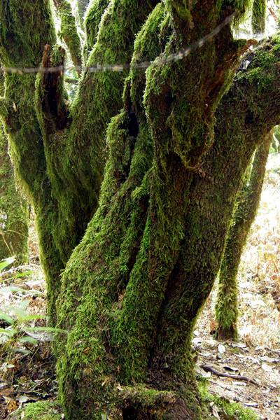
Relatively young, because it was established in 1981, and with an extension limited to only 40 square kilometers, this national park can nevertheless boast of having been declared, the first and last case of its kind in Spain, a UNESCO World Heritage Site, as an ecosystem unique in the world. The peculiarity of Garajonay is the so-called Laurisilva, a humid sub-tropical forest that represents the last, intact relic of the woods that millions of years ago, in the Tertiary era, covered North Africa and southern Europe... and if this living fossil still exists today, it is due to the particular geographical position of La Gomera. In fact, the Laurisilva is perpetually cool and soaked with water thanks to the trade winds which, laden with moisture, blow almost all year from the north.
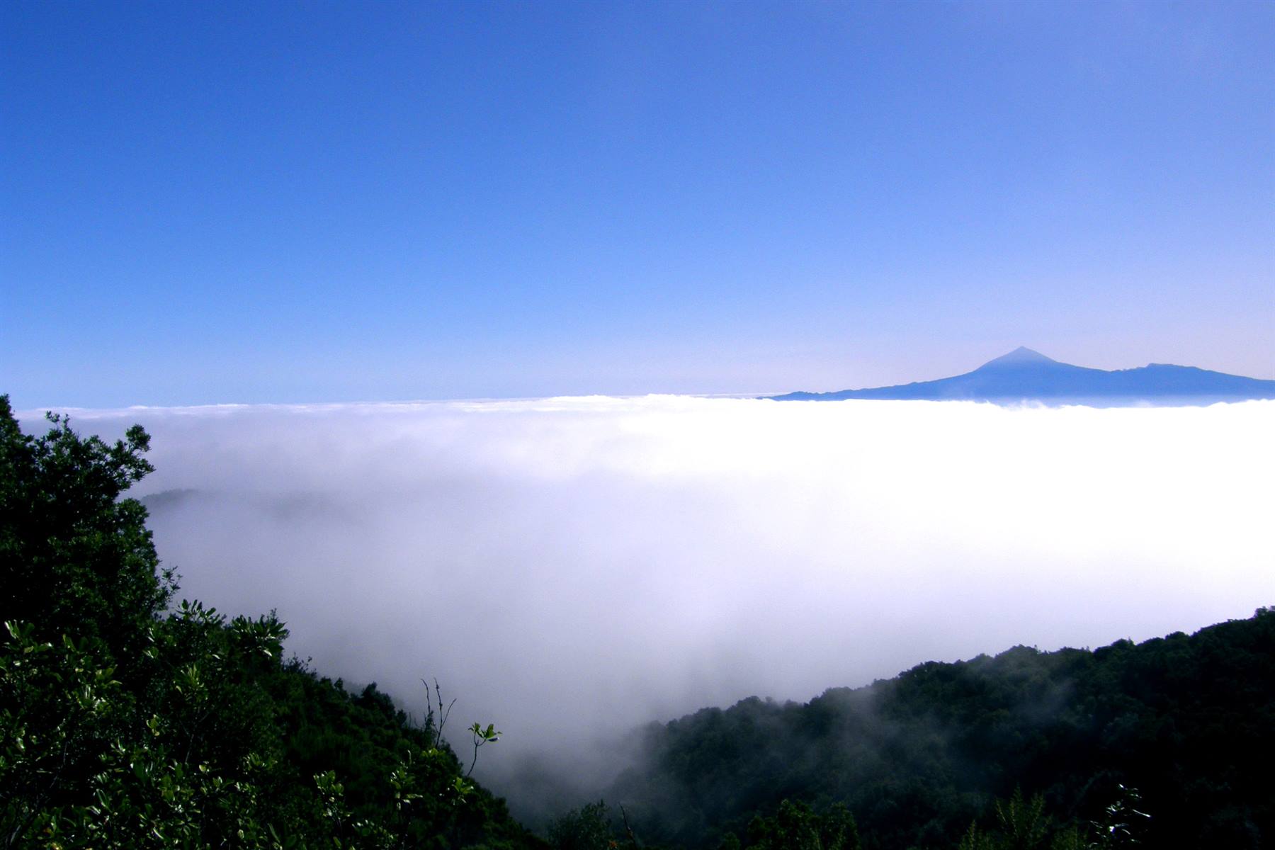
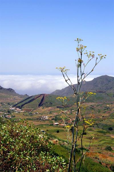
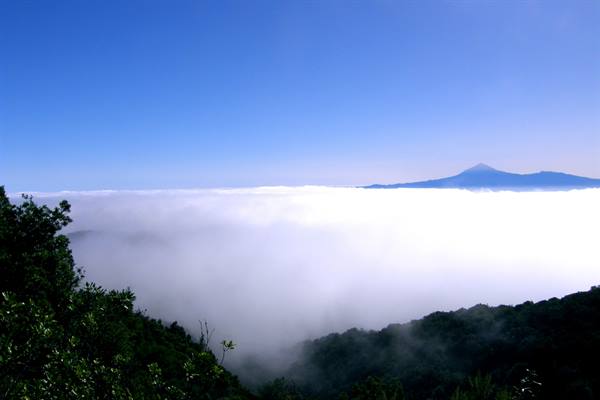
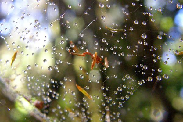
Upon reaching the island, these masses of humid air are pushed toward the mountains, where they condense forming a perpetual drizzle (the "horizontal rain"), retained by mosses and lichens, which act as an enormous natural sponge. As soon as the road we are traveling on overlooks the other side of the island, an immense sea of clouds appears below us... The effect is nothing short of astonishing, almost magical, immersed as it is in a muffled silence... and in the distance above that soft blanket, strange but true, towers imperiously, almost unsettling, the unmistakable silhouette of the Teide.
A few more kilometers and we arrive at Laguna Grande, somewhat the heart of the park, where the visitor center is located and where we undertake a very short trekking that gives us, in an exhaustive way, an idea of the primordial Laurisilva forest, a landscape, it seems, very similar to what Europe looked like millions of years ago, when man did not yet exist. After this beautiful experience we get back on the road and begin to descend in altitude, but in doing so we enter among the clouds, which seen from the inside are not so attractive, and we reach the north coast of the island at the town of Agulo, accompanied by a few timid rays of sun and a decent view of the village against the backdrop of a high rocky wall... The cloud bodies then regain the upper hand when we go back up the attractive Valle de Hermigua, which we will also travel tomorrow, hopefully with better weather luck.
It is past noon and we head toward San Sebastian where, thanks to the incredible climatic variability of these islands, the sun almost always shines, and there we set out in search of a beach. I had some good recommendations about Playa de Avalo, north of the city, but once we reach it we realize that apart from a few beautiful palms behind it, it is all made of large dark pebbles and rather dirty, so certainly not inviting. We then return to San Sebastian and stop at the city's black beach, which is not the best, but we have to make do. We have lunch somewhat uncomfortably, between the heat and some sudden gusts of wind, so in the early afternoon we decide to remove the disturbance and go spend the rest of the day, in complete relaxation, on the sea-view terrace of our apartment, accompanied by ice cream, chips and ice-cold beer...
The culinary pleasure then continues in the evening, with a seductive fish dinner on the waterfront of Playa de Santiago, cheered by the silvery reflection of the full moon on the bay in front.
Parque National de Garajonay
Day 126 Aug 2009
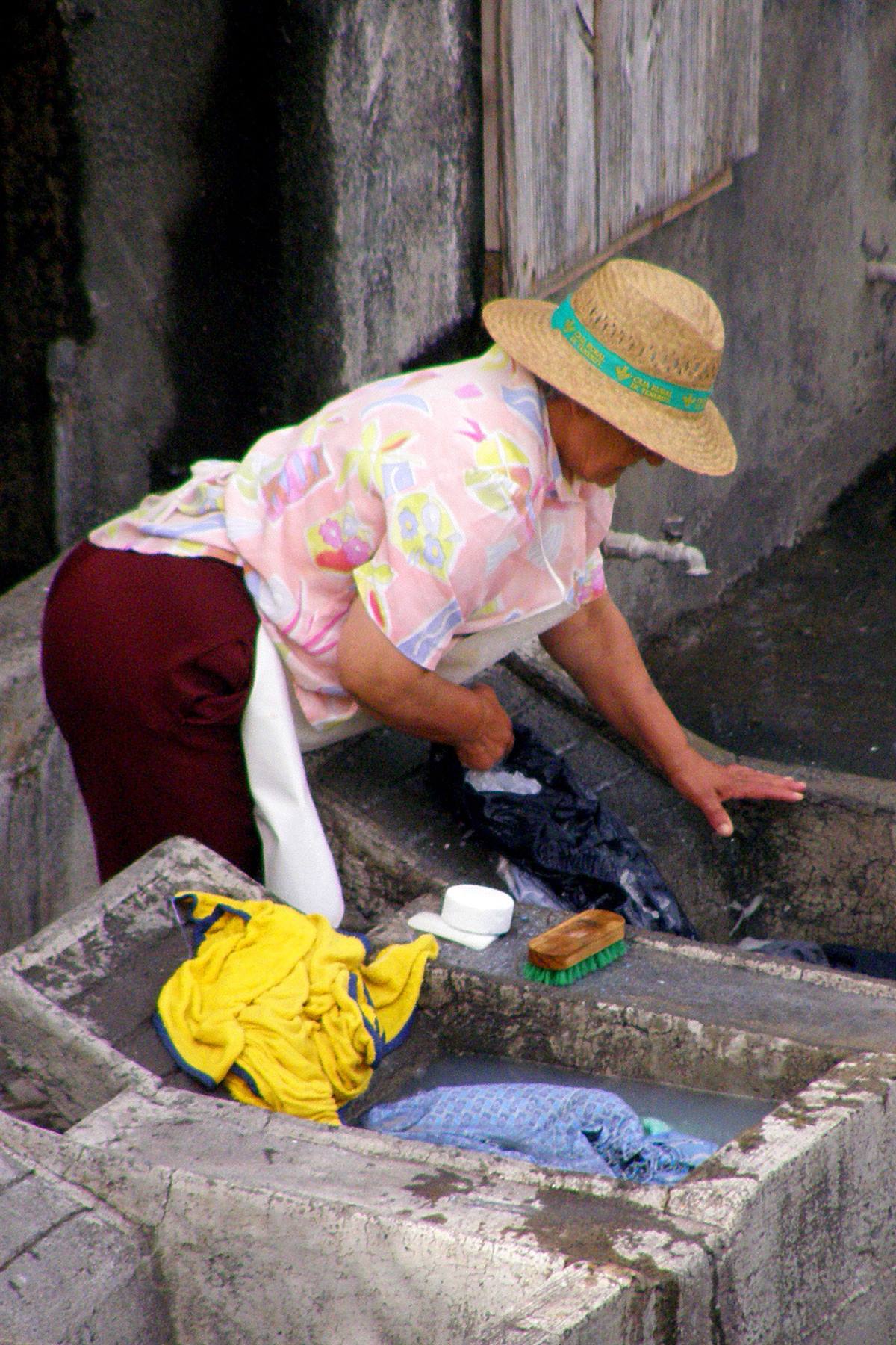
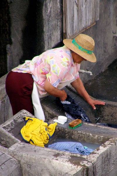
Mid-morning we leave the Apartamentos Bellavista with all our luggage and start climbing toward the center of the island, even though, unfortunately, today the sky is no longer as clear as in the last few days. We pass through the town of Alajero and shortly before the entrance to Garajonay Park we turn left following the signs for Chipude. Surrounded by harsh mountains, among which La Fortaleza, a large basaltic rock with a completely flat top, we reach, indeed, Chipude, which, located at over a thousand meters of altitude, is the highest village of La Gomera, and there, at an old public washhouse, we see some ladies doing the laundry... a scene from other times unfolding before our eyes... In the nearby hamlet of El Cercado we then stop to buy a black terracotta, typical of the area, before starting to descend toward the west coast.
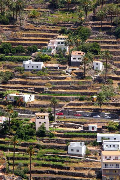
Along the road, a stop at the Mirador del Santo, just outside the village of Arure, is a must, where from a sort of natural balcony one embraces a beautiful stretch of coast, with the view ranging over the islands of El Hierro and La Palma, whose highest peaks stand out beyond the clouds on the horizon. Once we take the strip of asphalt that goes to Valle Gran Rey, in the most renowned barranco of the island, we also stop at the Mirador del Palmarejo, designed by César Manrique, but we find it largely closed, most likely for renovations. This does not prevent us from enjoying the panorama over the numerous terraces typical of the place, which however we expected greener and more lush, so much so that their comparison to the rice fields of Bali, sometimes praised, seems excessively far-fetched to us.
Arriving at the sea in what is the most developed tourist resort of La Gomera, we have lunch, given the time, in a small restaurant with a view over the ocean, and in the early afternoon we retrace our steps toward the higher areas of the island. We pass through the village of Vallehermoso, in a deep and beautiful valley, but we cannot savor its scenic qualities because the area is besieged by low cloud bodies which, by now we have understood, usually invade the northern part of the island... In fact, even at Playa de Vallehermoso grayness reigns absolute, and the boat service we hoped to find for the very nearby cliffs of Los Organos, one of the most surprising natural phenomena of La Gomera, simply does not exist, and to see them one must depart from much farther away (from Valle Gran Rey or from San Sebastian), with a great expenditure of time that we really cannot afford.
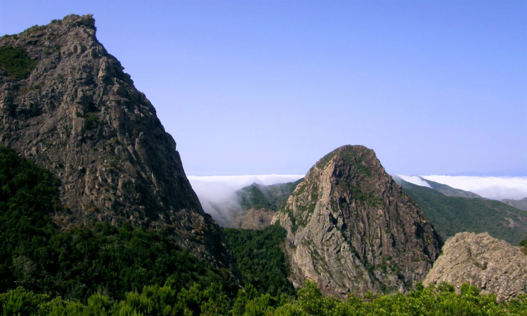
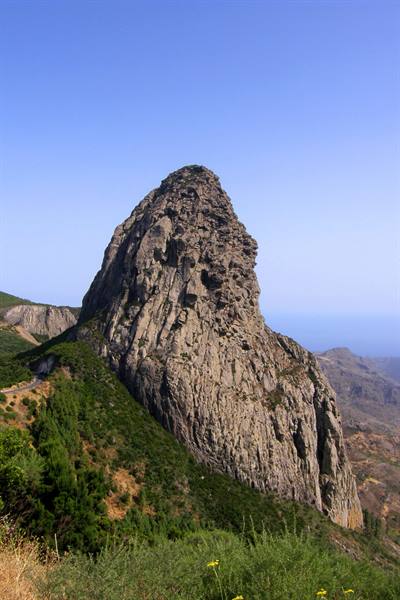
The almost autumnal climate accompanies us along the entire north coast and in the Valle de Hermigua (as yesterday), then we continue to climb in altitude toward the center of the island, along a route full of curves, and we enter the Garajonay National Park to find, once we reach the top, a beautiful sun. We are now in the area of Los Roques, characterized by steep volcanic formations, among which the imposing Roque de Agando stands out, with a sea of clouds lapping at them and creating fanciful waterfalls of water vapor... one of the most beautiful landscapes of La Gomera, which will certainly remain imprinted in our memory.
One hairpin turn after another we descend again toward the coast, to come into view of the colorful checkerboard of houses of San Sebastian, and on the waterfront of the capital we spend the last hours on the island, biting into our sandwiches for dinner, waiting for the Fred Olsen ferry. At 8:30 PM the usual Benchijigua Express pulls away from the dock of the port of La Gomera, bound for the island of La Palma, the fifth by extension of the archipelago, with its 706 square kilometers, but the highest and most mountainous in the world in relation to its extension... Also of volcanic origin, it was, in 1971, the scene of the last spectacular eruption that occurred in the Canaries. As soon as we depart, the sun sets behind La Gomera, and it is pitch black when at 10:30 PM we disembark at Santa Cruz de La Palma, the capital of the fourth island of our itinerary...
and a handful of minutes later we are at the Apartahotel El Galeon, which will host us for the next two nights. We take a nice refreshing shower and immediately afterward go to bed, because tomorrow awaits us, perhaps, the most demanding stage of the entire trip.
Chipude - woman at the public washhouse
Day 137 Aug 2009
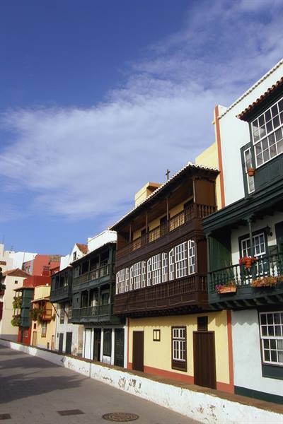
One day to visit the island of La Palma, we only have one full day, dictated by the ferry schedules, and we have to make it enough! There are a few too many clouds in the sky when we leave the Apartahotel El Galeon and stop along the Avenida Maritima in Santa Cruz to photograph the characteristic houses of Los Balcones: a complex of old and picturesque residences, superbly restored, with bright colours and the typical wooden balconies. There is instead a few pale rays of sun when, a little later, we observe the exact replica of the caravel Santa Maria, known as El Barco de la Virgen, moored... in Plaza de la Alameda and housing a small maritime museum, which we deliberately skip, before taking a short stroll in the surrounding streets. Then the sun definitely comes out as we leave Santa Cruz and begin to climb, climb, climb, climb...
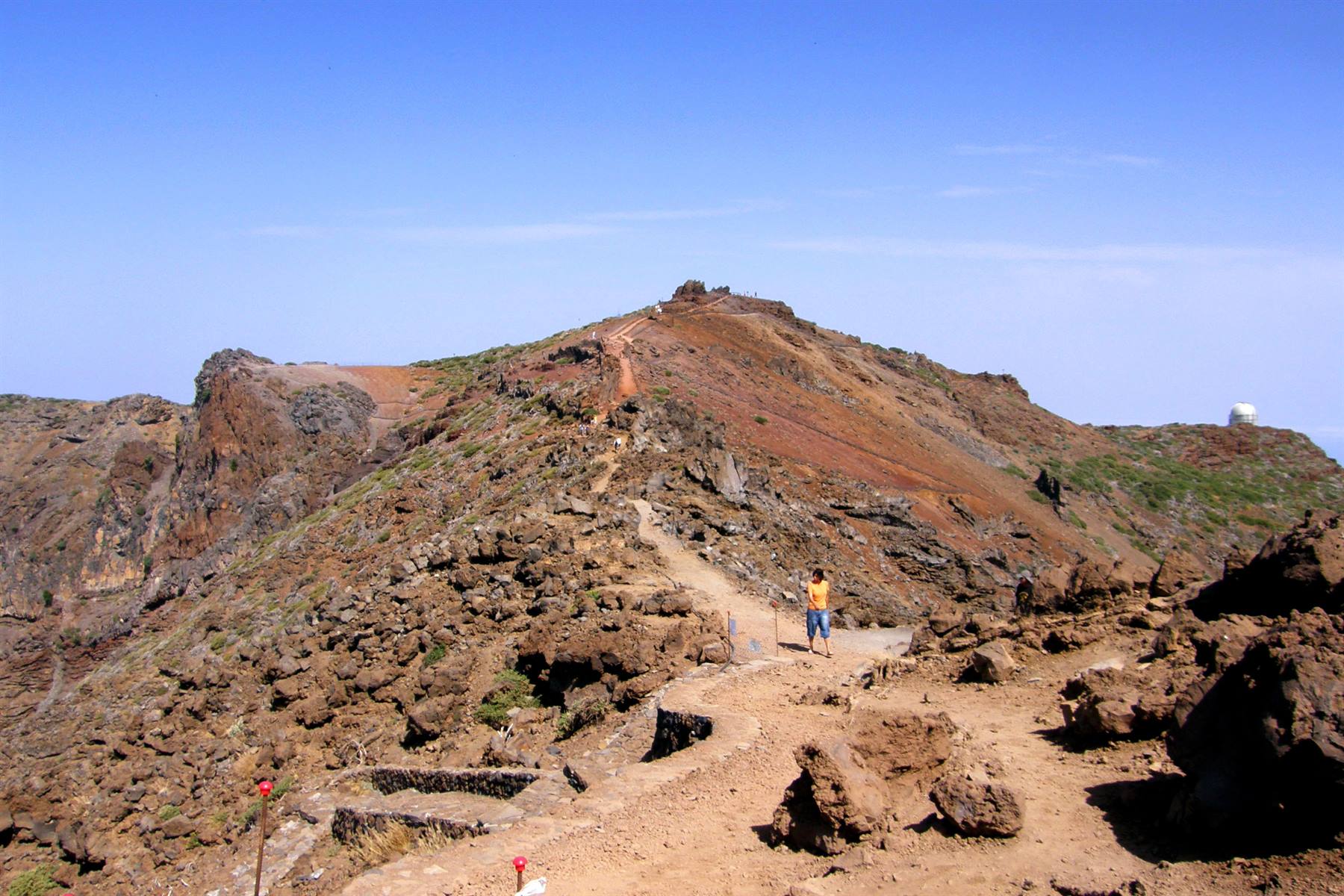
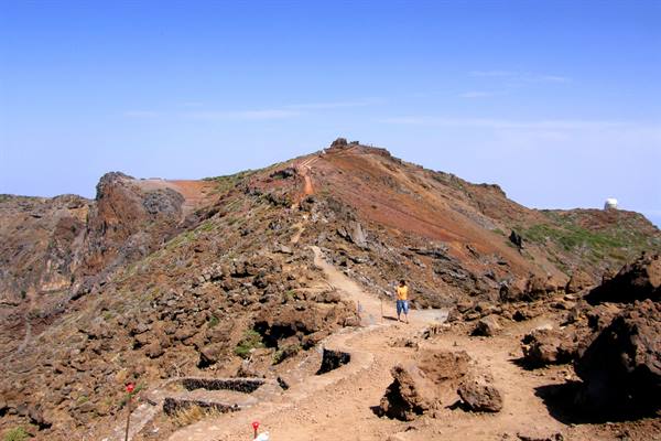
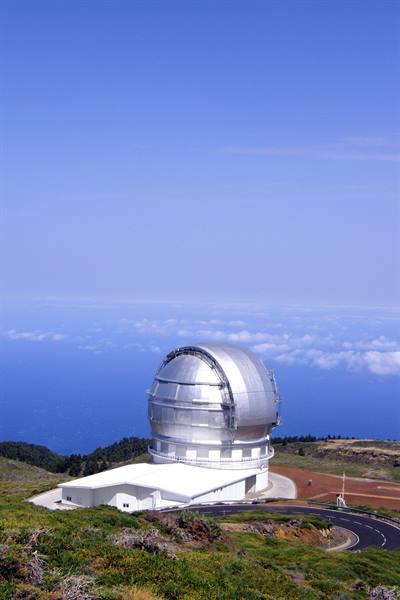
towards the centre of the island: 36 kilometres of hard ascent, up to 2426 metres at Roque de los Muchachos! The whole highest part of La Palma develops around the immense Caldera del Taburiente, a boundless no-longer-active crater, about ten kilometres in diameter, created over millions of years first by intense volcanic activity and then thanks to erosion. Since 1954 the whole area has become a national park, and rightly so given the splendid landscapes that characterise it. La Roque de los Muchachos is the highest peak in the park and on the whole island and from up there the panorama is truly breathtaking, with the view ranging on one side over the impressive rocky walls of the caldera and on the other over the immensity of the ocean.
What's more, enhancing the views are the domes, scattered here and there, of the powerful telescopes of the International Astrophysical Observatory, inaugurated in 1985 in the presence of King Juan Carlos and many European heads of state, the most important of its kind in the northern hemisphere, yes, because thanks to the clearness of the sky, the Canaries are considered one of the best places in the world for conducting astronomical observations. After a nice walk along the short hiking trail of Roque de los Muchachos we begin the descent towards the western coast... a long descent, which however does not take us to the sea, because the coastal road (if you can call it that) runs quite far from the coast.
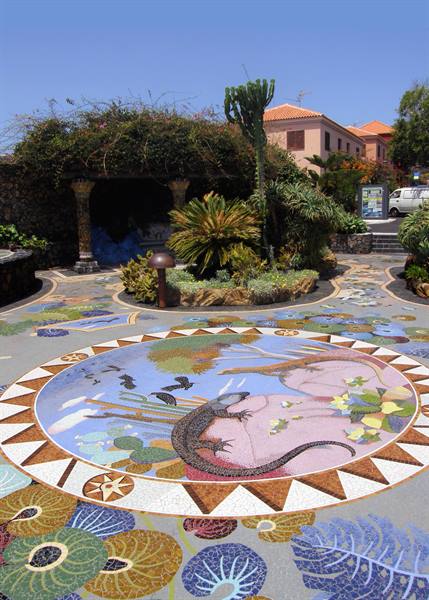
At this point we turn our bow towards the south of the island and, after lunch, the growing haze does not allow us to enjoy the best panorama from the Mirador del Time over the underlying plain of Tazacorte, completely carpeted with banana plantations. The view is limited by the mist also at the Mirador de la Cumbrecita, southern balcony over the Caldera del Taburiente, so we set off, with our Seat Leon, towards the extreme south of La Palma. We stop in the village of Las Manchas to see the highly original Plaza La Glorieta, a kaleidoscopic work by Luis Morera, a local artist and disciple of César Manrique, and then we arrive in the area of Fuencaliente, where only a few days ago, while we were on El Hierro, a big fire had broken out...
really big! It's impressive: we drive through kilometres of charred forest where you can still smell the acrid smell of smoke, but that's not enough, in fact along the road there are also burnt houses and blackened car wrecks... a real carnage!... The tragedy, on the other hand, was avoided by a hair's breadth because the village of Fuencaliente, literally surrounded by flames, was almost totally saved. From the centre of the village, still dazed by the events, we descend towards the coast. We cross immense banana plantations and arrive at the extreme southern tip of La Palma, in a purely volcanic landscape (here the last eruption occurred almost forty years ago), up to the lighthouse of Fuencaliente, where the view ranges offshore over the islands of El Hierro and La Gomera.
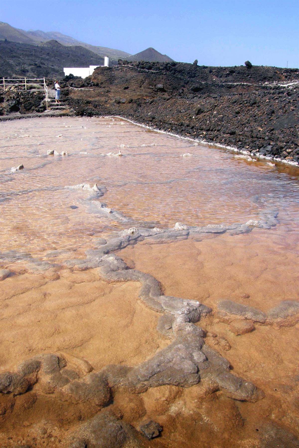
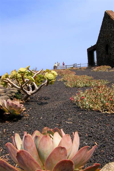
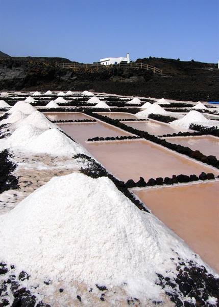
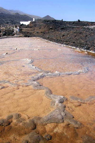
Beside the lighthouse, set among the black rocks pounded by the waves, are some scenic salt pans, still active, with the orderly piles of salt and the basins with the typical reddish reflections creating pictures with marvellous contrasts of colour... After Roque de los Muchachos the tip of Fuencaliente was certainly the most beautiful experience of La Palma, a very mountainous island but in certain respects a little disappointing. Back up along the eastern coast we close the circle and arrive in Santa Cruz just in time to take a walk along Calle O'Daly, the main, completely pedestrianised artery of the capital, lined on both sides by historic houses and residences bearing witness to the prestige the city once enjoyed. In this way we also reach Plaza de España, overlooked by the Renaissance facade of the Iglesia de El Salvador, the main religious building in the centre.
At the end of a very intense day we can say we have accomplished the mission of visiting the main places of interest of La Palma and a little tired we return to the Apartahotel El Galeon, to freshen up before dining with a good plate of paella in a restaurant on the seafront of Santa Cruz.
Los Roques
Day 148 Aug 2009
Today is the transfer day par excellence... and it begins very early. The alarm goes off at 4:30, just in time to be half an hour later at the port of Santa Cruz de La Palma, from where at 6:00 sharp, still in complete darkness, the faithful Benchijigua Express sets sail to take us back to the island of Tenerife. We make a stop at La Gomera, while the sun peeks out further east from the black silhouette of the Teide and less than an hour later, at 8:30, we disembark at Los Cristianos. We drive along the whole Autopista del Sur and once we reach the northernmost part of the island we decide to give up visiting the heights of Las Mercedes (the only area still unknown to us), because the peaks are completely wrapped in clouds (a constant, it seems, at this time of year). We then continue to Puerto de la Cruz, with the intention of going to spend a few hours at Lago Martiánez...
but on the north side of the island the temperature drops, suddenly, by almost ten degrees (so much for the microclimate!), while it seems that quite a few clouds are also accumulating along the coast. So we have no choice but to turn back to Santa Cruz and its Playa de las Teresitas, where they say the sun almost always shines. Indeed at Las Teresitas it's lovely and we spend the rest of the morning and a good part of the afternoon there, waiting for the next Fred Olsen ferry, which will take us to Gran Canaria. A few minutes after 18:00 the Bencomo Express sets sail from the port of Santa Cruz de Tenerife for the third largest of the Canary Islands, with its 1533 square kilometres, but the second by population and the main antagonist of Tenerife, since, like the latter, it is the capital of one of the only two provinces of the archipelago.
What's more, Gran Canaria shares with its bigger sister the nickname of "continent in miniature", for its division into distinctly different climatic zones, as well as the role of main destination for mass tourism, which we, to be honest, don't particularly love. After about an hour of sailing through the waves of the ocean we disembark at the port of Agaete, a cheerful little town on the north-western coast, and from there we drive, clockwise, along an easy motorway, over half of the island's perimeter to the hyper-touristy conglomeration of Playa del Ingles, which immediately makes a bad impression on us, chaotic and overflowing as it is with Northern European youngsters not exactly clear-headed, at least in appearance, and where the Aparthotel Green Field is located, where we will stay for the next five nights.
They hand us the keys to our room and, after a dinner nearby, at the end of an endless day, we finally go to rest... with the hope that tomorrow truly is another day.
Roque de los Muchachos
Day 159 Aug 2009
At the end of a night in the hellish heat of our new room, equipped yes with air conditioning but only in the living area and not even working too well, we set off with the intention of going to visit Las Palmas de Gran Canaria, the capital of the island, founded by the Spanish conquerors on 24 June 1478, but also the largest city in the entire Canary archipelago. A beautiful sun is shining, but while we proceed quickly towards our destination big grey clouds appear on the horizon, which don't surprise us, because in this season they are almost a constant in the north of the island...
The sky, however, becomes increasingly dark and a few drops of rain even fall, so much so that once we arrive on the seafront of Las Palmas it feels like a day in late autumn, what's more when we are before the sixteenth-century Castillo de la Luz, erected to protect the old port, we can't even photograph it as it is completely fenced off for works... we really can't find the right feeling with this island! We set off again to go and visit La Vegeta, the historic quarter of the city, but it starts raining insistently... It's impossible! It would be madness to spend an entire day like this, especially when there's an alternative!... So we turn our bow towards the south and completely change our plans. Already in the middle of the island the sun shines again and once past the super-touristy resort of Maspalomas the clouds are no longer visible even in the distance...
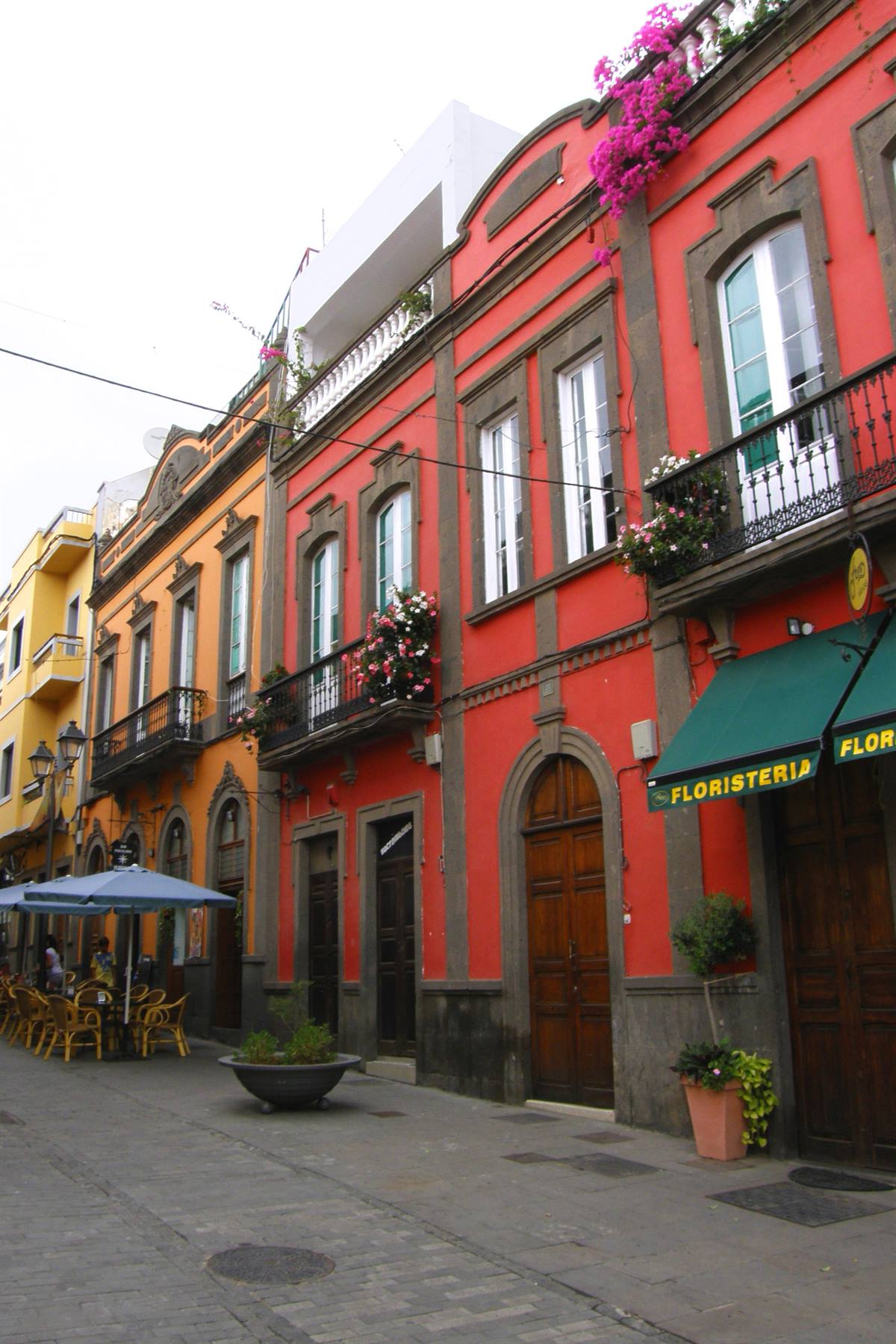
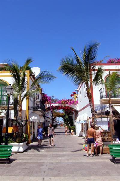
It seems a whole other world! So we arrive where the motorway ends, and then, a little further along the coast, at the village of Puerto de Mogán, located at the mouth of a wide valley (the Valle de Mogán). Here, it must be acknowledged, the whole village surrounding the tourist port has been built with great architectural respect, in harmony with the surrounding environment, giving life to an entire district of pretty, colourful buildings, with balconies overflowing with flowers, in Mediterranean style, arranged along a network of narrow pedestrian streets, in which we deliberately lose ourselves for a while. Later, with the sun now at its zenith, we go to the nearby Playa de los Amadores, a wide crescent of candid sand, certainly not Canarian, overflowing with people.
There we stop and, taking advantage, we also manage to get a parasol, which seems to be free since nobody bothers to collect money, nor are there any signs about it. Then we run into the water, which thanks to the light bottom is also inviting, and enjoy a long refreshing swim... Of course, Playa de los Amadores is also not the tropical dream par excellence but, despite the parade of horrendous tower blocks behind it, it's lovely there and we stay for the whole afternoon during which, in the company of Federico, I also become a bit of a child again, doing dives and balancing games in a fun water-park located a few dozen metres from the shore.
We leave Playa de los Amadores with the long shadows of the evening and, now in tune with Gran Canaria too, we return to Playa del Ingles, where we find, for dinner, a nice little restaurant (the Bacaná), on the edge of a pool, which offers delicious menus based on grilled meat at a very convenient cost... a place we will certainly return to before the end of the trip.
Salt pans of Fuencaliente
Day 1610 Aug 2009
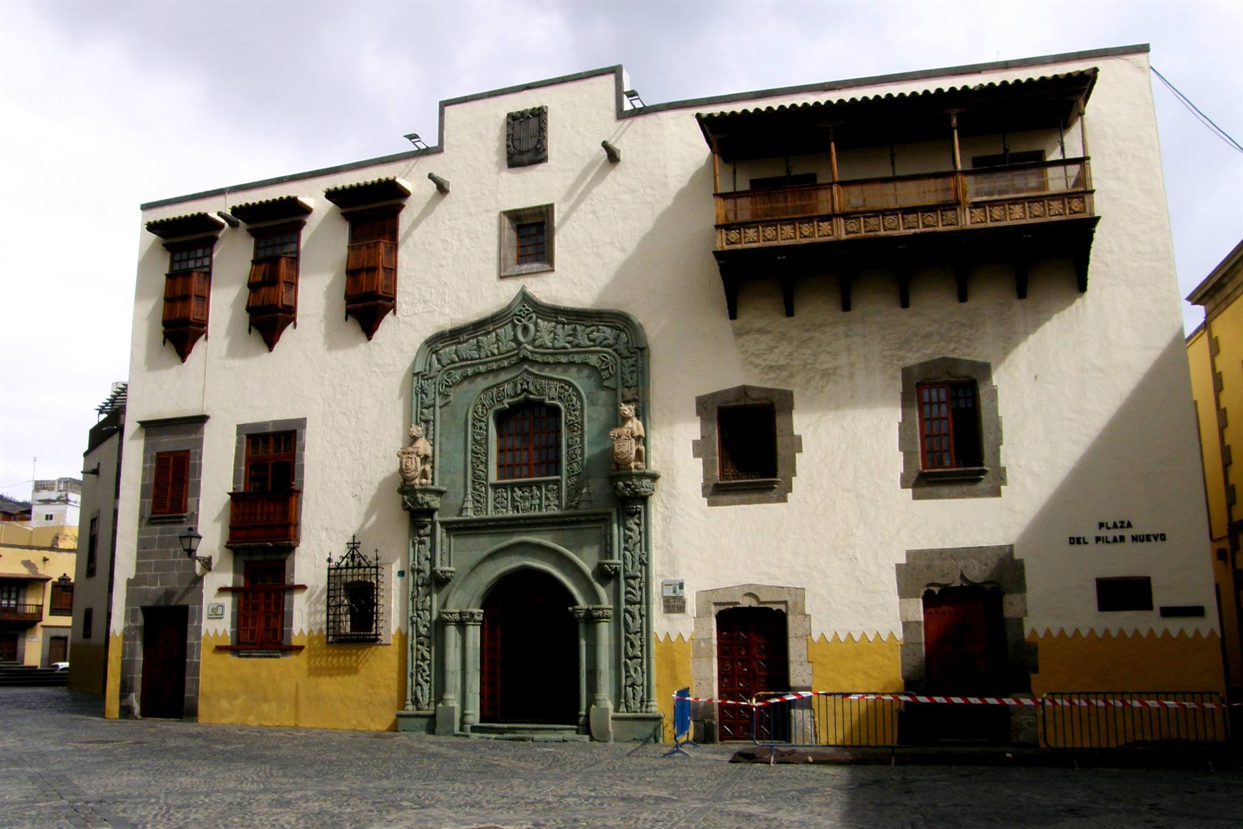
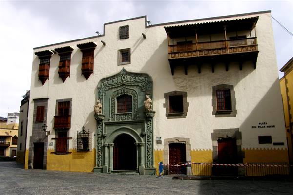
This morning too the sky is clear and we set off with the intention of resuming the programme of visits interrupted yesterday... Logically, however, once in sight of Las Palmas, there are the usual clouds lying in wait (it really seems impossible to avoid them at this time of year), but at least it isn't raining. We stop directly at the La Vegueta quarter and, having parked the car, we go to discover it. In a short time we find ourselves before the Casa de Colon, a stately building, with splendid wooden balconies, seat of the first governors of the island, where, according to tradition, Christopher Columbus also stayed, in 1492, forced to stop while waiting for one of his ships to be repaired: hence the name, Casa de Colon, or House of Columbus.
Inside there is a small but interesting museum, to which we dedicate some time, which preserves reconstructions and relics relating to the famous navigator and his voyages of discovery to the West Indies, but also evidence regarding the progress of cartography and the role of the Canaries as a crucial point on the route to the New World. Back in the open air we stroll a little through the streets of the quarter where we observe, as a few timid rays of sun come out, besides some historic buildings, the great Catedral de Santa Ana, begun in 1497, which has a monumental neoclassical facade and the tranquil Plaza de Santo Domingo. Once back in the car we set off to visit the entire northern region of Gran Canaria which, it seems, is completely under a thick blanket of clouds...
Heading inland we thus pass, on the first heights, through the small town of Tafira Alta, dotted with villas of colonial character and, nearby, we climb to the Pico de Bandama, an extinct volcano with a caldera about one kilometre in diameter, from whose summit you enjoy... or rather, you should enjoy a beautiful panorama over Las Palmas, because the greyness reigns absolute and it's really not the day. Back on the main route we pass the villages of Santa Brigida and San Mateo climbing in altitude... with the temperature instead dropping below twenty degrees when, shortly afterwards, we stop for lunch along the road. On setting off again we reach the village of Teror, the religious capital of the island since, in 1914, Pope Pius XII proclaimed Nuestra Señora del Pino patroness of Gran Canaria and its basilica the primary place of pilgrimages...
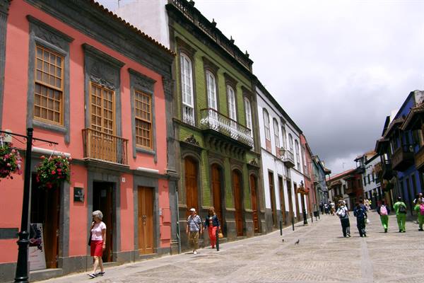
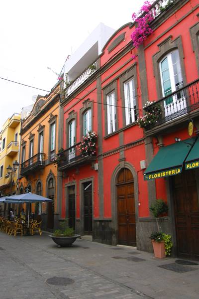
The great religious building overlooks the square of the same name, from which the most important artery of the small town also springs, flanked by interesting historic buildings dating back to the 16th century, with very characteristic wooden and stone balconies. After a short visit also of the interiors and the treasure of the holy patroness we return to grinding out kilometres and descending in the direction of the northern coast, to arrive at the village of Firgas, known more than anything for its Paseo de Gran Canaria: a straight little pedestrian street decorated on both sides with benches clad in ceramic and azulejos depicting landscapes and historic symbols of the island, while in the centre a small cascade flows and higher up large ceramic slabs represent maps and panoramas of the other islands of the archipelago...
an unusual lesson in Canarian geography created, with great imagination, in 1995. Just a few kilometres from Firgas we also stop in the locality of Arucas where, among other typically Canarian buildings, the enormous bulk of the neo-Gothic parish church of San Juan stands out... which however we find inexplicably closed. Having completed the tour of the north of the island, more than anything historical-cultural in character, but not overly exciting, we head south and find, naturally, the sun, accompanied by a lovely blue sky, so we decide to end the day in the pool of the Green Field... a couple of hours of well-deserved rest, which end up pleasing Federico too.
Las Palmas - Casa de Colon
Day 1711 Aug 2009
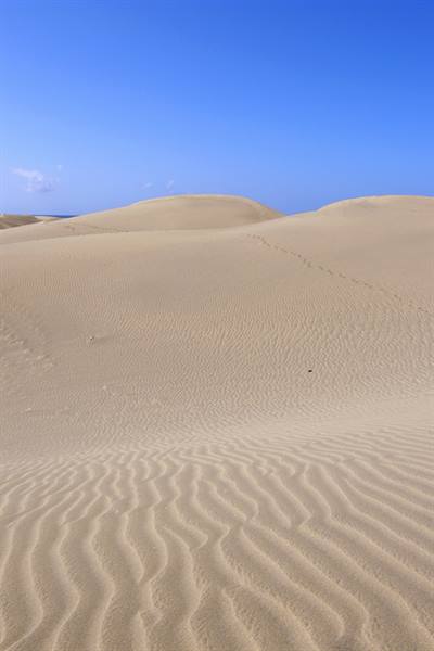
After yesterday's long drive around, seasoned, to be honest, with few satisfactions, today we decide to take a day of, more than anything, healthy relaxation. Having left the hotel we cover the very short distance that separates us from the famous dunes of Maspalomas and, having parked the car, we go to discover them... It's a tiny nature park, a handful of square kilometres of Sahara desert that ended up who knows how in the south of Gran Canaria. It's a magnificent landscape made of soft, golden sand on the shores of the ocean, into which we venture, in search of the most classic views made of ridges shaped by the wind... Only the camels are missing, which we knew were there and on whose backs you could even take an excursion, but they are nowhere to be seen even in the distance so much so that we begin to suspect they are no longer there, even though they weren't essential.
What is certain is that this strip of land, with its soft ups and downs, though shamefully besieged by concrete, has so far been the most beautiful thing this great island shaped by the most unrestrained mass tourism has been able to offer us. After Maspalomas we get back in the car and following the coast we cover the few kilometres that separate us from Playa de Varga, better known as Anfi sul Mar, an enormous tourist village whose beach is however accessible to everyone, ourselves included. The stretch of sand, clearly artificial, is all of very white sand (imported, it seems, from nothing less than the Bahamas), nevertheless it can hardly be defined as a paradise, very crowded and squeezed in the grip of the most reckless urbanisations, but there doesn't seem to be anything better nearby and we make do, then spend half a day at the seaside that is all in all pleasant.
Arucas
Day 1812 Aug 2009
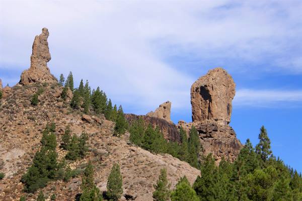
The holidays are inexorably drawing to a close and this will be the last full day on Gran Canaria... then tomorrow the return to Tenerife. Today we set off with the intention of visiting the central part of the island, the most rugged and wild... As soon as we leave Playa del Ingles we begin to climb inland along the spectacular Barranco de Fataga, a narrow and arid valley, dotted with cacti and rare palms, at the foot of vertiginous rocky walls, a severe landscape with strong colours, vaguely reminiscent of the American west. The road passes through the village of Fataga, then higher up through the remote village of San Bartolomé de Tirajana and one bend after another, once past the tiny hamlet of Ayacata we arrive in sight of the intriguing Roque Nublo, one of the symbols of the most genuine Gran Canaria, that of still unspoilt nature.
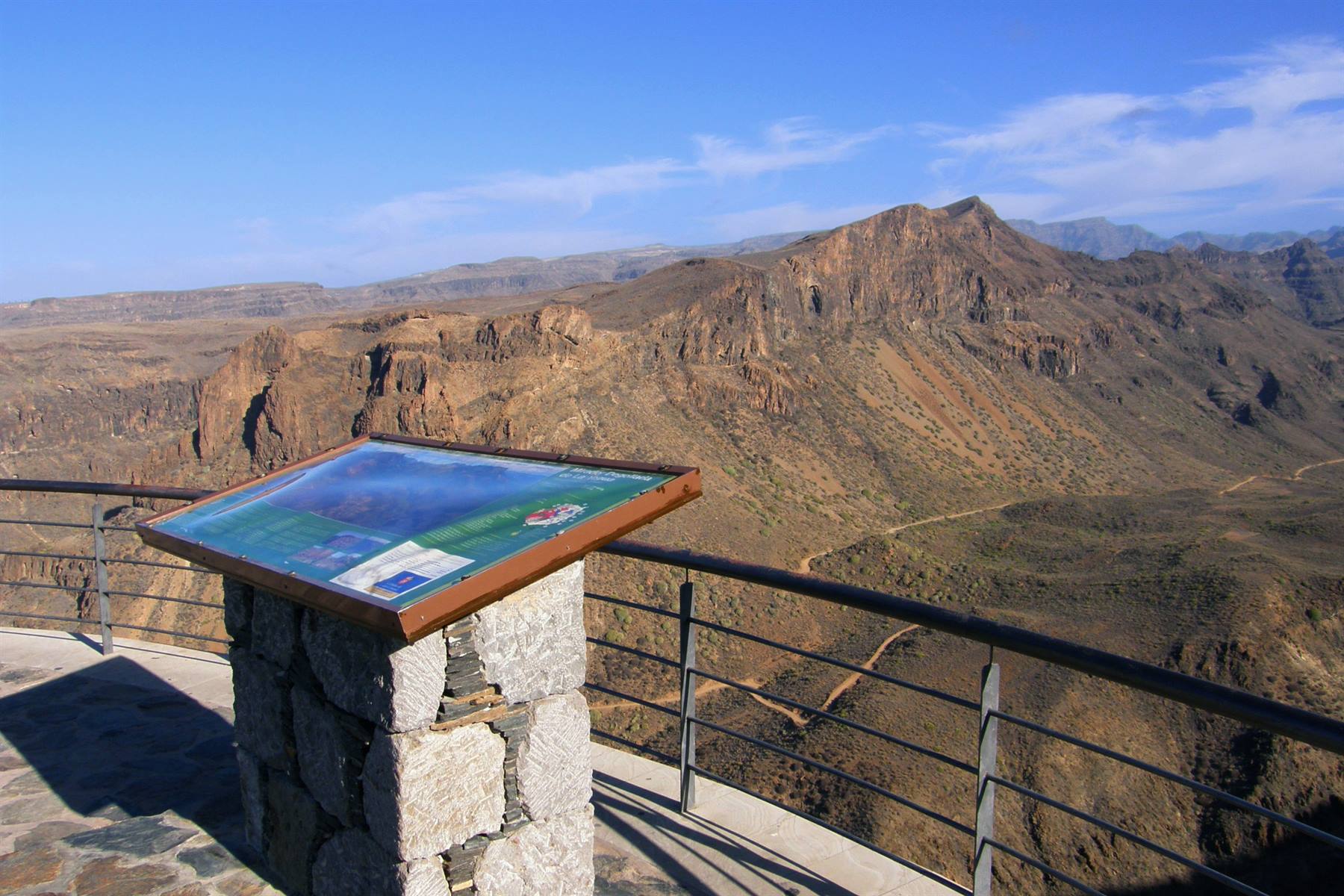
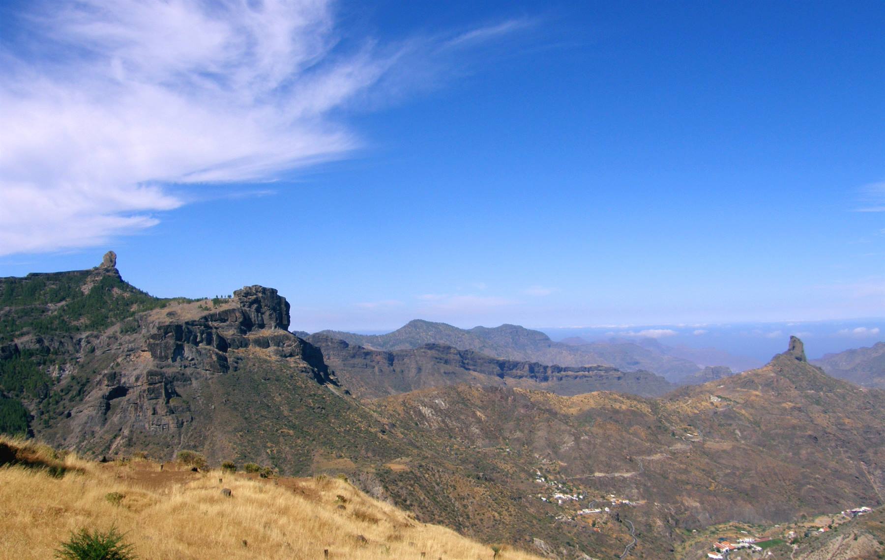
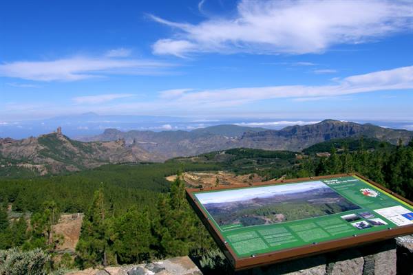
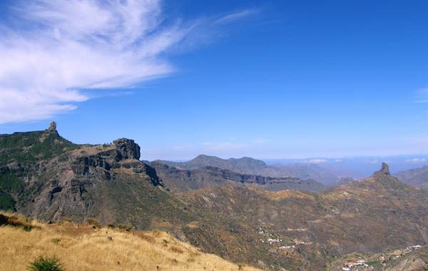
We take a short walk to capture some evocative images of the sixty-metre-high basalt monolith, considered a sacred place by the Guanches, the ancient inhabitants of this land, and then we resume climbing, up to the 1949 metres of the Pico de las Nieves, the highest point on the whole island... From up there the panorama, thanks also to the splendid day, is truly magnificent, with the view ranging over all the rocky peaks of Gran Canaria, its immense wooded valleys and on the horizon, in the distance, as far as the unmistakable silhouette of the Teide, over in Tenerife! We descend from the Pico de las Nieves and practically go anticlockwise around the Roque Nublo, which we also observe from the viewpoint of the Decollada de Becerra, paired with the Roque Bentayga, the other rocky peak symbol of Gran Canaria.
Continuing on our tour among the highest peaks of the island we also pass through the place where the so-called Cruz de Tejeda is located: a cross carved in stone which, according to tradition, marks the exact centre of Gran Canaria... Can it be true?... We take it as good and descend in altitude towards the village of Tejeda, so remote among the mountains that one wonders how any human being, other than a hermit, could have founded it, one day, right in this uncomfortable, albeit panoramic, position. We then climb again to reach the foot of the Roque Bentayga, a scenic basaltic rock that reaches 1412 metres above sea level and, like the Roque Nublo, a sacred place for the Guanches...
Then we face the very long descent towards the coast, following a narrow road all hairpin bends that flows into the Barranco de Mogán and, passing through the town of the same name, arrives at Puerto de Mogán. Now drunk on bends and hungry, given the late hour, we go straight to the nearby Playa de los Amadores to spend a quiet afternoon at the seaside and please Federico, who in this way can once again have fun in his water-park. Inevitably it then also becomes evening and, while the parasols one by one close around us, practically the curtain also falls on the fifth and last island of our itinerary.
Barranco de Fataga
Day 1913 Aug 2009
Today, in practice, the journey back to Italy begins... but we won't be home before tomorrow evening. We get up calmly, also because the sky this morning is rather cloudy, then around 11:00 we leave the Aparthotel Green Field heading west, so as to follow the road skirting the only side of the island still missing. At Puerto de Mogán the sun also comes out, while we head inland due to the lack of a coastal route in the westernmost part of Gran Canaria, and just before the village of Mogán we stop to photograph an old perfectly restored windmill.
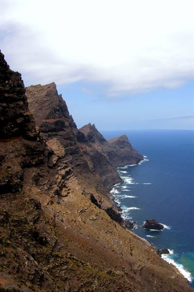
The GC200 road now climbs in altitude and ventures among the harsh mountains where there is also the volcanic formation of Los Azulejos, a rock face with incredible shades of colour, from red to blue-green, then, once over a pass, we descend towards the wide valley dotted with banana plantations that hosts the small hamlet of San Nicolás, to arrive shortly afterwards in sight of the ocean near the dark Playa de Aldea. From there we face the most spectacular stretch of the GC200: from Punta de Aldea to Agaete, along the extremely rugged and vertiginous north-western coast, starting from the impressive Mirador de los Balcones, on the edge of a steep cliff five hundred metres above sea level, unfortunately not helped by the sun, which has disappeared again under the clouds, typical of this area.
After several hundred bends and prodigious panoramas we arrive at Agaete, from where in the afternoon we will set sail, but it is not yet time to leave Gran Canaria, so we continue and, having reached the town of Galdar, we go, nearby, to visit the Cenobio de Valeron. One of the rare archaeological areas of the Canary Islands is a complex of about three hundred caves, declared an Asset of Cultural Interest, once used by the Guanches as granaries for wheat, but also, it seems, for the celebration of certain religious rites, a tangle of artificial cavities that can give the impression of a troglodyte settlement... all in all intriguing. Now in the early afternoon we go to lunch by the sea in the village of Sardina and without wasting any more time we immediately set off again so as not to arrive late for boarding.
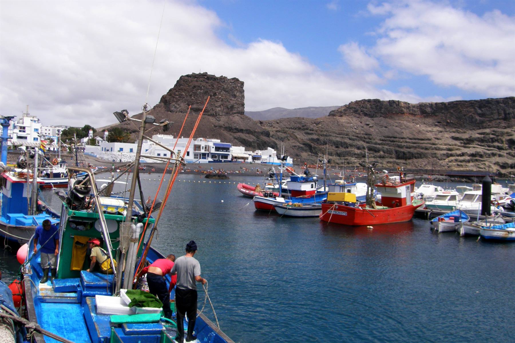
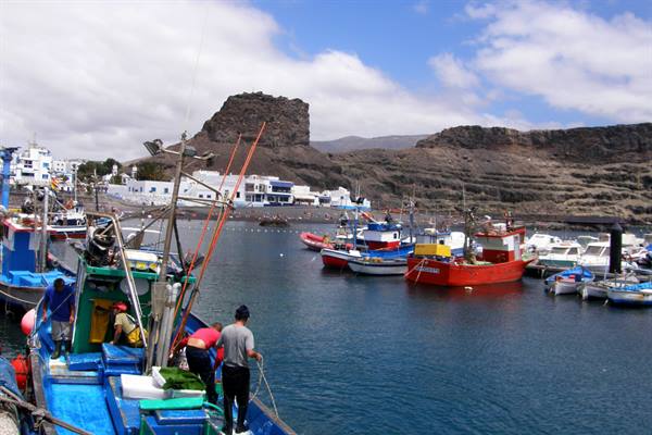
An extreme memory of Gran Canaria are the fishermen's nets and the colourful fishing boats of Agaete then, at 16:00 sharp, we cast off from the quay of the port, we pass beside the anonymous rock that until November 2005 was the so-called Dedo de Dios (the Finger of God), a very thin rocky pinnacle unfortunately brought down by tropical storm Delta and its wind gusts of 250 kilometres per hour, and the Bencomo Express, the last of our six ferries on this trip, takes us back, in about an hour, to Santa Cruz de Tenerife. Once disembarked, never satisfied, we go to spend a couple of hours on the beach at Las Teresitas, where a lovely sun is shining, then we also find our last hotel of the series, the hotel Pelinor, which we have to reach on foot, because it is right in the centre of Santa Cruz, in a pedestrian area.
At the end of the day we thus have dinner in Plaza de la Candelaria, with a lovely view over Plaza de España, and then we go to sort out the suitcases for tomorrow morning's departure.
Decollada de Becerra
Day 2014 Aug 2009
The alarm goes off at 4:30. We close all the bags and quietly leave the hotel Pelinor, then with our faithful Seat Leon we reach the Los Rodeos airport of Tenerife North. We leave the car in the Europecar car park: with it we have covered, roaming around five Canary islands, 2340 kilometres, which added to the 730 of the Focus, in the first days, make 3070 kilometres!... A nice little tour, with thousands and thousands of (splendid) bends! We have to wait a few minutes because the airport opens at 6:00, then once inside we hand the keys to the car hire company, check in and wait for the Air Europa flight UX9045 at gate number 11.
The Boeing 737 of the Spanish company takes off a little late, thanks to the usual four stragglers, at 7:54 and climbs above a thick blanket of clouds from which, while it is still dawning, the unmistakable Pico del Teide stands out and, further to the side, its astronomical observatory... this is the last image of the Canaries before beginning to follow the route that, towards the north-east, takes us in the direction of continental Europe. We adjust the hands of the clock moving them forward by an hour and then descend towards Madrid airport, where we land at 11:07... A long wait of over three hours awaits us, at the end of which we board the Alitalia Airbus A319 which at 14:49 takes off towards Italy as flight AZ49.
Beyond the window the sky is blue and below us first Spain and then France flow by, then we spot the white peaks of the Alps and immediately afterwards we begin to descend towards Milan, to land at Linate airport at 16:29. We collect all the luggage, exit the arrivals and with the help of the bus we find the Quick Parking and also our car. At 17:45 we set off from via Corsica and a quarter of an hour later we leave the Milan barrier behind us heading south on the A1... So at 19:00 sharp we are in Reggio Emilia and half an hour later in Bologna. We glimpse the finish line a few minutes before 20:00, when we exit the motorway at Faenza, and then we happily cross it at 20:08 in front of the gate of home...
It was a truly strange trip, an unusual "Island Hopping" among the western Canary Islands, an "On the road" holiday where this kind of holiday is usually not done, in discovery of lands yes touched by the ocean but shaped by fire, which know how to give their best between harsh cliffs and severe mountain landscapes... woe betide anyone who goes there just for the beaches and the crystal-clear sea, they would be disappointed... we knew it and we returned with many beautiful memories.






















0 reader comments