EAST TURKEY
Crew: Carlo and Jana (Pessano con Bornago -MI) Bike: Kawasaki KLR 650 Km traveled: 5,450 Duration: 2 weeks
Where are you going on holiday this year? Turkey again?... but you've already been there! True... but we were missing the easternmost area, so this year too we went back to Turkey to visit the areas bordering Armenia and Iran. Unfortunately we only had 15 days available, so everything had to be done a bit in a rush, and to reach quickly the places we wanted to visit we crossed the country without allowing ourselves too many stops in "already seen places".
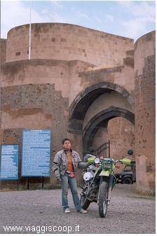
The first stop (930 km) took us to the Hittite capital of HATTUSAS near the town of Bogazkale, 120 km east of Ankara. (photos 1 and 2) A revelation... it's an enormous archaeological site that revolutionized the idea I had formed of the Hittites (and here I must reluctantly confess my historical ignorance on the subject). I had always imagined the Hittites as a people who lived in hot places... and my surprise was great when I discovered that the capital is at an altitude of about 2000 m, and even though it was July 20 the cold was biting. The visit, however, repays all the travel: there are very few tourists and the site is truly enormous (you have to move around inside it by bike, after paying the entrance fee, along an asphalted road for a route of about 5 km... unthinkable to do it on foot).
There are many references to Egypt also because of the political relations that existed between the two peoples. On site you can meet some shepherds (the livestock grazes peacefully inside the archaeological site, sharing the area with the archaeological teams carrying out new excavations) who willingly offer to accompany you to visit the highlights; those who don't want to can still rely on a good guidebook (we had the EDT-lonely planet) obtaining the same results. Once the visit is over, I recommend also going to see the sacred sites located a few kilometers from the Hattusas site and marked on any map, with particular regard to YAZILIKAYA... they are also very evocative.
With a bit more calm we reached the archaeological site of ANI, to visit which you must stop at the city of KARS. (To my great regret we were unable to stop at the Balikli Kaplica thermal baths, near Kangal, where in the thermal water pools small fish set about cleaning the skin of those who immerse themselves, particularly recommended for those suffering from psoriasis).
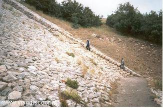
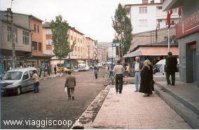
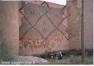
The city of KARS (photo 3) (which still bears the marks of the Russian colonization that took place until the beginning of this century) I found truly peculiar. I can't say it's a beautiful city or that it has monuments for which it deserves a visit, but precisely the grayness of its buildings and its streets (the main streets were paved between 2003 and 2004... before they were dirt, and teams of men were still working during our visit) represents its main attraction and curiosity. ANI (photos 4 and 5) is an ancient abandoned city (as it fell off the main trade routes) located about 30 km from Kars, right on the border between Turkey and Armenia. Today, in addition to the imposing walls, you can still visit mosques and Armenian churches, which are the only buildings still standing since of the dwellings only the foundations or little more remain.
It was an enormous inhabited center that was comparable in importance to Constantinople, where still clearly distinguishable (besides the religious buildings) are the residential areas, the commercial ones, the warehouses, the Hammams and the fortifications. The visit requires at least half a day and the entrance ticket can be bought directly on site (on less up-to-date guides a long procedure is described to be done in the city of Kars between museum and police stations to get the permits to access the archaeological site of Ani. In reality, a new Turkish law of 2003 liberalized the possibility of accessing the site without the need for special permits anymore).
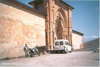
After Kars we moved toward DOGUBAIAZIT, an anonymous border town at the foot of Mount Ararat, and the last point of reference before the border with Iran. The town itself has nothing interesting except the monumental ISKAPASA palace (photos 6 and 7) located about 5 km from the town at the end of a long climb (some even cover the stretch on foot). The palace appears heavily restored (or it would be better to say "rebuilt"), but its position (built on the side of a mountain and overlooking a vast plain) and size (more than 300 rooms, with mosque, hammam, lodgings, harem, garden, courtyards and inner squares, storerooms, lodgings for guests and for the guards) leaves the visitor open-mouthed imagining what the display of wealth must have been in the years when it was in use (at the entrance there was even a fountain that dispensed milk).
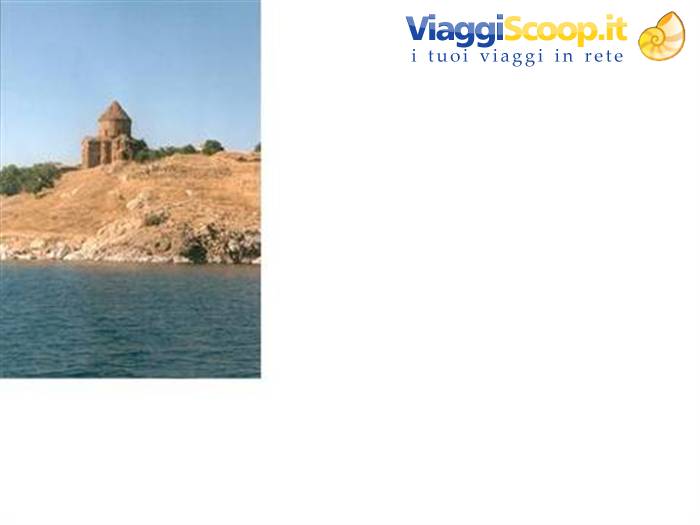
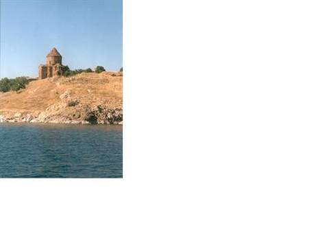
We then moved to VAN near the lake of the same name (photos 8 and 9). Here, besides the beauty of the places, it is very interesting to visit the Armenian church of AKDAMAR located on a small island reachable by boats that ferry visitors (today it is a very popular picnic spot used especially by locals), the fortress of HOSAP (on the border with Iran) and the volcano NEMRUT whose lava flow gave rise to Lake Van. This volcano has the same name as another mountain (Nemrut Dagi) located near the city of Adiyaman which has become an important tourist destination thanks to the presence of the tomb of King Antiochus.
On the volcano, contrary to what happens on the other Nemrut, there are no archaeological finds to visit, but it is very interesting to reach the interior of the crater (about 15 km of dirt road) where today you can see an enormous lake with hot springs (the latter were marked in the guidebook, but we couldn't find them). It is a desolate place, very little frequented by either locals or tourists.
Time is now pressing and in a few days we must board again for Italy. So we head back toward the port of Cesme, making some stops in various cities so we can visit them. During the return we cover long stretches of what was the "silk road", recognizable both thanks to the toponymy of the places (endings "han" and "saray" in the names of towns indicate the presence of caravanserais) and thanks to the actual presence of caravanserais along the route. These are placed about 35/40 km from one another (it was the average daily distance of the caravans) and they are all visitable... some are very well preserved, others less so, of some only the ruins remain or the traces of their presence traceable only to the toponymy.
We return to Italy with a bit of regret, knowing that we won't be back in Turkey anytime soon; by now we've visited it all and in the coming years we'll move on to new destinations. During the outward ferry crossing we met two likeable and interesting travel companions: Walter and Fulvio (two motorcyclists, the first about to go to China, and the second to do the complete tour of Turkey, having more days of holiday than us) who gave us quite a few ideas for future trips.
We have already started working out a hypothesis for a new trip, but first we have to get the bike back in order since, having already "clocked up" its first 40,000 km, and being a single-cylinder, it needs a bit of work.
Carlo and Jana.


0 reader comments