The story
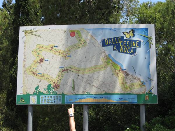
Taking advantage of the day of the oases and the beautiful, almost summery sunny weather, we headed down to the Salento, taking the 16-bis dual carriageway, which flows well with two lanes but is generally always rather congested during the good season. We then followed the not-very-precise signs towards the WWF Le Cesine oasis, in the Vernole area. It is one of the many protected areas managed and defended by the WWF in Italy, with the aim of conserving and protecting habitats and rare, threatened species. The Oasis can be reached from the 611 San Cataldo-Otranto coastal road but also from other villages such as Vanze and Acaja, hamlets of Vernole. The Oasis covers about 620 hectares, 350 of which are managed directly by the WWF; today it represents one of the last marshy areas that in the past stretched from Otranto to Brindisi.
It is made up of several environments: the reed bed, the marsh, the dunes, the wood and the farmland, all essential for the Oasis to be of great interest to the birds that frequent it. The two back-dune basins of the marsh are called "Pantano grande" and "Salapi", both with brackish water. The name Salapi comes from the discovery in the area of an ancient city called "Salapia". Other small back-dune basins are the "Salapieddhi". The boundary of the wetland is marked by the feeder canal that runs from Torre Specchia to San Cataldo for the western part, and by the sea for the eastern part. At San Cataldo there is the pumping station, a plant whose function is to expel the excess water. Inside the wood, just a few metres from the marsh, there are 3 hides (2 raised, 1 at sea level) specially built for birdwatching.
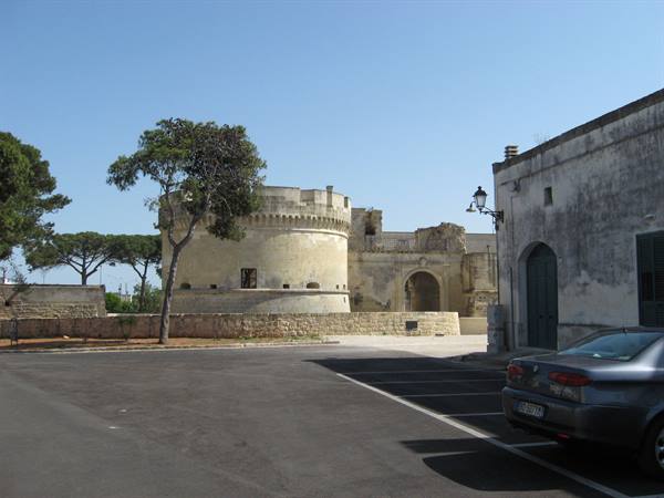
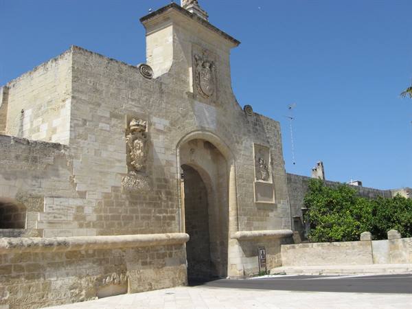
The guided route disappoints us a little because it is too short, but it is an invitation for another visit. We take the road towards Acaya: the ancient village of Segine, from the medieval period, became part of the County of Lecce in the 12th century, then was donated by the Angevins to the Convent of St John the Evangelist in Lecce and finally, in 1294, was granted as a fief by Charles II of Anjou to Gervasio Acaya. The Acaya held the fief for a good three centuries. It took its current name of Acaya in 1535, when the great master Gian Giacomo dell'Acaya, "royal military engineer" to Charles V, built the walls and the moat that still surround the town today, and added bastions, ramparts and a moat to the castle his father had had built 29 years earlier.
Today it is the only example of a fortified town in southern Italy, surviving the centuries intact and with a typically Renaissance imprint. The castle of Acaya and the town as a whole are the extraordinary result of the important architectural genius of a royal military engineer to Charles V: Gian Giacomo Dell'Acaya. The castle is the tangible testimony of a feudal power around which the history of these peoples developed, a history, in the end, of great and dignified poverty. Indeed, apart from the castle, the little village is decidedly small and made up of a series of low houses... though there's no lack of places to eat: we counted about three restaurants/trattorias within a few kilometres. After the visit to Acaya (the castle can be visited by prior booking) we move on towards Gallipoli, but first we take a look at some villages of the Grecìa Salentina, from Martano to Calimera.
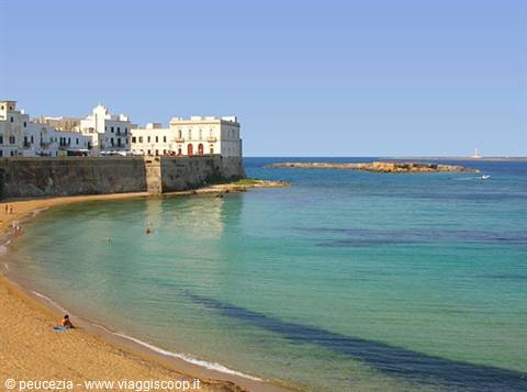
Gallipoli, washed by the Ionian Sea, stands on the western coast of the Salento peninsula, in the Gulf of Taranto. Characteristic is the town's division into two clearly defined areas: the "old town" and the "new town". The evocative historic centre, rich in ancient buildings and frescoes, stands on a limestone island linked to the mainland by a stone bridge. Around 1500 the mighty walls were built to face enemy attacks, later reduced in height at the end of the 1800s, down to the present panoramic road which, encircling the whole islet, lets you enjoy fantastic scenery (only a single fragment of the ancient walls still survives in good condition today). Looking north you glimpse part of the Nereto coast, while to the south the bay formed by the Pizzo promontory is clearly visible.
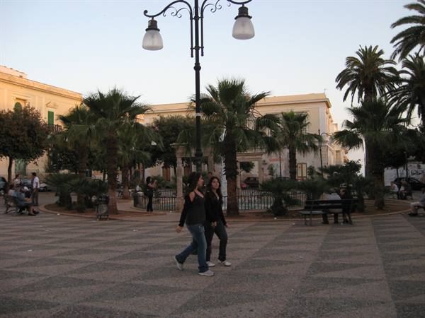
Near the coast to the west we find the Scoglio dei Piccioni, the islet of Campo, and on particularly clear days you can make out the outlines of the Sila mountains, while to the south-west the island of Sant'Andrea stands out clearly, home to a large lighthouse built in 1866. We found ourselves there in the late afternoon, as shown by the strolling along the city's avenues; unfortunately the city was barely captured on camera because the memory card ran out... never mind, there will be no shortage of chances to come back down.....
The journey's photographs
6 photographs · click to open them full screen

0 reader comments