Extraordinary, astonishing Sardinia, even for me who lives here, even though this is already the third time I've visited the magnificent Nuoro area, with its harsh and solitary landscapes, so majestic, wild and unspoiled, so different from the rest of the territory and from the Cagliari area where I live. From the sea of the Gulf of Orosei to the mountains of Supramonte, this part of my island is a constant surprise, leaving you open-mouthed every time. Even more so this time, because a week's stay in Cala Gonone turned out to be a real journey, full of places to see and things to do.
I read from numerous different sources, I learned the names of the mountains, the passes, the sheepfolds, the villages and the coves, the ancient archaeological complexes, and I finally pictured in my mind a precise and detailed map of the extraordinary geography of the place, driving for kilometre after kilometre, and walking trekking trails on foot, rounding it all off with the magnificent spots already visited last May. It should be said from the outset that many of Sardinia's most beautiful, evocative and unmissable stops are right here, starting with the thirty kilometres of the gulf's coastline, completely unspoiled and free of permanent buildings, from S.
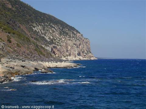
Maria Navarrese to Cala Gonone, with a sea so beautiful it's frightening, crystal-clear and transparent as I've never seen anywhere else in my life, with the fantastic Bue Marino caves reachable and visitable by boat, with marvellous coves like Cala Luna, Cala Sisine, Cala Goloritzè, Cala Mariolu, reachable only overland by long treks following the codule or by sea in summer via a boat service, and surrounded by a majestic, high and impenetrable limestone cliff, itself a renowned destination for die-hard climbers. There's only one full trek crossing the whole coast, rather technical and long (it takes practically a week), called the Selvaggio Blu, which the author Stefano Ardito in the book "A piedi in Sardegna Vol.
1" calls the most extraordinary and wild in the whole Mediterranean: certainly an unforgettable experience, to be done with competent guides, who are also highly recommended for other treks in these areas, truly not to be underestimated given the impervious terrain, the not always marked trails and the ease of losing your bearings. Many can still be done alone, though, by gathering information beforehand, getting a suitable map and following the right markers, as I've done so far.
And what about the incredible Supramonte, which offers extraordinary and striking landscapes like the Gola di Gorroppu, the highest and most imposing in Italy and, together with the Verdon in France, in Europe too, the vertical walls above the little villages perched in impossible places, the terrifying chasms like that of Su Sterru, 270 metres deep in a single vertical drop, a sought-after destination for any speleologist, the lunar and solitary landscapes and the countless caves found in the most unexpected places. Let's not forget either that this area is not only exceptionally rich and complex from a landscape and naturalistic point of view, but also has a culture and history dating back to the dawn of the very earliest Nuragic civilisation.
Everywhere you find settlements of the ancient Sardinian people, incredibly evolved as shown by the Nuragic village of Serra Orrios, one of the largest found so far on the whole island, and stubbornly attached to their own territory, which was never fully conquered by powerful civilisations from the time of the Carthaginians and Romans through to the Middle Ages and our own day. A clear demonstration of this is the extraordinary settlement of the Nuragic village of Tiscali, a name that brought so much fortune to the now famous Tiscali on the web, built at the foot of an enormous collapsed doline, in a place so absurd in the visitor's eyes, reachable only by a beautiful trek that gives a precise idea of the grandeur and geographical difficulties of these places.
Not to be missed either are the tombs of the giants, such as that of Sena Thomes for example, or the sacred spring of Su Tempiesu at Orune, the only example of its kind in Sardinia from an architectural point of view, truly fascinating and evocative. Finally, there's one last important issue I want to address before closing this brief preface: the impact of tourism on this area.
From this point of view I believe I speak on behalf of all the authors of the guides I've read, of all the naturalists and the people I've spoken to who have visited these places: it's absolutely essential not to let mass tourism arrive, not to build asphalt roads reaching the most important monuments, not to fill the coast and the Supramonte with concrete — all things that would lead to an excessive and radical change of the landscape and the population, with the resulting destruction of the charm surrounding this place. The beauty of these coves is being able to share it with few people, surrounded by majestic and extraordinary nature, toiling two hours on foot to get there and enjoy them, not as already happens in August when dozens of boats arrive from the sea and anchor offshore.
If tourists want to step out of their hotel or holiday rental and find themselves facing the sea, or if they want to arrive on an asphalt road and park behind the beach, they're wrong to come here: let them go elsewhere, there are so many places here in Sardinia! And if they want to see the monuments (both natural and man-made) hidden in the most impervious places, let them earn them with a good sweat that will certainly reward them beyond compare in the end: otherwise let them go and see Barumini and the well of Santa Cristina, equally beautiful and interesting but lacking the magic of the places I mentioned earlier.
The tourism that has developed in this area is that of naturalists, walkers, climbers and speleologists, and this must remain, perhaps better organised, promoted or signposted, but without overturning anything more than what has already been done to date (and some damage has already been done). I'm not quite sure whom to address this warning of mine to, whether to politicians, to tourists' consciences or to the local population. I think I'd ask everyone in general to think carefully before carrying out works or actions that could definitively jeopardise the safeguarding of this wonderful region within the region of Sardinia.
For all the photos I refer you to my website:
Day 116 Mar 2003
Departure, the journey and arrival in Cala Gonone
Since this year has had an exceptionally rainy winter, the like of which hasn't been seen for decades here in Sardinia, Stefania and I thought it best that spring would be more beautiful than ever, and we decided to take this one-week vacation, staying based in Cala Gonone, where we also stayed last year for a weekend in May, finding it very pleasant. Of course, setting off in March is quite risky; the weather is still unstable and, as everyone knows, in this month it's more capricious than ever. Besides, until two weeks ago we were truly in winter, but then last week the heat suddenly arrived, with sunshine and a blue sky for the first tan at the sea, which like every year seems to want to skip the spring season and introduce summer directly. Today, unfortunately, the weather has turned bad, the clouds have returned along with a cold little breeze, but we're hopeful for the week ahead.
At this point it's really hard to guess what to bring along, since in the mountains of the Gennargentu there are still three meters of snow, and we might need both scarves and gloves with heavy sweaters, and swimsuits to go to the sea if it repeats last week's temperatures! For this reason, even though it's only a week, my Fiat Brava, despite having a decent trunk, is completely full of suitcases and shopping bags, which we did in advance knowing we could use the kitchen in our studio apartment rented from the kind and courteous Mrs. Tendas. We set off at 3:45 p.m. from Cagliari, take the ring road and get onto the S.S. 131, the main road artery connecting the Sardinian provincial capitals.
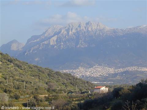
The first hour passes through the green and flat landscapes of the Campidanese countryside as far as Oristano, then at Abbasanta the highway splits into two branches and we take the one for Nuoro toward the East. The landscape begins to become more varied and interesting, we climb in altitude until we reach the junction for Nuoro, and the weather here is absolutely awful, it starts raining from heavy black clouds and my car's thermometer reads an outside temperature of 3 degrees! "Maybe we won't need the swimsuit..." Ste and I think simultaneously, but it's still not certain. We leave the S.S. 131 at the junction for Bitti - Dorgali, following the signs toward the latter. A few kilometers and there appears before us the magnificent view of the Supramonte of Oliena: its high and imposing vertical limestone walls that stand out with Punta Corrasi tower over the town and stir great emotion.
The road then continues, leaving the supramonte on the right and crossing the Cedrino on a bridge that offers a beautiful view again of the supramonte, and climbs with several hairpin turns up to Dorgali, the main inhabited center of the area. From Dorgali we follow the signs for Cala Gonone, which connect to a stretch of the S.S. 125, called the Orientale Sarda, continuing to climb until we arrive beneath the impenetrable ridges of the mountains that separate us from the sea. After just two kilometers there's the junction for Cala Gonone, which branches off to the left, passing through a tunnel that cuts through the mountain from side to side.
As soon as we exit the tunnel it feels like suddenly entering another dimension: from the typical inland landscape with countryside and mighty mountain ranges we pass to a fantastic panorama of the sea, already visible from the clearing at the first curve. The four kilometers of hairpin turns that descend rapidly toward Cala Gonone offer superb panoramas of the town below the mountains and facing the sea, which in the evening, with the sun behind us, takes on the color of the sky, fading into a single indistinguishable horizon. Once in the town center, getting to Mrs. Tendas's premises is very simple: you follow the main street that descends to the port and then turn right onto a small stretch of dead-end road facing the sea, where there are several restaurants and pizzerias, and it ends with a railing that looks out onto a splendid panorama of the coast north of the Gulf of Orosei.
Here is our studio apartment, comfortable and functional, facing the sea and in a very panoramic position where almost the whole gulf is visible from side to side, from the marina of Orosei to the beaches of Cala Luna, to the coast of Sisine and beyond (the beaches can't be seen but anyone who's been there recognizes the distinctive profile of the cliff of each cove). We arrive at 6:45 p.m. after exactly three hours of driving, unload all the suitcases and put the groceries away in our lodging.
The studio apartment is divided into two rooms plus the bathroom on the left; at the entrance there's the table, the sideboard with a complete set of plates, cutlery, pots and glasses (and everything needed for eating), the kitchenette on the left, the refrigerator, a washing machine, a gas stove and an armchair; right in front a curtain separates the bedroom with a double bed plus a sideboard adaptable as a third bed, two wardrobes and a nightstand. We rest for an hour and comfortably prepare dinner, then before going to sleep we dedicate ourselves to an instructive reading of the little book by...., along with other pages printed from the Internet about the treks to do in the area.
The Golgo
Day 217 Mar 2003
Oliena; Monte Maccione; Orgosolo; Supramonte; Montes
We get up nice and slow around 9:30, go out to buy bread and some cold cuts at the first SISA market found going up on the right along the main street of the town, noting that the day is nothing short of awful. There's wind, cold and it's completely cloudy to the horizon, and this invites us to gladly stay in our dear studio apartment in the warmth until lunchtime. We treat ourselves to a nice plate of gnocchi with tomato and mozzarella and decide to go out anyway despite the bad winter day persisting, taking a drive around the surroundings. We reach Dorgali and turn left for the Oliena junction, just over twenty kilometers away on an almost straight road, passing the junction for Su Gologone and Tiscali (where the trek to the nuragic village from Lanaitto begins).
We arrive in the town after about twenty minutes and are pleasantly surprised that in the meantime the day has radically transformed: a strong sun has come out and the clouds have vanished, leaving room for a beautiful blue sky! From the turnoff leading to the "Camisadu" farm stay, where I spent a night with my dear friends Carlo and Mario and our "sensei" master Marco visiting these places in 1999 after an unforgettable two-day trekking experience at Cala Sisine, we take a narrow road with a terrifying slope that climbs up Monte Maccione, a splendid hotel located in the middle of a holm oak grove, right below the majestic and impressive vertical wall of the Supramonte. The hotel seems closed but I had already seen it when I came a few years ago and I remembered the uniqueness of the place, the starting point of numerous trekking groups that stay here.
We continue even higher along the road, which at times becomes unpaved, until it degenerates with vertiginous hairpin turns and becomes impassable. We get out of the car and take a few steps, but we don't go far given the freezing mountain air, just enough time to snap a few photos of the vast panorama and the town of Oliena fully visible below us. We're right below Punta Corrasi, reachable by continuing a little longer on this road, and from where several treks mentioned in my guidebook also begin. It's 4:30 p.m., we still have two hours of daylight, and so we continue along the road connecting Oliena to Orgosolo, just sixteen kilometers apart.
Orgosolo is famous for its magnificent murals, and while we drive around to admire some of them I end up taking a turnoff that leads out of the town, attracted by the road sign that reads "panoramic point." The road turns out to be much longer than expected, and it arrives right above the Supramonte of Orgosolo, offering truly breathtaking and evocative panoramas, very different from one another within a few kilometers. We stop initially on a vast plateau, in front of the sign for the junction to Fonni and Lanusei.
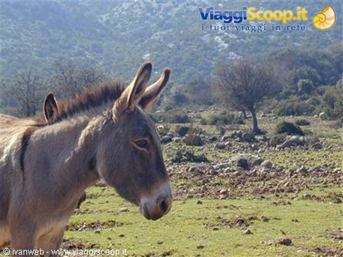
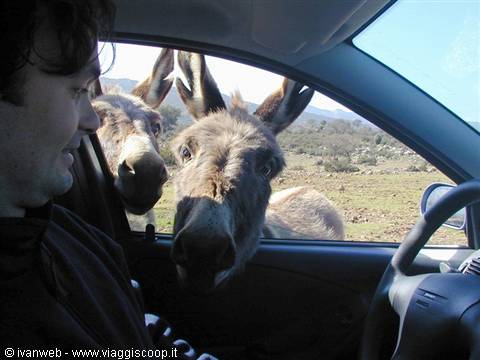
Among the clearly still snow-covered stretches of the beautiful forest, we get out of the car a bit, risking frostbite as we're not prepared for the temperature of 2° C, as my car's thermometer reads! We continue on the completely desolate road, with no dwellings, encountering very few cars, driving slowly and amused by the constant presence of animals that force us to stop, such as cows, sheep and pigs. There are also horses, grazing freely farther from the road. It feels like going back centuries, watching some western film at the cinema set in the boundless American plains, among farms, pastures and lands as vast as they are pristine and wild. The road heads South and the landscape changes again near the view of a lake basin, where the backdrop of the mountains becomes entirely covered in white, which pales with the fast falling of the light.
A few more curves and kilometers and yet another upheaval, with long straight stretches cutting across the plateau and the magnificent view of what should be, according to my reading, the profile of Monte Novo di S.Giovanni. A herd of cows in the middle of the road forces me to stop the car, and it takes a while before they decide to move. After all, this is their land and it's better not to disturb them too much, so I take the opportunity to snap a few photos. To the eyes of a city dweller like me, it can truly seem incredible to see all these animals grazing completely free on a road, without fences or restraints, without worrying that anyone might touch them.
But here no one would dare, as is right, given that among other things we're in a region considered on the whole "hot," where you encounter carabinieri patrols everywhere and which is sadly notorious, unfortunately, for past kidnappings. Fortunately this region is also famous, in sharp contrast to what was just said, for its hospitality and for its genuine flavors, since nowhere else on the island can you find pecorino, sausage and porceddu as good as here, and you can delight in an unforgettable lunch at one of the many farm stays in the area. Without entering into overly complex discussions, I limit myself to thinking, knowing a bit about the customs and traditions of Sardinia, that here the "foreigner" who wants to overturn, modify, and in any way not respect the nature of these lands is not really well regarded in these parts, and here they don't take these things lightly.
To be clear, although I'm Sardinian and come from Cagliari, I'm a foreigner here too... Probably for this reason this is considered, with full marks, the truest and most intact Sardinia, the one that has managed to preserve its territory with tenacity, the one that has never been conquered over the millennia and has magically known how to preserve its extraordinary traditions, customs and habits. Once the passage is freed from the cows, we continue following the road, which ends, after a few kilometers, at the Montes forestry barracks. This whole slope is in shadow and covered by a beautiful dense forest with tall trees, in turn entirely covered with snow that is slowly melting.
We get out of the car for a few minutes, observing the two dirt paths walkable on foot that start from the barracks and that constitute the beginning of some treks by which it's possible to reach the nearby Funtana Bona or farther on the splendid nuraghe Mereu and Gorroppu. It's really cold, the thermometer still reads 2° C and sunset is now near, a good reason to quickly return to the car and take the road in the opposite direction. We stop again to observe the suggestive sunset at the lake, and retrace the magnificent landscapes in reverse, reaching Orgosolo again, where we try venturing by car into the very narrow alleys of the town in search of some mural, then continue on to Oliena, Dorgali and finally Cala Gonone. We arrive at our studio apartment at 7:30 p.m. after a memorable car trip, prepare dinner and choose tomorrow's stops.
Codula di Fuili
Day 318 Mar 2003
Gola di Gorroppu; Baunei, Golgo; Pedra Longa; Arbatax
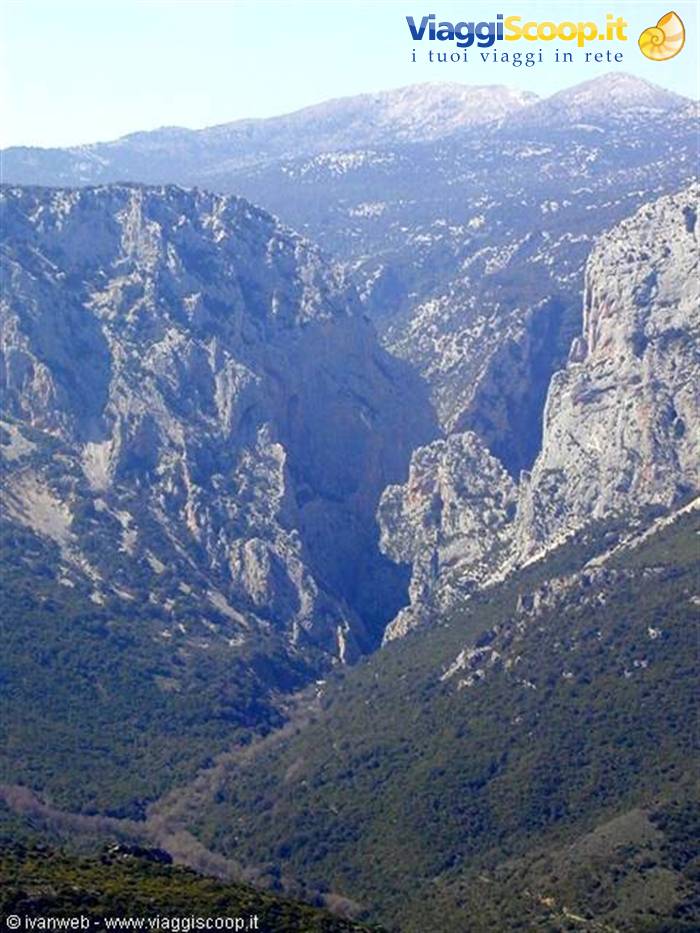
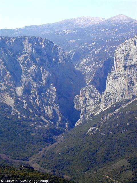
S.S. 125, toward Baunei. It's 46 kilometers of mountain road, with several curves and breathtaking panoramas, no inhabited center and only a few isolated clusters of houses. The first stretch is the most winding and hugs at high altitude the crest of the mountains on the left side, while on the right the view ranges over the vast panorama of the valley, between the mountain range where the S.S. 125 passes and the opposite parallel one of Monte Oddeu, characterized by enormous and vertiginous vertical walls. We stop at a first lay-by to observe this spectacle for a few minutes. Having left the view of Gorroppu behind, the S.S. 125 changes direction toward the East, crossing the pass of Genna Silvana at 1,017 meters.
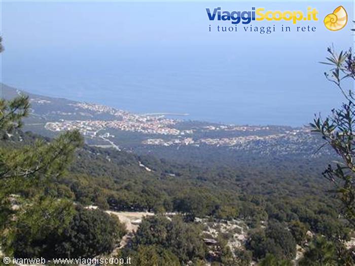
Among splendid panoramas and valleys, we arrive near the junction for Urzulei, recognizable by the characteristic promontory that towers over it, where at a dairy lost among the mountains the sign appears: "Fresh goat cheese," which tempts both Stefania and me not a little to take away a wheel of the delicious cheese. The variety of landscapes is considerable and so are the curves, even if in the last stretch they decrease noticeably. We thus arrive a few kilometers from Baunei, with a view that opens suddenly and ranges for tens of kilometers over the valley, the mountains and the sea in the distance as far as Arbatax. Once in the town, perched vertically in impressive fashion on the slope of its supramonte, the memories of this place begin to come back to me.
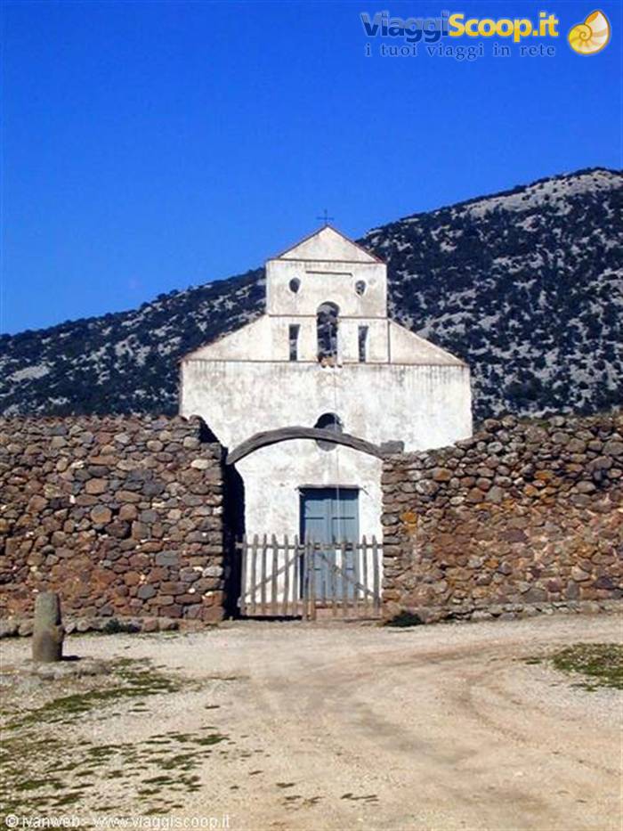
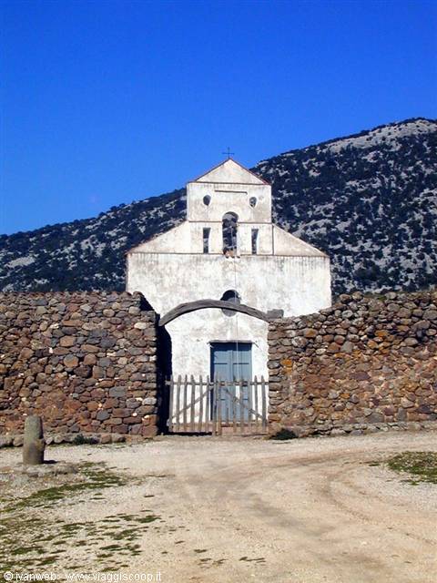
I even remember the incredible soccer field built near the precipice, and I ask myself the same question I asked myself then: "but if the ball falls beyond the net, who goes to retrieve it?!" From the town a sign points to "il Golgo" on a very steep little road, with a series of narrow and impressive hairpin turns, up to the plateau. From here you enjoy a magnificent view of the whole area and a stop is obligatory! Further on the road continues paved and flat for about ten kilometers, giving a first taste of the unspoiled beauty of this place. We arrive at a crossroads, the crucial point of the plateau. First we turn left onto a dirt road that after a few hundred meters leads to the characteristic and rustic restaurant "Il Golgo," open only from Easter until October.
Then we return to the crossroads and turn right where we reach the area called As Piscinas, for its small lakes and pools of water, a primary watering source for the animals. There are several stone tables for a peaceful snack under the trees, and it's full of cows and pigs roaming freely everywhere. We park the car in a clearing and follow the sign for Su Sterru, an impressive chasm with a single vertical drop of 280 meters: frightening! A short path leads to the fence, a necessary precaution to avoid unpleasant accidents for livestock and people, and from a balcony you look out over the mouth of this enormous cavern, managing of course to see only the first few meters of depth before total darkness. A sign explains the characteristics of the chasm, and shows with a photo some
Cala Gonone
Day 419 Mar 2003
Trekking: Gola di Gorroppu from Dorgali
It's a beautiful spring day, and so Ste and I decide to finally go and see the imposing Gorroppu gorge, following the trek that starts near the Sa Barva bridge, reachable from a road at the end of Dorgali or from a turnoff of the S.S. 125 after Cala Gonone toward Baunei which drops steeply down on the right of the valley. We take the latter, which once at the bottom becomes a dirt road and not always in good condition. We cross the small, picturesque bridge over the Flumineddu and turn left, following the signs indicating Gorroppu; the same junction on the right instead leads to the parking lot for the Tiscali trek. After about a hundred metres the dirt road continues to get worse, and we park the car in a lay-by. We start the trek from here at 12:00, knowing that at an average pace we're talking about a four-hour walk round trip.
A little further on, the signs indicate a proper large parking area, evidently created for the busier summer periods: today, instead, there seems to be no one! (after all, it's only mid-March and generally the tourist season here starts from Easter onward). A raised barrier but with a no-entry restriction for unauthorized persons nevertheless prevents cars from entering the dirt road that officially begins the trek, and climbs along the high, impressive vertical walls on the left of Monte Oddeu. Between various ups and downs, the trail remains straightforward without presenting any technical difficulty or orientation issue, since it doesn't even have any forks. You just feel the fatigue from the heat of an almost summer-like day. The panorama opens up on the left over the whole valley, as far as the opposite and parallel mountain chain where the S.S.
125 runs up high, in some stretches visible even to the naked eye. We stop near a hairpin bend that offers a fine view of the Flumineddu, whose winding course you can guess among the green valley precisely from the particular grey-brown colour of the line of trees growing along its sides. Around 13:40 we stop for about half an hour for our packed lunch, beginning to glimpse in the background the high walls that mark the entrance to the gorge. Having finished our snack we continue for another twenty minutes or so, finally arriving near the Gorroppu gorge, which becomes more gigantic with every step. The dirt road ends in a steep downhill little path that forces you to use your hands, where we meet a couple of friendly English people (the only people on the whole trek!) looking rather worn out.
The husband is a good sixty years old and confesses that for his age these experiences are starting to be too demanding... actually, with a certain envy, I hope to reach his age still able to do treks like this! Despite the suggestions of my friend and colleague Stefano, who recommended at this point not to take the wrong path by staying on the right rather than going down on the left, we make exactly the mistake of going straight down to the first little pools of the gorge, since the red paint blobs that pass on the right above the boulders are not at all obvious and it's much more intuitive to follow the path leading down to the pools of water.
We thus arrive at the marvellous little pools right at the entrance of the gorge, which completely blocks the sunlight with its immense walls and which in this first stretch is still very wide and doesn't give the idea of the canyon that follows after. It's quite cold here, unlike the sunny trail on the dirt road, and the water is obviously freezing too, but splendidly transparent and calm with shades of green that let you see clearly the bottom a few metres down. The place is totally immersed in unspoilt nature and sinks into an abysmal silence that's almost gloomy. One can't deny in fact that the mammoth vertical walls that hide the sun's rays, giving a striking backlit effect, instil a certain sense of fear and oppression in the face of such an imposing natural event.
After taking a few photos, we start thinking hard about how to find a way to go on, since the pools block the passage and the only alternative is to make our way among the big smooth white boulders. First of all I leave my backpack near the pool and venture with Stefania among some tree branches, then continue looking for the best spots to climb and scramble over the big boulders. Further on the water disappears completely and the gorge begins to narrow: now you can clearly make out the mouth of the actual canyon, but given the time and the boulders becoming more difficult we turn back. It's here that we realize, climbing back up the little path I mentioned earlier, that on the right there's probably a kind of much easier route among the boulders.
The guides talk about the canyon of the gorge, which anyway ends near other pools that require the use of double ropes and a twenty-metre drop. In any case, by now it's too late even to get that far: never mind, it'll be for next time! We therefore take the dirt road again which, after two hours, brings us back to the parking area and then to the lay-by where we left the car.
Golgo - Church of St.Peter
Day 520 Mar 2003
S.S. 125 heading North: Marina di Orosei; Cala Liberotto; Cala Ginepro; Capo Comino; La Caletta; Posada
After yesterday's long walk, today we opt for a more relaxing day to spend at the sea. The weather is splendid and we go out to do some shopping at the market (including sunscreen!) and then leave Cala Gonone around 12:00, with the intention of visiting some beaches on the northern coast of the Gulf easily reachable by car. At the end of the usual hairpin bends and having emerged from the tunnel we turn right toward Dorgali, continuing on the S.S. 125 toward Orosei where we arrive in about twenty minutes. From the village you follow the signs and arrive at the Marina di Orosei, a very long and beautiful beach of white, clean sand.
Even though there is in fact a rather cool breeze, it's hard for me to believe that on a sunny day like this there isn't a single person on the beach, even just to take a walk! We walk a bit on the deserted sand, leaving footprints as if we were the first to land on the moon, take a few photos and resume our journey on the S.S. 125 toward a more sheltered cove for lunch. Above Orosei the landscape changes sharply from the supramonte: the massive reliefs disappear, giving way to gentler, modest hills and to the plain. After half an hour we arrive at Cala Liberotto, a typically touristic locality of little villas, hotels and resorts, most still closed since the season starts at Easter. We park the car at the end of the asphalted road that leads straight in front of a cove and take a look around.
The beach in front of us is still full of seaweed (it will surely be cleaned with the arrival of summer), but on the left, passing through a lovely green meadow with several junipers, you reach another cove, much more beautiful than the first and well sheltered, where we immediately decide without hesitation to stop for lunch. We choose a small promontory covered with Mediterranean scrub and a few junipers to refresh ourselves, in front of a classic and always wonderful panorama usual in Sardinia: the blue of the clear and transparent sea below, the small deserted white beach and a few beautiful little villas behind. What better view to relax?! After about an hour we gather our courage to leave Cala Liberotto and continue further north, finding just a couple of kilometres later, practically next door, Cala Ginepro, which is nothing other than the continuation of the first.
This one appears even more beautiful though a bit more exposed to the wind. You arrive by passing beside a marsh and parking under a splendid shady pine wood (which in summer with the atrocious heat must be really something!). Having crossed the pine wood on foot you reach the beach of fine sand of a blinding white, lined behind by splendid specimens of junipers from which obviously the cove itself takes its name. The seabed is very shallow for several tens of metres beyond the shore and the sea crystal clear, and once again the place is completely deserted: what a superb idea to tour Sardinia in the low season! Back at the car we take a few inland roads, noticing several splendid hotels, a few campsites and an endless number of little villas, which make it quite clear that in summer this area is certainly very vibrant and offers tourists a vast choice for an unforgettable stay.
The typical features of the Gulf of Orosei have completely vanished, and now the harsh and wild coves, surrounded by high walls and difficult to reach, are replaced by wide beaches perfectly organized from a tourist point of view, and immersed in a landscape already very similar to that of the more northern Costa Smeralda. We emerge again at Cala Liberotto, take the S.S. 125 again and continue further north toward the next destination, which is Capo Comino. The road passes inland, the coast is no longer visible for several kilometres and the panorama is anyway always beautiful and unusual. We follow the signs indicating the turnoff toward the sea, and we find ourselves on a secondary road that we drive all the way along, skirting the sea until the end of a square.
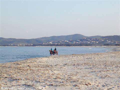
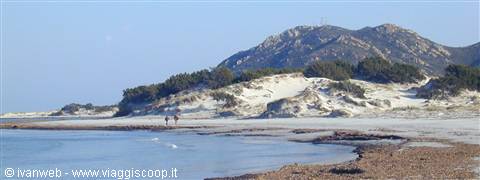
We've definitely gone too far, so we turn back to where we saw some high sand dunes in the background: the beach of Capo Comino is right there, even though no particular sign indicates its entrance, and unlike the previous ones there don't seem to be hotels or tourist resorts in the surroundings. We leave the car in an open area where the asphalted road ends, in front of one of the entrances to the enormous beach. The special feature is the beautiful high sand dunes and a very long coastline, where finally you see someone taking advantage of this beauty and enjoying a romantic ideal walk before sunset. After a short stop, we continue along another stretch of the S.S. 125 as far as La Caletta, a proper inhabited centre and not just a tourist spot, reaching the sea and yet another splendid beach, where two men gallop freely on horseback while we take a few photos.
The last stop is Posada, where we're just in time to take a stroll through the cheerful little town before joining the S.S. 131, the island's main thoroughfare which quickly takes us back to Nuoro. We turn off before arriving at the junction for Dorgali and return to the supramonte, as far as Cala Gonone. Before reaching the village, we try to find the road that leads to the Buchi Arta sheepfold, from which starts the shortest trek that reaches the codula di Luna and then the beautiful cove. Stefano Ardito's guide mentions a turnoff halfway along the coast without giving any indication; it probably hasn't been updated yet, but we gather that the road he names is the one with a clearly visible sign leading to the Nuraghe Mannu, where today a renowned farm-stay has also been built.
We take it and drive a few hundred metres, until we reach the Codula di Fuili, after which we turn back almost frightened by this narrow road at nightfall with a sheer drop on the left side to give you the shivers!
Gorroppu Gorge from S.S. 125
Day 621 Mar 2003
Codula di Fuili; Orune and Su Tempiesu
Given the very welcome persistence of the good weather, uninterrupted since the first day we came, we set off with the idea of going to Cala Luna, reaching the Buchi Arta sheepfold via the road glimpsed yesterday. Going up from the village, after the first U-shaped hairpin bend, the turnoff appears with the Nuraghe Mannu sign, and after a few hundred metres the road becomes enormously striking: the surface is freshly asphalted and the width is that of a single lane even though it's driven in both directions. On the right there's the mountainous wall, with several stones on the road surface that suggest easy erosion and friability, and on the left, with no guardrail at all, a very high ravine plunges shear into the colossal and impressive Codula di Fuili.
You can see in the distance, at the end of the codula, precisely the white little cove of Fuili embracing the blue sea: this is the most spectacular point which certainly deserves a few photographic shots! We continue for a few hundred metres, while the canyon disappears and the road becomes a dirt track, at times quite uneven. We come across roadworks with workers and bulldozers, and we ask for information. We discover that we've already passed the turnoff for the sheepfold, which stays on the left just after the end of the asphalted road, but unfortunately that stretch is now closed precisely for repair works. We turn back a bit disappointed and leave Cala Luna, opting for another destination that intrigues us: the sacred spring of Su Tempiesu, described very well as an extraordinary example of Sardinian archaeology, which has remained intact and was discovered recently.
Following the directions of our guide "A piedi in Sardegna Vol.1" and those of the Sardinian archaeological map of the ESIT, we head toward the S.S. 131, though following the old parallel branch (the two roads are much the same but we discover later that it's much faster to take the S.S. 131). We turn off at the junction for Orune, driving along a road full of curves but extremely scenic that leads to the village after about ten kilometres. From a distance the built-up area seems literally perched on the top of the mountain, with a view from the terraces of the houses that must be nothing short of spectacular.
We don't know whether there's an asphalted road leading straight to the spring, since one guide mentions a nice unmarked trek to reach it, while another mentions a white dirt track in broken-up condition, which means, being in Sardinia, certainly not driveable without a 4x4, while it mentions a new road still under construction. In reality the latter exists and is very much finished! We immediately find the signs for Su Tempiesu at the beginning of the village, which lead to a road that descends with still quite a few curves, and arrives right in front of a building complex, still under construction, the headquarters of the cooperative that manages the precious monument.
We leave the car and ask for information from a friendly gentleman, named Peppino, who explains that to reach the sacred spring you have to follow a path of about 800 metres downhill (and therefore uphill on the way back, with this heat!). The guide is still down there with some tourists and, given the time (it's 1:00 pm), it's presumed that on her return she'll stop for lunch. "No problem" we think, "we're hungry too and we have our nice sandwiches ready", but Peppino insists on taking part in a small banquet organized for the German lady who is visiting the spring right now: never refuse hospitality in these parts! So we gladly accept this cordial and succulent invitation, already knowing we'll have to taste the typical culinary wonders of these areas. Meanwhile the guide comes back, a young and friendly girl who immediately introduces herself as Maria Grazia.
We visit the interior of the cooperative, just born, which will take over the management of the monument for another two years. An exhibition dedicated to sacred wells is being set up, where a miniature reconstruction depicts that of Santa Cristina and this one of Su Tempiesu, of which she anticipates for us the features of the partly unroofed roof. There's also a perfect cast of a massive nuragic complex, found recently between Nuoro and Orani, and which unfortunately collapsed entirely for causes that weren't exactly natural...
It's getting to 2:00 pm and we're ready to have lunch all together, postponing the visit to the spring; we also meet the other members of the cooperative, and after a few minutes we all find ourselves cheerfully seated at the table chatting about this and that, together with the German lady (who is none other than a tour operator intending to bring a bit of tourism to these parts) and a cordial gentleman acting as simultaneous interpreter. The hospitality we receive is unequalled: we're offered at the table a very good red wine (and strong!), prosciutto crudo and sausage, as well as the inevitable Sardinian pecorino. All the products are of an exaggerated and genuine goodness, exclusively homemade and not available for sale anywhere.
The friendliness of Peppino and all the members of the cooperative make you feel for a moment just like you're at home, as if you'd known each other for a long time, ruling out any hesitation of embarrassment or shyness at finding yourself in a new place with people never seen before. This is what in Sardinia they call hospitality, and it's one of the justly recognized values that make it prouder and more proud in the eyes of the whole world: true flavours and genuine values, of a land capable of astonishing and surprising anyone who has the fortune to visit it in depth.
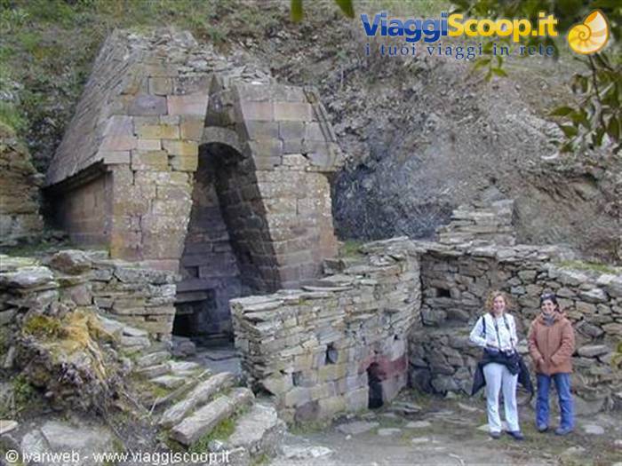
After enjoying a lunch like few in my life (so much for a snack, Peppino!), as well as drinking a for me unusual amount of house red wine that makes its effects felt, we can finally go and visit Su Tempiesu, going down with Maria Grazia along the pleasant path that makes up a veritable botanical itinerary with the description of the local flora. We arrive in front of the sacred spring, where we're told the story of this precious Sardinian monument, which presents architectural solutions unique in the context of well temples. It was discovered by chance in 1953 by the landowners and restored in the eighties, rebuilding its roof which had remained partly unroofed by a landslide. The latter allowed the preservation of the spring, covering it in the Iron Age and hiding it from man until our days.
The temple is built with volcanic stones transported from afar, presents two singular monolithic arches that embellish and reinforce the internal walls, and the base has a paving with a settling basin that collects impurities keeping the water always crystal clear. We remain astonished and attentive at these precious clarifications from Maria Grazia, after which we head back, climbing back up with no small effort along the path, weighed down as never before by the exquisite lunch. We also take a few photos at the cooperative with the whole friendly group, to remember this beautiful and instructive day in Orune, and then get in the car and return to Cala Gonone
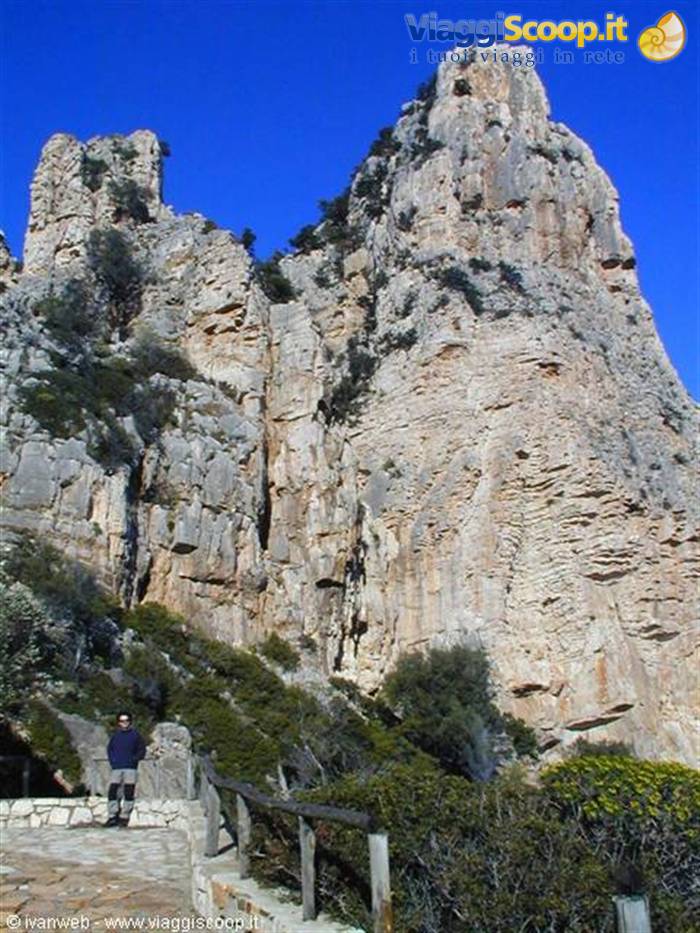
Pedra Longa
Day 722 Mar 2003
Trekking: Golgo - Cala Goloritzè
After buying what we needed for a comfortable packed lunch, we get in the car at 10:00 and take the S.S. 125 that connects Cala Gonone to Baunei. Halfway there, near Urzulei, we stop at the same dairy we saw a few days ago with the sign "Caprino fresco" (fresh goat cheese), and this time we don't let it slip away. We buy a nice two-and-a-half-kilo wheel of exquisite Gorroppu goat cheese and place it in the cooler bag we brought specifically for the occasion (and to keep the precious cheese from melting on a hot day like today!). We continue to be amazed by the variety of beautiful landscapes this road offers in just 46 kilometers of driving, until we reach Baunei, where we head up above the Golgo, following the signs for Goloritzè at the crossroads after about ten kilometers.
We stop near the As Piscinas pools to feed some piglets with all the leftover bread we brought along: at first they're a bit wary, but once they get going they devour everything, the little rascals! At noon we leave the car in a clearing next to a fence, almost where the dirt road ends near a wooden sign indicating the start of the trek to the famous cove. At first the path crosses through vegetation and tends to climb for about twenty minutes over a cobblestone pavement, making the walk more strenuous and requiring more caution than usual. You're immediately struck by this semi-lunar landscape created by glimpses of all these endless stones, one on top of the other, where only the junipers manage to grow, contrasting with their white.
The path is one-way and presents no orientation difficulties (the direction to follow is always north); in some sections it is literally built by gathering the stones on the ground, creating characteristic dividing walls to follow a direction and not get lost in the rocky expanses. Once we reach the top of the plateau, the descent begins through the Bacu Goloritzè, with a splendid, wide view of the gully and the blue sea in the background. The path descends steeply, always over the intrepid cobblestones, which encourages careful footsteps and makes good trekking shoes a must. The sea gets closer and closer, and along the way we come across charming shepherd's shelters, also used for camping overnight, as well as branches and trunks of centuries-old trees in the middle of the path that make the trek fun and unique.
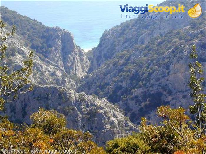
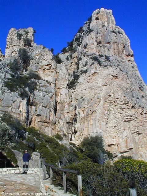
The surrounding landscape is majestic, superb, harsh and wild, incredibly lonely, with the mighty limestone walls of the gully towering over the place, full of caves, isolated trees growing in impossible spots, and in the most absolute sense there is only one sign of civilization, excluding the shepherds' shelters built into the rock itself in a completely natural way. At a certain point we pass through a characteristic natural rock arch, and continuing for about twenty minutes we finally catch sight of the tip of the Aguglia, a 120-meter-high limestone rock tower, the coveted and favored destination of the most die-hard climbers. We continue descending while the Aguglia grows taller and taller before us; we notice a rest area with wooden tables near some recessed walls, and a little further down, beside the Aguglia, we are enchanted by a beautiful view of the cove in front of us.
Unfortunately the weather has turned and in just ten minutes everything has clouded over, but the colors of the sea are quite beautiful even like this. Before reaching the steep ladder rigged into the rock that descends to the cove, we cross paths with two guys coming back up and heading back, and we discover with immense astonishment that they are the only two around! Carefully we descend the ladder that ends on a rocky floor and there before us is the sea, with the small beach made up of tiny, smooth cobblestone jewels.
The sight is extraordinary and unique of its kind and makes this the most evocative cove I know here in Sardinia: on the left a group of boulders marks the boundary of the cove, close to the very high vertical walls to the north where, just behind, there is another legendary beach, that of Sisine; in front, the crystal-clear sea that, as soon as the sun comes out again, incredibly takes on all the varieties of blue possible and imaginable and lets you see the entire seabed thanks to its perfect clarity; on the right, instead, you admire the singular natural rock arch over the sea, which makes Cala Goloritzè so famous and is photographed in every possible way in any magazine of Sardinian beaches; in the background, finally, the view of the Aguglia towering over the cove is remarkably impressive, and from a certain angle of the beach it almost looks like the mouth of an immense shark.
Everyone who describes this trek, or even just the cove, rightly speaks of a series of natural features that alone are worth the trip, but which all together make this place unique in the world: I can only fully agree, adding that, in my opinion, one important detail remains the difficulty of reaching Cala Goloritzè, and the immense joy of being able to share it with few people or, in lucky cases like today, even alone! If mass tourism arrived here, the magic of this place would quickly vanish and its beauty would be tarnished by the usual footprints of human civilization, as is already happening at Cala Luna.
After 1 hour and 40 minutes of descent, then, we can finally stop for lunch: we spread my usual waterproof blanket on the ground, in this case on the cobblestones of the beach which, despite not being real sand, are very comfortable, and we eat our packed lunch immersed in the full relaxation of such a surprising and pristine place. Meanwhile the sun comes out strong again, the clouds disappear, the sea takes on magical colors: this paradise is all ours alone! We soon realize that unfortunately the sun won't last long, since the cove faces east, the high vertical walls behind it block it no later than 3:30 PM. We stay until the beach is covered by shadow, and armed with courage we climb back up the path along the exact same route.
The return is decidedly more tiring, uphill with a fair gradient, for 1 hour and 30 minutes until we reach the top of the gully to merge onto the Golgo plateau. Another fifteen minutes separate us from the car, which appears in the distance in the middle of the plain in a splendid, wide panorama. From here we head back, exhausted and fulfilled, to Baunei and then to Cala Gonone via the S.S. 125. For dinner we opt for a classic takeaway pizza, but the feat isn't quite as easy as it seems even though it's Saturday night, since in low season restaurants and pizzerias can truly be counted on one hand around here. On the advice of Mrs. Tendas, with whom I have a nice chat, I luckily find "L'Angolo Blu" on a side street off the main road that crosses the town, and I order the pizzas we wanted.
Su Tempiesu
Day 823 Mar 2003
Heading back
Our trip ends this morning, we really have to pack our bags, give the studio apartment of Mrs. Tendas a quick clean, and hope to return as soon as possible to see other wonders that this area of Sardinia offers kilometer after kilometer. We have lunch with a nice plate of penne with Genoese pesto and leave at 3:10 PM, arriving after 260 kilometers and exactly three hours of driving, finally in Cagliari.








0 reader comments