.…He rushed to the sheet of paper and, with sparkling eyes and a moved voice, read the whole document, working back from the last letters to the first. Here is what was written: “…Descend into the crater of Yocul of Sneffels that the shadow of Scartaris comes to graze before the kalends of July, bold traveller, and you will reach the centre of the earth. And this I have done.” Arne Saknussemm. From “Journey to the Centre of the Earth” by Jules Verne.
A fantastic place, one of those you don't see every day. At the edges of Europe, up there where you think ice and cold rule, here rivers of lava, boiling pools, bubbling mud and anything else that resembles hell become just as much the protagonists. This is Iceland, a land where ice and fire are so close together that they have given rise to great disasters, to veritable demonstrations of nature's power. It is a land that, with its beauties, stirs anyone who goes to visit it.
It isn't a holiday suitable for everyone: because of the weather conditions, which when adverse are truly difficult to face. Because of the road to travel: a lot if you want to see the main locations, and to move a little away from the ring road, which is rather busy in August. Iceland, in fact, isn't small, and given also the speed limits and the type of roads to face, the times often stretch out. Because of the costs: it's well known that it isn't exactly a cheap country. All these things together mean that, having to watch your budget, you end up either cutting a few days of visiting, or looking for more spartan accommodation to save something and therefore, consequently, adapting. Obviously if you don't have budget problems these issues don't arise!
INGREDIENTS FOR THE TRIP.
GUIDES:
We brought 2, the usual ones we use when we travel, Lonely and Rough. Both well done. In any case it's always worth having a couple with you, to make up for any gaps in one or the other.
ITINERARY:
It took a while to decide on the exact itinerary, since the guides list many things to see. In the end, following the advice of other visitors, we created one tailored to us, taking into account the 14 days we had available (including travel there and back). We skipped the visit to the capital entirely, considered of little interest by most of the people who have been there. Not loving nightlife and museums, we're convinced we made the right choice. In the loop we also included the western fjords, advised against by many because they're far away. A choice amply repaid!
FLIGHTS:
Today there are 2 alternatives to reach Iceland by air: a direct flight with IcelandAir from Milan (cost around 800 euros per person return), or the now well-known IcelandExpress, which however doesn't fly from Italy. In the end we find a good solution via London Stansted with Ryanair in connection with the IE flight to Keflavik, the whole return trip costing us a round 400 euros per person. Not bad!
ACCOMMODATION:
Once the return flights were defined, we bombarded guesthouses, hotels, b & b with emails, to find the best fares in the places where we had decided to stay. Within a week, we had received, all in all, most of the replies, and we made the bookings. For some a confirmation email was enough, for others it was necessary to send the credit card number. We looked for decent accommodation (no luxury, then) but with a private bathroom. Anyway, 3 nights we did with a shared bathroom because there was nothing else. Going on these medium-low standards, we spent on average 120 euros a night for a double, always with breakfast included. Not little!
CAR:
The other big blow comes from the car rental. A small car for 13 days is around 700 / 800 euros, depending on the offers, the rental company etc..... Since everyone who came back from there regretted not having taken a 4x4, in the end we did the crazy thing, and for a round 1530 euros, including SCDW, we rented a Suzuki Jimny from Geysir, a company that doesn't have an office at Keflavik international airport, but in a town a few kilometres away. In the end the 4x4 turned out to be a smart choice, since we were planning to do quite a few kilometres of dirt road, and maybe the track to Landmannalaugar. If you plan to travel only the ring road without particular detours, a perfectly normal car is more than fine, since the road is by now almost all asphalted (apart from a few kilometres in the eastern fjords), and you save 1000 euros easily, not counting the lower fuel consumption.
PAYMENTS:
We didn't exchange a single euro from Italy; we set off with a traditional credit card, a prepaid card and a debit card. In the end, apart from the rental, we paid everything, absolutely everything, with the prepaid card (Visa Electron), accepted everywhere, even for tiny expenses of a few euros, even in the most isolated areas of the country!
To see all the photos of the trip:
Day 110 Aug 2007
BG - LONDON - KEFLAVIK - SELFOSS.
The first day is rather gruelling: wake-up at 02:45 at night, to catch the 06:50 flight at Bergamo. The arrival at Stansted at 07:45 is right on time. At the Iceland Express check-in, on the boarding pass they leave you a green sticker that says "Fast Check," which the clerk however hasn't explained to us; with that you can avoid all the monstrous queues at security checks, which are very meticulous as expected, simply by going through the side entrance showing the boarding pass to the attendant. The second flight is also right on time; at 14:40 we land on Icelandic soil. Desolate landscape, the peninsula (Reykjanes) on which the airport sits is flat, no hills to be seen, and not many houses either.... the ground is black as pitch, the clouds low and threatening. It doesn't seem a very welcoming place.
The luggage, thank God, arrives, and so we walk down a long corridor full of big backlit panels advertising the beauties of this land. We immediately meet the Geysir representative, a boy who's barely 18, holding a portable POS and the car rental contract, which we sign on an airport bench. We pay and another young lad immediately accompanies us outside where, parked right in front of the exit, is our Suzuki Jimny. We get in for a brief explanation, and I immediately notice the car doesn't have a full tank of petrol; I point this out and have him write it on the contract copy. Not the best of starts! An icy wind is blowing, we load the suitcases and set off immediately; we're in a no-parking zone and the last thing we need is a fine just after arriving. The first kilometres behind the wheel confirm the impressions at landing.
The area is an immense expanse of solidified black lava, in bizarre shapes, covered with moss and lichen. In the distance you can see the towns of Keflavik and Njardvik, on the coast. We continue on the highway, which looks like a motorway, and take the turn-off towards the Blue Lagoon. Enormous columns of white smoke, lava fields everywhere with rivulets of water of a blue never seen before flowing among them. It's the most visited place in Iceland..... and you can see why. It's magical. It feels like being in front of the landscape of a fantasy film, with unreal colours and atmosphere. We arrive at the big car park, and immediately notice lots of cars and coaches (the only jarring note, a bit too many people!!) Even the lagoon outside the facility is worth the visit on its own, with its colours, the water's shades ranging from the most intense blue to white.
We take loads of photos, also taking advantage of a ray of sun peeking through the clouds, then a quick peek inside, where besides the entrance to the pool there's a restaurant and a rather expensive souvenir shop!
BLUE LAGOON RATING: 9
There's time for a swim, we'll come back on the last day; now we head to our first destination: Selfoss, where we'll stay 2 nights. From Keflavik to Selfoss it must be about a hundred kilometres, but unfortunately we go round the Reykjavik bypass, which slows us down a lot; we can't wait to get out of the traffic chaos we find ourselves in; besides, people here seem to drive quite fast and pay little attention to the speed limits on the road. We arrive in Selfoss after passing only a few lovely stretches among green volcanic hills that remind us very much of certain Scottish landscapes. We stay two nights at the big campsite in the centre of town, in a wooden bungalow with kitchen and bathroom. The owner warns us that he won't be able to give us breakfast because a large group of families has just arrived and is occupying the whole dining room.
Discount on the room, shopping at a nearby supermarket (in all of Iceland a couple of chains close at 23:00, very handy!!), a quick dinner at one of the many fast-food places found everywhere (prices are more affordable, with 10/11 euros each you get burger + fries + Coke), fill up with petrol, buy a map at a service station and then off to bed while outside it's still light. Total darkness only comes around 23:00.
Wake-up at 07:30, the sun has been flooding the room for hours now..... perfect, we decide to go to Landmannalaugar: those who've been describe it as one of the best memories of Iceland, we can't let it slip by on such a beautiful day! The road to get there is long; as far as the Hrauneyjar dam it's all tarmac, and as you leave the coast behind, the green hills dotted with many farms, little white and red churches, and many horses give way to the endless lava fields left by the eruptions of Hekla, the mountain we see on our right whose summit is covered in clouds. Once we reach the Hrauneyjar hydroelectric station, the tracks suitable only for off-road vehicles begin. We follow the easier one, also recommended by other tourists.
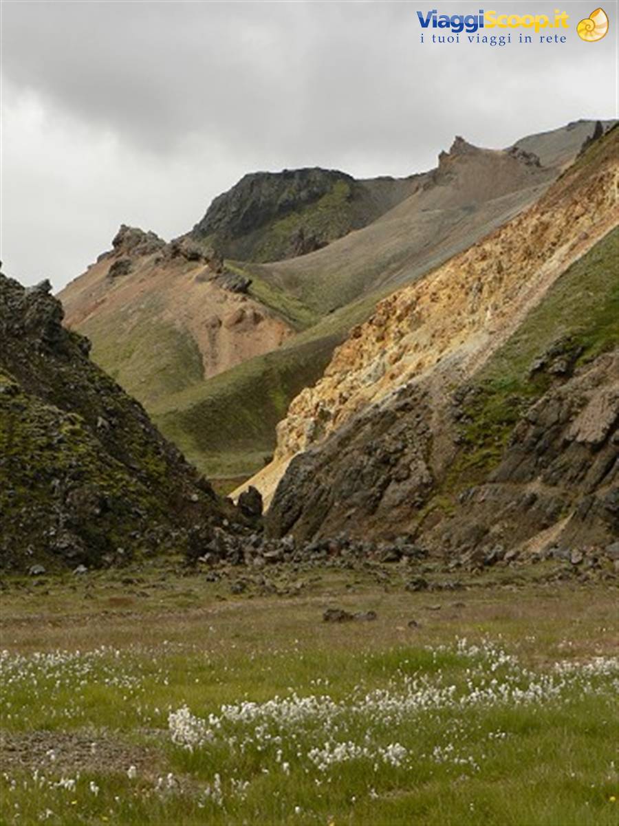
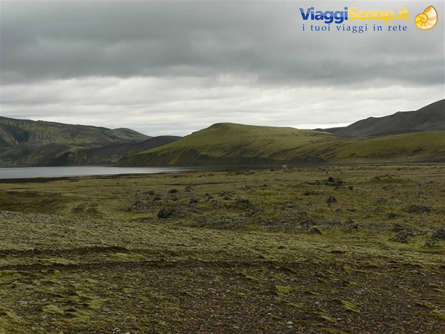
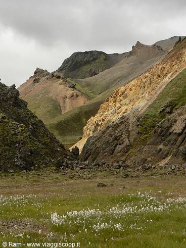
Although it presents no difficulty, the road is full of potholes and undulations that make the journey unpleasant, and above all it must be driven at reduced speed to avoid risking breaking something. The places we pass through offer desolate panoramas, and you realise how impossible life is in the interior. We stop often to take photos, even though here the sky is overcast and grey. We drive around black mountains with streaks of fluorescent green moss, fascinating. After at least an hour of dirt road, views of orange-coloured mountains open up, and following the ever-present signs, the road ends in a wide clearing before a river. We've arrived! We don't ford it, but park near other off-road vehicles, and reach the camp on foot, crossing the river on a couple of little wooden bridges.
The place is unusual, a green valley with hot pools and streams from which whitish steam rises, surrounded by lava flows, grey, black and orange mountains, from whose sides you can see many fissures giving off smoke. Here there's nothing but a hut and an adjoining campsite. Amphibious coaches come and go continually, and one of them leaves behind a large group of Italians. We imagine that the trails setting off from here to explore the surrounding areas must be tiring but beautiful, as the guides say. For the day-tripper, the best thing consists of a refreshing dip in the hot pools near the campsite, since here, at least in August, there's a bit too much coming and going. We were left with a slight sense of disappointment: compared to what other travellers reported, we didn't find the place of indescribable beauty, also given the road you have to take to get here.
Mind you, not that it's ugly, quite the opposite. But not breathtaking!
LANDMANNALAUGAR RATING: 8
On the way back, by now it's late afternoon, we detour towards two of the Golden Circle destinations: Gulfoss waterfall and the Geysir geothermal area. The first is a beautiful waterfall, which in the sun also rewards you with enormous, colourful rainbows. Beautiful!
GULFOSS RATING: 7.5
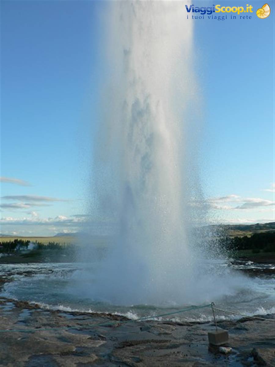
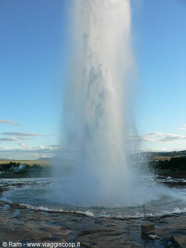
A few kilometres from Gulfoss, on the right side of the valley, is the Geysir area. There are several pools of boiling grey mud, pools of very blue water, and the only active geyser, Strokkur, which every 4/5 minutes shoots big jets of boiling water 20 metres high. It's a very particular phenomenon, worth observing several times, also to be able to get good photos. The walk among the pools along the paths is pleasant anyway.
GEYSIR RATING: 8
Landmannalaugar
Day 312 Aug 2007
SELFOSS - KIRKIUBLAEKLAUSTUR
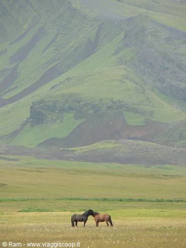
Wind and bright sunshine accompany us early in the morning as we leave Selfoss, heading South-East. We cross several meadows with many horses, of various breeds and colours, some truly very beautiful. We try a detour towards Porsmork. Unfortunately the Myrdalsjokull glaciers are covered by threatening grey clouds that are slowly approaching. It starts to rain, the road is no longer tarmac, so we stop at the foot of some waterfalls for a few photos, before turning back and continuing, next stop the Seljalandsfoss waterfalls. They're clearly visible from the Ring Road, and worth a quick stop. Nice but nothing exceptional.
SELJALANDFOSS RATING: 6
A few kilometres later, with the sky now overcast and a light drizzle falling, here we are at Skogafoss waterfall. This one is truly beautiful, majestic and very tall, with a great flow of water. There are people climbing the right side of the waterfall up to the top; from up there it must surely be beautiful. We prefer to stay on the ground, we don't have much time, we take a few photos and then set off again towards the Dyrholaey cliffs.
SKOGAFOSS RATING: 8
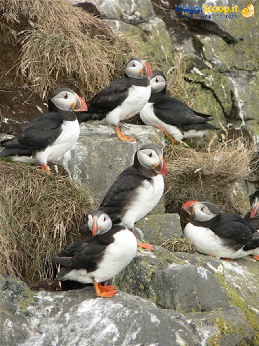
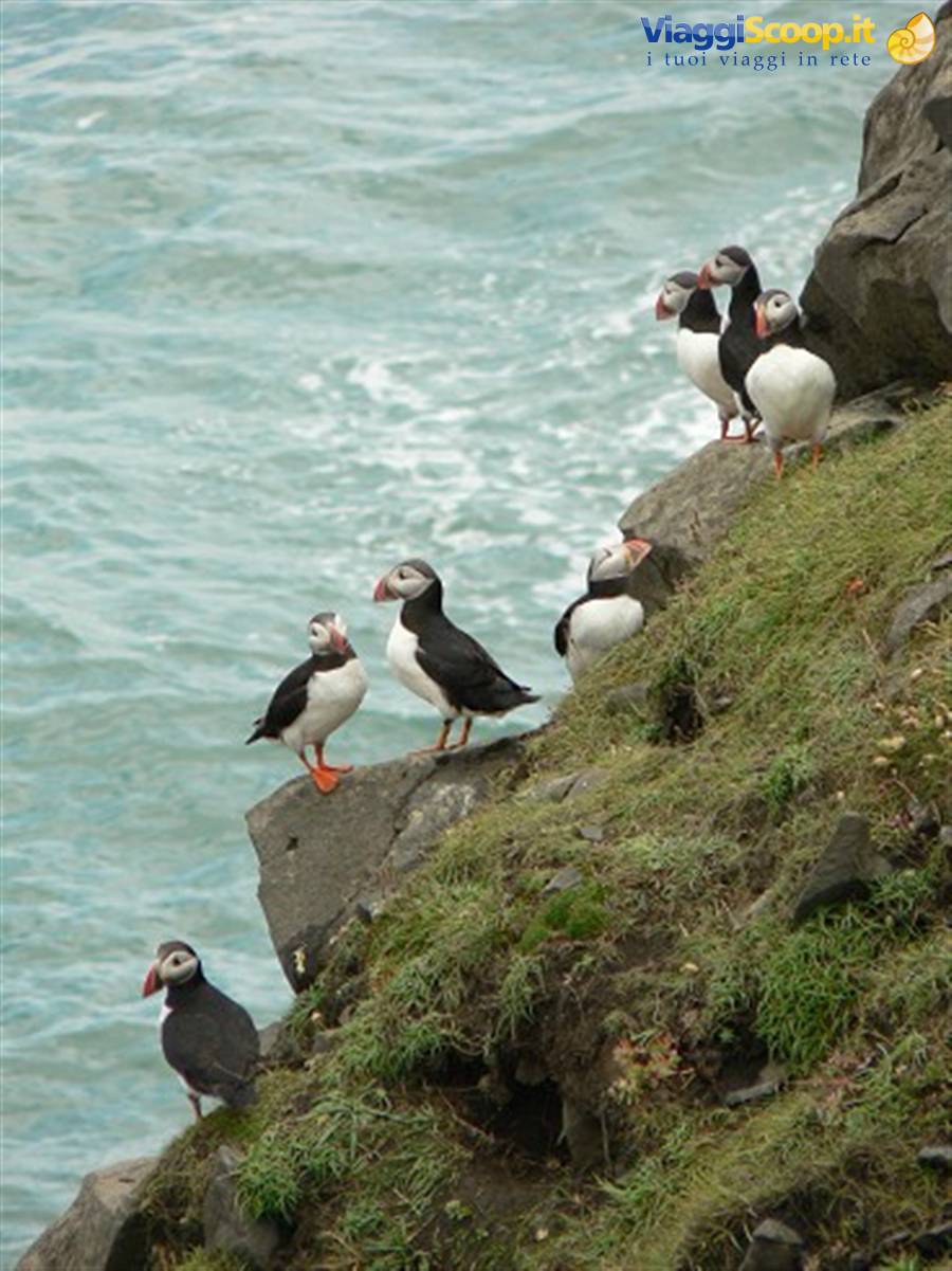
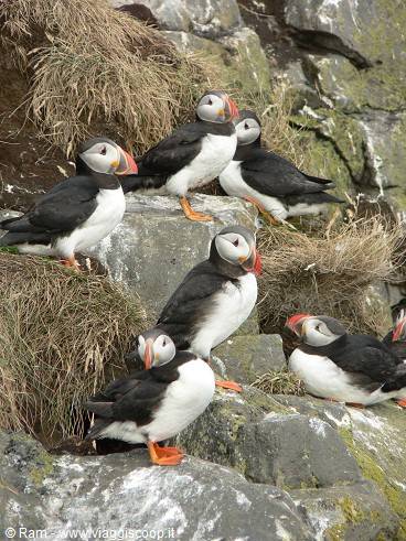
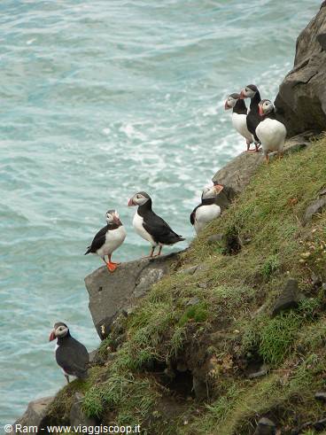
Shortly before reaching Vik, here's the turn-off for the Dyrholaey cliffs. The road isn't tarmac, it has rained recently and it's rather muddy. Shortly we cross lava fields and arrive at a car park. We're here essentially to see the puffins. I was a bit sceptical, and yet we manage to see huge numbers of them. And above all up close, a metre or little more away from us!! There are no coaches parked, and indeed there must be about twenty people in all admiring the spectacle. We get out at once and take dozens and dozens of photos! They're hilarious animals, a cross between a bird and a penguin, and they're very clumsy when they launch into flight and then land! Then, reading how the Rough Guide describes them, you really split your sides laughing! The place is also stupendous, the most beautiful seen so far on Icelandic soil.
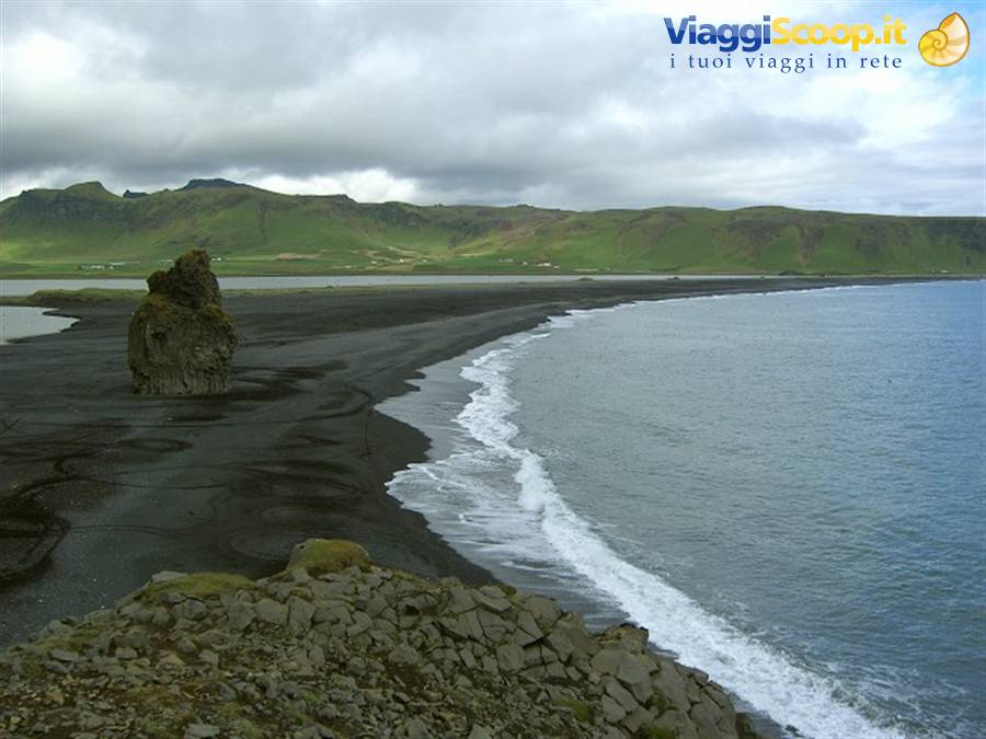
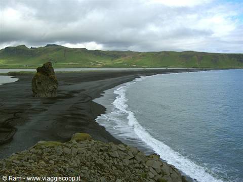
A long black beach, with a large sea stack in the middle; hundreds of birds flying everywhere. The green of the hills in the background and the blue of the ocean all around. Many rock formations, including an arch, out in the sea. We'd stay there for hours, but unfortunately the arrival of one of the usual coaches unloads about fifty people who invade the area, and since it starts to rain, we leave.
DYRHOLAEY RATING: 9.5
Soon we reach Vik, we make a quick detour just to see the famous beach. We wander a bit through the streets of the little town, half-deserted today as it's Sunday, a grey and cold day, everyone must be at home in the warm..... and yet here are some blond Icelandic children playing happily! We reach the beach and take a few photos. It's very particular, fairly fine sand, but black, black, black. A couple of steps along the "seafront" where we find a couple of people, lots of birds as usual, and in the distance you can see dark sea stacks. Maybe it's the day, maybe it's that there's no one around, but I quite like this little town: the little white and red church on a hill, tall and very green mountains right behind, few people about..... a shame only about the cold!
VIK RATING: 7.5
Vik is the last thing to see today. We do a couple of hours of driving crossing long lava deserts covered with thick green moss, the sky clears and the sun reappears, granting us some beautiful views around. We arrive at Kirkjubaejarklaustur, where we find our hotel at the end of a small valley. Very nice (and rather pricey), it will remain one of the best places to stay of the whole trip.
Geysir
Day 413 Aug 2007
KIRKIUBLAEKLAUSTUR - JOKULSARLON
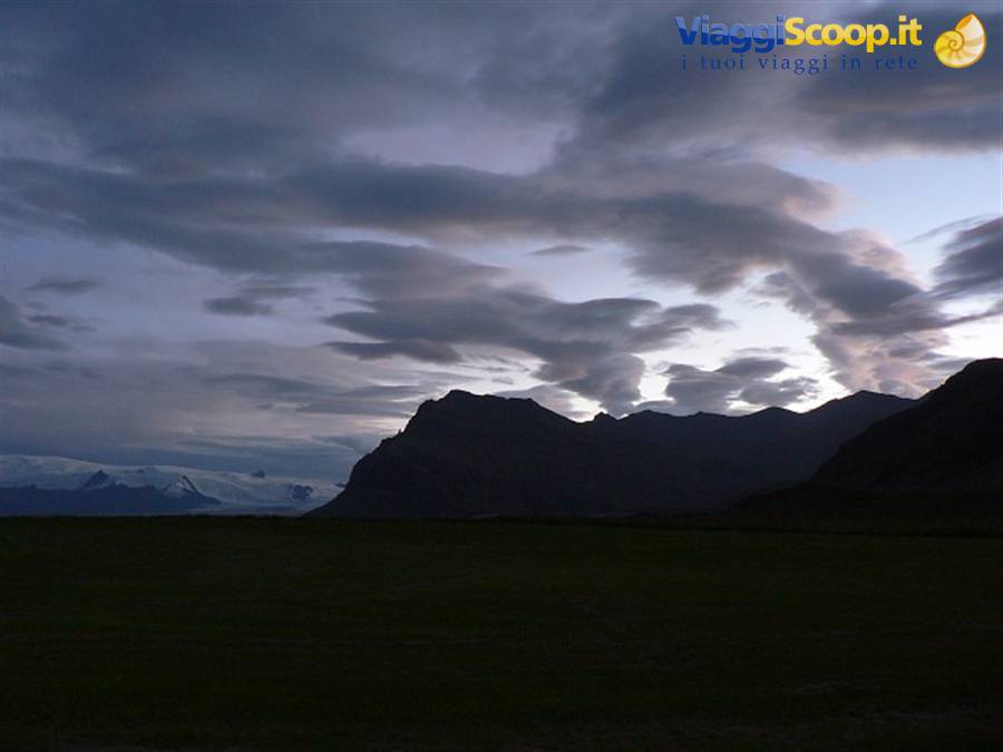
Today's a short drive, so we get up a little later than usual and have an excellent breakfast buffet. We briefly visit the little church of Kirkiublaeklaustur, fascinated by the story of the "Fire Sermon" we read about in the guidebook, which happened some time ago during a major eruption of the Lakagigar volcano behind the village. The usual morning fill-up at the village gas station, and off we go, crossing the long, grey Skeidararsandur, created by the disastrous eruptions that took place beneath the imposing glaciers of Vatnajokull, the largest glacier in Europe, which gradually comes into view on our left.
As the guidebook says, Iceland, and this area in particular, is at risk of "jokulhlaup," a destructive phenomenon that occurs when incandescent magma escapes from the earth's crust beneath a glacier, which melts rapidly from the heat, creating enormous underground lakes that then spill out over the surrounding land, carrying with them millions of cubic metres of water, debris, rocks, and blocks of ice as tall as buildings. You cross many bridges in this area, and several of them were swept away a few years ago during the last eruption, which sent up columns of smoke and steam visible even from satellites orbiting the earth. Just how devastating this phenomenon is becomes clearer when you reach the Visitor Centre of SKAFTAFELL national park, where you can watch a 20-minute film in a mini cinema that documents what happened in 1996. Very interesting.
From here we walk the trail that in about half an hour leads to one of the glacial tongues of Vatnajokull. I think it was the most disappointing thing of the whole trip; the ice is very dirty and gives a bad impression. To admire it properly, you definitely need to take one of the many organised excursions that take tourists much further up.
RATING SKAFTAFELL (without excursions): 6
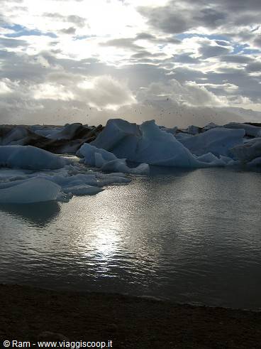
The other half of the day is one of the most anticipated of the whole trip: the iceberg lagoon of Jokulsarlon. We get there after a good hour's drive, during which the glaciers increasingly dominate the landscape. The scenery is fantastic. Never seen anything like it. Now all the mountains are almost entirely covered in ice. A sea of ice. So much so that we think the lagoon must be just a few steps away, but instead this landscape continues for dozens and dozens of kilometres, with only the paved road winding around the glaciers. They're all part of the gigantic Vatnajokull... there must be a reason it's the largest glacier in Europe!! We pass a sign indicating another glacial lagoon, reachable via a dirt track. I promise myself we'll visit it later, but unfortunately we won't have the time. We're almost there now, and we see some cars parked on the left side of the road.
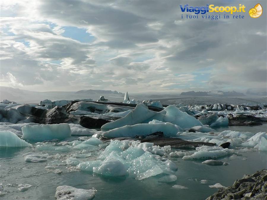
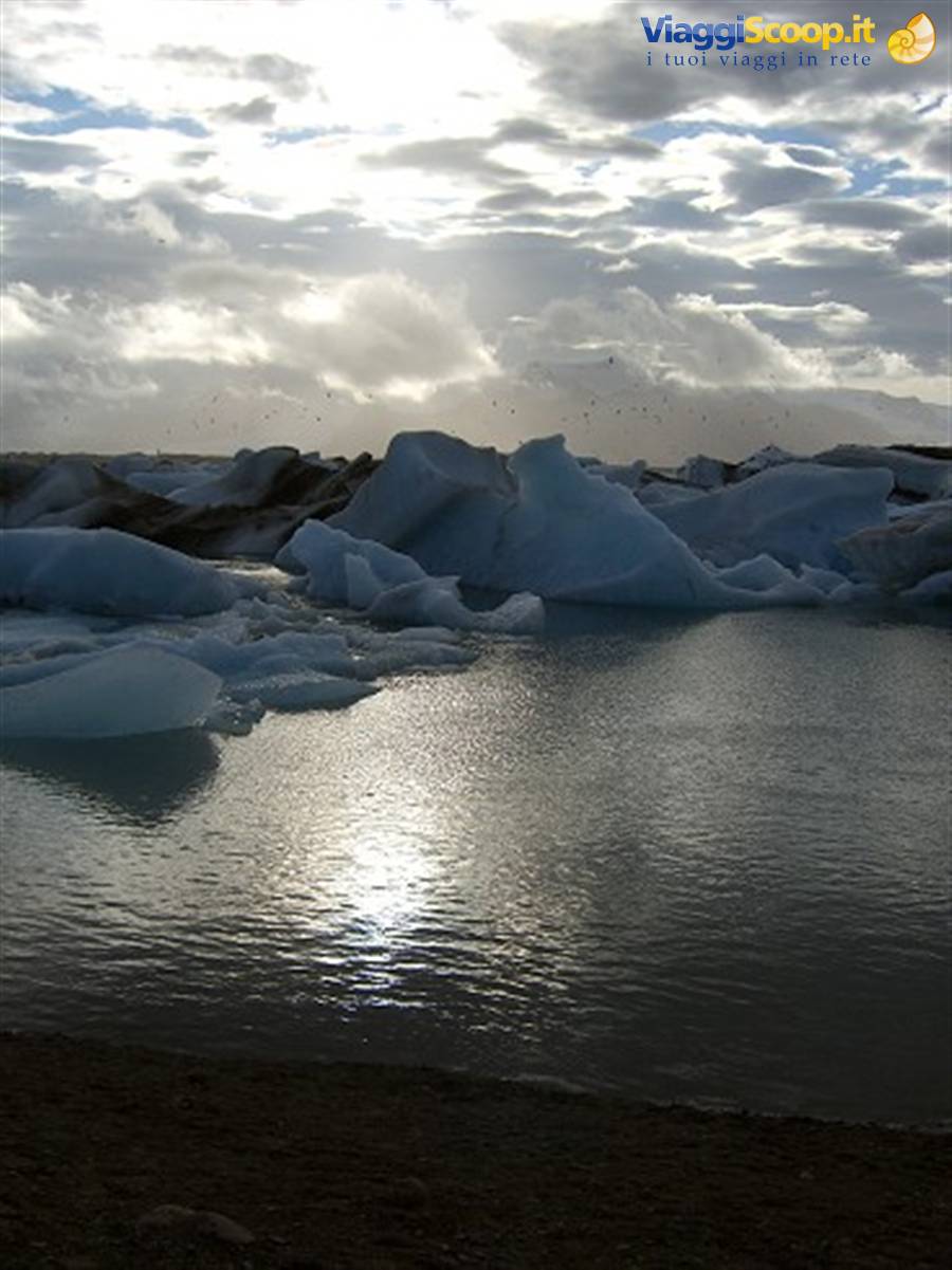
We stop; it's cold, like being in the mountains skiing. We walk back up the path to the top of the hill. Fantastic! We stand speechless for a few seconds watching thousands of white and blue blocks of ice floating in blue water. We're on the opposite shore from the one where tourists usually stop. There's nothing here, just a path that goes around the lake and about ten people scattered here and there. We stay for more than an hour taking photos, walking in silence along the shore, spotting seals swimming among the blocks of ice. The sun comes out intermittently, but it's already enough to appreciate the place. We get back in the car and decide to stop on the other side too, which we reach in 5 minutes. There are more people here, but by now it's 7:00 pm and most of the tourists have already gone. We grab something hot at the refuge, which is closing, and sit down to admire the view.
The sun comes out. From this side the lagoon is even more beautiful, the icebergs are bigger and more impressive, and there are lots of seals. We stay another hour taking photos and admiring it in awe. It looks like one of those fantasy film landscapes that you don't believe could really exist, but there it is right before your eyes.
RATING JOKULSARLON: 10
Fifteen kilometres from the lagoon is our B&B; we reach it in no time. The owners also run a museum/restaurant, where we pick up our keys. Tonight we have a shared bathroom, and we have to take off our shoes at the entrance of the house. A bit of a hassle, but being so close to the lagoon makes it fade into the background.
Dyrhólaey
Day 514 Aug 2007
JOKULSARLON - EGILSSTADIR
A transfer day from South to North. The usual excellent breakfast buffet in the morning, and then, given the beautiful sunny day, we go back to the lagoon. It's as beautiful as ever, but there are many, many more people. Still, we stay there another couple of hours because the place is simply stunning. It's late; today's drive is very long, we have to cross the eastern fjords, and we set off reluctantly. Gradually the weather worsens, and after the town of Hofn the beautiful sunshine is replaced by threatening dark clouds and extremely strong gusts of wind (we'll later find out they were 90 km/h). I have to keep the steering wheel turned just to go straight, and we're forced to slow down. Meanwhile, a snipe with its two chicks suddenly crosses the road in front of us. I brake hard, but the frightened mother flies away, leaving the two scared chicks peeping on the road.
We get out and chase them to the other side of the road, where there are vast ponds and perhaps they can find their mother again. They're incredibly sweet and tiny; they can barely walk. We spent the entire stretch of the ring road through the eastern fjords in the car, because it's practically impossible to get out without risking smashing a door due to the extremely strong wind; it rains intermittently. The fjords didn't seem particularly beautiful to us, but we could see very little due to the weather conditions.
RATING EASTERN FJORDS: 6
Technical notes: the road is unpaved in some sections, but it's still quite wide and not dangerous, at least in August when we went through. The Ring Road (No. 1) at a certain point in the fjords cuts inland towards Egilsstadir; be careful because it's largely unpaved and you have to tackle a mountain pass with several hairpin bends. We mistakenly took this one instead of the coastal road, hoping to shorten the route a bit, but I'm not sure it was the right choice. Bear in mind that either way it takes quite a lot of time!!
In Egilsstadir we find 2 degrees, freezing wind, and terrible weather. We don't even feel like looking for a place to eat; our B&B is isolated but has all the comforts, including various herbal teas, hot chocolate, etc... so we have dinner in our room, all warm and cosy!
Dyrhólaey
Day 615 Aug 2007
EGILSTADDIR - LAKE MYVATN.
The morning isn't any better than the previous evening; it's still freezing cold, the clouds are very low and you can barely see a thing. It's drizzling. We have breakfast in our room and leave quickly, hoping to find better weather further west. We head into the most active and most beautiful geothermal area in Iceland, the one near Lake Myvatn. We drive through gloomy landscapes, thanks to the black, low clouds: stretches of lava fields that stretch as far as the eye can see and nothing else. It's pouring rain. Despite the weather, we decide to see Dettifoss, the waterfall with the largest water flow in Europe. The road (not the track further on) to reach it is terrible, full of potholes, and with the rain coming down in buckets, you have to go slowly even in a 4x4. The waterfall is imposing, very large, but today the water is brown, probably because of the bad weather.
All in all it doesn't seem as spectacular as others we've seen before, but a lot also depends on the conditions in which you see them.
RATING DETTIFOSS: 7
We get back in the car soaked to the bone; I didn't put on my rain cape and my old Moncler absorbed everything that came down, becoming unusable at least until tomorrow. I have to make do wearing a couple of sweaters and a k-way, on the very day it's freezing. Given the weather conditions, we don't continue towards Asbirgi, and we go back onto the Ring Road towards Myvatn. In the car, at least, it's decently warm! Before the lake, the volcanic area of Krafla is an absolute must-see, and with a detour of a few kilometres on a paved road, you enter a place that seems to belong more to a sci-fi film than to our world. Driving up the valley towards the Viti crater, you pass the Leirbotn geothermal power plant, which extends its tentacle-like silver pipes towards the wells from which it draws energy. Here the earth smokes.
White vapours also rise from the water, which is hot and fluorescent yellow. There are yellow lakes and rivers. Red and yellow earth, bubbling pools of grey mud, fumaroles everywhere. Seen from above, it looks like a space base on Mars. We see Viti quickly; it's too cold and there's an extremely strong wind. The Hverarond area next to the ring road is also very beautiful and worth a stop! We've never seen landscapes like this before, incredibly strange colours, a unique atmosphere. We get back in the car. A few kilometres after the pass, Lake Myvatn opens up before us. A ray of sunlight peeks through the black clouds, white vapours everywhere here too; it's a somewhat "infernal" vision. We arrive at our B&B in Reykjahlid; we have a proper apartment, and since the radiators are on, I take the opportunity to dry my windbreaker.
We go out and have a good meal at the village pub, unfortunately surrounded by Italian tourists.
RATING KRAFLA AREA: 9.5
Dyrhólaey
Day 716 Aug 2007
LAKE MYVATN - AKUREYRI .
In the morning the weather seems a little better; it's still cold, but at least the clouds aren't so threatening. We go to have breakfast in the house next to ours, and we realise that here too we have to take off our shoes. We have breakfast barefoot this morning! Today we visit the area around the lake, which for an enthusiast offers many opportunities for walks and even challenging trails. We limit ourselves to visiting the places accessible from the paved road, also because we've heard rather mixed opinions about what to see, with some people very disappointed. Meanwhile the weather improves, the temperature rises, there's no more wind, and the sun even comes out! We see the large black crater of Hverfjall from below. We visit DIMMUBORGIR with its strange lava rock formations created over time, including the most famous one, the "Church." Nice.
We continue along the road with some beautiful views to the area of the Skutustadir pseudocraters. We take a short walk; these are nice too but nothing incredible.
RATING LAKE MYVATN: 6.5
It's now late afternoon, and we need to continue towards Akureyri, about an hour's drive away. Along the way, we stop to see GODAFOSS waterfall. Beautiful, with incredibly blue, sparkling water. One of the most beautiful sights so far.
RATING GODAFOSS: 8
We finally reach Akureyri. Finally a real town, and not just a cluster of houses! It will be the only one of our entire trip. We stay at Guesthouse ********, right in the centre. Perfect location and breakfast at Hotel *******, run by the same people. Small but nice room. We'll stay here for 2 nights. Akureyri is very nice, with some tourist shops too, and a few places to eat. Plus it's pleasant to be outside; the temperature has risen! We have dinner at the pub at the end of our street; delicious dinner at a reasonable price!!
RATING AKUREYRI: 7.5
Jökulsárlón
Day 817 Aug 2007
AKUREYRI - OLAFSFJORDUR - SIGLUFJORDUR - AKUREYRI
Given the risk of seasickness, we decide not to go to Husavik to try to see the whales, and instead head towards the fishing villages north of Akureyri, along the Eyiafjordur. The day is beautiful and warm, and the sun is out. We see Olafsjordur in passing both on the way there and back, also because there isn't much to it. After about an hour and a half we arrive at Siglufjordur, the northernmost town in all of Iceland. It's extremely isolated, and we drive the dirt road that crosses the mountains, with many beautiful views; it's well maintained, but the guidebook says it's normally only open in the summer season, when the snow recedes. To get to Siglufjordur you have to go through a claustrophobic single-lane tunnel, without lighting, with occasional passing places to let oncoming cars through.
It's the first place where we don't find mass tourism, with buses racing everywhere, also because this is a place where the road ends (they're building a tunnel to connect Siglufjordur with Olafsfjordur, but the work won't be finished for a few years), so either you go there on purpose or you don't go at all. It's a place very far from civilisation, and the guidebook says that during winter the inhabitants often remain isolated from the rest of the island because the paved road is impassable. We're 20 km from the Arctic Circle. It's a fishing village, once famous for herring fishing, no longer thriving today, and so it's fallen into something of a decline. There are no noteworthy accommodation facilities; a colourful museum about fish processing is the most characteristic thing, along with the fact that you can savour a bit of Icelandic peace even in August.
On the way back we do a bit of shopping and have dinner at the same place as the day before, with a delicious soup and excellent lamb.
RATING OLAFSFJORDUR - SIGLUFJORDUR: 7.5
Jökulsárlón
Day 918 Aug 2007
AKUREYRI - HVAMMSTANGI
A day dedicated to the transfer before crossing the Westfjords. We get up veryyy slowly, have an excellent breakfast, take a stroll in the centre, I get an excellent Pylsa, and then we get in the car. We'd read that the stretch from Akureyri to the Snaefellsnes Peninsula is often done in one go, and indeed from a scenic point of view it doesn't offer much either. We stop at Glaumbaer to visit the best-preserved turf-roofed houses in Iceland, and the adjoining little church. Very nice. We get something hot at the nearby café (really very very beautiful, it feels like being in a doll's house), with waitresses dressed in period costumes. We set off again, and around 5:30 pm we're near Hvammstangi. Since it's still early and the sun is out, we decide to go and see a seal colony at the tip of the Vatnsnes peninsula. The road is all dirt after Hvammstangi, with few cars.
When we arrive at Hindisvik, silence envelops us. You can only hear a few horses neighing and sheep bleating. Marvellous. We do see the seals, but they're a bit far away; still, the place is worth it, even just to come and admire the sunset.
RATING VATNSNES PENINSULA: 7.5
We reach our B&B (Brekkulaekur, 12 km in the middle of nowhere, on a side dirt road) at 9:00 pm, but they're waiting for us and the room is still available!
Jökulsárlón
Day 1019 Aug 2007
HVAMMSTANGI - ISAFJORDUR
The longest leg by far, about 400 kilometres. That's why we leave early in the morning, even though looking at the road map it seems that fortunately not all of the road is unpaved. It's Sunday and there isn't a living soul around. A few kilometres and we leave the Ring Road, heading north. The road alternates between paved and unpaved sections, but the average speed, thanks also to the beautiful sunny day, is still quite high. Let's hope it stays that way! Up to Holmavik there are some beautiful views of the eastern part of the fjords, but nothing exceptional. Strangely, compared to what's happened until today, we don't meet anyone. This was the Iceland we were hoping to see! We're finally off the most touristy routes, off the Ring Road where, willing or not, you have to go. And here it feels like being on another island.
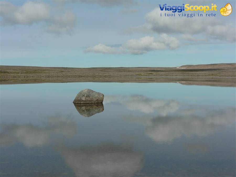
After Holmavik, the road, here all unpaved but well maintained, climbs in hairpin bends towards the interior, cutting through the middle of the wide Porskafjorderheidi plateau. There are no villages. Nothing. Just lots of small lakes that magnificently reflect the blue sky. We stop to take photos and have something to eat. In this area, more than anywhere else in Iceland, we come across many red Emergency Shelters near the road; they're unsettling, they look like space capsules, like the ones man sent to the moon, equipped with solar panels and antennas to communicate with the outside and call for help, beds and food. They're located in the most remote areas of Iceland, where there's no possibility of reaching an inhabited centre quickly. After the plateau, you descend back down towards the ocean, towards Isafjardardjup.
Here before us stand the glaciers of DrangaJokull, the only glacier of the Westfjords, located in the remote and extremely isolated Hornstrandir peninsula. The road winds along the various fjords, but here it's mostly paved throughout. The route is long, but it offers splendid views, and no cars to disturb you. It's really pleasant. By mid-afternoon we arrive at Isafjordur, which stretches along a strip of land in the middle of the fjord. We find our Guesthouse, and take a walk around the town reading the Lonely Planet. It's clouding over, and there are very few people around. The town is nice but not very touristy. There are no typical souvenir shops, it's Sunday and everything is closed. The tourist masses don't come here. For the most part, the people we meet seem to be locals.
We have dinner at a pub of the Pizza67 chain, which gradually fills up with Icelandic people, including a group of lads, one of whom is dressed in a pig costume, with a sign written on the back whose meaning we don't know. Maybe a bachelor party?
Westfjords
Day 1120 Aug 2007
ISAFJORDUR - BUDARDALUR
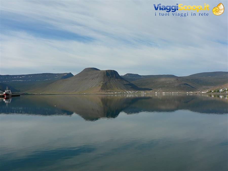
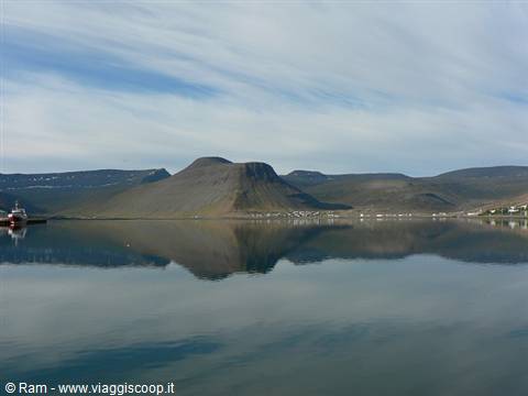
Another demanding long drive today, shorter than yesterday's, but which will turn out to be longer because of the greater stretches of dirt road we'll have to tackle. We wake up to sunshine; it's a beautiful day, and we take the opportunity to finish seeing ISAFJORDUR, which this morning gives us a different impression! The view of the fjord, the moored fishing boats, the high peaks around it reflect beautifully on the water and give us wonderful photos. We see the public gardens, whose entrance has been made with whale bones. Very characteristic! There are lots of flowers everywhere, and lots of colourful little houses. It's the largest town in all the Westfjords, and all the main services for the community are concentrated here.
RATING ISAFJORDUR: 8
We set off south. After the Isafjordur tunnel (with a built-in junction, never seen anything like it), we reach Pingeyri, where we leave the main road to head towards the end of the peninsula, as indicated by the Lonely Planet. We stop a few times to take photos and listen to the silence, which here is truly profound. There's no one around and it's absolutely wonderful. The waters of the fjord are calm and crystal clear. The road, on the other hand, is very rough, lots of stones and potholes, and we proceed very slowly. We try to reach the lighthouse, but at a certain point the road becomes really narrow and steep, and seems a bit dangerous. Patiently and carefully, we slowly turn the car around and go back. We get back on the road, which goes up and down a peninsula offering more beautiful views, until we reach the only waterfall of the Westfjords, Dynjandi.
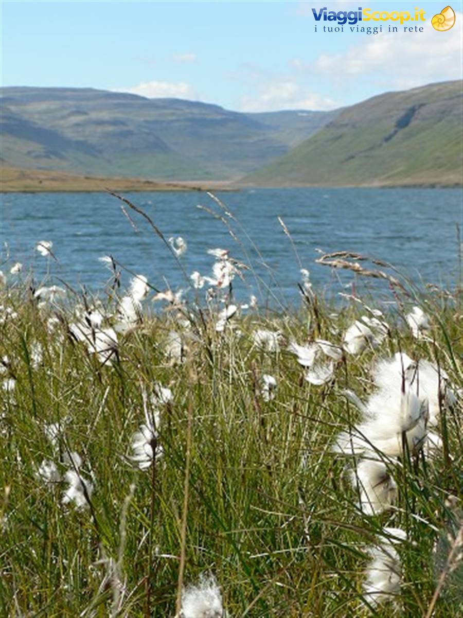
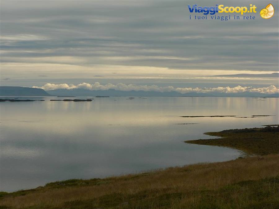
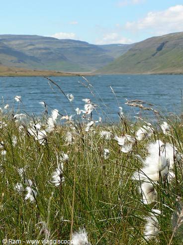
It's nothing special, but it's the whole surroundings that make it worthwhile. Shame the sky is overcast again. We walk up the slope from which the waterfall descends, and from the top there are beautiful views of the fjord from above, crossing the river that gives rise to the waterfall. We pass close to snowfields and beautiful lakes with lots of cotton grass. The road, still unpaved, crosses the plateau and then descends towards the southern coast of the Westfjords near Flokalundur. Here we turn left and follow the coast eastwards, passing the many fjords of the area. Here we have beautiful views of the Snaefellsnes peninsula, where the snowy Snaefellsjokull stands tall. It will be the only time we see it.
For the rest, the road continues past bays where huge numbers of birds live; we see a bird of prey just a few metres away, and then we don't stop again until Budardalur, by now outside the Westfjords. The stretch of road from Isafjordur to Budardalur is very long, due to the road conditions with still few paved sections: you need to set off in good time and plan carefully!
RATING WESTFJORDS: 9.5
There's nothing in Budardalur; it's the first place we found via the internet outside the Westfjords, which we use only as a base to sleep. On top of that, the owner of the guesthouse where we're staying makes a mistake and gives our room to 2 other lads who arrived that evening. The owner is extremely kind, offers us 2 beers, and after giving us the room back, even gives us a discount, apologising. The place is basic anyway, with a shared bathroom.
Westfjords
Day 1221 Aug 2007
BUDARDALUR - STYKKISHOLMUR - SNAEFFELSNES .
After the usual breakfast buffet, we cover the 80 kilometres separating us from Stykkisholmur. The weather has turned awful again, with dark clouds covering the sky. Shortly after arriving in the town, it starts to rain. Fortunately the hotel where we're staying is very nice, the room is already ready, and there's even free internet access! We take the opportunity to rest a bit. The weather doesn't improve in the afternoon either, so we try to go out anyway, heading towards Olafsvik. We stop now and then to take some photos, but the weather conditions don't allow us to see much, so we soon return to the hotel, look up some info online about Jules Verne's novel "Journey to the Centre of the Earth," and go to dinner.
Westfjords
Day 1322 Aug 2007
SNAEFFELSNES - BLUE LAGOON - KEFLAVIK.
Today the weather conditions are slightly better, and after an excellent breakfast, we immediately set off to visit at least the most important things. A bit of sun comes out, so we drive up the track leading to SnaefellsJokull: the place is very beautiful, it reminds us a bit of Landmannalaugar with its colours. There are snowfields, and an extremely strong wind blows. Low clouds alternate rapidly, and from the top the wind-blown snow creates wonderful rainbows. We take some photos, and then, given the cold, we head back down to the coast. We drive around the peninsula with the sun coming and going, aware that we won't see everything it has to offer. Unfortunately we didn't get it right here, but we can't complain about how the trip went.
We see the wide beaches of the southern part of the peninsula, and then quickly descend towards Reykjavik with its traffic, and beyond towards the Blue Lagoon, for a restorative dip.
RATING SNAEFELLSNES PENINSULA: 8
Our guesthouse is in Keflavik, with free transport to the airport included the next morning. So we stop at a gas station to fill up and wash the car a bit (in Iceland car washes are all free, anyway) and then we first go to the guesthouse, where we leave our luggage but can't find the owner (whom we call in the meantime), and then to the Geysir offices to return the car. Here we find no one, contrary to what we'd agreed, so we have to call again and get them to explain how and where to leave the car. Meanwhile the guesthouse manager arrives and takes us to our room in his van, by which time it's already past 9:00 pm. We have a frugal dinner and pack our suitcases for the return journey.






2 reader comments
Ottimo il tutto! La descrizione di questo viaggio è invitante....Scenari fiabeschi e foto stupende!
Splendide immagini.armonia,serenità e pace!!!