The desert of Niger is a silent world. A silence made of clay kneaded with straw, crumbling walls, ochre-coloured dunes and yellow sand that meets black rock. A world populated by craftsmen who forge glittering jewels and by women who wash fabrics and cloths in a thousand shades. A mysterious universe but ready, for those who know how to listen, to reveal the most incredible stories: those of adventurers, of slaves and merchants, of explorations with no return, of people swallowed by the desert and gone forever. But also stories borrowed from everyday life. Like the encounter with oases crowded with date palms, villages of zeribe, fennec and moula moula. All of it while crossing the tracks of the Azalai, the famous salt road that is still today the undisputed kingdom of the Tuareg of the Air.
It's a long off-road journey - a three-door Toyota KZJ 90, equipped with BF Goodrich All Terrain tyres and Ferrino camping gear - covering over 8000 kilometres (half of it on dirt roads) through Tunisia and Libya to then reach Niger, one of the most fascinating African countries, and finally heading back up from Algeria. A whole month in the land of the last free men, where time, as a saying goes, "has decided never to pass"...
MADAMA, Niger:
The official entry into Niger is at Madama (coordinates 21° 57' north and 13° 39' east), at 500 metres above sea level, where the remains of an old military fort dominate an immense expanse of sand that in winter hosts dozens of trucks loaded with men, women and goods of every kind. On the left, continuing along the route, Mount Emi Fezzane accompanies us towards the first real destination of the trip: a tour of over 200 kilometres among the unexplored sands of the Tchigai Plateau, where pinnacles of white rock rise from the iridescent sand that lets flint arrowheads and perfectly smooth round black stones, ancient Neolithic tools, emerge on the surface.
A splendid basin of sand with palms and tamarisks, then a lunar landscape, similar to that of Mars, reveal the signs of the passage of men and animals: on the route leading towards Dirkou, among stony ground and stretches of sand as soft as talc that put the off-roaders to the test, we come across "caravan mosques" and remains of old stone structures, perhaps shelters for dromedaries and goats. Behind the characteristic sugar-loaf shape of Pic Zumri, the palm grove of the oasis of Seguedine (20° 12' north and 12° 59' east) appears, which we drive alongside heading south. Then 50 km from Dirkou a splendid oasis heralds what will be the constant landscape all the way to one of the most typical villages of the Ténéré: date palms and gigantic tamarisks.
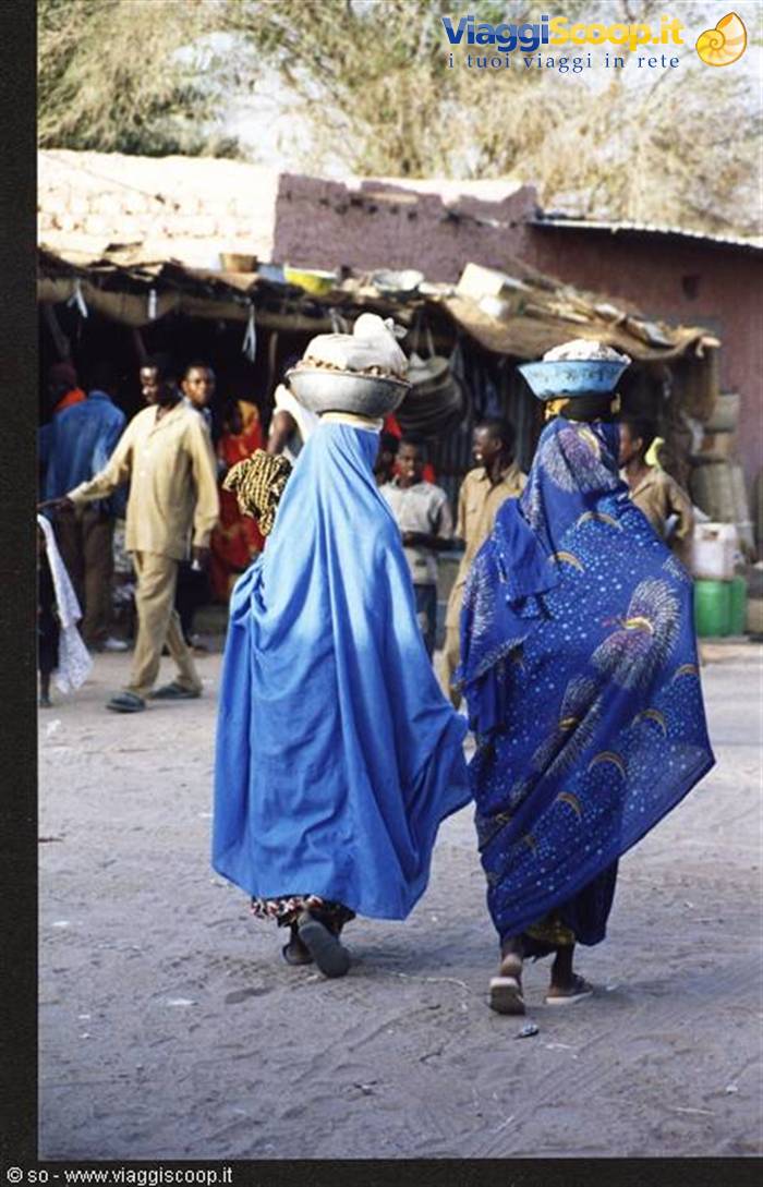
Nothing has changed since the last time we were in these parts: welcoming you to Dirkou is always the military checkpoint with the horizontally striped flag fluttering in the wind and the soldiers with submachine guns and sunglasses. This time we are guests of Boubacar Djaram Mohamed, the town's new mayor - and his family - who invites us to spend the day at his home, where a straw roof and trees scented with mimosa offer precious shelter from the heat. At sunset we walk through the streets of the town, peering into the shops that display colourful fabrics, freshly baked bread, dates, spices of every kind and fried locusts. The atmosphere of Dirkou, with the muezzin calling to prayer, the children in the street racing old toys of rusted tin and the women smiling, really leaves you speechless.
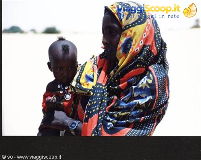
Just like that of the oasis of Bilma, 30 km south of Dirkou, where we drive our off-roaders through the fortified village and the palm grove. Then it's the turn of Zoo Baba (18° 14' north and 13° 03' east), a suggestive oasis nestled in a basin of golden sand where in the shade of two large acacias we meet the women of the village. As they show us flint and obsidian arrowheads, necklaces with amulets, finely chiselled knives, small straw containers and "colocynth" (the famous desert gourd), beneath their colourful clothes we glimpse the lively, smiling eyes of the youngest children.
Towards the dunes:
The next destination we head for is the oasis of Fachi with its salt flats and its Quranic school. Accompanying us are arabesque dunes, soft "whale backs" and thrilling passages among stony ground where the 90, Toyota's short-wheelbase model, really seems to be in its element. At Fachi (18° 09' north and 11° 36' east), one of the most beautiful sites in the Nigerien Sahara for its landscape, its dromedary caravans and its various ethnic groups, we visit the salt flats where the men and women of the village work. The brine - a young Tuareg explains to us - gives vivid colours, from ochre to dark brown, to the square pools framed by a white border where the film of crystals that forms on the surface of the water is broken several times a day with a large wooden stick.
Watching the women intent on extracting and packing into cylindrical and round blocks the salt destined for the oases of the Sahel - the salt flats of Fachi are among the most important of all, because the oasis is the stopping point of the Azalai, the caravan that since time immemorial has transported salt from Bilma to Agadez to then be exchanged for tea, millet and fabrics - is truly a scene from another age. Before leaving Fachi we certainly can't miss a visit to the Quranic school attended by about sixty pupils, mostly boys. Colourful clothes, bizarre hairstyles that leave only a few tufts of black hair on the shaved head, the smile that makes the white of their teeth stand out: these are the children of the oasis, who go to school with their wooden tablets written with black ink from right to left.
An ancient script, the one used in the local Quranic school, perhaps one of the last oases in the world to use it. From the teacher's desk - a rectangular slab of clay - the marabout directs his pupils sitting on the ground in a semicircle in the recitation of a verse from the Koran. It's their way of saying goodbye and wishing us a good trip home.
There where a tree once stood:
The next stage of the journey takes us to the legendary Tree of Ténéré, an enormous thala - also marked on the Michelin 953, an old acquaintance of African travellers - uprooted in 1973 by a Libyan truck driver. Today, in its place there are two sad metal replicas while the historic trunk of the tree is kept in the museum of Niamey. Now it's time to venture into the Air. The rock engravings of Anakom, where hundreds of rocks bear witness to the art of millions of years ago, let us observe the outlines of ostriches, elephants, giraffes and men of that time. A spectacular landscape is the one offered by the Kori Anakom, where among yellow sand, dark rocks, bushes and acacias, the timid croaking of frogs reveals somewhere the presence of water. Ten kilometres and the scenery continues to amaze: we are at Agamgam, famous for its clear, fresh waters, set among rocks and palms.
With our off-roaders we enter Arakaou, a grandiose natural amphitheatre also known as the "crab's claws" because of its characteristic shape: enormous dunes, up to 200 metres high, have settled inside the caldera made of black granite rock of the Takolokouzet. Driving along the busy truck track crowded with old Mercedes vehicles loaded with people and goods, we head for Agadez. After the village of Anguezziz, with its characteristic straw huts and shops at the roadside, 40 km from Agadez we come across marshes and pools of water, caused by the heavy rains of the previous days, which we are forced to get past with longer and longer detours. We are no longer among dunes and rocks but rather right in the middle of a marshy area with bushes, gigantic caper trees, flocks of goats and cows.


0 reader comments