"But as long as we are not put to the test we know little of the uncontrollable within us that drives us across glaciers, torrents and up dangerous cliffs, even though judgement forbids it" John Muir, The Mountains of California
Beppe convinced me. I must admit he didn't have much trouble getting me to decide to take part in the expedition to climb Huascaran, 6,768 metres, the highest peak in Peru, located in the Cordillera Blanca. So, on the fourth of August, we find ourselves at Venice's Marco Polo airport, leaving for Lima, via New York and Atlanta. Here I meet my new travel companions, Mario and Gabriele with their partners Roberta and Anna Maria who, with Beppe and myself, complete the group.
Day 16 Aug 2000
Arrival in Lima
After a long flight with a one-day stopover in Atlanta, we land at 4:15 local time on August 6 at the airport of Lima, the capital of Peru. This city deserves a few words, because although it was described by Herman Melville, a 19th-century American writer, as "the saddest city on earth," it is capable of offering many pleasant surprises. Lima possesses both the decaying splendor of colonial cities and the teeming vitality of Eastern cities; it offers cloudy, melancholic winters and warm, breezy summers; it has chaotic, poor neighborhoods, but also quiet, elegant corners. It is located on the shores of the Pacific Ocean, in the middle of the coastal desert that characterizes this part of Peru's coast.
Due to a meteorological phenomenon known as thermal inversion, Lima remains shrouded in a layer of low clouds throughout the period from May to October, and only during the summer does the climate become more pleasant; precipitation is limited to a few winter drizzles, insufficient to sweep away the desert dust. It was founded on January 5, 1535 by the Spanish conquistador Francisco Pizarro under the name Ciudad de los Reyes, on the plan of a pre-existing indigenous settlement near the bank of the Rimac River, from which the current name seems to derive. At first Lima was populated by only about a hundred conquistadores, but already by the 17th century the population reached approximately 25,000 people, mostly Indians, servants and artisans, as well as African slaves.
In recent years it has experienced strong uncontrolled immigration, going from 550,000 inhabitants in the 1960s to about 6,000,000 today; this phenomenon has caused major social and economic problems such as unemployment and marginalization, relegating most immigrants (Andean Indians of Incan origin) to live in huge peripheral neighborhoods, often lacking electricity, water supply and paved roads, made up of shantytowns which here are called barriadas, while the upper-middle classes, of Spanish origin, have moved to the central neighborhoods of Miraflores and San Isidro.
The visit to Lima begins at the central Plaza de Armas, located in the oldest heart of the city, where the spirit of Pizarro's era can still be felt; the square is home to the Government Palace, the Cathedral and the Archbishop's Palace, and at 12:45 on weekdays, one can watch the changing of the guard carried out by the troops of the Hussars regiment, in red and blue dress uniforms. A few steps from here one encounters another aspect of Lima's social reality, the thriving contraband market of Polvos Azules, where one can buy Chilean wines, Scotch whisky, cigarettes and handicrafts at very advantageous prices. In addition to buyers, unfortunately there are also plenty of pickpockets, so it is necessary to keep a close watch on one's valuables; the same situation applies to the entire city center, where it is inadvisable to venture out alone at night.
Continuing the tour of the city, six blocks from Plaza de Armas, is Plaza San Martin, the hub of the modern center. The two squares are connected by the Jiron de la Union, closed to car traffic and home to Lima's most elegant shops. Until the 1940s, ladies who walked this street without a hat were looked upon with disapproval; today the street is crowded with street vendors and fast-food outlets. Among the various activities there is an Andean version of bingo, where the prizes are decided by the movements of a guinea pig running among numbered cardboard arches. We leave Lima on a scheduled bus that takes us to Huaraz, the "Courmayeur of the Andes." Leaving the city, we pass through the enormous shantytowns that characterize its outskirts; these slums are made up of houses built of brick or wood with cane roofs.
Once out of Lima we skirt the Pacific for about two hours; the landscape appears as an immense sandy desert, with enormous dunes hundreds of meters high, without any sign of life. Turning inland, the desert changes from sandy to rocky and mountainous with countless cacti and prickly pears. As we gain altitude, vegetation takes the place of the desert, agaves and eucalyptus trees accompany us up to over 3,500 meters, higher up pastures predominate. After crossing a pass at 4,100 meters the road descends gently toward Huaraz, where we arrive at 4:30 p.m. Huaraz (3,190 meters) is the capital of the department of Ancash and has a population of over 60,000 inhabitants; despite its Far West town appearance, it is well organized to meet the needs of tourism and offers various accommodation options with very convenient hotels.
It is a very lively city and along its main street the campesinos display for sale large quantities of fruit, vegetables and woolen garments; the many travel agencies present display colorful boards advertising the tourist destinations of the area and the possibility of renting every kind of equipment for mountaineering and trekking. Good restaurants are not lacking either, from pizzerias to Chinese restaurants; however, it is advisable to try those where the typical local dishes are served: lomo saltado, pollo a la brasa and cuy, roast guinea pig.
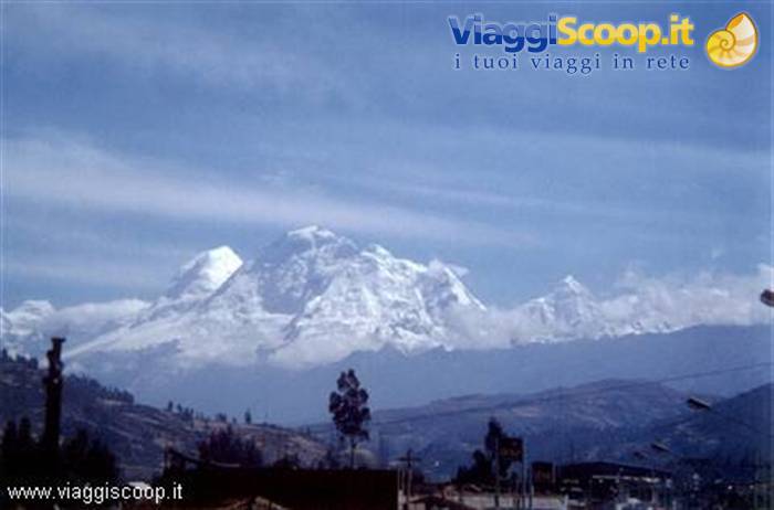
The Cordillera Blanca from Huaraz
Day 27 Aug 2000
The preparations
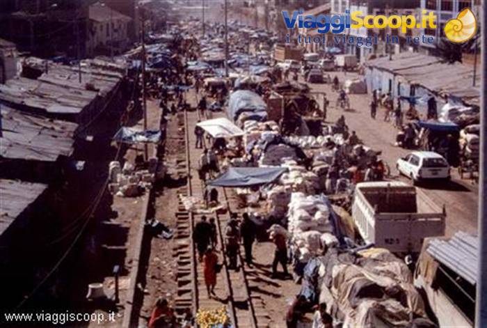
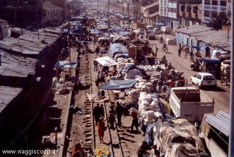
We devote the day following our arrival to visiting Huaraz and preparing for the ascent. We hire a guide and two porters. Accompanied by one of them, who will also serve as cook, we wander through the open-air markets to buy fruit, vegetables for minestrone, as well as sugar, cookies and whatever else will be needed in the following days. In no other place, in my opinion, is it so pleasant to stroll among the great variety and quantity of goods found there, especially because of the intense colors that characterize these streets. The local women displaying goods for sale wear very showy traditional clothing, with strong, vivid colors; the sun at 3,000 meters makes the color of the enormous piles of fruit on display even brighter.
The fabrics and garments placed on the stalls are also very gaudy and attract the attention of those who, like us, are not used to admiring them in their own country. Another item displayed and widely sold in the markets is coca leaves; one can see sacks full of these small dried leaves that are bought to make infusions similar to tea or to chew, like American gum back home. Coca leaves, even though they are the raw material for the production of cocaine, used naturally, without being processed, do not constitute a drug; they have a slightly stimulating effect, certainly less than coffee, and they seem to lighten the fatigue at high altitudes. As for fatigue, in the following days I will feel plenty of it even while trying to drink coca tea and chew its leaves; who knows how much there would have been without it!
Climb to camp 1 of the Huascaran
Day 38 Aug 2000
The departure
The day of departure for Huascaran finally arrives (or should I say unfortunately?). The girls will not attempt to reach the summit, but will wait for us at base camp. I am slightly worried because, unlike my companions, it is the first time I have taken part in an ascent to an altitude above 6,000 meters. At 8:30 we set off for Musho (3,080 meters), the gateway to Huascaran National Park. After completing the registration formalities and paying the entrance fee (10 US$), at 10:30 we set off on foot to reach base camp, located at 4,230 meters, where we arrive at 3:30 p.m. The climb to camp presents no difficulties and winds along a comfortable path that, up to about 3,500 meters, crosses a eucalyptus forest; the only negative note is represented by the weather conditions, which are slowly beginning to worsen. At 5 p.m. it starts to rain; fortunately we had time to pitch our tents.
At these latitudes (we are in the equatorial zone), there are 12 hours of daylight and as many of darkness all year round; at 6 p.m. the sun sets and by 6:30 it is already completely dark. Dinner is therefore consumed not only in the dark, but also under an annoying drizzle, with no possibility of any shelter. The cook has prepared us an excellent vegetable minestrone, followed by chicken with potatoes and rice; since we had been fasting since 7:30 in the morning, all the courses were much appreciated despite the various discomforts. At 7:30 p.m. everyone in the tent to sleep.
At Camp 1 of the Huascaran
Day 49 Aug 2000
The acclimatisation
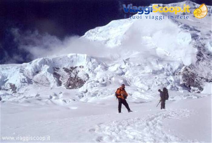
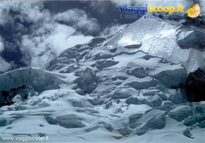
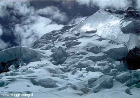
Today is dedicated to acclimatization; we are not going up to Camp 1, but at 11, despite the uncertain weather, we set off on a training hike and reach the advanced camp at an altitude of 4800 metres, on the edge of the Huascaran glacier. The place is fascinating: just above the camp the rocks, which have been a constant since base camp, give way to the glacier that rises up to the summit, 2000 metres above us. A pale sun manages at times to break through the clouds and, in these rare moments, the summit of Huascaran shows all its charm. The sight of the crevasses at its base instils fear and also worry at the thought that we will have to cross them in the coming days. While we silently admire this spectacular landscape, unfortunately it starts to snow, so we quickly begin descending towards base camp.
The first stretch of the descent is on inclined slabs which, during the ascent, had caused no problems as they were dry; now that they are quickly being covered by a thin layer of snow, we are forced to descend very cautiously so as not to slip. During the descent it stops snowing and a beautiful sun comes out. Huascaran presents itself again in all its terrible splendour; one can admire very well the Garganta col that separates its two peaks. We reach base camp at 15.30 and, after about an hour, it starts raining again; after a frugal dinner consisting of two spoonfuls of rice eaten in the tent because it is raining outside, we go to sleep. Tomorrow, if the weather improves, we should go up to Camp 1.
The Huascaran Glacier
Day 510 Aug 2000
Ascent to Camp 1
It rains all night, but at 7 in the morning it is clear. We decide to wait for the tents to dry so we can take them down and set off for Camp 1 at 5200 metres on the glacier. While the girls return to Huaraz, at 11 we set off following the same route as yesterday up to 4800 metres, which marks the beginning of the glacier. The ascent is not trivial. A rocky passage is equipped by our guide Rafael; yesterday we had climbed it free, but we were without backpacks. Almost the entire route towards the advanced camp winds over inclined granite slabs, to be tackled with caution. The stretch of glacier that takes us from 4800 metres to the 5200 metres of Camp 1 presents no difficulties and is covered without crampons and without roping up.
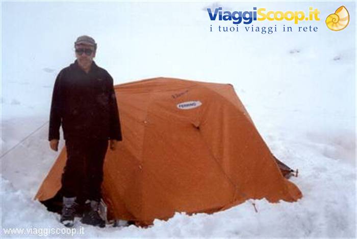
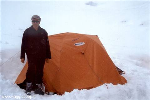
Once past 5000 metres, I begin to feel the fatigue; a single day of acclimatization at this altitude was not enough; in any case at 17 we are all at the camp where we pitch our tents. The day, which in the morning was clear, has slowly deteriorated and, while we set up the tents, it starts to snow. Today too we have been fasting since 7.30 this morning; at 19 we manage to drink a tea and eat a bowl of soup. Despite the forced diet and the discomfort of the bad weather, I feel well; inside the tent, warm in my sleeping bag, I manage to sleep and only every now and then am I woken by the impetuous gusts of wind blowing hard. It snows all night. At 7.30 in the morning I put my head outside: it is no longer snowing, but a thick fog envelops the whole camp and the tents are half-buried in snow. It is not possible to continue.
We decide to spend the day here in the hope that the weather improves, not to go up to the summit, because with all the fresh snow it would be too dangerous, but to see whether we can take some photos of the mountain. At times it starts snowing again. Even right now, while I am writing these notes in the tent, it is snowing; it is 11.30 on 11 August. Even the descent from the advanced camp, which is at the base of the glacier, to base camp, could prove dangerous if the inclined slabs are heavily covered in snow. The day passes slowly inside the tent with a few outings when the weather shows a little mercy. We are not alone at the camp: a Chilean and a Peruvian expedition, also stuck by the bad weather, keep us company; someone has even built a magnificent snowman complete with a woolly hat.
Arequipa
Day 612 Aug 2000
The failed attempt
The next day the weather had improved; the Chileans and the Peruvians set off to attempt the ascent. We decide to imitate them and at 9 we set off too. The fresh snow is very deep and at times we sink up to our knees; the ascent immediately proves very demanding. Having reached the altitude of 5500 metres, I feel the fatigue and proceed slowly; so as not to slow down my companions too much, who are certainly much better trained than me, I decide to stop and return to Camp 1. My companions and the other two expeditions continue but, having reached an altitude of 5700 metres, they decide to turn back too. Besides the very deep fresh snow that hinders the way, there is also a high risk of avalanches.
An avalanche that fell a few hundred metres ahead of them, on the route they were supposed to follow, convinced them to take this decision, which proved wise; indeed, a few days later a fatal accident occurred right at the spot they had reached. A Spanish expedition arrives at the camp to attempt the ascent the following day. We spend the third night on the glacier at 5200 metres. Tomorrow we return to Huaraz. At midnight, in order to find icy snow and not sink in, the Spanish expedition sets off for the summit, but it too is forced to turn back because of the terrible snow conditions. At 10 we begin the descent that takes us first to base camp and then to Musho, from where, in a minibus, we reach Huaraz, where we find Roberta and Anna Maria again. Finally, after a hot shower (much longed for!), a decent dinner awaits us based on lomo fino (fillet) and chips.
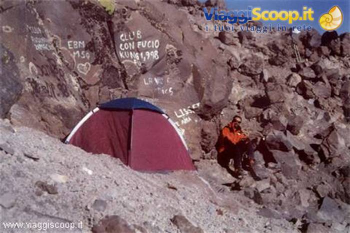
The camp for the climb to the Misti Volcano
Day 713 Aug 2000
Changing destination
More than the disappointment of not having reached the summit, a question haunts me: would I have succeeded in the feat if the weather conditions had been better? The only answer to this question is to try again, perhaps on another mountain of equal charm and beauty. For this time we decide to fall back on an easier and lower summit: the choice falls on the Misti volcano (5822 meters), in southern Peru. By bus we reach Lima and, from here, by a flight, we move to Arequipa, a city located on a desert plateau at 2300 meters, at the base of the volcano. Peru is crossed by the Cadena del Fuego (chain of fire), an underground lava river that runs through its entire length and crosses the subsoil of Arequipa which, over the centuries, has suffered seismic shocks several times.
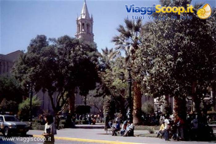
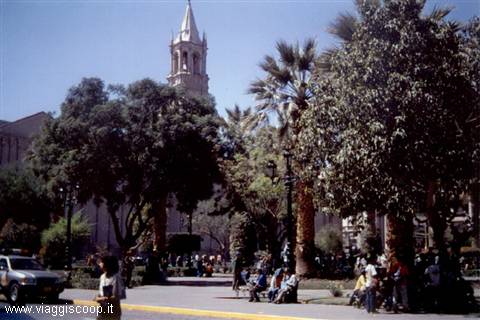
Arequipa, with about 1,000,000 inhabitants, is the second urban area of Peru and is nicknamed the Ciudad Blanca (white city); this name derives from the fact that it is almost entirely built with sillar, a white volcanic rock from the Misti volcano. It is characterized by a dry and mild climate all year round; agriculture and pastoralism, as well as tourism, are the main sources of wealth in the region. The Plaza de Armas of Arequipa is one of the most beautiful squares in Peru. An entire side is occupied by the enormous cathedral with two bell towers, rebuilt twice in the early 1800s after being destroyed by a fire and an earthquake. A two-story portico runs along the other three sides of the square.
The crater of the Misti Volcano
Day 814 Aug 2000
Arequipa
Before starting the ascent to the volcano, we dedicate a day to visiting the city; one of the most interesting places is the convent of Santa Catalina, which in 1970, after four hundred years of isolation, was opened to the public. Despite having been, and still being, a cloistered convent, the vow of poverty and silence was not much respected by the first nuns. In the period of maximum splendor the cells were in reality similar to luxurious rooms. In 1832 the French feminist Flora Tristan visited the convent and reported that the nuns (daughters of the local aristocracy) spoke without restriction and spent enormous sums of money; each had her own servants. Visiting Santa Catalina, three blocks from the central Plaza de Armas, is like diving into the world of the 16th century; the little streets, the porticoes and the gardens still bear their original names.
The convent, where up to five hundred nuns once lived, today hosts only about fifty. Walking around the city, one cannot help but notice the enormous bulk of the volcano that towers over it and that is visible from every point. Tomorrow, while the girls will wait for us in the city, with a trek that will engage us for two days, we will try to reach its summit.
At the top of the Misti Volcano
Day 915 Aug 2000
Ascent to Misti Volcano
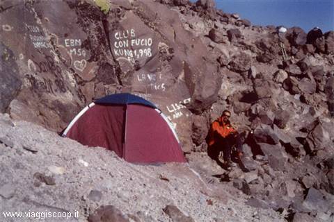
The Misti volcano is an enormous cone formed by rocks and volcanic sand that rises isolated in the middle of a true high-altitude desert; on its slopes there is not a drop of water, nor a thread of shade, only rare shrubs are present at the lower altitudes. Its base is reached, at 3300 meters, by a dirt road passable only by off-road vehicles. From here one continues on foot and, on the first day, one must climb until finding a space where it is possible to pitch the camp. The place is located at 4600 meters, on a cliff of notable steepness, formed by volcanic rocks with rare flat spots suitable for containing a single tent.
The first half of the stage is fairly easy and winds along a comfortable path with moderate slopes; little by little, however, the ground turns from solid to sandy, the ascent also steepens and fatigue begins to be felt, moreover the entire route is accompanied by a very hot sun. In the last stretch, before the camp, the path is totally made of volcanic sand with notable steepness; at every step the inconsistent ground collapses under our weight, greatly increasing the fatigue of the ascent. Once the tents are pitched, the sun begins slowly to set, the heat, which has accompanied us throughout the day, slowly diminishes and an icy wind further contributes to lowering the temperature which, after sunset, reaches a few degrees below zero.
The light haze that was present during the hot hours clears; when night falls the sky is perfectly clear and a breathtaking spectacle presents itself to our eyes; the city of Arequipa, 2300 meters below us and the only inhabited center within a radius of a few hundred kilometers, lights up and appears like a gigantic island emerging from an impassive but gloomy ocean; this unique scenario is already enough to repay us for the cold of the evening and the labors of the day. Wake-up at 3:30, departure at 4 without dismantling the camp. After about an hour of fairly easy walking because the ground is compact, made of volcanic rocks, dawn begins to break.
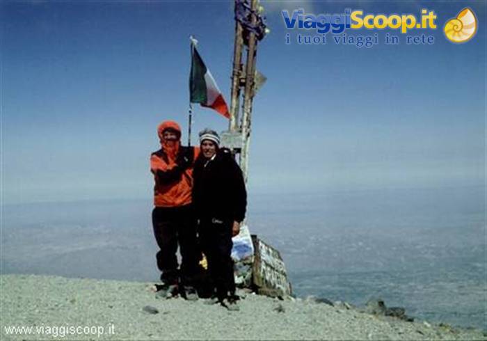
Below us, in the distance, one sees the desert plateau in the middle of which the shadow of the volcano is projected; it is undoubtedly an unusual and beautiful spectacle: a desert plain, illuminated by the pale rays of the rising sun, with an enormous and regular cone of shadow in the middle. Considering the altitude and the fact that the ground has turned from rocky into an immense crumbling stone field, one understands why fatigue begins to be felt again. At 10 o'clock we reach the summit at 5822 meters; the day is clear and the cold, unlike yesterday, has accompanied us throughout the entire walk; despite the altitude and the rather low temperature, there are few traces of snow, only a few patches in places less exposed to the sun.
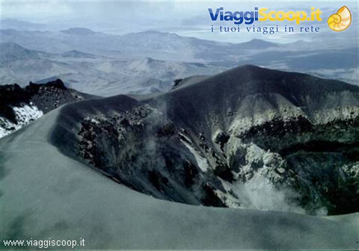
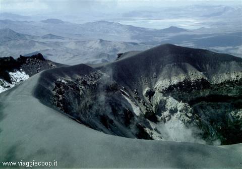
Upon reaching the top, the fatigue of the ascent is amply rewarded by the view of the enormous crater, in whose mouth several still-active fumaroles can be seen; below us, 3500 meters lower down, one can see very well the desert plain and, only in the distance, the foothills of the Andean chain. After half an hour of staying at the summit, unfortunately, we must descend again so as not to miss the appointment with the off-road vehicle that will come to pick us up. With a long descent and a single stop at the camp to dismantle the tents, around 15:30 we reach the meeting place where our driver is already present waiting for us. The mountaineering (or rather Andean) part of our journey has ended. Tomorrow Mario, Gabriele, Roberta and Anna Maria will return to Italy, while Beppe and I grant ourselves another week of tourism.
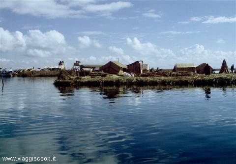
Uros Islands
Day 1017 Aug 2000
Lake Titicaca
By local bus we reach Puno, on the shores of Lake Titicaca, on the border with Bolivia. Titicaca is the highest navigable lake in the world, being located at 3856 metres of altitude. The inhabitants of the region live, as well as on tourism, by fishing in its icy waters, growing potatoes and raising llamas. This is the area of Peru where traditions have remained most intact, where neither the Spanish invaders nor present-day modernity and tourism have managed to prevail over the Inca culture. According to legend, it is here, on the shores of the lake, that the Inca civilisation originated: it is told that the Sun God, with his children, emerged from the waters of the lake to give rise to the Inca dynasty. We dedicate the very day of our arrival to visiting the ruins of Sillustani, about 35 km from Puno. The ruins consist of chullpa (funerary towers) where nobles were buried.
These circular towers, which reach a height of 12 metres, are shrouded in mystery; the era of their construction is not known, although a Spanish chronicle from 1549 reports that they were "built recently". They are made of enormous squared blocks placed one on top of the other, with a small entrance doorway through which it is not possible to fit the body; for this reason it is thought that the body of the deceased was lowered from above, before the construction of the roof. Even the technique for lifting the enormous and heavy stone blocks is a mystery; it could be the same one used by the Egyptians in the construction of the pyramids: huge inclined ramps made of earth removed at the end of the work. We dedicate another day to navigating the lake to visit some of the more than thirty islands that rise from its waters.
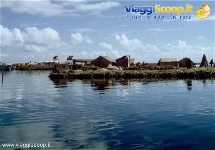
The most famous islands of Titicaca are the Uros, floating reed islands about an hour's navigation from Puno, which take their name from the Indians who inhabit them. This small archipelago, made up of about half a dozen islets, is the first stop of our visit to the lake. These islands, formed of reeds that grow on the shores of the lake, are artificial, probably built as a refuge to defend themselves from enemies. Due to the poverty of the area, most of the Uros have moved to Puno. The few who remain sell the products of their craftsmanship to tourists, devote themselves to fishing and to hunting the many birds that populate the lake; their survival is also based on the lake vegetation, above all on the reeds, used to build dwellings, boats and even the islands themselves.
Since the bottom of these artificial islands deteriorates rapidly in the water, the inhabitants must continually add layers of reeds on top; this makes the consistency of the surface spongy and causes a strange feeling of instability when walking on it. The second and last destination of our visit to the lake is the island of Taquile, homeland of highly skilled weavers, two hours' navigation from the Uros islands. The village is located at the top of the island, at about 4000 metres, and to reach it one must walk up a steep staircase with more than 500 steps that tests many tourists severely. Taquile is the homeland of traditional Peruvian textiles and it is common to meet, along the streets and in the main square of the village, men intent on making the splendid woolen headwear worn by the inhabitants of the island.
The colours and decorative motifs of the garments provide information about whoever wears them: marital status, family position, and so on. For example, bachelors wear a knitted hat with a white tuft, while the headwear of married men is decorated with red stitches. One can buy excellent woolen garments, with very colourful designs, at convenient prices.
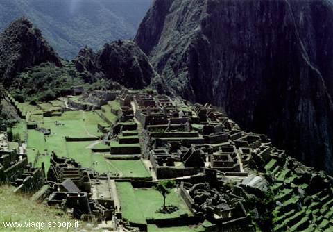
Machu Picchu
Day 1119 Aug 2000
Cuzco and Machu Picchu
Today is dedicated to visiting Cuzco, the ancient capital of the Inca Empire. Cuzco, 225000 inhabitants, is a city where present and past coexist; almost 500 years after the arrival of the Spanish, the city remains still a crossroads between Inca and European culture. Today, of course, it is very different from the descriptions given in the Spanish chronicles, when from here the chasqui, the swift messengers of the Inca Empire, set out to carry news and orders to each of the four sectors of Tahuantinsuyu, as the whole of the regions over which the Incas had extended their dominion was called. According to legend, Cuzco was founded by Manco Capac and his sister Mama Oclla, sent by Inti, the Sun God. Provided with a golden staff, the two had to find a place where the staff would sink easily into the ground.
They found it at Cuzco; there Manco Capac founded the city and taught men how to cultivate the fields, while Mama Oclla instructed the women in the secrets of weaving. At the moment of its greatest splendour, Cuzco had a sophisticated system of aqueducts, the streets were paved and poverty did not exist. But its role as Inca capital lasted only about seventy years, that is, until the arrival of the Spanish. Since no written testimonies of the Incas exist, many clues about the appearance of the ancient Inca capital are provided to us by the diaries, often unreliable, of the conquistadores who, in their frantic search for treasures, threw themselves greedily upon the ancient temples, removing the works in gold and silver that were found inside them.
Only in 1535, when the capital of the new Spanish colony was transferred to Lima and the wealth of Cuzco had already been completely exploited, did the silver of Bolivia definitively divert attention from the valley. Today, after centuries of oblivion, the discovery of Machu Picchu, made in 1911, has transformed Cuzco into the starting point for visits to one of the most famous tourist attractions of South America. The visit of Cuzco must necessarily begin from the fascinating Plaza de Armas, the tourist and commercial heart of the city. In the times of the Incas this square covered an area corresponding to twice the current one and represented the exact centre of the empire of Tahuantinsuyu.
The Plaza was the place where the most important military and religious ceremonies were held and where there was a stone covered with gold sheets to which offerings were dedicated before undertaking any military action. In the days of Spanish domination the square was the theatre of bloody scenes, such as the execution of Tupac Amaru II, the leader of the Indian rebellion who, captured while trying to flee, was condemned to be disembowelled and quartered. Today people gather in Plaza de Armas especially on the occasion of festivities. The square is particularly spectacular after sunset, thanks to the lighting that highlights its most solemn aspects. The last stop of our journey is dedicated to visiting Machu Picchu, the oldest ruins of the Inca period.
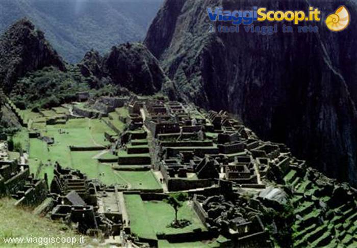
Machu Picchu can be reached from Cuzco with a four-hour journey on a characteristic and rattling little train that goes deep into the high Urubamba valley. In 1536 the Incas rebelled against the Spanish and took refuge at Vilcabamba, in the forest northeast of Cuzco, where they resisted for thirty-five years before being definitively defeated. The city was rapidly swallowed by the jungle and fell into oblivion. When, in the 18th century, the race to search for the "lost city" broke out, where all the gold that had escaped the Spanish was supposed to be found, the name of Vilcabamba was associated with it and it returned to the chronicles.
The Muisca Indians, who inhabited present-day Colombia, provided a trail to those obsessed with that search by reporting to the Spanish a tribal chief who every year, during a rite, after covering his body with gold dust, immersed himself in the waters of a lake. This episode helped to associate with the lost city also the name of "El Dorado", the Golden Man. When in 1911 Hiram Bingham discovered Machu Picchu, he was in reality looking for the ruins of Vilcabamba. Bingham was convinced he had found the last refuge of the Incas; Vilcabamba is in reality located about a hundred kilometres west of Machu Picchu. Bingham's error is understandable: he could not imagine that in the forest north of Cuzco there were indeed two lost cities.
Today it is clear that the ruins found by Bingham are not those of Vilcabamba, but the discovery poses an enigma: if Machu Picchu was not Vilcabamba, then what was it? The ruins took their name from the mountain that overlooks them (Machu Picchu means Old Peak), while the other nearby peak has the name of Huayna Picchu (Young Peak). Certainly the Spanish were unaware of the existence of Machu Picchu and, since they had many informers among the Incas themselves, the only plausible explanation is that not even the Incas, in the period of the Spanish conquest, knew of it.
The city and the region were probably abandoned before the Spanish conquest, disappearing from the memory of the People of the Sun themselves; this total ignorance regarding the existence of the ruins can be explained by the fact that the quipucamayocs, the historians who orally handed down the chronicles of the empire, are today known to modern historians for their censorial habit of erasing from memory facts or people whose memory was, for various reasons, inconvenient. Perhaps this was the fate of Machu Picchu: a rebellious province punished in such a cruel manner that its existence had not even passed into history.
The market of Cuzco
Day 1222 Aug 2000
Back home
The journey is drawing to a close, tomorrow we set off to return to Italy. Not having managed to conquer the summit of Huascaran has certainly left a bit of a bitter taste in all of us. A bitterness that has been partly softened, with the reaching of the summit of the Misti volcano and with the subsequent immersion in the Inca and Peruvian cultures. Climbing mountains, crossing passes above 5000 metres, walking across boundless valleys and living for weeks immersed in untouched nature, certainly lets one taste the flavour of the unknown and of adventure, gives wonderful panoramas, sunrises and sunsets with beautiful shades of colour. Even getting to know peoples with ethnicities, traditions and customs totally different from ours has a charm that can hardly be found in other situations. All this was our journey in Peru.
Despite the disappointment for not having reached the summit, we keep in our hearts the memory of the magnificent and, at the same time, frightening glacier on which we remained three days and three nights. The climb to the Misti volcano, together with the joy of reaching its summit, has left us the memory of the splendid and at the same time terrifying vision of its crater, the beautiful panorama of the desert plain below us and the indescribable sunrise that surprised us on its slopes as we admired the cone of shadow projected on the valley. Visiting the ancient Inca settlements and treading the same ground that, hundreds of years earlier, was inhabited by peoples of whom, even today, almost everything is unknown, has the charm of mystery and stimulates the desire to deepen one's knowledge of them.
Strolling through the villages, outside the totally touristy areas, among the bright local colours, visiting the many open-air little markets that display the strangest goods and chatting with the local inhabitants, gives a sense of tranquillity and inner peace that is in clear contrast with the frenzy and collective agitation that pervades our cities. These peoples, despite their extreme simplicity of life, have managed to maintain unaltered over time an enviable balance with nature.



0 reader comments