Bergen, Ålesund, Helgeland, Lofoten, Trondheim, Tromsø, North Cape
When
19 Jul 2008 – 31 Jul 2008 13 days · trip of 2008
Who
Cip Civectitis Civetta · @tizimari · Sâo Tomé
How
Travel diary
The story · 3 days
A journey dedicated to light, water and.... salmon! A trip to Norway in summer means never sleeping, or almost. In fact it's hard to go to bed at midnight when the sun has just set and everything is still bright as day. We can describe this trip as a scenic dash along the spectacular Norwegian coasts, which would certainly deserve a more detailed visit. The limited time in fact forced us into a long run from Oslo to the North Cape along the Norwegian fjords and the Lofoten Islands, touching the main Norwegian cities, and then returning through Finnish Lapland and Sweden with a quick visit to Stockholm and back to Oslo for the return to Italy. In 12 days we covered 6,463 km, used 391 litres of petrol and took 12 ferries. A temperature range of about 22º (28º in Stockholm and 6º at the North Cape) and practically 288 hours of daylight, a few thousand little lakes and a few kilos of salmon.
Cost: about 3,800 euros for two. The images of this trip: breathtaking landscapes, the fjords, the little lakes, the midnight light, the strawberries, the speed limits, the reindeer, the ferries, the salmon and the cod, the rorbuer. Top five: Lofoten Islands, Helgeland and the coastal road, Geirangerfjord, Trollstigen, Bergen.
Practical information: The Ryanair flight from Bergamo to Oslo Torp (Sandefjord), about 90 km south of Oslo. Car prepaid from Italy with Hertz, through Ryanair's discounted rates. Watch the speed limits. In Norway the maximum limit is 80 km/h. The trip is extremely expensive, so if you don't want to spend a fortune you have to choose relatively cheaper solutions for accommodation and meals. We stayed in hostels, bungalows (hytter, rorbuer, sjøhus) and three times in hotels. As for meals we favoured shopping at supermarkets or markets and occasionally treated ourselves to restaurants. Better to pay by credit card or debit card (accepted for any purchase) to get a better exchange rate. Keep some reserves of kroner for motorway tolls (often automatic) or for some private accommodation that doesn't accept credit cards.
The trip: 19 July 2008; Saturday Sandefjord – Bergen. 545 km, cloudy with light drizzle. Departure from Bergamo with Ryanair; after a couple of hours of flight we're at Oslo Torp airport, we pick up the Opel Corsa from Hertz and at 13h00 we set off. The first km immerse us in a velvety landscape; green is the dominant colour, the temperature is pleasant (18º-20º), the presence of water, which will be the dominant feature of this holiday, makes itself felt from the start with a series of lakes and little lakes. Maybe it's the limited speed or the virtually nonexistent traffic, but we feel extremely relaxed. We then take the no. 40, crossing the Telemark region. Before reaching Geilo we cross a couple of mountain passes around 1,000 metres and the temperature starts to drop. Geilo is a ski resort surrounded by mountains; from here we take the no. 7, which will lead us to Bergen.
After the Vøringfossen pass we descend between a spectacular gorge and a series of tunnels carved into the rock, until our first contact with the fjords of the western coast on the Hardangerfjord, which we follow as far as the ferry between Brimnes and Bruravik. Norway's ferry system is extremely efficient and generally you wait only a few dozen minutes. The ferry (103 NOK, 10 minutes) takes us to the other shore of the fjord. We continue on the no. 7 and near Norheimsund we come across the spectacular Steinsdalsfossen waterfall. We reach Bergen around 24h00 and it's just starting to get a little darker. We stay at the Montana Vandrerhjem (hostel), in a position with a magnificent view over the city (750 NOK for a double). 20 July 2008; Sunday Bergen – Bergen – 41 km - Temperature 16º, sun and light drizzle in the afternoon.
After an abundant breakfast at the hostel we start visiting the city. Bergen is the second-largest city in Norway. In 2000 it was European Capital of Culture. It's also called the gateway to the fjords. Its position, in southern Norway, facing the Atlantic Ocean at the country's westernmost point, makes it the ideal starting point for exploring the vast fjord region. Bergen was founded in 1070 by King Olav Kyrre. It stands on a peninsula, surrounded by seven hills. It was the capital of Norway for two centuries, until the 13th. Its history and culture are essentially tied to the sea. In the Middle Ages Bergen was part of the Hanseatic League, the merchant league that united the most important port and trading cities of Northern Europe. Bergen was in fact the richest and most powerful city in Scandinavia. Its heart is still Torget, the square facing the Vågen, the harbour.
Here the lively and colourful fish market takes place. Bryggen is the city's ancient trading centre from the time of the Hanseatic League. It lies on the northern side of the harbour and consists of beautiful coloured wooden houses lined up along the quay. It's the symbol of the city and was added to the UNESCO World Heritage list in 1980. Although the original houses were mostly destroyed by a fire in the early 1700s, the current ones keep the medieval structure and style. It was once the residence of German merchants; now its narrow lanes house museums, restaurants and shops. Among the museums to visit are the Hanseatic Museum, which offers an insight into the life of medieval merchants, and the Bryggens Museum, the archaeological museum where you can see the ancient foundations of the quarter.
For lunch there's nothing better than a taste of prawns, marinated salmon, herring and crab at one of the many stalls in Torget square. In the afternoon a visit to Troldhaugen, the house where the Norwegian composer Edvard Grieg died, located near Lake Nordås, about ten km from the city centre. It now houses a museum dedicated to the artist and a concert hall.
21 July 2008; Monday Bergen – Ålesund. 633 km - Temperature 14º, sun Today's programme includes crossing some of the most famous fjords, part of the Jostedalsbreen glacier and the famous Trolls' Road, the Trollstigen, so there's no time to waste. Early-morning departure from Bergen; we take the E39 and go straight on to the first ferry at Oppedal on the Sognefjord (121 NOK), trying not to be too tempted to photograph the landscapes that immediately reveal themselves as breathtaking. We continue on the E39 on the opposite side of the Sognefjord and at Byrkjelo we turn onto the 60 towards Olden and Loen to venture into the glacial valleys of the Jostedalsbreen. We opt for the Kjendalsbreen, reached from Loen, where a road of about 20 km leads to the glacier tongue, reachable with a short one-hour hike. The landscape is enchanting and the glacial lakes have jade-coloured water.
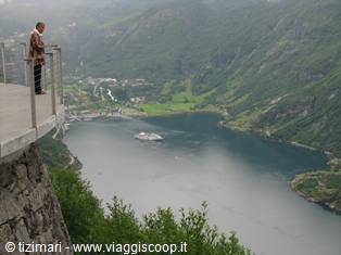
Back in Loen we reach the 15 at Stryn and then take the 63 towards Geiranger. At Dalsnibba (1,500 metres) you should have a spectacular view of Geiranger, but we're completely wrapped in clouds, which thin out only a few hundred metres lower, giving us a spectacular view. The 63 climbs again on the other side of the fjord, offering other spectacular glimpses. Having reached the Eidsdal ferry (78 NOK), we cross the Norddalsfjord and continue towards the
Day 121 Jul 2008
From Trollstigen to the Lofoten
As we head toward the pass, the atmosphere is straight out of Trolls, and it wouldn't surprise us too much to see a little man with a long nose, a little tail, and four fingers per hand pop out. We're wrapped in clouds and can only hear the roar of the waterfalls crashing a few hundred metres further down. After a few hairpin bends on the Trollstigveien, the clouds thin out and we're treated to the spectacle of this winding road dotted with towering waterfalls. Along the way various trolls watch us from atop the rocks; they must have been exposed to the sun and turned to stone. We reach Alesund around 10 p.m., our eyes stuffed with landscapes and endless open space. Along the route, we gorge on strawberries and cherries and, of course, the ever-present salmon. In Alesund we stay at the hostel, which gives us an apartment a few metres from the sea (750 NOK).
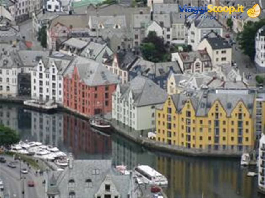
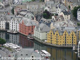
22 July 2008; Tuesday Alesund - Trondheim – Levanger; 350 km, temperature 12º, sunny with few clouds In the morning we visit the historic centre of Alesund, with its Art Nouveau buildings rebuilt with the support of Wilhelm II after the town was completely destroyed by a fire in 1904. Definitely not to be missed is the view of the city from the AKSLA hill, reached by an endless flight of stairs or, much more comfortably, by a couple of km of driving. From Alesund we continue on the E39 toward Trondheim; on the route there are 2 ferries, the first at Vestres (137 NOK) and the second at Kanestraum (98 NOK); then you have to pay the toll on the bridge at Giemnes and for some stretches of motorway around Trondheim where you can let loose up to 90 km an hour — on the other hand, "the motorway" is a single lane.
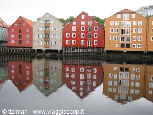
Once in Trondheim we visit Nidaros Cathedral, the largest medieval building in Scandinavia and a pilgrimage site for Norwegians, since King Olav the Holy was martyred here in 1030. Not to be missed is the atmospheric Bakklandet district, reached by crossing the historic Gamle Bybro bridge. In Trondheim, anyone travelling north must choose between the spectacular coastal road (Kystriksveien), which is slower and more expensive (6 ferries), and the Arctic road, which is faster and more direct. We opt for the coastal road, and we won't regret it! So we change our original plan to stay overnight in Trondheim and continue about a hundred km north; around 9:30 p.m. we find a cabin (Hytten) in a campsite near Levanger (450 NOK). Lunch and dinner with the usual salmon, cheeses and sliced ham bought at SPAR and, of course, the ever-present strawberries.
23 July 2008; Wednesday Levanger – Halsa (Foroy); 565 km, temperature 14º, rain We wake to a light drizzle. After Steinkjer we leave the E6 (the Arctic road) to take route 17, or the Atlantic Road. On the first ferry from Holm to Vennesund (98 NOK), about 220 km from Steikjer, we pick up the Kystriksveien guide, a free booklet with all the information you need for travelling the Atlantic Road: accommodation, campsites, points of interest, ferry timetables, etc. We thus enter the Helgeland region, a series of islands and peninsulas with mountains plunging into the sea and breathtaking panoramic views. Unfortunately, the dreary day and low clouds don't let us make the most of the landscape's beauty. The day continues with a constant up and down from one ferry to the next.
After 64 km we reach the second ferry from Horn to Andalsvag (90 NOK), 20 minutes; after just 17 km, the third ferry from Forvik to Tjotta (162 NOK) forces us to wait almost 2 hours. This ferry is smaller than the others because of the shallow seabed, and the crossing takes about an hour. Considering that we were the last to get off the previous ferry, we found ourselves in a long queue, and the result was a wait of a couple of hours. 71 km on the Sandnessjoen take us to the fourth ferry, between Levang and Nesna (109 NOK), 25 minutes. From Nesna, 91 km along route 17 lead to Killboghamm, where we arrive shortly after the second-to-last ferry departs; all we can do is wait for the last ferry at 9:30 p.m., which will take us to Jektvik in about an hour and fifteen minutes (168 NOK).
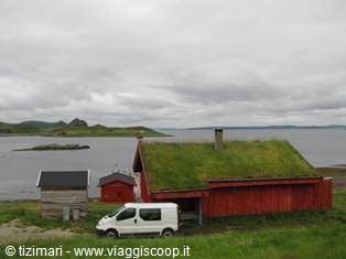
With this ferry you cross the Arctic Circle; the landscape is evocative — it feels like sailing among the high peaks of the Alps. While waiting for the Killboghamm ferry, consulting the Atlantic Road guide, we phone to book a room in Halsa, right after the last ferry from Agskardet to Foroy (78 NOK), 15 minutes. We find a place at the Kvittbrygge, a series of roerbur intended for fishermen. The stretch between Jektvik and Agskardet (28 km) is perhaps among the most spectacular of the whole route. Unfortunately, we don't have enough time for an excursion on the Svartisen glacier, the largest in Norway and the lowest-altitude one in Europe. At Agskardet we wait for the last ferry at 0:15 a.m. in the company of a group of seagulls resting on the pier. The light is still excellent and lets us take photos without a flash.
We reach the roerbur at the Kvittbrygge around 12:30 a.m., where a fox wandering around the little cabins is waiting for us. The accommodation is truly lovely (600 NOK). 24 July 2008; Thursday Halsa (Foroy) – Reine (Lofoten); 240 km; temperature 13º, rain We wake to the usual drizzle, and what could be better in a fisherman's house than a breakfast of raw herring marinated in lemon? A real delight. Today's route covers the last stretch of the Atlantic Road to Bodo. The clouds merging with the sea create a mysterious, fairy-tale atmosphere. During the summer there are 6 daily connections between Bodo and Moskenes in the Lofoten Islands. We arrive in Bodo around 2 p.m. and queue for the 3 p.m. ferry. The crossing takes about 4 hours, and the cost for a car with 2 passengers is 716 NOK.
According to Lonely Planet, the most evocative place in the Lofoten Islands is Reine, and it's probably right. We head to Reine to find accommodation for the night; at the entrance to Reine we find the usual Hytten sign with a phone number, we call and find a room in a Roerbur in an enviable position, which justifies the slightly higher price than usual (800 NOK). In the evening we visit the village of A, with the usual drizzle that has been with us for three days now. The forecast says it will improve tomorrow anyway — let's hope so! Dinner in Sorvagen at the Holmen restaurant, where we have the honour of trying breaded cod tongues, a local delicacy that doesn't leave us very enthusiastic; the prawns, langoustines and grilled cod are much better.
Ålesund
Day 225 Jul 2008
From the Lofoten to North Cape and into Finland
25 July 2008; Friday
Reine (Lofoten) - Harstad; 385 km; temperature 14º, cloudy with clear spells. The morning gives us a fantastic rainbow right outside the rourbur window — never have we seen a rainbow begin so close to us; one end is in fact on the boat moored in the little harbour below and the other end finishes on the pier below the house. We get up quickly so as not to miss this fabulous spectacle over the Lofoten Islands; the drizzle continues, but there are some clear spells that colour the landscape. We go back in for breakfast and set off again around 10:45 a.m. The most evocative and scenic stretch of the Lofoten Islands is probably the one between A, at the extreme southern tip, and Reine on the island of Moskenes. We leave Moskenes to cross to the island of Vestvagoy, where we leave the E10 for a more scenic detour on route 815.
Once on the island of Austvagoy we take the right-hand turn onto route 816; a delightful road leads us to the charming and lively village of Henningsvar. A snack of blueberry cake in a bar-candle shop, and we continue toward Svolvaer, which, after the enchanting villages visited in the morning, leaves us a bit disappointed. A long underwater tunnel, recently opened, lets us leave the Lofoten Islands and cross to the island of Hinnoya, part of the Versteralen archipelago. We then reach Harstad, which will be our stop for tonight. Overnight at the Harstad Verderheim hostel (590 NOK).
26 July 2008; Saturday
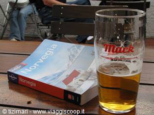
Harstad – Diupvik (Lyngenfjord) 520 km; temperature 13º, sun. From Harstad we rejoin the Arctic road, the E6, about fifty km north of Narvik. We then head toward Tromso, visit the polar museum, stroll through the city centre and have lunch at the Skarven pub to sample the excellent Mack beer. On the way out of Tromso, a small lapse in attention, and we get "photographed" by one of the many speed cameras; with the limit at 50 we were doing 60 — who knows whether the fine will reach us?? We continue north and, once on the Lyngenfjord, look for accommodation for the night. As always, no problem, and we find a place at the first Hytten we ask about (500 NOK, Lill Kristin Berg and Jens Simonsen, tel 91815695). We're in Djupvik on the Lyngen fjord, right across from the Lyngen Alps with their glaciers clearly visible.
It feels like stepping into a fairy tale; the Hytten we found for the night is a cabin more than 100 years old that was used as a sauna and then as a school; now it seems turned into a trolls' house and everything is made to troll size, including the doors, which don't exceed a metre and a half. The cabin is nestled in greenery a few steps from the sea with an enviable view of the Lyngen Alps. Dinner on the little terrace despite the 8 degrees. The chubby little boy who rented us the cabin even gives us a packet of coffee to warm up the evening a bit. Midnight, and the very blue sky has just hidden the sun. Everything is lit up as bright as day, though. We put on our eye masks to create a bit of darkness and fall asleep.
27 July 2008; Sunday
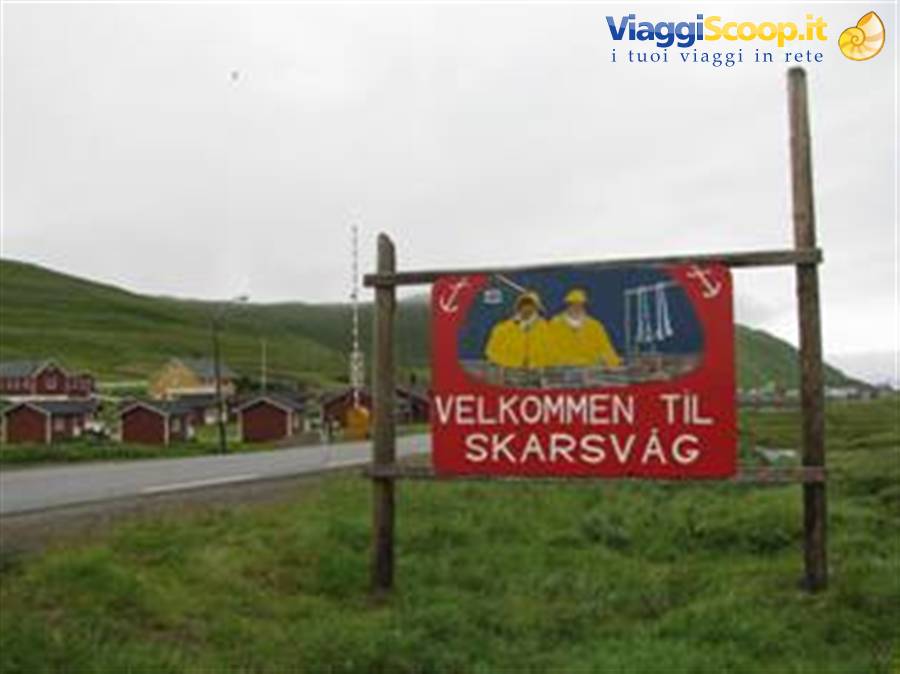
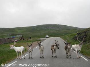
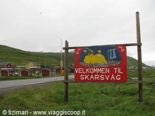
Diupvik (Lyngenfjord) – Skarvag (North Cape) 545 km; temperature 8º, cloudy. We leave Nordland to enter Finnmark, the extreme northern region of Norway. Although on the Arctic road, for several hundred km, there have been signs warning of reindeer and elk, we haven't come across any yet — but suddenly here's the first group of reindeer right beside the road, and from here on they won't leave us until southern Sweden. For the elk we'll still have to wait a while. Stop in Alta for lunch at "Han Steike". Alta is an utterly anonymous town with a modern city centre completely rebuilt after the destruction of the Second World War. The Nordkapptunnelen (toll 192 NOK), passing at a depth of 212 metres below sea level, takes us to the island of Magaroya, where North Cape is located. We find a place in a cabin at the Kirkeporten campsite in Skarsvag, just 12 km from North Cape. Around 8 p.m.
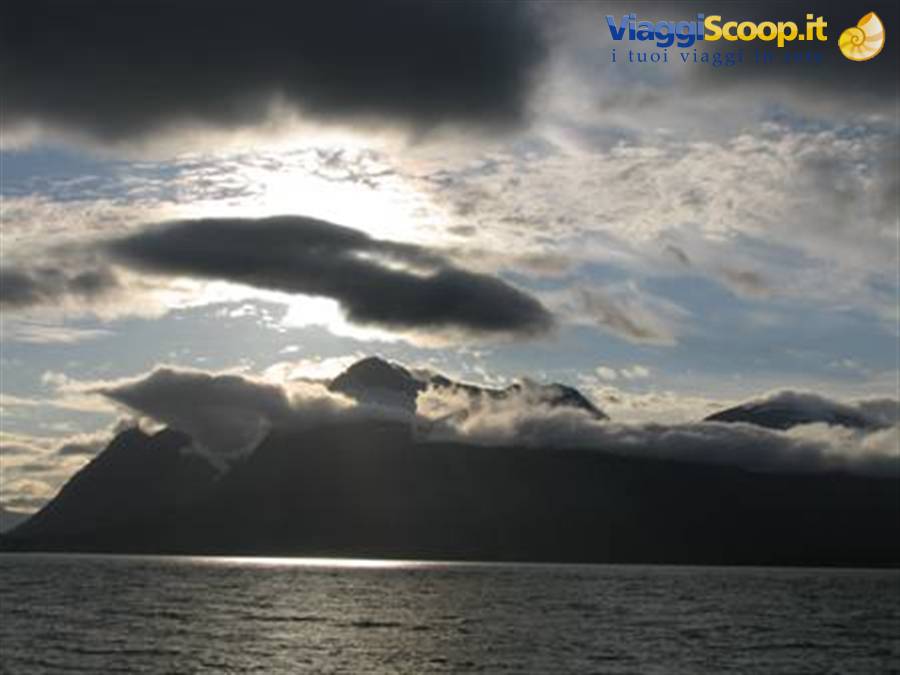
we set off for the legendary North Cape; these are the last days when you can still see the midnight sun, but the weather promises nothing good. As soon as the road starts to climb, we're surrounded by increasingly thick clouds. At the North Cape sign, visibility is limited to a maximum of 30 metres. So for the moment, no midnight sun; all we can do is wait and see whether the weather improves. Toward midnight the clouds come down to the sea and we're completely wrapped in a damp veil; better to go to sleep and wait for the next day. 28 July 2008; Monday Skarvag (North Cape) - Rovaniemi (Finland) 735 km; temperature 8º, cloudy, sun. We wake still wrapped in the blanket of clouds; the view of the cliff from North Cape will be for next time.
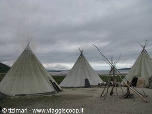
So we decide to head south, since further north you can't go — or rather, you can reach the true northernmost point of Europe, which strangely is not North Cape but another cape reachable on foot with a 9-km trek. We leave the island of Magaroya, again the toll for the tunnel and lots of groups of reindeer on the road. The sun starts to appear near Laknes at the southern end of the Porsangen gulf. We wonder whether it has cleared up at North Cape too, but turning north, the big clouds on the horizon seem to give us the answer. We continue on the E6 to Karasjok, where we'll leave it to head for the Finnish border. In the town of Karasjok we visit the Sami museum, though the visit to the Sami museum in Inari, Finland, will be much more interesting.
We're now in Finnish Lapland; the clouds have completely disappeared, the speed limit has risen to 100 km an hour, and the long rolling straights flanked by little lakes and the ever-present reindeer let us quickly reach Inari, on Lake Anar, where we visit the interesting Sami museum. We then continue toward Rovaniemi, our destination for today. A few km before entering Rovaniemi you cross the Arctic Circle, or "napapiiri" in Finnish, and right here is Santa Klaus village, the famous Santa Claus village. It's now 11 p.m. and we wander around the square in front of Santa's office, from which Christmas tunes waft out. We reach Rovaniemi and find a room at the City Hotel (70 euros) right in the centre of Rovaniemi. After Norway's prohibitive prices, Finland seems to us a very cheap country.
Skarvag - North Cape
Day 329 Jul 2008
From Rovaniemi (Fin) to Oslo via Stockholm
29 July 2008; Tuesday
Rovaniemi (Finland)- Stockholm 1200 km; temperature 19º, clear. We should set off for Stockholm right away, considering the 1200 km separating us, but our curiosity to visit Santa Klaus Village is stronger than us, so we turn north and here we are at the village again. Now all the facilities are open: the post office complete with letters from children all over the world, Santa's office, the somewhat gloomy route through the polar night and, as a final treat, in the main office we find ourselves face to face with Santa Claus — we really weren't expecting that. We leave behind the reminiscences of childhood and head for Stockholm. A long route among little lakes and pine forests. We're driving along the Baltic Sea; the temperature has risen considerably — we're now around 20 degrees, and Swedish kids are splashing about in the sea.
The most interesting stretch of the E4 is definitely the one between Ornskoldsvik and Sundsvall. Toward 10 p.m., a fiery red sunset. We reach Stockholm around 11 p.m. and in the blink of an eye we find the Haga Kristineberg Hotel (850 SEK) that we had booked online.
30 July 2008; Wednesday
Stockholm – Sandenfjord; 700 km; temperature 24º, clear. The Haga Kristineberg hotel is a good option for a visit to Stockholm; it's in fact 100 metres from the metro, which in about 10 minutes takes you to the city's historic centre. Morning and early afternoon devoted to visiting Stockholm: the historic centre, the Skeppet, the Royal Palace, Riddarholmen, the City Hall. Lunch at a little restaurant in Torget square — a magnificent reindeer fillet. Toward 4 p.m. we leave Stockholm with a temperature of a good 28 degrees. To reach Oslo, we prefer to get as close as possible to Sandenfjord airport. The last km on Swedish territory treat us to an encounter with an elk — at least after so many warning signs for crossing elk, we've seen at least one real one. We arrive in Sandenfjord around midnight and settle for the night at the Motel (950 NOK) near the airport (4 km).
31 July 2008; Thursday
Sandenfjord – airport – Bergamo; 4 km; temperature 22º, clear. We wake without rushing, have breakfast and head to the airport for the flight to Bergamo.



0 reader comments