"...here you spend the night, on the straw, to go and watch the sunrise from the edge of the crater. We leave the mules and start climbing the terrifying wall of hardened ash that gives way under our steps, where you can find no foothold, hold on to nothing, where you slide back one step for every three. You push on, puffing and panting, sinking the iron-shod stick into the soft ground, stopping again and again. You then have to plant the stick between your legs so as not to slide down, because the slope is so steep that you can't even stay seated." Guy De Maupassant (1885)
Guy de Maupassant described his climb up Etna this way. It was 1885; nowadays, even those who don't use the cable car can reach it via comfortable trails, though you can't escape the effort and must show respect and some caution, especially near the summit craters.
As I approach the volcano, an expressive thought of Leonardo da Vinci comes back to me: "What moves you, o man, to abandon your own dwellings in the city, and leave your relatives and friends, and go to rural places, over mountains and valleys, if not the natural beauty of the world?" What else could have driven me, along with my companions, to face four days of walking with particularly heavy backpacks (we had to be completely self-sufficient, including food and water, as there was no possibility of resupply of any kind), to sleep on the ground and endure a wind that was at times very strong, if not the charm and wild beauty of these places? Etna, also called Mongibello, from the Latin-Arabic Mons and Jebel, "the Great Mountain", or, as the Sicilians familiarly call it, "a Muntagna", is the highest and largest active volcano in Europe, with its 3343 metres of height and an average radius
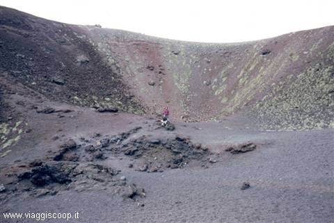
of 20 km. Its presence has influenced both the culture and the life of all the Etnean villages, whose inhabitants live in symbiosis with the volcano. Its plumes of smoke, the explosions and the recurring lava flows are by now a routine for those who live there, and serve only to never let them forget that there is a volcano under their feet. Along its flanks there is a great number of craters, grouped into over two hundred clusters, among which the most famous are certainly the Monti Rossi, on the southern side, towards Nicolosi, which originated from the 1669 eruption.
Day 118 Apr 2001
The Eruptions The first eruptions, which occurred about 700,000 years ago, were underwater, since the whole area was occupied by a gulf; the emergence came about later as a result of the accumulation of lava and a general uplift of the area. Even the ancients knew of the volcanic nature of Etna, described as the forge of Vulcan and the Cyclopes, or as the pillar of the sky, beneath which lay the giant Typhon, who, writhing, made the ground tremble. Pindar and Aeschylus described the eruption of 475 BC in a marvellous way. Among the ancient eruptions, mention should also be made of that of 396 BC, which reached as far as the sea; in the Middle Ages the most imposing of all is certainly that of 1329, which emitted a triple flow of lava, coming to threaten the territory of Catania, later invaded by the flow of 1381.
In the modern era the most famous was that of 1669 which, preceded by local earthquakes, on 11 March opened a fissure from the central crater at Nicolosi. As we approach our own times, the following eruptions deserve to be mentioned: that of 1811, which formed many vents, including that of Monte Simone in the Valle del Bove; that of 1843 which, reaching very damp ground, caused a violent explosion and the death of several onlookers; that of 1852 which threatened Zafferana; that of 1879 which began simultaneously on the South and North flanks; the eruption of 1892 which formed four large craters known as the Monti Silvestri. There have also been numerous eruptions in the last century. In 1917, from the NE vent, a fountain of lava about 800 metres high rose up which poured out, in a few minutes, three million cubic metres of very fluid lava.
The most violent eruption of the first half of the century was that of 1928 which, gushing from a long fissure, reached as far as Mascali, destroying it. Many other minor eruptions further modified the appearance of the volcano. The Park The first proposal for the establishment of the Etna park was made in 1960. In 1980 thousands of people took part in a march to demand the establishment of the Zingaro reserve, which was established in 1981 by a law of the Sicilian Parliament. In 1987 the Etna park was definitively established over an area of about 45,000 hectares, divided into zones A and B, and a pre-park area of 14,000 hectares divided into zones C and D. Zone A Zone A is the most protected and extends over 19,000 hectares, from the summit craters down to 870 metres above sea level in the Monte Minardo area.
The aim in this zone is to protect the ecosystem which here is little altered given the small human presence, a presence that is to be progressively reduced. At high altitudes the territory is characterised by craters and lava desert, while at lower altitudes there are forests of beech, birch and Laricio pine. There are no human settlements, with the exception of a few forest refuges. Zone B Zone B extends over 26,000 hectares, ranging from 1,880 metres above sea level at Monte Vetore to 640 metres above sea level at Monte Gorna. Its territory is covered by woods of Laricio pine, downy oak and Turkey oak.
The centuries-old agricultural activity affecting this zone has formed a singular contrast of traditional rural landscape and natural landscape, creating a territory characterised by terraces with vineyards and orchards, with old manor houses and peasant farmhouses that, without the establishment of the park, would have been replaced by concrete and asphalt. In this zone new residential construction, hunting and quarrying are forbidden; instead, the construction of infrastructure serving traditional agriculture is permitted. Zone C This part of the pre-park covers an area of 4,300 hectares and is located at an altitude between 600 and 800 metres above sea level. Its purpose is to allow development compatible with the natural environment while also permitting the establishment of tourist facilities.
In this zone there is a strong presence of agricultural crops, but also of natural vegetation. The construction of second residential homes is forbidden. There are also two areas of zone C at higher altitudes; these are two territories, with a total area of about 800 hectares, within zone A, located at ski lifts, hotels and other infrastructure built before the establishment of the Park. Zone D It is the outermost area of the pre-park, covering an area of 9,700 hectares. Its main objective is to allow development that does not interfere with the purposes of the Park. The construction of new homes is permitted, however following criteria compatible with this environment.
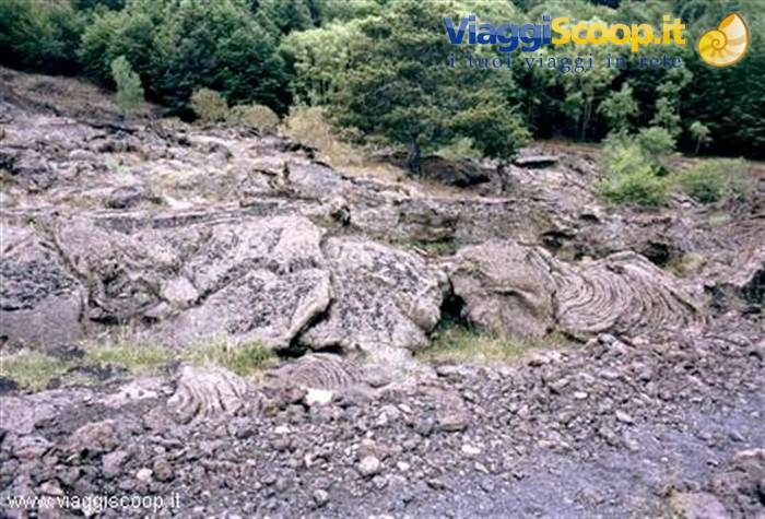
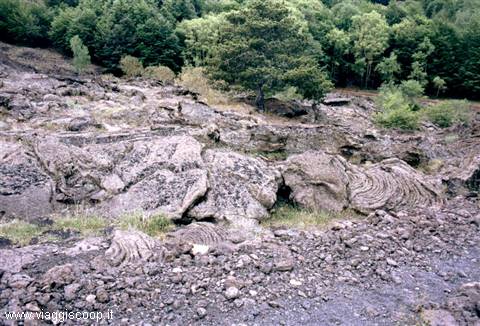
Lava flow
Day 218 Apr 2001
The Trekking At 2 p.m. on 18 May we land at Fontanarossa airport in Catania, where Fabio, our guide, is waiting for us. After buying the food and water needed for all the planned days, we reach the village of Serra la Nave, in the municipality of Nicolosi, the starting point of the trek, by minibus. The Etna area is very poor in water resources; the water from the rare wells encountered is not drinkable, so it is necessary to get some before setting off. The sharing out of the food and water (36 litres) made our backpacks very heavy; at the start they certainly exceed 20 kg. Carrying them proved to be the greatest difficulty of our walk. At 6 p.m. we manage to set off for the first short stage, which runs along a wide, completely flat mule track. We pass by the S.
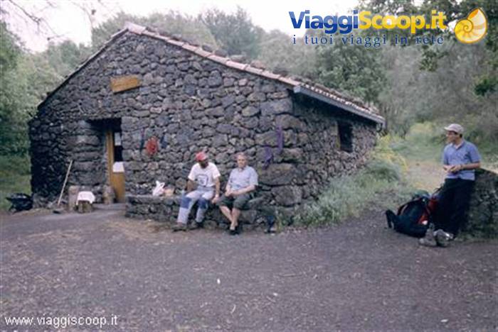
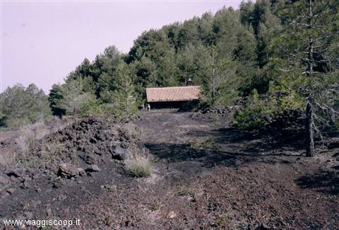
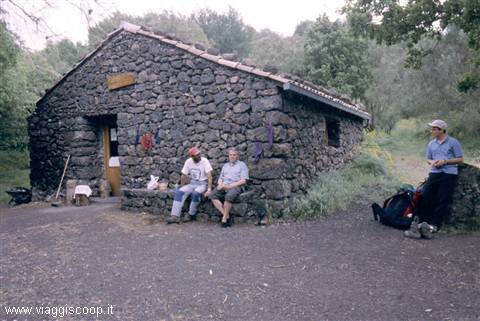
Giovanni Gualberto Forestry refuge and, at 8 p.m., reach the Galvarina refuge, the destination of the stage and of our first overnight stay. On the slopes of Etna there are dozens of these small unattended refuges, consisting of a single room containing a table, some benches and a small fireplace where it is possible to light a fire; the only bed is the floor, there are no bunks or other places to sleep, so one must adapt to the hard ground. Despite the brevity of the stage, we are all happy to have arrived so we can unload the weight of our backpacks; we are comforted by the thought that in the coming days they will get lighter as we consume the food and water. After dinner, in the darkness of the night, two small points of light approach the refuge.
They are the phosphorescent eyes of a little fox which, not at all frightened, comes looking for food; cautiously it comes within a few metres of us to collect the pieces of bread we have thrown to it. Its natural instinct had allowed it to understand that it had nothing to fear from our presence.
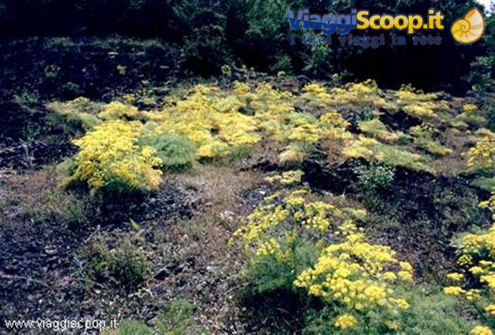
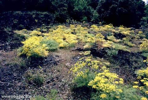
Fennel in bloom among the lava
Day 318 Apr 2001
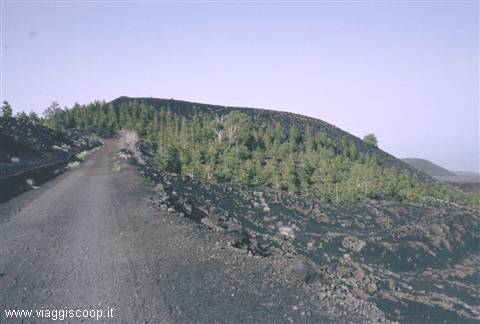
Wake-up at 6 and departure at 6.45 for the third stage; today the walk continues in a gentle climb along the same mule track as the previous days, as far as the Timparossa refuge, where we arrive at 10. Fortunately, the weight of the backpacks on our shoulders is beginning to decrease. We stop to look around the refuge and, after an early lunch, at 12 we resume walking. The mule track ends and the walk continues easily along a path which, after a gentle descent, starts to climb again. The landscape also changes radically: the woods that, with their shade, gave us a bit of coolness are replaced by the immense lava flows of 1911 and 1923. Fortunately the sun is veiled by a light haze which, although it does not soften its heat, at least shelters us from its rays. Shortly before reaching today's destination, Piano Provenzana, we cross an area rich in old extinct craters.
The place has the "charm" of the antechamber of hell: the immense expanses of black lava flows, over which our path winds, are interrupted only by the craters that emerge from them. In the distance, the presence of a few trees and the green of the meadows signal that our goal is near; at 2 p.m. we reach Piano Provenzana, a tourist resort reached by road, with kiosks selling souvenirs and postcards; there are also several ski lifts for winter sports. We can finally afford the luxury of drinking something cold and making use of a bar's services to freshen up. Here there are no refuges, as on the stretch of path covered in the previous days, so we decide to camp near a ski lift which, being slightly secluded and used only in the winter season, we think could make an excellent place to spend the night.
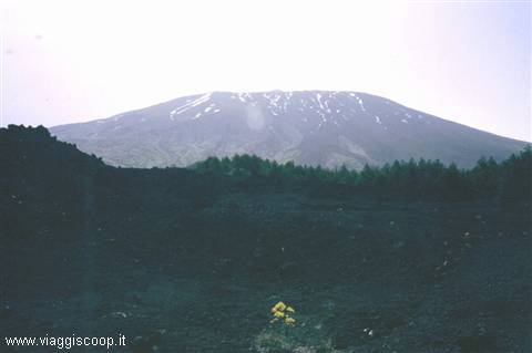
In front of us, 1,500 metres higher up, the summit craters of Etna dominate the scene; as darkness falls, from the north-east crater, in modest activity, glimmers of vivid red rise that were not visible during the day. Tomorrow we will try to get as close to them as possible.
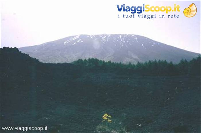
The west slope of Etna
Day 419 Apr 2001
Departure at 7.30 for the second stage, longer than the previous one and with backpacks still heavy; last night perhaps we should have eaten and drunk in large quantities to lighten them more. Today too the trek winds along a mule track which, with a continuous up and down, circles the mountain clockwise, keeping between 1,600 and 1,800 metres above sea level. After about 30 minutes of walking we reach the Poggio la Caccia refuge, another of the many small refuges we will encounter along our way. A brief stop to look around and to relieve our backs from the weight of the backpack, then the walk resumes. After another half hour we reach the Grotte di Monte Nunziata, which we admire only from the outside; on the slopes of Etna there are many lava caves which unfortunately we do not have time to explore thoroughly.
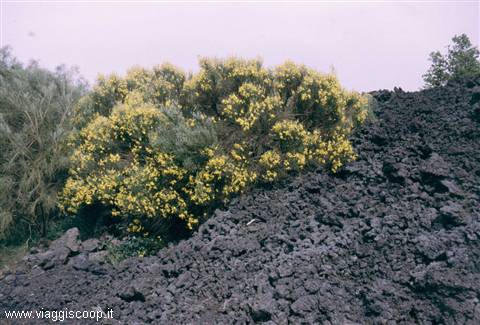
Today's stage is characterised by an alternation of pine, birch and beech forests with lava flows; the green of the trees, which reaches right to the edges of the lava, and the yellow of the many flowering broom plants create a magnificent contrast with the black of the lava flows, some of which are even several kilometres long. Near the Monte Scavo refuge, which we encounter on our route, there is a well whose water, although not drinkable, allows us to refresh ourselves and at least wash our faces; in fact, where we spent the night there was no water and therefore no possibility of washing. This too is part of trekking and one must be able to accept it. Towards midday we reach the Monte Spagnolo refuge, where we stop for lunch. This small refuge is situated among beautiful pines whose branches form an inviting shade that is impossible to resist.
Considering that the destination of our stage is fairly close, we stay until 3 p.m. lazing about near the refuge, also to escape the hottest hours of the day. Once we resume walking, at 5 p.m. we reach the Saletti refuge, the destination of our second stage. We are not alone: a group of Dutch hikers, with whom we share the refuge, keep us company until the following morning.
Saletti refuge
Day 521 Apr 2001
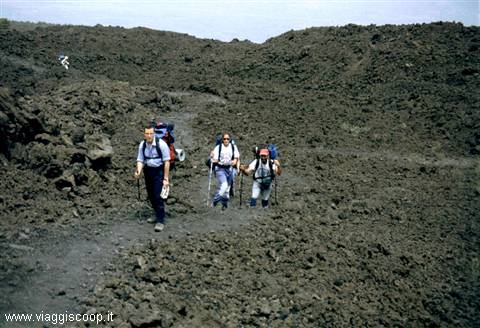
At 5 in the morning we are all already awake. Considering the length of the stage and the fair difference in elevation that awaits us, we decide to set off as early as possible. At 6.15 we begin to cover the 18 km and 1,300 metres of elevation gain that separate us from the base of the craters. The backpacks are relatively light, since this is the last day of walking we no longer need large quantities of food and water; the path too, although long, climbs gradually and is fairly easy. The landscape is the classic one of volcanic areas: enormous expanses of lava with no vegetation at all. As we gain altitude the wind, which had already made itself felt during the night, increases in intensity and considerably hinders our pace. At about 2,700 metres above sea level a detour allows us to reach a Volcanological Observatory.
The path, totally flat, crosses along the ridge, for about 1 km, a hill called Piano delle Concazze. On this plateau the fury of the wind reaches its peak: the gusts exceed 100 km/h, the volcanic sand penetrates everywhere, especially in the mouth and eyes; on the skin one feels countless prickles, like pinpricks, caused by the impact of the sand carried at high speed. Even our balance is unstable, the force of the wind tends to make you roll on the ground and drag you along with it. We take shelter near the Observatory, where we stop for ½ hour; unfortunately the wind shows no sign of calming down, so we must muster our courage and cross the plateau again, defying its unleashed fury. Back on the main path, being in a less exposed area, we find relative calm and continue towards the summit craters.
Once we arrive below the craters, at 3,100 metres above sea level, a surprise awaits us: the path we have followed until now and which climbs the northern area of Etna comes to an end; the connection with the one that descends in the southern area, although marked on the map we are examining, was swept away and erased some years ago by a lava flow. To continue we are forced to cross, for about 1 km, the expanse of lava without the help of even the slightest trace. The difficulty is not finding the right direction of travel, it is enough to go around the craters keeping to the same altitude we are at, but it is represented by the blocks of lava which are sharp and unstable. Having managed to overcome this obstacle, at no small expense of energy and time, the ground becomes sandy; the walk becomes easier although our feet sink into the sand, which hinders our progress.
Having found the path again, we reach in a short time the Torre del Filosofo refuge at 2,919 metres above sea level. Although we knew it was unusable, since it is half submerged by a lava flow, we thought we could camp in the shelter of its walls to admire the craters up close in the darkness of the night, spend the night and descend the following morning. The temperature, which with the falling of evening had dropped considerably, combined with the strong wind which, although not with the vehemence encountered on the Piano delle Concazze, continued to raise sand and dust, made us give up the idea. A hundred metres below us we spot a dirt road where two off-road minibuses are parked; what better opportunity could present itself to ask for a lift down to the valley? Saving three hours of walking, we comfortably reach at 5.30 p.m.
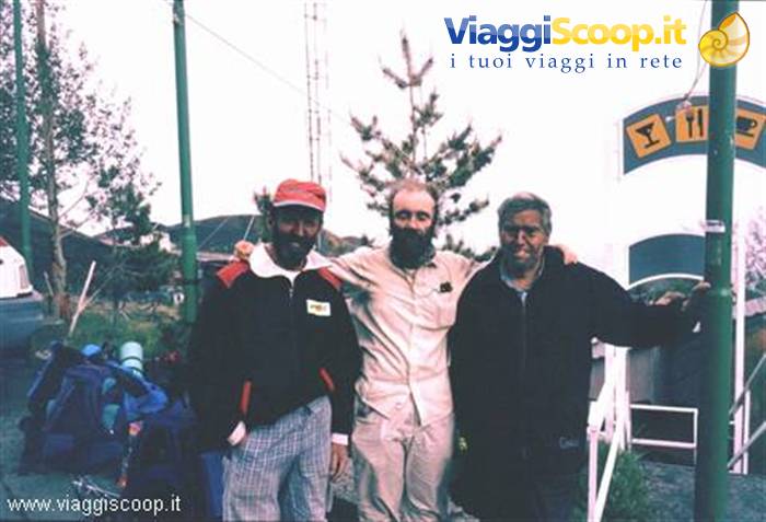
the area near the departure station of the Etna cable car and the Sapienza refuge (under renovation and therefore unusable). Our faces, covered with the black lava sand carried by the wind, are indescribable and almost unrecognisable; fortunately we can take advantage of the services offered by the cable car station to wash and change. Tomorrow morning the minibus will arrive to pick us up and take us to the airport for the return flight. The refuge is closed, so another night camping in the open awaits us, but here, at 1,850 metres above sea level, the temperature is acceptable and even the wind has turned into a pleasant breeze. The discovery that there is a restaurant-pizzeria on the spot lifts our morale even higher which, despite the various hardships, has always been high. Finally we can have a real dinner and toast to the happy conclusion of our trekking.


0 reader comments