This trip takes its cue from a publication by the Ente Parco dei Monti Sibillini, specifically “Pedalando nel parco”, which illustrates the park's main mountain-bike itineraries and the Grande Anello dei Sibillini, a route that unfolds over 5 stages all around this range, allowing the tourist to see all the main cultural and natural attractions of the park. The Monti Sibillini, a national park for several years now, represent one of the most interesting and varied mountain systems in the Apennines.
Barely considered by tourism, also because of its not-easy accessibility, its territory gathers many facets, from the most naturalistic (spectacular blooms, the presence of rare animals such as the goshawk, the golden eagle and the wolf and of endemic species such as the chirocephalus of Lake Pilato) to the historical and sacred ones (the Norcia side with all the parish churches and monasteries of the surrounding villages). A further fascination comes from the legends that over the centuries have told of these territories, long known as the kingdom of demons and fairies: toponyms such as the gorges of the Infernaccio or the very name “Monti Sibillini” leave no doubt (it's said that the Sibyl lived here in a cave).
Visiting these places by mountain-bike lets you appreciate all this even better: contact with nature is total, numerous tracks, both paved and unpaved, cross the territory connecting the various villages and allowing you to pass through meadows and panoramic peaks, and human presence is so scarce that we rarely met anyone along the route except in the villages.
Notes on the Route
The park publication that illustrates the Grande Anello route pleasantly describes the flora and fauna of each place as well as the most important cultural aspects of each stage, but it is very poor in details both on the gradients of the roads and on their surface. We went and bought the map of the park's paths, scale 1:50000, to use in the rucksack in front of the bike for convenience, and the one at scale 1:25000, which is also more up-to-date, on which we relied when in doubt. The maps allowed us to deviate from stretches of the route that already looked too arduous on paper to ride by mountain-bike; others we “endured”, realising on the spot that whoever had devised the route perhaps hadn't ridden it in its entirety by bicycle. Reading through the diary, the changes and the main difficulties have been pointed out.
We also stress that many descents and some “single-track” stretches would certainly be more enjoyable without bags in tow: the jolts to control on some rocky descents and the lateral bulk of the bags on the more demanding paths slowed us down a lot. So if you have a friend who wants to join you on holiday but isn't interested in riding the Sibillini by bike, arrange for them to follow you by car and leave the luggage with them: you'll have a lot more fun! Maybe they'll have a bit less... In any case we can assure you that the route is overall a monstrous treat for two-wheel enthusiasts! Broadly speaking, the paths and tracks are rich in signposts, many of which, however, relate to the Grande Anello hiking route, which is done on foot and is more on the outside than the mountain-bike one.
When in doubt, always refer to the Park's houses, present in more or less every village, where the staff will always be able to advise you on the route and update you on the state of the roads. It's also always useful to say, on setting out, which route you intend to take and where you want to arrive, so that in case of problems it's easier to be traced: we repeat that in the woods and on the mountains in August we met very few people! Our route is made up of 6 stages rather than 5, to allow us an excursion on Monte Vettore on foot on the third day.
Accommodation
In general we recommend taking into account the park's mountain huts, all very recent, comfortable and in excellent positions, both for those doing the Sibillini hiking ring and for those doing it by bike. Other huts and holiday homes are present in some villages of the park.
Fiastra: Rifugio di Tribbio (Tel/Fax: 0737527027 rifugio@alcina.it) Recent structure; dormitories of 6-8 places with bathroom inside the room or outside. It's the starting and finishing hut of our loop, right along the dirt track that descends to Fiastra, a few steps from the village; the hut is in a quiet spot and can be reached by car, so we were able to leave our vehicle with some of the luggage in their car park for the 6 days of the mountain-bike loop. Run by Michele together with other young people from Fiastra, we received a warm welcome. On our return there was no room and we slept next to the hut in a tent on a plateau with wild boar circling around us! Worth considering also for lunches and dinners. 18 euros per person for overnight stay and breakfast, 15 for dinner.
Amandola: Casa per Ferie Fillide (Lega Ambiente) - (Via Indipendenza, 73 Tel 0736847294 fillide@tin.it) Located right in the centre, this holiday home is also an environmental education centre. Ketty, one of the people who runs it, welcomed us warmly and let us keep the bikes inside the house in a room. Low prices and spacious rooms with bathroom.
Colle di Montegallo: Rifugio Colle le Cese (Tel 0736807016) Colle di Montegallo is a hamlet made up of about ten stone houses overlooking a little square with a fountain at around 1000 metres of altitude. The hut, then, like the village, is in a splendid position, and strategic for possible excursions on Monte Vettore and Sibilla. Unfortunately the running of it doesn't inspire enthusiasm, especially in dealings with customers. Dinner is decent; bear in mind that in the village there's no other choice; breakfast when the staff feel like getting up.
Forca di Presta: Rifugio degli Alpini (Tel 0736809278 Cell 3470875331). Located at around 1500 metres of altitude, right opposite Monte Vettore (reachable in an hour and forty minutes' walk) it is visited by many hikers interested in conquering the main peaks of the group. You can also get there by car and it offers an excellent viewpoint over the plain of Castelluccio. But the real added value is Gino, the manager, known by everyone in the park and even beyond its borders. Typical Roman sarcasm, he spares no guest (we were the “Ansimanti” for the record!), and is capable of telling uproarious anecdotes in bursts; he's helped in running it by his rasta son, who dreams of opening a spaghetteria on the Costa de la Luz in Spain... Excellent dinner, prices around 35 euros, breakfast and dinner included.
Serravalle di Norcia: Albergo Italia (Tel 0743822267 note: the number given in the leaflets provided by the ATP is wrong! info@albergonorcia.it) It can't be denied that it was a fallback choice, not finding any free rooms to sleep in Norcia on the evening of Ferragosto. Expensive compared with the other nights of the holiday, though not compared with the average in Norcia and surroundings. The manager also owns the bar next door where they make filled sandwiches that wouldn't pass an anti-doping test. Shelter for storing the bikes.
Visso: Hotel Elena (Via Rosi, 20 Tel 07379277 info@hotelristorantelena.com) Here too no other option. Elegant hotel, prices not excessive. Bikes kept in a ground-floor room. Super breakfast
Day 112 Aug 2007
First Stage: Fiastra(756 m) - Amandola (535 m) 40 km 926 m of elevation gain.
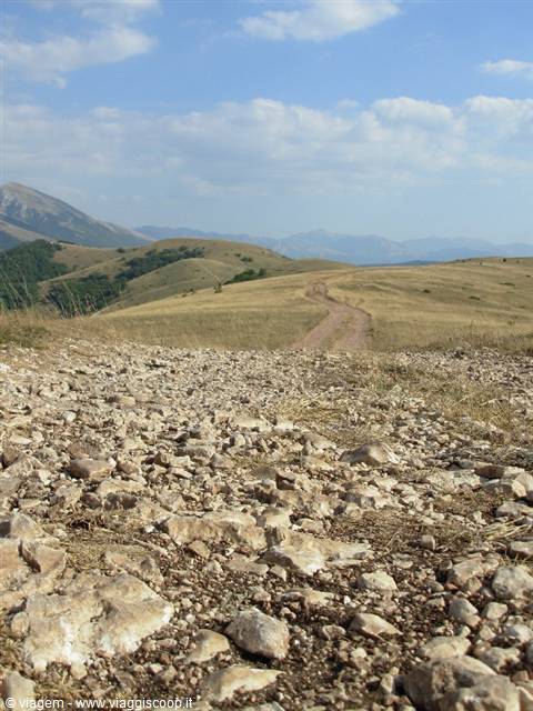
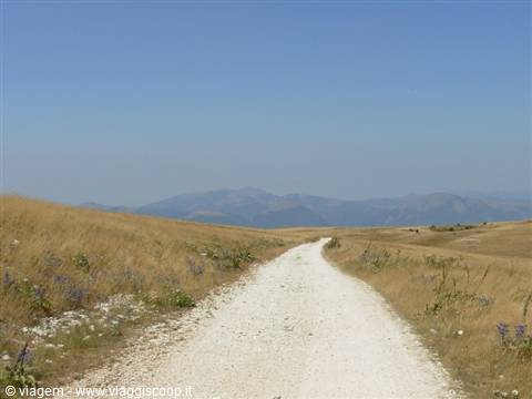
This stage follows the one described in the park's publication, except for the final stretch from Garulla to Amandola, where we detoured onto the dirt road of Vidoni and Canale di Pietra. The climb to the meadows of Ragnolo (1520 m) is paved and with little car traffic, tough at the beginning (a 15% section is indicated) it gradually becomes gentler until reaching the meadows. It is advisable to stock up on water at Acquacanina, where there is a fountain along the road with very good water (as will happen everywhere here in the park) and rather icy. The meadows are ideal for sunbathing in the cool and sought after by children for flying kites. The descent from Pintura to Garulla, on dirt road, is rather ugly in the last part, with rough ground full of stones and rutted in the center of the mule track. No orientation difficulties.
In Amaldola we enjoyed the "fregnacce" at the town's unità festival, a name that made us dream more than the reality of the dish.
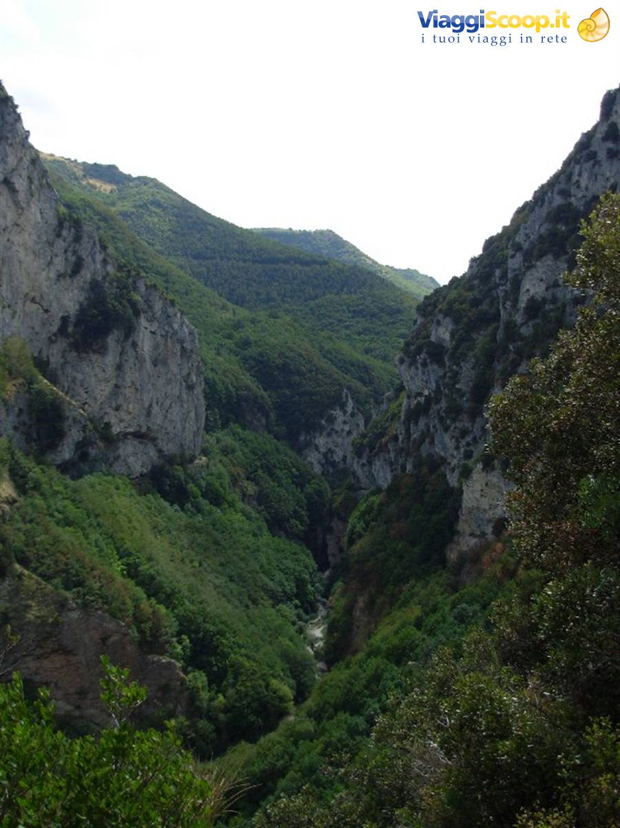
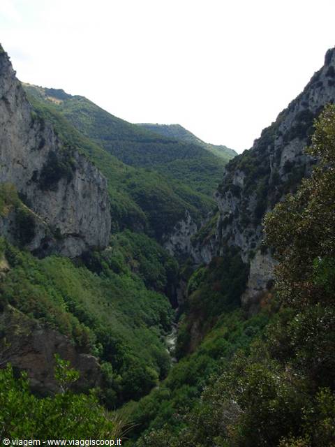
Fiastrone Gorge from above
Day 213 Aug 2007
Second Stage: Amandola (535 m) - Colle di Montegallo (1015 m) 46 km 1100 m of elevation gain.
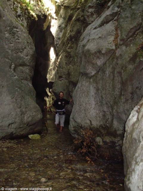
The route is very varied and passes through numerous small villages without ever climbing too high in altitude, but with continuous ups and downs. We added the detour to the Gole dell'Infernaccio (beautiful, but those of the Fiastrone at Monastero are much more wild: still unknown and passable only by walking inside the water!), easily reachable by mountain bike via a wide dirt road with a slight climb, keeping an eye out for all those who travel it on foot. From Amandola after a stretch of dirt road we climb on asphalt to Cossudro, going around the beautiful village of Montefortino, up to Colle Regnone (beautiful village) and Montemonaco. Having descended to Cittadella on a fast dirt road, where the vegetation has been completely ruined by a fire, the umpteenth of this year, we wanted to follow the route indicated in the guide. Well, avoid it.
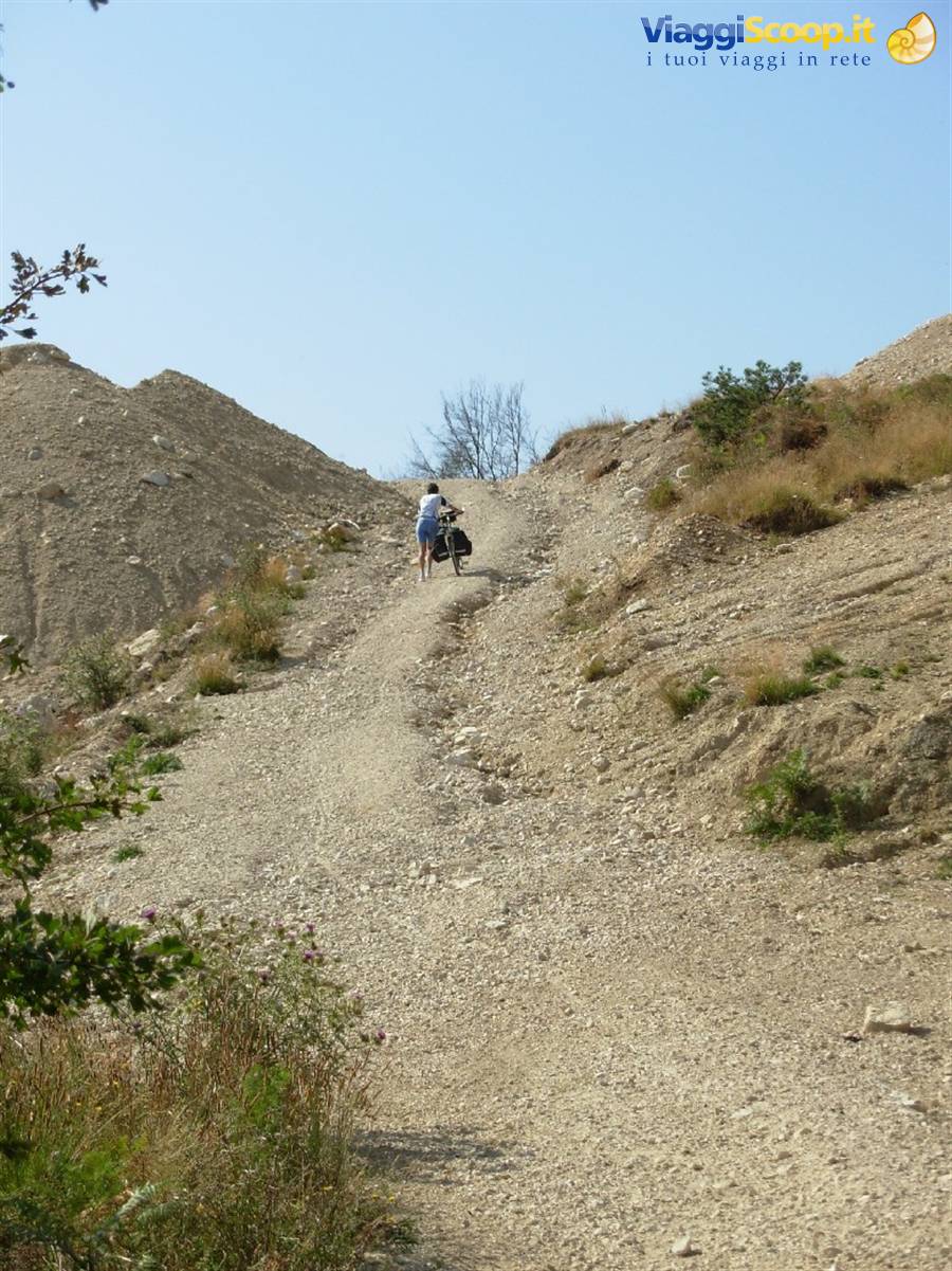
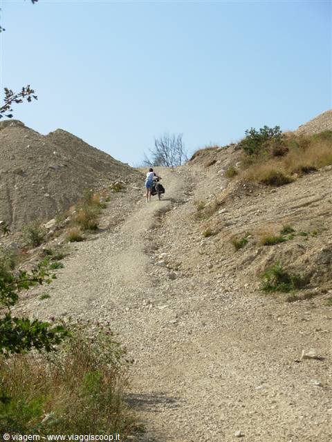
It is a dirt road that looks more like a stream bed from how disastrous it is, which leads to Propezzano through 3 km of extremely tough climb, all done pushing the bikes. Even without the bags it is impossible to ride more than a few meters in the saddle, I wonder if whoever wrote the guide has ever traveled this mule track. Exhausted by this immense effort, we headed to Montegallo via the asphalt and saved our last energies to reach Colle, after 2 km of climb that seemed never to end. Car traffic only on the road from Montemonaco to Montegallo.
But who made us do it
Day 314 Aug 2007
Third Stage: Colle di Montegallo (1015 m) - Rifugio degli Alpini (1520 m) 13 km 850 m of elevation gain.
Very short stage but a particularly demanding day from a physical point of view. We set off not trusting the guide's route and preferring a dirt road that seems wider and easier, but after 2 kilometers the surprise: a landslide has eaten the path and we find ourselves wandering among rocks and pines repeatedly lifting our bikes off the ground to overcome the obstacles. We are already tired. We continue toward Colle Galluccio descending along a nice dirt road and then climb up to the Rifugio degli Alpini along an asphalt road that is easy at first, but increasingly demanding as one approaches the pass. We stop at the Rifugio degli Alpini in such a condition that the manager cannot but nickname us "The panting ones"! We end the bike stage here to have a chance to climb on foot near Monte Vettore and see Lake Pilato (700 m of elevation gain).
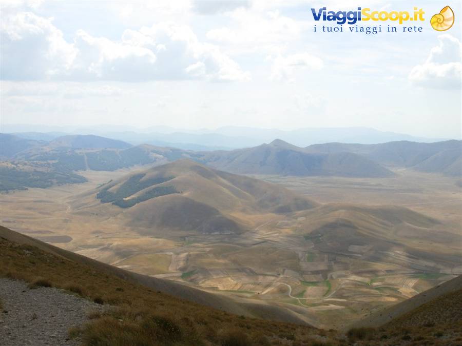
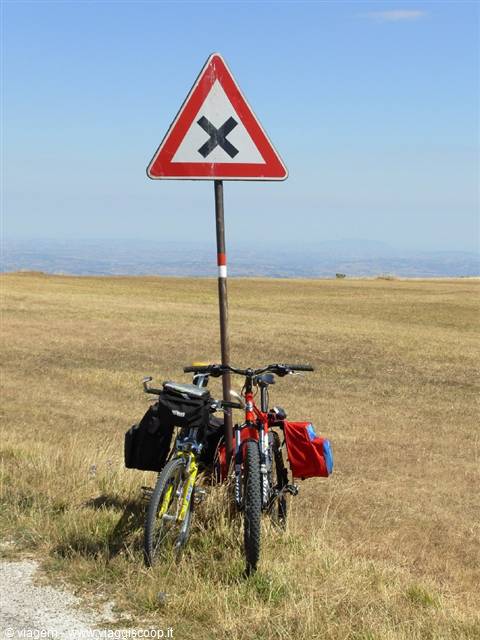
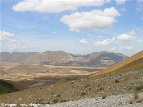
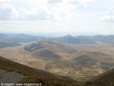
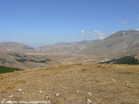
Another massacre given the steepness of the path, fortunately the clouds spare us from the sun that would have been directly overhead. The path, although brutal in its ramps to the point of having to use even the hands at times to climb, allows us to observe the plain of Castelluccio from an ideal viewpoint. This place, lunar in August, is actually a pole of attraction for many tourists at the end of May, when for 1-2 weeks it blooms coloring the entire horizon with all the shades that mother nature has available. It is incredible to observe this plain, at 1300 meters of altitude, surrounded by mountains that rise steeply: like having an empty pool before us, and indeed it is what remains of the bottom of a lake.
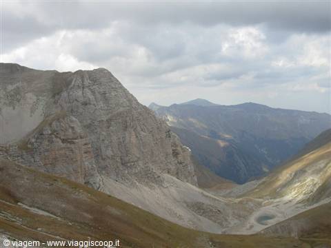
In the mountains in front of us they have left a conifer forest that recalls the shape of Italy, complete with islands! Lake Pilato owes its name to a legend that tells that the corpse of the famous Roman procurator, after being killed by order of the emperor, was transported here by a cart drawn by buffalo and dropped into the lake, long consecrated to devils, to the point that crowds of necromancers and wizards until recently made appointments near these waters to practice their spells. The lake is very beautiful and among its inhabitants sees a small animal very similar to a shrimp, the chirocephalus.
It has the peculiarity of living exclusively in these waters, moreover its eggs can hatch within 8 years, depending on environmental conditions: in short, if I feel like it I am born, if instead I see that it is too cold I wait for next year or the year after! Convenient! Unfortunately by now the lake is almost dried up and in order to be seen one must climb to the crest of the Cima del Lago or descend after the Zilioli pass (2200 m) down to the lake itself (1940 m). The evening in the refuge turns out to be very pleasant: we meet a guy from Bologna who is going from Forlì to Gargano by mountain bike passing through the main Apennine peaks, tent in tow! But also two very nice motorcyclists from Jesi, who tell us about life in their town.
Plain of Castelluccio
Day 415 Aug 2007
Fourth stage: Forca di Presta (Rifugio Alpini 1520 m) - Serravalle di Norcia (530 m) 32 km 200 m of
It is almost a rest day (after all it's Ferragosto!), after a nice high-altitude dirt road, we descend from the Forca Canapine down to Norcia, the first part consists of a long paved descent (a good half hour!), the second of pleasant dirt roads and secondary roads in the surroundings of Norcia. From here to Serravalle we proceed along the Salaria, quite busy, in a slight descent. We avoid a downhill dirt road right after the Forca Canapine, present in the itinerary suggested by the guide, because on the map it seems too steep and more similar to a path than to a mule track. The heat begins to make itself felt.
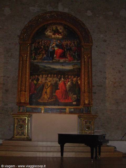
But there is another guest whose traces we had lost since we arrived here on the Sibillini: traffic! Hearing the car horns asking for the right of way in Norcia threw us off: we were no longer used to it! During the day we visit Norcia: a pleasant town but really crowded with tourists at Ferragosto (so much so that we had to fall back on Serravalle to find accommodation!). Piazza San Benedetto, nestled between the basilica of the same name, the Cathedral and the Town Hall, is a little jewel. Also to remember is the auditorium of San Francesco, where an altarpiece by Jacopo Siculo, recently restored, is kept and alone deserves a visit to the town. Dinner based on black truffle at the trattoria "Dal francese". Highly recommended!
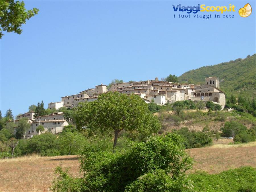
Campi Vecchio
Day 516 Aug 2007
Fifth stage: Serravalle (530 m) - Visso (607 m) 36 km 1100 m of elevation gain
This stage will turn out to be the most demanding, but also the most varied and rewarding, for the villages visited as much as for the nature and panoramas contemplated. Even the dirt roads we travel are among the most interesting of the tour, with difficulties of every type and level. The Umbrian side of the park welcomes us with a succession of villages on the side of the mountains that flank the valley that leads from Norcia to Preci. Beautiful villages, by now abandoned by their inhabitants, who have mostly moved to Rome or to the main Umbrian towns, whether for work or also because of the last earthquake of 1997.
In Collescille we talk to a guy (the only encounter of the day!) who returns to the village only in summer because his family's house is still here; he tells us that only 3 families live permanently in the village and that in winter Collescilli is in fact unreachable by car due to ice and snow. The only church is unsafe after the earthquake and running water in summer is scarce. Despite all this, these villages are splendid, surrounded by parish churches, abbeys, monasteries and convents, all in isolated places and immersed in nature. We start off with a bang, that is, during the night we get hit by the classic Umbrian-Marchigian earthquake, in a hotel that had been razed to the ground by the earthquake 10 years earlier... ehm...
After a visit to the marcite of Norcia, a peculiar environment where water springs up a bit everywhere, comparable to our Venetian resurgences, but used since the Middle Ages for the cultivation of the plain, we begin the climb toward the Forca di Ancarano (1008 m). It is on asphalt, easily pedalable apart from the insistent heat already in the morning. We therefore give up the dirt road that leads to the Forca to avoid increasing the already significant difficulties of the stage. From the pass a very pleasant and very varied dirt road begins, which leads us to the villages of Piè la Rocca and Capo del colle passing through dense woods, with a surface that continuously varies from stony to packed, but always rather easy and in a slight descent.
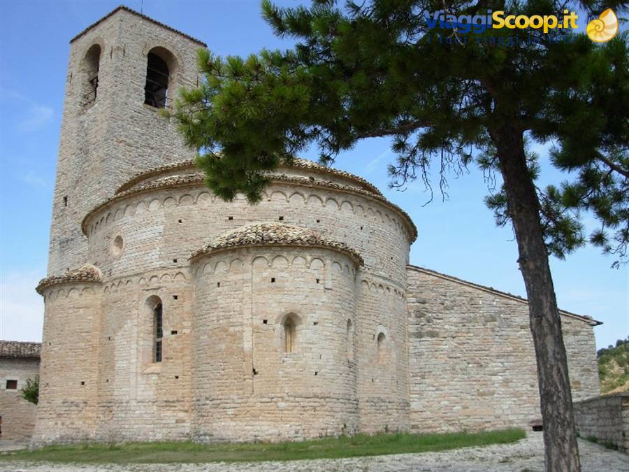
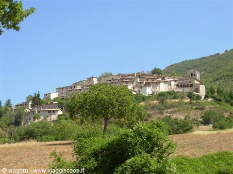
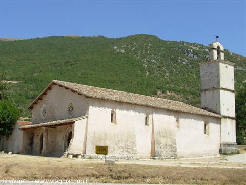
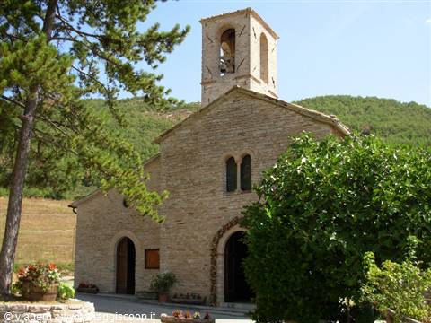
Arriving at Campi we admire the village of Campi Vecchio, excellently preserved, and the church of San Salvatore (710 m), which stands in an isolated position in the middle of the valley. Incredible the beauty of this monument and the total absence of tourism in its surroundings, but about this we can only be happy! Campi is the only place where it is possible to stock up a bit on food and energy, very useful given the difficulties that await us. Every village instead has a fountain to supply water, but the one in Collescille is decidedly scarce and warm in summer. From Campi begins a steep uphill dirt road (pushing) that after a couple of kilometers turns into a technical and interesting single-track, but unfortunately impassable with the bags. We have to proceed with the bike in hand, because the risk of slipping off the path down into the valley for several meters is tangible.
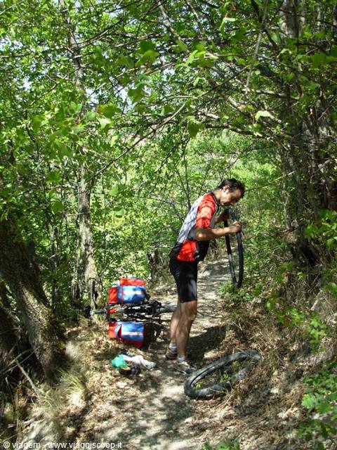
The bags force us with the rear wheel often outside the trackbed. In this decidedly demanding stretch for the first time we get a flat tire! And finding a sufficiently wide spot to change the inner tube is not an easy thing. I still remember the words of the guide: "Flat dirt road" and "slight ups and downs", that is how this stretch of the route was described! Arriving at Acquaro we emerge from the woods and can contemplate the incomparable Benedictine abbey of Sant'Eutizio. From here, along a fairly demanding asphalt road all in the sun, we climb to Collescilli (944 m). The heat is unbearable, the road becomes concrete inside the village and with gradients over 15%, we decide to stop to let the hottest hours pass.
We set off again after stocking up on water and energy, but the gradients are unbearable, sections over 20% on dirt road: impossible to proceed except by pushing, even without the bags it would have been quite hard. And together with us the warning of the inhabitants of Collescille accompanies us: "Watch out for the Maremma shepherds when you are near the summit, they are free and if the shepherd is not there they could attack you!" We conquer Monte Lungo at 1250 m with a wonderful panorama over the valley of Preci and Visso and begin the descent without meeting the respectable quadruped. The first part of the descent is very fast, one must always keep one's eyes open to avoid the most significant obstacles, which could damage the bags tied to the luggage rack. We zip past a Maremma shepherd without giving him time to react.
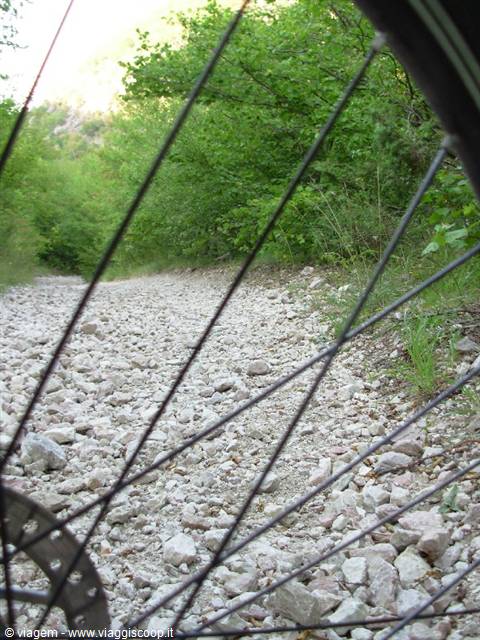
Then the path becomes more stony, sometimes steep sometimes less, we absolutely must slow down. The descent is very long, hands on the brakes for half an hour straight and speed comparable to the one we keep on the climb. The surface is practically the bed of a river, a scree! Every now and then we stop and throw water on the disc brakes: a cloud of steam rises... Finally, almost at sunset, we reach Visso, a town nestled at the confluence of 5 valleys and very rich in water. This town is truly cheerful and wins the heart of anyone who passes through: impossible not to stop there. The pedestrian little square in the center, embellished by the Church of Sant'Agostino and the Collegiate church, is always full of events and above all of people! Visso combines an enchanting natural environment with a cultural and artistic presence of remarkable importance.
S. Eutizio
Day 617 Aug 2007
Sixth and last stage: Visso (607 m) - Fiastra (756 m) 32 km 1007 m of elevation gain
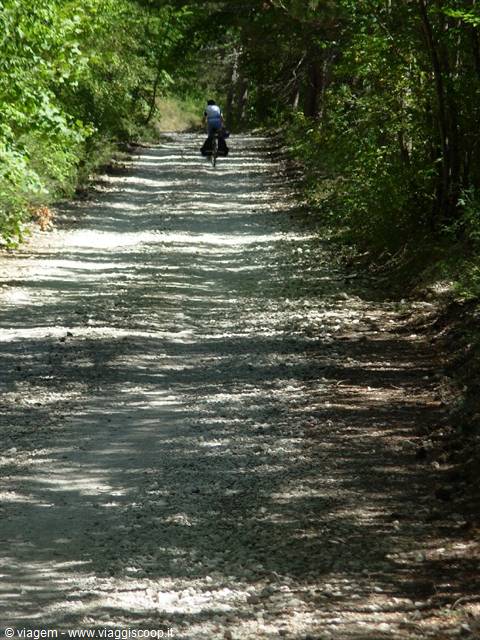
This stage faithfully follows the one described in the park's publication. Maybe because it was the last one, maybe because the climb was all concentrated at the beginning and in a single go, but this turned out to be the easiest stage of the tour. No orientation difficulties, splendid dirt roads, adequate gradients. From Visso we climb to Casali along an asphalt road completely free of traffic, the climb has partially demanding sections just outside the built-up area of Ussita, then it is pedalable. Arriving at Casali it is advisable to stop, catch your breath and fill the water bottles with the excellent water of the village fountain (there will be no other supply points along the route, for food instead one must have already provided at Visso!). It is also worth admiring the elegant stone church of the village, in the center of a panoramic clearing over the valley below.
From Casali (1080 m) begins the dirt road that leads to the meadows of Pao and del Capriolo (1570 m). The surface is never excessively rough, nor is the gradient, one must only pay attention to the cars that every now and then travel the road (about one passes every quarter of an hour...). As the climb proceeds the route becomes even more pleasant, running under a conifer forest with a light breeze easing the summer heat. We emerge from the woods into the usual meadows of the bare peaks of the Sibillini. From here on the traffic becomes nil and we will no longer meet a living soul (what a novelty! Actually no, we do meet a bull!). The descent, easy, long and unfortunately last, accompanies us down to the Trebbio refuge, with continuous glimpses of Lake Fiastra stretched out before us.
Final big surprise: the refuge is full, so we sleep in a tent in the meadows around it, with the nice noise of the wild boars that come to eat next to our dwelling for the night!
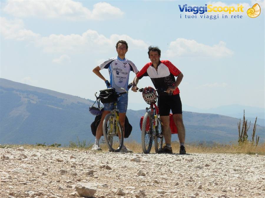
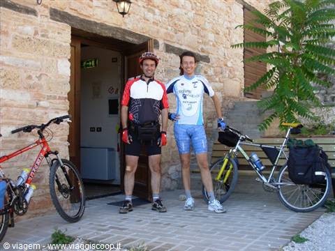
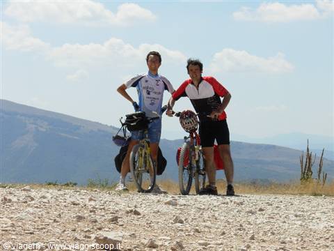
Two cyclists in jerseys stop their bicycles on a rocky mountain trail
Day 720 Aug 2007
...in the yard at home..
Surprise of surprises: returning home after 3 days and finding the bike with a flat tire! It got a flat in the car (not deflated, there is an actual puncture) and no one knows how, or else Saint Rita of Cascia, the saint of the impossible, put a finger in and kept the air inside the inner tube until we finished the tour!!! Thank you Saint Rita, on behalf of all reckless cycle tourists like us!





0 reader comments