This year for our summer holidays we chose to stay in the Bel Paese [Italy] and go for a stroll in the Dolomites. Despite the unfavourable weather we still managed to do quite a few trips. Unfortunately we are aware that our friend the little cloud loves to travel and consequently there isn't a time when it doesn't decide to come on holiday with us; this year, though, curse it, it brought along all its friends too! If it had rained a little less we would have got less wet, avoided using all the rain gear and above all camping life would have been simpler. Yes, because after years of holidays spent in hotels, this year we went back to camping.
When we talk about the Dolomites we refer to a very distinct geographical area in the north-east of Italy. The term Dolomites comes from the name, Dolomia, given to the particular rock of this area. The mountains are exactly as they say: spectacular. The possibilities for trekking, excursions and so on are many; the only problem is choosing. For this first holiday in these mountains we limited ourselves to the best-known places, and that also means the most crowded, but despite this they were very pleasant days full of satisfaction. Whether because the areas are really stormed by tourists or because the ski lifts bring the mountains within everyone's reach, walking along the trails sometimes comes down to a constant 'excuse me', 'sorry', 'thank you'.
It is also true that to leave behind the crowd of sedentary holidaymakers it is enough to choose more demanding or longer routes, but you certainly can't say you risk meeting no one! There is a lot to say about the ski lifts. There really are a great many of them; while on the one hand it is convenient to be at altitude without any effort, on the other all these lifts pour mountains of sedentary holidaymakers onto the summit who then tackle trails beyond their ability. Welcome are the people who want to learn to walk in the mountains, to move about, but let us always keep our limits in mind. People often forget that the mountain can also turn into something dangerous if you are not properly equipped and above all prepared. No one dreams of going to the sea without first buying a nice little swimming costume.
Have you ever seen anyone on the beach in their underpants? Because if in the mountains we only stay a week, what's the point of investing in a good pair of boots and some warm fleece — we just make do with what we have? Of course, a swimming costume costs much less than a good pair of boots and so on. And if that person can't swim or has little confidence in the water, they don't start diving into the pool from the diving board, they don't hire a speedboat to go swimming offshore... they take good care not to swim far from the shore or where the water is too deep until they feel able to. Why doesn't this happen in the mountains? It's not enough to put on shorts and a pair of trainers, the little rucksack with which the child carries their snack to nursery and off you go.. all transformed into seasoned expert hikers.
There are routes that require at least a suitable pair of footwear, others that need special equipment! I don't want to sound presumptuous but before choosing a route I check the map and do my research. I don't take a direction just because a sign points that way without asking myself what kind of route it is, especially when it is at certain altitudes and in certain environments. I've seen people come down, come down because they had gone up by cable car, from trails of scree and earth sitting on the ground, literally sliding their backsides along the ground because they couldn't stay upright; people held by the hand taking steps smaller than an ant's because they kept slipping; people with tennis shoes on the snow, and so on.
I live in the Alps and go walking almost every week; I have walked in the Andes, in the Rocky Mountains and in other places around the world, but such 'unprepared' people I have only seen here, and do you know why? Because of the ski lifts. Very convenient — I've used them too — but it is people's heads that must first of all be trained; the mountain is beautiful but must be faced and experienced in the right way. This side of the Dolomites left me rather puzzled.
And another sore point, mobile phones.... Is it really possible that you can't go on a trip without using a mobile phone? And then, the calls, if only there had been one worth making. Do you remember those made on the train to let the family know you're arriving home? Hasn't it always been the case that commuters go home in the evening? Did they use carrier pigeons before mobile phones were invented, or did the wives survive just the same without knowing minute by minute where the husband was? And technology advances, and so we have to hear 'I'm here', 'the sun's out', 'it's cold' and so on.... Conversations useful only to the phone companies! Undoubtedly they are a useful little gadget and in case of accidents or other things they can be useful, but these futile conversations are just annoying and, in my opinion, 'profane' the mountain.
Guides and magazines: Dolomiti – Istituto Geografico De Agostani Guida Escursionistica 964 Dolomiti – Kompass Hans Kammerer – Vie Ferrate nelle Dolomiti – Tappeiner Goedeke/Kammerer – I 3000 delle Dolomiti – Tappeiner ALP Grandi Montagne – n. 20 Pale di San Martino – CDA&Vivalda Editori Meridiani Montagne – n. 13 Pale di San Martino – Editoriale Domus Meridiani Montagne – n. 21 Catinaccio – Editoriale Domus ALP Grandi Montagne – n. 23 Gruppo di Sella - CDA&Vivalda Editori ALP Grandi Montagne – n. 31 Sassolungo - CDA&Vivalda Editori Merdiani Montagne – n. 17 Tre Cime di Lavaredo – Editoriale Domus ALP Grandi Montagne – n. 17 Tofane e Cinque Torri Scotoni - CDA&Vivalda Editori Merdiani Montagne – n. 11 Tofane – Editoriale Domus
Day 123 Jul 2006
San Martino di Castrozza
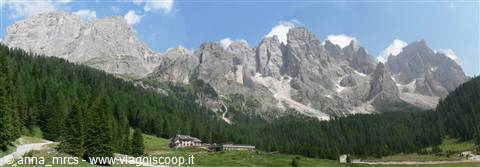
After filling our car quite nicely, we set off toward the Dolomites. The traffic on the highway is negligible, there are quite a few cars but you travel well and calmly, there are no lines or slowdowns, so much so that we manage to go have lunch peacefully in one of those rest areas along the Val di Fiemme. In the afternoon we make a stop at the park's visitor center near Paneveggio, to visit the deer enclosure. A short path winding along the enclosure allows you to see the deer inside it. There are females, young ones, and males, some with antlers. They are calm and rather indifferent to the people crowding along the fence. They are very beautiful, a shame that they are in an enclosure. This is the area of the Paneveggio forest where the red spruce grows, whose prized wood is used to make the soundboxes of musical instruments.
The Paneveggio forest, together with the Dolomite group of the Pale di San Martino and the Logorai chain, forms the Paneveggio - Pale di San Martino nature park. It is an area of particular value, especially given its varied nature, both in scenic and naturalistic terms.
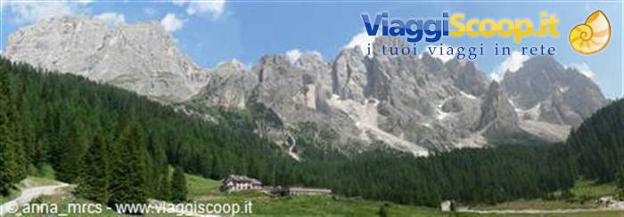
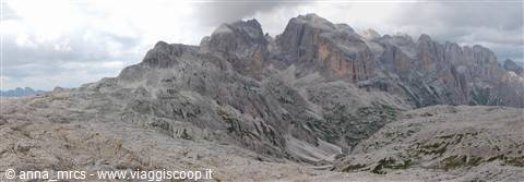
The road that takes us to San Martino di Castrozza, coming from Val di Fiemme, first reaches Passo Rolle, from which you enjoy a fantastic view of the Pale di San Martino. Passo Rolle (1,980 m) is the pass that connects the other Dolomite valleys with San Martino di Castrozza. Someone has called Spitzkoppe (Namibia) the Matterhorn of Africa because of its resemblance, although it is much smaller and less imposing in size. By virtue of these similarities we can venture to compare the Pale di S. Martino to the Torres del Paine in Chile. They resemble each other, although the latter are more imposing. San Martino di Castrozza (1,450 m) arose as a tourist resort in the 19th century. It preserves a town center in perfect mountain style which, with its succession of venues and shops, makes it a lively center crowded with tourists.
After 4 p.m., the central streets of the town become pedestrian zones, so to reach the only campsite in town, for us arriving from Passo Rolle, we have to go all the way around the built-up area. The town is in any case located in a very favorable position from a scenic point of view. The campsite is nice, the ground is mostly dirt and gravel, not exactly the best ground for a tent. The campsite is rather full but there are many seasonal campers and many 'fixed' caravans. The bathrooms are clean and well organized, there is even background music that makes taking a shower even more pleasant! Next to the campsite there is a restaurant affiliated with the campsite (campers get a discount on the bill) which we try that same evening, and a small market. Once we have settled our things, we set off on foot, since it's not far, to the town center.
Since it's Sunday, the grocery stores are closed. Open we find souvenir shops, a few clothing shops or various goods, bars and restaurants.
Campsite: SASS MAOR - - via laghetto, 48 - S. Martino di Castrozza - 9.00 € per person and 10.00 € per pitch
Catinaccio and Sciliar
Day 224 Jul 2006
Tour of the Pale di San Martino
With today we begin our Dolomite hikes. First stop the supermarket, luckily it opens early (at 7) so we have time to stop and buy what we need for lunch. After that we go to take the ski lifts that from San Martino di Castrozza lead to Rifugio Pedrotti. The first lift, a kind of gondola/chairlift, takes us up to Col Verde, and from here you take a cable car and go up to the plateau of Rifugio Pedrotti (round trip 16.50 standard - round trip 14.70 CAI members). It is still early and there aren't many people going up, us and a few others with what's needed for a good climb.
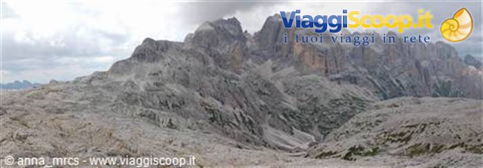
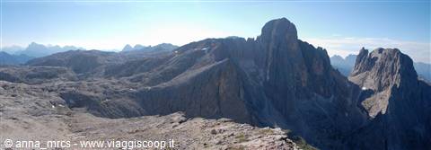
Today's itinerary, commonly called the 'Giro delle Pale,' is, besides being one of the classic routes of this area, a route that allows you to admire some of the most important walls of this massif. Before starting the actual tour we make a quick dash up Cima La Rosetta (2,743 m). It is a stone's throw from the cable car arrival point, and not reaching its summit would really be a shame considering that the view enjoyed from the top is very beautiful. After this first detour we return to the cable car departure point and continue to the nearby Rifugio Pedrotti alla Rosetta (2,581 m). After leaving the refuge we head, in this strange landscape, toward Passo di Roda (2,572 m).
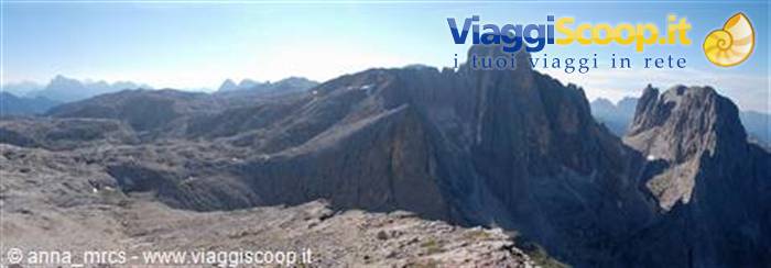
The trail begins to descend with many switchbacks (too many), thus arriving at Col della Fede (2,278 m), passing below Cima di Roda: impressive! We continue toward Passo di Ball (2,443 m), and to reach it you have to cross a short stretch in the rocks equipped with steel cables, nothing special. From the pass you then descend quickly to Rifugio Pradidali (2,278 m). I am impressed by the imposingness of these mountains and by this austere environment surrounding them. You feel very small walking so close to them. Since it is not yet lunchtime we continue to Lake Pradidali. Lake is a big word because not much of this lake remains. We then continue our climb amid this particular rocky landscape, thus arriving at Passo della Fradusta and then at Passo Pradidali Basso (2,658 m), where we finally stop for lunch. Meanwhile the sky has clouded over and promises nothing good.
Indeed, we just have time to have lunch and set off when it starts to rain. Fortunately it rains on and off and not too hard, so we manage to reach the cable car departure point in time before the downpour begins. While, in the cable car, we leave this place and the rain starts to fall heavily, I think back on this splendid tour: we walked a lot, but the landscapes, the peaks that can be admired along the way are truly spectacular and repay the effort. As it came, the storm went away. We had to wait a bit at the chairlift departure point because due to the heavy storm both lifts were stopped. In any case we reach the car and the rain has completely stopped and the sky is slowly turning blue again.
Catinaccio
Day 325 Jul 2006
Tour of Passo Mulaz
After leaving our car at Passo Valles (2,031 m), reachable by way of Passo Rolle, we set off on the trail that climbs to Forcella di Venagia, from which you enjoy a beautiful view of Cimon della Pala. The panorama is impressive. We ignore the trail that descends into Val Venagia and continue on the trail leading to Passo della Venegiotta (2,303 m), where a flock of sheep grazes peacefully. The trail continues with various ups and downs, crossing wide basins until climbing into a rocky area that leads to a saddle from which Rifugio Mulaz is seen for the first time. Some stretches of this trail are equipped but nothing special. One point is also quite striking because it almost feels like passing under an arch of rock. From the saddle a very short detour leads to Sasso Arduini (2,582 m).
Of course Marco doesn't let it slip by! We continue toward Rifugio Mulaz (2,571 m), where a couple is enjoying lunch on the benches in front of the refuge. Colle Mulaz is a stone's throw away, so we decide to go have lunch near the pass (2,619 m). The summit of Monte Mulaz (2,906 m) is there tempting us. Just below the summit two ibex stroll calmly. Oh.. finally a bit of wildlife, because Trentino boasts the highest number of chamois, but we haven't seen any yet. We decide to have lunch and wait to see what the weather decides to do, since in no time it is all overcast again. And as expected, we haven't even finished our sandwiches when it starts to rain, and hail. Fortunately it doesn't last long and we always have the 'anti-rain' gear with us.
Really, I look a bit like a turtle, since I always carry the 'great cold' gear too! In any case, since the sky continues to be dark, and at times a few drops of light rain make themselves felt, we abandon the plan to reach the summit of Monte Mulaz and take the return route, which is by no means short. We follow the trail that descends from Passo Mulaz into Val Venegia, where we come across a forest road. This trail made of countless switchbacks is very panoramic. It must be said that this area really seems to have come out of some photo album. These mountains and these valleys are truly amazing. Once I reach the forest track, Marco and I split up.
Since the day has picked up again, if we had gone to Monte Mulaz it would surely have poured! As I was saying, since the sky is again free of clouds, I continue into Val Venagia along this panoramic road, first following the forest track and then the road that connects this valley to the state or provincial road, whichever it is. Marco, on the other hand, first climbs back up to Forcella di Venegia and then descends again to Passo Valles to retrieve the car. Someone had to go get the car! Val Venagia is very beautiful, I meet many families and many groups. It is a quiet valley; there are a series of alpine pastures and mountain huts. The kind of amphitheater that the Pale form in this valley is very striking, so much so that as I descend I often turn around to enjoy the panorama.
The walk is pleasant until I reach the first parking lot; from there the car traffic on the road makes the walk less pleasant. There are two parking lots for those arriving by car in the valley. One at the beginning of the valley and one further on, both paid. A free shuttle bus connects not only these parking lots but also the headquarters of the Paneveggio park.
Back in San Martino we stop in the center for a couple of errands, and as if on cue a mega storm makes its appearance. Of course we don't have an umbrella, so we take shelter under the nearest portico in the hope that the storm passes quickly. When the storm finally ends we set off home. A nasty surprise awaits us at the campsite. That joker of our pitch neighbor very kindly dug himself a nice little channel to drain the water, except that the channel pours the water onto our pitch right up against our tent!!! And to think that he has a caravan resting on 4 legs, so even if a bit of water passed underneath it wouldn't have given him a stomachache!!! Fortunately the water didn't get into the tent, but we decide to move it anyway because we don't know how long the ground intends to take to reabsorb this nice little lake.
For dinner we console ourselves at the nearby restaurant affiliated with the campsite: two nice plates of polenta, mushrooms, sausage and a local cheese.
Marmolada
Day 426 Jul 2006
Campitello di Fassa
Cloudy and foggy weather, but we had seen it from the weather forecast posted at the campsite entrance. We wanted to try to climb Punta Mezzana, but today's weather is not at all suitable and the forecast doesn't promise well for the next few days either, so we decide to continue our itinerary and move to Val di Fassa, who knows, maybe the weather there will be a little better!
Since we've been here, Marco has been itching to go stick his nose into the Sportiva factory outlet; how could I not indulge him, since today he's the one driving? So, a detour to Ziano di Fiemme. Well.. have you ever seen a child in a toy store? Imagine the same thing but in a boot store.. Needless to say, we came out with two nice bags. There are women who have shoes for every occasion, well.. Marco has a pair of boots for every occasion! After this detour, which increased our luggage and lightened our wallets, we head to Val di Fassa. We are undecided whether to stop at the campsite in Campitello or Canazei. Campitello di Fassa is a nice little village, the campsite is practically central, and since it seems like a nice place we decide to stop. The pitches are very large and the ground is grass. We choose one we like and settle in.
Among the campsite's facilities there are also two freezers which, for those like us who don't have an electric fridge, come in very handy. There are also coin-operated washing machines and a dryer, a gas stove and a microwave, in short, more than that...
In the village there is a supermarket, the tourist information office, quite a few venues, restaurants and pizzerias, a rotisserie that makes real delicacies and an equally good bakery that sells many tasty pastries.
Throughout Val di Fassa the so-called 'smart traffic lights' are scattered about. A road sign announces their presence and also indicates the speed limit that must be observed to get a green light. If you arrive faster, the yellow and then red light come on so the driver stops. They are usually placed in built-up areas and the speed limit is the 50 one. Often you also see the carabinieri patrols stopped right after these traffic lights.
Campsite: Miravalle - Vicolo Camping 15 - Campitello di Fassa - - 9.50 € per person - 9.50 per pitch
Marmolada
Day 527 Jul 2006
Catenaccio: Santner Pass via ferrata
Big day today... my first via ferrata! For Marco it will be a walk in the park since he climbs, but for yours truly, who has never done these things, it's the first time! I'm also a bit worried because I'm someone who suffers in exposed areas and overhangs, let's hope I don't die too much of fear!!! The Catinaccio area was for a long time frequented only by lumberjacks and shepherds, so the guide says. It is an area of particular beauty with walls, rocky overhangs, towers and breathtaking spires. In my humble opinion, one of the areas that preserves a particular, unique charm and beauty.
After leaving the car at Malga Frommes we go up by chairlift (round trip 9 € CAI - 10 € non-CAI members) to Rifugio Fronza (2,339 m). Below our little feet are beautiful green pastures and many cows. From the refuge you immediately climb, on an equipped trail, up a rock face. The trail continues to the left, in the direction of Passo Santner and the start of the via ferrata of the same name. The beginning isn't bad. You climb by steps inside gullies and ledges. I like the route, even though I find myself thinking 'who knows what awaits me.' Everything fascinates me and captivates me. In some points the rocks are very smoothed by wear, impressive! So, struggling up these little gullies, climbing an iron ladder, crossing a snowy little gully, I reach the final part of the route, which is equipped with fixed ropes, and finally Passo Santner (2,741 m).
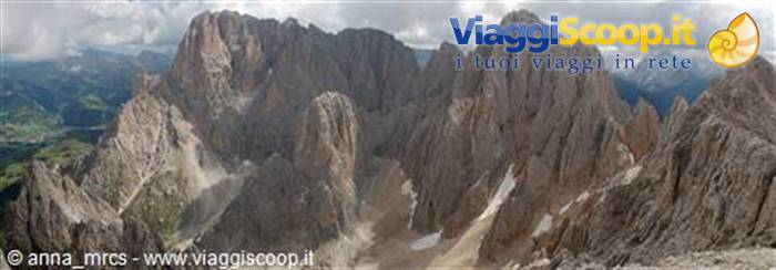
Needless to say, I was veeery satisfied. For me it was a beautiful experience and above all great fun. So all excited I head toward Rifugio Santner. A small structure located a short distance from Passo Santner. The view from the pass is very beautiful. And now the boring part of the route begins. From the pass we descend to Rifugio Re Alberto I (2,621 m), located in the Gartl basin. There is also a nice little lake, but the highlight of the landscape are the Vajolet towers, towering in all their majesty and beauty. They are impressive, full of charm and I don't know what. The fact is that I am enchanted looking at them. There are lots of climbers hanging on their walls, I envy them a little, but it's not for me! We have lunch sitting in a beautiful panoramic position that allows us to watch the progress of the climbs on the extremely vertical walls of the Towers.
After lunch, since a very large group of teenage kids is arriving, we take the return route. The area around the refuge is getting a bit too crowded. So we descend to Rifugio Vajolet and Preuss (2,243 m). The trail passes among some small rocks and in some points is equipped with fixed ropes. We also meet a 'microbe,' as Marco nicknames him. He is a German child no more than 5-6 years old, accompanied by his father and a much older man, perhaps the grandfather. Watching him descend the trail is a spectacle. He looks like a little chamois. An ability and dexterity to make many adults envious. Let no one ever tell me again that children don't walk in the mountains, because this 'microbe' blows all those beliefs out of the water. During the descent we are entertained by some good classical music.
Indeed, the people we see around Rifugio Vajolet and Preuss are a bit too many not to justify some special event. When we reach the refuge we discover that we have to descend a little further before taking our trail. What a rip-off; the more I descend now, the more I'll have to climb afterward to get back to the starting point, that is, to Rifugio Fronza, which is on exactly the other side of these rocky walls. So we follow the Gardeccia road for a short stretch, which fortunately is not open to car traffic, and take the trail to Passo delle Coronelle. We cross areas of pastures and boulders to reach a grassy scree area. Finally we climb on rocky terrain to Passo delle Coronelle (2,416 m). As we climb, in the distance we see the 'microbe' going up our same trail. My goodness, how that little one walks! The environment around the pass is truly harsh and severe.
From here you descend through a steep gully and continue toward Rifugio Fronza (2,339 m), where we take the chairlift again and return home. What a fantastic day. I am very tired but also very satisfied.
Marmolada
Day 628 Jul 2006
Sella Group: Pitz Boè
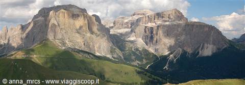
After my performance yesterday, which left me with various aches and pains and a few bruises here and there as a souvenir (I mean, really!?!), we decide to take a relaxing little outing today. Actually, my idea of relaxing differs a bit from Marco's, but since he chose the route, the concept of relaxing that applies is his! The route he chose is inside the Sella group, an area that seems to emerge from these mountains, supported by great walls and towers. From below you can admire these steep walls, but as you climb up and enter inside, it feels like being on another mountain. Almost on the moon. Almost an island that, instead of emerging from the sea, emerges from the rocks. We leave our car at Passo Pordoi (2239 m), which connects Val di Fassa with Val Cordevole. From here we take the cable car (€7.00) that goes up to Sass Pordoi (2950 m).
Even though the lift has just opened, there are already quite a lot of people going up. But that was to be expected: when access to these areas is made easy by lifts, the crowds are always large. Our destination is Pitz Boè. After getting off the cable car, we set off downhill toward Rifugio Forcella Pordoi (2829 m). The landscape around me is very strange, a broad scree terrace that looks more like a lunar landscape than a mountain one. From the refuge we continue toward Pitz Boè, ignoring the junction that leads to Rifugio Boè. The path crosses these scree landscapes and then climbs over a series of rocky steps to finally reach the summit of Pitz Boè (3152 m). In some places the path is equipped, but nothing special. Today's weather, unfortunately, is not like yesterday's. The fog comes and goes and at times offers us a few glimpses of the Marmolada.
According to the guides, the panorama is magnificent; we can only admire small snatches of it. At the top there is also a small refuge (Piz Fassa) and quite a few choughs and alpine finches fluttering around in search of crumbs left by tourists. Since the weather is not improving and it is even a little chilly, we set off toward Rifugio Boè, descending the other side of this mountain. We soon reach Rifugio Boè (2871 m). After lunch we take the return route. From the refuge we take the path that leads to Forcella Pordoi and from there the path that descends directly to Passo Pordoi. The path starts off very straight. Many people, like us, have chosen not to take the cable car down but to walk down. Some of them, perhaps, would have been better off taking the cable car, since for them the descent will certainly have been an experience not to repeat.
The path is steep and slippery, because it is made of this scree-like earth, but with a good pair of boots there is no problem descending quickly along this well-maintained path. This area is also very beautiful, strange, but beautiful. We just have time to get back to the campsite before it starts to rain. Tonight, too, we have to deal with the pre-evening thunderstorm. But the forecast posted at the information office promises nothing good for tomorrow.
Pale di San Martino
Day 729 Jul 2006
Canazei
We wake up to the sound of rain falling on the tent. No outings today... everything is cloudy and rainy, so there is nothing left to do but take a nice stroll around Canazei. From the center of Capitello, just after the bridge, in the direction of Canazei, you take a pedestrian path that first runs alongside the river and then parallel to the main road, allowing you to reach the center of Canazei with a peaceful walk without using the car. Traffic in Canazei is a bit chaotic and critical when the sun is out, so imagine with rain!
Canazei is just a few steps from three of the most beautiful and famous Dolomite passes: Sella, Pordoi and Fedaia. In summer it is packed with tourists, just as in winter. In my opinion, excessive tourist exploitation has made this town lose some of its Alpine charm, but it still remains a beautiful place.
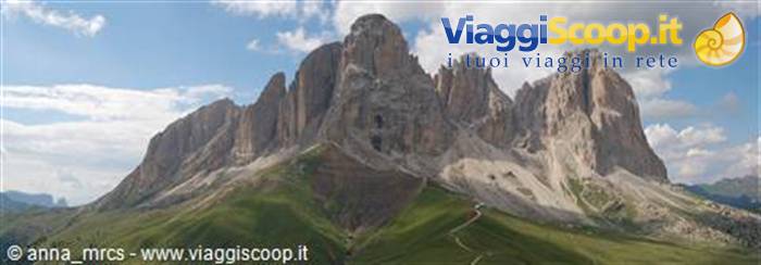
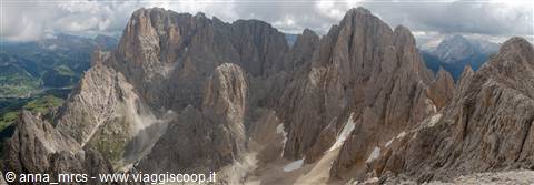
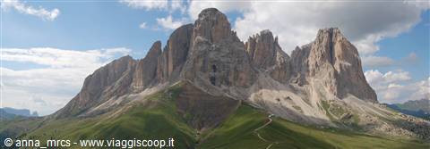
The streets in the center are crowded; unfortunately it is raining, there is nothing else to do, and so everyone has poured into the town. We look at the shop windows, souvenir shops, sports gear, local products and so on. For lunch we get a piadina with prosciutto crudo and stracchino and a chocolate crêpe in a little shop not far from the center. The shops close for the lunch break and reopen around 4 p.m. Later we return to Campitello and go to the information office to ask about the times of the shuttle bus that goes to Val Duron. Our destination for tomorrow is the Sassolungo group. It is a small Dolomite area in terms of extent, but very spectacular and distinctive because of its verticality. These mountains literally dominate Val Gardena, Val Duron and Val di Fassa, and the view from their summit is spectacular. Passo Sella separates them from the nearby Sella group.
Today was a bit of an odd day; at least we rested, and we also saved a little mouse. We saw a little vole running around the campsite and stopping at the pitch next to ours. We took a few photos of it and stayed a while watching it motionless in the middle of the grass, then we decided to catch it and move it to an area where no one would harm it. I am not sure all campers would be pleased to see it scampering around the campsite. With the help of a container we catch it and release it in a meadow far from the tents. Au revoir mon ami!!
Pale di San Martino
Day 830 Jul 2006
Sassolungo Group: Sassopiatto
After breakfast, we take our backpacks and walk into town. Today we do not even have to use the car. In the square and along the streets of the center they are setting up the flea market, antique items mixed with knick-knacks and all sorts of things. The bus leaves exactly where the traffic ban for Val Duron is. A private transport service travels along Val Duron up to Rifugio Micheluzzi (€7). There are two vehicles ready to leave and two drivers. Some people and a lot of South American nonchalance, but there is not a single South American. The buses will stop their service at 9:30, but it is only 7, so they will make more than one trip. A man and a woman who want to take the bus, however, first need to run a quick errand in town and ask the driver to delay the departure of the first bus.
Anyway, the shops are still closed at this hour, and consequently the wait does not seem to be a small thing. This attitude annoys Marco, who cannot stand having to wait beyond the departure time for other people's convenience. Meanwhile another small group of people arrives, and the driver decides to have people get into the off-road vehicle so they can leave. We all settle in, including the woman whose husband has gone off to run the errand, and she keeps repeating that we have to wait for her husband. Fortunately the driver has more sense than the woman and points out to her that since the vehicle is full, he would leave. The woman repeats for the umpteenth time that we had to wait for her husband. The driver does not give in and points out that there would be another trip in half an hour. She insists, but in the end she gets off and we finally leave.
I will not comment on the fact that people always have fine demands; if it had been the only vehicle, fine, but others were going to leave. She expects 6-7 people, which is what we were, to all wait for the shops to open because they had forgotten their trekking poles at the hotel—well, that seems like quite a demand to me! Anyway, for the record, departure times are listed, but it seems to us that they are rather approximate, since we left well past the departure time. The dirt road takes us, in a short time but at the cost of 7 euros (this is a bit of a rip-off), to Rifugio Micheluzzi (1880 m). From here we take a path, not even very well marked and in some places rather steep, that leads to Rifugio Sassopiatto (2300 m). We leave this path, however, shortly before reaching the refuge, near Malga Sassopiatto, to continue toward the summit of Sassopiatto. Our destination for today.
There are many alpine pastures and many grazing animals in this area, and we finally also see some marmots scampering through the meadows. We climb the most common and easy route to reach the summit. There is also the possibility of going up via a via ferrata, but not from this side. The path, well traced, first over grassy flats and then over rocky and scree terrain, finally reaches the summit (2964 m). The weather is not the best and every now and then it clouds over. The view is fantastic, stretching over all the surrounding mountains as far as Alpe di Siusi. We have lunch on the crowded summit and in the afternoon take the return route. Instead of taking the same route as on the way up, once near Malga Sassopiatto we take the very crowded path that leads, almost flat, to Rifugio Pertini (2300 m) and from there to Forcella Rodella (2318 m).
From here it is possible to descend to Passo Sella or, for those like us coming from Campitello, to go and take the Col Rodella cable car (2484 m – descent only €5.70), which leads directly to Campitello. This path, partly because it is practically flat and has no difficulty at all, is very crowded: families with children, kids on mountain bikes. There is a child who has no intention of walking and screams as if he were being torn apart. The parents try to calm him, but he only calms down in their arms. He does not seem at all like the 'microbe' we met a few days ago, and yet this one is even bigger. Well, I do not envy the parents having to carry him around in their arms at all. Of course, the climb to Sassopiatto via this path would have had less elevation gain, but Val Duron still had to be seen, and not just from afar.
Personally I prefer this kind of loop, going up one way and coming down another. They allow me to see more places instead of going back and forth along the same route. They are not always possible, but when they are, I gladly choose them.
From the large number of ski lifts in this area it is easy to deduce that in winter it will be teeming with skiers.
Pale di San Martino
Day 931 Jul 2006
Tour of Sassolungo
Today we will do a loop itinerary, just the way I like it, described as one of the most spectacular in the Dolomites. We'll see... We leave our car in the parking lot of the chairlift or gondola or whatever the hell it is at Passo Sella (2180 m). Our intention is to use this lift to reach Forcella del Sassolungo (2681 m), but since the price does not exactly please us (€10.00), we decide to do it on foot. The elevation gain is not much, and in about an hour we are at the destination. On the way up we meet other people who made the same choice as us, including a little family with two children, between 6 and 10 years old, calmly making their way toward the pass. At the pass there is also a small refuge.
As if to prove the point, wherever lifts arrive, mountains of tourists arrive too; we have little to complain about since we are there too! At the pass there are a lot of people, and also on the path leading to Rifugio Vicenza. We stop for breakfast, and while we eat our delicious croissants, the little family we had passed on the way up also arrives. Our loop continues, descending to Rifugio Vicenza. It is a normal path like many in this rocky expanse, but it is very crowded. Marco remembers an interview he read with the manager of Rifugio Vicenza about accidents in the mountains. For years, it said, the helicopter has not been coming to pick up climbers or mountaineers in difficulty, but simple tourists who sprain their ankles falling while descending from the pass to the refuge. Well, we do not find that hard to believe. At one point I even risked taking a good-sized rock on the head.
A group of young people, clearly fed up with following someone moving slowly, decided to descend off the path; this caused stones to shift, and one landed right in front of my nose. I was lucky; if it had hit my head, I would not have been at all pleased. What a bunch of reckless people! But how can you blame them? I already walk at the speed of dead snails, but here some people walk at the speed of dead-and-buried sloths. Nothing to say about the fact that everyone has their own pace, but people should put themselves in the shoes of those behind them, and if those people are moving faster, let them pass. At least that is how I see it. I do not like forcing those behind me to go at my pace; everyone has their own. Anyway, we arrive at Rifugio Vicenza, and it feels like being in a bar in the city center, there are so many people.
But we have already had occasion to notice that the refuges here do a lot of business.
After lunch we take the return route. A little below the refuge we leave the wide path to take a narrower path that crosses grassy flats at mid-slope. It really looks a bit like a shortcut, but we take it anyway, and so do many others. The path then descends and joins another path, continuing first through rocky terrain and then through a small wood. Along the way, which here too involves lots of ups and downs, we meet and pass our little family again. They are playing a strange word game; I cannot quite grasp the rules, but I understand its purpose. While they play, the children walk, and the day goes on. They keep them entertained while walking; after all, you cannot expect them to walk all day in perfect silence, absorbed in their own thoughts. I am pleased to see families like this.
The mountains are very beautiful, they are meant to be experienced, and limiting yourself to experiencing them only as far as transport can take you is an absurd limitation. Meanwhile we continue, passing through Pian Sosaslònch (2044) and arriving at Rifugio Comici. From here we continue, then making a detour into the Città dei Sassi area. Quite a trick: instead of continuing flat toward Passo Sella, we decide to detour, with a very slight climb, following some panels scattered around this area called Città dei Sassi. They are information panels about the mountains, the rocks, the wildlife. The area is nothing more than an area scattered with a great many stones, hence the name 'Città dei Sassi'.
Pale di San Martino
Day 101 Aug 2006
Campitello di Fassa
We wake up to rain; today, too, the weather forecast people were right. Curse them for always getting it right. Since we went to Canazei the other day, today we decide to drive to Passo Falzarego. Marco is toying with the idea of going up to the top of the Marmolada. The weather is not at all good, so we cannot even take a short walk without getting rained on. So we wander around all day. The fog is low and the mountains cannot be seen, it is cold and everything is so sad and gloomy. While the sea in summer has a certain charm and melancholy, the mountains with low fog and bad weather are only melancholy and sad. The day passes anyway, and we hope to be able to do something tomorrow. We still have many destinations and many outings planned!
Pale di San Martino
Day 112 Aug 2006
Catinaccio d’Artemoia
At least for the moment it is not raining. The weather is not great because clouds are crowding the sky, but for the moment it is not raining. Today we return to the Catenaccio area, which in my humble opinion is one of the most beautiful areas I have seen. By car we go to the departure point of the shuttle buses that go up the Vajolet valley. These leave from the parking lot of the chairlift in the nearby village of Pera (€5.00 – round trip €7.00). The bus drops us off near Rifugio Gardeccia (1940 m). Via a service road you climb up to Rifugi Vajolet and Preuss. Compared with the other day, today it seems deserted. True, it is still early morning, but there is not a living soul around. From here we continue along a mule track to Rifugio Passo Principe (2601 m). I cannot tell whether the refuge is open or closed; to me it seems a bit abandoned. At this point we split up.
The weather threatens rain, and I do not at all like the idea of 'rummaging' among the rocks in the rain or a storm. So I continue toward Passo d'Artemonia (2769 m) while Marco continues toward the summit of Catinaccio d'Artemonia (3004 m) via the west via ferrata. Once at the top he will descend on the other side via another via ferrata, and we will meet again a little below Passo d'Artemonia. As if to prove it, it did not rain, but I am more than sure that if I had gone too it would have poured. Once at the pass I settled on a small knoll a short distance toward Passo del Larsec, in a position that allowed me to see part of the descent. Meanwhile another girl also arrived, whom I had met on the way up in the company of a boy and an older man. She is alone too; she asks me for news about the via ferrata and asks if I am waiting for someone. She is waiting for her brother and father.
Meanwhile I see Marco appear, so I go to meet him along the path. From here we descend into the Antermoia basin. Ah... if you want any information about the via ferrata, well... I was not there, so I cannot comment. As I was saying, instead of turning back we descend through the Antermoia basin, passing by the beautiful little Lago d'Antermoia (2498 m), and stop for lunch near the nearby Rifugio d'Antermoia (2497 m).
Since there is a long way to go, right after lunch we set off toward Passo di Dona (2516 m); from here we continue toward Pian delle Gialine. I do not know what 'Gialine' means exactly in the local dialect, but where I come from, read as it is written, it means hens. Hmm... We continue across this practically deserted flatland; we meet only one very chubby girl with an equally chubby backpack on her back, sitting on a rock catching her breath. I do not know what her destination is, but I do not envy her at all. The backpack is enormous, and she seems exhausted and worn out, and to reach the nearest refuge a good climb awaits her. We leave the path that continues toward Val di Dona and take a small path, damaged by the rains of the past few days, that runs through Val d'Udai. We meet no one until the final part of the itinerary. This little valley is very green; I like it a lot.
At a certain point we follow a dirt road, which we then leave to head toward Pian dei Bai; from here we arrive at the hamlet of Ronch (1484 m), and there is nothing left but to descend to the main road and then go retrieve our car at Pera (1326 m).
Alternatively, from Rifugio di Antermoia one could take another path that led, via an equipped route, to Gardeccia, and from there either walk down along the road or take the shuttle buses again.
Sassolungo
Day 123 Aug 2006
Campitello di Fassa
And today it is raining again, but today it means business. It looks as if someone has opened taps in the sky. The water falls with an intensity and force that seems about to submerge everything. Like many others, we stay in the tent to, as they say, 'hold the fort'. The ground cannot absorb the water falling, and in no time many puddles form. Someone, exasperated by the bad weather, despite all the water falling, takes down camp and leaves. The rain goes on for much of the day, and toward evening it finally stops. Our tent neighbors, two very young sweethearts who arrived a few days ago on their first camping experience together, did not withstand the test. They take down all their stuff except the tent. They put off leaving until the next day, but in the meantime one of them will spend the night in the car. Ahi ahi ahi... here camping and rain have made quite a mess.
It must be said that today the rain put everyone to a hard test. You only have to look around and see the myriad empty pitches. The campsite seems deserted. Those who remain are trying to limit the rain damage. Some move the tent, like us, some seal parts of the caravan with silicone, in short, there is something for everyone. Later it starts raining again. Having dinner at the campsite is out of the question, even though sheltered gazebos and a small indoor room are available. This rain and this snow have brought temperatures down a lot, so we go out for dinner at a pizzeria.
Sassolungo
Day 134 Aug 2006
Cortina d’Ampezzo
And as the forecast had predicted, during the night the temperatures dropped further and snow made its appearance. The peaks are snow-covered and not only that. The air is cold and it feels like autumn. In the end we decide it is time to move to Cortina. Enough rain and enough cold. We gather all our stuff and get in the car. It is quite striking to go up to Passo Pordoi and see snow along the road. Of course it is only a light dusting, but meanwhile it is snow. The peaks, however, show an unusual winter outfit. Temperatures have dropped; let us hope the weather recovers and the snow goes away so we can continue our outings. After all, it is still too early to use snowshoes!!! We reach Cortina via Passo Falzarego, where a very strong wind is blowing.
The road system in Cortina is not exactly the best; there are no traffic jams or queues, but you always end up taking very long detours to get from one part of town to another. Cortina's position, surrounded by mountains, which today are also snow-covered (boy, did it snow!!), makes it a very beautiful and suggestive corner of the world. The town indeed retains an irresistible charm and is a destination for many tourists both in winter and summer. It is also a very fashionable place, chosen by many VIPs for their holidays. The town is pretty; in the afternoon, after setting up our tent at the campsite, we also stroll through the streets of the center. The shops in the center reflect the town's fashionable character. Along the main street there are several statues of people portrayed in their daily lives that to a distracted eye can appear real. They are very realistic and well made.
It is a different world compared with Campitello, and so are the people at the campsite. Most are regulars or people who have been coming for years. While in Campitello the vast majority of people left the campsite during the day, here everyone knows everyone and everyone spends part of their time at the campsite. A different type of tourism. There are grandparents with grandchildren, whole families or just wives with children, and many teenagers scampering around the campsite until late at night without caring about lowering their voices or avoiding bothering others. I admit I am not very tolerant of people who make noise or a racket.
The campsite itself would not have been bad, but some evenings it felt like sleeping in Piazza Castello in Turin, so much was the coming and going of people strolling along the campsite lanes, and I certainly do not go to bed with the chickens! Not to mention the countless TV programs listened to for free. As with mobile phones, people can no longer live without a television! This campsite is also equipped with all comforts, freezer and washing machines. The other one was undoubtedly better in quality, but this one holds up well too. At the entrance there is also a small shop and a bar, but not far away, after the trampolines in an industrial area, we found a discount store that sells everything, or rather everything we need.
For today we have chosen an itinerary steeped in history: Lagazuoi, the mountain that was the scene of contention between the Italians and the Austrians during World War I. We leave our car at Passo Falzarego (2107 m) and take the path that leads up to the Lagazuoi. There is still snow on the peaks; they look more like autumn landscapes than summer ones, and after walking a little I realize I have forgotten the camera in the car. He he he, lucky I noticed at the beginning and the distance back to the car was short. As the guide recommends, we will take the path that goes through the Italians' tunnel and then descend via the Austrians' path; that way we wrong no one. Alternatively, one could descend along the wide path marked by the ski slopes.
From the cable car parking lot (yes indeed, it is possible to get almost to the top of the Lagazuoi by cable car too), we take the path heading toward the mountain and the ski slopes. We then leave this wide path to take one that leads us to Cengia Martini (2400 m), where the tunnel route begins. No special gear is required, just a helmet and a torch. The tunnels, of course, are not illuminated and cover a length of just over a kilometer over about 300 meters of elevation gain. The route through the tunnels is fascinating; the tunnel is equipped with a fixed rope and a staircase. At times some little windows allow you to see the world outside. In some places explanatory panels explain the use of certain tunnels and rooms. There are also some reconstructions, such as the soldiers' hut.
If you turn off the torch for a second and stay silent, you can imagine only minimally what it might have meant to live in these tunnels for so long. We finally emerge from the tunnel at Punta Berrino (2556 m), where the path passes among the trenches. We continue toward Rifugio Lagazuoi (2752 m), also the arrival point of the cable car. The weather is not good at all and it is very cold. At times it snows lightly, and to think it is August! From the refuge we continue, following the ridge, to the very crowded summit of Lagazuoi Piccolo (2788 m). The panorama from the top, even if the weather is not the best, is nevertheless interesting. A little beyond the summit we take the Austrians' path. The guide describes it as a path that is a bit exposed and not very suitable for people who suffer from vertigo.
In the initial part of the route the path crosses a somewhat exposed ledge; the snow that has fallen has left a white coating on the little path, frozen in some places. Before proceeding, however, we have to wait for a group of kids to reach the end of the path. They are all well equipped with via ferrata gear; a group leader is holding the hand of a little girl who, as soon as she realizes the route is over, blurts out that she would have taken the cable car down. Poor thing, what an experience! The path in its initial part is exposed, but there are fixed ropes. The snow that fell in recent days certainly does not help. It is nevertheless a beautiful path, very panoramic. The path then descends over gravelly terrain, then crosses a final section through the rocks with a ladder and a fine suspended iron bridge.
Very evocative! You still come across trenches and continue toward the now nearby Passo Falzarego. And in my opinion this was also one of the most beautiful outings we have done. The area, for the record, is entirely an open-air museum. A leaflet distributed at the information office located in the cable car parking area, where it is also possible to rent a helmet and torch for those who do not have one, explains and tells the history of these places, of the Lagazuoi, of Forte Tre Sassi and of the 5 Torri area.
Sella group
Day 156 Aug 2006
Tre cime di Lavaredo: Monte Paterno via ferrata and Torre di Toblin via ferrata
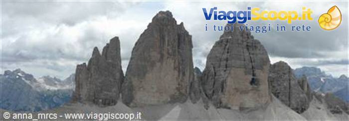
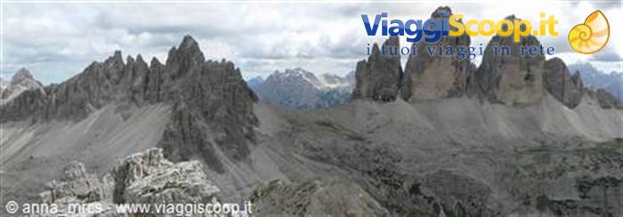
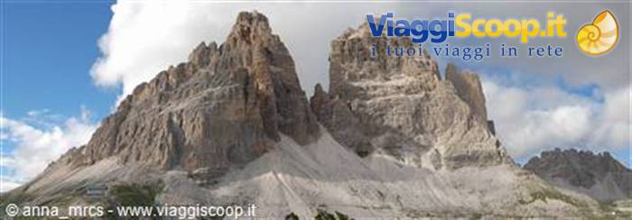
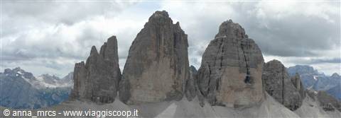
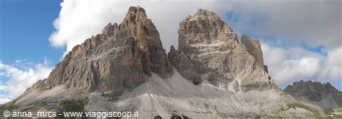
The Tre di Lavaredo are perhaps the most famous mountains in the Dolomites. With their imposing size and verticality, these three giants fascinate and enchant. To admire them at their best, we have chosen the itinerary that leads to Monte Paterno. This mountain, too, bears evidence of the war, such as tunnels and equipped routes built during the war. We leave our campsite early by car; the sky seems more free of clouds, but one still cannot say that good weather has returned. The air is cool and a light breeze makes us hope there is no wind at altitude. By car we pass through Passo Tre Croci and continue toward Lago di Misurina, practically deserted. From here we take, still by car, the private road that will bring us to Rifugio Auronzo (2330 m). Of course, transit or parking, call it what you like, in this area is not at all free; it costs a hefty 20 euros.
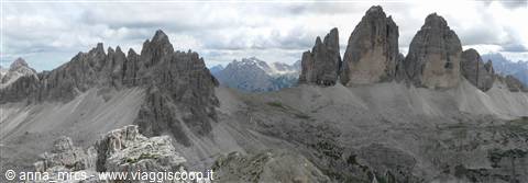
Once we arrive at the refuge, without even having gotten out of the car, we have already understood that the light breeze here is a strong wind and that the temperatures are anything but summery. So there is nothing left for me to do but pull out a beanie, gloves and jacket and set off toward Rifugio Lavaredo and from there toward Monte Paterno. The road, not open to traffic, that connects the two refuges is practically flat. We pass beneath the three peaks, which seen from below looking upward appear even more vertical and impressive. Once we reach Rifugio Lavaredo (234? m), we continue to Forcella Lavaredo (2454 m), where we leave the path leading to Rifugio Locatelli to take the path leading to the start of the Monte Paterno via ferrata. The via ferrata begins near a dark tunnel. While I am getting all my gear sorted, two couples of a certain age head toward the tunnel.
They are neither equipped for a via ferrata nor provided with a torch. I imagine they have come this far out of curiosity. At the start of the route a sign indicates the equipment needed to do the route safely. And while I am there getting ready, I see one of these gentlemen come out, followed by the other three people, with one hand on his head (or bald head, as Marco would say), pressing a handkerchief to it. I would have liked to stop him and ask whether he thought I was such a masochist as to go around with half a plastic watermelon on my head if it had not been more than necessary!!! Before starting our tunnel route, a German father-and-son pair ask us to take a photo of them. It is their first via ferrata together. I understand and share the emotion and enthusiasm. The route begins with an unlit tunnel that continues with a small elbow bend, descending quite a bit.
The route then continues, in my opinion, spectacularly, crossing the face as if on balconies to reach Forcella Passaporto (2530 m), from which you enjoy a beautiful view. It is a stretch of the route that I really liked a lot. The path continues and then climbs up a scree gully to Forcella del Camoscio (2650 m). From here begins the last equipped stretch that leads to the summit of Monte Paterno (2744 m). Instead of easing off, the wind has picked up and it is devilishly cold. As I said, from Monte Paterno the view is spectacular, and Marco takes quite a few photos. To descend to Rifugio Locatelli—every time I say it, stracchino comes to mind!!! As I was saying, to descend to the refuge there are two alternatives, a longer one via Forcella dei Laghi and Cengia, and a shorter one that descends from Forcella dei Camosci directly to the refuge. Both are equipped routes.
Since it is really cold, we decide, like many others, to take the short route, also because according to the guide the route passes through a tunnel, and the idea of poking my nose into this tunnel too appeals to me a lot. The route is well equipped right from the start; in some places it is a bit exposed, and on the descent it always feels more intimidating than on the ascent, so I find myself thinking about that poor girl we met on the way up. Poor thing, and to think that going up is always going up, but going down is another story... In one passage, not particularly exposed, she was afraid, and her boyfriend, or husband, instead of helping and encouraging her, like all men, had lost patience and was giving her hell. I could only feel solidarity with her, poor woman, I understood perfectly how she felt.
I am no example of courage when it comes to the mountains either, and my dear husband sometimes behaves exactly like her boyfriend or husband. Anyway, on the way down I found myself thinking about her; at one point my shortness created a bit of a problem for me because I had—actually I still have them, they have not grown since then—legs that are too short and I could not reach the holds. What can you do, even Smurfs go to the mountains and then run into difficulties like these. Of the tunnel there was not even a shadow. We followed the marked route faithfully, which is usually difficult for Marco, but it must have been changed because we did not pass anywhere near anything that looked like a tunnel entrance. What a rip-off; if I had known, I would have gone down the other path.
We have lunch a short distance from the refuge and then go get a nice hot tea because the sandwiches, even though they were in the backpack, seemed just out of the refrigerator we do not have! In the afternoon Marco decides to make a quick trip up the Torre di Toblin; I have had enough via ferratas for today and I look for a spot sheltered from the wind, a little below the tower. This mountain also has two equipped ascent routes and, according to the guide, and then according to Marco when he came down, it is a good panoramic viewpoint. In wartime this was an Austrian observation point; in fact the ascent route was partly equipped following this path. That is what I read, because I comfortably stayed below enjoying the view and some well-earned relaxation. For the record, to stay on the history theme, Monte Paterno, by contrast, was in Italian hands.
From Rifugio Locatelli we return to Rifugio Lavaredo along the higher path that crosses the mountain at mid-slope, just so as not to lose too much elevation. From here we retrace this morning's road and return to Rifugio Auronzo and our car. As the afternoon wears on, the cold and wind increase. At least since we have been in Cortina we have not yet gotten rained on. So much cold but no rain!
Tofane
Day 167 Aug 2006
Tour of the 5 Torri
Today we take a little outing around the 5 Torri; it is a little outing because today is the day dedicated to relaxation. Another plunge into history, and to think I never liked it as a subject. It was the Italians, fearing an Austrian attack, who erected a defensive position right around the 5 Torri. The trenches and some structures have been restored and can now be visited, a true open-air museum that not only allows you to immerse yourself in history but also to admire these peaks up close. Today, too, promises to be a rather windy and cold day, in the face of summer! We leave our car in a small parking lot along the road leading to Passo Falzarego, well beyond the junction for the chairlift that goes to Rifugio Scoiattoli. This balcony path leads us, without too much effort, passing initially through a quiet wood where we spot a little squirrel, up to Rifugio Scoiattoli (2255 m).
From here we continue in the direction of the 5 Torri, which rise before us. Honestly, they jut up a bit as if they were lots of pieces of Lego scattered haphazardly on a carpet of grass and stones by a fanciful child. You cannot really say we are following a proper itinerary; we wander among the various trenches and positions, poking around here and there. There are many people climbing; in fact we read that there are many routes and many climbing gyms for those who love this kind of sport. We pass among these enormous piles of stone and then return to the starting point. A short stop at the refuge to enjoy a cup of hot lemonade and then off again toward the car. On the meadows in front of the refuge a rabbit grazes undisturbed until it is seen by some children who try, in vain, to catch it. It is faster and smarter and immediately hides under the refuge's balcony.
In front of us are the Tofane, our destination for tomorrow. The light dusting of snow that had covered them has only partly gone away.
Tofane
Day 178 Aug 2006
Tofana di Rozes
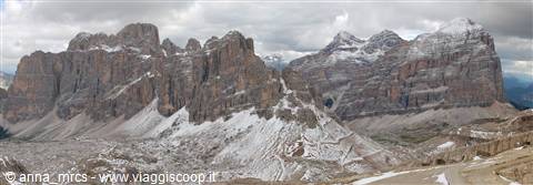
In the local dialect, the term "tofò", from which the name Tofana is thought to derive, was used to indicate a type of very crumbly rocky terrain, exactly the type of terrain that characterizes this massif. There are three Tofane: Tofana di Rozes, Tofana di Mezzo and Tofana di Dentro. Our intention would be to make a quick trip up all of them, but today we start with the first, Tofana di Rozes, one of the most imposing peaks dominating this area. Today it dominates amid the fog; if yesterday was windy and cold, today is no different, what a prospect! We leave our car in the parking lot next to Rif
Tre Cime di Lavaredo
Day 189 Aug 2006
Campitello di Fassa
Today we have to decide what to do. The weather today isn't great, but tomorrow it looks like it will improve. After four days of walking, a full day of complete relaxation is in order. My little legs are starting to complain and if I don't grant them a bit of a rest they've let me know they intend to turn to the unions and go on strike. There would still be the tour of the other two Tofane to do. The days at our disposal are almost at an end and Marco is fuming because he wants to go up the Marmolada. He counts and recounts, also considering that the forecasts announce an improvement for tomorrow and then so long to good weather for a few days, in the end we decide to give up the other two Tofane. After all they've been there a long time, they're not about to go away right now! It'll be for another time, another trip.
After all the Dolomites aren't on the other side of the world and coming back won't be difficult. In theory the same reasoning would apply to the Marmolada but Marco is fuming with the desire to go up it. It's true that the glaciers are in regression but his frenzy goes well beyond that.
So we pack up all our stuff again and return to Campitello di Fassa. We decide to take a different road from the one we took to get here, just to see some new places. From Cortina we take the road that leads to Passo Falzarego but we turn before towards Selva di Cadore. These valleys are also very beautiful and distinctive. They seem to me a little less crowded than the other valleys, perhaps they're less well known but they're just as beautiful. We stop to have lunch in the area of the Serrai di Sottoguda. I was there many years ago with my parents. I don't remember much about that camper trip but I remember this place. My parents aren't walkers so that trip had a very different feel from this year's. We then continue towards Malga Ciapela and it starts to rain. From here the cable cars depart that take you to the top of the Marmolada. Oh no..
it's not for this kind of ascent that Marco is fuming so much. He doesn't just want to go on the glacier, he wants to go up Punta Penia! It's the second time I've reached the Fedaia pass and the lake and this time too it's raining in buckets. In Canazei we make a stop to rent crampons and an ice axe. Since he hadn't counted on doing this climb at all, all the gear needed for the occasion stayed quietly at home in the wardrobe. Yours truly has no intention of going on a glacier given her nonexistent mountaineering skills and her little familiarity and dexterity with ice, so I consult the map to choose an alternative route so as not to spend the whole day waiting.
Tre Cime di Lavaredo
Day 1910 Aug 2006
Marmolada/Rifugio Viel del Pan
Thursday 10 August 2006 – Campitello di Fassa – Marmolada/Rifugio Viel del pan Although it rained for most of the night, the good Lord thought of me and of how much I would have had to endure Marco's whining for not having gone up the Marmolada. Of course, when men get something into their heads… As I was saying, the good Lord thought of us and made the rain stop. Of course the weather isn't great but we can go and do what we set out to do. I leave Marco and the car in front of the departure point of the chairlift, or whatever the devil this thing is called, that would take him to Pain dei Fiacconi (2626 m). Along with him go a French couple and a group of Italians. Besides the rest of the gear he's also brought his rope and I urge him to join up with some group. I really don't like the idea of him going alone risking falling into some crevasse, better that he joins a rope team.
The route I've chosen is on the other side of the valley. Nothing special. I chose something very very easy where I shouldn't run the risk of getting lost since he swiped the map. I cross the lake (2040 m) on the bridge and make my way to the other side of the valley, where a trail begins that will take me to the Rifugio Viel del Pan (2432 m). The trail initially climbs, then turns, staying fairly level, in the direction of the refuge. At times it drizzles, there should be a nice view of the Marmolada, since I'm right in front of it but the fog covers everything. I also meet a nice group of goats that lends itself to a few photos with very suggestive backdrops. Today I got the 'serious' camera. Marco took the more compact digital one for reasons of practicality and convenience, while I got the digital reflex, serious stuff.
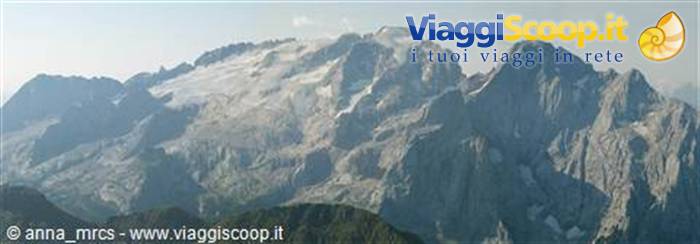
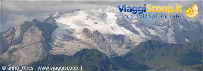
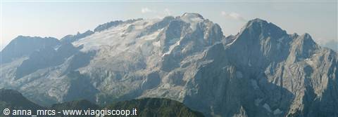
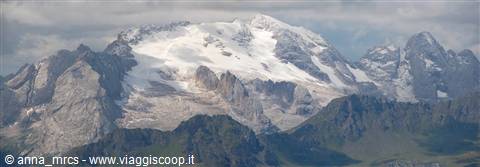
I handle it with great care because if I ruin it or break it I think he'll ask for a divorce. Given the rains of the past few days and the light drizzle that's falling, the dirt trail in some stretches is also a bit muddy. Goodness, I'm getting all my boots muddy!!! Of course the route is short and I'm soon at the Rifugio Viel del pan. I continue along the trail that goes on to the Fradarola from where a chairlift or cable car arrives, from which in turn the vast majority of the people I saw at the refuge arrive. Back at the refuge I park myself on the benches in front of the refuge that offer a nice panoramic view of the Marmolada. The weather is clearing up anyway and little by little the mists are thinning. I manage to take quite a few photos of the Marmolada and also to see the peak, or at least I imagine it's the peak.
After lunch I take the way back and once at the car I wait for Marco. He arrives happy and content. He tells me about his climb, about the manager of the Rifugio Capanna Punta Penia (3343 m), about his little lunch of polenta, and I poor thing ate a measly ham sandwich, about the people he met and about the descent. He's very satisfied with his outing. The next time we come back to these parts he wants to return going by the via ferrata. In fact it's possible to climb to the summit via a via ferrata and come back down via the glacier.
Tre Cime di Lavaredo
Day 2011 Aug 2006
Roda di Vael via ferrata
We're undecided whether to pack up and go home or stay one more day and do another route. The weather doesn't invite choosing this second option but in the end we decide to try anyway. With the backpacks and all the gear loaded into the car we head off again to the Catenaccio area. We leave the car, in Vigo di Fassa, in the parking lot of the cable car that takes us to the Rifugio 2000 Bellavista. From here we set off towards the Rifugio Ciampedie (1998 m) and continue in the direction of the Rifugio Roda di Vael. Initially we walk on the road that is the cross-country ski trail and then leave it, taking a trail that passes through the woods. Here too the rains have made the trail very muddy in places. From here we continue, in perfect solitude, past the refuge. A sign indicating an alpine farm (2028 m) and the refuge makes us leave the trail.
It's a 'crafty' detour signposted by the owner of the alpine farm who sells typical products. From the malga the trail begins to climb rapidly to reach the plateau where the Rifugio Roda di Vael (2283 m) stands. In the square a group of scouts is singing various songs, they're not ready yet to take part in a singing festival! From the refuge we continue on the trail that leads to the Passo del Vajolon. The trail crosses a long level stretch and then climbs, with several switchbacks, into an area of scree and stones. There's a bit of snow on the ground and some people are having difficulty proceeding. If instead of sneakers they had put on more suitable shoes they wouldn't have had these problems. We proceed further and after crossing another level stretch we reach the Passo del Vajolon (2550 m) where the start of the via ferrata begins. There are many people climbing.
We sort out our gear and set off too. The ascent route is fully equipped with fixed ropes for the entire route. The weather doesn't promise anything good, in fact once at the top of the Roda di Vael (2806 m) the view isn't visible. Total fog, a fine rip-off, so much effort for nothing. Instead of stopping to have lunch, we prefer to descend, you never know, it might start raining afterwards. The first part of the descent is on a well-marked trail. Then you descend among little rocks with a trail equipped with fixed ropes. We continue descending into the gully, ignoring the junction for the Masarè via ferrata, a ferrata, says the guidebook, with some very difficult stretches and therefore not suitable for wimps like me, no wonder I went up via the other ferrata which was much easier. Finally, still following this trail, we arrive at the Rifugio di Roda di Vael.
We can't make it to the refuge without pulling out the necessary rain gear. Goodness, it could have waited a little longer. Lunchtime passed a while ago and the rain shows no sign of stopping so we go into the refuge and treat ourselves to a nice tea accompanied by a superb slice of Lynz cake. We return, under the rain, by the same route as on the way out, avoiding the useless detour to the malga, since we had no intention of stopping to shop. The rain shows no sign of stopping, tomorrow morning we'll decide what to do. In the meantime our stuff is all wet and it won't be easy to dry it with the temperatures that drop quite a lot at night. Tomorrow we'll see.
Tre Cime di Lavaredo
Day 2112 Aug 2006
Return
The weather doesn't promise much. It rained for part of the night. We take stock of the situation a bit and in the end we decide to leave a day early. Our stuff is still all wet and damp, it didn't dry during the night, the weather promises more rain, so we might as well head home. So slowly we take down the tent and load our car. I have the brilliant idea of suggesting to Marco a change of route for the return, just to see something else. So I suggest going to Canazei and from there continuing towards Ortisei, that is passing through the Val Gardena and then getting on the motorway a bit further up. The idea wouldn't have been bad if not for the fact that crossing Canazei by car put our nerves to a hard test, not to mention the Val Gardena and Ortisei.
While Marco grumbled I looked innocently out the window, in certain cases it's better to keep quiet than to answer back!! Eh eh eh he The longest traffic jam then we hit on the motorway, from before Bolzano almost to Trento, panic-inducing. Luckily the rest of the journey was calm. And so these splendid holidays came to an end too.


0 reader comments