I leave Delhi airport and observe the taxis and buses waiting. I immediately have the impression of having taken a leap 50 years back in time. Entering Zanskar the leap into the past becomes a full 1000 years, a true return to the Middle Ages. The region of Zanskar, which corresponds to the basin of the river of the same name, extends south-east of Leh and is a desert and isolated area with fabulous landscapes of immensity and harshness, where the ancient Tibetan traditions are perpetuated. The population lives on a self-sufficient economy because of the altitude and the isolation caused both by the lack of connections and by the snow that for much of the year blocks the access roads. Faithful to its origins and insensitive to the passing of time, Zanskar continues to live its archaic biological rhythms. To breathe in the religion of the heights you don't need mystical predispositions.
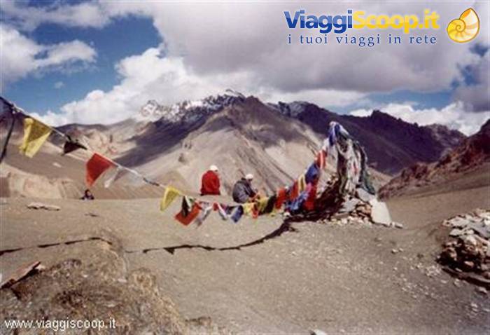
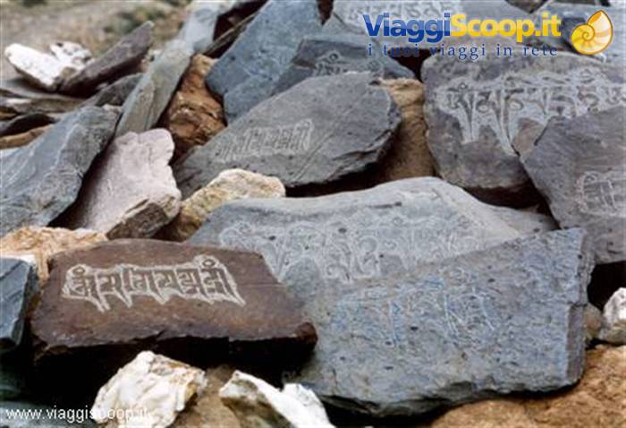
In the villages, along the paths and on the peaks of Zanskar religion is a constant presence, the call to the divine is everywhere. The garlands of prayers entrusted to the wind on every height recall it, the banners and gilded emblems of the monasteries, the chortens and the votive stones carved at every turn of the path, the countless monks, the very sacredness of the mountains. And the walk in the clear light of 5,000 metres also becomes a pilgrimage into the sanctuary of the oldest faith in the world: the Buddhist one.
The trek in Zanskar revealed three fundamental components: natural, adventurous and cultural. I must say that none of the three disappointed my expectations; on the contrary, they were amply exceeded. Describing the natural component is simple: 19 days of walking through unspoilt nature and surrounded by mountains that exceed 6000 metres in height. Following the course of impetuous rivers and crossing passes that sometimes exceeded 5000 metres. It was the first time I visited these places and it proved to be an astonishing experience. The colour of the mountains is fascinating: copper red with greenish shades that recall the colour of the Dolomites. Stunning are the bushes of flowers that grow close to the boulders, even on the highest passes. Fantastic is the starry firmament observed on clear nights.
Personally I do not remember ever having seen a sky so rich in stars as the one you can observe in Zanskar. Adventurous component. The word adventure derives from the Latin "ad venturam", that is, entrusted to chance. So adventure is everything that is not planned down to the smallest detail and that presents even just a small unforeseen event. In our case adventure was the two-day journey by minibus from Delhi to Darcha on narrow roads, often unpaved and flanked by precipices. Roads that could even be interrupted by landslides. Adventure was coming across, during the trek, multiple fords crossed barefoot. Adventure was the encounter with the inhabitants of the numerous villages met along our way. Certainly ours was an adventure with a small "a" compared with the journeys made by Bonatti, but for me amply rewarding. The cultural component was certainly the most interesting.
We were lucky to have in our group Gianfranco, a university lecturer in History of Religions, who for several years has been crossing these places to document the various signs of Tibetan culture. On the visits to the different monasteries, Gianfranco was a very useful source of information and explanations. The many figures represented held no secrets for him and now not for me either. The strongest emotion I felt entering a monastery is that of time: stopped hundreds of years ago. A tranquillity and a peace reign that we Westerners have forgotten or that perhaps we have never known.
Day 124 Jul 1999
From Delhi to Manali
At 6.30, about an hour late, we land at Delhi airport. Once we've collected our luggage and got through customs, we leave the airport. Here we find our minibus waiting for us, to immediately face the two days of travel that still separate us from Darcha, the start of our trekking. We cross the outskirts of Delhi amid chaotic traffic and accompanied by an asphyxiating humid heat. Right away we encounter the first signs of the poverty that will accompany us throughout our journey and that in this case are represented by endless tent cities along the edges of the road, where the least well-off live. Just outside the city the weather improves and the sun comes out. The journey turns out to be long and tiring. Finally, after midnight, we reach Manali and hurriedly settle into a hotel.
Prinkti-La pass
Day 225 Jul 1999
From Manali to Jispi
Manali is a cheerful tourist town located at 2000 metres of altitude in the Kullu Valley and is surrounded by green coniferous forests. In its centre you can find shops and little markets where it is possible to go shopping and meet people. I spend the morning wandering around its centre teeming with people. Patrizia and Beppe are buying more provisions which, in addition to those brought from Italy, will be needed during the trekking: sacks of potatoes, rice and various vegetables are added to spaghetti, tuna, cheeses, cured meats, jams, honey and biscuits. A stock of provisions sufficient to cover the 19 days of trekking that await us. The day is splendid with a hot sun. At 13.00 we take our bus again and set off for Jispi. The road in some points is breathtaking: unpaved, narrow and steep. After 3h we are at Rothang Pass (3,980m) 51 km, where we stop for a short break.
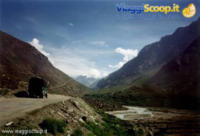
Unfortunately there is a fog that prevents us from seeing the panorama and it is cold. Having set off again we descend into the Lahaul Valley. The landscape changes drastically, the green mountains that characterised the Kullu Valley are replaced by barren mountains. We pass through the middle of tiny villages surrounded by fields of barley and potatoes. The road runs alongside the Bhaga river. In the village of Khoksar, after 20 km, there is a military check point. While we are at it we eat something at a characteristic little restaurant. At 21.00 we stop at Jispi in a refuge, about 6 km from Darcha, where we spend the last night under a roof. Tomorrow we will finally start walking. The evening is beautiful: the sky is covered with stars.
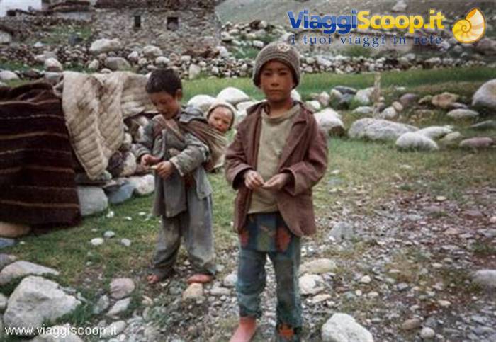
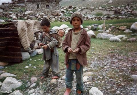
Children of Ladakh
Day 326 Jul 1999
From Jispi to Palamo
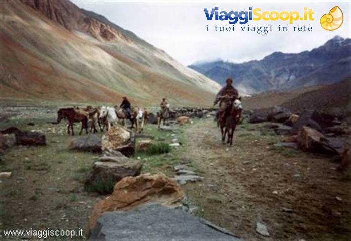
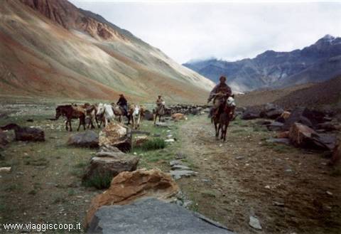
In the morning we meet our cook-guide, Hary, and the 4 horsemen who, together with 15 horses for transporting the provisions and luggage, will accompany us for the whole trekking. They seem very young. They have no luggage and the only things they own are those they are wearing: light trousers, a t-shirt, a sweatshirt, a k-way and some wear rubber boots, others sports shoes and one wears simple flip-flops. I stop to think and turn my gaze towards my bulky luggage. The day is splendid with a hot sun and a clear sky. Patrizia, our coordinator, gathers us and says: «Guys, if we want the minibus can take us as far as Darcha. The other groups set off on foot from here. What do we want to do?». Not content with all the km that await us, the answer was unanimous: «Let's set off from here too!!!». I don't know if we were really convinced or if none of us wanted to show signs of weakness.
Certainly we could have saved ourselves those 6 km of unpaved road continually travelled by columns of military vehicles and civilian trucks, which as they passed raised clouds of dust. Anyway this too is part of the adventure. While the horsemen load the horses, we set off slowly on foot, and after a little more than an hour we finally arrive at Darcha, the starting point of the Zanskar trek. Darcha is a small village, located at 3400 metres of altitude, made up of a few houses, built like the majority of Ladakhi dwellings in stones held together by clay, dung and whitewashed with lime, and of small little shops set up under military parachute-tents, in which you can find a bit of everything. Moreover here too there is one of the many military checkpoints.
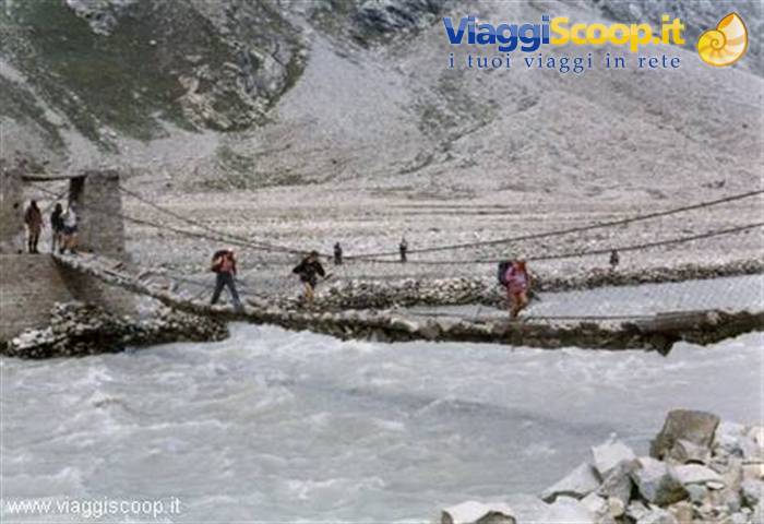
Once our horsemen have arrived and the next stopping place has been agreed with them, we finally manage to set off for the trek, it is 11.00. The path sets off decisively for 100m, behind the little shops at the side of the truck road, and climbs back up the left bank of the river above. We pass among grass meadows, where we find women busy gathering it. Then we walk on a road under construction until we reach the village of Rari, 12.30. Here we decide to stop for lunch under some willows. It is very hot and the sun is scorching (T=27°C). We set off again at 13.00. Shortly afterwards we cross a second village, Cikak. A little further on we find a suspension bridge hanging in the void and made with wooden logs, where below flows the impetuous river (beautiful canyon). We pass onto the right bank of the river. At this point there are a series of simple fords to cross.
At 15.00 we arrive at Palamo. The stage is short and simple, but it is better to climb in altitude slowly for better acclimatisation. The camping is beautiful: an English lawn with a stream flowing through the middle and there is a parachute tent as the house. Once the camp is set up we wander around until dinner time. Angela, our flower child, taken by the enthusiasm of the hot day even puts on a swimming costume and bathes in the river... after all she had signed up for a sea trip and found herself on a high-altitude trek trip. The evening is beautiful with a starry sky, you can see a very bright Milky Way (T=12°C).
Children of Ladakh
Day 427 Jul 1999
From Palamo to Jankarsumdo
Wake-up at 8.00 (T=10°C), breakfast and then we set off at 9.30. A short and monotonous stage. The path runs along the right bank of the river over a stony stretch in a continuous up and down. The sun is scorching and it is very hot (T=27°C). Shortly before the camping there is a first demanding ford and then other less difficult little streams to deal with. We arrive at 14.00. The camping is decent and is located in the middle of a wide valley: grassy ground with a few stones, unfortunately the spring is dry and we have to take water from the river nearby, here too there is a the house. I notice a lot of rubbish around, a sign of the passing of tourists. Beppe, Giovanna and I decide to scout a stretch of the path that awaits us tomorrow. We cross the suspension bridge over the impetuous river and we climb up the steep way. 20.00 T= 13°C.
Some of us begin to suffer from a strong headache and it is difficult to sleep.
Colours of Ladakh
Day 528 Jul 1999
From Jankarsumdo to Chuminakpo
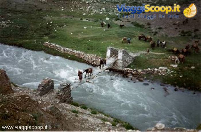
Wake-up at 7:30 (T=8°C), breakfast and then we set off at 9:00. The sky is veiled by a few clouds. We immediately cross the suspension bridge made of wooden beams, stones and held together by metal mesh (it will be the most demanding of the trek). The horses show some reluctance in crossing the bridge and three of them flatly refuse. They are unloaded of their baggage, which is carried by hand, and are made to ford by swimming. The current is very strong and impetuous, but luckily they manage to reach the opposite bank. From this point the trail begins to climb steadily for 150 m, after which, skirting the right bank of the river, we cover several ups and downs along the hillside. The path is a stony stretch. At 12:30 we stop for lunch. During the day the weather worsens and the sky becomes completely covered with threatening clouds. Having resumed our walk, we cross two streams.
At 14:30 we are at our 3rd camp: Chuminakpo. It is the highest camp of the whole trek. The camping spot is adequate: grassy false flats with many stones and hard ground, the spring and the river are nearby. Unfortunately we are enveloped in thick fog and cannot see the surrounding landscape. In the early evening a violent storm breaks out, forcing us to retreat into our tents (T=11°C).
Colours of Ladakh
Day 629 Jul 1999
From Chuminakpo to Lakong
At 4:00 it stops raining. We get up at 6:30 (T=7°C), breakfast and then we set off at 8:00 heading for the legendary pass. The surrounding landscape is still enveloped in thick fog. After 1 hour we reach the Ramjak camp (small and stony). The trail climbs gently for about 400 m, then the last 100 m become more demanding. Shortly before the pass a bothersome light drizzle begins to fall. Along the trail we find no snow, but we walk on irregular and slippery stones. At 12:00 we are at the Shingo La pass (5,090 m, T=3°C), marked by the classic prayer flags. A short stop with the classic group photo and then a long descent, slipping on several snowfields and fording some streams. We have entered the Zanskar valley. We walk for a long time alongside the stream among expanses of grass, flowers and edelweiss. At 15:00 we reach the Lakong camp.
The camping spot is decent and is located in a large valley: grassy ground with many stones, the spring and the river are nearby, and there is also a tea house. Luckily it has stopped raining and we can pitch our tents without worry. We try to dry our things, but it's useless, there is a strong dampness. We are very tired and we have dinner early so that we can retreat into our tents (T=9°C). At midnight another violent storm breaks out.
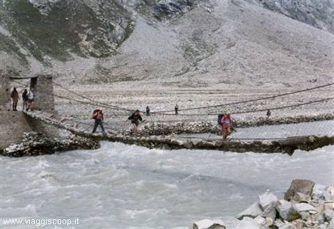
Crossing a bridge in the Zanskar Valley
Day 730 Jul 1999
From Lakong to Kargiakh
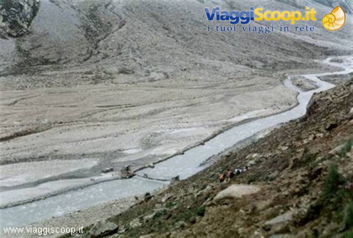
At 3:00 it stops raining. Wake-up at 6:30 (T=6°C), breakfast and then we set off at 8:00. The clouds have lifted and the various peaks surrounding us are full of fresh snow. Even the road we walked the day before is covered in white. If today we had had to cross the Shingo-la pass, we would certainly have encountered snow, but luckily we have already passed it. We immediately cross a wooden bridge and then ford several streams. We walk along the Kargiakh river valley, skirting it on the right bank. The trail is beautiful, easy and unfolds on a false flat. Moreover it is rich in flowers of blue, pink and yellow, and the mountains begin to show the typical colors of Zanskar: purple and green. We walk under a bothersome drizzle that will alternate with moments of clear skies.
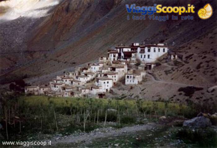
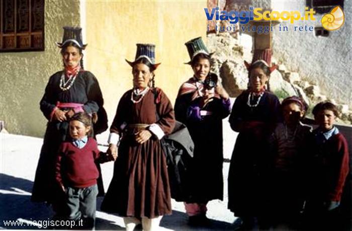
Shortly before the village of Kargiakh we encounter various mani walls and chortens (decidedly evocative) that welcome us to Zanskar! At 14:00 we are at the village, we cross it and in a tea house we find a hyperbaric "chamber" (incredible). Inside there is a Nepalese who is ill due to the altitude. The camp is 1/2 hour beyond the village. The camping spot is good: a nice grassy meadow, near the river and the spring. After pitching camp, together with the girls of the group and Beppe we go to visit the village. We find many small children and women, the men with the older boys are in the high pastures with the yaks. The people are very hospitable and offer us their food and the classic Tibetan tea. Back at camp we have dinner and then off to sleep (T=10°C). In the evening it starts raining again.
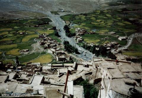
Village of Zanskar
Day 831 Jul 1999
From Kargiakh to Purne
Wake up at 6:30 (8°C), breakfast and then we set off at 8:00. The day is beautiful with gorgeous sunshine. We continue along the river. The valley we cross is dotted with countless chortens and religious relics. We reach the village of Tanzi after 3h and stop at a tea shop for 1/2h. The village is picturesque and there are many women working in the fields. We resume walking on a continuous up and down, and cross the river at the 2nd bridge, taking us along the edge on the left bank. After 1.3h we come across another village: Karu. We pass two more villages: Tetha and Jal. After Jal there is a steep sandy descent, we cross a wooden bridge, and then a steep climb takes us up to Purne. At 16:40 we are at camp. Today's stage has been very beautiful from a scenic point of view, long but not tiring, and we walked without major elevation changes. Here we stop for two nights.
The camping is good: a nice grassy meadow near the stream and the spring, there is a guest house, restaurant and a tea shop. You can buy biscuits, drinks and canned goods. At 19:00 it starts raining again. We have dinner in the kitchen tent, which unfortunately is starting to leak. At 21:00 we go to sleep (T=11°C).
Village of Zanskar
Day 91 Aug 1999
Purne - Phuktal -Purne
Today we don't break camp but make a detour from the main route to go and visit the Phuktal monastery. Having left the horses at Purne, we follow the path that starts right above the camping and runs alongside the Tsarap river. The way winds through a splendid gorge. The path is a rocky stretch and in some points there is a danger of landslides. After about 1 hour and a half we reach a small tributary of the Tsarap with a magnificent waterfall. We cross a bridge and, with a short climb of about 15 minutes, we reach a plateau with a chorten. The way turns sharply to the left and Phuktal presents itself as a breathtaking sight: a long row of mani walls and chortens lead to the monastery perched on a rocky wall, beneath a natural cave in a fantastic position. It looks like a beehive.
In the cave there is a well in which the water level always remains constant, even though a considerable amount is drawn from it. This water is famous for its therapeutic properties. In the monastery there is also a stone tablet left by Alexander Cosma de Koros, a Hungarian who visited Tibet and lived here in 1826-27. The Phuktal monastery is one of the most spectacular in Zanskar. Phuktal belongs to the Gelupa tradition (yellow-hat monks) and about 70 people live here. In the late afternoon another storm breaks out. We take refuge in the kitchen tent... let's hope it holds. Dinner and then off to bed (T=11°C). Many of us are showing flu symptoms: cough, cold and sore throat.
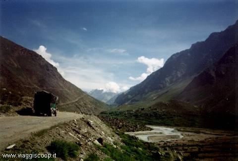
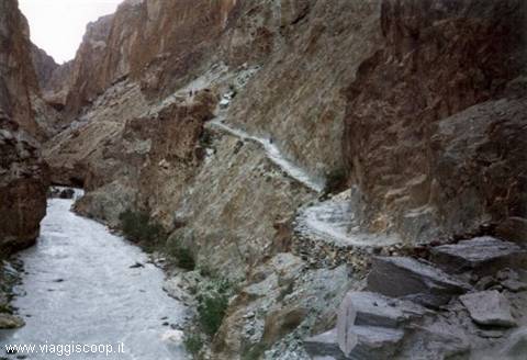
Road between Jispi and Darcha
Day 102 Aug 1999
From Purne to Pipula
Towards morning it stops raining. On waking we are met with an unpleasant surprise: 5 horses have run off and our horsemen are looking for them. Patrizia doesn't trust setting off and we stay in Purne until they find them. The day is beautiful and the sky is clear. Only at 12:30 do we manage to set off. We return to the path for Jal and after crossing the wooden bridge again we resume the way, turning right. The route is a dusty rocky stretch and stays along the edge following the Tsarap river on the left bank. In many points there is a danger of landslides. We pass through various villages: Cha, Kaydang and Hamuni. In the latter we stop for 1/2h at a well-equipped tea shop. It is very hot. The scenery is striking. Shortly after the tea shop there is a steep descent followed by a steep climb. The way continues along the river in the lower part, inside a canyon.
At 18:00 we reach the Pipula camp. The camping is ugly, small and hemmed in. The ground is hard and full of stones and we are very close to the river (the noise is deafening). There is a small spring and a tea shop. We decide to camp here even though it is very ugly, but unfortunately it is too late to continue and the next camping is at Ichar, which is about 1.30h away. We have dinner and then everyone off to bed (T=13°C). This will be the first night it doesn't rain after several days.
Road between Jispi and Darcha
Day 113 Aug 1999
From Pipula to Reru
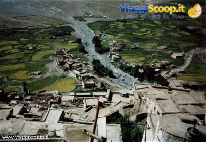
Wake up at 6:30 (T= 11°C), breakfast and then we leave at 8:00. The weather is uncertain, the sky is veiled by a few clouds. We get back on the trail in a continuous up and down until we reach a wooden and iron bridge, after 1h15. We cross it and visit the village of Dorzog. The small cluster of houses is characteristic, in particular the prayer hall and the various chortens. We set off again at 10:30 following the trail on the right bank of the Tsarap river and after 45 minutes we arrive at the fortress-village of Ichar. We visit it accompanied by countless children. At 12:00 we set off again and cross barley fields staying at altitude relative to the river below, always on the right bank. The route is scenic and spectacular. At the confluence of another river, the green meadows of Reru can be seen in the distance.
The trail descends sharply and then, after crossing a new wooden bridge, climbs again for another 200m. The camping site remains behind the village in an elevated position. At 15:00 we are at the camp. The camping site is excellent: a beautiful English lawn with a small pond in the middle (be careful that in the morning the water level rises), a spring and a stream nearby; a quiet place. The temperature is pleasant and a beautiful sun warms us. I take the opportunity to dry my things and do the laundry. Angela suffers from strong knee pain (inflammation), the next day she will continue on horseback. We have dinner under a spectacular starry sky (T= 13°C).
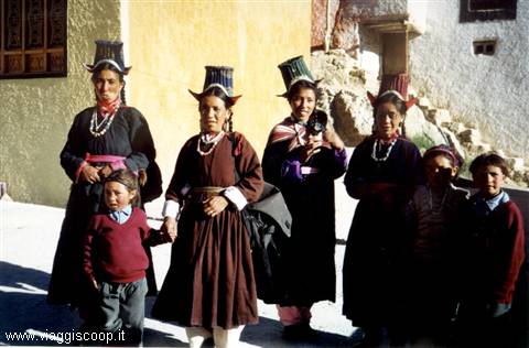
Costumes of Ladakh
Day 124 Aug 1999
From Reru to Padum
Wake up 6:30 (T= 11°C), breakfast and then we leave at 7:45. The weather is beautiful with a warm sun. After about 45 minutes we arrive at the monastery of Mune. We manage to attend the morning service. At 9:30 we set off on an unpaved road under construction. There is a lot of dust and the day is muggy, the route is monotonous. After about 2h we arrive at the monastery of Bardan, located on a small hill on a bend in the river. Bardan is 12 km from Padum. Here we stop for lunch. At 13:00 we set off again and after 2h we reach Padum. The route is flat. Once we arrive in town, a general drink to celebrate the end of the first part of the trek. Padum is the capital of Zanskar, rather ugly, but situated on a beautiful plateau, on the bank of the Zanskar river at an altitude of 3650 metres. It is connected by a drivable road to Kargil, Leh and Srinagar.
There are numerous hotels and restaurants, the post office, the public telephone office and numerous shops. On this cold and inhospitable plateau live simple people whose only sustenance is represented by barley and peas, the only crops that grow at this altitude. Their only wealth comes from flocks of sheep and goats as well as the famous horses of Zanskar. With the exception of Padum, where 40% of the population is Muslim, the inhabitants of this plateau are Buddhists. Having set up camp about 1 km from the road to Kargil, we visit the town and buy what we need for the continuation of the trekking. The situation is calm and no tensions or strange troop movements are noticeable. Angela decides to continue on her own, taking the bus to Leh. The bus leaves from Padum at 5:00 and arrives in Kargil around midnight.
The following morning it sets off again towards Leh, where it arrives in the late afternoon (always depending on road conditions). All together we eat some local delicacies, such as the classic momo (very good) in the kitchen tent. In the evening a shining starry sky comes out (14°C).
Gorges of Honupatta
Day 135 Aug 1999
From Padum to Pishu
We find a truck that takes us to the village of Karsha, located on the opposite bank of the Zanskar and connected to Padum by an unpaved road, thus saving us about 2 hours of monotonous walking. The sun shines high and the sky is cobalt blue. The monastery overlooks the village offering a magnificent view over the vast valley of Padum, enclosed by spectacular mountains. Two imposing peaks can be admired: Nun and Kun, respectively 7135 and 7076 metres. At 10:30 we set off along the sandy and dusty trail. The surrounding landscape is very beautiful, but harsh. Today's stage, more than a trekking in the Himalayan range, resembles a crossing in the desert. We walk on a track without a single tree and the only shade we find is that of some large boulder. The sun is scorching and the temperature certainly exceeds 30 degrees. After 2h we are in Rinam, where we meet 2 tea houses. Stop for lunch.
We set off again skirting the Zanskar river on the left bank. After 2h we reach the village of Pishu. We wander through the alleys and after passing the last house we glimpse a beautiful green field: our destination. The camping site is excellent: a beautiful English lawn with a spring and river nearby and there is a tea house. Given the beautiful day we decide to do the laundry and have a general wash, then relax. The evening is beautiful with a magnificent starry sky (17°C).
Gorges of Honupatta
Day 146 Aug 1999
From Pishu to Hanumil
The day is beautiful with warm sunshine and a clear sky. The trail is easy with continual ups and downs skirting the Zanskar River. After 2h we pass through the village of Pidmo. Along the way we stop several times to drink. We arrive at Hanumil at 13.00. Not a difficult stage, with beautiful landscapes. The only difficulty is a rather long ford made barefoot on sharp stones, shortly before the camp. From tomorrow we start climbing again. The camp is excellent: a nice grassy meadow covered with edelweiss and surrounded by willows, there's a tea house, river and spring nearby. In the afternoon we wander around the surroundings and then general relaxation. The evening is beautiful and warm (T = 20°C).
Crossing a bridge over the Zanskar river
Day 157 Aug 1999
From Hanumil to Snertze
We continue following the course of the Zanskar River on the left bank, with continual ups and downs for 1.3h. After that the valley narrows more and more and we begin to climb towards the Purfi La pass (3,900m). The last 300 m are steep, but made easier by narrow switchbacks. We arrive at the pass in 3h. We stop to admire the surrounding landscape. At 11.00 we set off again along a vertiginous descent (halfway there's a tap for water), where we lose altitude quickly (500m). After 45 minutes we arrive at a bridge over the Oma-Chu river and stop for a short break under some nice willows in the shade. It's very hot. From this point the trail climbs steeply again. The way is dusty and exposed with impressive sheer drops, in particular the last stretch overlooks a canyon whose bottom cannot be seen. A hard climb of 400 m in 1h.
Once at the top we enter the Hanuma valley, reached by a comfortable contour-path, which, descending to the river, leads to the camping area between two mud-brick huts and some terraces for tents. We arrive at Snertze at 13.30. The camping is ugly: hard-packed earth with lots of stones, there's a tea house, a nice river and spring nearby. We decide to all go and bathe in the river. The evening is warm (T=20°C).
Crossing a bridge over the Zanskar river
Day 168 Aug 1999
From Snertze to Lingshad
We leave at 7.00. The trail starts off decisively with continual zigzags along the river for about 400 m, 1h. We also cross an ice bridge. Then it becomes less tiring and the way narrows more and more in the narrow valley. We see some ibex. After 2h we come across a house used as a tea house. We arrive at the Hanuma La pass (4,700 m) at 10.30; 900 m of climb in 3.3h. We stop to eat something. From here we enjoy a magnificent view over the splendid Lingshad valley. In the distance we can glimpse the monastery and the village with its green terraces. Everything is surrounded by dolomite peaks of incredible colour. It's one of the most beautiful landscapes of the trip. The sun is veiled by a few clouds, but warm. At 12.00 we set off again along the very steep descent that leads to the stream; 1,000 m in 45 minutes.
We go back up the river for 10 minutes, after which we take a trail that climbs up a ridge on our right. The stage is very eventful: we go up and down for another 2.3h. We arrive at the camping at 15.30, after passing through the village of Lingshad. The camp is ugly: hard-packed earth and full of stones; nearby there's a small spring and a well-stocked tea house. However, it's next to the monastery and enjoys a splendid view over the village. The evening is beautiful with a splendid starry sky (T=18°C).
Zanskar river
Day 179 Aug 1999
From Lingshad to Marlin
In the early morning we visit the monastery. It is very beautiful and we arrive while the monks are eating and meditating in the prayer hall. They offer us tea and zampa. At 8.30 we set off on the trail right behind the campsite. The path starts off decisively up to 2 chortens. At this point we walk along a long traverse and then the trail becomes steep again up to the Margum La pass (4,100m), 1h. From this pass you can clearly see the trail we have to follow: a marked zigzag strip climbs the golden mountain in front of us. The day is beautiful and muggy. Steep and dusty descent until we reach a watercourse, 1h. We pass through two villages: Gongma and Skiumpata. From this point the trail starts off decisively again and we climb for 500 m, 1h. We reach the Kuba La pass (3,800m) at 12.30 and stop for lunch.
After the pass we proceed for a long stretch along the ridge to the large flat area of Marlin, 45 minutes. We camp on a splendid balcony surrounded by a frame of pastel colours. The campsite is decent: packed earth with stones, there is a stream and a spring nearby and a tea house. In the evening the sky clouds over and at 21.00 it starts to rain for about 1h (T= 18°C).
The Padum Valley from the Karsha Monastery
Day 1810 Aug 1999
From Marlin to Photaksar
The sky is covered with clouds and we are wrapped in thick fog. The path continues with constant ups and downs and after 45 minutes we reach the Gagio campsite (ugly and small). From this point the trail starts to climb steadily. Only the last 100 m are harder, though helped by a narrow series of switchbacks. In 1.3h we are at the Singe La pass (5,060m). The fog has lifted, but the sky is still overcast. In front of us opens a large valley surrounded by mountains topped with glaciers. We leave behind the Zanskar basin to enter that of the Yapola, a direct tributary of the Indus. We stop for 1h. As usual a steep descent awaits us, 1,000 m of elevation loss. After that we continue on a false flat alongside the river until we find some challenging fords, 1.3h.
After crossing the watercourses the trail starts to go up and down again until we reach the Boumitse La pass (4,200m); the ascent is easy. We arrive at the pass at 14.00. In the valley below we see several marmots running from one burrow to another. The descent is along a side ridge on the left and then continues along false flats with a few small streams to cross. After 30 minutes we are at the Photoksar campsite. The campsite is excellent: a nice English-style lawn with the stream and the spring nearby. It is located on a splendid balcony overlooking the village, perched on the edge of a ravine and surrounded by spectacular pastel-coloured mountains. Behind us towers a mountain with a fabulous glacier at its top. Unfortunately at 16.00 a violent storm breaks out for about 1h. When it ends, two magnificent rainbows appear magically.
In the evening the sky clears and a beautiful starry sky comes out (T=18°C).
The Padum Valley from the Karsha Monastery
Day 1911 Aug 1999
From Photaksar to Honupatta
The day is beautiful with glorious sunshine. The trail continues to descend for another 200 m and crosses some streams. We pass through barley fields and meet many people at work. The village of Photaksar is wonderful, perched on a small plateau above a sheer cliff. After about 1h we arrive at a bridge over the river, we cross it, and the path starts to climb. Shortly after we come across a chorten and the trail turns sharply to the right, first with a slight climb then with narrow switchbacks up to the Sirsi La pass (4,850m). At the top a breathtaking sight awaits us: a large valley made up of countless golden sand pinnacles opens up before us. We remain spellbound and stop to admire the view for 1.3h. We resume the trail, which is made of stones, and descend vertiginously for about 700 m. We see many marmots: fat and with dark fur.
There are various streams to ford and we come across a new wooden bridge. We arrive at 13.30 at the first Honupatta campsite (there are several campsites), but this one is ugly, small and full of stones. We see a nice green meadow below us near the river and after a long discussion with the horsemen we convince them to follow us. In the afternoon we wander around the area, bathe in the river and relax. The evening is beautiful and warm (T=20°C) and a magnificent moon silvers the river and the valley.
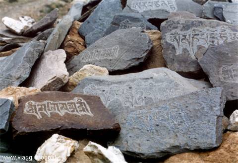
A characteristic 'Mani Wall'
Day 2012 Aug 1999
From Honupatta to Wanlah
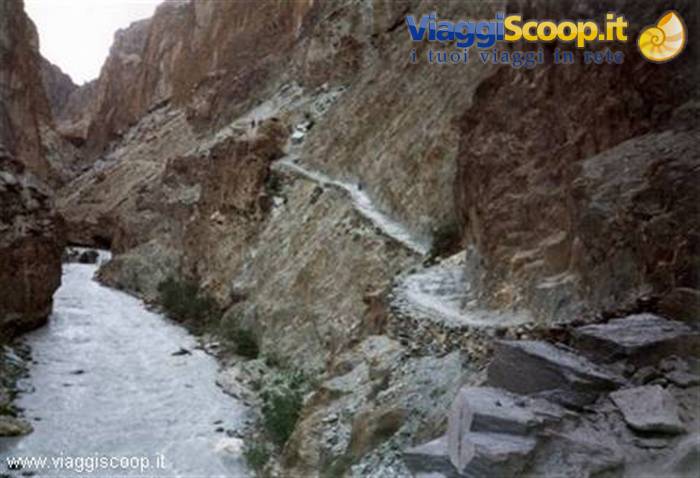
All the horses are missing again. We decide not to wait for them to be found, but to set off anyway; today's stage is shaping up to be very long. After 15 minutes we spot the main Honupatta campsite on the other side of the river: crowded with people and tents. A little further on we come across the first houses of the village. There's everything: hotels, restaurants and shops. Thank goodness we decided to stop earlier. The sun is veiled by a few clouds, but it's very hot. The path runs alongside the river on the left bank, down below. We meet several caravans of people and horses heading to Lingshad. The landscape in the gorges ahead of us is beautiful, distinctive and striking for its colours, with the different shades of purple and green, and the rock formations. The path is recent, often cut into the bare rock, sheer above the river. The route is a continuous up and down.
We come across a recently built bridge, but we don't cross it; we carry on right against the rock, continuing along the left bank of the river. We leave the gorges reluctantly because we have to abandon the magnificent and almost unreal landscape that characterises them. The valley quickly widens and the path also turns into a wide mule track. From this point we walk on a road under construction until we reach the village of Phanijla. It's beautiful with its fields of ripe barley and numerous apricot trees. The people are busy with the harvest. We decide to stop and wait for our horsemen. Fortunately they arrive at 15.00 and so we set off again. The landscape has changed: all around us are trees and green or yellow fields. Still along the vehicle road under construction, we reach Wanlah after 1.3h. The village is large and there are numerous tourists.
The monastery is perched on a ridge above the village. The campsite is ugly: hard-packed earth with several stones. We agree with the owner that we can camp on a lovely green field that has just been cut. Nearby there's the river and a small spring. Unfortunately the trek is over and the relaxing, quiet evenings have come to an end. In the evening we see a bright Milky Way (T=20°C).
A characteristic 'Mani Wall'
Day 2113 Aug 1999
From Wanlah to Lamayuru
This is the last stage of our trekking. Before setting off we go to visit the monastery. Unfortunately we find it in a state of semi-abandonment, dilapidated, and there isn't even a single monk. At 8.15 we set off towards the last pass to be tackled before reaching our destination: Lamayuru. The path continues up the stream on the right bank, behind the campsite. After 1/2h we come across a cluster of houses and a bridge; we cross it and move onto the left bank of the stream. A little further on we find a chorten and several mani walls. We turn sharply right and enter a gully. The narrow gorge is bleak and doesn't let you see anything; quite monotonous. The last 150 m get harder and the path follows with several zigzags. At 10.15 we reach the Prinkiti La pass (3,725 m). The view is magnificent: a spectacular valley with golden mountains. A quick descent along the bed of a dry stream.
We come across a chorten and, turning our gaze to the left, Lamayuru appears before us in all its splendour: magically perched on a hill. The oldest monastery in Ladakh is in front of us, after having covered 340 km on foot. The surrounding landscape is wonderful: green willows, fields of ripe barley, red and yellow mountains. The campsite is above the village, near the vehicle road. We decide to pitch our tents for the last time and find a field near the Dekung Labrong Restaurant. Here we also find Angela, who welcomes us with kisses and hugs. In the afternoon we visit the monastery. The walls are frescoed with scenes that inspire serenity and peace, alternating with paintings depicting bloody dragons and demons. The day is fine with a light breeze and a cobalt blue sky. We have dinner at the restaurant with unlimited beer to celebrate the glorious feat.
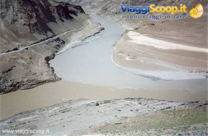
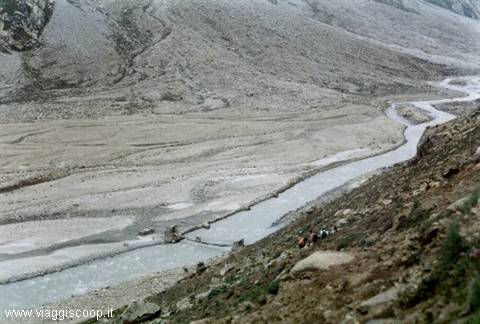
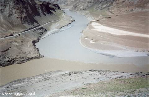
Confluence of the Zanskar river into the Indus river
Day 2214 Aug 1999
We have finished the trekking and, certainly, the most interesting part of our journey. We still have a week left before returning to Italy. With a 6-hour journey on a truck loaded with sacks of potatoes, we reach the capital of Ladakh: Leh. Here we stop for four days to rest from the exertions of the trekking. We spend this period visiting the splendid little town and the monasteries in the surrounding area (Rizong, Alchi, Likir, Hemis, Matho and Tikse). Leh is situated on a green plateau formed by the Indus river at an altitude of 3,500 metres. It is a small town with narrow intersecting streets, and a main road leading to the old palace of the Rajah of Ladakh, built in 1553. In ancient times a king had 108 chortens built in this place, placed in a row (the number 108, which is also the number of volumes of the Buddhist bible, is sacred to both the Hindu and the Buddhist religions).
On 18 August we set off again for Italy. The connections between one flight and the next allow us to visit Delhi and, subsequently, Amman, the capital of Jordan.
Reflection: It is not easy to put into words the experiences we had and above all the countless emotions felt during the journey. Certainly I had the impression of having been among the last witnesses of a culture and a world that is destined to disappear. In Tibet, after the Chinese invasion, Tibetan culture has almost vanished. Only the remote regions of Mustang and Dolpo in Nepal and Zanskar in Ladakh have been able to preserve their ancient traditions. I think tourists contribute, even if unintentionally, to changing, for better or for worse, the way of life of these populations. This consideration of mine must not be interpreted as an invitation not to visit these places; on the contrary, only by knowing them can one understand and love them. It is rather meant as an invitation to visit them "on tiptoe".
Not to flaunt an all-too-easy "well-being" towards people who have always lived, and still live, with the very scant resources that nature offers them. Even the harsh climatic conditions contribute to the almost total isolation of the inhabitants. Children, for example, attend school only in the summer months, because during the long winter season the whole population is forced to live shut indoors. Contacts between the inhabitants of the various villages are also very rare because of the difficulty of the routes and the distances. The rivers and streams that we crossed are completely frozen in the winter months and are used as "roads" by the inhabitants to shorten the journey from one village to another. Another very interesting aspect of this journey was the pilgrimage from one monastery to another.
In ancient times these served only as a refuge for itinerant monks during the rainy season. Later they became permanent dwellings. It is striking to note how many objects that we Westerners consider mere rubbish, such as empty cans, broken shoes and many others, are instead jealously recovered and considered a treasure by those who live in these places. Concluding these travel reflections of mine, I think that all those who intend to approach such unique and unspoilt places must behave not as tourists, but as travellers who love adventure and are always respectful of every reality they encounter. Trying, as far as possible, to adapt to the way of life of these peoples. By behaving in this way we certainly will not stop the end of this culture, but we will surely slow down its extinction.
Zanskar Trek fact sheet: The total kilometres to be covered are 340 and there are as many as 9 passes to be crossed. From the landscape point of view, the first part of the trek turned out to be monotonous in the early stages, but from the religious point of view it is the best-preserved and most interesting part. The second part of the trek is the better-known one and for this reason the most frequented. The various symbols of the Tibetan religion appear neglected. It is certainly the most beautiful itinerary from the mountaineering point of view: magnificent scenery with breathtaking mountains and canyons. The route is well trodden and recognisable; there is no chance of getting lost. The main difficulties of this trek turn out to be: the altitude and the countless fords to be crossed.
On the whole it proved to be very well maintained and not dangerous, if the weather conditions are the same as those we encountered. Otherwise, since the area is a high-altitude desert, where for the most part the path is on a slope and exposed, if it rains there could be landslides. Our timings were always quite relaxed, tranquil walks that allowed us to look around, take photos, and enjoy the marvellous panoramas. In general no stage turned out to be overwhelming from a physical point of view.
Confluence of the Zanskar river into the Indus river



0 reader comments