Murchison Falls, Queen Elizabeth, Bwindi, Fort Portal, Kibale, Kampala, Kisoro, Semliki · West e Sud
When
5 Mar 2012 – 15 Mar 2012 11 days · trip of 2012
Who
Cip Civectitis Civetta · @tizimari · Sâo Tomé
How
Travel diary
The story · 2 days
Uganda, a trip that was a wonderful surprise in the company of Joel, a superb host, discreet and deeply knowledgeable about his country and about conservation. So many glimpses of Africa with different landscapes within a single country, moving from the legendary Nile falls to the savannas of Murchison Falls and Queen Elizabeth, up to the cool high-mountain forests in the magical world of the mountain gorillas, passing lakes and hills with tea plantations and Friesian cows. A peaceful country, even though the armed presence of soldiers and private guards can sometimes be a little worrying. Eighty-two ethnic groups and just as many languages. This is Uganda. Top five Uganda: Bwindi NP and the mountain gorilla visit, boat trip on the Kazinga Channel in Queen Elizabeth NP, the Murchison Falls, Murchison Falls NP, the crater itinerary in Queen Elizabeth NP.
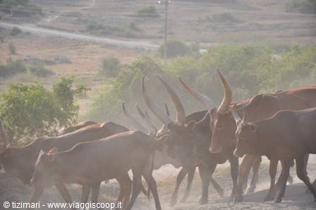
Sunday 4/3/2012 Departure from Libreville at 15h00, arrival in Addis Ababa at 21h30 (- 2 hours). Departure from Addis Ababa at 23h00 and arrival in Entebbe at 01h15. Transfer from Entebbe to Kampala and overnight at the College Inn. Monday 5/3/2012 Kampala – Murchison Falls NP. Breakfast at the College Inn. Panoramic tour of Kampala, we visit the Catholic cathedral, the Protestant cathedral, the mosque recently built by Gaddafi, the residential district of Kololo. Self-service lunch and departure from Kampala around 15h00. Along the road several herds of Ankole cattle, with their incredible giant horns. Coffee stop in Masindi, then we take the 90 km of red dirt track to reach Murchison Falls Park. After 20 km we reach the entrance gate. Shortly after, the first groups of baboons and a few gazelles. We arrive at Red Chilli Camp at 19h45.
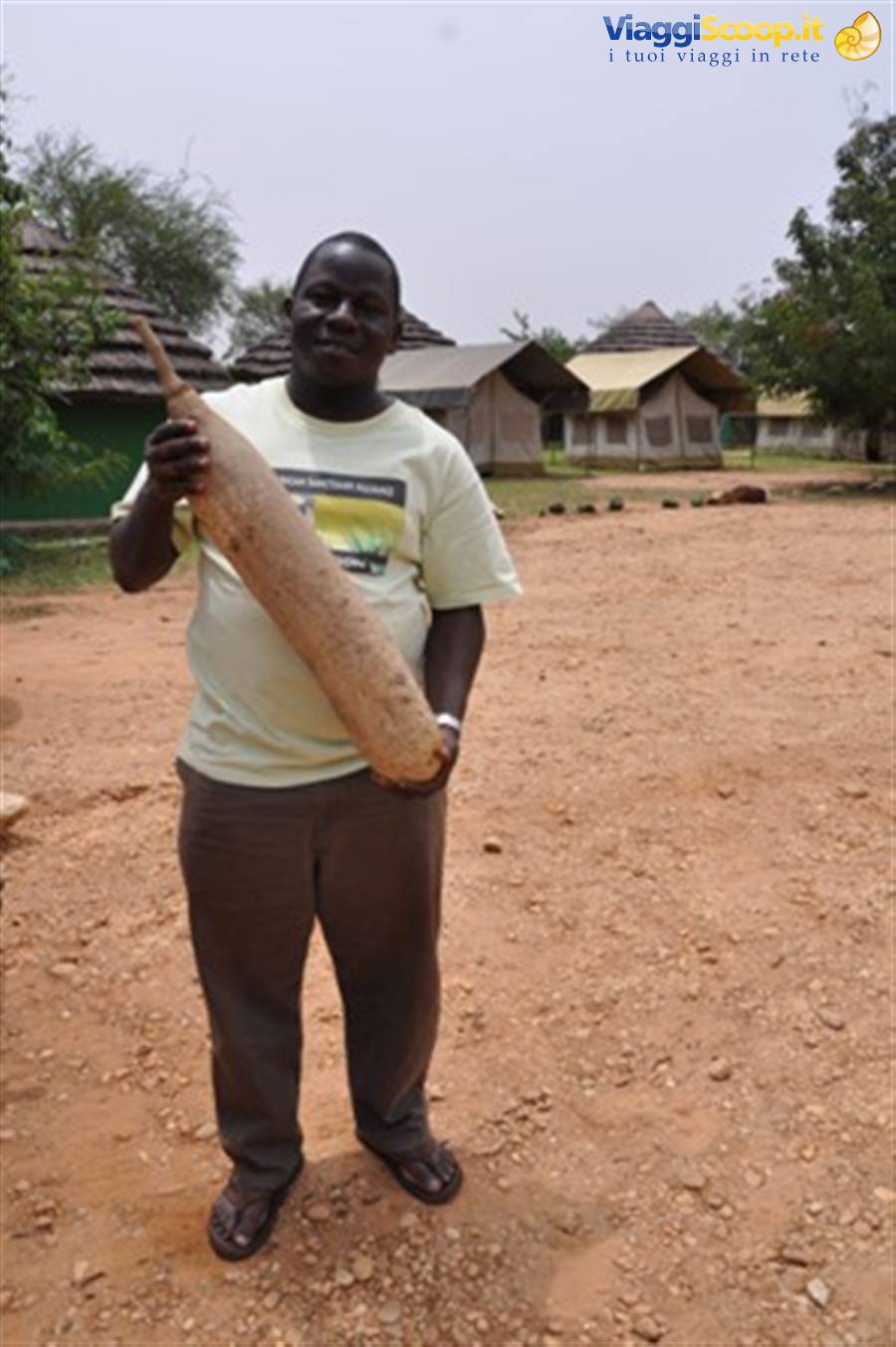
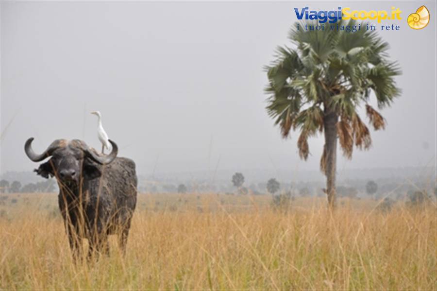
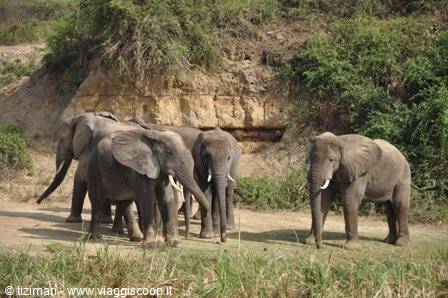
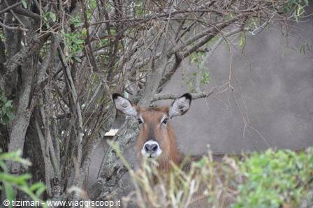
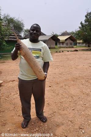
Dinner (11000 shillings each) and we settle in for the night in a "banda" (bungalow – 40 USD a night). Tuesday 6/3/2012 Murchison Falls NP - Murchison Falls NP During the night the hippos came to graze around our bungalow, while a couple of warthogs slept a little further off. Wake-up at 6 for a safari on the north bank of the Victoria Nile. We cross the Nile on a barge and head towards the Delta in the northern part of Lake Albert. The landscape is savanna with many borassus palms, acacias and sausage trees. Many buffalo, waterbuck, oribi, Uganda kob, elephants, giraffes, hippos and many birds including the magnificent green and red bee-eaters, jacana, black and grey storks, hornbills and various herons. Coffee stop at Paara Lodge and back to the jetty to return on the south side. We pick up a giant sausage-tree seed.
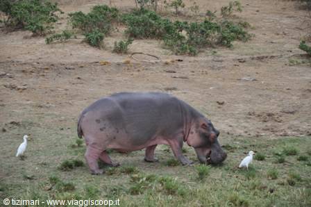
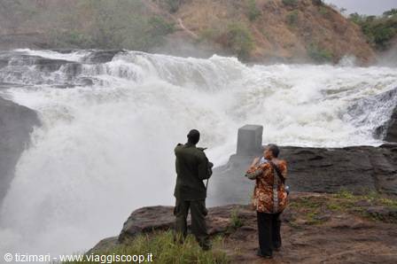
Lunch at Red Chilli Camp and at 14h00 departure for the boat trip up the Nile to the Murchison Falls. During the 2 hours of navigation hugging the north bank, it is a continuous succession of hippos. We come across a few specimens of Nile crocodile, over 3 metres long. Then baboons, elephants, white-tailed colobus monkeys and sedimentary walls full of bee-eater nests. We disembark on the south bank just downstream of the falls and begin a trek of about 1h30 that will take us to the top of the falls.
These falls were reached by the Englishman Samuel Becket???, sailing and climbing the whole Nile; when he arrived here he thought he had reached the source of the Nile, in fact the water emerging from the gorge gives the impression of gushing from the rock, even if it seems hard to imagine that a spring could have such a flow (350 cubic metres per second), terrifying! In 1962, the year of Uganda's independence, following a major flood of the Victoria Nile a new waterfall opened about 500 metres from the original gorge. As the birth of the fall coincided with Uganda's independence, it was given the name Freedom Falls (Oruro in Swahili). During the walk there are remarkable views of the two falls and when you reach the upper part you have the chance to admire the stupendous natural spectacle of the Nile plunging into this gorge no more than 15 metres wide.
At this point Winston Churchill had a bridge built to join the two banks of the Nile. The bridge was swept away by the water only about ten years later. We take the car again to return to Red Chilli Camp, crossing an area infested with tsetse flies. Dinner and overnight at Red Chilli. Wednesday 7/3/2012 Murchison Falls to Fort Portal. During the night again the hippos grazing in the garden around the bungalow. Breakfast at Red Chilli Camp with banana pancake. Departure at 8h00. We leave the camp heading for Buulisa. Right outside we come across the oil fields being installed beside villages with mud huts. In a few years everything here will have changed. In Buulisa, located near Lake Albert, we continue on the red track towards Hoima. Along the road several herds of Ankole cattle, a breed typical of Uganda, endowed with record-breaking horns.
After climbing the eastern escarpment of the Rift Valley, we leave the territory of the Buliisa tribe to enter the territory of the Banyoro tribe. The area is much more populated and much greener than the valley area. We reach Hoima, where we have lunch at the xxxxxxx restaurant. Village after village with mud huts and schools. Every school is a splash of colour. The children's uniforms change from school to school, yellow, green, light blue, lilac, purple. We continue on the dirt track, which gets worse and worse. We pass Pechwe, Malabe, Kagadi and Muhororo, before crossing the Muzizi river, which becomes impassable in the rainy season. We reach the tarmac at Kienjojo, where the tea plantations also begin. They spread across a hilly area overlooked by the tea estates. After Fort Portal we take a dirt road that in about 6 km brings us to Kluge Guest Farm.
Located in a very quiet hilly area with a view of the Ruwenzori range. Dinner and after-dinner in front of the bonfire with the spectacle of the full moon appearing at intervals from behind the clouds. Thursday 8/3/2012 Fort Portal – Fort Portal Breakfast at Kluges Guest Farm and then departure for Semliki National Park. From Fort Portal the new road under construction descends towards the Rift Valley. A pharaonic job carried out by a Chinese company. This road leads to the border with the DRC in an area rich in minerals (coltan, gold, etc.) and to the future oil zone of Lake Albert. Semliki park, located between the Rwenzori range and the river of the same name that marks the border with the DRC. It has a couple of hot springs and a secondary forest with various monkeys (colobus, red-tailed, etc.). The forest consists mainly of abandoned old oil palms.
A walk of about two hours round trip, to reach the two springs that were considered sacred places by the Batwa people. The first spring (female) was reserved for women for rites related to fertility and the second, male, was reserved for men, where sacrifices were made. The park is nothing special and above all now, with the new road passing right alongside the area of greatest interest, it will become even less so. It is still worth the route, with the road descending from the escarpment of the Rwenzori range down to the Rift Valley. Return to Fort Portal with a stop at the Garden Restaurant. Small craft shop with Ugandan and Zimbabwean products. Return to Kluges Guest Farm. Excellent dinner. Kluges Guest Farm (
Day 19 Mar 2012
Friday 9/3/2012 Fort Portal – Queen Elisabeth NP We leave the Luges Guest Farm and head toward Kibale National Park, considered the main park for primates. A 4-hour walk in the park accompanied by the ranger. At the starting point a group of black-and-white colobus monkeys. After about ten minutes an encounter with the first group of red-tailed colobus monkeys. The forest is quite interesting and with various species of trees that produce fruits the monkeys feed on. The park also hosts chimpanzees, but unfortunately we don't see any. Lots of elephant droppings on all the trails, but according to the ranger they've moved to the southern sector in recent days. After about an hour an encounter with a second group of red-tailed colobus monkeys and some black-and-white colobus monkeys.
Then a blue monkey together with a group of black-and-white colobus monkeys and a third group of red-tailed colobus monkeys. We return to the starting point and set off again toward Queen Elisabeth National Park, after a stop for lunch at Restaurant Gardens in Fort Portal. At the entrance of QE Park we cross the equator line, a photo is a must. After about ten kilometers we take the dirt road on the right toward the main entrance gate. We then reach the Mweia Lodge located on a peninsula between Lake Edward and the Kazinga Channel. Sunset and dinner at the Mweia Lodge and overnight at the Mweia Hostel. Saturday 10/3/2012 Queen Elisabeth NP – Queen Elisabeth NP In the morning departure at 6:30 for a visit to the northwestern area of Lake Edward, as far as Lake George, passing through some salt lakes, from which salt is extracted for animal feed.
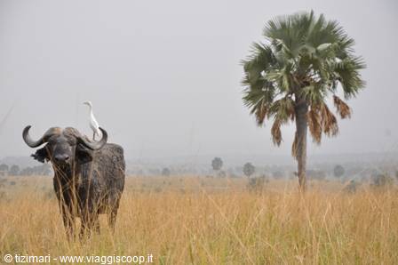
We then reach the fishing village of Kasenyi on Lake George. We continue the visit of this sector of the Park where in theory some lions should be found, but unfortunately for some days no one has seen them. This area until about ten years ago was a completely open savanna that has now been invaded by a type of cactus and a series of bushes that are completely closing off the savanna, putting the life of the local wildlife at risk and making it difficult to spot the animals. We encounter buffaloes, kob, warthogs, elephants. We return to the Mweia Hostel for lunch and book the boat trip on the Kazinga Channel for the afternoon. At 15:00 we set off for the 2-hour boat trip on the Kazinga. On the banks an incredible spectacle of birds, hippos, buffaloes, elephants, crocodiles and, as a final treat, a leopard.
Among the birds, large groups of cormorants, pelicans, storks, herons, kingfishers that hover over the water and then dive to catch fish, and many fish eagles. The boat trip on the channel is truly not to be missed. Return to the landing stage and we set off for the salt lake of Katwe and for the crater area route, to which probably a bit more time should have been devoted. The track climbs up the rims of a series of extinct craters, in some of which salt water still exists. From above you enjoy a breathtaking view of the savanna as far as Lake George. The track then descends into the savanna below toward the equator gate. We return to the Mweia Hostel for dinner. After dinner a traditional dance performance from the region at the Mweia Lodge.
Sunday 11/3/2012 Queen Elisabeth NP - Bwindi We set off from the Mweia Hostel, reach the main road to cross the Kazinga Channel and re-enter the southern sector of QENP in the direction of the Ishasa area, famous for its tree-climbing lions. On the night before our arrival the lions killed 8 cows that had entered the park from one of the nearby villages. We see the marks left by the vehicles of the trackers who follow the lions by sight, but they're in an area that isn't visible and not accessible, certainly resting after the feast. We leave the QENP and stop at the Savannah Lodge for lunch. We continue toward Bwindi, leaving the Rift Valley behind and climbing higher and higher into the mountains. We camp in tents at the Buhoma Community Camp.
A stroll in the village where there's a lot of local handicraft and a lot of handicraft imported from the Democratic Congo, which is only a few kilometers from here. We bought a Songwe mask and a Choque sculpture. Dinner at the Camp, not bad. Monday 12/3/2012 Buhoma (Bwindi) – Buhoma (Bwindi) Today the highlight of the trip is scheduled: the trek in search of the mountain gorillas. This whole area lives on the resources generated by tourism related to the gorillas. The trek costs 500 USD per person and in peak seasons you have to book about a year in advance. In Bwindi Park there are 8 habituated gorilla groups, 3 of them in the Buhoma area. Visits can be made for groups of at most 8 people and you can stay at most one hour in the vicinity of the gorillas, to avoid excessive stress on the animals. Visits are once a day.
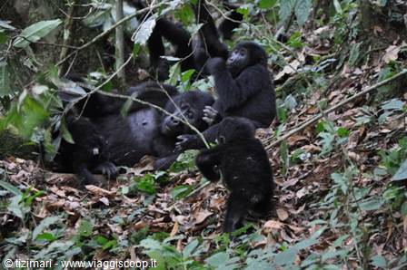
We set off around 9 for the trek; we're in the Mubare group, among the smaller ones and made up of 6 individuals. One guide, one porter and 2 armed soldiers as escort. After about 3 hours we reach the gorilla group and a big surprise for everyone, rangers included: the group has been joined by part of another group, 12 individuals among females and young. According to the rangers, a very rare event that has occurred only once in the last 2 years. Great luck! So we find ourselves with a group of 18 individuals. The enormous male sleeps blissfully on a trunk. The young play around the females and we're in the middle of the whole group; it seems like a dream. After spending about an hour in the company of the group we set off on the way back. In two hours we reach the starting point. Return to the Buhoma Community Camp. Dinner and overnight.
The prices at Buhoma, as in the whole area, are a bit high, 100 USD for a room, 80 USD for a tent. The campsite is more affordable, 10 USD per person per night. Tuesday 13/3/2012 Buhoma (Bwindi) – Lake Bunyoni
From Buhoma we take the road leading south, skirting and crossing the entire Bwindi natural park. A superb panorama of the forest of the natural park that hosts almost 50% of the gorillas existing in the world. Stop at the ITCF research station. We arrive in Kabale for lunch. We set off again toward Lake Bunyonyi; shortly after Kabale the road climbs to a pass from which you enjoy an excellent view of the lake. We settle into the Bunyoni resort in a tent on stilts directly on the lake. A canoe trip for sunset on the lake. Lake Bunyonyi is the second deepest in Africa, after Tanganyika, about 2000 meters. Dinner at the Resort. During the night some unidentified little animal visits us, wandering around the tent.
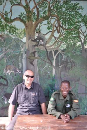
Joel at the red Chilli camp with the seed of the sausage tree
Day 214 Mar 2012
Lake Bunyonyi
Wednesday 14/3/2012 Lake Bunyonyi – Kisoro Even before dawn the drums of the school on the other shore of the lake start playing to wake up the pupils; shortly afterwards more drumbeats for the start of school. The children's singing spreads across the lake; we are immersed in a calm and relaxed atmosphere. After breakfast on the shores of the lake, we go back down to Kabale to take the road for Kisoro and the border with the DRC and Rwanda. Stop at Kisoro at the coffee pot for an excellent pancake with homemade passion fruit jam and local honey. Climb up to the slopes of the volcanoes in Mgahinga park with a view of the three craters of Muhavuro, Mgahinga and Sabinyio. Along the route stretch immense potato plantations with women busy at work in the fields.
Visit to the platform (under construction) located on the edge of the park and from which you can enjoy the view of the three volcanoes and the villages below. The park borders Volcanoes park in Rwanda and Virunga park in the DRC. Mount Sabinyo marks the border between the three countries. The gorillas of Mgahinga have moved to the Rwandan side and therefore visits from the Ugandan side are suspended. Return to Kisoro and overnight stay at the Kisoro Hotel. Thursday 15/3/2012 Kisoro (Uganda). Musanze/Ruhengeri (Rwanda) Transfer from Kisoro to the Kianika (Chianika) border post. We say goodbye to Joel who accompanied us during the 10 days in Uganda and cross the border on foot. The formalities are quick; on the Rwandan side we present the visa requested online, pay 30 USD each and we are in Rwanda.
A minibus takes us about 3 km to the first village from where the bus for Musanze departs, about 30 minutes for 400 FRW each (1 EUR = 770 FRW). We arrive at the bus station of Musanze and to acclimatise and organise ourselves we sit at the adjacent bar. Change money, buy a phone card and transfer by taxi to the friends of Team Rwanda. Lunch at the Vulcana bar with lasagne and pizza, not bad at all. A stroll around the city and back for dinner with the cyclists of Team Rwanda.
0 reader comments