Etosha National Park, Waterberg Plateau, Epupa Falls, Twyfelfontein, Cape Cross, Spitzkoppe, Namib Naukluft Park, Kakerboom Forest, Fish River Canyon, Hardap Dam
When
8 Aug 2002 – 30 Aug 2002 23 days · trip of 2002
Who
Bruno Visca · @Bruno · Germagnano (TO)
How
Travel diary
The story · 15 days
"A country is needed, if only for the pleasure of leaving it." Cesare Pavese, The Moon and the Bonfires
Leaving, setting off to escape the daily grind and to try to quench that constant thirst for knowledge of new peoples and new ethnic groups, to satisfy the curiosity of seeing different places, but always with the certainty of coming back... for the pleasure of setting off again as soon as possible! So it was that I found myself looking for a new country to visit, with these thoughts in my head. There are countless places worthy of a journey; every time my attention falls on one there is also the regret of having to deny myself or postpone a visit to all the others. Still, a decision had to be made: this time the choice fell on Namibia.
Day 19 Aug 2002
Windhoek
Namibia, located in the south of the African continent, is a young country that only gained independence in 1992. In the mid-17th century the Dutch colonists who landed on its shores brought, along with the European customs of that time, a particular language of Germanic stamp, akin to the Dutch of the time. This language, over the years, was influenced by that of other German colonists. The result was the birth of a new language, further modified over the years: Afrikaans, which in 1914 became the official language used in schools. At 12 local time (13 in Italy) on 9 August, with my other travel companions we land at the airport of Windhoek, the capital. Seen from the plane, the landscape surrounding the airport looks like an enormous desert savannah, with rare thorny plants interrupted only in the distance by some small mountainous reliefs.
Immediately we have the first surprises: Jonny's luggage doesn't arrive and two travel companions stayed in Johannesburg because the plane was full; they will arrive, we hope, at 20:30. We go to collect the three four-wheel drives we booked, but they won't be available until Saturday the 11th. After much discussion, perhaps we will manage to have them tomorrow; therefore we have no choice but to reach the city by taxi. Located at an altitude of 1660 metres, Windhoek is a quiet, tidy, elegant and atypical little town compared to the other African capitals. With about 160,000 inhabitants belonging to different ethnic groups, Windhoek is the most populous city in Namibia. The pleasant feeling that remains, even after a short visit, is that of its clear sky, its tidy avenues and its gardens with perfectly cut grass; new and rare skyscrapers surround houses with typically German architecture.
In reality there is not much to see but Windhoek is an excellent base camp for preparing and making plans for the trip and, inevitably, a pleasant point of return.
The Waterberg Plateau
Day 210 Aug 2002
Waterberg Plateau
The four-wheel drives aren't there; unable to postpone the departure we manage to get a minibus with a driver who will take us to our first destination: the Waterberg Plateau in the north of the country. The 4x4s will be delivered to us the next day. Finally, at 14:00 on 10 August, we manage to leave; the first part of the road is rather monotonous, asphalted and always straight in the middle of an enormous plain. When you turn off the main road and take a dirt track, the landscape becomes more interesting; in the distance the Waterberg range appears in all its vitality and we encounter the first animals, among them several warthogs and a cheetah lying in the middle of the track; when we arrive, it lazily gets up and moves away.
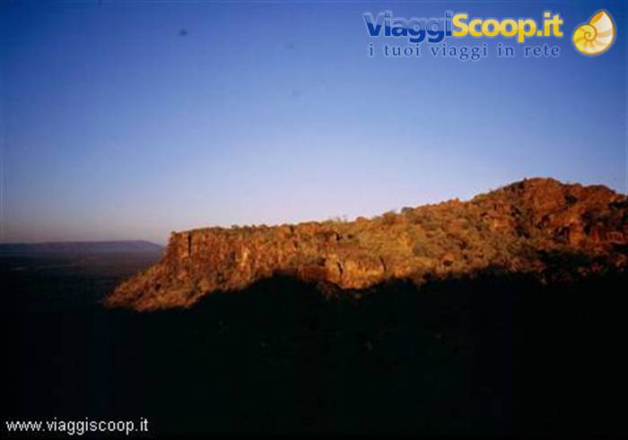
The Waterberg Plateau is a plateau with two sides that come close to 50 km in length and two narrower and more irregular ones, between 8 and 20 km; it is clearly visible from the surrounding plain despite its height, about 150 metres, not being considerable. The beauty of the place comes from the steep cliffs that plunge downwards along the entire perimeter of the formation. The region, inhabited since remote times, was the scene of hard clashes, during the expeditions of the German colonial army, with the indigenous populations. The first whites to settle in the area were the German missionaries, but the mistrust of the natives made the religious men give up and they had to abandon the idea. On the morning after our arrival we take a hike on the top of the Plateau to admire the sunrise.
After some initial uncertainty about the direction, due to the darkness, we finally find the right path and at 6:15 we reach the top of the Plateau. The dawn is beautiful: the rocks gradually take on an intense brick red colour and the gaze ranges over the plain below as far as the horizon.
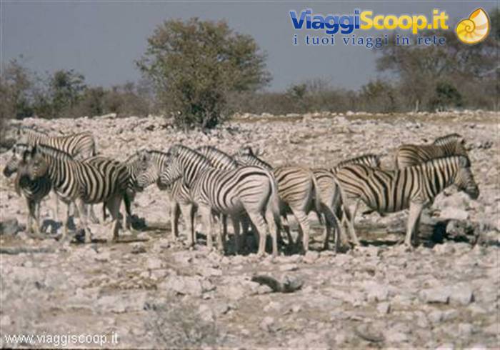
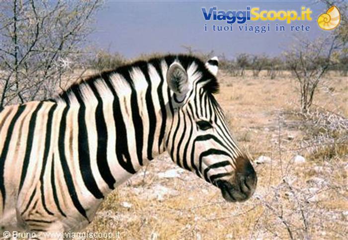
Group of zebras in Etosha National Park
Day 311 Aug 2002
Etosha National Park
At 10:00 we set off again with the minibus; we have an appointment in Otjiwarongo to collect the three four-wheel drives; finally at 12:00 we take possession of them! The journey continues towards the Etosha National Park, and specifically to the Namutoni entrance where we arrive at 17:00. Here a surprise awaits us: Jonny's luggage has arrived. Once camp is set up, at sunset, we have the first of the many indescribable and fascinating encounters with the animals that the park knows how to gift to visitors: a group of giraffes comes, for the evening watering, to the water hole located near the camp. At dusk, the figure of the giraffe in the foreground with the red and fiery ball of the setting sun form a landscape that seems unreal; only in some nature documentaries have I happened to see such a spectacle.
The Etosha National Park is immersed in a territory that surely closely resembles how Africa was before the arrival of man: savannahs, clearings, salt lakes, but above all thousands of animals, living in the wonderful and cruel harmony that nature imposes. Every day the cycle of life repeats itself, made up of struggles for supremacy and for mating, of migrations, of months of drought alternating with rainy periods. This cycle is interrupted only around the many water holes for the few minutes in which each animal quenches its thirst, in mutual respect, but with the awareness that such a moment is brief and, immediately afterwards, the cycle will resume, and with it the life, the struggle for food and for territory that the thousands of animals face continuously every day, now, as at the dawn of time, in the desert savannahs of Etosha.
My personal impression is that the three nights and two days spent inside the park are worth the trip to Namibia on their own. The Namutoni camp, where we spent the first night, is the historic camp of the park: built inside the fort constructed at the beginning of the 20th century by the German colonial troops and opened to the public in 1958, after being used for years as a police post. On the second day of our stay in the park we move to the Halali camp, not directly but driving around on the various tracks and visiting the many water holes where the animals drink. The camp was inaugurated in 1967, in the central area of the park. The structure is less evocative than that of Namutoni but it is located in a particular area of the park, where the usual flat horizon is broken by some hills.
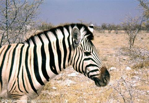
During the journey, especially near the watering places, it is possible to admire dozens of giraffes, zebras, wildebeest, elephants, different species of antelopes as well as very numerous varieties of birds that nest on the branches of the trees. The most evocative water hole is certainly that of Goas, located about twenty km from the Halali camp, in a plain surrounded by sparse vegetation. The whole area is dotted with stones and large sharp rocks, but this doesn't stop hundreds of animals from approaching the water hole.
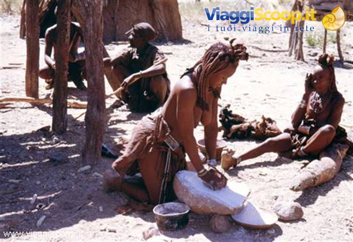
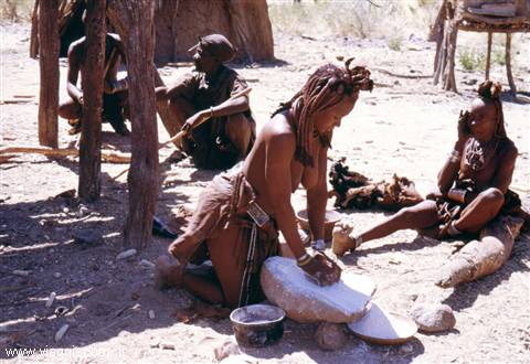
Himba village
Day 412 Aug 2002
Etosha Pan
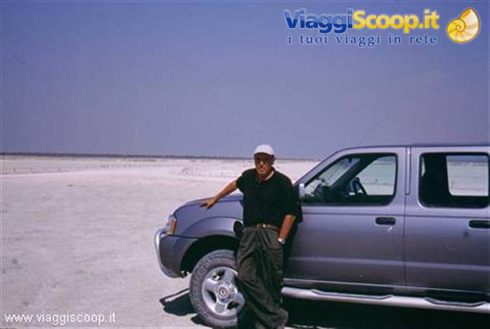
The heart of the park is the expanse of the Etosha Pan which we visit during the day. The Etosha Pan is an immense flat surface of about 4700 km², completely covered in salt, which extends north of the main track. There are very many water holes that have formed over the years along its southern side. The basin, once a gigantic shallow lake fed by the Kunene River, was subsequently subject to tectonic and climatic upheavals that changed its position relative to the water table, making it as it is today. It is seasonally affected by an irregular inflow of water, but the particularly incisive phenomenon of evaporation makes it completely dry for many months of the year. During the drier periods, following the evaporation of the water, a white crust of salt forms which, covering the dry surface of the basin, creates an unreal atmosphere in the heart of the savannah.
Departure at 9:00 for the last camp in the park: that of Okaukuejo. It is the oldest camp inside the park, having been inaugurated in 1957, and it is the seat of the administrative centre of the Etosha National Park. The flagship of this camp is the enchanting water hole located right at its edges, separated by a wall from which, comfortably seated, you can admire the animals drinking. The floodlights switched on at night illuminate the whole area and don't seem to disturb the animals that continually come to drink: elephants, hyenas, rhinos take turns no more than 10 metres from the observation points.
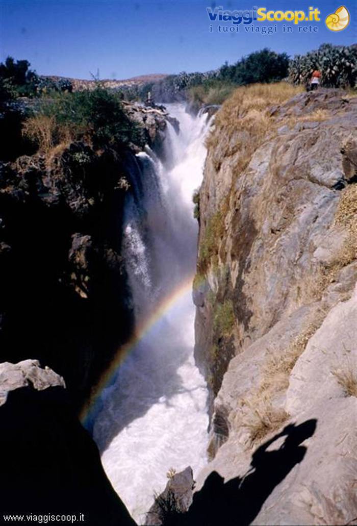
The waterfall of Epupa Falls
Day 514 Aug 2002
Himba Villages
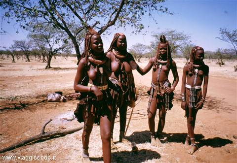
Today we leave the park and head north, to Opuwo, capital of the Kaokoveld, where we arrive at 17:00. Opuwo is located at the beginning of the territory inhabited by the Himba and offers nothing particularly attractive; it is useful only as a stopover, just long enough to organize ourselves for pushing further on, into the Himba territories. Many Himba live in the town anyway, together with the population of Herero ethnicity, but they have lost much of their traditions. Tourism, even though it has arrived only in small doses, has already shattered the atmosphere that Opuwo must have possessed until a few years ago. Fortunately we are still far from what one thinks of when talking about mass tourism; not far away, just beyond the outskirts of the town, in the middle of the Himba territory, the real Africa exists, far from "civilization" and consumerism.
Here the true visit to the Kaokoveld region begins, when one moves away from Opuwo, when one travels the dusty and incredibly rough tracks that lead even further north, toward the Kunene River and the Epupa Falls. There, along the tracks, groups of Himba appear out of nowhere. The women and children, mainly to protect their skin from the sun, smear on their bodies and hair a red clay that gives their complexion a reddish hue; their appearance is thus completely different from the other African ethnic groups. It is possible to stop and, in exchange for a few small gifts, take photos without offending the dignity of this people who have incredibly managed to keep their most ancient traditions to this day.
The Etosha Pan
Day 615 Aug 2002
Epupa Falls
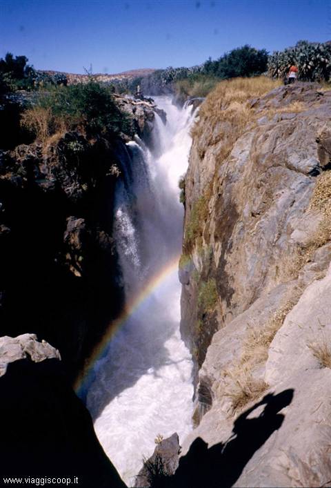
The certainly most evocative and wild region of the Kaokoveld is that strip of land that constitutes the last sliver of Namibia, right at the border with Angola: the area of the Kunene River and its falls, the Epupa Falls. By the falls we set up our camp. The Epupa Falls, which in the Herero dialect means "waters that fall," have a length of about 2 km and drop over 65 meters, creating falls of various heights, the highest of which is 38 meters. The calm pools of water found above the falls invite the visitor to a refreshing bath, also because the temperature is always high; one must nevertheless pay attention to the current which, moving away from the bank, is always very strong. We dedicate the afternoon to exploring the river, following a path that runs alongside it going downhill.
At the end of the falls the river forms bends with beautiful beaches made of particularly fine sand; on the opposite bank one sees an uninterrupted succession of hills: it is Angola.
Graffiti at Twyfelfontein
Day 717 Aug 2002
Twyfelfontein
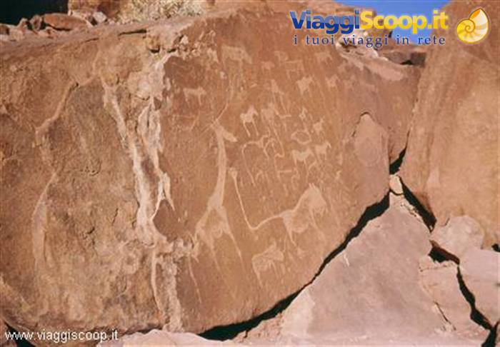
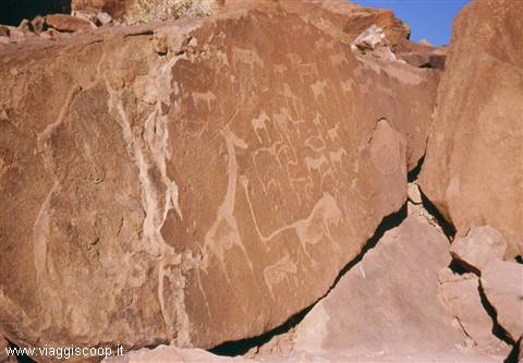
After admiring the sunrise over the falls, around 10:00 we set off heading south. An overnight stay in Opuwo and then on toward Twyfelfontein, in the Damaraland. The stretch features magnificent scenery; after crossing plains of immense spaces, near Twyfelfontein, the Brandberg massif appears on the horizon which, with its 2606 meters of height, is the highest peak in Namibia. Twyfelfontein is the most interesting locality of the region from an archaeological point of view; here we are in the presence of rock engravings dating back 5000-6000 years. These engravings have remained perfectly distinguishable despite the millennia that have passed. They depict scenes of daily life and hunting; figures of animals that today are found only in the savannas, such as elephants, lions and giraffes, are also represented, clear testimony of their presence in the area in remote epochs.
We visit the rock engraving site in the late afternoon, with the sun already low on the horizon. Walking the paths present within the archaeological area and admiring the engravings and the rocks that turn red at sunset instills in visitors a deep emotion for the enchantment and peace that these places give off. The following morning, 18 August, before leaving for the Skeleton Coast, we visit the petrified forest, "Versteende Woud," which is located near Twyfelfontein and is marked by a sign. In the area there is an expanse of petrified tree trunks dating back 250 million years, probably carried to this site by a flooded river. About sixty trunks are clearly visible, some with a length of over 25 meters.
Seals at Cape Cross
Day 818 Aug 2002
Skeleton Coast
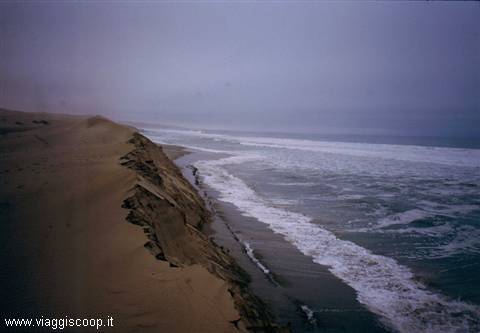
After some mishaps due to a vehicle and its crew getting lost, at 11:00 we set off for the Skeleton Coast and Henties Bay. Once past the entrance gate to the Skeleton Coast, which is a few tens of kilometers from the ocean, the landscape changes radically: from savanna it transforms into sandy desert with dunes that reach all the way to the sea. Arriving on the coast one is fascinated by the sight of the ocean, always tempestuous, with enormous waves, under a gloomy sky permanently battered by a very cold wind. The name of the park and the coast derives from the number of shipwrecks that over the years have been found in the area. The sandy shores, always covered by the fog that rises from the ocean, have been for decades the nightmare of sailors who saw their ships run aground in the shallow waters with no possibility of escape.
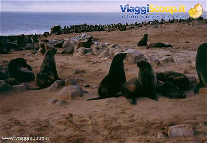
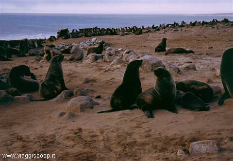
Still today many of these wrecks are visible, rusted and invaded by sand. Traveling along the road that skirts the ocean we stop to visit the seal colony present at Cape Cross, interesting from a naturalistic and historical point of view. In this colony there are thousands of seals that spend most of the day in the water, hunting fish and managing to withstand the low temperatures of the ocean thanks to the insulating fur found beneath the first layer of hair; this fur, besides being waterproof, traps air and keeps body temperature above 36°. The thousands of seals lying out to dry in the sun, with mothers tending to their pups, others ceaselessly hunting fish among the ocean waves, offer a priceless and unique spectacle.
But Cape Cross is not only interesting from a naturalistic point of view but also from a historical one: here landed in 1486 Diogo Cao, a Portuguese navigator who, in search of the route to the Indies, reached latitudes never touched by a white man before then. Cao placed, in memory of the event and as testimony of the Portuguese possession of the site, a "padrao" (a carved milestone) and a stone cross bearing inscriptions, as the Portuguese were accustomed to leave when they discovered new territories.
Sunset at Swakopmund
Day 919 Aug 2002
Spitzkoppe
Today, 19 August, we move to the foot of the Spitzkoppe: an enormous granite complex of volcanic origins with a name of clear German derivation. This great mountain, with its 1729 meters of height, is visible from many kilometers away and rises from the flat and desolate plain. The mountain complex, formed by a multitude of curious rock formations, becomes very fascinating as one approaches and acquires a particular liveliness of colors. Beneath one of these formations we pitch our tents: it will turn out to be the only camp made in a totally solitary area and free from the structures of guarded campsites.
We read in the guidebook that nearby there is a path that leads toward a natural raised plateau, the so-called "Bushman's Paradise." We cannot miss the opportunity to go and visit it! So we find ourselves following a path that becomes increasingly impervious until it disappears entirely. When we realize that perhaps we have not taken the right track, we do not lose heart and decide to reach the top of the knoll that towers above us anyway. Our efforts are amply repaid by the beauty of the place reached and by the vastness of the panorama: from the top the gaze can range into the distance over the plain and lose itself on the horizon, while the summit of the Spitzkoppe seems to stand as a sentinel. Once we come back down, almost by chance, we find the right path marked by a sign. All that remains is to climb back up.
The path is well marked and is, in certain more dangerous stretches, easily passable thanks to metal cables that allow one to help oneself on the climb. Once at the top one finds oneself walking on granite rock with a rough surface, eroded by the elements. After the climb, which is moreover not even very tiring, one can relax, lying in the sun on the warm granite rocks. The place is pleasant, the panorama is not bad either but, in my opinion, we were lucky to take the wrong path, because the beauty of the summit reached first and its panorama far surpassed that offered by "Bushman's Paradise." In the evening, in the darkness interrupted only by the light of a few candles and our headlamps, we pay tribute to the wild beauty of the place with an excellent grilled meat cooked over a wood fire.
Cormorants in the Namib Naukluft Park
Day 1020 Aug 2002
Swakopmund
On 20 August we return to the Atlantic and precisely to Swakopmund, a small town made up of buildings in pure Bavarian style, crossed by avenues lined with palms, regularly invaded by fogs and surrounded by one of the harshest deserts in the world: the Namib. Swakopmund was founded by German colonists in 1892 to make up for the fact that the English had annexed the nearby port of Walvis Bay to South Africa, thus seeking to replace what until then had been the only port on the Namibian coast. The walk taken along its orderly avenues, lined with buildings from the German colonial period, proved to be an interesting and fun experience since the small town offers an atmosphere out of time, with its buildings with Gothic facades and windows adorned with many flower pots.
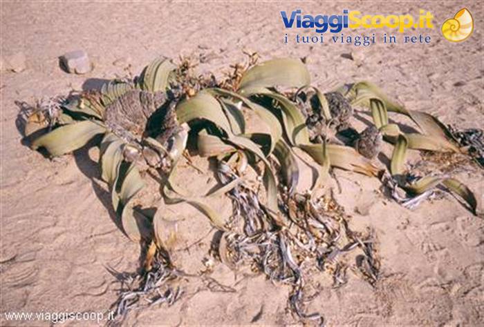
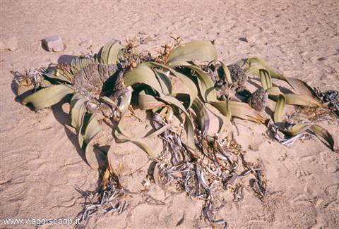
In the afternoon, departing at 13:00, we take an excursion with off-road vehicles along the Welwitschia route: an itinerary of about 100 km that from Swakopmund reaches the area where extraordinary plants live, endowed with a stocky and low trunk, with only 2 leaves that can reach a length of several meters which unusually then curl around their own stem. These plants, the Welwitschia, which gave their name to the itinerary, grow very slowly and the largest ones even have 2000 years. A point of interest along the route are the fields of lichens that draw what they need to live from the drops of moisture that the fog leaves in the morning. According to the guide, these lichens need just one drop of water to bloom instantly: I must say, however, that despite our many attempts we were not able to see their flower.
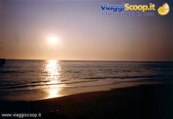
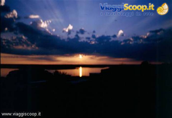
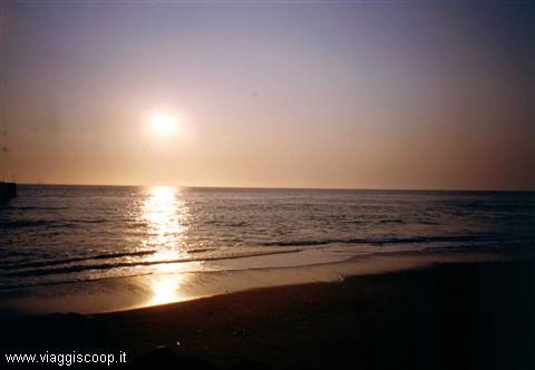
Another point of attraction encountered during this excursion is the "Moon Landscape." Never has a name been more appropriate: the landscape that can be admired truly appears lunar, due to the rock formations eroded by the action of the Swakop River. On returning from the excursion we stop on the beach waiting for the sunset. The fogs, which in the area are normally present, today, to our good fortune, are not there; we were thus able to admire one of the most beautiful sunsets one can see over the sea. The sun that slowly plunges into the Atlantic, the silence and the tranquility that reign on the beach, attract the gaze and make us not perceive the cold that slowly, as evening falls, becomes increasingly intense.
Dunes in the ocean at the Namib Naukluft Park
Day 1121 Aug 2002
Namib Naukluft Park
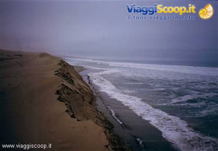
About 50 km south of Swakopmund begins the Namib Naukluft Park, within which extends the Namib desert, whose dunes reaching all the way to the ocean draw the line of the coast; often the whole landscape is wrapped in the fogs that rise every night from the ocean. The desert Atlantic coast extends south for hundreds of kilometers presenting characteristics unique in the world: it has no roads whatsoever and is completely uninhabited; there is only a trace of a track passable exclusively by 4x4 off-road vehicles. On the day following our arrival in Swakopmund, we take an excursion with off-road vehicles along this coast. We set off from the beautiful inlet of Walvis Bay where one can admire hundreds of pink flamingos just a few meters from the shore, while groups of pelicans taking off from the beach perform acrobatic maneuvers.
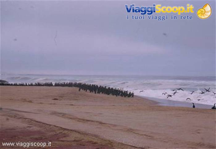
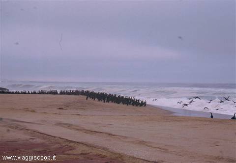
Via a sandy track one reaches Sandwich Harbour, another ornithological reserve where one can see thousands of cormorants perfectly lined up on the water's edge waiting to dive into the sea to procure food. There is also no lack of some seals glimpsed peeking out among the ocean waves, and it is not rare to encounter jackals that follow the coast hoping to catch some bird. Venturing a few tens of meters inland one can climb small dunes, from the top of which one contemplates the Atlantic in all its immensity.
Welwitschia
Day 1222 Aug 2002
Sesriem and Sossusvlei
On 22 August we continue the visit to the Namib desert, moving further south and inland, to the Sesriem camp. Along the way one crosses mainly desert areas and savanna. Before reaching Solitaire, a small town about halfway between Swakopmund and Sesriem, one crosses the "Kuiseb Pass" traveling along a track in constant ups and downs and full of dangerous curves. If there had not been a sign indicating it, the pass would have gone unnoticed: nothing to do with our Alpine passes. The Sesriem camp is located at the beginning of the track that, in about 25 km, leads to the edge of the dune area. About 4 km from the camp is the canyon of the same name, often overlooked due to the proximity of the more renowned dunes, but which deserves a visit for the evocative views it offers.
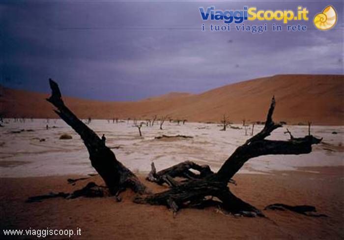
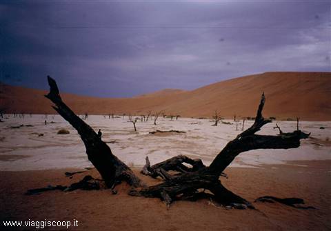
Even the hurried visit made on the day of our arrival, in the late afternoon, allowed us to admire the colors and shadows of the rock formations shaped by the water that once flowed through the canyon. The next morning we visit Sossusvlei, undoubtedly the point of greatest interest near Sesriem. The dunes of Sossusvlei reach a height of three hundred meters and stand out sharply against a flat horizon. The spectacle of the sunrise, seen from the top of a dune, amply repaid us for the effort made to climb it. The panorama enjoyed from the top is breathtaking: desert all around and dunes to infinity. Below, at the base of the dunes, one admires the contrast of the white of the salt flats formed by the evaporation of the water that deposits during the rainy season.
The colors change as the day advances, from the faded ocher yellow that the sand shows in the early hours of the morning one moves to more saturated colors, in the midday hours, then to the warm colors of the afternoon that become increasingly intense, almost red, in the fiery sunset.
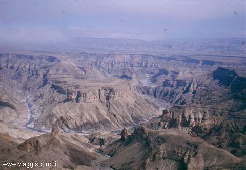
Fisch River Canyon
Day 1324 Aug 2002
Keetmanshoop and Kakerboom Forest
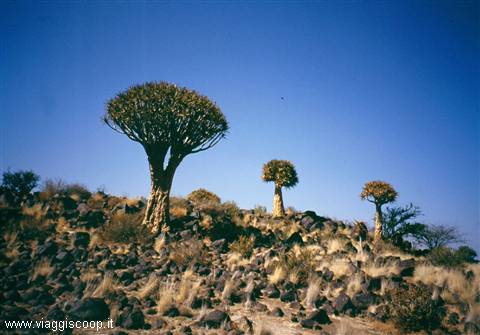
Our journey continues toward the south of Namibia; on 24 August we move to Keetmanshoop to reach, the following day, the Fish River Canyon. In Keetmanshoop, a small town of about 15,000 inhabitants, we stay overnight in the bungalows of a campsite in perfect old-west style. There is even a multiple gallows, where we try to insert our heads in the noose: fortunately the trapdoor that opened under the feet when hangings were carried out is not there. Near Keetmanshoop is the Kokerboom Forest, a "forest" of strange trees, the Kokerboom, which grow very slowly and which we visit the morning after our arrival. Adjacent to the forest is the Giant's Playground: these are singular formations of black rocks formed 170 million years ago.
Deadvlei
Day 1425 Aug 2002
Fish River Canyon
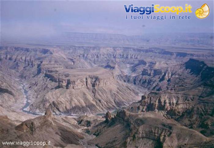
In the early afternoon we arrive at the Fish River Canyon park, at the Hobas camp, positioned at the northern end of the park. The Fish River Canyon is located near the border with the Republic of South Africa and is probably one of the most significant attractions of Namibia: carved by the Fish River, it extends for 162 km with a depth of over 500 meters and a width that, in some points, reaches 27 km. About 10 km from the camp are the two main "view points" which we reach after pitching our tents. From here we appreciate the view of the beautiful sunset: 500 meters below, the Fish River winds, though almost dry, between steep rock walls, in its bed slowly carved over thousands of years. The morning following our arrival we move, still within the Fish River Canyon park, to the Ai-Ais camp, at the southern end of the park, known for the thermal waters that spring within it.
Sunset at Hardap Dam
Day 1527 Aug 2002
Heading home
Unfortunately our itinerary is drawing to a close: tomorrow, 27 August, we begin the journey home to Windhoek, where the plane that will take us back to Italy awaits us. Travel companions (in alphabetical order) · Alberto - Turin · Antonella - Rastignano (BO) · Bruno - Germagnano (TO) · Daniela - Turin · Davide - Vercelli · Fabrizio - Saronno (VA) · Fabrizio - Turin · Francesco - Budrio (BO) · Fransisco - Oggiono (LC) · Ivana - Bologna · Jonny - Gussago (BS) · Mirko - Turin · Paolo - San Donato (MI) · Serena - Valle S. Nicolao (BI) · Tiziana - Rome



0 reader comments